Mori Atlas logo
National parkLauhanvuori National Park

Discover the distinct protected land and natural terrain of Finland's national parks.

Lauhanvuori National Park: Mapped Protected Landscape and Regional Geography in Finland

(Lauhanvuoren kansallispuisto)

Lauhanvuori National Park represents a significant protected natural area within Finland's diverse geography. This canonical page provides an atlas-level view of the park, focusing on its mapped boundaries and its place within the broader national landscape context. Explore the unique terrain and protected status of this Finnish national park.

Boreal forestsPeatland ecosystemsGeological heritageNorthern FinlandNational parksProtected areas

Lauhanvuori National Park

National park

Park overview

Structured park overview, official facts, and landscape profile for Lauhanvuori National Park

Lauhanvuori National Park park facts, protected area profile, and essential visitor context
Review the core facts for Lauhanvuori National Park, including designation, size, terrain, visitor scale, habitats, and operating context in one park-focused overview.

About Lauhanvuori National Park

Lauhanvuori National Park occupies a distinctive position in Finland's protected area network as a representative of western Finnish highland landscapes and boreal forest ecosystems. The park's terrain is dominated by pine forestland on well-drained slopes, interspersed with wetter peatland areas and the clear, cold spring brooks that flow from the higher ground. The Lauhanvuori mountain itself rises 231 meters above sea level, a modest elevation by alpine standards but a prominent landmark in the flat landscape of South Ostrobothnia. The summit's geological significance derives from its formation as a terminal moraine during the final stages of the Weichselian glaciation and its subsequent exposure as a nunatak or island as the ice sheet retreated and the waters of the Ancylus Lake inundated the surrounding lowlands. This extended period of isolation allowed the summit to retain a more diverse soil community and support plant species that could not survive in the subsequently developed marine and freshwater wetlands of the surrounding region. The park was established in 1982 to protect these geological, ecological, and landscape values, and is managed by Metsähallitus under Finland's national parks framework.

Quick facts and research context for Lauhanvuori National Park

Lauhanvuori National Park is located in South Ostrobothnia, western Finland, approximately 230 kilometers north of the Gulf of Bothnia. The park's defining feature is Lauhanvuori mountain, an ancient terminal moraine that was never submerged during the post-glacial Ancylus Lake period, making it a biological island of older, richer soils in a landscape otherwise shaped by later marine and freshwater deposits. The park contains approximately one hectare of fen habitat that supports particularly rare vegetation, including the southernmost known population of Scottish asphodel in Finland. The area supports populations of crane, capercaillie, and willow grouse, species characteristic of Finland's extensive peatland and forest ecosystems.

Park context

Deeper park guide and search-rich context for Lauhanvuori National Park

Lauhanvuori National Park history, landscape, wildlife, and travel context
Explore Lauhanvuori National Park through its history, landscape character, ecosystems, wildlife, conservation priorities, cultural context, and seasonal travel timing in a structured park guide built for atlas discovery and search intent.

Why Lauhanvuori National Park stands out

Lauhanvuori National Park is best known for its exceptional geological heritage and the ecological island effect created by its ancient, never-inundated summit. The mountain's unique history means that its summit area retained nutrient-rich soils through the post-glacial period while surrounding lands were repeatedly submerged, creating a distinct ecological island that supports flora more typical of northern Finland or Scandinavia. The park's peatland ecosystems, particularly the rare fen habitats, support specialized vegetation including Scottish asphodel at its southern range limit, along with carnation sedge, brown beak-sedge, moor rush, and communities of rare mosses. The park also preserves representative examples of western Finnish pine forestland and the cultural landscape shaped by traditional wetland use.

Lauhanvuori National Park history and protected-area timeline

Lauhanvuori National Park was established in 1982 as part of Finland's expanding network of protected areas during the late twentieth century. The designation reflected growing recognition of the site's geological significance and the need to preserve the unique ecological island habitat created by the mountain's post-glacial history. Prior to national park designation, the area had been subject to varying levels of protection and management, with the municipality and local communities maintaining connections to the landscape through traditional uses including berry picking, hunting, and limited forestry. The establishment of the park formalized protections for the area while also creating a framework for sustainable nature-based recreation and environmental education. The park has since become a destination for visitors seeking to experience the distinctive character of western Finnish highlands and to observe rare plant species at the edge of their ecological ranges.

Lauhanvuori National Park landscape and geographic character

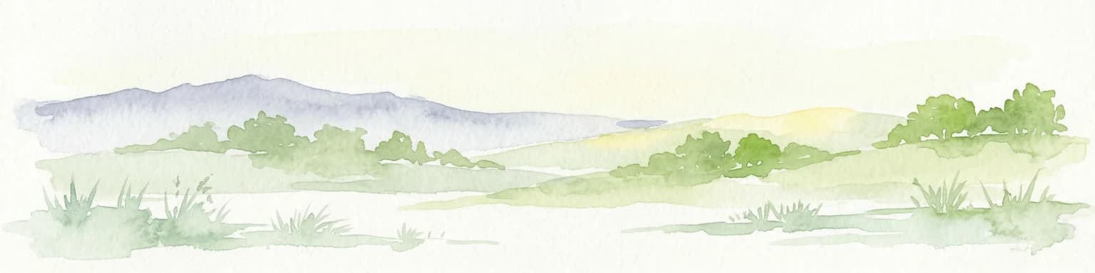
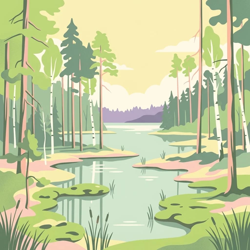
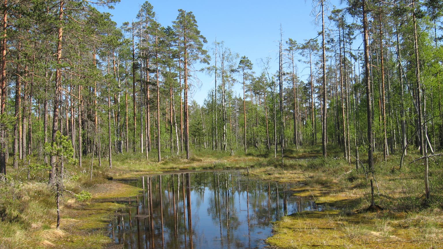
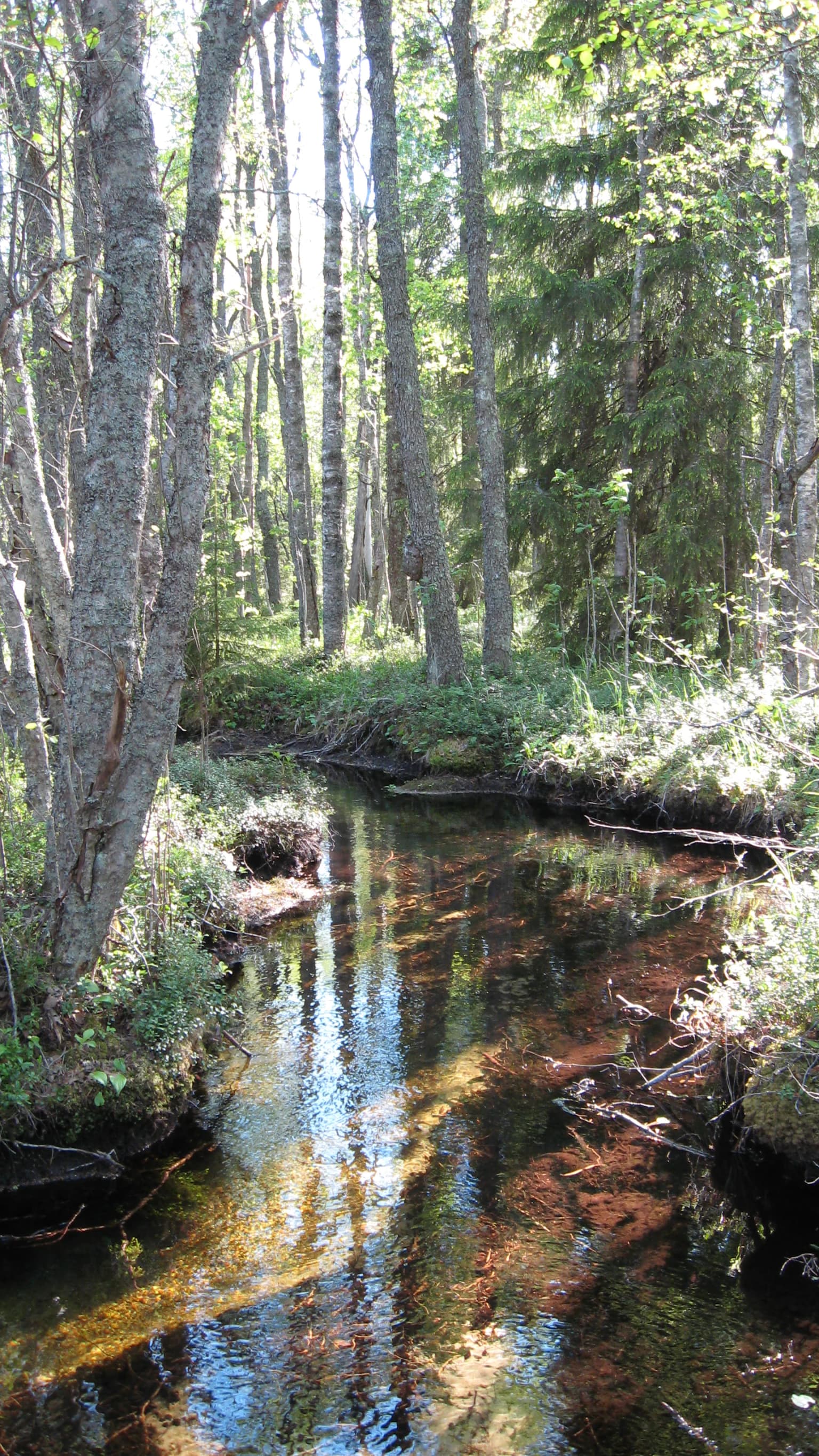
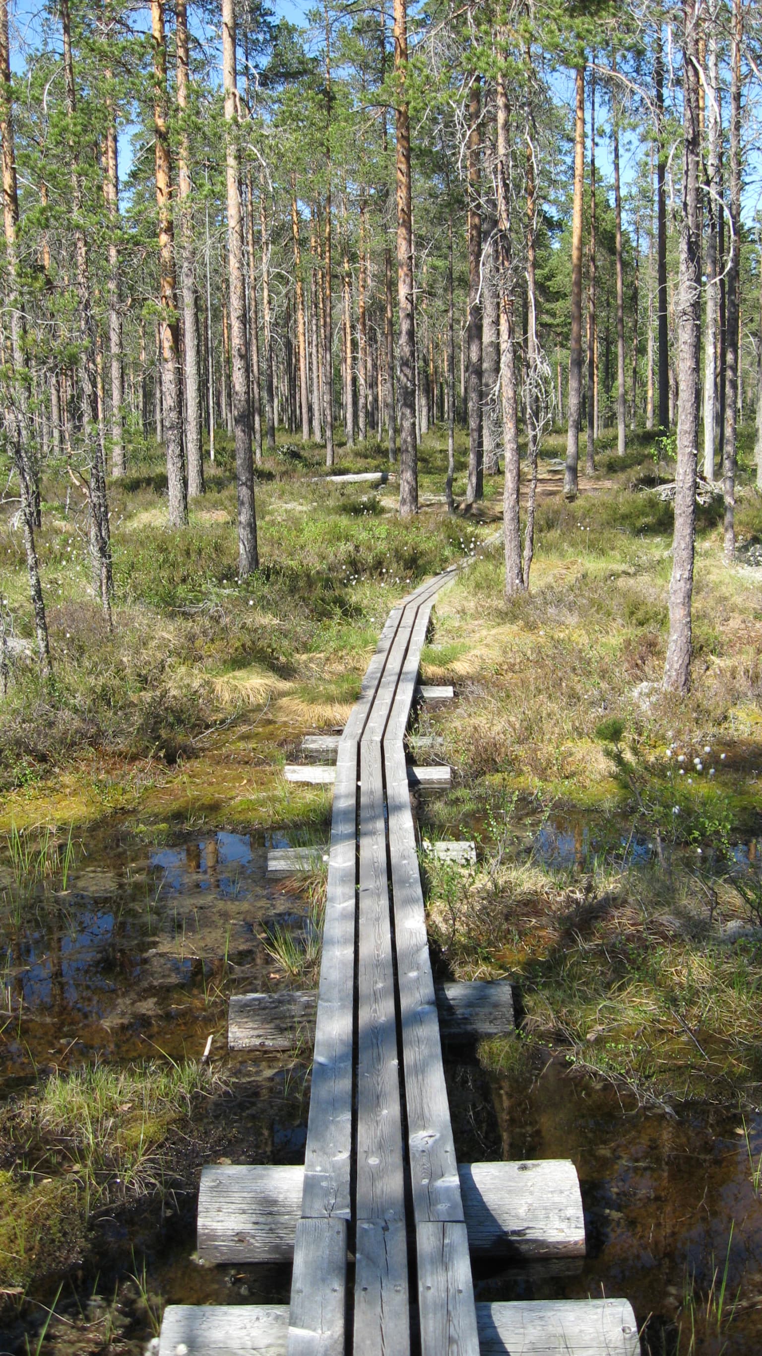
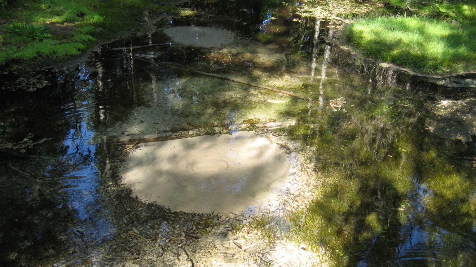
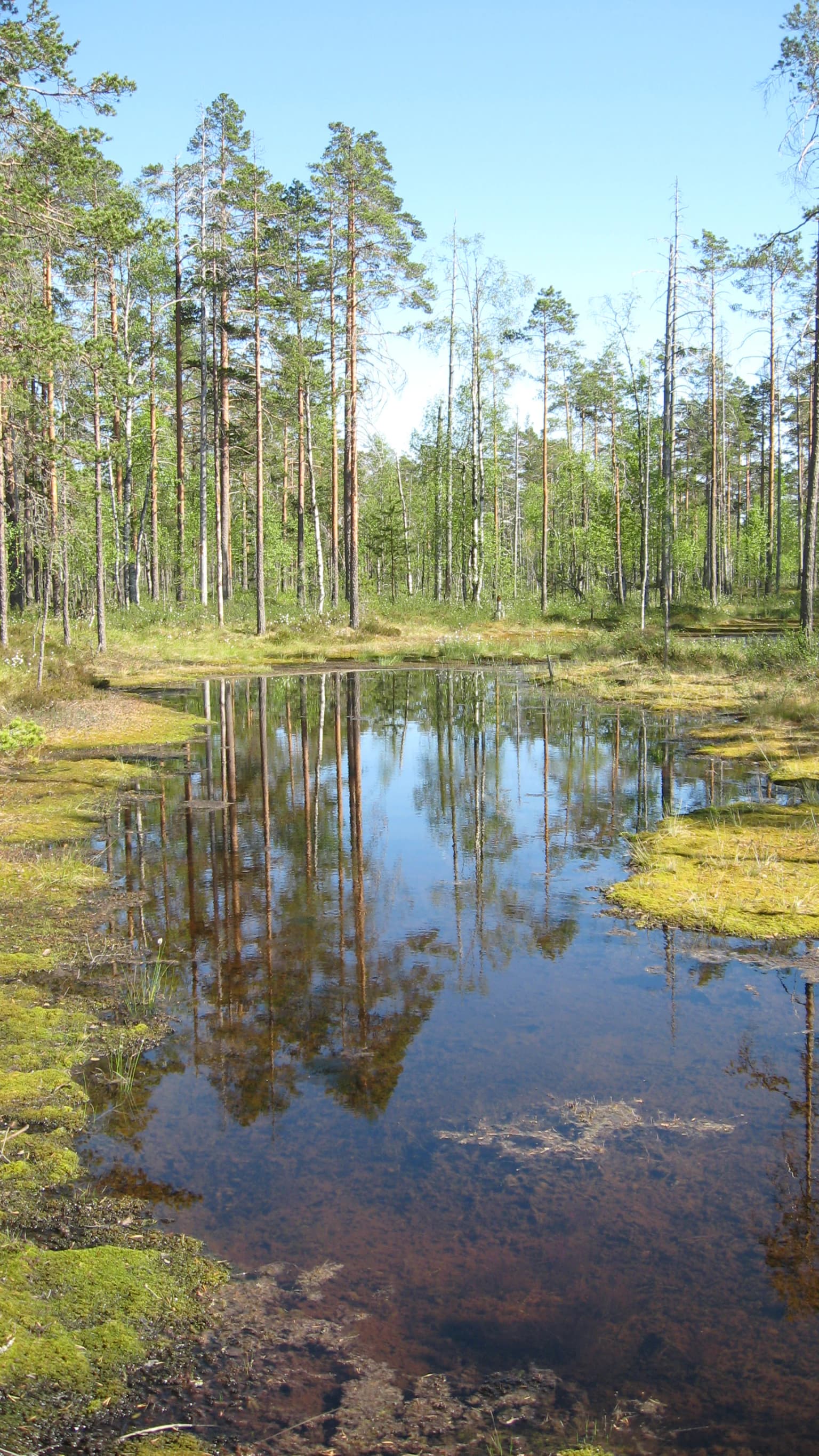
The landscape of Lauhanvuori National Park is characterized by the contrast between the ancient, exposed highlands of Lauhanvuori mountain and the surrounding glacial and post-glacial terrain. The mountain itself is a prominent feature in the otherwise flat agricultural landscape of South Ostrobothnia, its forested slopes rising above the surrounding farmland and peat extraction areas. The summit area features exposed rocky outcrops known locally as Kivijata, where the underlying bedrock and glacial deposits are visible. The lower slopes and surrounding areas support pine forest on well-drained sites, while the valley bottoms and lower areas transition into extensive peatland complexes. Spring brooks, clear and cold, flow from the higher ground through the forest and into the wetland systems. The park's lakes, including the swamp lakes visible in the landscape, represent the hydrological expression of the impermeable peat soils that dominate the lower elevations.

Lauhanvuori National Park ecosystems, habitats, and plant life

The ecological character of Lauhanvuori National Park reflects the interplay between boreal forest ecosystems and the unique conditions created by the mountain's geological history. The pine forests of the park represent typical western Finnish boreal woodland, with understory communities adapted to the relatively nutrient-poor conditions of glacial soil deposits. However, the summit area of Lauhanvuori presents a notably different picture, where the retention of ancient, nutrient-richer soils has allowed a lusher vegetation community to develop. This ecological island effect supports plant species that are more commonly found in northern Finland or in more mountainous terrain. The park's peatland ecosystems, particularly the fen habitats, support distinctive vegetation communities adapted to waterlogged, nutrient-poor conditions. The fen areas contain specialized species including Succisa pratensis, brown beak-sedge, carnation sedge, moor rush, and Scottish asphodel, along with diverse communities of mosses that are characteristic of relatively intact peatland systems.

Lauhanvuori National Park wildlife and species highlights

The wildlife of Lauhanvuori National Park reflects the boreal forest and peatland ecosystems that dominate the park's habitats. The wetlands and open peatland areas provide important habitat for large birds including cranes, whose haunting calls echo across the bogs during the summer months. The capercaillie, a large grouse species characteristic of mature pine forests, inhabits the wooded areas and can be heard displaying in the forest clearings during the breeding season. The willow grouse, a species well-adapted to the willow scrub and wetland margins of northern latitudes, is also present in the park's peatland habitats. These bird species represent the avifaunal character of Finland's boreal wetlands and forests, though the park does not contain especially rare or endangered species. The forested areas support the typical mammal community of Finnish pine forests, though specific notable species are not highlighted in the park's documentation.

Lauhanvuori National Park conservation status and protection priorities

Lauhanvuori National Park serves important conservation functions within Finland's protected area network. The park protects the geological heritage of western Finland's highland landscape and preserves the ecological island created by Lauhanvuori mountain's unique post-glacial history. The fen habitats within the park are of particular conservation significance, supporting rare plant species including the southernmost population of Scottish asphodel in Finland. The presence of specialized moss communities indicates the ecological integrity of the peatland systems and their relative freedom from drainage or extraction impacts that have affected much of Finland's original peatland resource. The park contributes to the conservation of representative boreal forest ecosystems and provides connectivity for wildlife movement through the agricultural landscape of South Ostrobothnia.

Lauhanvuori National Park cultural meaning and human context

Lauhanvuori National Park lies within the traditional cultural landscape of South Ostrobothnia, a region with strong connections to agriculture, forestry, and rural community life. The surrounding municipalities of Kauhajoki and Isojoki have historical relationships with the land that now falls within the park boundaries, though the park itself does not contain significant built heritage or documented indigenous sites requiring separate cultural management. The landscape reflects the broader pattern of Finnish land use, where peat extraction, forestry, and agriculture have shaped the lowlands while the higher ground and wetlands have remained in more natural states. The park provides opportunities for Finns to connect with the natural heritage of their region and maintains traditional relationships with the landscape through sustainable recreation and nature experiences.

Top sights and standout views in Lauhanvuori National Park

Lauhanvuori National Park offers distinctive experiences centered on Finland's geological and ecological heritage. The summit of Lauhanvuori mountain provides panoramic views over the South Ostrobothnian landscape and access to the ancient rocky outcrops of Kivijata. The rare fen habitats in the park offer opportunities to observe specialized wetland vegetation including Scottish asphodel at its southern range limit. The summer birdlife, particularly the calls of cranes echoing across the peatlands, provides an evocative wilderness experience. The contrast between the ancient mountain summit with its richer soils and the surrounding younger landscape illustrates fundamental concepts of Finnish geological history and ecological island biogeography.

Best time to visit Lauhanvuori National Park

The optimal time to visit Lauhanvuori National Park is during the Finnish summer months from June through August, when the long daylight hours allow extended exploration and the park's wildlife is most active. The summer season brings the cranes to their breeding territories in the peatlands, the capercaillies to their display grounds in the forest, and the wildflowers into bloom in the more diverse summit areas. Autumn September offers another excellent period, with the Finnish forest displaying its characteristic autumn colors and fewer visitors in the park. Winter visits are possible but require appropriate preparation for the cold and short daylight hours typical of Finnish winters. Spring, while potentially rewarding with the return of migratory birds, may still have snow cover and wet ground conditions that limit access to some areas.

Park location guide

Geography guide, regional context, and park location map for Lauhanvuori National Park

Lauhanvuori National Park park geography, regions, and map view in Finland
Understand where Lauhanvuori National Park sits in Finland through a broader geographic reading of the surrounding landscape, nearby location context, and its mapped position within the national park landscape.

How Lauhanvuori National Park fits into Finland

Finland, officially the Republic of Finland, is a Nordic country in Northern Europe with a population of 5.6 million. It borders Sweden, Norway, and Russia, with the Gulf of Bothnia to the west and the Gulf of Finland to the south. The country gained independence from Russia in 1917 and is a unitary parliamentary republic. Its landscape is characterized by extensive boreal forests and over 180,000 lakes.

Wider geography shaping Lauhanvuori National Park in Finland

Finland is located in Northern Europe, occupying a peninsula bordered by the Gulf of Bothnia to the west and the Gulf of Finland to the south. It shares land borders with Sweden to the northwest, Norway to the north, and Russia to the east. The terrain is predominantly flat with extensive forest coverage and numerous lakes.

Map view of Lauhanvuori National Park

Use this park location map to pinpoint Lauhanvuori National Park in Finland, understand its exact geographic position, and read its mapped placement within the surrounding landscape more clearly.

Pigeon | © OpenStreetMap contributors

Location context for Lauhanvuori National Park

South Ostrobothnia
Park atlas

Compare nearby Finnish protected landscapes, assess geological heritage, and discover regional park geography.

Explore Other National Parks and Protected Areas Near Lauhanvuori National Park
Browse other national parks and protected areas situated near Lauhanvuori National Park, encompassing diverse Finnish landscapes from ancient boreal forests to expansive peatland ecosystems. Compare geological heritage and ecological island effects within a broader regional context, enhancing your understanding of protected areas throughout South Ostrobothnia.
Watercolor painting of a lake surrounded by trees with a colorful sky.
National parkFinland

Seitseminen National Park: Ancient Boreal Forests and Vast Mire Systems in Finland

Explore mapped terrain and protected wilderness landscapes.

Seitseminen National Park represents a significant protected area in western Finland, characterized by classic boreal forest ecosystems interspersed with extensive mire and bog landscapes. The park's geography includes the notable Seitsemisharju esker, contributing to its diverse terrain. As a sanctuary for ancient forests, including the historic Multiharju primeval forest, Seitseminen offers a unique focus for understanding Finnish protected wilderness and its mapped geographic features within the Nordic context.

Area
45.5 km²
Established
1982
IUCN
II
Visitors
42.3K annual
Watercolor painting depicting a landscape with hills, forests, and a river using muted colors
National parkPirkanmaa

Helvetinjärvi National Park: Protected Landscape and Geographic Context in Pirkanmaa

Mapped national park boundaries and regional natural terrain.

Delve into the details of Helvetinjärvi National Park, a protected area within the Pirkanmaa region of Finland. This atlas entry highlights the park's mapped geographic features and its identity as a national park. Understand the protected landscape and its place in the broader Finnish geography, offering structured insights for map-based discovery.

Area
49.8 km²
Established
1982
IUCN
II
Visitors
44K annual
National parkPirkanmaa

Puurijärvi-Isosuo National Park: Protected Landscape Discovery in Pirkanmaa Region

Explore mapped protected areas and regional geography.

Puurijärvi-Isosuo National Park is a significant protected area in Finland's Pirkanmaa region. This entry provides detailed geographic context and maps the park's boundaries, offering a focused perspective for atlas-driven discovery of Finnish natural landscapes. Understand its place within the regional geography and the wider network of protected lands.

Area
27 km²
Established
1993
IUCN
II
Visitors
19.8K annual
National parkSouthwest Finland

Bothnian Sea National Park: Southwest Finland's Coastal Protected Landscape

Mapped geography and regional protected area context.

Bothnian Sea National Park stands as a significant protected landscape situated within the extensive island formations of Southwest Finland's Archipelago Sea. This page provides an atlas-focused view of the national park, detailing its geographic spread, mapped boundaries, and its place within the regional context of Varsinais-Suomi. Understand the protected area's unique coastal identity and its contribution to the mapped natural terrain of southern Finland, facilitating structured discovery and geographic exploration.

Area
917 km²
Established
2011
IUCN
II
Visitors
79.4K annual
National park

Isojärvi National Park: Finland's Protected Landscape with Dynamic Beaver-Shaped Terrain

Central Finland's boreal forest, ravines, and lake district geography.

Isojärvi National Park offers a unique atlas perspective on Central Finland's protected natural landscapes. This national park is characterized by a dynamic boreal environment, featuring steep hills, deep ravines, and varied topography shaped by both ancient geological processes and contemporary beaver activity. Discover the mapped boundaries of this protected area, its central role in the Finnish lake district's geography, and the distinctive wetland habitats created by beavers that enhance its ecological diversity. It serves as a key point for understanding regional landscape context and protected land exploration.

Area
19 km²
Established
1982
IUCN
II
Visitors
24.4K annual
Watercolor painting showing green hills, trees, and a stream in a landscape
National parkSouthwest Finland

Kurjenrahka National Park: Southwest Finland's Protected Landscape Atlas Entry

Discover geographic context and park boundaries.

Delve into Kurjenrahka National Park, a designated national park situated in Southwest Finland. This page provides an atlas-focused view of the park, detailing its protected landscape identity, mapped terrain, and its specific geographic location within the broader Finnish region. Understand the park's ecological context and its significance as a key protected area for regional geographic exploration.

Area
29 km²
Established
1998
IUCN
II
Visitors
66.8K annual
Watercolor illustration of a landscape featuring a body of water, trees, and distant mountains
National parkKanta-Häme

Torronsuo National Park: Explore Finland's Exceptional Raised Bog Ecosystem and Kanta-Häme Geography

Discover mapped peatlands, unique birdlife, and protected boreal wilderness.

Torronsuo National Park stands as a testament to Finland's remarkable wetland conservation efforts, presenting a striking example of a raised bog ecosystem. Located within the Kanta-Häme region, this national park is celebrated for its vast, domed peat landscape, some of the thickest peat layers ever measured in Finland, and its status as a Ramsar-designated wetland. The park's protected status ensures the preservation of its unique natural terrain, which supports a rich diversity of northern bird species and specialized bog flora, making it a significant area for ecological and geographic exploration.

Area
25.5 km²
Established
1990
IUCN
II
Visitors
58.6K annual
National parkFinland

Salamajärvi National Park: Explore Finland's Premier Mired Wilderness and Protected Landscape

Mapped boundaries and wetland ecosystems of this Finnish National Park.

Salamajärvi National Park is a critical protected area in Finland, celebrated for its unparalleled mire ecosystems, which represent some of the country's most extensive and intact peatland environments. The park's landscape is shaped by the Suomenselkä watershed, featuring a mosaic of old-growth forests, forest lakes, and rugged terrain, providing a vital sanctuary for forest reindeer. MoriAtlas details its geographic context and protected landscape features, offering users a structured way to explore its natural identity and mapped boundaries within Finland.

Area
62 km²
Established
1982
IUCN
II
Visitors
24.5K annual

Common questions about visiting, size, designation, and location context for Lauhanvuori National Park

Lauhanvuori National Park FAQs for park facts, access, geography, and protected area context
Find quick answers about Lauhanvuori National Park, including protected-area facts, park geography, trail and visitor context, and how the park fits into its surrounding country and regional landscape.
MoriAtlas Explorer

Continue Your Protected Areas Search Across the Global Atlas

Deepen your exploration by continuing the structured search for national parks and protected areas worldwide. Utilize the comprehensive filtering capabilities to compare different conservation landscapes and refine your understanding of global park geography. Discover more about the distribution and characteristics of protected natural areas.

Global natural geography