Mori Atlas logo
National parkLower Sula National Nature Park

Discover the unique wetland ecosystems and protected landscape boundaries of this vital national park.

Lower Sula National Nature Park: Mapped Protected Wetlands and River Floodplain Geography in Poltava Oblast

(Нижньосульський національний природний парк)

Lower Sula National Nature Park is a significant protected area situated in Poltava Oblast, Ukraine, safeguarding the lower reaches of the Sula River as it converges with the Kremenchuk Reservoir. This national park protects an extensive mosaic of wetland habitats, including marshes, shallow lakes, and floodplain ecosystems. These areas are crucial for fish spawning and serve as essential nesting and migratory grounds for diverse waterfowl populations, making it a landmark protected landscape for regional geography and atlas exploration.

wetlandsnational parkriver floodplainwaterfowl habitatEastern Europemarshland
Stylized illustration of a winding river through grassy banks and hills with forests in the background

Lower Sula National Nature Park

National park

Park overview

Structured park overview, official facts, and landscape profile for Lower Sula National Nature Park

Lower Sula National Nature Park park facts, protected area profile, and essential visitor context
Review the core facts for Lower Sula National Nature Park, including designation, size, terrain, visitor scale, habitats, and operating context in one park-focused overview.

About Lower Sula National Nature Park

Lower Sula National Nature Park represents one of Ukraine's significant wetland conservation areas, established to protect the ecological integrity of the lower Sula River basin and its transition into the Kremenchuk Reservoir. The park's creation in 2010 brought together a collection of previously protected areas, each retaining its individual protected status while operating under the unified park administration. The terrain across the park is predominantly flat, particularly around Sulsky Bay which opens directly into the reservoir, though some right bank areas feature gentle hills. Several islands within the bay area rise 2 to 6 meters above the water level, providing elevated habitat patches within the otherwise low-lying wetland landscape. The park serves as an important ecological corridor and transitional zone between the broader forests of northern Ukraine and the grassland steppes to the south, embodying the characteristic mosaic of the East European forest steppe ecoregion.

Quick facts and research context for Lower Sula National Nature Park

Lower Sula National Nature Park occupies 18,635 hectares along the lower Sula River and its confluence with the Kremenchuk Reservoir in central Ukraine. The park was established in 2010 under President Viktor Yushchenko's decree to preserve valuable natural and historical-cultural complexes of the Middle Dnipro region. It encompasses eight distinct protected areas including national landmarks, hydrological reserves, landscape reserves, and entomological reserves. The park lies within a humid continental climate zone with warm summers and features a diverse landscape ranging from flat marshland around Sulsky Bay to hilly terrain on the right bank of the river. The area is recognized for its botanical diversity with over 600 vascular plant species documented within its boundaries.

Park context

Deeper park guide and search-rich context for Lower Sula National Nature Park

Lower Sula National Nature Park history, landscape, wildlife, and travel context
Explore Lower Sula National Nature Park through its history, landscape character, ecosystems, wildlife, conservation priorities, cultural context, and seasonal travel timing in a structured park guide built for atlas discovery and search intent.

Why Lower Sula National Nature Park stands out

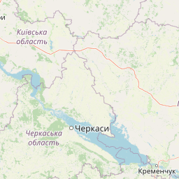
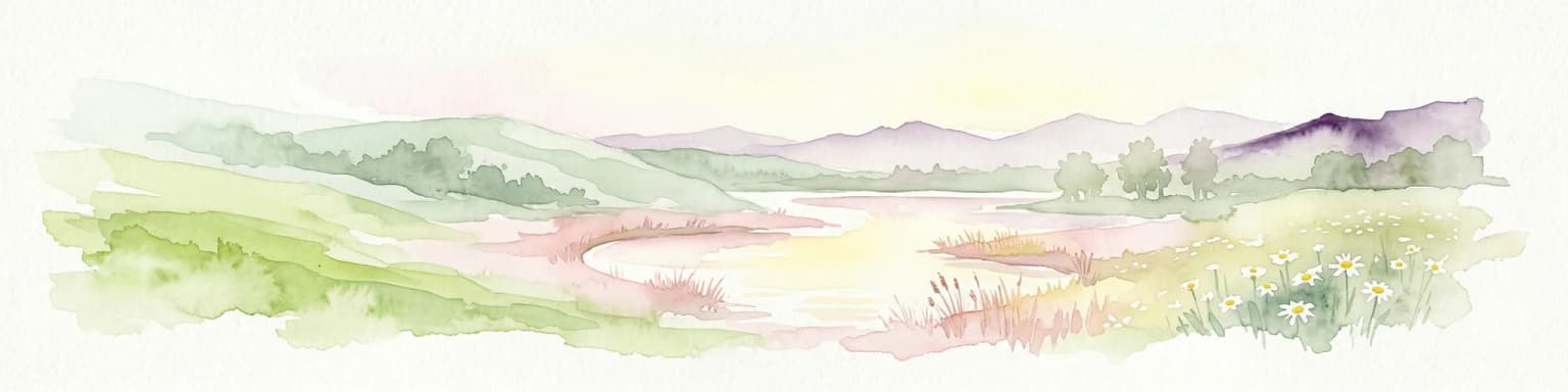
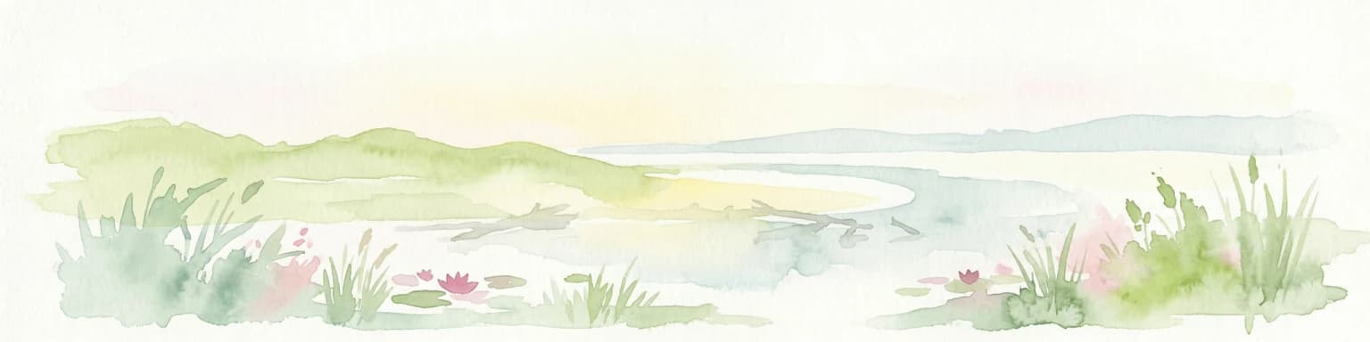
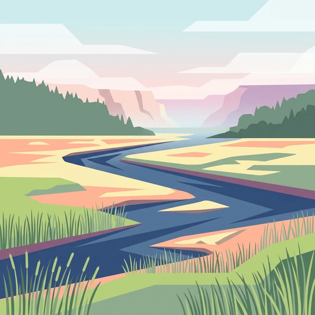
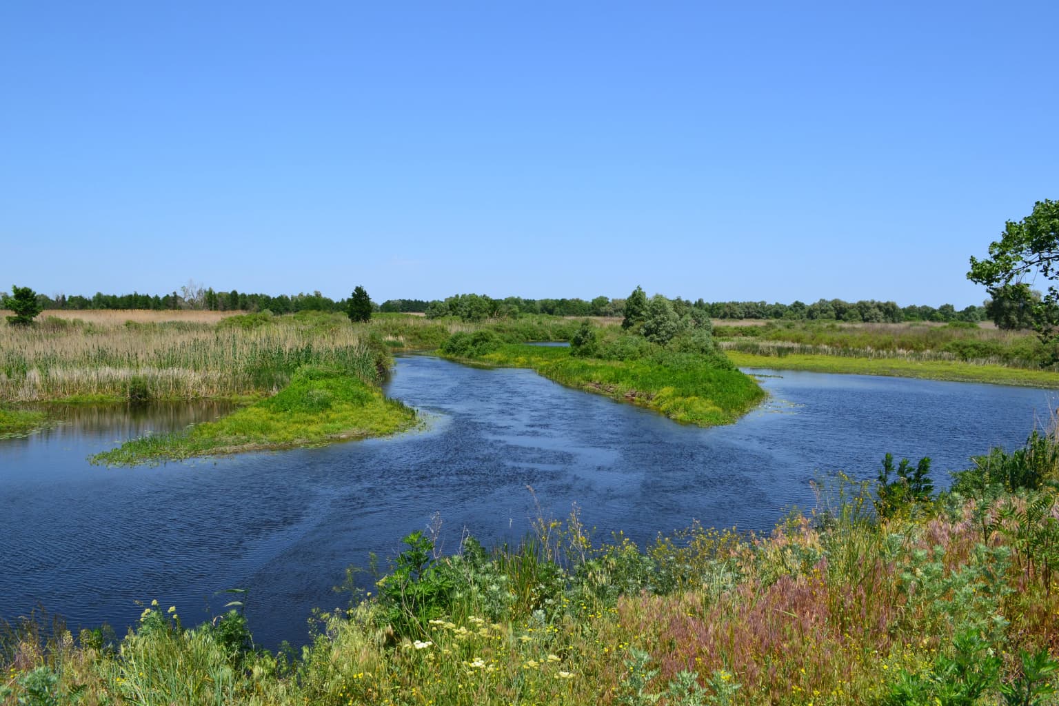
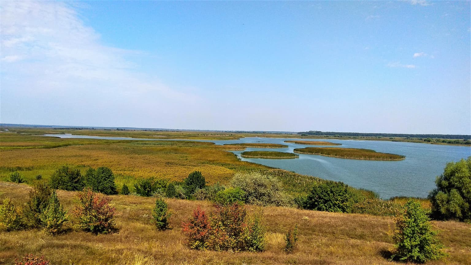
Lower Sula is best known for its extensive wetland complex protecting the lower Sula River floodplain where it meets the Kremenchuk Reservoir. The park contains critical fish spawning and waterfowl habitats that make it ecologically significant for both resident and migratory bird species. The area features a unique combination of shallow lakes, floodplain marshes, swamps, and meadow-halophytic vegetation communities adapted to the reservoir's influence. The diverse habitat types support populations of elk, fox, beech marten, and wild boar, while the wetland areas provide crucial breeding and feeding grounds for waterfowl populations.

A wide river flows through lush green wetlands with vegetation along the banks under a clear blue sky
Sula River flowing through Lower Sula National Nature Park wetlands

Lower Sula National Nature Park history and protected-area timeline

Lower Sula National Nature Park was established on February 10, 2010, through a presidential decree issued by Viktor Yushchenko, aimed at preserving valuable natural and historical-cultural complexes of the Middle Dnipro region. The park administration began operations in December 2011, with a dedicated protection service established in February 2012 consisting of 20 staff members who maintain continuous surveillance across the entire park territory. The park was created by combining several previously designated protected areas, each maintaining its original protective status within the larger park boundaries. These include the national landmark Sulinsky, the hydrological reserves Velikoselytsky, Plekhovsky, Salty, Rogozov's corner, and Chutovsky, the landscape reserve Onyshkivsky, and the cultural-entomological reserve Tarasenkovsky. The establishment process involved incorporating 18,635 hectares of state-owned land, with 1,315 hectares removed from the Zolotonosha Forestry Enterprise and transferred to permanent park use, along with additional reserve lands from Orzhytsia and Semenivka raions.

Lower Sula National Nature Park landscape and geographic character

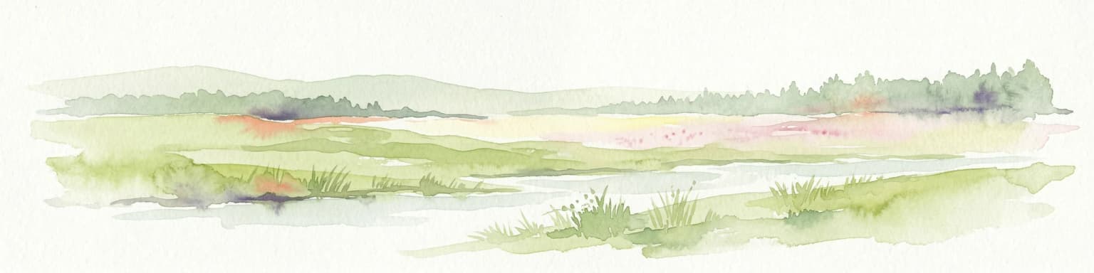
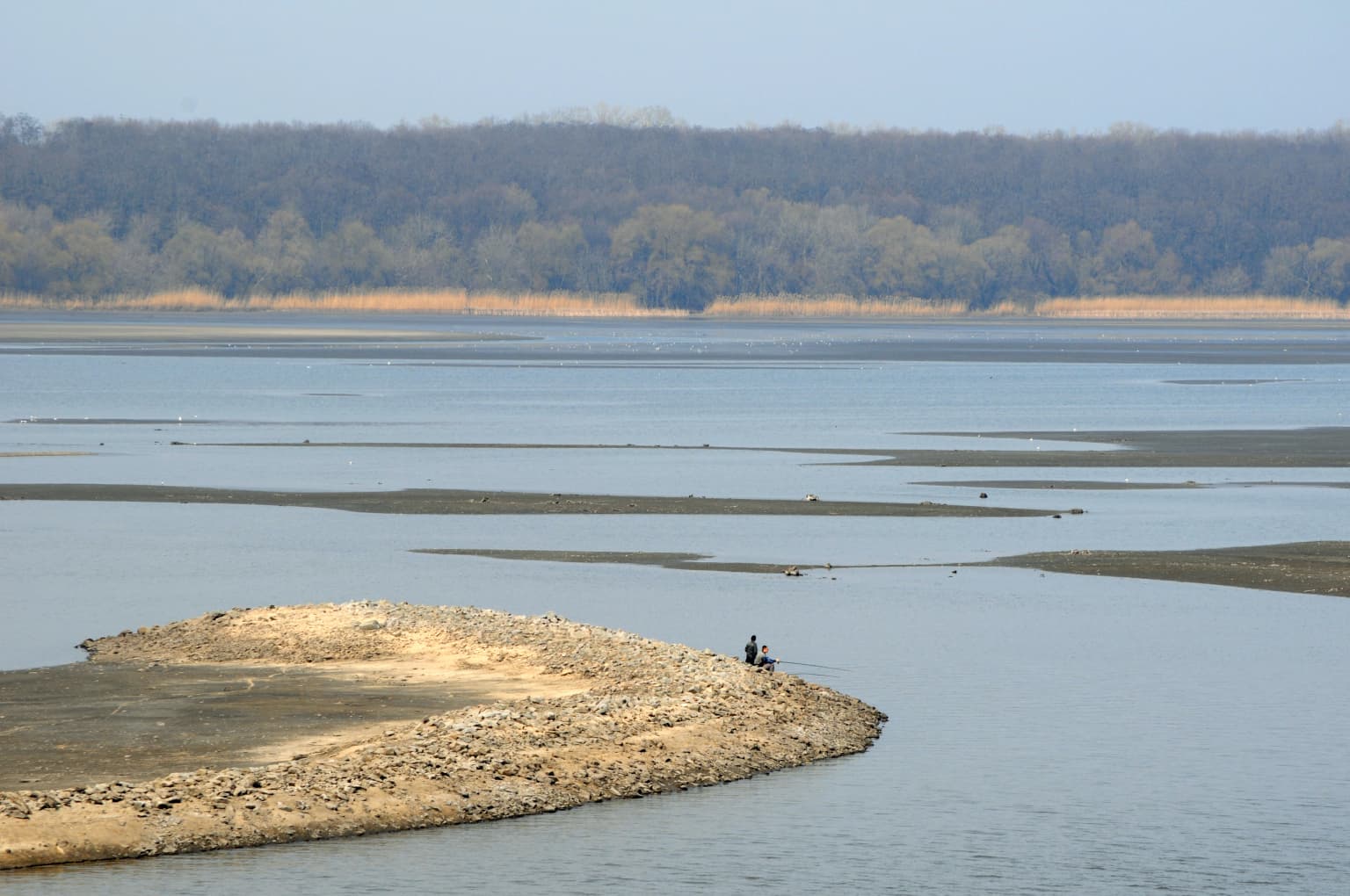
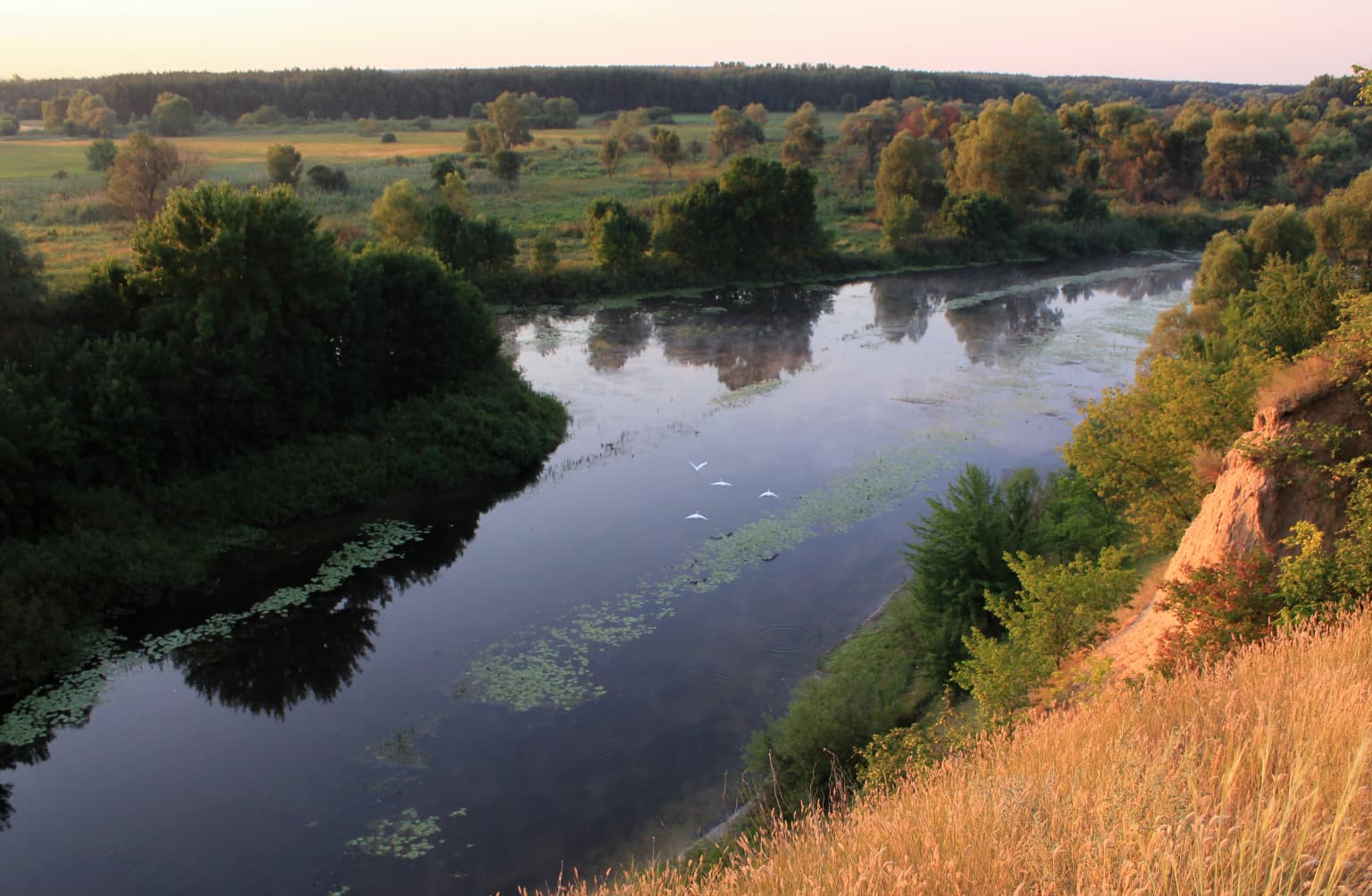
The park landscape is characterized by its low-lying wetland terrain surrounding the lower Sula River and its approach to the Kremenchuk Reservoir. The terrain is predominantly flat, especially in the vicinity of Sulsky Bay where the river opens into the reservoir, creating extensive areas of marsh and shallow water. The right bank areas of the river feature more hilly terrain, providing topographic variation within the park. The park encompasses a complex of shallow lakes, floodplain marshes, and swamps that form along the river's lower tributaries and reservoir margins. Some islands within Sulsky Bay rise between 2 and 6 meters above the water level, creating elevated ground that supports different vegetation communities than the surrounding wetland. The hydrological character of the area is strongly influenced by the Kremenchuk Reservoir, whose creation in 1959 significantly altered the natural hydrology and created the extensive shallow-water conditions that now characterize much of the park.

Two weathered wooden boats resting on a grassy riverbank during sunrise, with trees and calm water in the background
Sunrise over the Sula River with weathered boats on the grassy riverbank

Lower Sula National Nature Park ecosystems, habitats, and plant life

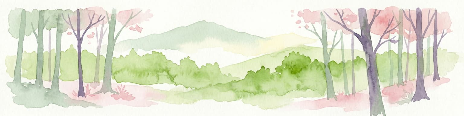
The ecological character of Lower Sula is defined by its position at the western edge of the East European forest steppe ecoregion, where the park protects a transitional landscape between northern broadleaf forests and southern grassland steppes. The park encompasses several distinct botanical zones including terraced meadow steppes, terraced oak-pine forests, floodplain areas along the Sula River and its tributaries, eutrophic marshes, and meadow-halophytic vegetation communities. The creation of the Kremenchuk Reservoir in 1959 substantially influenced the hydrological regime, creating large areas of shallow water where aquatic vegetation has become highly developed. The ecological systems of the area remain relatively young and have not yet been fully studied, though current documentation indicates the presence of over 600 vascular plant species within the park boundaries. The halophyte communities in areas with saline soils represent particularly distinctive vegetation adapted to the specific hydrological conditions created by the reservoir.

Two wooden boats on a shore with tall grasses and reeds by a calm body of water
Two wooden boats resting on the shore of the Kremenchuk Reservoir in Lower Sula National Nature Park

Lower Sula National Nature Park wildlife and species highlights

The wetlands of Lower Sula provide crucial habitat for significant fish populations, serving as important spawning and wintering areas that support commercial and recreational fisheries in the region. Waterfowl populations depend heavily on the park's marshes, shallow lakes, and floodplain areas for nesting, feeding, and migratory resting points. The terrestrial portions of the park support populations of wild elk, red fox, beech marten, and wild boar, particularly in the meadow and marsh areas of the Plekhovsky reserve. The diverse habitat mosaic created by the combination of wetlands, forests, and grasslands supports a range of species adapted to this transitional ecological zone. The park's significance for birdlife is particularly notable, with the wetland complexes providing essential habitat for both resident waterfowl species and migratory birds traversing the Central European flyway.

Panoramic view from a hill showing the Sula River estuary with grassy fields and scattered trees in the foreground
Panoramic view of Lower Sula National Nature Park showing the Sula River estuary flowing into the Kremenchuk Reservoir

Lower Sula National Nature Park conservation status and protection priorities

Lower Sula National Nature Park represents an important conservation designation within Ukraine's protected area network, protecting a critical wetland ecosystem at the regional scale. The park's designation as an IUCN Category II protected area reflects its national park status and the recognition of its significant natural values. The wetland habitats are particularly important for biodiversity conservation, providing essential ecosystem services including water filtration, flood control, and habitat for migratory species. The park incorporates multiple protected areas of different designations, including national landmarks and hydrological reserves of both national and local significance, creating a layered conservation framework. Conservation challenges include addressing illegal fishing activities, poaching, and unauthorized private use of the park's resources, with enforcement efforts including a 2012 operation that removed 12.8 kilometers of prohibited fishing nets from park waters.

Lower Sula National Nature Park cultural meaning and human context

The park encompasses several cultural heritage elements, including the Tarasenkovsky reserve which serves as both a cultural park and entomological reserve, reflecting the historical significance of the area for scientific collection and natural study. The Chutovsky hydrological reserve also holds local cultural value as a protected area of local cultural significance. These designations acknowledge the human connection to the landscape that predates the park's formal establishment and recognize the importance of preserving cultural elements alongside natural ecosystems. The park's location in the Middle Dnipro region places it within an area of historical significance for Ukrainian heritage, with the Sula River basin having supported human settlement and agricultural activity for centuries.

Wide view of Sula River in Lower Sula National Nature Park with sandy peninsula extending into water and forested shoreline in background
Sula River within Lower Sula National Nature Park showing a sandy riverbank and distant forest

Top sights and standout views in Lower Sula National Nature Park

The park's standout features include its extensive wetland complex protecting critical fish spawning and waterfowl habitats at the lower Sula River, its position at the ecological transition between forest and steppe biomes, and its network of eight distinct protected areas within a single national park designation. The diverse habitat mosaic ranging from shallow lakes and marshes to oak-pine forests and meadow steppes creates exceptional biodiversity value. The relatively young ecological systems, still being studied, offer ongoing scientific interest. The 2017 ecological tour path provides visitor access to representative park habitats with educational signage, while the park's proximity to Kyiv makes it accessible for day trips and educational visits.

River winding through wetlands with lush vegetation and grassy embankments, reflecting the sky
River flowing through wetlands with lush vegetation and grassy banks

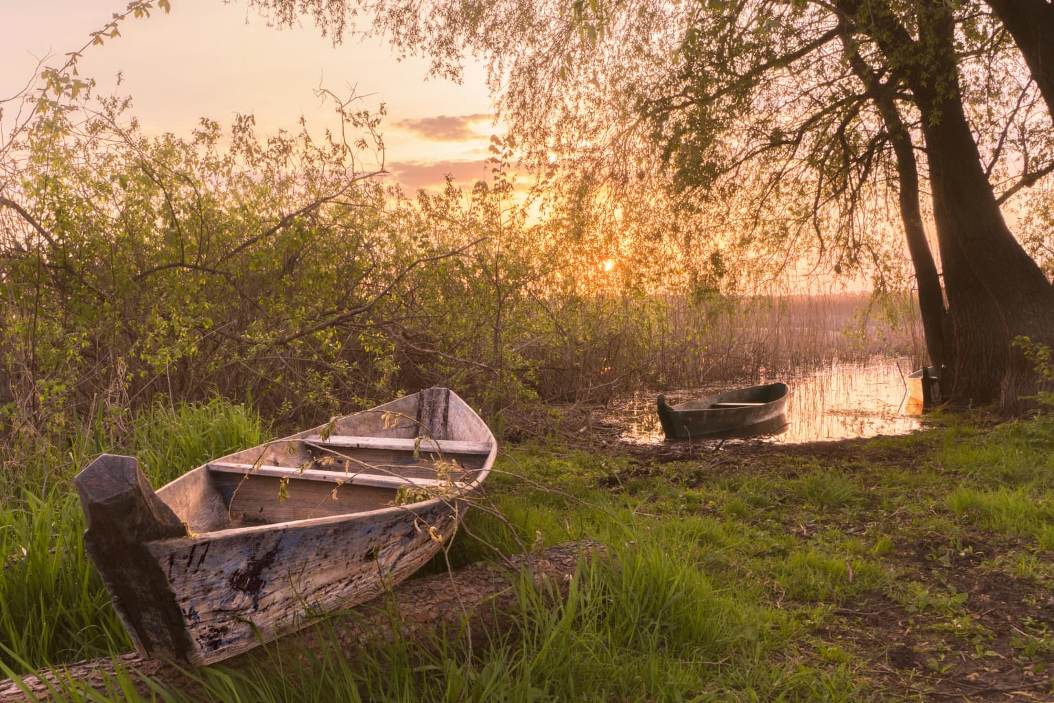
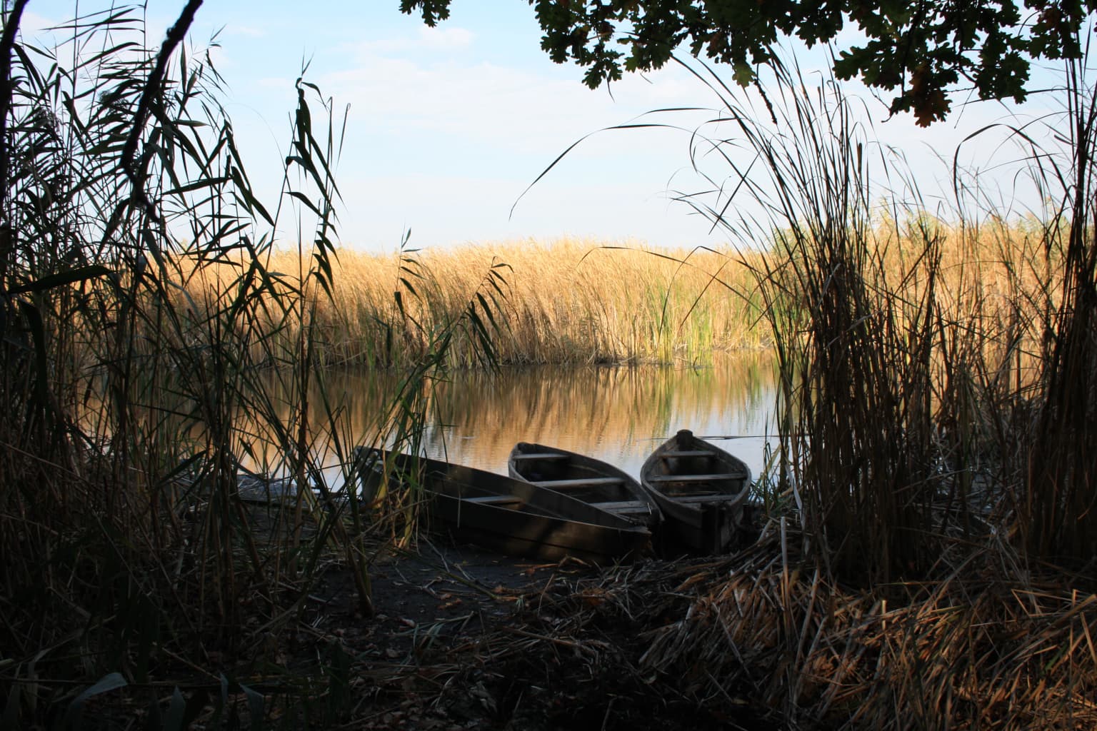
Best time to visit Lower Sula National Nature Park

The park can be visited throughout the year, though spring and summer offer the most active wildlife viewing opportunities when waterfowl nesting and plant flowering are at their peak. Spring flooding creates particularly dynamic wetland conditions, while summer provides opportunities for recreational activities including swimming, recreational fishing, and boat tours in designated areas. Autumn offers peaceful exploration of the changing landscape with fewer visitors, and winter provides a different perspective on the frozen wetland terrain. The park's four-season character reflects its continental climate, with each season offering distinct experiences of the wetland ecosystem.

Park location guide

Geography guide, regional context, and park location map for Lower Sula National Nature Park

Lower Sula National Nature Park park geography, regions, and map view in Ukraine
Understand where Lower Sula National Nature Park sits in Ukraine through a broader geographic reading of the surrounding landscape, nearby location context, and its mapped position within the national park landscape.

How Lower Sula National Nature Park fits into Ukraine

Ukraine is a sovereign nation in Eastern Europe, bordered by Russia, Belarus, Poland, Slovakia, Hungary, Romania, Moldova, and the Black Sea. It is the second-largest country in Europe by area. Kyiv is the capital and largest city, followed by Kharkiv, Odesa, and Dnipro. The official language is Ukrainian. Ukraine has a population of approximately 32.9 million and operates as a unitary semi-presidential republic.

Wider geography shaping Lower Sula National Nature Park in Ukraine

Ukraine occupies 603,628 km² in Eastern Europe, making it the second-largest country in Europe. It shares borders with Russia, Belarus, Poland, Slovakia, Hungary, Romania, and Moldova. The country has a southern coastline along the Black Sea and Sea of Azov. The terrain includes plains, steppes, and the Carpathian Mountains in the west.

Map view of Lower Sula National Nature Park

Use this park location map to pinpoint Lower Sula National Nature Park in Ukraine, understand its exact geographic position, and read its mapped placement within the surrounding landscape more clearly.

Pigeon | © OpenStreetMap contributors

Location context for Lower Sula National Nature Park

Cherkasy OblastPoltava Oblast

Browse images showcasing the unique wetland terrain, diverse floodplain habitats, and scenic views of this important Ukrainian protected area.

Lower Sula National Nature Park Photos: Discover Wetland Landscapes and Habitat Scenery
Journey through a visual atlas of Lower Sula National Nature Park, presenting its extensive wetland habitats, river floodplain ecosystems, and unique transitional forest-steppe landscapes. This imagery provides crucial insight into the park's hydrological character, diverse scenery, and vital conservation role as a major waterfowl and fish spawning ground.

A wide river flows through lush green wetlands with vegetation along the banks under a clear blue sky

Dawn scene with a river reflecting the sunrise, trees along the riverbank, and a distant tree in the water

Two weathered wooden boats resting on a grassy riverbank during sunrise, with trees and calm water in the background

Two wooden boats on a shore with tall grasses and reeds by a calm body of water

Panoramic view from a hill showing the Sula River estuary with grassy fields and scattered trees in the foreground

Snow-covered mountain peaks in the distance, with forested slopes and rocky terrain in the foreground under a partly cloudy sky.

Wide view of Sula River in Lower Sula National Nature Park with sandy peninsula extending into water and forested shoreline in background

River winding through wetlands with lush vegetation and grassy embankments, reflecting the sky

Light purple flowers with yellow centers and green foliage in close-up

Large light brown mushroom with smooth cap growing among fallen leaves and green foliage

Misty landscape with rolling hills, trees, and a river in the distance under a dawn sky

Scattered plastic bottles and debris on a muddy riverbank with sparse vegetation and water in the background

Park atlas

Map the geographic context and compare protected areas across Ukraine's wetland and forest steppe regions.

Explore Other National Parks and Protected Areas Surrounding Lower Sula National Nature Park
Continue exploring protected areas, tracing the regional geography of national parks and nature reserves located near Lower Sula National Nature Park. Compare different conservation landscapes and wetland ecosystems across central Ukraine, gaining deeper insights into their unique environmental roles and geographic distribution.
National parkPoltava Oblast

Pyriatyn National Nature Park: Detailed Atlas View of Ukrainian River Valley Protected Landscapes

Explore Poltava Oblast's unique wetland and floodplain ecosystems.

Pyriatyn National Nature Park provides an exceptional case study of a complete river valley ecosystem within Ukraine's Poltava Oblast. This protected area showcases a distinct topographic sequence, transitioning from upland terraces to extensive floodplain wetlands and the meandering Udai River. Discover the park's significant role in conserving boreal plant species at their southern range limits and its importance as a mapped natural landscape for geographic atlas exploration.

Area
120 km²
Established
2009
IUCN
II
Relief
Lowland
National parkKyiv Oblast

Bile Ozero National Nature Park: Detailed National Park Atlas and Geography

Explore protected landscape boundaries in Kyiv Oblast.

Delve into Bile Ozero National Nature Park, a prominent national park situated in Kyiv Oblast, Ukraine. This entry provides a focused atlas-style exploration of the park's protected area status and its precise geographic positioning. Understand the mapped contours of this natural landscape and its regional context, essential for comprehensive geographic discovery on MoriAtlas.

Area
70.14 km²
Established
2009
IUCN
II
Scope
Terrestrial
National parkUkraine

Ichnia National Nature Park: A Protected Landscape with Geographic Identity in Ukraine

Explore the mapped boundaries and regional natural context of this national park.

Ichnia National Nature Park represents a significant protected landscape within Ukraine, providing users with a focused entry point for geographic discovery. This page details its designation as a national park, highlighting its mapped features and regional setting. It serves as a foundational resource for understanding the park's specific landscape character and its contribution to the broader atlas of Ukraine's protected natural areas, offering detailed geographic context for further exploration.

Area
97 km²
Established
2004
IUCN
II
Relief
Lowland
National parkKharkiv Oblast

Sloboda National Nature Park: National Park Protected Landscape in Kharkiv Oblast

Mapped Boundaries and Regional Geography Exploration

Investigate Sloboda National Nature Park, a recognized national park situated within Ukraine's Kharkiv Oblast. This page offers detailed insights into its protected landscape, focusing on its geographic setting and mapped terrain. Understand how this park contributes to the regional geography of Sloboda Ukraine and explore its mapped boundaries for a structured atlas discovery experience.

Area
52.44 km²
Established
2009
IUCN
II
Relief
Mixed relief
National parkSumy Oblast

Hetman National Nature Park: National Park Geography and Protected Landscape Atlas

Mapped protected area within Sumy Oblast, Ukraine.

Explore Hetman National Nature Park, a designated national park situated in Sumy Oblast, Ukraine. This page offers a detailed look at its geographic setting, mapped boundaries, and role as a protected landscape. Understand its place within the regional geography of northeastern Ukraine and utilize MoriAtlas for structured map-based discovery of this significant natural area.

Area
234 km²
Established
2009
IUCN
II
Relief
Lowland
National parkUkraine

Holosiiv National Nature Park: Ukraine's Protected Area and Mapped Landscape

Explore geographic boundaries and regional context.

Holosiiv National Nature Park represents a significant protected natural landscape within Ukraine. This detail page offers in-depth atlas exploration of the park's mapped boundaries and its integration into the country's regional geography. Understand the value of this protected area through structured geographic data and visual context, enabling a deeper appreciation of its unique landscape identity within the national park system.

Area
45.255 km²
Established
2007
IUCN
II
Relief
Lowland
Watercolor illustration of a river landscape with green hills, reeds, and water lilies
National park

Zalissia National Nature Park: Protected Forest Atlas and Regional Geography

Mapping Ukraine's temperate hardwood and pine forest ecosystems.

Delve into Zalissia National Nature Park, a significant protected landscape in Ukraine renowned for its vast temperate hardwood forests and ancient pine stands. This atlas entry details the park's mapped boundaries, its position within the Desna River floodplain, and the unique geographic context of its forest ecosystems. Understanding Zalissia National Nature Park offers insight into the conservation of northern Ukraine's natural heritage and its place in the broader regional geography.

Area
148 km²
Established
2009
IUCN
II
Relief
Lowland
Watercolor illustration showing a valley with a winding river, green trees, and distant purple mountains under a light sky
National parkKharkiv Oblast

Homilsha Woods National Nature Park: National Park & Protected Landscape Atlas

Ancient oak woodlands and river valley geography in Kharkiv Oblast.

Delve into the protected natural heritage of Homilsha Woods National Nature Park, a significant national park situated in Ukraine's Kharkiv Oblast. This park preserves exceptional examples of ancient oak forests, some hundreds of years old, set within a complex geographic transition zone between steppe and forest ecosystems. Its diverse terrain, including hilly uplands and riverine plains, provides a compelling subject for mapped landscape discovery and understanding regional protected area distribution.

Area
143 km²
Established
2004
IUCN
II
Relief
Upland

Common questions about visiting, size, designation, and location context for Lower Sula National Nature Park

Lower Sula National Nature Park FAQs for park facts, access, geography, and protected area context
Find quick answers about Lower Sula National Nature Park, including protected-area facts, park geography, trail and visitor context, and how the park fits into its surrounding country and regional landscape.
MoriAtlas Explorer

Continue Your Protected Areas Search Across the Global Atlas

Deepen your exploration by continuing the structured search for national parks and protected areas worldwide. Utilize the comprehensive filtering capabilities to compare different conservation landscapes and refine your understanding of global park geography. Discover more about the distribution and characteristics of protected natural areas.

Global natural geography