Mori Atlas logo
Protected areaMăcin Mountains

Discover the mapped boundaries and landscape context of this protected area.

Măcin Mountains Protected Area: Geographic Identity and Atlas Exploration in Tulcea County

(Parcul Național Munții Măcinului)

The Măcin Mountains represent a distinct protected area within Romania's Tulcea County, offering unique opportunities for geographic and atlas-based discovery. This page provides detailed insight into the park's mapped boundaries and its place within the regional landscape. Understand the protected land's geographic setting and how it contributes to the broader atlas of natural areas, facilitating a structured exploration of its unique terrain and conservation context.

mountain rangegranite formationssteppe ecosystembird migrationendemic speciesPaleozoic geology
Stylized illustration of Măcin Mountains featuring rocky cliffs, green slopes, a winding river, and distant hills under a light sky

Măcin Mountains

Protected area

Park overview

Structured park overview, official facts, and landscape profile for Măcin Mountains

Măcin Mountains park facts, protected area profile, and essential visitor context
Review the core facts for Măcin Mountains, including designation, size, terrain, visitor scale, habitats, and operating context in one park-focused overview.

About Măcin Mountains

The Măcin Mountains form a triangular-shaped mountain range occupying the northwestern portion of the Dobruja plateau in eastern Romania. Geologically, they represent the most prominent residual witness of Hercynian orogeny at the end of the Paleozoic, appearing as inselberg formations rising from the surrounding lowland. The range extends approximately 24 kilometers between Turcoaia and the Lozova valley in its widest section, oriented along a northwest-to-southeast axis. The granite-dominated geology has produced numerous sharp peaks and steep slopes covered in scree, particularly in the crystalline areas. The mountains rise abruptly from the Danube floodplain, with a vertical difference of about 450 meters between the river valley and the main ridge. This dramatic relief creates a distinctive landscape that contrasts sharply with the surrounding steppe and agricultural lands of Dobruja.

Quick facts and research context for Măcin Mountains

The Măcin Mountains occupy the northwestern corner of Dobruja, rising above the Danube floodplain in eastern Romania. The highest peak Țuțuiatu reaches 467 meters and is the tallest point in the entire Dobruja plateau. The mountains are composed primarily of Paleozoic granite with secondary formations of gneiss, mica schist, quartzite, and amphibolite. The protected area covers approximately 11,321 hectares and represents a unique biogeographical zone where continental steppe meets sub-Mediterranean and Balkan forest ecosystems. The region serves as a critical staging area for migratory raptors moving between Europe and Africa.

Park context

Deeper park guide and search-rich context for Măcin Mountains

Măcin Mountains history, landscape, wildlife, and travel context
Explore Măcin Mountains through its history, landscape character, ecosystems, wildlife, conservation priorities, cultural context, and seasonal travel timing in a structured park guide built for atlas discovery and search intent.

Why Măcin Mountains stands out

The Măcin Mountains are renowned for their exceptional biodiversity and geological significance. They represent the only national park in Romania protecting authentic steppe vegetation, a habitat that has largely disappeared from Europe. The mountains host 27 endemic plant species and over 72 threatened flora species, making them globally significant for conservation. The area is particularly important for birds of prey, serving as Romania's most significant breeding area for raptors and a crucial passage point for migratory species. The unique beech and hornbeam forest found here is the only such formation in Romania, while the Dobrogean bellflower exists nowhere else on Earth except within this park.

Rocky mountain peak with scattered trees and a winding path overlooking a vast plain under clear blue sky
Măcin Mountains National Park landscape showing Ghiunaltu Peak with rocky terrain and surrounding plains

Măcin Mountains history and protected-area timeline

The geological history of the Măcin Mountains spans hundreds of millions of years, beginning with the Precambrian orogenetic cycles and continuing through the Caledonian, Hercynian, and early Alpine deformations. During the Triassic period, the granite formations existed as an island within the ancient Tethys Ocean. The current structural arrangement was finalized during the Eco-Cimmerian orogenetic phase in the Late Neocomian. The region has been inhabited since ancient times, with archaeological evidence pointing to Daco-Roman settlements along the Danube, including the fortified settlement of Aegyssus on what is now Tulcea. The historical town of Arrubium, located at modern-day Măcin, dates to the Celtic period. Throughout subsequent centuries, the Dobruja region experienced Byzantine, Ottoman, and Romanian rule, each leaving cultural imprints on the landscape.

Măcin Mountains landscape and geographic character

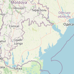
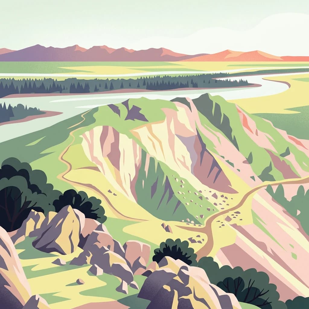
The Măcin Mountains present a landscape of rounded summits and steep, erosion-sculpted slopes dominated by granite outcrops. The terrain is characterized by a series of parallel ridges and isolated mound-like massifs that rise from the surrounding loess-covered plain. The main ridge follows the Pintenul Bugeacului from the northwest before fragmenting into numerous spurs in the south-southwest direction. Key peaks include Țuțuiatu at 467 meters, Pietrosul Mare at 426 meters, Priopcea at 409 meters, and Victoria peak at 341 meters. The landscape features numerous depressions, including the Greci depression drained by the Dumbravei and Plopilor valleys. Steep-sided valleys, rock-covered slopes, and the ruin-like appearance of weathered granite formations create a distinctive visual character. The mountains are bordered by the Danube to the north and west, the Taița River and Niculițel Hills to the east, and the Casimcea Plateau to the south.

Măcin Mountains ecosystems, habitats, and plant life

The ecological character of the Măcin Mountains is defined by a remarkable convergence of biogeographical influences. The region sits at the crossroads of Central European, Mediterranean, Balkan, and Pontic ecological zones, creating a unique blend of habitats and species. The vegetation spans multiple zones: steppe grasslands in lower areas, xerophilic forests of pubescent oak and hornbeam at medium altitudes, and mesophilic beech and hornbeam forests at higher elevations. The forests cover approximately 8,600 hectares within the mountain range, representing the most extensive woodlands in Dobruja. The park protects Romania's only remaining significant steppe vegetation, an ecosystem that has vanished from most of Europe. Plant communities here include rare associations found nowhere else in Europe, with 27 endemic species and over 72 nationally and internationally protected plant taxa.

Măcin Mountains wildlife and species highlights

The wildlife population of the Măcin Mountains reflects the diversity of habitats present, from open steppe to dense forests. The area is particularly significant for birds, with 187 species recorded within the park and 60 percent considered vulnerable, rare, or possibly extinct according to IUCN criteria. The mountains constitute Romania's most important breeding area for birds of prey, including the long-legged buzzard, short-toed snake eagle, booted eagle, Levant sparrowhawk, and saker falcon. The Danube falcon breeds exclusively here within Romania. The mammal population includes 41 species, with 11 protected under international conventions. Notable species include roe deer, red deer, fallow deer, wild boar, and the endangered ground squirrel. The park supports significant populations of small mammals and herpetofauna, with all 11 reptile species and 7 amphibian species protected under the Bern Convention.

Măcin Mountains conservation status and protection priorities

The Măcin Mountains were established as a national park primarily to protect Romania's last significant steppe ecosystem and the unique biodiversity it contains. The park covers 11,321 hectares, with 10,160 hectares under forest management by the National Forest Administration. The area has been recognized internationally for its importance in conserving European biodiversity, with numerous habitat types protected under the EU Habitats Directive including steppe grasslands, thermophilic oak forests, and beech woodlands. The presence of 27 endemic plant species, including the Dobrogean bellflower found nowhere else in the world, gives this park global significance for conservation. The International Union for Conservation of Nature has noted that without this park, the protection of European biodiversity would be incomplete.

Măcin Mountains cultural meaning and human context

The Măcin Mountains region has been inhabited continuously since prehistoric times, with archaeological evidence of Neolithic settlements in the Luncavița area and Daco-Roman settlements along the Danube. The nearby town of Măcin contains ruins of the ancient settlement of Arrubium, dating to Celtic times. The region bears traces of multiple historical periods, including Roman fortifications, medieval Genoese trading posts, Ottoman mosques such as the Ali Gazi Pasha Mosque in Babadag, and Romanian Orthodox monasteries. The traditional villages surrounding the mountains maintain agricultural practices that have shaped the cultural landscape over centuries.

Top sights and standout views in Măcin Mountains

The park offers several standout features that distinguish it within Romania's protected areas. The steppe ecosystem, representing the last significant example in Romania and one of the few remaining in Europe, supports plant and animal communities found nowhere else on the continent. The bird migration corridor here is one of the most important in Eastern Europe, with thousands of raptors passing through annually. The geological formations, among the oldest in Romania, provide insights into Earth's deep past. The Țuțuiatu peak offers panoramic views across the Danube floodplain and toward the Black Sea coast. The Pădurea Valea Fagilor (Beech Forest Valley) reserve contains exceptional examples of beech and hornbeam woodland unique to Romania.

Best time to visit Măcin Mountains

The Măcin Mountains can be visited throughout the year, though spring and early summer offer the most favorable conditions for observing wildlife and vegetation. April through June brings bird migration activity and the flowering of many endemic plant species. Autumn provides pleasant temperatures and the opportunity to observe raptor migration, particularly in September and October when numerous birds of prey pass through the area. Summer months can be hot and dry, while winter offers a stark beauty but with limited access to higher trails. The continental climate means significant temperature variation between seasons, with average annual temperatures between 10.5 and 11 degrees Celsius.

Park location guide

Geography guide, regional context, and park location map for Măcin Mountains

Măcin Mountains park geography, regions, and map view in Romania
Understand where Măcin Mountains sits in Romania through a broader geographic reading of the surrounding landscape, nearby location context, and its mapped position within the national park landscape.

How Măcin Mountains fits into Romania

Romania is a unitary semi-presidential republic located in Southeast and Central Europe. It borders Ukraine, Hungary, Serbia, Bulgaria, Moldova, and the Black Sea. The country has a population of approximately 19 million and covers an area of 238,397 km². Bucharest is the capital and largest city. Romania joined the European Union in 2007.

Wider geography shaping Măcin Mountains in Romania

Romania lies on the lower course of the Danube River, north of the Balkan Peninsula, and on the northwestern shore of the Black Sea. The terrain is varied, featuring the Carpathian Mountains in the center, the Transylvanian Plateau, the Moldavian Plateau, and plains along the Danube and in the south. The country has a diverse landscape that includes forests, meadows, and wetland areas.

Map view of Măcin Mountains

Use this park location map to pinpoint Măcin Mountains in Romania, understand its exact geographic position, and read its mapped placement within the surrounding landscape more clearly.

Pigeon | © OpenStreetMap contributors

Location context for Măcin Mountains

Tulcea County

Browse detailed imagery showcasing the unique granite formations, steppe ecosystems, and diverse habitats within Romania's ancient mountain range.

Măcin Mountains National Park Photos: Explore Landscapes, Scenery, and Protected Area Views
Visualizing Măcin Mountains provides essential insights into its distinctive terrain, from its rounded granite summits to unique steppe ecosystems. Explore park photography to understand the varied habitats, bird migration corridors, and the ancient geological character that define this important protected area in Romania.

Rocky mountain peak with scattered trees and a winding path overlooking a vast plain under clear blue sky

Wide landscape showing golden-brown grassy plains in the foreground, scattered trees and shrubs, a river in the midground, forested area beyond the river, and mountain range in the background under a clear sky

Park atlas

Explore the diverse protected landscapes and regional park geography surrounding Măcin Mountains, from granite formations to unique steppe ecosystems.

Discover Other National Parks and Protected Areas Near Măcin Mountains in Romania's Dobruja Region
After exploring Măcin Mountains National Park, browse other protected areas within the surrounding Dobruja region and adjacent landscapes, comparing their geological features and conservation efforts. Continue your atlas-style park discovery by mapping interconnected protected landscapes and tracing the geographical spread of mountain ranges, steppe ecosystems, and riparian zones.
Watercolor illustration of a wetland landscape with lakes, reeds, and distant mountains under a light sky
Protected landscapeBrăila County

Balta Mică a Brăilei Natural Park: Protected Landscape & Lower Danube Wetland Geography

Discover mapped boundaries and critical waterfowl habitats.

Balta Mică a Brăilei Natural Park is a vital protected landscape located in Brăila County, Romania, recognized for its extensive wetland ecosystems and importance for migratory bird populations. Situated within the Lower Danube floodplain, this park serves as a critical habitat and staging area for waterfowl traveling along major flyways. Its designation as a protected landscape highlights its significance for conservation and offers users a rich opportunity for geographic discovery, focusing on its unique riparian and steppe landscape interface, mapped terrain, and ecological value within the regional context.

Area
175.29 km²
Established
2000
IUCN
V
Relief
Lowland
Watercolor illustration of a river delta landscape with winding waterways, green fields, distant mountains, and a pale sky
Protected area

Danube Delta Protected Area: Mapping Europe's Largest River Delta Geography and Wetland Landscape

Explore the mapped protected area, its unique terrain, and regional landscape context.

The Danube Delta, a protected area in Romania, presents a remarkable geography defined by its extensive wetland terrain, intricate waterways, and significant biodiversity. As Europe's largest and best-preserved river delta, it offers a unique landscape for atlas-based exploration, focusing on its mapped boundaries, regional geographic context, and its role as a critical ecological zone where the Danube River merges with the Black Sea. Understand the delta's horizontal expanse, its network of channels, and its evolving landforms within a protected landscape of global importance.

Area
4,152 km²
Established
1998
IUCN
V
Relief
Lowland
Watercolor painting of a river flowing through a wetland with green hills and distant mountains
Protected landscapeGalați County

Lunca Joasă a Prutului Inferior Natural Park: Protected Landscape Atlas and Geographic Context

Explore its wetland terrain and mapped protected area boundaries.

Lunca Joasă a Prutului Inferior Natural Park is a crucial protected landscape within Galați County, Romania, recognized for its extensive wetland ecosystems and role as a vital bird migration hub. This atlas-focused entry details the park's mapped geography, showcasing its complex network of lakes, canals, and floodplains, and its significant habitats that support exceptional biodiversity along major European flyways.

Area
82.47 km²
Established
2005
IUCN
V
Relief
Lowland
National parkBilhorod-Dnistrovskyi Raion

Tuzly Lagoons National Nature Park: National Park Atlas and Geographic Context

Mapped protected landscape within Bilhorod-Dnistrovskyi Raion, Ukraine.

Navigate the protected landscape of Tuzly Lagoons National Nature Park through a detailed geographic lens. This national park entry within MoriAtlas provides structured information on its mapped boundaries and regional context within Bilhorod-Dnistrovskyi Raion, part of Ukraine's Bessarabia region. Understand its position and significance as a protected natural area, facilitating a deeper exploration of its geographical attributes and its place in the broader atlas of Ukrainian protected lands.

Area
278.65 km²
Established
2010
IUCN
II
Relief
Lowland
Illustration of a waterfall surrounded by trees with mountains in the background
Protected landscapeVrancea County

Putna-Vrancea Natural Park: A Protected Landscape in Vrancea County's Carpathian Mountains

Explore mapped terrain, natural park boundaries, and regional geography.

Putna-Vrancea Natural Park, designated as a protected landscape, offers detailed geographic insights into the Vrancea Mountains in Romania. Users can explore the park's mapped terrain, understand its protected boundaries, and contextualize its natural park status within Vrancea County and the broader Eastern Carpathians region. This atlas-focused view highlights the unique landscape features and regional geographic significance of this Romanian protected area.

Area
302.04 km²
Established
2005
IUCN
V
Relief
Mountain
Watercolor painting of a wetland landscape featuring marshes, a river, and distant hills under a soft sky
Protected landscapeGiurgiu County

Comana Natural Park: Protected Landscape Atlas and Regional Geography

Giurgiu County, Romania: Mapped protected area context.

Navigate the geographic features and protected landscape boundaries of Comana Natural Park, situated within Giurgiu County. This dedicated atlas entry provides a clear view of the park's mapped territory and its significance as a protected area, offering essential context for understanding its regional setting and natural terrain within Romania.

Area
249.63 km²
Established
2005
IUCN
V
Relief
Lowland
Watercolor illustration of a landscape with hills, a river, and green vegetation
National parkOdesa Oblast

Lower Dniester National Nature Park: National Park Map and Protected Landscape Atlas

Explore Odesa Oblast's protected natural geography and park boundaries.

The Lower Dniester National Nature Park is a vital component of Ukraine's protected lands, situated within the expansive Odesa Oblast. This page offers detailed geographic context, focusing on the park's mapped boundaries and its contribution to the regional landscape. Dive into an atlas-style exploration that highlights the park's protected terrain and its significance within the natural geography of southwestern Ukraine, offering structured discovery beyond basic park facts.

Area
213 km²
Established
2008
IUCN
II
Relief
Lowland
Watercolor painting of mountains, forests, and a body of water
Protected landscape

Bucegi Natural Park: Protected Landscape Mapping and Regional Geographic Overview

Explore its mapped boundaries and natural terrain.

As a protected landscape in Romania, Bucegi Natural Park offers a distinct focus for geographic study and atlas exploration. This detail page provides access to its mapped protected boundaries, helping users understand its specific location and regional context. Discover how this natural area contributes to the broader understanding of protected lands within the national geography. MoriAtlas enables a clear view of Bucegi Natural Park's landscape characteristics and its place within a mapped system of natural reserves.

Area
0.327 km²
Established
2000
IUCN
V
Relief
Mountain

Common questions about visiting, size, designation, and location context for Măcin Mountains

Măcin Mountains FAQs for park facts, access, geography, and protected area context
Find quick answers about Măcin Mountains, including protected-area facts, park geography, trail and visitor context, and how the park fits into its surrounding country and regional landscape.
MoriAtlas Explorer

Continue Your Protected Areas Search Across the Global Atlas

Deepen your exploration by continuing the structured search for national parks and protected areas worldwide. Utilize the comprehensive filtering capabilities to compare different conservation landscapes and refine your understanding of global park geography. Discover more about the distribution and characteristics of protected natural areas.

Global natural geography