Mori Atlas logo
National parkMeotyda National Nature Park

Discover the mapped boundaries and diverse habitats of this vital Ukrainian national park.

Meotyda National Nature Park: Protected Coastal Landscape and Bird Migration Corridor in Donetsk Oblast

(National Nature Park "Meotyda")

Meotyda National Nature Park represents a significant protected area along the northern coast of the Sea of Azov, situated within Donetsk Oblast. Established in 2009, this national park safeguards a unique mosaic of coastal landforms, including extensive spits, estuaries, and steppe ecosystems. Its landscape is characterized by dynamic interactions between the marine environment and continental terrain, making it a crucial component of the Azov-Black Sea coastal ecological network. Through MoriAtlas, users can explore the detailed geographic context and protected landscape of Meotyda National Nature Park, understanding its role in supporting millions of migratory birds and preserving unique coastal habitats.

Coastal WetlandsBird MigrationSea of AzovSteppe EcosystemsIUCN Category IIEastern Ukraine
Stylized illustration of a coastal scene with cliffs, sandy beach, calm water, green forests, and mountains under a sunny sky

Meotyda National Nature Park

National park

Park overview

Structured park overview, official facts, and landscape profile for Meotyda National Nature Park

Meotyda National Nature Park park facts, protected area profile, and essential visitor context
Review the core facts for Meotyda National Nature Park, including designation, size, terrain, visitor scale, habitats, and operating context in one park-focused overview.

About Meotyda National Nature Park

Meotyda National Nature Park occupies a strategic position on the northern coastline of the Sea of Azov, protecting one of Ukraine's most ecologically significant coastal wetland complexes. The park encompasses a two-kilometer coastal strip along with interior estuaries, tidal flats, and associated terrestrial habitats that form a continuous ecological corridor from the Black Sea to the steppe zones of eastern Ukraine.

The park's establishment built upon a network of existing protected areas, including the Belosariaiskka Spit nature reserve, the Bakai of Kryva Spit ornithological reserve, the Yelanchan Bakai reserve, and the Pryazovsky Heronry. These protected zones were integrated into a unified management framework in 2009 when the regional landscape park was upgraded to national park status. The park also incorporated the Kryvokisky Liman ornithological reserve and local nature monuments including Kryva Spit and Pine Cultures.

Geographically, the park sits at the interface between the marine environment of the Sea of Azov and the continental steppe ecosystems of the Pontic-Caspian region. The coastline features distinctive landforms including long sandy spits that extend into the sea, coastal dunes, and brackish lagoon systems where freshwater meets saltwater. These varied habitats support remarkable biological diversity despite the relatively harsh continental climate conditions.

The park's location near Mariupol and its proximity to major population centers has created ongoing challenges for conservation management. The area supports a local population exceeding 600,000 permanent residents, with an additional 90,000 seasonal visitors during summer months. This human presence, combined with agricultural and fishing activities in the surrounding region, has shaped both the ecological character and the conservation challenges facing the park.

Quick facts and research context for Meotyda National Nature Park

Meotyda National Nature Park covers approximately 207,000 hectares along the northern Sea of Azov coast in Donetsk Oblast, Ukraine. The park was established in 2009 and is categorized as IUCN protected area management type II. It lies near Mariupol and crosses several administrative districts including former Novoazovsk and Manhush raions. The climate is humid continental with hot summers and average annual precipitation of 350mm. The park sits within the Pontic-Caspian steppe ecoregion and includes the Belosariaiskka Spit in the west and Kryva Bay with Kryva Spit in the east. The area was created as a regional landscape park in 2000 before achieving national park status in 2009.

Park context

Deeper park guide and search-rich context for Meotyda National Nature Park

Meotyda National Nature Park history, landscape, wildlife, and travel context
Explore Meotyda National Nature Park through its history, landscape character, ecosystems, wildlife, conservation priorities, cultural context, and seasonal travel timing in a structured park guide built for atlas discovery and search intent.

Why Meotyda National Nature Park stands out

Meotyda is best known for its exceptional ornithological significance as a major migratory bird corridor and nesting ground along the Azov coast. The park supports over 100 species of nesting birds and serves as a critical stopover for millions of migratory waterfowl. The protected wetlands and spits create ideal conditions for colonial waterbird nesting, with the Kryva Spit area hosting one of Europe's largest black-tailed godwit colonies. The park also protects diverse coastal steppe and wetland habitats that represent the southwestern edge of the Pontic-Caspian steppe ecoregion.

Wide view of Meotyda National Nature Park showing extensive wetlands with water channels, golden grassland in the foreground, and the Sea of Azov on the horizon
Wetland and coastal plain landscape of Meotyda National Nature Park with water channels and golden grasses along the Sea of Azov

Meotyda National Nature Park history and protected-area timeline

Meotyda National Nature Park emerged from a stepwise conservation development process that began in the late 20th century. The foundation of the current protected area was laid in 2000 when the Donetsk Oblast Council established the Meotyda Regional Landscape Park on June 30, covering an initial area of 13,016.9 hectares across what were then Novoazovsk and Manhush raions.

The regional landscape park was created primarily to protect the coastal wetland ecosystems and their exceptional bird populations, particularly the colonial nesting grounds along the Kryva Spit. Even before formal protection, the Strilka area at the tip of Kryva Spit had been designated as an ornithological reserve in the early 1980s due to mounting concerns about declining bird populations. At that time, hunting, commercial and amateur fishing, reed cutting, and tourism had significantly reduced the numbers of waterbirds using the area, with many rare species abandoning the site as a nesting ground.

Under the leadership of ornithologist and conservationist H.M. Molodan, the regional landscape park implemented strict protection measures, establishing a fully protected zone where all economic activities and human access were prohibited. These measures proved remarkably effective, with bird populations recovering dramatically within seven years. The black-tailed godwit population grew from zero nesting pairs to approximately 3,000 nests, and the Dalmatian Pelican established a breeding colony of 17 nests.

In 2009, the park was elevated to national status by decree of the President of Ukraine, expanding the protected area and strengthening its conservation mandate. The park's boundaries were significantly modified again in January 2022 according to a presidential decree. However, since 2014, the park has faced extraordinary challenges due to the armed conflict in eastern Ukraine, with the administrative center in Novoazovsk falling outside government control and park operations severely disrupted.

Meotyda National Nature Park landscape and geographic character

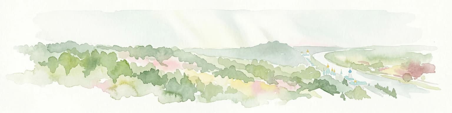
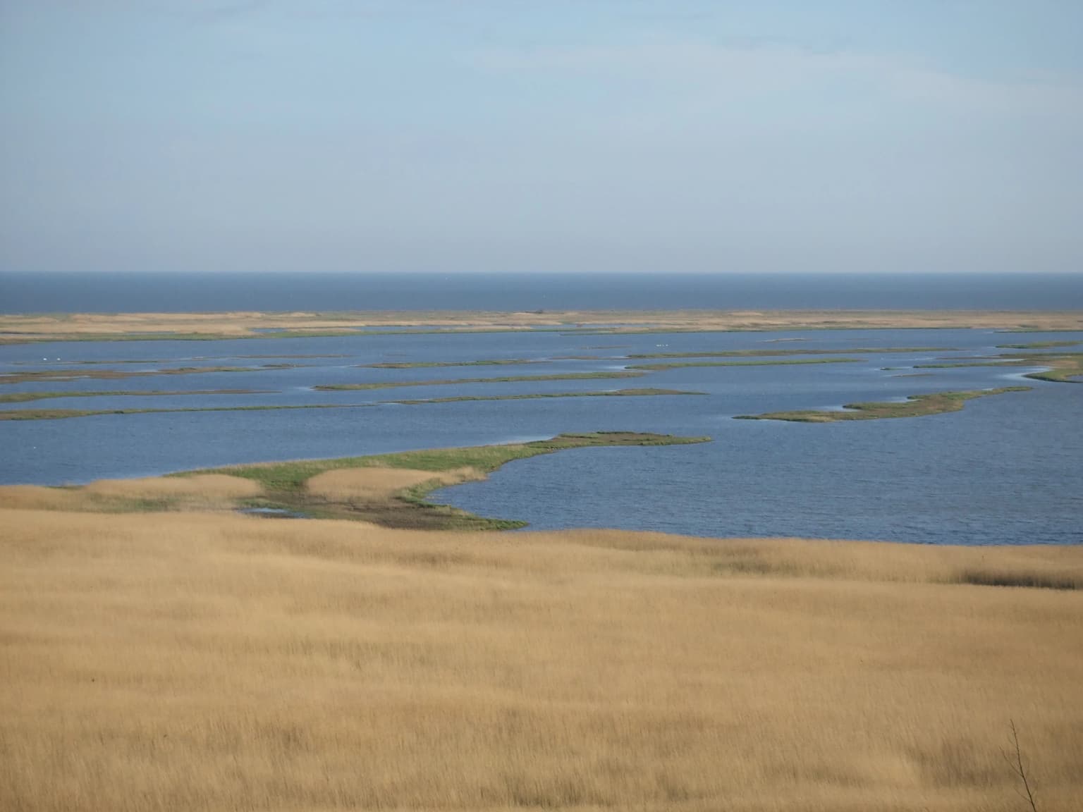
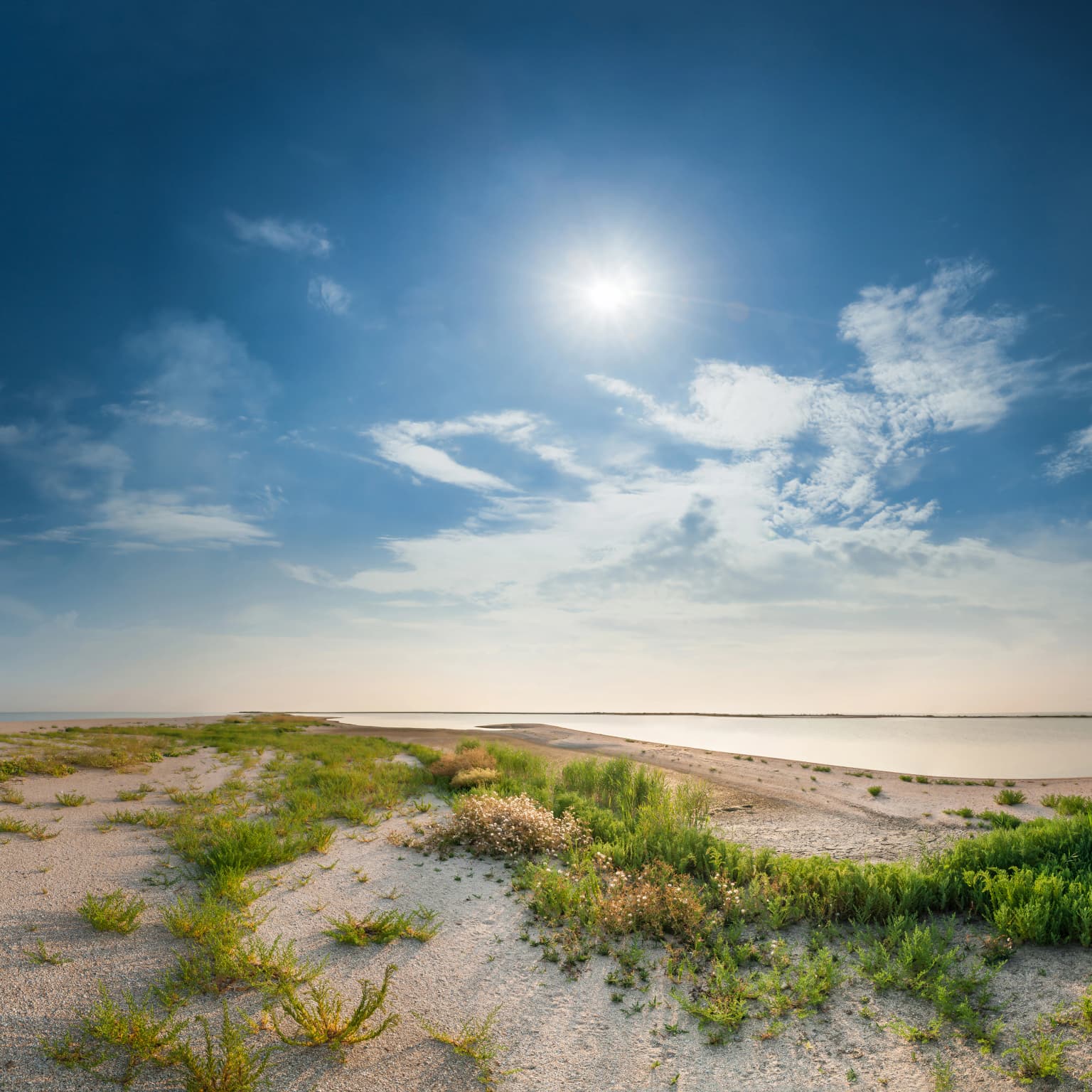
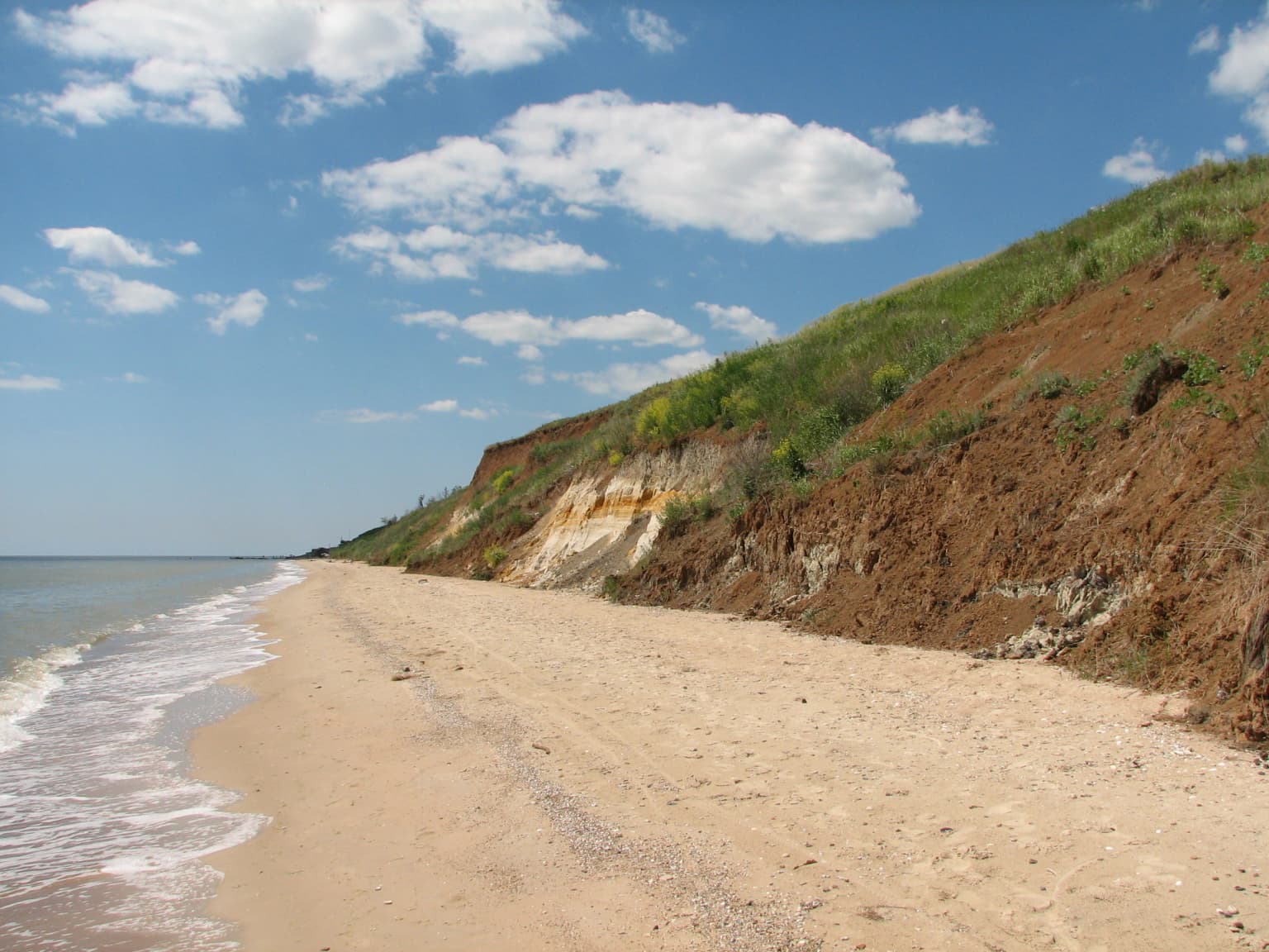
The landscape of Meotyda National Nature Park is defined by the dynamic interaction between the Sea of Azov and the surrounding steppe terrain. The park protects a complex mosaic of coastal landforms including long sandy spits that protrude into the sea, wave-cut beaches, coastal dunes, and brackish lagoon systems behind the beach barriers. Two primary coastal sections form the core of the park's ornithological importance: the Belosariaiskka Spit in the western portion and the Kryva Bay and Kryva Spit in the east.

Inland from the coast, the terrain transitions into flat coastal plains and floodplain wetlands associated with the estuarine systems that feed into the Sea of Azov. These wetlands feature variable salinity depending on seasonal freshwater inflow and tidal exchange, creating heterogeneous habitat conditions that support different ecological communities. The park also encompasses areas of steppe vegetation on the higher ground between the wetlands and the sea.

The underwater portion of the park extends to approximately 14,000 hectares of marine and lagoon waters, protecting the aquatic ecosystems that are integral to the coastal wetland complex. Saline lakes and coastal marshes add to the habitat diversity, particularly in areas where freshwater seepage creates distinct zonation patterns in the vegetation. The overall landscape presents a relatively flat topography broken by the subtle relief of beach ridges, dune systems, and the elevated areas of the spits themselves.

Sandy coastal plain with patches of grass and low vegetation under a bright sun with a clear blue sky and distant sea horizon
Coastal plain with sparse vegetation and sea view in Meotyda National Nature Park

Meotyda National Nature Park ecosystems, habitats, and plant life

Meotyda occupies a key position within the Pontic-Caspian steppe ecoregion, one of the most significant grassland ecosystems in Eurasia. The park's location on the Azov coast places it at a critical biogeographic junction where steppe, coastal, and wetland habitats converge. Ecologists from the Donetsk Botanical Garden have identified 49 distinct plant formations within the park, encompassing halophyte (salt-tolerant) vegetation, steppe communities, wetland and aquatic plants, psammophyte (sand-dune) vegetation, and synanthropic species adapted to human-modified environments.

The coastal wetlands represent the most ecologically significant portion of the park, forming part of the Azov-Black Sea coastal ecological corridor that connects protected areas from the Black Sea coast through the Azov region to the steppe zones further east. This corridor provides essential stopover habitat for migratory birds moving between breeding grounds in northern Europe and wintering areas in the Mediterranean, Africa, and Southwest Asia.

The park's aquatic environments support a remarkable fish diversity, with all 79 species historically found in the Sea of Azov recorded in the park's waters. The Azov Sea was historically renowned as one of the world's most productive fishing seas, and the park's protected waters continue to support this biological heritage. Rare individuals of the Azov subspecies of common dolphin are occasionally observed in the park's marine waters, representing a small but notable population of this Black Sea cetacean.

Sandy beach with shallow waves, coastal cliffs with green vegetation, and blue sky with scattered clouds.
Sandy beach with gentle waves and coastal cliffs at Meotyda National Nature Park near Rybatske village.

Meotyda National Nature Park wildlife and species highlights

The wildlife of Meotyda National Nature Park is exceptionally rich, with particular significance for ornithology. The park supports over 100 species of nesting birds and serves as a major concentration point for migratory waterfowl traveling along the East Atlantic Flyway. During spring and summer, the suitable nesting areas become covered with a near-continuous carpet of waders, gulls, and terns.

Among the nesting species, several are listed in the Red Book of Ukraine and represent significant conservation priorities. The black-tailed godwit has established its largest European colony within the park, growing from complete absence to approximately 3,000 nesting pairs following protection measures. The Dalmatian Pelican, one of Europe's rarest breeding birds, also nests in significant numbers within the protected area. The Kentish Plover and the Greater Ringed Plover are among the shorebird species that use the coastal spits for breeding.

During migration, the park hosts millions of birds representing numerous species. The steppe bustard, a magnificent ground bird of the open grasslands, passes through during its seasonal movements. The Black Stork, a symbol of clean waters and healthy ecosystems, uses the park as a stopover. The Red-breasted Goose, a species that breeds in the distant tundra, visits the area during migration, while the Cinereous Vulture arrives from mountain habitats to the south. Winter brings species such as the Snowy Owl to the coastal areas.

The marine and lagoon waters support 79 fish species, and occasional Azov dolphins are spotted in the deeper waters. The invertebrate fauna of the protected spits also retains good representations of indigenous species, indicating relatively healthy ecosystem function in the protected coastal areas.

Meotyda National Nature Park conservation status and protection priorities

Meotyda National Nature Park represents one of Ukraine's most important protected areas for coastal wetland and steppe bird conservation. The park was designed to serve as the eastern anchor of the Azov-Black Sea coastal ecological corridor, connecting the entire Azov coast (with the exception of Mariupol itself) into a continuous protected network. This corridor function is critical for migratory birds that depend on a chain of suitable stopover and nesting sites along their transcontinental journeys.

The park's conservation value is demonstrated by the remarkable recovery of bird populations following the establishment of strict protection zones. The transformation of the Strilka area from an abandoned nesting ground to Europe's largest black-tailed godwit colony represents a notable conservation success story. Similar population recoveries for the Dalmatian Pelican and other species highlight the effectiveness of protection measures when adequately enforced.

However, the park faces severe conservation challenges due to the armed conflict that has affected eastern Ukraine since 2014. The administrative infrastructure was based in Novoazovsk, which came under non-government control, leading to the cessation of regular park protection services. This resulted in numerous violations and significant losses to bird populations in affected areas. The eastern sections of the park fell outside effective administrative control, with unclear impacts on vulnerable wildlife populations. In the retained western sections, increased military patrols paradoxically provided some security for nesting birds by reducing human and dog disturbance.

Meotyda National Nature Park cultural meaning and human context

The park takes its name from the Maeotians, an ancient people who inhabited the shores of the Sea of Azov in classical antiquity. The sea itself was known in ancient sources as Lake Maeotis and the Maeotian Sea, reflecting this historical connection. This naming links the modern protected area to the long human history of interaction with the Azov coast landscape.

The park lies in a region that has been contested and populated by various peoples over the centuries, forming part of the historical interface between different cultural spheres. The coastal location meant that fishing and maritime activities shaped local economies and settlement patterns, while the adjacent steppes supported pastoral traditions. The modern population of the surrounding area exceeds 600,000 permanent residents, with the city of Mariupol serving as the primary urban center.

The administrative structure of the park encompasses territories in what were formerly Kalmiusky and Mariupol districts of Donetsk Oblast, reflecting the historical settlement patterns along this coastal strip. The park incorporates areas that have been used for traditional economic activities including fishing, reed harvesting, and seasonal livestock grazing, though these activities are now regulated within the protected area framework.

Top sights and standout views in Meotyda National Nature Park

Meotyda National Nature Park stands out as a premier birdwatching and ecological destination on the Azov coast, offering access to one of Europe's most important migratory bird corridors. The Kryva Spit area hosts remarkable colonial nesting colonies including the continent's largest black-tailed godwit population and breeding Dalmatian Pelicans. The diverse coastal landscapes of spits, wetlands, and steppe provide habitat for over 100 breeding bird species and millions of migrants. The park serves as the eastern anchor of the Azov-Black Sea coastal ecological corridor, connecting protected areas across hundreds of kilometers of Ukrainian coastline. Visitors can experience the interface between marine and continental ecosystems, with opportunities to observe both coastal birdlife and steppe species in close proximity. The combination of significant biodiversity and the historical depth of human interaction with the landscape adds cultural dimension to the ecological experience.

Best time to visit Meotyda National Nature Park

The optimal time to visit Meotyda National Nature Park depends on the specific interests of visitors, though spring and early summer offer the most spectacular birdwatching opportunities. May and June coincide with the peak breeding season when colonial nesting birds occupy the coastal spits and wetlands in large numbers. The sight of thousands of waders, gulls, and terns nesting across the coastal areas represents a remarkable natural spectacle. Migratory bird passage in spring provides additional opportunities to observe diverse species as they move north to breeding grounds.

Autumn migration, particularly during September and October, brings another wave of bird activity as many species move southward toward wintering areas. The park's position along major flyway routes means that significant bird movements can be observed during both seasonal transitions. Winter visits offer a different experience, with the possibility of encountering species such as the Snowy Owl that venture south from Arctic breeding grounds.

Visitors should be aware that the park's operational status has been affected by the ongoing conflict in eastern Ukraine, and access conditions may vary. The information provided reflects general ecological patterns and historical visitor experiences rather than current operational guidance.

Park location guide

Geography guide, regional context, and park location map for Meotyda National Nature Park

Meotyda National Nature Park park geography, regions, and map view in Ukraine
Understand where Meotyda National Nature Park sits in Ukraine through a broader geographic reading of the surrounding landscape, nearby location context, and its mapped position within the national park landscape.

How Meotyda National Nature Park fits into Ukraine

Ukraine is a sovereign nation in Eastern Europe, bordered by Russia, Belarus, Poland, Slovakia, Hungary, Romania, Moldova, and the Black Sea. It is the second-largest country in Europe by area. Kyiv is the capital and largest city, followed by Kharkiv, Odesa, and Dnipro. The official language is Ukrainian. Ukraine has a population of approximately 32.9 million and operates as a unitary semi-presidential republic.

Wider geography shaping Meotyda National Nature Park in Ukraine

Ukraine occupies 603,628 km² in Eastern Europe, making it the second-largest country in Europe. It shares borders with Russia, Belarus, Poland, Slovakia, Hungary, Romania, and Moldova. The country has a southern coastline along the Black Sea and Sea of Azov. The terrain includes plains, steppes, and the Carpathian Mountains in the west.

Map view of Meotyda National Nature Park

Use this park location map to pinpoint Meotyda National Nature Park in Ukraine, understand its exact geographic position, and read its mapped placement within the surrounding landscape more clearly.

Pigeon | © OpenStreetMap contributors

Location context for Meotyda National Nature Park

Donetsk Oblast

Explore diverse Azov Sea terrain, from sandy spits to brackish estuaries and steppe, revealing the park's ecological character.

Meotyda National Nature Park Photos: Visualizing Coastal Landscapes and Critical Bird Habitats
Gain a deeper understanding of Meotyda National Nature Park through a curated collection of imagery, illustrating its complex coastal landforms, expansive wetlands, and vibrant birdlife. These visuals provide crucial insight into the park's protected status, showcasing the environmental features and unique scenery that define this vital Azov-Black Sea ecological corridor.

Wide view of Meotyda National Nature Park showing extensive wetlands with water channels, golden grassland in the foreground, and the Sea of Azov on the horizon

Panoramic view of mountain peaks with forested terrain, rocky outcrops in foreground, and partly cloudy sky

Sandy coastal plain with patches of grass and low vegetation under a bright sun with a clear blue sky and distant sea horizon

Sandy beach with shallow waves, coastal cliffs with green vegetation, and blue sky with scattered clouds.

Park atlas

Compare other protected landscapes, coastal wetlands, and steppe ecosystems in the wider Azov Sea region, tracing regional park geography.

Discover Nearby National Parks and Protected Areas Around Meotyda National Nature Park
Expand your park discovery from Meotyda National Nature Park to explore other national parks and protected areas within related coastal wetland and steppe ecosystems. Compare the diverse regional park geography, understanding broader conservation patterns and the interconnectedness of protected landscapes around the Sea of Azov.
Watercolor illustration showing a river winding through a forested valley with rolling hills and distant mountains under a light sky
National parkDonetsk Oblast

Holy Mountains National Nature Park: Donetsk Oblast Protected Landscape

Mapped boundaries and regional geographic context.

This entry details Holy Mountains National Nature Park, a protected national park located in Donetsk Oblast, Ukraine. It serves as a key point for exploring the mapped protected areas and natural landscapes within the Donbas region. Understand the park's geographic significance and its place within the atlas of eastern Ukraine's diverse terrain and conservation efforts.

Area
406 km²
Established
1997
IUCN
II
Relief
Mixed relief
National parkZaporizhzhia Oblast

Pryazovia National Nature Park: National Park Protected Landscape Atlas

Explore the mapped boundaries and regional geography of Pryazovia National Nature Park.

Pryazovia National Nature Park represents a key protected area within Zaporizhzhia Oblast, Ukraine. This MoriAtlas entry provides detailed atlas-style information, emphasizing the park's mapped boundaries and its integration into the regional geography. Understand the park's character as a protected natural landscape situated in the southeastern Ukrainian coastal zone near the Sea of Azov, offering valuable context for geographic exploration.

Area
781 km²
Established
2010
IUCN
II
Relief
Lowland
Watercolor illustration of a landscape with rolling hills, a body of water, and greenery
National parkZaporizhzhia Oblast

Grand Meadow National Nature Park: National Park Protected Landscape and Regional Geography

Explore the mapped boundaries and natural terrain.

Grand Meadow National Nature Park represents a distinct protected landscape within Zaporizhzhia Oblast, Ukraine. As a national park, its designation signifies an area managed for conservation and geographic study. This entry on MoriAtlas details the park's physical presence, offering users the opportunity to explore its mapped terrain, understand its role in regional geography, and place it within the broader atlas of Ukrainian protected areas. It is ideal for users seeking concrete landscape context and precise geographic data.

Area
168 km²
Established
2006
IUCN
II
Relief
Lowland
National park

Azov, Syvash National Nature Park: National Park Protected Landscape and Geography

Explore mapped boundaries and regional landscape context.

Azov, Syvash National Nature Park stands as a notable protected area, offering a distinct geographic identity within Ukraine's atlas of natural landscapes. This national park's mapped boundaries provide a foundation for understanding its landscape context and regional significance. MoriAtlas enables detailed exploration of its protected terrain and its place within the country's conservation geography, serving as a gateway to structured geographic information and detailed park data for researchers and explorers.

Area
525.8 km²
Established
1993
IUCN
II
Relief
Lowland
Watercolor illustration showing a valley with a winding river, green trees, and distant purple mountains under a light sky
National parkKharkiv Oblast

Homilsha Woods National Nature Park: National Park & Protected Landscape Atlas

Ancient oak woodlands and river valley geography in Kharkiv Oblast.

Delve into the protected natural heritage of Homilsha Woods National Nature Park, a significant national park situated in Ukraine's Kharkiv Oblast. This park preserves exceptional examples of ancient oak forests, some hundreds of years old, set within a complex geographic transition zone between steppe and forest ecosystems. Its diverse terrain, including hilly uplands and riverine plains, provides a compelling subject for mapped landscape discovery and understanding regional protected area distribution.

Area
143 km²
Established
2004
IUCN
II
Relief
Upland
Watercolor illustration of a river valley with hills, green fields, and distant mountains under a soft sky
National parkUkraine

Dvorichna National Nature Park: Protected Landscape and Geographic Atlas in Ukraine

Explore mapped boundaries and regional geography within Ukraine.

Understand the protected landscape identity of Dvorichna National Nature Park, a national park situated in Ukraine. This page provides detailed geographic context, focusing on mapped protected areas and the park's natural terrain. It serves as an atlas entry point to comprehend the park's placement within Eastern Europe and its significance as a conservation landscape.

Area
31.31 km²
Established
2009
IUCN
II
Relief
Highland
National parkKharkiv Oblast

Sloboda National Nature Park: National Park Protected Landscape in Kharkiv Oblast

Mapped Boundaries and Regional Geography Exploration

Investigate Sloboda National Nature Park, a recognized national park situated within Ukraine's Kharkiv Oblast. This page offers detailed insights into its protected landscape, focusing on its geographic setting and mapped terrain. Understand how this park contributes to the regional geography of Sloboda Ukraine and explore its mapped boundaries for a structured atlas discovery experience.

Area
52.44 km²
Established
2009
IUCN
II
Relief
Mixed relief
Nature reserve

Crimean Nature Reserve: Nature Reserve with Mountain Forests and Karst Geography

Explore protected area landscapes and terrain.

The Crimean Nature Reserve is a key protected area within the Crimean Mountains, recognized for its significant mountain forests and unique karst landscapes. This nature reserve encompasses a critical span of the peninsula's rugged terrain, from high mountain ridges to dramatic southern slopes. Its designation as a protected area highlights its ecological importance and its role in preserving diverse natural habitats and geological features within a regional geographic context, making it a notable destination for landscape exploration.

Area
442 km²
Established
1991
IUCN
Ia
Relief
Mountain

Common questions about visiting, size, designation, and location context for Meotyda National Nature Park

Meotyda National Nature Park FAQs for park facts, access, geography, and protected area context
Find quick answers about Meotyda National Nature Park, including protected-area facts, park geography, trail and visitor context, and how the park fits into its surrounding country and regional landscape.
MoriAtlas Explorer

Continue Your Protected Areas Search Across the Global Atlas

Deepen your exploration by continuing the structured search for national parks and protected areas worldwide. Utilize the comprehensive filtering capabilities to compare different conservation landscapes and refine your understanding of global park geography. Discover more about the distribution and characteristics of protected natural areas.

Global natural geography