Mori Atlas logo
National parkNechkinsky National Park

Discover the unique river valley terrain, ecological richness, and archaeological heritage mapped within this Russian national park.

Nechkinsky National Park: Protected Landscape Atlas and Geographic Context in Udmurt Republic

(National Park «Nechkinsky»)

Nechkinsky National Park represents a significant protected landscape within the Udmurt Republic, Russia. This national park anchors itself along the confluence of the Kama and Siva Rivers, its geography defined by an asymmetrical river valley featuring steep slopes and expansive floodplains. With its protected area boundaries encompassing diverse terrain, from riverine wetlands to mixed forests, Nechkinsky National Park offers a rich context for understanding regional geography and the mapped distribution of natural and cultural heritage.

National ParksRussiaUdmurt RepublicRiver ValleysWetlandsMixed Forests

Nechkinsky National Park

National park

Park overview

Structured park overview, official facts, and landscape profile for Nechkinsky National Park

Nechkinsky National Park park facts, protected area profile, and essential visitor context
Review the core facts for Nechkinsky National Park, including designation, size, terrain, visitor scale, habitats, and operating context in one park-focused overview.

About Nechkinsky National Park

Nechkinsky National Park occupies a strategically important position in the central Volga-Ural region, protecting a segment of the Kama River valley and its tributary, the Siva River, along with the coastal zone of the Votkinsk reservoir. The park's landscape is defined by a forested valley system that descends 110 to 160 meters below the surrounding terrain, with a width ranging from 3 to 20 kilometers. This asymmetrical valley features a flat left bank and a steeply sloped right bank, creating diverse microhabitats within a relatively compact area. The Kama River at this location develops a wide floodplain with multiple fluvial terraces at elevated levels, adding to the topographic complexity. The park sits on the western side of the central Ural Mountains, placing it at an ecological transition zone between European and Siberian biomes. Beyond its natural values, the park contains numerous ancient archaeological sites that document thousands of years of human occupation in this river valley environment.

Quick facts and research context for Nechkinsky National Park

Nechkinsky National Park spans 20,753 hectares in the Udmurt Republic, Russia, along the middle Kama River valley and Siva River watershed. The terrain features an asymmetrical valley 110–160 meters deep and 3–20 kilometers wide, with a flat left bank and steep right bank. The park lies within the Sarmatic mixed forests ecoregion and experiences a humid continental climate with warm summers and cold, snowy winters. The protected area contains 712 vascular plant species representing 70% of Udmurtia's flora, and supports 50 mammal species, 191 bird species, and 37 fish species.

Park context

Deeper park guide and search-rich context for Nechkinsky National Park

Nechkinsky National Park history, landscape, wildlife, and travel context
Explore Nechkinsky National Park through its history, landscape character, ecosystems, wildlife, conservation priorities, cultural context, and seasonal travel timing in a structured park guide built for atlas discovery and search intent.

Why Nechkinsky National Park stands out

Nechkinsky National Park is best known for its combination of rich biodiversity and significant archaeological heritage within a diverse river valley landscape. The park protects important populations of rare species including the vulnerable Russian desman, an unusual semi-aquatic mammal historically trapped for its fur, as well as endangered waterfowl such as the red-breasted goose. The landscape features a distinctive asymmetrical valley with flat and steep banks, extensive floodplain wetlands including the Kemulskoye bog, and a transition zone between taiga, mixed forests, and steppe-forest ecosystems. The park also preserves ancient archaeological sites spanning from the 3rd millennium BCE through the Iron Age, associated with the Ananyino culture.

Nechkinsky National Park history and protected-area timeline

The history of human occupation in the Nechkinsky area stretches back to ancient times, with archaeological evidence of settlement by hunters and fishers dating to the 3rd and 2nd millennia BCE. The earliest clearly identifiable archaeological sites within the park are fortified Iron Age settlements from the first millennium BCE, associated with the Ananyino culture. This cultural group represented an early Finno-Ugric population that inhabited the river valleys of the eastern Volga region. Nechkinsky National Park was officially established on October 16, 1997, as a protected area combining natural and cultural heritage conservation objectives. The park was created to preserve the unique combination of biological diversity, landscape features, and archaeological heritage found in this section of the Kama River valley.

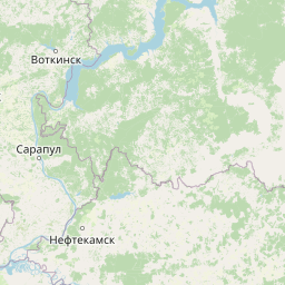
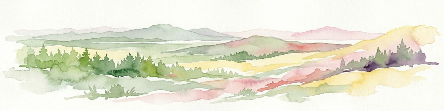
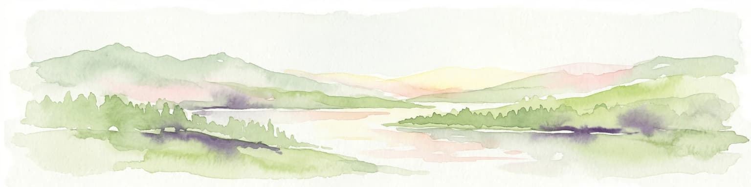
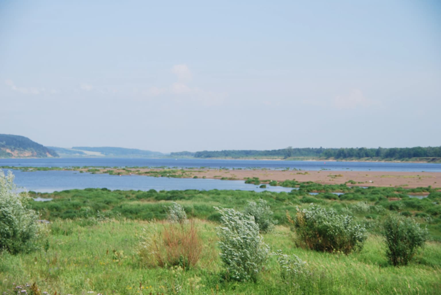
Nechkinsky National Park landscape and geographic character

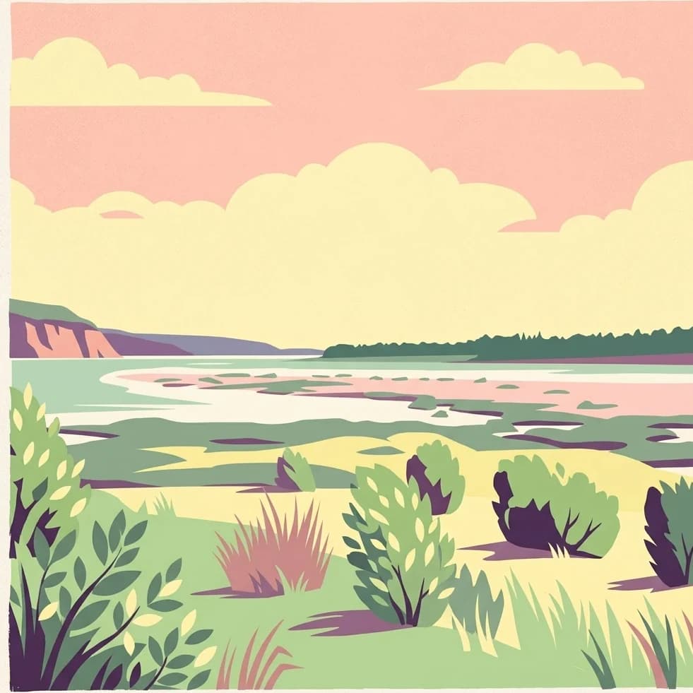
The physical landscape of Nechkinsky National Park centers on the forested valley of the Siva River watershed, a tributary of the Kama River. The valley is distinctly asymmetrical, with the left bank presenting a relatively flat terrain and the right bank forming a steep hillside that rises prominently above the river corridor. The valley floor ranges from 3 to 20 kilometers in width and cuts 110 to 160 meters into the surrounding landscape. The Kama River within the park boundaries features a wide floodplain with several distinct fluvial terraces visible at higher elevations, indicating the river's historical meandering and avulsion patterns. The coastal area along the Votkinsk reservoir adds a large impounded water body to the park's hydrological character, creating additional habitat diversity along its shores.

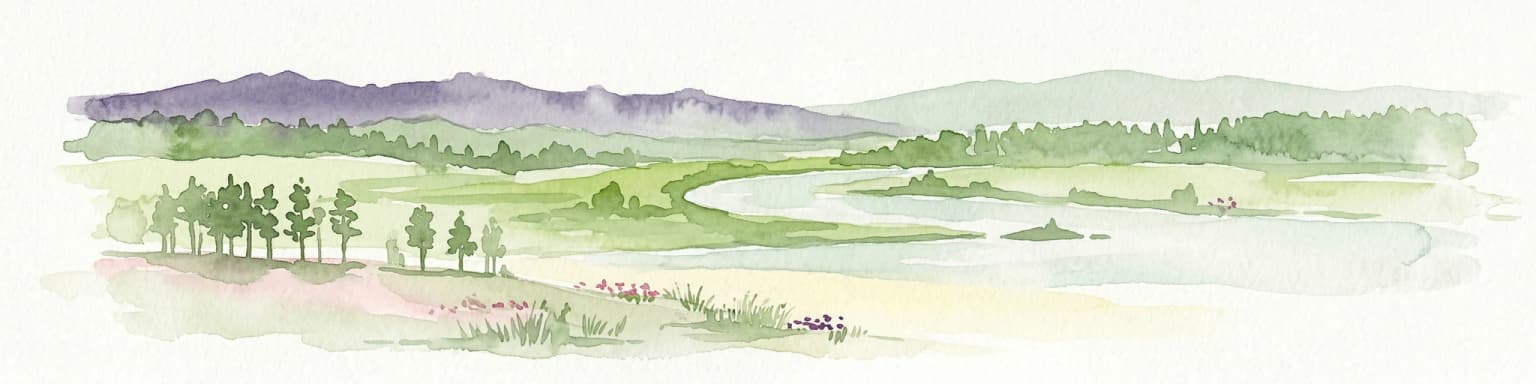
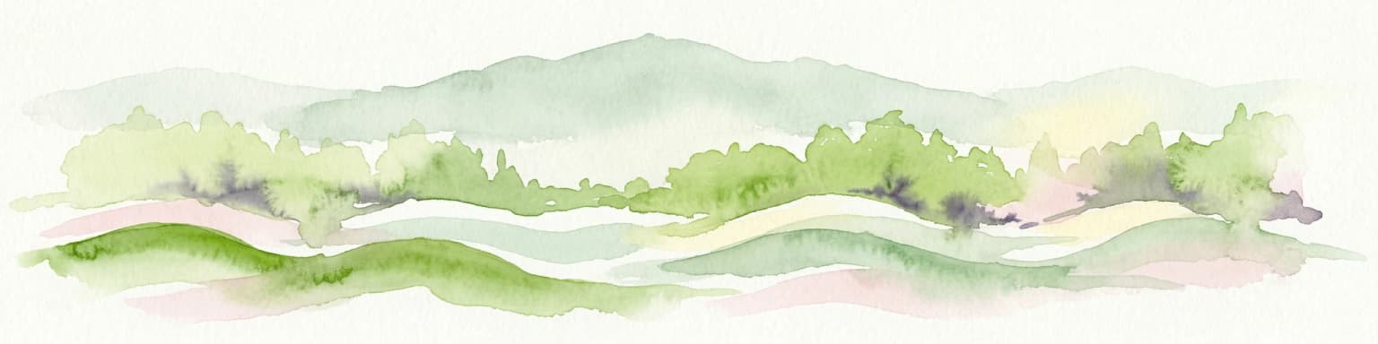
Nechkinsky National Park ecosystems, habitats, and plant life

The ecological character of Nechkinsky reflects its position within the Sarmatic mixed forests ecoregion, a corridor of mixed coniferous and deciduous forest extending from the Baltic Sea eastward to the Ural Mountains. The park's forest communities represent a transition between taiga, mixed forest, and steppe-forest environments, creating a mosaic of habitat types. The lower elevations and depressions support oligotrophic and mesotrophic bogs, with the Kemulskoye bog covering approximately 2,000 hectares representing one of the most significant wetland complexes. Gully and depression environments contain Siberian spruce communities, while the valley slopes host pine forests with occurrences of silver fir and Siberian larch. The lower forest layers transition to broadleaf communities dominated by oak, with secondary growth of birch and aspen. The park records 712 species of vascular plants, representing approximately 70% of the entire flora documented in Udmurtia, indicating the region's ecological significance.

Nechkinsky National Park wildlife and species highlights

Nechkinsky National Park supports diverse animal communities across its terrestrial and aquatic habitats. Mammal populations include 50 species, with particular conservation significance attached to the Russian desman, a semi-aquatic insectivore that resembles a large mole or muskrat. This species was historically targeted by trapping for its valuable fur and now receives protected status due to its vulnerable population status. The park's avian fauna numbers 191 bird species, including the red-breasted goose, an endangered waterfowl species that uses the park's wetlands. Fish diversity includes 37 species, among them the sterlet, a type of Eurasian sturgeon classified as vulnerable. Additional invertebrate surveys have documented 33 mollusk species, 120 spider species, 600 beetle species, 500 butterfly species, and 25 dragonfly species, indicating rich invertebrate biodiversity.

Nechkinsky National Park conservation status and protection priorities

Nechkinsky National Park functions as an Important Bird Area and protects key habitat for several species of conservation concern. The park provides critical refuge for the vulnerable Russian desman, a species whose populations have declined due to historical fur trade pressure and habitat loss across its range. The wetlands and floodplains support endangered waterfowl including the red-breasted goose, while the riverine environments protect vulnerable fish species such as the sterlet. The park's vegetation communities represent a significant portion of Udmurtia's botanical diversity, with 712 vascular plant species documented, accounting for 70% of the republic's flora. The combination of old-growth forest, wetland complexes, and the Kama River floodplain creates a conservation landscape of regional importance within the broader Sarmatic mixed forests ecoregion.

Nechkinsky National Park cultural meaning and human context

The cultural heritage of Nechkinsky National Park is closely tied to the river valley setting that has supported human communities for millennia. Archaeological investigations have revealed evidence of settlement by ancient hunters and fishers dating to the 3rd and 2nd millennia BCE, representing some of the earliest documented human occupation in the region. The most significant archaeological sites within the park are fortified settlements from the Iron Age, associated with the Ananyino culture of the first millennium BCE. This cultural group was part of the Finno-Ugric peoples who inhabited the river valleys of the eastern Volga region, and their material culture represents an important component of the regional ethnographic landscape. The park preserves traces of these ancient communities alongside its natural values, creating a combined natural and cultural protected area.

Top sights and standout views in Nechkinsky National Park

Nechkinsky National Park offers visitors a combination of natural landscapes and cultural heritage within a compact protected area near Izhevsk. The valley landscape provides opportunities to observe the distinctive asymmetrical topography with flat and steep banks, while the Kama River floodplain and associated wetlands create diverse habitats. The park maintains educational ecological trails with guided interpretation, and a developed 25-kilometer hiking route called «Dear Ancestors» with rest areas and observation decks overlooking the reservoir. The archaeological heritage adds historical depth, with ancient settlement sites offering connection to prehistoric and Iron Age cultures of the Volga-Ural region.

Best time to visit Nechkinsky National Park

The optimal time to visit Nechkinsky National Park depends on seasonal conditions and visitor interests. Summer months offer warm temperatures averaging around 25°C in July, comfortable for hiking the park's trails and exploring the river valleys. The summer season allows full access to the educational trails and the 25-kilometer tourist route. Winter provides a different experience with cold, snowy conditions and the opportunity to use the park's two ski trails, though temperatures can drop significantly below freezing. Spring and autumn offer transitional periods with varying conditions. The park's humid continental climate means each season presents distinctly different landscape character, from snow-covered winter scenes to the lush green of summer and the color changes of autumn.

Park location guide

Geography guide, regional context, and park location map for Nechkinsky National Park

Nechkinsky National Park park geography, regions, and map view in Russia
Understand where Nechkinsky National Park sits in Russia through a broader geographic reading of the surrounding landscape, nearby location context, and its mapped position within the national park landscape.

How Nechkinsky National Park fits into Russia

Russia is a transcontinental nation spanning eleven time zones, bordered by fourteen countries. It is the world's largest country by area, covering 17,098,246 km². Moscow is the capital and largest city, while Saint Petersburg is the second-largest and a major cultural centre.

Wider geography shaping Nechkinsky National Park in Russia

Russia spans Eastern Europe and North Asia, covering 17,098,246 km². It shares land borders with fourteen countries, more than any other nation, and spans eleven time zones. The landscape includes vast plains, mountain ranges such as the Urals and Caucasus, and extensive coastlines along the Arctic Ocean, Pacific Ocean, Baltic Sea, Black Sea, and Caspian Sea.

Map view of Nechkinsky National Park

Use this park location map to pinpoint Nechkinsky National Park in Russia, understand its exact geographic position, and read its mapped placement within the surrounding landscape more clearly.

Pigeon | © OpenStreetMap contributors

Location context for Nechkinsky National Park

Udmurt Republic
Park atlas

Compare national park geography and conservation landscapes in the surrounding Udmurt Republic.

Nearby National Parks and Protected Areas for Geographic Comparison After Nechkinsky National Park
Browse national parks and protected areas located in the Udmurt Republic and surrounding regions, offering diverse landscapes comparable to Nechkinsky National Park's river valleys and mixed forests. This geographic view enables deeper atlas exploration, allowing you to trace protected-area spreads, compare distinct conservation efforts, and understand regional ecological patterns.
National parkTatarstan

Nizhnyaya Kama National Park: Protected Area and Geographic Context in Tatarstan

Discover mapped boundaries and regional landscape insights.

Nizhnyaya Kama National Park serves as a distinct protected area within the republic of Tatarstan, Russia. This detail page provides essential geographic context and map-oriented information, focusing on the park's boundaries and its contribution to the regional landscape. It is designed for users seeking structured data on protected lands, offering a factual entry point for understanding this Russian national park within a broader atlas framework.

Area
265.87 km²
Established
1991
IUCN
II
Relief
Lowland
Watercolor illustration of a mountain range with purple peaks, green hills, a single tall pine tree, and pinkish foreground vegetation
National parkChelyabinsk Oblast

Zigalga National Park: National Park within Chelyabinsk Oblast's Southern Urals Geography

Mapped protected landscape and regional geographic context for atlas discovery.

Zigalga National Park offers a specific focus for exploring protected natural areas in Russia's Chelyabinsk Oblast. This page provides essential geographic data, detailing the park's mapped boundaries and its position within the Southern Urals region. Understand the park's unique protected landscape identity and its contribution to the atlas of Russian natural areas, fostering detailed map-based exploration and regional geographic understanding.

Area
457 km²
Established
2019
IUCN
II
National parkChelyabinsk Oblast

Zyuratkul National Park: Protected Landscape Atlas and Regional Geography

Explore national park boundaries and terrain in Chelyabinsk Oblast.

Zyuratkul National Park represents a distinct protected landscape within the Chelyabinsk Oblast of Russia. This page offers an atlas-centric view, detailing its geographic position and significance as a national park. Users can explore the mapped context of Zyuratkul National Park, understanding its terrain and its contribution to the protected areas landscape of the Southern Urals region.

Area
882.49 km²
Established
1993
IUCN
II
Relief
Mountain
National parkKomi Republic

Koygorodsky National Park: Protected Landscape Exploration and Regional Geography

Mapped boundaries and natural landscape context.

Gain a structured understanding of Koygorodsky National Park, a designated national park within the Komi Republic. This entry facilitates exploration of its protected landscape, mapped geographic features, and its role within the broader regional atlas. Focus on the park's identity as a distinct protected area and its contribution to understanding Russian natural geography through detailed, map-centric data.

Area
567 km²
Established
2019
IUCN
II
National park

Buzuluksky Bor National Park: An Atlas of Russia's Largest Isolated Pine Forest Ecosystem

Explore mapped boundaries and regional geographic context.

Delve into the protected landscape of Buzuluksky Bor National Park, a significant national park in European Russia. This page provides detailed atlas-level insight into its unique formation as the world's largest isolated pine forest, situated atop deep sandy plains and surrounded by steppe. Understand its geographic setting, the ancient dune geology, and the ecological significance of this remarkable natural reserve.

Area
1,060 km²
Established
2007
IUCN
II
Relief
Lowland
National parkBashkortostan

Bashkiriya National Park: Karst Geography and Protected Ural Forest Landscape

Explore Ural Mountains national park mapped boundaries and terrain.

Delve into the geography and protected landscape of Bashkiriya National Park, a significant national park within Russia's Bashkortostan region. This detailed page highlights its striking karst topography, extensive cave systems, and over 92 percent forest cover across the southern Ural Mountains. Understand the park's role as a conservation buffer zone and its unique position at the Europe-Asia biogeographical boundary through structured geographic data and mapped context.

Area
920 km²
Established
1986
IUCN
II
Relief
Mixed relief
National parkRepublic of Mordovia

Smolny National Park: National Park Protected Area and Geographic Context in Republic of Mordovia

Explore the mapped landscape and regional geography of Smolny National Park.

Delve into the specifics of Smolny National Park, a designated national park in Russia's Republic of Mordovia. This detailed atlas view focuses on its protected area identity and geographic setting, providing essential context for understanding its landscape. Discover the mapped boundaries and regional placement that define this protected territory, crucial for any structured exploration of Russian natural areas.

Area
365 km²
Established
1995
IUCN
II
Relief
Lowland
National parkSaratov Oblast

Khvalynsky National Park: Protected Landscape and Regional Geography Atlas

Discover mapped park boundaries in Saratov Oblast

Khvalynsky National Park is a significant protected area designated as a national park within the Saratov Oblast. This entry provides detailed atlas-based insights into its geographic scope, protected landscape features, and its context within the wider regional geography of Southeastern European Russia. Explore the mapped terrain and understand how this park contributes to the conservation landscape of the Volga region.

Area
255 km²
Established
1994
IUCN
II
Visitors
35K annual

Common questions about visiting, size, designation, and location context for Nechkinsky National Park

Nechkinsky National Park FAQs for park facts, access, geography, and protected area context
Find quick answers about Nechkinsky National Park, including protected-area facts, park geography, trail and visitor context, and how the park fits into its surrounding country and regional landscape.
MoriAtlas Explorer

Continue Your Protected Areas Search Across the Global Atlas

Deepen your exploration by continuing the structured search for national parks and protected areas worldwide. Utilize the comprehensive filtering capabilities to compare different conservation landscapes and refine your understanding of global park geography. Discover more about the distribution and characteristics of protected natural areas.

Global natural geography