Mori Atlas logo
Nearby park discovery

Mapping regional landscapes and the geographic distribution of northern protected areas

Protected Areas and National Parks Near Northumberland National Park Geography

This geographic overview examines protected landscapes and national parks located within the regional context of Northumberland National Park. By analyzing mapped boundaries and topographic patterns, the content facilitates a comparative understanding of how nearby wilderness areas relate to the Cheviot Hills and the broader northern frontier terrain.

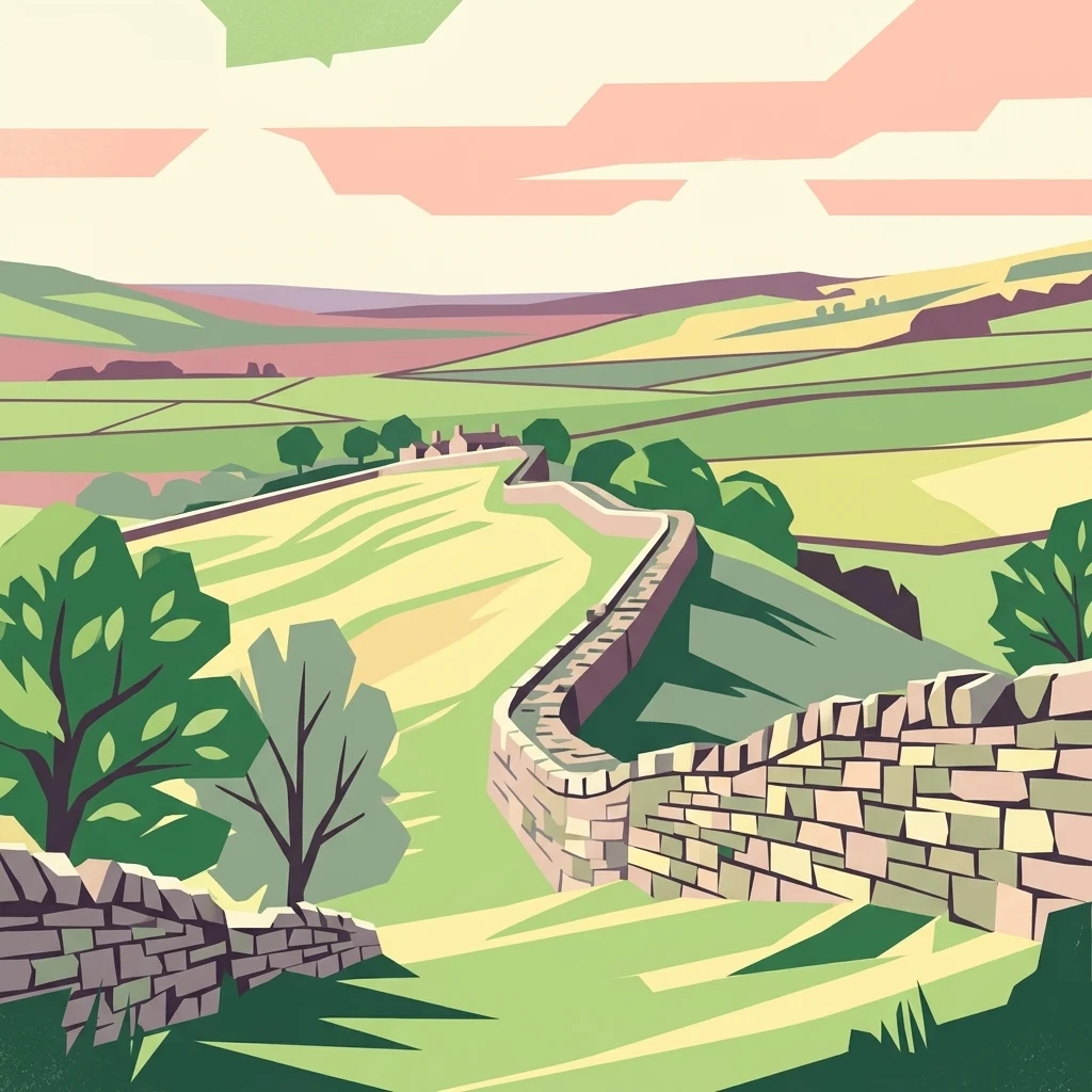
Stone wall of Hadrian's Wall on a grassy hillside with green fields and trees

England's most remote national park with dark skies, Roman heritage, and expansive moorland

Northumberland National Park

Northumberland National Park is the northernmost national park in England, spanning over 1,050 square kilometres of Northumberland county between the Scottish border in the north and the historic Hadrian's Wall in the south. As the most remote, least populated, and least visited of England's thirteen national parks, it offers an extraordinary landscape of rolling moorlands, forested valleys, and dramatic hill ranges that define the character of Britain's northern frontier. The park encompasses the Cheviot Hills, which mark the traditional boundary between England and Scotland, as well as substantial portions of Kielder Forest—the largest man-made forest in Europe—and the central section of one of Rome's most significant architectural achievements. The park's ecological identity is shaped by its varied topography and latitude. The Cheviot Hills rise to over 800 metres, creating alpine-style habitats and exposed moorland that support specialized vegetation and bird communities. The extensive blanket bogs and heather-dominated moorlands represent some of the most intact semi-natural landscapes in lowland Britain. In December 2013, the International Dark Sky Association conferred Dark Sky Park status on Northumberland and Kielder, creating the largest protected dark sky area in Europe—a remarkable recognition of the park's nocturnal wilderness character. Human presence in this landscape spans approximately 10,000 years, leaving a rich archaeological fabric that includes prehistoric monuments, Roman fortifications along Hadrian's Wall, medieval pele towers, and traces of the Border Reivers who dominated this contested frontier between England and Scotland. The park remains partially under Ministry of Defence ownership as the Otterburn Training Area, which accounts for roughly 23 percent of the protected landscape and represents a unusual integration of military activity within a conservation framework.

Location
United Kingdom
Park type
National park
Established
1956
Area
1,050 km²
Northumberland National Park Atlas
Regional park map

See the ranked park cluster in its geographic setting

Nearby parks around Northumberland National Park

This regional map shows the same 20 nearby parks ranked below around Northumberland National Park. Select a ranked marker to highlight that park’s boundary where boundary data is available.
Reference park: Northumberland National ParkRanked nearby parkSelected boundary: Northumberland National Park20 nearby parks shown
20 nearby parks

Distance-ranked regional park geography and surrounding protected landscapes

Parks and Protected Areas Geographically Near Northumberland National Park

Examine the ranked collection of nearby protected areas surrounding Northumberland National Park based on direct geographic proximity and boundary separation. Analyzing surrounding regional park geography reveals diverse conservation patterns and neighboring ecological designations across the wider border landscape.
Watercolor painting showing a lake, green hills, and sky
National parkCumbria
40 km away#1 closest

Southwest

Lake District National Park: Protected Landscape Atlas and Geographic Exploration

Mapped mountain terrain and glacial valleys in Cumbria

Delve into the geography of Lake District National Park, a protected area renowned for its dramatic mountainous terrain, U-shaped glacial valleys, and stunning natural lakes. This atlas perspective highlights the park's unique landscape features, mapped boundaries, and its significance within Cumbria, offering a comprehensive view for geographic discovery.

Area
2,292 km²
Established
1951
IUCN
V
Relief
Mountain
Watercolor painting of green hills, a stream, and grassy areas
National parkNorth Yorkshire
46 km away#2 closest

South

Yorkshire Dales National Park: A Protected Landscape in North Yorkshire

Explore mapped boundaries and distinctive limestone terrain.

Yorkshire Dales National Park offers a rich tapestry of mapped natural landscapes, characterized by its iconic limestone valleys, U-shaped glacial formations, and rolling heather-clad moorlands. Situated within North Yorkshire, this protected area showcases a unique karst geology, evident in features like Malham Cove and extensive cave systems. The park's traditional dry-stone walls and working farms contribute to a living cultural landscape, making it a prime destination for atlas-driven geographic discovery and understanding regional terrain.

Area
2,178 km²
Established
1954
IUCN
V
Relief
Mountain
Protected landscapeScottish Borders
About 60 km away#3 closest

Northwest

Upper Tweeddale National Scenic Area: Geography and Protected Landscape Atlas Map

Regional landscape profile in the Scottish Borders

Upper Tweeddale National Scenic Area encompasses 12,770 hectares of refined southern Scottish countryside. This atlas entry provides an overview of the area landscape, defined by its narrow river valley, tributary glens, and the significant upland plateau of the Tweedsmuir Hills. Examine the geographic intersection of protected habitats, historic estates, and the winding course of the River Tweed.

Area
128 km²
Established
1981
Relief
Upland
Climate
Temperate
Watercolor illustration of a coastal bay with green grassy foreground and distant purple hills against a plain white background.
Marine protected areaCumbria
About 62 km away#4 closest

Southwest

Allonby Bay Marine Protected Area: Coastal Landscapes and Roman Archaeology in Cumbria

A vital protected coastal stretch along the Solway Firth.

Discover the unique geography of Allonby Bay, a marine protected zone distinguished by its sweeping dunes, honeycomb worm reefs, and saline marshes. Situated along the Solway coast of Cumbria, the area serves as a critical habitat for marine species while housing significant Roman milefortlets that mark the historic frontier of northern England.

Area
40 km²
Established
2016
Relief
Lowland
Climate
Temperate
A horizontal watercolor painting showing a wetland in the foreground with grasses, rolling hills, and distant mountains under a pale sky.
Wildlife reserveLancashire
About 93 km away#5 closest

South

Leighton Moss RSPB Reserve: Geographic Atlas and Protected Wetland Boundary Analysis

Lancashire coastal wetland and reedbed ecosystems

Leighton Moss RSPB Reserve stands as the largest reedbed complex in north west England. This protected wildlife reserve offers a distinct landscape contrast between enclosed freshwater wetlands and the open saltmarsh of Morecambe Bay, providing essential habitat data for regional environmental study and birdlife geography.

Established
1964
Relief
Lowland
Access
Easy access
Scope
Terrestrial
Marine protected areaScotland
About 95 km away#6 closest

North

Firth of Forth Banks Complex: Offshore Marine Protected Area Geography and Seabed Atlas

Dynamic sand and gravel ridges off the coast of Scotland

The Firth of Forth Banks Complex encompasses a series of prominent submarine sediment banks at the meeting point of the Firth of Forth and the North Sea. These raised seafloor formations, characterized by strong currents and varied substrate types, function as an essential component of the marine conservation network in Scotland. The area sustains rich benthic biodiversity and supports ecologically significant populations of fish and long lived bivalves.

Area
2,130 km²
Established
2014
Relief
Lowland
Climate
Temperate
Watercolor illustration showing rolling hills, green vegetation, and a pale sky
National parkNorth Yorkshire
About 98 km away#7 closest

Southeast

North York Moors National Park: Explore its Protected Landscape and Geography

Discover mapped moorland, dales, and coastlines.

The North York Moors National Park is a vital protected landscape in North Yorkshire, celebrated for its extensive heather moorland and distinctive deeply incised dales. This page provides an atlas-style exploration of the park's geography, highlighting its unique terrain, mapped boundaries, and its integral role within the regional landscape context. Understand the diverse natural features that define this iconic national park, from the upland plateau to the dramatic Jurassic coast.

Area
1,430 km²
Established
1952
IUCN
V
Relief
Upland
Marine protected areaEngland
About 123 km away#8 closest

Southwest

West of Walney Marine Protected Area: Irish Sea Geographic and Seabed Analysis

Mapped protected landscape in northwest England

West of Walney is a major marine protected area off the Cumbrian coast, notable for its 388 square kilometre coverage of subtidal mud and sand habitats. This site is uniquely shaped by its overlap with offshore wind energy infrastructure, providing a distinct study in regional conservation and seabed management within the Irish Sea.

Area
388 km²
Established
2016
Relief
Lowland
Climate
Temperate
Protected areaPerth and Kinross
About 125 km away#9 closest

Northwest

Coupar Angus Protected Area: Geographic Boundaries and Regional Landscape Mapping

Located in the Perth and Kinross council area of Scotland

Coupar Angus is a key protected area providing essential insights into the geography and terrain of the Perth and Kinross council area. This detailed mapping overview captures the unique landscape features and boundary distributions characteristic of this Scottish region. Perfect for understanding the spatial configuration and natural setting of the site within its broader local government context.

Area
3.76 km²
Established
1976
Relief
Lowland
Climate
Temperate
Nature reserveWest Yorkshire
About 132 km away#10 closest

South

Bradford Pennine Gateway: Protected Pennine Fringe Geography in West Yorkshire

A sprawling network of moorland, wetlands, and gritstone valleys.

Spanning over a thousand hectares, this protected nature reserve integrates varied terrain across the Bradford district. From the ancient post-glacial sediments of Bingley North Bog to the sweeping gritstone plateaus, the reserve provides essential habitat for upland bird species and rare reptiles. It stands as a vital corridor of wilderness within the northern landscape, illustrating the geological character of the South Pennines.

Area
12.74 km²
Established
2025
Water
Minor water
Season
Year-round
Watercolor illustration showing mountains, green forests, a loch, and a river in a landscape
National parkScotland
140 km away#11 closest

Northwest

Loch Lomond and The Trossachs National Park: Mapped Landscapes and Terrain

Regional geography and protected Highland boundaries in Scotland

Loch Lomond and The Trossachs National Park covers a vast array of protected habitats, from coastal sea lochs to high-altitude Munros. This geographic profile outlines the park's position across the Highland Boundary Fault, highlighting its role as a core protected area for Caledonian forests and freshwater lake ecosystems within Scotland.

Area
1,865 km²
Established
2002
IUCN
V
Visitors
2.9M annual
Watercolor painting depicting mountains, forested hills, and a river in a scenic landscape
National parkScotland
146 km away#12 closest

Northwest

Cairngorms National Park: Explore Scotland's Largest Protected Mountain Landscape

Mapped boundaries and arctic-alpine geography.

As the United Kingdom's largest national park, Cairngorms National Park in Scotland presents a vast expanse of distinctive arctic-alpine terrain and ancient Caledonian forests. This protected landscape offers a unique opportunity to explore mapped geographic features, from its extensive mountain plateaus to its vital river systems. Discover the contours and context of this significant natural area within the broader atlas of Scotland's protected lands.

Area
4,528 km²
Established
2003
IUCN
V
Visitors
1.9M annual
A soft watercolor painting of a landscape featuring green rolling hills, a suggestion of a reflective body of water, and layers of purple distant mountains against a light sky.
National parkScotland
About 154 km away#13 closest

Northwest

Loch Lomond and The Trossachs National Park: Geographic and Protected Area Overview

Tracing Highland and Lowland transition zones in Scotland

This protected area captures the contrast between the rugged mountainous terrain of the northern Trossachs and the gentler southern loch basins. By examining the Highland Boundary Fault, users can analyze how glaciers carved the landscape, creating the deep fjord-like trenches and islands that define the region's unique natural geography.

Area
71 km²
Established
2002
Relief
Mountain
Climate
Temperate
National parkUnited Kingdom
158 km away#14 closest

South

Peak District National Park: Explore Protected Landscape and Regional Geography

Mapped boundaries and natural terrain context for this UK national park.

Investigate the Peak District National Park, a cornerstone of the United Kingdom's protected natural areas. This MoriAtlas entry provides essential details on its geographic scope, mapped boundaries, and landscape characteristics. Engage with structured data to understand how this national park fits into the atlas of the United Kingdom, supporting detailed geographic and protected-area discovery for researchers and explorers.

Area
1,440 km²
Established
1951
IUCN
V
Visitors
13M annual
A horizontal watercolor painting showing a soft, impressionistic view of green hills, trees, and a lake, set against a light background.
Protected landscapePerth and Kinross
About 163 km away#15 closest

Northwest

Loch Tummel National Scenic Area: Geography and Mapped Protected Landscape Features

Highland landscape corridor in Perth and Kinross

Loch Tummel National Scenic Area encompasses a vital Highland corridor where freshwater lochs, river gorges, and managed woodlands intersect. This overview focuses on the physical geography of the Tummel valley, providing a detailed look at the protected land, elevation changes, and the hydro-electric history that shaped the current terrain of this scenic region.

Area
90.1 km²
Established
1981
Relief
Upland
Climate
Temperate
A soft watercolor illustration featuring green rolling hills; pink foliage; and a calm bay under a pale sky.
Marine protected areaScotland
About 169 km away#16 closest

West

Lamlash Marine Protected Area: Coastal Geography and Protected Waters in Scotland

Maritime terrain and conservation landscapes of the Firth of Clyde

Located along the eastern coast of the Isle of Arran, the Lamlash Marine Protected Area serves as a landmark for community-led conservation in Scotland. The site protects a vital marine ecosystem including maerl beds within a sheltered natural harbour, providing a distinct study of coastal boundaries and marine terrain facing Holy Isle across the Firth of Clyde.

Established
2008
Visitors
1.1K annual
Relief
Lowland
Climate
Temperate
A soft, artistic watercolor painting of a Scottish sea loch surrounded by gentle, green hills against a faint mountainous background.
Marine protected areaArgyll and Bute
About 175 km away#17 closest

Northwest

Loch Goil Marine Protected Area: Geography and Landscape Overview

Protected marine habitats in the Argyll and Bute region

Loch Goil offers a distinct look at an enclosed, sea loch landscape in western Scotland. Surrounded by the Arrochar Alps and steep conifer slopes, this marine protected area demonstrates the intersection of Highland wilderness and formal conservation zones. Use this atlas resource to understand its topographical form and regional context.

Established
2014
Relief
Mountain
Climate
Temperate
Access
Moderate access
A soft watercolor illustration depicting green rolling hills and a body of water in a minimalist style.
Marine protected areaArgyll and Bute
About 194 km away#18 closest

Northwest

Loch Fyne Marine Protected Area and Highland Coastal Geography

Mapped sea loch landscapes in Argyll and Bute

Loch Fyne represents a unique intersection of maritime tradition and protected natural terrain. This entry maps the loch as it winds through the Cowal Peninsula, highlighting the contrast between northern mountain hinterlands and southern coastal inlets. Users can examine the extent of its protected waters, the surrounding topography, and its historical significance within the geography of western Scotland.

Established
2014
Relief
Mixed relief
Climate
Temperate
Access
Easy access
Watercolor illustration of rolling mountains and green valleys with distant peaks
National parkWales
208 km away#19 closest

South

Snowdonia National Park: Protected Landscape and Map Exploration in North Wales

Mountain terrain, glacial lakes, and regional geography.

Snowdonia National Park offers a profound exploration of mountainous protected landscapes in North Wales. This page details the park's mapped boundaries, revealing a terrain shaped by glaciation, featuring dramatic peaks like Snowdon, steep valleys, and pristine glacial lakes. Understand its geographic identity within the United Kingdom and how its protected status contributes to the regional landscape context, providing a unique focus for atlas-based discovery.

Area
2,142 km²
Established
1951
IUCN
V
Relief
Mountain
Marine protected areaArgyll and Bute
About 211 km away#20 closest

West

Loch Sween Marine Protected Area: Coastal Geography and Regional Atlas Map

A distinctive sea loch ecosystem in Argyll and Bute.

Investigate the coastal topography and protected marine boundaries of Loch Sween. This sea loch is defined by its irregular branching inlets and islands, creating a unique habitat mosaic of maerl beds and burrowed mud within the broader context of the western Scottish coastline.

Area
41 km²
Established
2014
IUCN
IV
Access
Access unknown
Distance methodology

Geographic measurements, not driving distances

How nearby park distances are calculated

Distances use park boundaries whenever the available geometry allows it. When one or both boundaries are missing, the mapped park locations provide a clearly labelled estimate. Every value represents straight-line geographic separation and does not use roads or routing.

Boundary distance

Calculated between the nearest points of both park boundaries.

Location-to-boundary estimate

Estimated from one mapped park location to the nearest boundary of the other park.

Mapped-location estimate

Estimated between the mapped locations of both parks.

MoriAtlas Explorer

Continue Exploring Northumberland National Park's Remote Geography and Landscape Atlas

Delve deeper into the structured geographic information and protected landscape context of Northumberland National Park. Understanding this northern frontier's unique terrain, from the Cheviot Hills to Hadrian's Wall, enhances your atlas exploration of Britain's protected areas. MoriAtlas provides the detailed map and geographic insights needed to appreciate the full scope of this significant natural and historical region.

Global natural geography