Mori Atlas logo
Nearby park discovery

Mapping the karst massifs and protected natural boundaries near the Bay of Kotor

Protected Landscapes and National Park Geography in the Region Surrounding Orjen

This geographic comparison charts the distribution of protected areas and parks in proximity to the Orjen massif in southwestern Montenegro. By analyzing these regional boundaries, gain perspective on the wider Dinaric Alps landscape, from high altitude glacial cirques to the coastal limestone cliffs that define this section of the Adriatic coast.

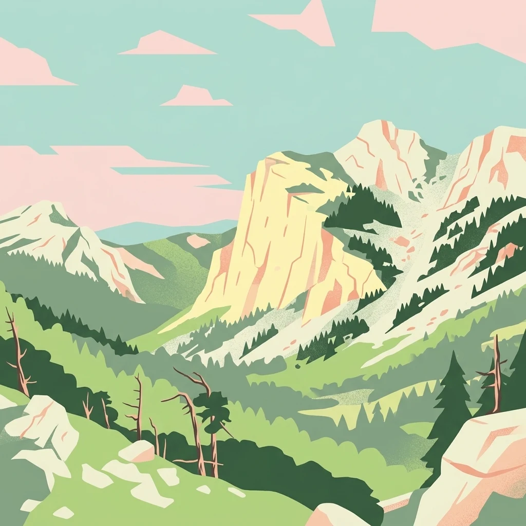
A stylized digital illustration of a mountain valley with steep limestone cliffs, rocky terrain, and coniferous trees under a soft, pastel-colored sky.

A heavily karstified coastal mountain on the southern Dinaric Adriatic; Europe's wettest region with exceptional Pleistocene glacial traces and rich sub-Mediterranean biodiversity.

Orjen

Orjen is a strongly karstified high mountain in southwestern Montenegro, forming the southernmost lobe of the coastal Dinaric Alps along with Lovćen and Rumija. The massif rises directly above the deeply incised Bay of Kotor, with vertical limestone cliffs towering over 1000 meters above the narrow coastal strip and the Adriatic Sea. Climatologically, the Orjen is the wettest region of Europe and one of the wettest non-monsoonal regions of the Northern Hemisphere. Annual precipitation measured at the Crkvice observatory can exceed 9000 mm in extreme years, with a long-term mean around 5000 mm. Despite this rainfall, the deeply developed karst drains almost entirely underground; there are no significant surface streams, and the famous Ombla spring near Dubrovnik is fed partly by Orjen's subsurface waters. The combination of high precipitation, long-lasting snow cover, and Pleistocene glaciation has produced an exceptionally varied landscape of glacial cirques, U-shaped valleys, roches moutonnées, and relict cold-air refugia. These conditions allowed arctic, arcto-alpine, and alpine flora and fauna to survive as glacial relicts. Endemic and sub-endemic species of plants and animals grow on the oromediterranean slopes, in the Dinaric karst block-field fir forests, and in the Bosnian pine (Pinus heldreichii) rock forests. Zubački kabao (1894 m) is the highest peak and the highest summit of the sub-Adriatic Dinarids, making Orjen the highest mountain of historical Dalmatia.

Location
Montenegro
Park type
Protected landscape
Established
2017
Area
400 km²
Highest point
1,894 m
Orjen Protected Landscape Atlas
Regional park map

See the ranked park cluster in its geographic setting

Nearby parks around Orjen

This regional map shows the same 20 nearby parks ranked below around Orjen. Select a ranked marker to highlight that park’s boundary where boundary data is available.
Reference park: OrjenRanked nearby park20 nearby parks shown
20 nearby parks

Explore surrounding protected landscapes and spatial proximity metrics for Orjen

Ranked Parks and Protected Areas Geographically Near Orjen in Regional Atlas Context

Examine the ranked collection of nearby protected areas to evaluate surrounding regional geography and spatial separation relative to Orjen. These mapped relationships provide structured environmental comparisons across neighboring conservation units without relying on driving routes or travel metrics.
National parkMontenegro
About 30 km away#1 closest

Southeast

Lovćen National Park: Karst Geography and Protected Mountain Landscapes in Montenegro

Dinaric massif rising above the Adriatic coastal basin.

Lovćen National Park encompasses a dense, rocky landscape of limestone and dolomite in southwestern Montenegro. Known as the namesake for the country itself, the massif creates a sharp geographic boundary between the Adriatic Sea and the inland highlands. The area offers a profound look at Dinaric karst features, including dramatic cliffs and endemic botanical habitats, preserved within a culturally rich mountain setting.

Area
62.2 km²
Established
1952
Relief
Mountain
Climate
Mediterranean
National parkMontenegro
About 31 km away#2 closest

Southeast

Lovćen National Park: Karst Mountain Geography and Protected Landscapes in Montenegro

Dinaric Alps limestone terrain and historic mountain heritage

Spanning from 400 to 1,749 meters, Lovćen National Park protects the symbolic limestone massifs of southwestern Montenegro. The terrain is defined by complex karst formations, deep gorges, and distinct ecological zones, forming a critical observation point across the rugged Dinaric mountain interior.

IUCN
II
Scope
Terrestrial
Water
No major water
A watercolor painting showing a soft, panoramic landscape of low hills, green fields, and water, with a light and ethereal style.
Protected areaMontenegro
About 60 km away#3 closest

Southeast

Cijevna Protected Area: Mapping the River Canyon and Balkan Highlands Geography

An alpine river system spanning the Montenegro and Albania border

The Cijevna represents a striking natural corridor carved into the Prokletije mountains. This protected landscape is defined by its deep V-shaped valleys, high-altitude gorges, and seasonal discharge patterns that sustain important freshwater biodiversity across the Balkan highlands.

Watercolor illustration showing mountains, a winding river, and forested areas
National parkMontenegro
About 74 km away#4 closest

Northeast

Durmitor National Park: Geography and Protected Landscape Atlas of Northern Montenegro

Alpine mountain terrain, deep river canyons, and glacial lake ecosystems.

Delve into the geography of Durmitor National Park, a rugged sanctuary in Montenegro that protects spectacular limestone peaks and the dramatic Tara River canyon. This protected area highlights the geological complexity of the Dinaric Alps through its U-shaped valleys, karst features, and diverse alpine meadows that define this significant regional wilderness.

IUCN
II
Relief
Mountain
Climate
Alpine
Scope
Terrestrial
A soft watercolor illustration of a mountain range with foreground meadows and trees, rendered in light green, pink, and muted purple tones against a white background.
National parkŽabljak
About 77 km away#5 closest

Northeast

Durmitor National Park: Exploring the Dinaric Alps and Tara River Canyon Landscapes

High-altitude mountain geography and glacial plateau systems

Durmitor National Park preserves a unique concentration of limestone peaks, deep river gorges, and eighteen glacial lakes within the northern highlands of Montenegro. This protected area showcases the interplay between the massive Tara River Canyon and the high-elevation Jezerska površ plateau, offering a comprehensive look at the diverse mountain terrain that defines this Dinaric Alpine wilderness.

Area
390 km²
Established
1952
IUCN
II
Relief
Mountain
Watercolor illustration of mountain ranges, a lake, and forested hills in soft pastel colors
National parkBosnia and Herzegovina
About 77 km away#6 closest

North

Sutjeska National Park: Bosnia and Herzegovina's Oldest National Park and Primeval Forest Reserve

Explore the mapped geography and protected landscape of this vital Balkan natural area.

Sutjeska National Park, Bosnia and Herzegovina's inaugural national park, protects a dramatic mountainous region defined by primeval forests and its highest peak, Maglić. As a strict nature reserve, Perućica's ancient trees represent a rare ecological treasure within the Balkan landscape. This page offers a detailed look at the park's protected boundaries, its diverse natural terrain, and its significant geographic setting for atlas exploration.

Area
160.52 km²
Established
1962
IUCN
II
Relief
Mountain
Watercolor painting of a lake landscape with green marshes in the foreground, small islands in the middle, and rolling hills in the background.
National parkMontenegro
About 78 km away#7 closest

Southeast

Lake Skadar National Park: An Atlas Overview of Montenegro's Largest Freshwater Wetland

Karst Terrain and Transboundary Protected Landscapes

Lake Skadar stands as a monumental geographic feature in Montenegro, serving as the largest lake in Southern Europe. This national park protects a diverse ecosystem ranging from submerged karst springs to expansive seasonal marshes. Its status as a transboundary system offers insights into Mediterranean hydrology and endemic freshwater biodiversity within the unique Balkan karst basin.

Area
450 km²
Established
1983
Relief
Lowland
Climate
Mediterranean
Watercolor painting showing a mountainous landscape with a lake, green hills, and pink flowers
National parkAlbania
About 83 km away#8 closest

East

Alps of Albania National Park: Explore Albania's Largest Protected Alpine Wilderness

Dramatic karst, glacial valleys, and high-altitude ecosystems await.

The Alps of Albania National Park offers an expansive view into one of the Balkans' most significant mountain protected areas. This national park encompasses a spectacular landscape characterized by towering limestone peaks, deep glacial valleys carved over millennia, and intricate karst formations like Grunas Canyon. Its pristine wilderness protects diverse high-altitude ecosystems and unique geological features, serving as a key destination for understanding regional geography and protected landscapes.

Area
828.447 km²
Established
2022
IUCN
II
Relief
Mountain
Watercolor painting showing two pink-hued lakes surrounded by green vegetation and distant mountains under a light yellow sky
National parkCroatia
About 92 km away#9 closest

West

Mljet National Park: Protected Karst Terrain and Unique Marine Lakes in Croatia

Explore mapped park boundaries and Mediterranean island geography.

Mljet National Park represents a significant protected landscape within the Adriatic Sea, celebrated for its distinctive karst terrain and the extraordinary phenomenon of its saltwater lakes, Veliko and Malo jezero. This national park showcases some of the most intact Mediterranean forests in the region, offering a unique geographic profile for atlas-based discovery. Examine the park's protected status and its relationship to the surrounding island and marine geography.

Area
53 km²
Established
1960
IUCN
II
Relief
Lowland
A watercolor painting showing a light-colored walking path leading into a forest of green trees against a pale sky.
National parkKolašin Municipality
About 92 km away#10 closest

Northeast

Biogradska Gora National Park: Mountain Geography and Old-Growth Forest Map Exploration

Protected wilderness in the Bjelasica mountain range of central Montenegro

Biogradska Gora serves as a vital protected area in Montenegro, characterized by its sprawling Bjelasica ridges, six distinct glacial lakes, and primeval beech ecosystems. The park terrain offers an expansive look at Balkan high-mountain geography, ranging from deep forested valleys to alpine meadows and peaks exceeding 2,000 meters in elevation.

Area
54 km²
Established
1952
IUCN
II
Relief
Mountain
Watercolor painting showing a mountain landscape with green forests, valleys, and distant hills
National parkMontenegro
About 95 km away#11 closest

Northeast

Biogradska Gora National Park: Ancient Beech Forest and Protected Landscape Exploration

Discover Montenegro's oldest national park with mapped terrain and regional geography.

Biogradska Gora National Park represents a critical protected area in Montenegro, celebrated for its exceptionally well-preserved ancient beech forest. This national park features a heterogeneous terrain of rolling hills and river valleys that create a unique natural setting. The dense, old-growth canopy offers an immersive experience of a primeval forest ecosystem, providing significant value for understanding Balkan nature and protected forest dynamics. Explore the mapped boundaries and discover the distinct landscape character that defines this remarkable natural reserve.

IUCN
II
Watercolor painting of a wide wetland area with distant purple mountains, green grassy banks, and water channels.
Protected landscapeUlcinj
About 95 km away#12 closest

Southeast

Saline Ulcinj: Coastal Wetland Geography and Protected Landscape Mapping

A large-scale saline nature park near Ulcinj in southern Montenegro.

Saline Ulcinj represents a significant coastal wetland complex nestled in the Buna delta. This protected landscape is defined by its unusual industrial history and modern transition into a vital nature reserve, characterized by expansive saline pools and shallow mudflats. Its geographic footprint offers a clear look at how coastal water management shapes the surrounding terrain and provides essential stopover habitats for Adriatic migratory birds.

Area
15 km²
Established
2019
Relief
Lowland
Water
Water-dominated
A watercolor painting showing a panoramic view of green rolling hills and a body of water under a soft, light sky.
Nature reserveShkodër District
About 96 km away#13 closest

Southeast

Lake Shkodër Nature Reserve: Mapping Protected Wetland and Riverine Geography in Albania

A critical Balkan freshwater protected area.

The Lake Shkodër Nature Reserve serves as a foundational protected landscape in northern Albania, encompassing the extensive shoreline and riverine floodplains of Lake Skadar. This geographic entity showcases a transition from fertile lowlands to mountainous ridges, offering a detailed look at how hydrologic processes and alpine proximity define Balkan wetland habitats.

Area
265.35 km²
Established
2005
IUCN
IV
Relief
Lowland
A horizontal watercolor painting of a serene river landscape with green trees on both banks and small boats floating on the water at sunset.
Protected landscapeShkodër County
About 103 km away#14 closest

Southeast

Buna River-Velipojë Protected Landscape: Albania Coastal and Wetland Geography

Mapped protected landscape in Shkodër County

The Buna River-Velipojë Protected Landscape encompasses the crucial junction of riverine systems and the Adriatic Sea. This protected area features a mosaic of marshes, lagoons, and alluvial forests that form a significant migratory corridor in northwestern Albania.

Area
230.27 km²
Established
2005
IUCN
V
Relief
Lowland
A watercolor illustration of a soft mountain range landscape with pine trees in the foreground against a white background.
Protected areaAlbania
About 106 km away#15 closest

East

Accursed Mountains: Geographic Analysis of Albania High Alpine Protected Terrain

Rugged karstic relief and glacial mountain landscapes.

Discover the Accursed Mountains, a formidable high-mountain range in northern Albania known for its sheer limestone cliffs and profound glacial sculpting. This protected area provides a critical habitat for relict flora and fauna while maintaining one of the most intense relief profiles in the Balkans. Examine the mapped canyons, alpine cirques, and jagged ridges that shape this landmark range.

Relief
Mountain
Climate
Alpine
Access
Moderate access
Scope
Terrestrial
Watercolor illustration of rolling hills, green vegetation, and distant mountains under a light sky
Protected areaCroatia
About 115 km away#16 closest

West

Lastovo Nature Park: Discover the Adriatic Karst Archipelago's Protected Landscape

Mapped karst terrain, ancient architecture, and natural island geography.

Lastovo Nature Park protects a remote Croatian archipelago characterized by its striking karst landscape, featuring 46 hills and 46 karstic fields. This protected area offers significant natural biodiversity and remarkably preserved cultural heritage, with extensive Holm Oak and Aleppo Pine forests covering over 60% of the island. Explore Lastovo's unique geography, mapped terrain, and its distinct place within the Adriatic region.

Area
46.87 km²
Established
2006
IUCN
V
Relief
Upland
Watercolor painting of green mountains, forests, and fields under a light sky
National parkKosovo
About 123 km away#17 closest

East

Bjeshkët e Nemuna National Park: Kosovo's Largest Alpine Protected Landscape

Explore dramatic mountains, glacial lakes, and diverse ecosystems.

Delve into the protected geography of Bjeshkët e Nemuna National Park, Kosovo's expansive national park located in the Accursed Mountains. This atlas entry details its significant alpine terrain, from dense forests to high-altitude meadows, and highlights the presence of glacial lakes like Liqenat. Understand its role as a vital conservation corridor and a key component of the Balkan's natural heritage.

Area
630.28 km²
Established
2012
IUCN
II
Relief
Mountain
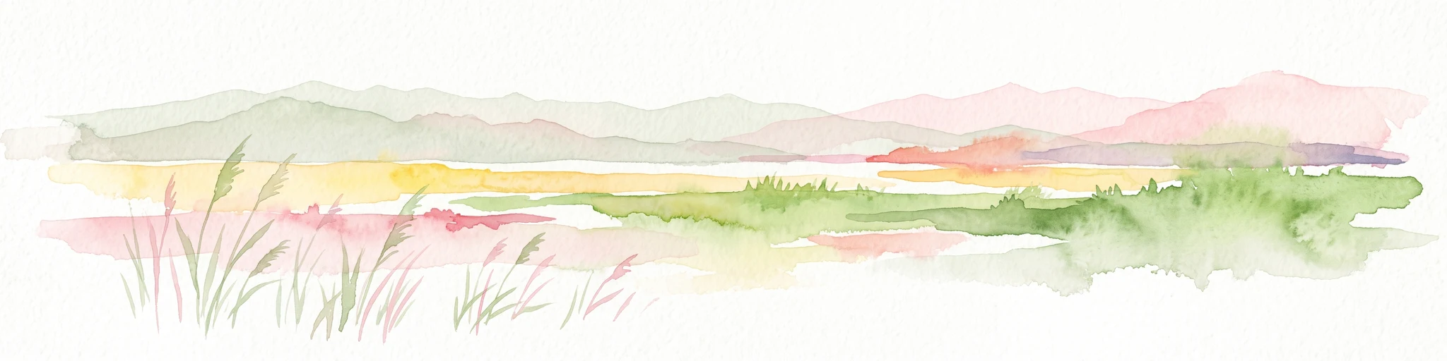
A minimalist watercolor painting depicting a soft-focus landscape with green marshes, pale yellow flats, and light pink rolling hills in the background.
Nature reserveLezhë County
About 126 km away#18 closest

Southeast

Kunë-Vain-Talë-Patok-Fushëkuqe-Ishëm Nature Park: Mapped Geography and Coastal Wetlands

Protected lagoon and forest landscapes in Lezhë County, Albania

Examine the protected territory of Kunë-Vain-Talë-Patok-Fushëkuqe-Ishëm Nature Park, defined by its dynamic lagoon systems, alluvial forests, and coastal dunes along the Adriatic shore. This area provides deep insight into deltaic hydrology and the preservation of Mediterranean woodland habitats within a regional geographic context.

Area
43.93 km²
Established
2010
IUCN
IV
Relief
Lowland
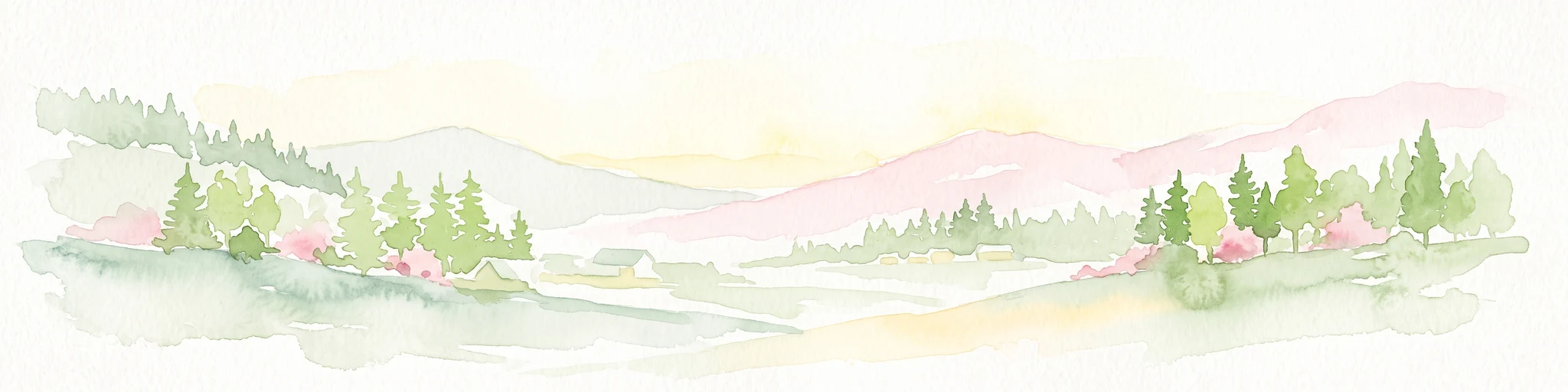
A soft watercolor illustration of a mountain landscape with coniferous trees, rolling hills, and hazy pink mountains in the distance, set against a plain white background.
Nature reserveKukës County
About 129 km away#19 closest

East

Gashi Valley Nature Reserve: A Geographic Profile of Alpine Albania

Glacial terrain and protected primeval forests in Kukës County

Gashi Valley represents a vital nature reserve and protected alpine landscape in the Albanian Alps. Characterized by its glacial history, the area contains rugged ridges, morainic lakes, and primeval beech forests that serve as a crucial benchmark for European broadleaf ecosystems. This site offers deep insight into the complex geology and ecological significance of the northeastern mountain regions in Albania.

Area
30 km²
IUCN
Ia
Relief
Mountain
Climate
Alpine
Watercolor illustration of a landscape with green hills, a river, and distant mountains under a light sky
Protected landscapeDalmatia
About 148 km away#20 closest

Northwest

Biokovo Nature Park: Protected Landscape and Karst Terrain in Dalmatia

Explore Dalmatia's premier protected mountain range along the Adriatic.

Biokovo Nature Park is a striking protected landscape situated in the Dalmatia region of Croatia, characterized by its immense limestone massifs that create a formidable barrier between the coast and the continental interior. This protected area is defined by its classic karst topography, featuring a complex network of sinkholes and caves, and offers unparalleled views from peaks like Sveti Jure. MoriAtlas provides detailed geographic context for understanding Biokovo Nature Park's unique terrain, mapped boundaries, and its significant role in the regional landscape.

Area
196 km²
Established
1981
IUCN
V
Relief
Mountain
Distance methodology

Geographic measurements, not driving distances

How nearby park distances are calculated

Distances use park boundaries whenever the available geometry allows it. When one or both boundaries are missing, the mapped park locations provide a clearly labelled estimate. Every value represents straight-line geographic separation and does not use roads or routing.

Boundary distance

Calculated between the nearest points of both park boundaries.

Location-to-boundary estimate

Estimated from one mapped park location to the nearest boundary of the other park.

Mapped-location estimate

Estimated between the mapped locations of both parks.

MoriAtlas Explorer

Discover the Rugged Geography of the Orjen Protected Landscape

Trace the glacial valleys and limestone peaks of Montenegro's Orjen massif through this detailed geographic overview. MoriAtlas provides a structured look at the mountain's climate, terrain, and role as a protected area within the Dinaric Alps, offering essential context for understanding this complex Mediterranean mountain landscape.

Global natural geography