Mori Atlas logo
Nearby park discovery

Mapping regional biodiversity reserves and coastal habitat proximities

Protected Areas and Geographic Landscapes Near Ormara Turtle Beaches in Balochistan

Explore the geographic distribution of protected areas surrounding the Ormara Turtle Beaches in the Balochistan region of Pakistan. This spatial overview identifies neighboring conservation sites and regional landscapes to provide context for the coastal habitats along the Arabian Sea.

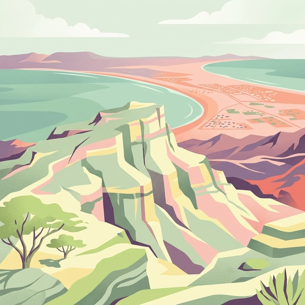
A stylized digital illustration of a coastal landscape with high cliffs, a sandy shoreline, and a turquoise sea under a soft sky.

A 10 km stretch of Makran coastline in Balochistan, recognized internationally for its role as one of Pakistan's largest sea turtle nesting grounds.

Ormara Turtle Beaches

The Ormara Turtle Beaches are a 10 km long sandy stretch of coastline along the Makran coast of Balochistan, in southwestern Pakistan. The site covers roughly 2,400 hectares of coastal habitat bordering the Arabian Sea and was designated as a Ramsar Wetland of International Importance in 2001, reflecting its global recognition as a key marine turtle nesting area. The beaches form one of the largest known sea turtle nesting sites along Pakistan's coastline. Olive ridley and green turtles nest on the sand in significant numbers, and hawksbill turtles may also use the habitat, although their presence is less well documented. The surrounding vegetation is adapted to arid, salt-influenced conditions typical of the Makran shoreline. Beyond its ecological role, the site sits within a broader coastal landscape characterized by long crescent-shaped beaches and minimal freshwater input. Its protected status highlights both the biological importance of the nesting grounds and the conservation challenges facing the area, including turtle capture for export and accumulation of marine debris.

Location
Pakistan
Park type
Wildlife reserve
Established
2001
Area
24 km²
Explore Ormara Turtle Beaches Wildlife Reserve Map
Regional park map

See the ranked park cluster in its geographic setting

Nearby parks around Ormara Turtle Beaches

This regional map shows the same 20 nearby parks ranked below around Ormara Turtle Beaches. Select a ranked marker to highlight that park’s boundary where boundary data is available.
Reference park: Ormara Turtle BeachesRanked nearby park20 nearby parks shown
20 nearby parks

Distance-ranked collection of surrounding protected landscapes and regional park geography

Parks and Protected Areas Geographically Near Ormara Turtle Beaches

Examine the distance-ranked collection of protected areas situated geographically near Ormara Turtle Beaches through measured spatial separation and directional context. This curated index enables structured environmental comparison across regional park geography without implying shared habitats or route connectivity.
National parkBalochistan
About 48 km away#1 closest

Northeast

Hingol National Park: Pakistan's Unique Protected Landscape and Geological Atlas

Discover dramatic rock formations and coastal geography.

Hingol National Park stands as a monumental protected landscape within Balochistan, Pakistan, offering an unparalleled atlas view of geological diversity. Renowned for its hoodoos like the Princess of Hope and the Balochistan Sphinx, the park also features active mud volcanoes and striking coastal semi-desert terrain. The confluence of the Hingol River with the Arabian Sea creates important wetland habitats. This national park provides a rich context for exploring unique natural formations and regional geography, making it a significant point of discovery within Pakistan's protected areas.

Area
6,100 km²
Established
1988
IUCN
II
Relief
Mixed relief
A watercolor painting of soft, layered hills in shades of green, yellow, and muted pink against a white background.
Marine protected areaBalochistan
About 80 km away#2 closest

West

Astola Island Marine Protected Area: Geography and Coastal Landscape in Balochistan

Remote island plateau and offshore protected ecosystem

Trace the fractured terrain and limestone cliffs of Astola Island, a significant marine protected area located off the coast of Balochistan. This uninhabited island serves as a critical habitat for seabirds, reptiles, and sea turtles, marking a rare convergence of geological and ecological importance within the northern Arabian Sea.

Area
6.7 km²
Established
2017
Relief
Upland
Climate
Arid
Protected areaBalochistan
About 163 km away#3 closest

East

Miani Hor Protected Area: Coastal Lagoon Mapping and Regional Geography in Balochistan

Coastal lagoon and unique mangrove wetland ecosystem

Miani Hor functions as a major tidal lagoon and protected wetland along the Balochistan coast. The area is defined by its extensive mangrove forests and connection to the Arabian Sea, providing a essential study in estuarine geography and wetland conservation within the Lasbela District.

Area
74.71 km²
Established
2001
Relief
Lowland
Scope
Mixed
A pale, minimalist watercolor painting showing soft green hills or islands against a light, misty horizon.
Marine protected areaBalochistan
About 201 km away#4 closest

East

Churna Island Marine Protected Area: Geography and Coastal Atlas of Balochistan

Mapping the coral reef systems and rocky island terrain

Churna Island represents a unique marine protected area located near the border of Balochistan and Sindh. Characterized by a desolate rocky surface, the true ecological value resides in its extensive submerged reef structures, which provide habitat for a vast array of coral species and pelagic fish. This atlas resource provides a structured look at the island's coastal geography and its growing role in regional marine conservation.

Area
0.6 km²
Established
2024
Relief
Upland
Climate
Subtropical
A minimalist watercolor illustration showing a winding river or estuary flowing through green coastal marshlands with soft hills in the background.
Wildlife reserveBalochistan
About 288 km away#5 closest

West

Jiwani Coastal Wetland: Mapped Protected Area and Coastal Geography in Balochistan

A vital mangrove-dominated estuary and wildlife reserve.

Jiwani Coastal Wetland stands as a unique protected reserve within Balochistan, characterized by its mix of brackish lagoons, mangrove swamps, and critical sea turtle nesting beaches. Its geographic position at the Gwatar Bay edge makes it a vital ecological link along the Arabian Sea, offering distinct landscape insights into the intersection of river-fed marshes and arid coastal terrain.

Area
19 km²
Established
2001
Relief
Lowland
Climate
Arid
National parkPakistan
About 303 km away#6 closest

East

Kirthar National Park: Discover Pakistan's Arid Mountain Protected Landscape

Explore the mapped geography and unique terrain of this vital national park.

Kirthar National Park represents a critical expanse of protected semi-arid mountainous terrain in southern Pakistan, covering over 3,000 square kilometers. It is recognized for its significant populations of Sindh ibex, urial, and chinkara gazelles, alongside a diverse array of raptors, including migratory vulture and eagle species. The park's unique landscape, characterized by parallel ridges and deep, dry valleys, provides crucial habitat in a region facing considerable development pressures, offering a distinct geographical context for protected area exploration.

Area
3,087 km²
Established
1974
IUCN
II
Relief
Mountain
A wide watercolor painting showing a body of water in the foreground, green trees and shrubs in the middle ground, and rolling hills in the background under a pale sky.
Protected areaThatta District
About 321 km away#7 closest

East

Haleji Lake Protected Area: Mapping Wetlands and Freshwater Ecosystems in Thatta District

A significant freshwater reservoir and Ramsar site in southern Sindh, Pakistan.

Situated in the low-lying plains of Thatta District, Haleji Lake functions as an essential freshwater sanctuary for migratory bird species. The site features a distinct mosaic of managed reservoirs, fringing marshes, and brackish lagoons, offering a unique look at the interaction between water engineering and natural wetland conservation in the Indus basin.

Area
6.58 km²
Established
1943
Relief
Lowland
Scope
Terrestrial
Watercolor painting of a calm lake with grassy foreground, small islands, and distant hills under a soft light.
Wildlife reserveSindh
About 346 km away#8 closest

East

Keenjhar Lake Wildlife Reserve: Sindh Province Protected Wetland and Geographic Atlas

Mapped freshwater wetland and regional wildlife sanctuary

Keenjhar Lake is a prominent freshwater wetland and wildlife reserve in the Thatta District of Sindh. This expansive basin serves as a key ecological anchor for migratory waterbirds and a central feature of the regional landscape. The area combines significant hydrological value with distinct cultural history, providing a unique look into the protected geography of southeastern Pakistan.

Area
134.68 km²
Relief
Lowland
Scope
Terrestrial
Water
Water-dominated
Nature reserveSindh
About 378 km away#9 closest

East

Pai Forest Nature Reserve: Geography and Protected Landscape Context in Sindh

An Indus floodplain reserve featuring arid and riverine flora

Pai Forest in Sindh offers a distinctive study of protected landscapes where canal irrigation sustains both riverine and arid plant communities. This reserve functions as a vital ecological island amidst agricultural plains, providing a rich case for exploring the interaction between water management and natural terrain within the Indus valley geography.

Relief
Lowland
Climate
Arid
Scope
Terrestrial
Water
Major water bodies
Wildlife reserveSindh
About 414 km away#10 closest

Northeast

Deh Akro-II Desert Wetland Complex: Protected Landscape and Geographic Mapping

Inland wetland and desert sanctuary in Sindh, Pakistan

Explore the distinctive geography of Deh Akro-II Desert Wetland Complex, a protected wildlife reserve defined by its unusual combination of sand dunes and freshwater lakes. This atlas entry details the natural terrain and ecological boundaries of one of Pakistan's most significant inland wetland systems, illustrating the complex intersection of arid and aquatic habitats within the Indus River system.

Area
205 km²
Established
1988
Relief
Lowland
Climate
Arid
Wildlife reserveSindh
About 419 km away#11 closest

East

Jubho Lagoon Wildlife Reserve: Coastal Wetland Geography and Regional Map Context

Mapping brackish lagoons and migratory bird habitats in Sindh

Investigate the protected landscape of Jubho Lagoon, a shallow brackish wetland in southern Sindh. The area features a complex mosaic of tidal inlets, exposed mudflats, and freshwater-influenced marshes that serve as a primary regional habitat for migratory flamingos and pelicans.

Area
7.06 km²
Established
2001
Relief
Lowland
Scope
Terrestrial
Wildlife reserveSindh
About 423 km away#12 closest

Northeast

Drigh Lake Wildlife Reserve: Protected Wetland Geography in Sindh, Pakistan

Mapped freshwater habitat in the Indus river basin

Drigh Lake is a designated wildlife sanctuary and Ramsar site in the Qambar Shahdadkot District of Sindh. This protected area features shallow, reed-fringed freshwater environments that serve as an essential waterbird haven. Analyze the park boundaries and the surrounding alluvial plains that characterize this significant regional wetland geography.

Area
1.64 km²
Established
1972
Scope
Terrestrial
Water
Water-dominated
Wildlife reserveKhairpur District
About 487 km away#13 closest

Northeast

Mehrano Wildlife Sanctuary: Protected Forest Landscapes and Geography in Khairpur District

A historic wildlife reserve along the Indus riverine corridor.

Mehrano Wildlife Sanctuary represents a unique intersection of private historical stewardship and modern conservation. This riverine forest in Khairpur District provides a critical habitat for large game and migratory bird populations, functioning as a lush ecological refuge at the edge of the Cholistan desert. The terrain offers a distinct study in Indus floodplain geography and long-standing protected land management.

Area
2.8 km²
Established
1790
Relief
Lowland
Scope
Terrestrial
Wildlife reserveSindh
About 557 km away#14 closest

East

Rann of Kutch Wildlife Sanctuary: Protected Desert Wetlands and Salt Flats of Sindh

Regional geography and wetland conservation boundaries

Located in the Badin District of Sindh, Rann of Kutch Wildlife Sanctuary spans a unique convergence of desert and wetland environments. The sanctuary serves as a major Ramsar site, preserving large-scale salt flats and seasonal marshlands that support threatened species including the great Indian bustard and migratory flamingo populations, while highlighting the complex ecological interface of the Indus delta region.

Area
5,663.75 km²
Established
1980
Relief
Lowland
Access
Access unknown
National parkGujarat
About 590 km away#15 closest

Southeast

Marine National Park, Gulf of Kutch: A Protected Coastal Landscape in Gujarat, India

Explore its mapped boundaries and regional geography.

Marine National Park, Gulf of Kutch is a designated national park located in the Gujarat region of India. This page serves as an atlas-centric resource for understanding the park's protected landscape, its position within the broader geography of Western India, and its mapped natural features. Discover the distinct protected-area characteristics and regional context that define this important Indian national park.

Area
162.89 km²
Established
1982
IUCN
II
Relief
Lowland
National parkBalochistan
About 597 km away#16 closest

North

Hazarganji-Chiltan National Park: Balochistan's Mountain Protected Area & Landscape

Explore protected wildlife habitats and unique terrain in the Sulaiman Mountains.

Hazarganji-Chiltan National Park represents a significant protected landscape within Balochistan, Pakistan. Designated as a national park, it is fundamental to the conservation of the Chiltan ibex and Sulaiman Markhor, showcasing a unique arid mountain ecosystem. The park's terrain encompasses a transition from desert conditions to higher juniper forests, offering a detailed case study in regional geography and protected area management. Understanding Hazarganji-Chiltan National Park provides essential context for the mapped distribution of critical wildlife habitats in the Sulaiman Mountains range.

Area
155.55 km²
Established
1980
IUCN
II
Relief
Mountain
National parkRajasthan
About 597 km away#17 closest

East

Desert National Park: A Sprawling National Park in Rajasthan's Thar Desert

Explore unique desert geography, mapped terrain, and fossil discoveries.

Desert National Park offers an expansive atlas view of the Thar Desert's unique aeolian sand deposits and arid terrain. Covering over 3,100 square kilometers across Rajasthan's Jaisalmer and Barmer districts, this national park is a critical landscape for desert conservation. Its features include iconic sand dunes, rocky formations, and ancient fossil beds, providing a profound geographic context for understanding desert ecosystems and prehistoric life.

Area
3,162 km²
Established
1981
IUCN
II
Relief
Lowland
National parkBalochistan
About 621 km away#18 closest

North

Takatu National Park: Balochistan's Mountainous National Park and Protected Landscape

Explore the park's mapped terrain and Sulaiman markhor habitat.

Takatu National Park represents a significant protected landscape in the highlands of Balochistan, Pakistan. Established in 2025, this national park features the dramatic mountainous terrain dominated by Koh-i-Takatu, the region's third-highest peak. The park's boundaries encompass critical habitat for the endangered Sulaiman markhor, contributing to a vital conservation corridor. Its geography offers a distinctive semi-arid mountain character, distinct from other protected areas in Pakistan, making it a notable site for atlas-driven exploration and understanding of regional biodiversity.

Area
135.246 km²
Established
2025
IUCN
II
Relief
Mountain
Wildlife reserveGujarat
About 632 km away#19 closest

Southeast

Khijadiya Bird Sanctuary: Protected Wetland Landscapes and Coastal Geography in Gujarat, India

A Ramsar-recognized haven for migratory waterfowl and estuarine biodiversity

Khijadiya Bird Sanctuary protects a rare wetland environment on the edge of the Gulf of Kutch. The site is defined by a distinct bund that separates freshwater lake systems from saline tidal creeks and mangrove vegetation, resulting in a complex, high-value habitat for hundreds of migratory and resident bird species across the coastal plains.

Area
6.05 km²
Established
1982
IUCN
IV
Relief
Lowland
Wildlife reserveOman
About 635 km away#20 closest

Southwest

Al Saleel National Park: A Protected Acacia Forest Wildlife Reserve in Oman

Explore its unique landscape and protected area geography.

Al Saleel National Park in Oman is distinguished by its exceptional acacia forest ecosystem, a scarce habitat type across the Arabian Peninsula. Covering 220 square kilometers, this wildlife reserve serves as a crucial sanctuary for at-risk species like the Arabian gazelle and the endemic Omani wild cat. Its landscape offers a compelling study of arid zone forest ecology and protected area management, providing valuable context for understanding Oman's commitment to natural heritage and conservation within its regional geography.

Area
220 km²
Climate
Arid
Scope
Terrestrial
Water
No major water
Distance methodology

Geographic measurements, not driving distances

How nearby park distances are calculated

Distances use park boundaries whenever the available geometry allows it. When one or both boundaries are missing, the mapped park locations provide a clearly labelled estimate. Every value represents straight-line geographic separation and does not use roads or routing.

Boundary distance

Calculated between the nearest points of both park boundaries.

Location-to-boundary estimate

Estimated from one mapped park location to the nearest boundary of the other park.

Mapped-location estimate

Estimated between the mapped locations of both parks.

MoriAtlas Explorer

Continue Exploring the Ormara Turtle Beaches Wildlife Reserve Geographic Profile

Deepen your understanding of the Ormara Turtle Beaches Wildlife Reserve by mapping its unique coastal boundaries and arid terrain. MoriAtlas provides detailed context on the Makran coast protected areas, offering a clear geographic look at this critical nesting habitat along the Arabian Sea shoreline.