Mori Atlas logo
Nearby park discovery

Geographic map overview of protected environments surrounding the Kaczawskie Foothills

Regional Protected Landscapes and Natural Areas Near Park Krajobrazowy Chełmy

Explore the distribution of protected areas and regional landscapes positioned near Park Krajobrazowy Chełmy. This map-based perspective highlights the spatial context of natural terrain, volcanic hill formations, and forest ecosystems across the Lower Silesian Voivodeship and the wider Sudetes foothills geography.

Related tags

landscape parkSudetes foothillsPogórze KaczawskieLower Silesiavolcanic geology

A volcanic heritage and orchid-rich deciduous forest landscape in the Sudetes foothills.

Chełmy Landscape Park

Chełmy Landscape Park is a protected natural area in southwestern Poland, situated in the Lower Silesian Voivodeship across the Jawor and Złotoryja counties. It lies in the eastern Kaczawskie Foothills (Pogórze Kaczawskie), with a small extension into the eastern ridge of the Kaczawskie Mountains and the northern Rów Świerzawski; the northwestern fringe of the park meets a corner of the Chojnów Plain of the Silesian-Lusatian Lowland. The park's defining scientific value lies in its geological record, which preserves relict traces of volcanic activity spanning the early Paleozoic, the Permian, and the Tertiary. This unusual layering, rare on a European scale, sits within a hill country of basalt-capped summits, deep stream-cut gorges, and abrupt fault-edge scarps facing the Silesian Lowland. Ecologically, the park is dominated by deciduous forests of oak, beech, and hornbeam, sheltering a remarkable concentration of orchid species and the nationally rare brekinia (wild service tree) oakwoods. Combined with its five nature reserves, Natura 2000 coverage, and centuries of layered human history, the park reads as a compact but unusually rich natural region at the edge of the Sudetes.

Location
Poland
Park type
Protected landscape
Established
1992
Area
159.9 km²
Park Krajobrazowy Chełmy Geography
Regional park map

See the ranked park cluster in its geographic setting

Nearby parks around Chełmy Landscape Park

This regional map shows the same 20 nearby parks ranked below around Chełmy Landscape Park. Select a ranked marker to highlight that park’s boundary where boundary data is available.
Reference park: Chełmy Landscape ParkRanked nearby parkSelected boundary: Chełmy Landscape Park20 nearby parks shown
20 nearby parks

Ranked spatial distances and regional environmental comparisons across surrounding landscapes

Parks and Protected Areas Geographically Near Park Krajobrazowy Chełmy

Explore a distance-ranked collection of nearby protected areas surrounding Park Krajobrazowy Chełmy using structured geographic measurements derived from boundary proximities. These comparison signals map out surrounding regional terrain patterns, providing useful context for broader conservation analysis across the territory.
Nature reserveLower Silesian Voivodeship
Mapped location lies within the park boundary#1 closest

South

Rezerwat przyrody Mszana i Obłoga: Geological and Forest Protected Area Overview

Volcanic terrain in the Lower Silesian Voivodeship

This nature reserve preserves the natural maple-lime and oak-hornbeam forest communities found on the slopes of the Mszana and Obłoga hills. The area is defined by its striking basalt outcrops and volcanic rubble fields, providing a unique ecological character within the broader Kaczawskie foothills of southwestern Poland.

Area
0.999 km²
Established
2015
Relief
Mountain
Climate
Temperate
A soft watercolor painting of a river flowing through a hilly, forested landscape with light green and pastel tones.
Nature reserveLower Silesian Voivodeship
11 km away#2 closest

West

Ostoja nad Bobrem Nature Reserve and Bóbr River Valley Geographic Atlas

Protected Sudetes foothills landscape in Poland

Ostoja nad Bobrem represents a significant protected area within the Lower Silesian Voivodeship, characterized by its winding river corridor and hilly topography. The reserve supports a range of habitats including rare orchid-rich grasslands and dense slope forests. This atlas entry provides a detailed look at the geographic distribution and ecological importance of this essential Polish nature reserve.

Area
153.73 km²
Established
2009
Relief
Upland
Climate
Temperate
Protected areaLower Silesian Voivodeship
13 km away#3 closest

Southwest

Trzcińskie Mokradła Protected Area: Geographic Overview and Mapped Sudeten Wetland Landscape

Located in the Lower Silesian Voivodeship of Poland

Trzcińskie Mokradła stands as a significant mire complex in the Jelenia Góra Basin, providing a rare look at peat-forming habitats in the Sudetes. This protected area offers deep insight into regional wetland conservation and the environmental history of southwestern Poland, serving as an essential reference for researchers and landscape enthusiasts interested in intramontane basin geography.

Area
0.753 km²
Established
2011
Scope
Terrestrial
Water
Major water bodies
A minimalist, flat-design vector illustration showing a tall waterfall flowing down a rocky canyon flanked by pine trees and layers of cliffs.
Protected landscapeLower Silesian Voivodeship
22 km away#4 closest

South

Park Krajobrazowy Sudetów Wałbrzyskich: Protected Mountain Landscape Map

Geographic overview of forested ridges and rock formations

Gain insight into the topography of Park Krajobrazowy Sudetów Wałbrzyskich, where elevations reach 936 meters. This atlas entry details the forested Central Sudetes landscape, highlighting protected geological monuments like Małpia Skała and the unique hydrology of the Rybna river capture.

Area
64.93 km²
Established
1998
Relief
Mountain
Climate
Temperate
Watercolor illustration of a mountain range with green hills, pink and yellow sky, and sparse vegetation
National parkPoland
23 km away#5 closest

Southwest

Karkonosze National Park: A Premier National Park in Poland's Giant Mountains

Discover alpine terrain and unique glacial landscapes.

Karkonosze National Park is a significant protected area in Poland, renowned for its dramatic alpine topography carved by ancient glaciers. As the highest range in the Polish Sudetes, it features striking U-shaped valleys, U-shaped glacial cirques, and diverse subalpine to alpine ecosystems. This national park provides a rich context for understanding Central European mountain geography and exploring its mapped protected boundaries.

IUCN
II
Relief
Mountain
Scope
Terrestrial
Nature reserveLower Silesian Voivodeship
25 km away#6 closest

West

Żerkowice-Skała Nature Reserve: Mapped Sandstone Cuestas and Forest Habitats in Lower Silesia

A study of Cretaceous geology and protected forest landscapes in Poland

Żerkowice-Skała offers a window into the geological complexity of the Pogórze Izerskie. This nature reserve protects a vital sandstone cuesta edge, creating a mosaic of cliff habitats and old-growth deciduous forest communities. As a key Natura 2000 site, it serves as a crucial reference point for understanding the distribution of rare species and the northernmost Cretaceous exposures linked to the broader Bohemian Massif region.

Area
0.849 km²
Established
2011
Relief
Upland
Climate
Temperate
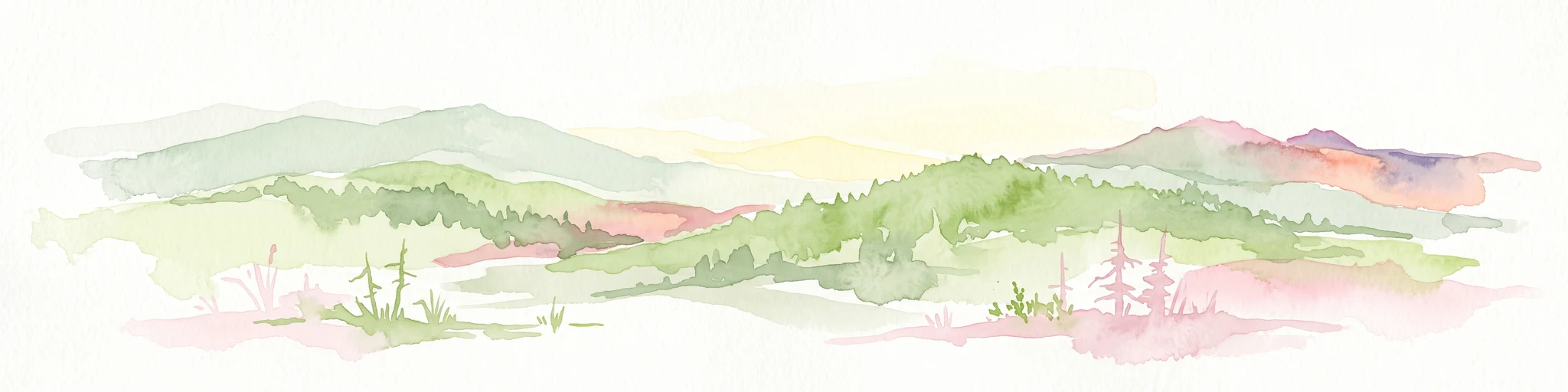
A minimalist watercolor illustration depicting rolling, layered mountain ridges in soft shades of green, yellow, and light pink against a white background.
National parkDolnośląskie Voivodeship
27 km away#7 closest

Southwest

Karkonoski Park Narodowy: Mapping Protected Granite Peaks and Glacial Terrain in Poland

High-mountain landscapes in the Dolnośląskie Voivodeship

Trace the diverse geography of Karkonoski Park Narodowy, where granite blockfields and glacial cirques define the high-altitude terrain. This protected area represents one of Central Europe's most significant upland ecosystems, showcasing a vertical transition from dense forest to alpine tundra.

Area
59.51 km²
Established
1959
Visitors
2M annual
Relief
Mountain
Watercolor painting showing green forests, a valley, and distant mountains under a soft sky
National parkLiberec Region
27 km away#8 closest

Southwest

Krkonoše National Park: Central European Alpine Protected Area and Map Context

Discover glacial landforms and unique ecosystems in the Giant Mountains.

Krkonoše National Park, situated in the Liberec Region, is a premier example of a protected alpine landscape in Central Europe. This page facilitates exploration of its significant glacial geography, including distinct cirques, rockfields, and valleys, providing vital context for understanding its protected area status. Engage with the mapped terrain and discover the unique ecological features that make this national park a cornerstone of conservation and geographic study within the Czech Republic.

Area
363.52 km²
Established
1963
IUCN
II
Visitors
12.1M annual
Watercolor painting depicting a gentle river winding through green meadows and groves of trees with a soft, hazy background.
Protected areaLower Silesian Voivodeship
31 km away#9 closest

Northeast

Łęgi Odrzańskie: Protected Riverine Corridor in Lower Silesian Voivodeship

A 101-kilometer valley mosaic of forest and wetland habitats.

Traversing the Pradolina Wrocławska and beyond, Łęgi Odrzańskie serves as a critical protected landscape preserving remnant floodplain forests and oxbow lakes. The area functions as a premier riverine sanctuary in Central Europe, documented through its unique combination of alder swamps, peatlands, and diverse avian populations maintained along the middle Oder.

Area
21,350.5 km²
Established
2007
Relief
Lowland
Scope
Mixed
Protected areaLower Silesian Voivodeship
37 km away#10 closest

East

Przeplatki nad Bystrzycą Protected Area: Regional Geography and Riverine Habitat Mapping

Protected riparian corridors and floodplain landscapes in southwestern Poland

Trace the three enclaves of Przeplatki nad Bystrzycą across the Lower Silesian Voivodeship. This protected area offers insight into European lowland river systems, where alluvial forests, oxbow lakes, and traditionally managed grasslands form a vital ecological mosaic for rare meadow butterflies and freshwater species.

Area
8.437 km²
A soft watercolor painting of gentle rolling green hills and meadows with patches of trees, set against a background of distant mountains.
Natural monumentKrálovéhradecký kraj
About 38 km away#11 closest

South

Sklenářovické údolí Natural Monument: Geography, Terrain, and Protected Land Features

Meadow-rich valley ecosystems in the Krkonoše foothills

Sklenářovické údolí stands as a significant protected natural monument in the Královéhradecký kraj region. Its geography consists of a deeply carved stream valley that shelters an unusually high concentration of rare orchid species and sensitive wetland habitats. The area provides a clear look at historical land-use restoration, where meadow and forest boundaries are maintained to protect diverse raptor nesting grounds and fragile montane flora within the broader Czech landscape network.

Area
1.806 km²
Established
2009
IUCN
III
Relief
Mountain
A horizontal watercolor illustration showing rolling green hills, a small pond, and trees under a soft, light sky.
Protected landscapeTrutnov District
About 43 km away#12 closest

South

Přírodní park Hrádeček: Protected Landscape Geography and Mapped Regional Terrain

A forested hill-country protected area in Trutnov District

Přírodní park Hrádeček is a regional protected landscape characterized by a compact cluster of forested summits and traditional Bohemian countryside. Located in the Trutnov District, this area features a distinctive bowl-shaped topography anchored by the ruins of Břecštejn castle, offering a clear example of protected hill-forest and rural mosaic environments within the eastern Giant Mountains foothills.

Established
2000
Relief
Upland
Climate
Temperate
Access
Easy access
Natural monumentKrálovéhradecký kraj
About 48 km away#13 closest

Southwest

Vejsplachy Natural Monument: Protected Floodplain Forest and Wetland Geography in Czech Republic

Ecological mosaic and regional floodplain habitat in Královéhradecký kraj

Vejsplachy serves as a significant natural monument, preserving a rare convergence of ash and alder floodplain forest, wet thistle meadows, and aquatic reedbeds. Located on the edge of the town of Vrchlabí, this 3.34 hectare protected area offers a deep look into the geomorphology of the Královéhradecký kraj foothills and the delicate balance of surviving wetland habitats in a changing landscape.

Area
0.033 km²
Established
2020
IUCN
IV
Relief
Upland
Nature reservePoland
About 50 km away#14 closest

Northeast

Rezerwat przyrody Jodłowice: Nature Reserve Geography and Protected Forest Boundaries in Poland

Glacial valley forest landscapes and rare silver fir conservation

Located in the Lower Silesian Voivodeship, Rezerwat przyrody Jodłowice represents a vital pocket of protected woodland within the Pradolina Wrocławska. This reserve is recognized for maintaining rare forest communities and significant geological remnants, including a massive glacial erratic boulder. It stands as a prime example of localized conservation efforts focused on protecting fragile forest ecosystems and specialized wildlife habitats within the broader Polish landscape.

Area
0.094 km²
Established
1958
Relief
Lowland
Climate
Temperate
A horizontal watercolor illustration depicting a prominent weathered sandstone rock formation surrounded by forest, set against a soft, light-filled sky.
National parkDolnośląskie
51 km away#15 closest

South

Park Narodowy Gór Stołowych: A Geologic Atlas of Table Mountains in Lower Silesia

Mapping sandstone labyrinths and protected forest plateaus in the Sudetes

Explore the definitive map and geographic profile of Park Narodowy Gór Stołowych, a protected area characterized by its horizontal sandstone layers and dramatic rock towers. This atlas entry provides insight into the park's sedimentary landscape, covering iconic summit plateaus, dense forest environments, and the contrasting igneous geology of the surrounding terrain.

Area
63.402 km²
Established
1993
Visitors
1.3M annual
Relief
Mountain
Watercolor artwork depicting a landscape with green hills, distant mountains, and pastel sky
National parkLower Silesian Voivodeship
51 km away#16 closest

South

Stołowe Mountains National Park: Explore Poland's Sandstone Rock Cities and Protected Terrain

National Park in Lower Silesian Voivodeship: Geological Wonders.

Stołowe Mountains National Park is a protected national park in Poland celebrated for its unparalleled sandstone geological features. Within the Lower Silesian Voivodeship, the park showcases a dramatic landscape dominated by flat-topped rock plateaus, natural labyrinths, and vertical sandstone formations that create a visually stunning and geologically significant environment. Its protected status ensures the preservation of these unique landforms and the rare ecosystems, such as raised peat bogs, offering extensive opportunities for atlas exploration and understanding the region's distinct natural context.

Area
63.39 km²
Established
1993
IUCN
II
Visitors
1.3M annual
Watercolor painting of a mountain range with spruce forest in the foreground on a white background.
Nature reserveLiberec Region
About 53 km away#17 closest

Southwest

Prales Jizera Nature Reserve: Protected Mountain Geography and Summit Landscapes

Highland spruce forests and granite outcrops in the Liberec Region

Investigate the summit geomorphology of Prales Jizera, a vital protected area encompassing rare climax spruce forest and granite blockfields. This record provides detailed geographic context on the reserve's unique soil, hydrological watershed position, and its role as a landmark conservation site in the Jizera Mountains.

Area
0.936 km²
Established
1960
IUCN
IV
Relief
Mountain
Natural monumentLiberecký kraj
About 54 km away#18 closest

West

Vlčí louka Natural Monument: Protected Bog Landscape in the Liberecký kraj Region

High-elevation peatland and mountain habitat geography

Vlčí louka serves as a prime example of a high-altitude raised bog located along the Smědavská hora ridge. This protected area supports a diverse suite of peatland plants and serves as a vital refuge for mountain birds. By studying its unique terrain, mapped boundaries, and position within the Jizera Mountains, users gain a deeper understanding of this specialized, elevated ecosystem in the Czech Republic.

Area
0.08 km²
Established
1965
IUCN
IV
Relief
Highland
A soft watercolor painting of rolling hills, grassy meadows, and coniferous trees set against a pale background.
Natural monumentCzechia
About 54 km away#19 closest

Southwest

Na kneipě Natural Monument: Geography and Protected Mire Landscape in the Jizera Mountains

A rare summit peat bog and granite mountain plateau in Czechia.

Na kneipě serves as a preserved natural monument in the Czech Jizera Mountains, characterized by its rare summit mire and dense mountain pine coverage. Situated on a modest granite plateau, the area functions as a key hydrological hub that sustains surrounding upland habitats. This site provides essential context for understanding the high-elevation mire ecosystems and protected terrain found across northern Bohemia.

Established
1965
Relief
Mountain
Water
Minor water
A soft watercolor painting depicting rolling forested mountains in muted green, pink, and yellow tones against a white background.
Nature reserveLiberec Region
About 58 km away#20 closest

West

Ptačí Kupy Nature Reserve: Granite Formations and Montane Forest in Liberec Region

Protected mountain geography and high-elevation beech forest terrain

Ptačí Kupy stands as a notable nature reserve in the Liberec Region, defined by its coarse-grained granite outcrops and preserved acidophilic beech forest ecosystems. This compact area sits within the high-elevation ridge of the Jizera Mountains, offering a window into specialized montane vegetation and complex frost-riven geological structures. As a key segment of the regional conservation network, it illustrates the recovery of mountain woodland landscapes from historical environmental pressures.

Area
0.118 km²
Established
1960
IUCN
IV
Relief
Mountain
Distance methodology

Geographic measurements, not driving distances

How nearby park distances are calculated

Distances use park boundaries whenever the available geometry allows it. When one or both boundaries are missing, the mapped park locations provide a clearly labelled estimate. Every value represents straight-line geographic separation and does not use roads or routing.

Boundary distance

Calculated between the nearest points of both park boundaries.

Location-to-boundary estimate

Estimated from one mapped park location to the nearest boundary of the other park.

Mapped-location estimate

Estimated between the mapped locations of both parks.

MoriAtlas Explorer

Examine the Protected Landscapes of Park Krajobrazowy Chełmy

Investigate the detailed geological composition and natural terrain of Park Krajobrazowy Chełmy through the MoriAtlas dataset. Analyze the distribution of volcanic remnants and forest habitats within this Lower Silesian protected area to gain a clear understanding of its regional geographic importance and environmental structure.

Global natural geography