Mori Atlas logo
National parkPyrénées National Park

Discover the dramatic glacial cirques and alpine terrain of this Hautes-Pyrénées protected area.

Pyrénées National Park: French National Park, Map Boundaries & High Mountain Landscapes

Pyrénées National Park represents a monumental protected landscape within the Hautes-Pyrénées department, serving as a key entry point for atlas-driven geographic discovery. This national park, established in 1967, safeguards a vast expanse of high mountain terrain characterized by spectacular limestone formations, deep glacial valleys, and significant transboundary conservation efforts with neighboring Spain. Explore the park's mapped boundaries, understand its dramatic geological heritage shaped by Quaternary glaciers, and gain context on its role as a vital protected area.

national parkmountainsglacial landscapeslimestone formationscirqueshigh altitude lakes

Pyrénées National Park

National park

Park overview

Structured park overview, official facts, and landscape profile for Pyrénées National Park

Pyrénées National Park park facts, protected area profile, and essential visitor context
Review the core facts for Pyrénées National Park, including designation, size, terrain, visitor scale, habitats, and operating context in one park-focused overview.

About Pyrénées National Park

Pyrénées National Park represents the French Pyrenees' most significant protected area, established to preserve the region's exceptional natural heritage while maintaining the traditional pastoral character of the mountain communities. The park encompasses a remarkable diversity of mountain ecosystems, from subalpine meadows and coniferous forests to rocky alpine zones and permanent snowfields. The landscape tells a compelling geological story, with limestone bedrock that records millions of years of Earth history, shaped by ancient seas, tectonic forces, and the erosive power of glacial ice.

The park's creation in 1967 marked a significant milestone in French conservation, embodying the principle of protecting natural heritage without artificial barriers, allowing animals to move freely throughout the territory. This approach reflects the park's commitment to maintaining ecological connectivity and natural processes. The park serves as a living laboratory for scientific research into mountain ecology, climate change impacts, and species adaptation to high-altitude environments. Its transboundary relationship with Spain's Ordesa y Monte Perdido National Park demonstrates the importance of international cooperation in conserving shared mountain ecosystems and migratory species.

The park attracts nearly one million visitors annually, with the Cirque de Gavarnie, the Néouvielle lakes, and the Pont d'Espagne representing the most visited sites. The visitor experience emphasizes respect for the fragile mountain environment and appreciation of the park's natural and cultural values.

Quick facts and research context for Pyrénées National Park

Pyrénées National Park occupies the western portion of the Pyrenees mountain range in southwestern France, with its core area spanning 45,707 hectares across 15 municipalities at altitudes ranging from 1,273 to 3,298 meters. The park is characterized by a dual-zone structure comprising a central "coeur de parc" with strict protection and a surrounding peripheral zone that allows more flexible land use. The Vignemale, the highest peak in the French Pyrenees at 3,298 meters, marks the park's highest point. The park contains over 230 high-altitude lakes and manages nearly 2,100 square kilometers including its peripheral zone.

Park context

Deeper park guide and search-rich context for Pyrénées National Park

Pyrénées National Park history, landscape, wildlife, and travel context
Explore Pyrénées National Park through its history, landscape character, ecosystems, wildlife, conservation priorities, cultural context, and seasonal travel timing in a structured park guide built for atlas discovery and search intent.

Why Pyrénées National Park stands out

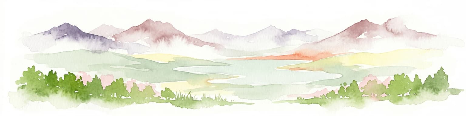
Pyrénées National Park is best known for its spectacular glacial cirques, particularly the Cirque de Gavarnie, which ranks among the most impressive mountain amphitheaters in the Alps and Pyrenees. The park protects some of the most significant high-mountain landscapes in Western Europe, with vertical limestone walls rising dramatically above alpine meadows and glacial valleys. It is also recognized for its population of reintroduced Pyrenean brown bears and the presence of the lammergeier, one of Europe's rarest and most distinctive raptors. The park's network of high-altitude lakes, particularly those in the Néouvielle massif, represents a distinctive hydrological feature.

Pyrénées National Park history and protected-area timeline

Pyrénées National Park was created by decree on March 23, 1967, following years of advocacy for protecting the Pyrenean mountain environment. The park's establishment was notably influenced by Pierre Chimits, who played a key role in developing French national park policy during this period. Prior to the park's creation, the Société Nationale de Protection de la Nature had established the Néouvielle Nature Reserve in 1935, which was later integrated into the national park in 1968.

The park's administrative headquarters are located in Tarbes at Villa Fould, a historic mansion built in 1850 that once belonged to Achille Fould, a prominent statesman during the Second Empire who served as Minister of Finance and Minister of State under Napoleon III. The building sits within the Paul-Chastellain park, a landscaped garden spanning 2.3 hectares with cascading water features. This location reflects the park's integration with the region's cultural heritage and its roots in the broader history of French environmental protection.

In 1997, the park achieved international recognition when its eastern portion was inscribed as part of the UNESCO World Heritage Site "Pyrénées – Mont Perdu," a transboundary listing shared with Spain. This designation was subsequently extended in 1999, acknowledging the outstanding universal value of the landscape's natural and cultural elements.

Pyrénées National Park landscape and geographic character

The landscape of Pyrénées National Park is defined by its dramatic mountain terrain shaped by millions of years of geological processes and repeated glacial cycles. The park protects some of the Pyrenees' most spectacular limestone formations, including the renowned cirques of Gavarnie, Troumouse, and Estaubé—each representing classic examples of glacial amphitheaters with their steep walls and cascading waterfalls. The Cirque de Gavarnie, with its 1,500-meter-high walls surrounding a vast glacial valley, stands as perhaps the most iconic landscape feature.

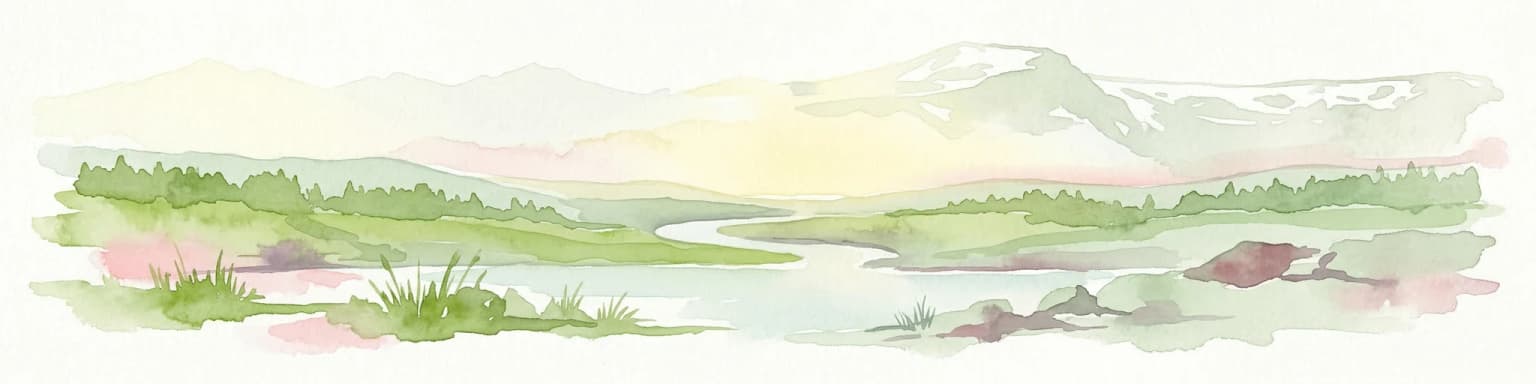
The park encompasses the high valley systems of Aspe, Ossau, Aure, and the Marcadau, each carved by ancient glaciers into characteristic U-shaped valleys. Deep canyons cut through the limestone as a result of tectonic uplift, while the landscape features numerous karst phenomena including caves and underground drainage systems. The Vignemale massif contains the highest summits in the French Pyrenees, with granite and limestone peaks rising above permanent snowfields and glacial remnants.

The hydrological network is particularly notable, with over 230 high-altitude lakes dotting the landscape, particularly concentrated in the Néouvielle region. These glacial lakes, ranging from small tarns to substantial bodies of water, represent an important landscape feature and habitat. The park's position along the French-Spanish border creates a mountainous frontier landscape of exceptional visual and ecological significance.

Pyrénées National Park ecosystems, habitats, and plant life

The ecological character of Pyrénées National Park reflects the unique position of the Pyrenees as a bridge between the Mediterranean and Atlantic biogeographic regions. The park protects a remarkable diversity of habitats across its altitudinal gradient, from montane forests through subalpine meadows to rocky alpine zones. The limestone-derived soils support distinctive vegetation communities, while the variety of exposures and microclimates creates a mosaic of ecological conditions.

The flora of the park is exceptionally rich, with approximately 2,500 higher plant species recorded, representing about 12% endemism—remarkably high for a European mountain range. Endemic species such as the Pyrenean violet and various endemic saxifrages and gentians contribute to the park's botanical significance. The forest zones feature beech, oak, and coniferous species, while the subalpine and alpine zones support characteristic high-mountain vegetation including grasslands, heaths, and rock-dwelling plant communities.

The park's designation as a UNESCO World Heritage site recognizes the outstanding ecological values of this mountain landscape, where natural processes continue to function largely unimpeded by human intervention in the core protection zone.

Pyrénées National Park wildlife and species highlights

Pyrénées National Park protects an impressive array of wildlife, with over 70 mammal species and approximately 200 bird species documented within its boundaries. The park's flagship mammal species is the Pyrenean brown bear, with a small population of individuals including both native survivors and reintroduced animals from Slovenia that have become established in the valleys of Aspe and Ossau. This bear population represents one of the most significant conservation achievements in Western Europe, though the population remains small and faces ongoing challenges.

The ungulate community features the Pyrenean chamois (isard), the symbolic mammal of the park, alongside red deer and roe deer in the lower valleys. The ibex, reintroduced from Spain beginning in 2013, has established a population exceeding 250 individuals. The bird fauna includes impressive raptors such as the lammergeier (bearded vulture), golden eagle, and griffon vulture, while the Pyrenean desman—an odd, semi-aquatic insectivore related to moles—represents one of Europe's most obscure and specialized mammals, found in the park's mountain streams.

The park also supports significant invertebrate diversity, including approximately 1,000 beetle species and 300 butterfly species. Introduced Alpine marmots have thrived since their arrival in 1948, now common throughout the park's meadows and rocky areas.

Pyrénées National Park conservation status and protection priorities

Pyrénées National Park plays a crucial role in conserving the Pyrenees' most significant natural heritage, protecting species and habitats that face threats throughout their range. The park's strict protection zone preserves areas where natural processes can function with minimal human intervention, while the peripheral zone allows for sustainable traditional activities including pastoralism that has shaped the landscape for centuries. This dual-zone approach reflects the French national park model that integrates conservation with sustainable development.

The conservation of the Pyrenean brown bear represents the park's most high-profile conservation challenge and achievement. Following the near-extinction of the native population, reintroduction efforts beginning in 1996 have established a small but viable population, though concerns remain about the population's long-term viability given its size. The park also participates in broader European conservation networks and collaborates closely with the adjoining Spanish Ordesa y Monte Perdido National Park on transboundary conservation issues.

The UNESCO World Heritage designation underscores the international recognition of the park's conservation values, while also creating obligations for ongoing protection and management that meet the highest international standards.

Pyrénées National Park cultural meaning and human context

The cultural landscape of Pyrénées National Park reflects centuries of human presence in these mountain valleys, with pastoral activity shaping both the terrain and the communities that call the region home. The traditional practice of transhumance—the seasonal movement of livestock between high summer pastures and lower winter grazing areas—has influenced the landscape through the creation of mountain meadows, farm buildings, and the characteristic "granges" (mountain barns) that dot the terrain. This agro-pastoral heritage remains active within the park's peripheral zone.

The park's location in the historic region of Bigorre and the Béarn adds cultural depth to the natural landscape. The town of Gavarnie, with its famous cirque and traditional architecture, exemplifies the connection between cultural heritage and the mountain environment. The Brèche de Roland, a famous mountain pass in the park, carries significant historical and legendary associations related to the Frankish hero Roland from the Song of Roland. The park's administration from Tarbes, a historic city with deep roots in Pyrenean history, further connects the protected area to the broader cultural fabric of the region.

Top sights and standout views in Pyrénées National Park

Pyrénées National Park offers visitors extraordinary mountain landscapes characterized by towering limestone cirques, glacial valleys, and high-altitude lakes that rank among the most spectacular in Western Europe. The Cirque de Gavarnie stands as the park's signature landscape, its massive amphitheater of vertical walls surrounding a valley crowned by one of France's highest waterfalls. The Néouvielle region contains a remarkable concentration of glacial lakes, with the Lac d'Orédon and Lac de Cap de Long among the most visited. The park's wildlife, including the chance to observe reintroduced bears, chamois, and the rare lammergeier, provides exceptional nature-viewing opportunities. The transboundary connection with Spain's Ordesa y Monte Perdido creates one of Europe's most significant mountain protected-area complexes.

Best time to visit Pyrénées National Park

The summer months of June through September offer the most reliable access to the park's high mountain areas, with warm days, accessible trails, and the full display of alpine meadows in bloom. July and August represent peak visitation, particularly in the popular areas around Gavarnie and the Néuvielle lakes, though this period also offers the longest days and most comfortable temperatures for hiking. Spring and early summer bring snowmelt and rushing waterfalls, while autumn offers fewer crowds and the golden colors of larch forests. Winter access is limited to lower valleys and cross-country skiing opportunities, with the high mountain areas experiencing heavy snowfall that closes many access routes.

Park location guide

Geography guide, regional context, and park location map for Pyrénées National Park

Pyrénées National Park park geography, regions, and map view in France
Understand where Pyrénées National Park sits in France through a broader geographic reading of the surrounding landscape, nearby location context, and its mapped position within the national park landscape.

How Pyrénées National Park fits into France

France is a unitary semi-presidential republic and one of the world's largest economies. It borders Belgium, Luxembourg, Germany, Switzerland, Italy, Monaco, Andorra, and Spain, with a maritime border to the United Kingdom. The country is known for its cultural influence, art, cuisine, and political history spanning centuries.

Wider geography shaping Pyrénées National Park in France

France is located in Western Europe. Metropolitan France extends from the Rhine to the Atlantic Ocean and from the Mediterranean Sea to the English Channel and North Sea. The country borders Belgium, Luxembourg, Germany, Switzerland, Italy, Monaco, Andorra, Spain, and has a maritime border with the United Kingdom.

Map view of Pyrénées National Park

Use this park location map to pinpoint Pyrénées National Park in France, understand its exact geographic position, and read its mapped placement within the surrounding landscape more clearly.

Pigeon | © OpenStreetMap contributors

Location context for Pyrénées National Park

Hautes-PyrénéesPyrénées-Atlantiques
Park atlas

Explore Mountain Landscapes and Connected Protected Areas Across the Pyrenees Region

Discover Other National Parks and Protected Areas Near Pyrénées National Park
Explore a curated selection of national parks and protected areas geographically close to Pyrénées National Park, tracing the broader mountain landscapes and conservation efforts across the Pyrenees. Compare diverse alpine environments, glacial features, and unique wildlife habitats to deepen your understanding of this significant transboundary region.
Watercolor painting showing a mountain range with a winding river through a valley
National park

Ordesa y Monte Perdido National Park: Glacial Terrain and Pyrenean Protected Landscape

Explore its dramatic valleys, cliffs, and alpine geography.

Ordesa y Monte Perdido National Park is a critical protected area within the Pyrenean geography, defined by its spectacular glacial valleys, towering limestone massifs, and unique karst formations. As a National Park and UNESCO World Heritage Site, it offers a rich environment for exploring mapped terrain and understanding the interplay of geology and high-alpine ecosystems. Delve into the mapped boundaries and distinct landscape features that characterize this significant protected landscape.

Area
156.08 km²
Established
1918
IUCN
II
Relief
Mountain
National parkProvince of Lleida

Aigüestortes i Estany de Sant Maurici National Park: Pyrenean High Mountain National Park Landscape

Explore glacial lakes and winding waterways in Catalonia.

Aigüestortes i Estany de Sant Maurici National Park is a premier national park in the Pyrenees, celebrated for its extensive network of almost 200 glacial lakes and the dramatic natural beauty of the Sant Maurici lake. Its landscape is defined by high mountain terrain, characterized by U-shaped valleys, sharp ridges, and unique hydrological features like the Aigüestortes plain's meandering streams. This protected area in the Province of Lleida offers a rich setting for understanding alpine environments and Pyrenean geography through detailed mapping and atlas exploration.

Area
141 km²
Established
1955
IUCN
II
Visitors
525K annual
Watercolor painting of a river winding through a valley with green fields, trees, and distant hills
Protected area

Parc Natural Comunal de les Valls del Comapedrosa: Andorra's Highest Protected Alpine Landscape

Explore the Pyrenean terrain and mapped boundaries of Andorra's summit park.

Parc Natural Comunal de les Valls del Comapedrosa is the primary high-altitude protected area in Andorra, defined by its rugged alpine terrain and the presence of Coma Pedrosa, the country's highest peak. This protected landscape offers a significant geographic anchor for exploring the Pyrenees, highlighting the unique mountain conservation efforts. Its mapped boundaries encompass dramatic valleys and steep ridges, providing a clear context for understanding Andorra's mountainous geography through a structured atlas lens.

Area
15.43 km²
Established
2003
IUCN
IV
Relief
Mountain
Watercolor illustration of green fields, a river, and mountains under a soft pink and yellow sky
National parkOccitanie

Cévennes National Park: Explore its Mapped Terrain and Protected Landscape in Occitanie

Discover the unique geographic context and park boundaries.

Cévennes National Park, situated in Occitanie, France, offers a rich exploration of mid-mountain Mediterranean geography. As a protected landscape, its mapped terrain features dramatic limestone plateaus, deep river gorges, and distinct granite massifs. This entry provides essential geographic context for Cévennes National Park, highlighting its unique natural features and its significance as a protected area within the broader regional atlas.

Area
937 km²
Established
1970
IUCN
V
Visitors
800K annual
National park

Picos de Europa National Park: Dramatic Limestone Peaks and Protected Landscape Atlas

Explore Spain's historic national park and UNESCO Biosphere Reserve.

Picos de Europa National Park offers an unparalleled exploration of dramatic limestone peaks, deep glacial valleys, and extensive Atlantic forests. As Spain's oldest national park and a UNESCO Biosphere Reserve, it presents a remarkable study in karst landscape evolution and biodiversity conservation. This protected area, spanning significant territory across northern Spain, provides a rich geographic context for understanding regional natural heritage and mapped natural features.

Area
671.27 km²
Established
1918
IUCN
II
Relief
Mountain
Watercolor illustration depicting a mountain range, river, and green vegetation under a light sky
National park

Sierra de Guadarrama National Park: Protected Area Landscape and Geographic Context

Explore diverse high Mediterranean mountain terrain and ecosystems.

Sierra de Guadarrama National Park is a significant protected national park in central Spain, characterized by its extensive granite landscapes and eleven distinct ecosystems. This park protects crucial high Mediterranean mountain environments, ancient pine forests, and dramatic glacial formations. Its geographic position within the Sistema Central makes it essential for understanding the regional geography and mapped terrain of the Iberian Peninsula, offering a unique look at a vital protected landscape.

Area
339.6 km²
Established
2013
IUCN
II
Visitors
3M annual
National parkBouches-du-Rhône

Calanques National Park: Mediterranean Limestone Cliffs and Marine Protected Area

France's First Peri-Urban National Park

Calanques National Park, situated in the Bouches-du-Rhône department, represents a significant protected landscape where dramatic limestone geology meets the Mediterranean Sea. This atlas-focused entry details the park's iconic calanques, its combined terrestrial and marine protected zones, and its rich prehistoric cultural significance. Understand its unique geographic setting and its importance as a conservation area accessible for map-based discovery and regional landscape context.

Area
520 km²
Established
2012
IUCN
II
Relief
Mountain
Watercolor illustration showing a wetland landscape with grasses, a body of water, and distant hills
National park

Tablas de Daimiel National Park: Spain's Inland Wetland National Park and Protected Area

Explore mapped boundaries and regional geographic context.

Tablas de Daimiel National Park represents one of the last remaining examples of floodplain wetland systems in Spain's interior. Located in Castilla-La Mancha, this protected area showcases a unique confluence of fresh and brackish waters, supporting a rich mosaic of emergent vegetation and serving as a critical habitat for migratory birds. Use MoriAtlas to explore its precise geographic setting, mapped terrain, and its role as a vital conservation landscape within the Iberian Peninsula.

Area
30.3 km²
Established
1973
IUCN
II
Relief
Lowland

Common questions about visiting, size, designation, and location context for Pyrénées National Park

Pyrénées National Park FAQs for park facts, access, geography, and protected area context
Find quick answers about Pyrénées National Park, including protected-area facts, park geography, trail and visitor context, and how the park fits into its surrounding country and regional landscape.
MoriAtlas Explorer

Continue Your Protected Areas Search Across the Global Atlas

Deepen your exploration by continuing the structured search for national parks and protected areas worldwide. Utilize the comprehensive filtering capabilities to compare different conservation landscapes and refine your understanding of global park geography. Discover more about the distribution and characteristics of protected natural areas.

Global natural geography