Mori Atlas logo
National parkRohkunborri National Park

Discover the dramatic Sørdalen canyon, alpine tundra, and boreal forests via interactive park maps.

Rohkunborri National Park: Norway's Protected Landscape in Troms County

Rohkunborri National Park represents a significant protected wilderness area within Norway's Troms county, offering a deep dive into its mapped landscapes and protected terrain. Established in 2011, this national park spans 571 square kilometers along the Norwegian-Swedish border, featuring the striking Sørdalen canyon and diverse ecosystems that transition from rich deciduous forests to high alpine tundra. Its geographic context in northern Norway provides a unique vantage point for exploring the dynamics of transboundary conservation and northern European ecology.

National ParksNorwayAlpine EnvironmentsBoreal ForestsBorder ParksTundra

Rohkunborri National Park

National park

Park overview

Structured park overview, official facts, and landscape profile for Rohkunborri National Park

Rohkunborri National Park park facts, protected area profile, and essential visitor context
Review the core facts for Rohkunborri National Park, including designation, size, terrain, visitor scale, habitats, and operating context in one park-focused overview.

About Rohkunborri National Park

Rohkunborri National Park occupies a strategic position in northern Scandinavia's network of protected areas, connecting Norwegian and Swedish conservation efforts across an international border. The park's establishment in 2011 reflected growing recognition of the ecological importance of this transition zone between boreal and Arctic environments. The landscape is characterized by dramatic topography, with the Sørdalen valley forming a deep canyon that bisects the protected area, flanked by mountain ridges reaching elevations of approximately 1,500 meters. This varied terrain creates multiple microhabitats and supports the park's remarkable biodiversity.

The ecological character of Rohkunborri shifts dramatically with altitude, from the deciduous forests of the valley floors to the harsh alpine conditions of the high ground. The lower elevations support rich boreal forests, while the higher terrain gives way to tundra vegetation adapted to extreme northern conditions. The presence of wetlands, bogs, and areas with lime-rich bedrock adds botanical complexity, supporting plant communities that are rare in this latitude. The eastern lakes contain Arctic char, a cold-water fish species that thrives in subarctic conditions.

Wildlife in the park reflects both the Scandinavian and broader Holarctic faunal communities. Large mammals including brown bears, wolverines, and lynx roam the territory, representing species that require extensive ranges and intact habitats. The park also supports significant populations of reindeer, which are managed by Sami herders in accordance with traditional pastoral practices that have shaped the northern Scandinavian landscape for centuries. Birdlife includes notable species such as snowy owl and gyrfalcon, both associated with open tundra and boreal landscapes.

Quick facts and research context for Rohkunborri National Park

Rohkunborri National Park is located in the far north of Norway, straddling the border with Sweden in Troms county. The park was established in 2011, making it one of Norway's younger national parks. It forms part of a contiguous protected area network that includes the Swedish Vadvetjåkka National Park to the south and Øvre Dividal National Park to the north. The terrain is characterized by the deep Sørdalen canyon, mountainous terrain, and several significant lakes including Geavdnjajávri, with Altevatnet and Leinavatnet situated just outside the boundary. The park sits at a transition zone between boreal and Arctic environments, supporting a distinctive mix of flora and fauna.

Park context

Deeper park guide and search-rich context for Rohkunborri National Park

Rohkunborri National Park history, landscape, wildlife, and travel context
Explore Rohkunborri National Park through its history, landscape character, ecosystems, wildlife, conservation priorities, cultural context, and seasonal travel timing in a structured park guide built for atlas discovery and search intent.

Why Rohkunborri National Park stands out

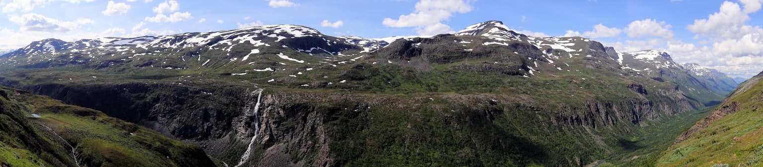
Rohkunborri National Park is best known for its dramatic Sørdalen canyon, which cuts through the landscape as one of the park's most distinctive geological features. The park is recognized for its remarkable ecological diversity, spanning from rich deciduous forests to alpine tundra within a relatively compact area. It is particularly notable for supporting populations of large predators including brown bears, wolverines, and lynx, alongside significant Sami-managed reindeer herds. The presence of species such as snowy owl and gyrfalcon, combined with wetlands and lime-rich bedrock supporting specialized vegetation including Arctic rhododendron, gives the park exceptional conservation value within the Scandinavian mountain region.

Rohkunborri National Park history and protected-area timeline

Rohkunborri National Park was established in 2011 as part of Norway's ongoing effort to expand and strengthen its network of protected areas. The creation of the park reflected both growing scientific understanding of the ecological significance of this border region and broader political commitments to transboundary conservation between Norway and Sweden. The park was designated as an IUCN Category II protected area, recognizing its national park status and the primary goal of preserving natural ecosystems while allowing for limited compatible uses.

The establishment of Rohkunborri completed a contiguous protected area corridor that connects with existing Norwegian parks to the north and the Swedish Vadvetjåkka National Park to the south. This network approach reflects contemporary conservation thinking about the importance of large, connected habitats for maintaining viable populations of wide-ranging species and preserving ecological processes across broader landscapes. The park's location along an international border also necessitated coordination with Swedish authorities to ensure effective management of the shared ecological region.

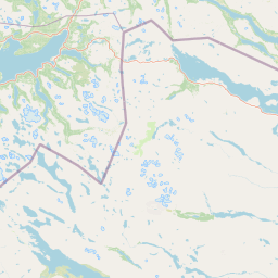
Rohkunborri National Park landscape and geographic character

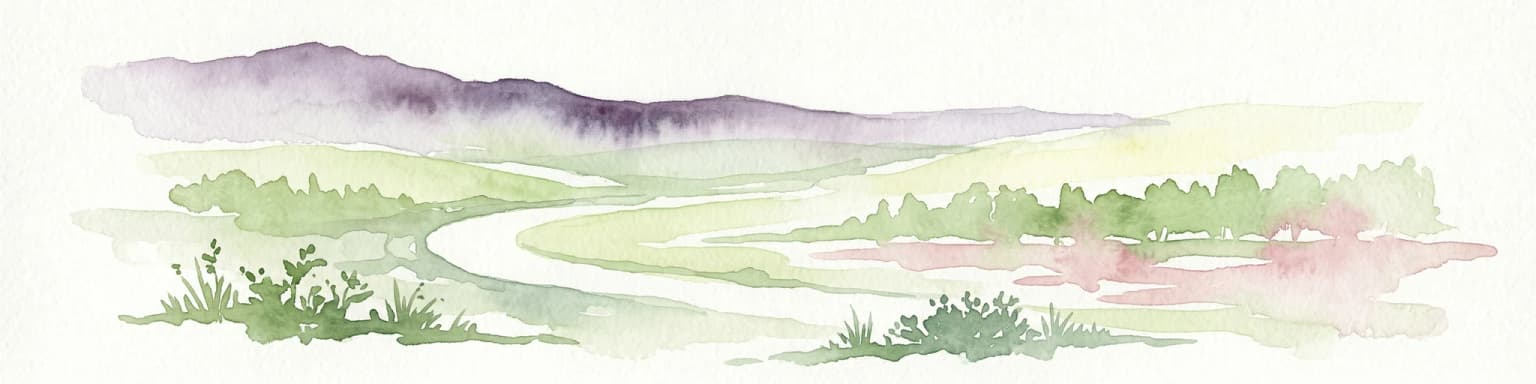
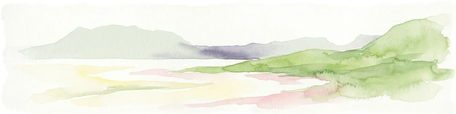
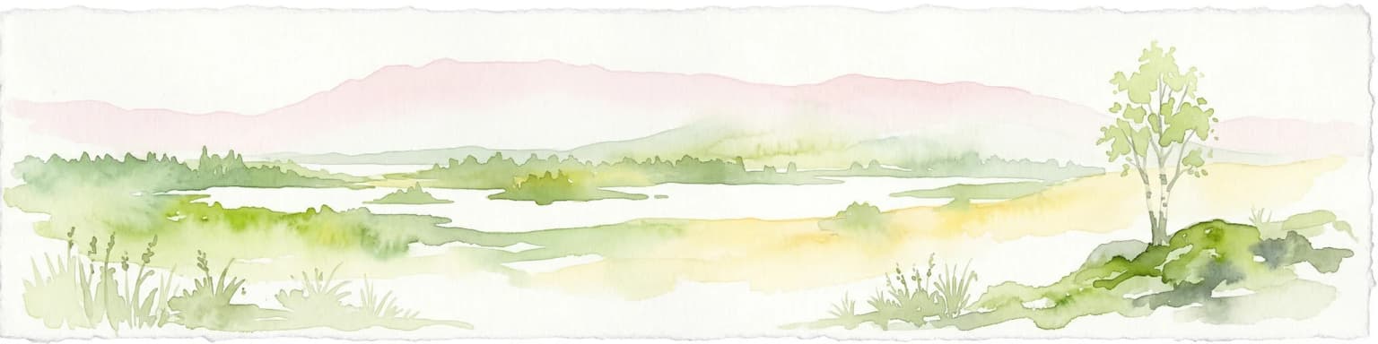
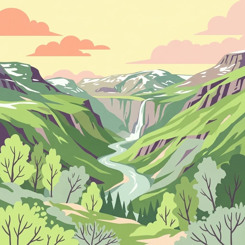
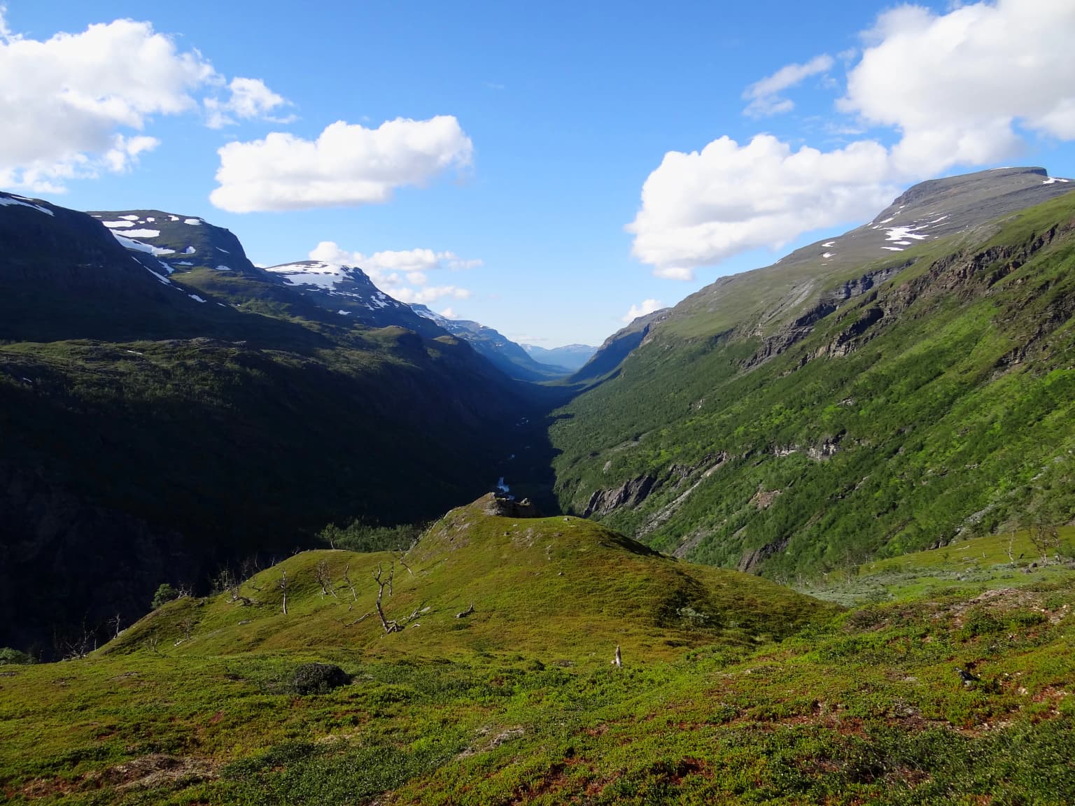
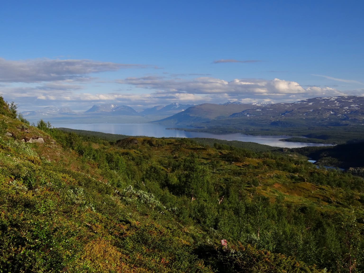
The landscape of Rohkunborri National Park is defined by its dramatic topographic diversity and the dramatic Sørdalen canyon that forms the park's central geographic feature. This deep valley cuts through the protected area, creating a natural corridor that has shaped both ecological patterns and human movement through the region. The surrounding mountain ridges rise to approximately 1,500 meters above sea level, forming a rugged backdrop that transitions from forested slopes to exposed alpine terrain. The park encompasses significant water bodies including the large lake Geavdnjajávri, while Altevatnet and Leinavatnet lie just beyond the northern boundary. The combination of canyon, mountains, lakes, and wetlands creates a landscape of considerable visual and ecological variety within a relatively compact area.

Rohkunborri National Park ecosystems, habitats, and plant life

The nature of Rohkunborri National Park is characterized by a remarkable transition from boreal to Arctic ecosystems that occurs across a relatively short elevational gradient. At lower elevations, the park supports rich boreal deciduous forests that represent the northern limit of more southerly forest types. These forests give way progressively to alpine tundra as elevation increases, with the upper areas supporting only sparse vegetation adapted to harsh conditions, thin soils, and the extreme seasonality of northern latitudes. The park's geology includes areas of lime-rich bedrock, which influences soil chemistry and supports plant communities that differ from the surrounding terrain.

Wetlands and bogs are significant features within the park, adding to habitat diversity and providing important ecological functions. The presence of Arctic rhododendron represents a botanical highlight, with this distinctive species adding to the park's ecological character. The lakes in the eastern portion of the park support Arctic char, a cold-water fish species that is characteristic of subarctic aquatic environments. This combination of terrestrial and aquatic habitats creates an ecological system of considerable complexity and conservation significance.

Rohkunborri National Park wildlife and species highlights

Rohkunborri National Park supports an impressive roster of wildlife, with particular significance attached to its populations of large carnivores. Brown bears, wolverines, and lynx all occur within the park, representing species that require extensive territories and intact habitats to maintain viable populations. The presence of these predators indicates a healthy, functioning ecosystem with sufficient prey base and habitat connectivity. The park also supports significant populations of reindeer, which are owned and managed by Sami herders using traditional practices that have shaped the northern landscape for generations.

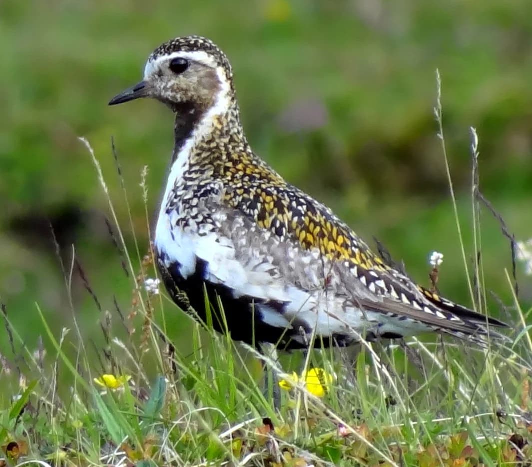
Birdlife in the park includes species that are characteristic of northern and alpine environments. The snowy owl, with its distinctive white plumage, is associated with open tundra and represents one of the more iconic species found in the park. The gyrfalcon, largest of the falcon species, also occurs here, preferring open habitats in northern regions. The golden plover, documented in the park's imagery, represents the broader community of wading birds and ground-nesting species that thrive in the park's alpine and wetland habitats.

Rohkunborri National Park conservation status and protection priorities

Rohkunborri National Park represents an important contribution to Norway's conservation network and to transboundary environmental protection in northern Europe. The park's position along the Norwegian-Swedish border connects it with protected areas on both sides of the frontier, creating a larger conservation landscape that supports ecological processes requiring extensive areas. This network approach is particularly important for wide-ranging species such as brown bears, wolverines, and lynx, which require territories that extend well beyond individual protected areas.

The diversity of habitats within the park, from boreal forest to alpine tundra, adds to its conservation value by preserving ecological gradients that might otherwise be lost to development or land-use changes. The presence of Sami-managed reindeer herds represents a traditional land-use pattern that has shaped the northern landscape over centuries, and the park's management must balance conservation objectives with recognition of these established uses. The protection of wetlands, species-rich bedrock areas, and critical wildlife habitats within the park contributes to broader biodiversity conservation in a region that faces ongoing pressures from climate change and development.

Rohkunborri National Park cultural meaning and human context

Rohkunborri National Park exists within a landscape that has been shaped by human activity, particularly through the traditional practices of the Sami people. Reindeer husbandry has been practiced in this region for centuries, and the park continues to support Sami-owned reindeer herds that represent an important cultural and economic tradition. This historical use of the landscape is reflected in the park's Northern Sami name, Rohkunborri álbmotmeahcci, which translates to indicate the park's established place within the cultural landscape of the region.

The park's location along the Norway-Sweden border also places it within a region of historical significance, where the boundaries between nations have fluctuated over time and where cross-border movement and interaction have shaped local communities. While the protected area itself is focused on preserving natural ecosystems, this cultural context adds depth to understanding the landscape and its significance beyond purely ecological considerations.

Top sights and standout views in Rohkunborri National Park

Rohkunborri National Park offers exceptional wilderness character within northern Norway, combining dramatic canyon landscapes with ecological diversity that spans from boreal forest to alpine tundra. The Sørdalen canyon provides the park's most distinctive visual feature, a dramatic valley that showcases the geological forces that have shaped this border region. Wildlife viewing opportunities for large predators including brown bears, wolverines, and lynx distinguish this park, alongside the chance to observe snowy owls and gyrfalcons in their natural habitat. The transboundary location, connecting with Swedish protected areas, creates a significant conservation corridor that supports ecological processes across an international frontier. The presence of Sami-managed reindeer herds adds cultural dimension to the natural landscape, reflecting the long history of human presence in this northern region.

Best time to visit Rohkunborri National Park

The best time to visit Rohkunborri National Park depends on the experiences sought, with different seasons offering distinct perspectives on this northern wilderness. Summer months bring extended daylight hours, relatively mild conditions for the latitude, and access to higher elevations, making this the most popular season for hiking and wildlife observation. The late summer period often offers particularly good conditions for viewing wildlife as animals become more active in preparation for winter. Winter transforms the park dramatically, with heavy snow cover, limited daylight, and harsh conditions creating a very different experience that appeals to those seeking solitude and winter wilderness. The shoulder seasons of spring and autumn offer transitional experiences, though access and conditions can be variable.

Park location guide

Geography guide, regional context, and park location map for Rohkunborri National Park

Rohkunborri National Park park geography, regions, and map view in Norway
Understand where Rohkunborri National Park sits in Norway through a broader geographic reading of the surrounding landscape, nearby location context, and its mapped position within the national park landscape.

How Rohkunborri National Park fits into Norway

Norway, officially the Kingdom of Norway, is a Nordic country in Northern Europe located on the Scandinavian Peninsula. It encompasses mainland Norway, the Arctic islands of Svalbard and Jan Mayen, and maintains dependencies including Bouvet Island and Antarctic claims. The country has a population of about 5.6 million and is bordered by Sweden, Finland, and Russia. Norway is a unitary parliamentary constitutional monarchy with Oslo as its capital and largest city.

Wider geography shaping Rohkunborri National Park in Norway

Norway occupies the western and northern portions of the Scandinavian Peninsula in Northern Europe. The country shares a long eastern border with Sweden, and borders Finland and Russia to the northeast. Norway has an extensive coastline facing the Skagerrak, North Sea, Norwegian Sea, and Barents Sea. The terrain is predominantly mountainous with numerous fjords along the coastline.

Map view of Rohkunborri National Park

Use this park location map to pinpoint Rohkunborri National Park in Norway, understand its exact geographic position, and read its mapped placement within the surrounding landscape more clearly.

Pigeon | © OpenStreetMap contributors

Location context for Rohkunborri National Park

Bardu MunicipalityTroms
Park atlas

Browse mapped park geography and discover transboundary conservation landscapes surrounding this distinctive Norwegian protected area.

Explore Other National Parks Near Rohkunborri: Discover Similar Protected Areas in Norway's Northern Wilderness
Continue your exploration from Rohkunborri National Park by discovering other national parks and protected areas across northern Norway and its adjacent transboundary landscapes. Explore the wider regional context of alpine tundra, boreal forests, and dramatic mountain terrain to compare diverse park geography and conservation efforts in Scandinavia.
National parkNorrbotten County

Vadvetjåkka National Park: Arctic Mountain Landscape and Karst Terrain

Northernmost National Park in Norrbotten County, Sweden

Vadvetjåkka National Park offers a unique atlas perspective on Sweden's northernmost protected mountain landscape. Explore its remote Arctic terrain, characterized by glaciers existing at unusual low altitudes and significant karst cave systems carved into limestone bedrock. This is a vital point for understanding the mapped geography and protected natural features of Norrbotten County and Swedish Lapland.

Area
26.3 km²
Established
1920
IUCN
II
Relief
Mountain
Watercolor painting showing green hills, a body of water, and distant mountains
National parkNorrbotten County

Abisko National Park

Subarctic national park with unique landscapes

Abisko National Park in Swedish Lapland offers a glimpse into dramatic subarctic terrain. Explore its protected boundaries, river canyons, and alpine tundra through structured geographic data.

Area
77 km²
Established
1909
IUCN
II
Visitors
50K annual
National parkTroms

Øvre Dividal National Park: Arctic Alpine Protected Landscape in Troms, Norway

Mapped boundaries and unique ecological terrain of a pristine wilderness.

Øvre Dividal National Park stands as a premier example of Arctic alpine wilderness, meticulously preserved as a national park in Norway's Troms region. This entry facilitates a detailed exploration of its mapped protected boundaries and the distinct elevational ecological zones, from boreal forests to high-altitude tundra. Gain geographic context for this vital landscape, which supports diverse habitats and contributes to Scandinavia's largest contiguous wilderness areas.

Area
750 km²
Established
1971
IUCN
II
Relief
Mountain
National parkSenja

Ånderdalen National Park: Ancient Coastal Pine Forest and Glacial Valley Landscape

Norway's protected area within the Senja region.

Delve into the detailed protected landscape of Ånderdalen National Park, a national park located on Norway's Senja island. This entry offers a focused atlas exploration of its unique geographic features, including its celebrated ancient coastal pine forest, dramatic glacial valleys carved from granite, and its significance as a representative example of the northern Norwegian coastal mountain terrain. Understand the mapped boundaries and the natural context of this vital conservation area.

Area
134 km²
Established
1970
IUCN
II
Relief
Mixed relief
Watercolor painting of a landscape featuring a body of water, green fields, a single tree, and distant mountains under a light sky
National parkNorrbotten County

Stora Sjöfallet National Park: Protected Arctic Landscape in Norrbotten County

Explore mapped terrain and regional geography.

Stora Sjöfallet National Park stands as a significant protected landscape within Norrbotten County, Sweden, renowned for its striking Arctic mountain scenery centered on the Áhkká massif. As a key component of the Laponian Area UNESCO World Heritage Site, its vast expanse of over 1,278 square kilometers offers critical insights into subarctic ecosystems, glacial terrain, and the mapped boundaries of a protected natural territory. Discover the unique geographic features and ecological value of this expansive national park.

Area
1,278 km²
Established
1909
IUCN
II
Relief
Mountain
Watercolor illustration showing mountains, a lake, and rolling hills
National parkNordland

Møysalen National Park: Coastal Alpine Protected Landscape in Nordland, Norway

Mapped boundaries, dramatic terrain, and coastal ecosystems.

Møysalen National Park offers a compelling study in coastal alpine geography, situated within Nordland county, Norway. This protected area is renowned for its dramatic mountain scenery where peaks plunge directly into the sea and deep fjords. The park's 51 square kilometres encompass a unique ecological transition from alpine summits to sea level, featuring jagged peaks, sheltered valleys with birch forests, and coastal wetlands. Explore the mapped landscape of this distinctive Norwegian national park and understand its place in regional geography and protected land networks.

Area
51 km²
Established
2003
IUCN
II
Relief
Mountain
National parkTroms

Reisa National Park: Dramatic River Valley and Protected Landscape Atlas

Subarctic terrain and geographic context in Troms, Norway.

MoriAtlas offers detailed geographic context for Reisa National Park, a protected landscape in Norway's Troms county. Explore the park's identity as a significant subarctic river valley, carved by the Reisa River into a dramatic canyon system. This page provides insights into its mapped natural features, regional landscape setting, and its importance within the broader atlas of protected areas. Understand the park's protected boundaries and terrain for structured geographic discovery.

Area
803 km²
Established
1986
IUCN
II
Relief
Mixed relief
Watercolor illustration of a mountainous landscape with a river, grass, and distant hills
National parkNorrbotten County

Sarek National Park: Mapping Sweden's Rugged Alpine Wilderness and Glacial Terrain

Explore the mapped geography of Norrbotten County's largest alpine national park.

Sarek National Park represents the heart of Sweden's alpine wilderness, a protected landscape defined by its towering mountain peaks, expansive glaciers, and deeply carved glacial valleys. Situated in Norrbotten County, the park's geography is characterized by a remote and rugged terrain, making it a prime destination for understanding high-altitude natural environments through mapped context. Discover the unique contours of this iconic national park and its place within the broader regional geography of Swedish Lapland.

Area
1,970 km²
Established
1909
IUCN
II
Relief
Mountain

Common questions about visiting, size, designation, and location context for Rohkunborri National Park

Rohkunborri National Park FAQs for park facts, access, geography, and protected area context
Find quick answers about Rohkunborri National Park, including protected-area facts, park geography, trail and visitor context, and how the park fits into its surrounding country and regional landscape.
MoriAtlas Explorer

Continue Your Protected Areas Search Across the Global Atlas

Deepen your exploration by continuing the structured search for national parks and protected areas worldwide. Utilize the comprehensive filtering capabilities to compare different conservation landscapes and refine your understanding of global park geography. Discover more about the distribution and characteristics of protected natural areas.

Global natural geography