Mori Atlas logo
National parkSeitseminen National Park

Discover the mapped geography and diverse terrain of this significant protected wilderness in western Finland.

Seitseminen National Park: Finland's Ancient Boreal Forest and Mire Protected Landscape

Seitseminen National Park offers a unique window into Finland's characteristic boreal forest and wetland ecosystems. This dedicated protected area showcases extensive old-growth woodlands, vast peatland complexes, and the prominent Seitsemisharju esker ridge, presenting a diverse mapped landscape for geographic exploration. As one of Finland's most accessible wilderness areas, Seitseminen provides a crucial reference for understanding regional protected lands and the unique terrain of the Suomenselkä watershed.

Boreal forestsMires and peatlandsOld-growth forestsNature trailsNorthern FinlandPirkanmaa
An illustrated forest scene with a winding path through tall coniferous trees, moss-covered rocks, and ferns under a light blue sky

Seitseminen National Park

National park

Park overview

Structured park overview, official facts, and landscape profile for Seitseminen National Park

Seitseminen National Park park facts, protected area profile, and essential visitor context
Review the core facts for Seitseminen National Park, including designation, size, terrain, visitor scale, habitats, and operating context in one park-focused overview.

About Seitseminen National Park

Seitseminen National Park protects a representative slice of Finnish boreal wilderness in the heart of the Suomenselkä watershed region. The landscape evolved through glacial processes that left behind the prominent Seitsemisharju esker ridge running north-south through the western portion of the park, creating slightly elevated terrain that contrasts sharply with the surrounding peatlands. The forests here reflect centuries of ecological succession, with Norway spruce and Scots pine forming closed canopies on drier sites while the lower-lying areas transitioned over millennia into the extensive bog and fen systems that now dominate the park's character. The Multiharju area represents the ecological heart of the park, with its old-growth forest reserve established as early as 1910, making it one of Finland's longest-protected forest areas. This protection has allowed natural forest processes to continue unimpeded, creating the complex habitat structures that support diverse wildlife communities. The park's position in the boreal zone places it within a transition area between southern and northern Finnish ecosystems, giving it ecological significance as a mixing zone for species with different geographic affinities.

Quick facts and research context for Seitseminen National Park

Seitseminen National Park is located in western Finland's Pirkanmaa region across the municipalities of Ikaalinen and Ylöjärvi. The 45.5 km² protected area was established in 1982 and features the typical boreal forest and mire landscape of the Suomenselkä watershed. Over half the park consists of peatlands including bogs, fens, and treeless mires, while the drier upland areas support closed-canopy coniferous forests. The Multiharju area contains some of Finland's oldest accessible forests, with pines exceeding 350 years in age. The park is managed by Metsähallitus and receives approximately 42,000 visitors annually, with the majority arriving as day visitors.

Park context

Deeper park guide and search-rich context for Seitseminen National Park

Seitseminen National Park history, landscape, wildlife, and travel context
Explore Seitseminen National Park through its history, landscape character, ecosystems, wildlife, conservation priorities, cultural context, and seasonal travel timing in a structured park guide built for atlas discovery and search intent.

Why Seitseminen National Park stands out

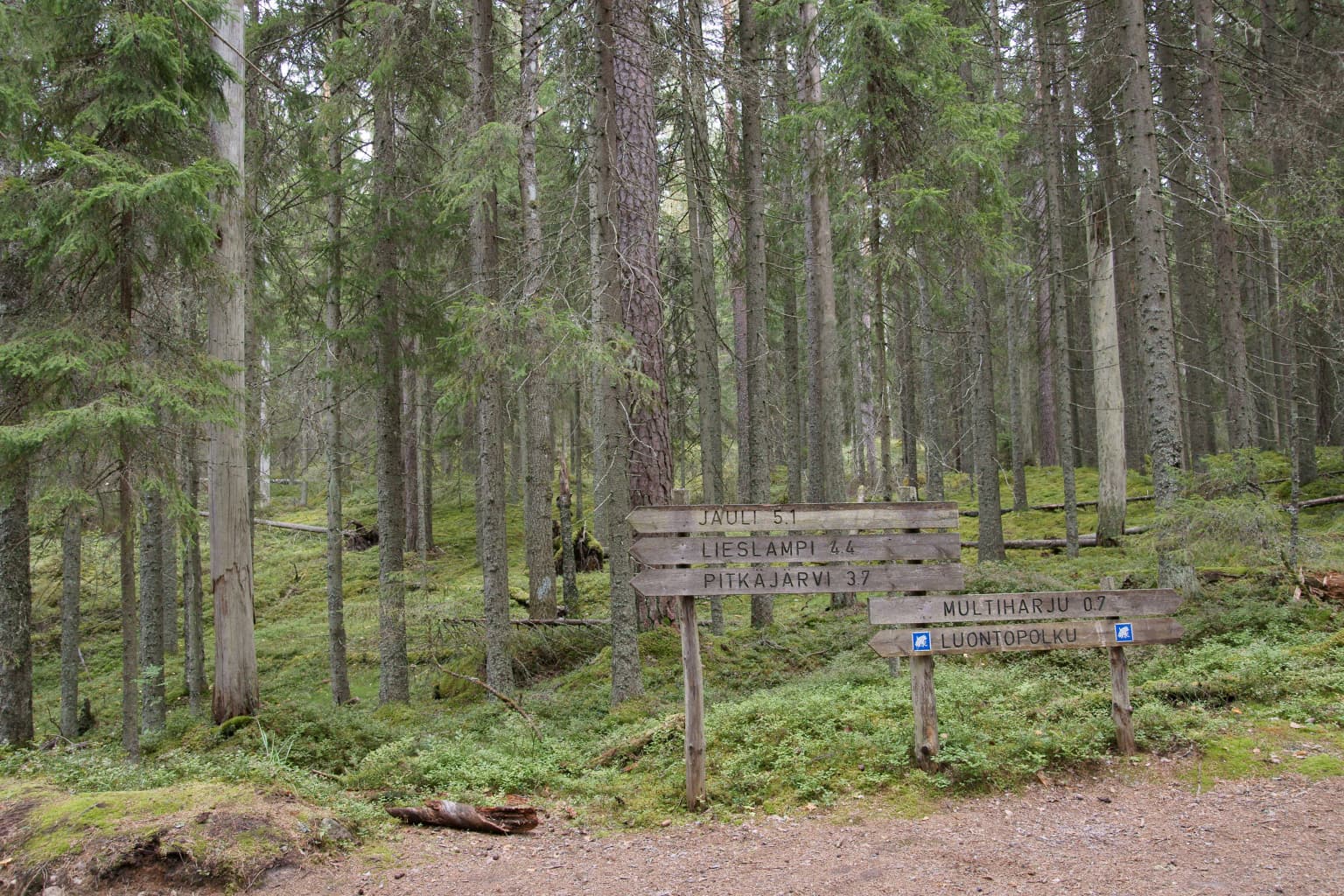
Seitseminen is best known for its extensive old-growth boreal forests and the Multiharju primeval forest area, which contains some of the oldest trees accessible to the public in Finland. The park also stands out for its vast mire systems covering more than half of its territory, representing a classic Finnish bog landscape with sparse pine and stunted spruce creating an almost barren appearance across the peatlands. The park's emblem species, the pine marten, is commonly encountered throughout the forest and mire habitats, making it one of Finland's most reliably observable national parks for this distinctive mustelid. The Kovero heritage farm provides cultural context, while the network of well-maintained hiking trails, including the 18-kilometre Uittajanpolku route, makes the park accessible for visitors seeking to experience boreal wilderness.

Wooden trail signs with blue markers in a boreal forest with tall pine trees and moss-covered ground
Wooden trail signs in a forested area of Seitseminen National Park

Seitseminen National Park history and protected-area timeline

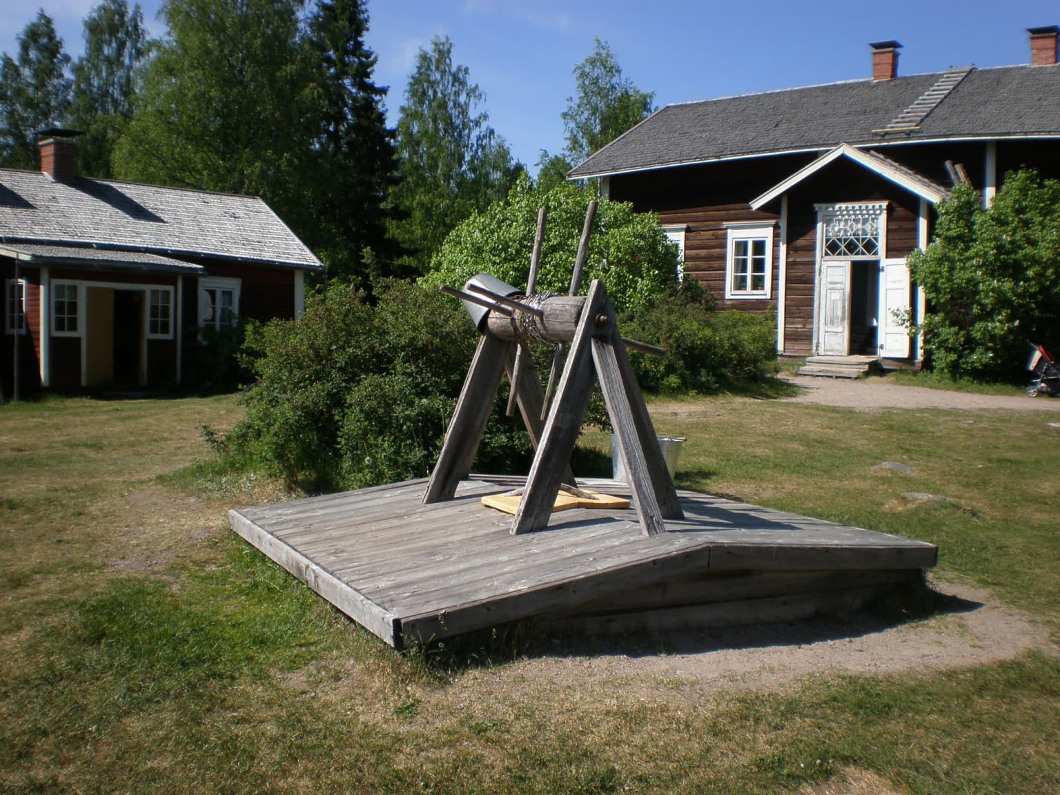
Seitseminen National Park was established in 1982 as part of Finland's expanding network of protected areas during the conservation movement's growth in the late twentieth century. The park was expanded in 1989 to include additional territory, bringing the total area to its current 45.5 square kilometres. The Multiharju old-growth forest section within the park received protection as early as 1910, making it one of Finland's earliest protected forest areas and providing a foundation of conservation precedent that influenced the later national park designation. The park received the European Diploma of Protected Areas in 1996, a significant recognition from the Council of Europe that acknowledged the park's value within the continental network of protected areas. This diploma remained valid until 2011, reflecting a period of international recognition for Finland's conservation management. The Kovero Farm, known historically as Koveron kruununmetsätorppa (Kovero Crown Forest Tenant Farm), represents the human history embedded within the park landscape, having been established as a tenant farm in 1859. The nature centre at the park has operated since 1989, providing visitor education and interpretation services.

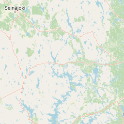
Seitseminen National Park landscape and geographic character

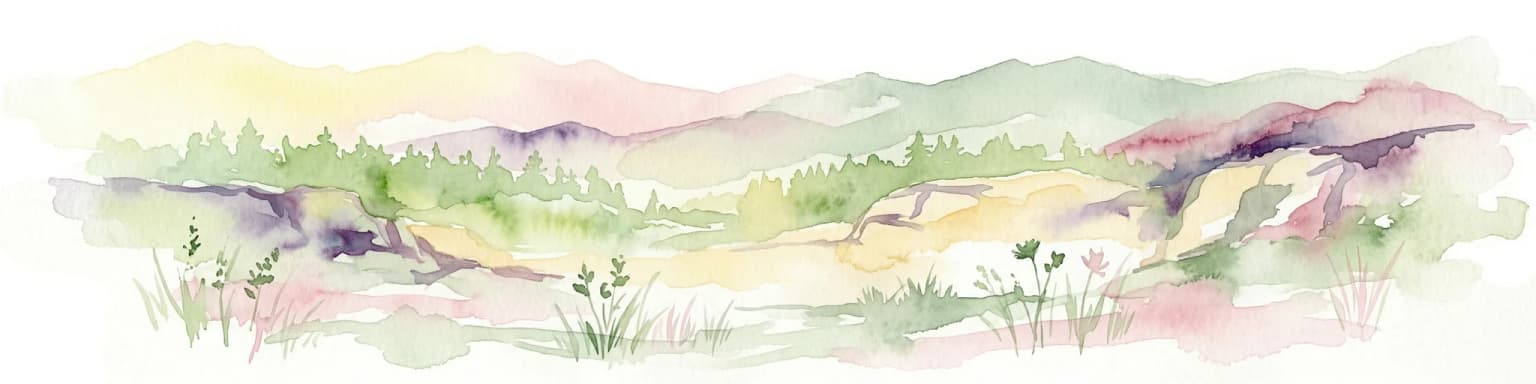
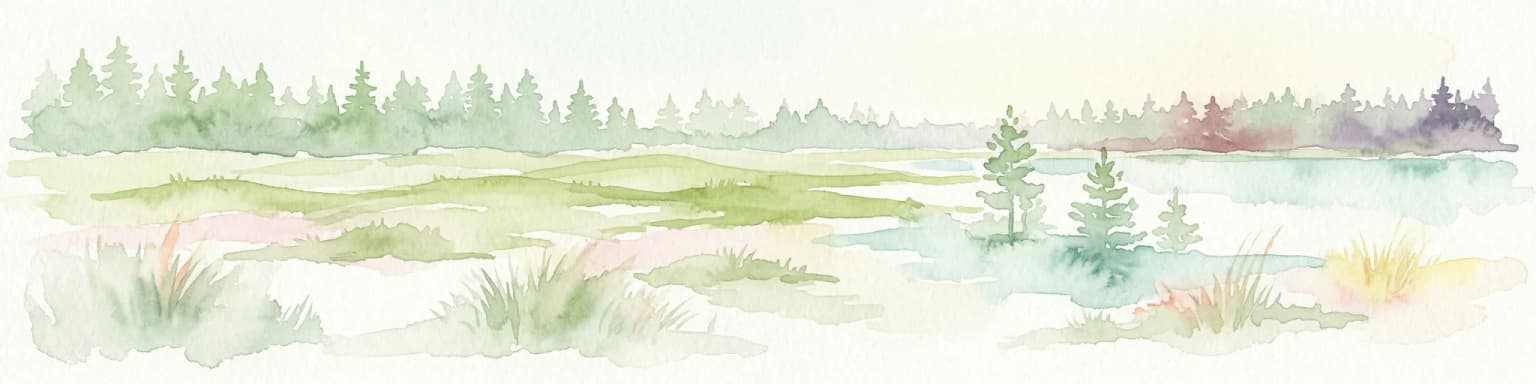
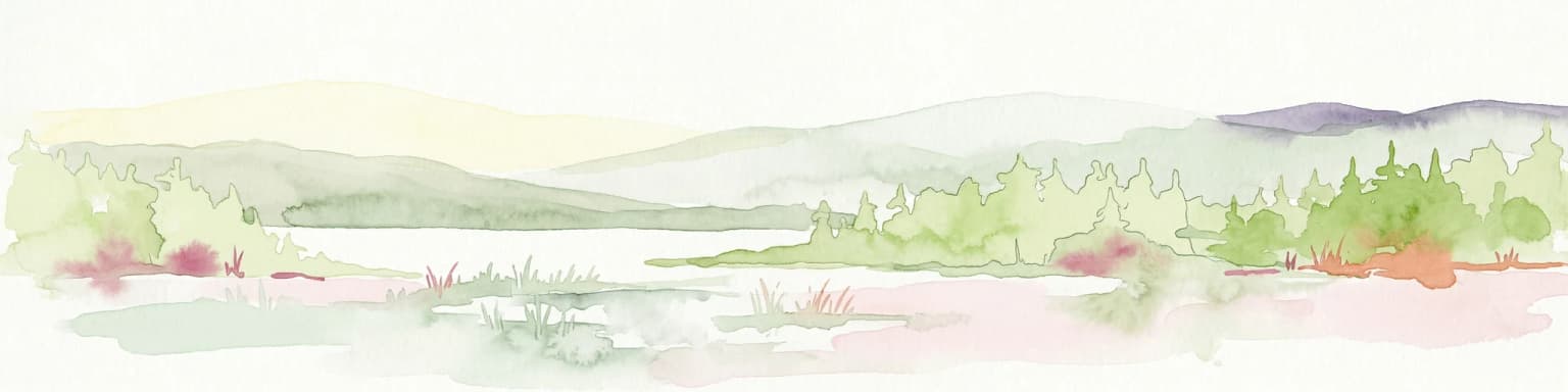
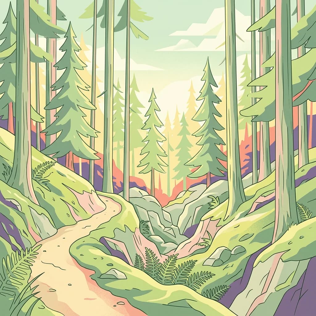
The landscape of Seitseminen National Park presents a characteristic Finnish terrain of mixed forest and wetland. The most distinctive topographic feature is the Seitsemisharju, a glacial esker ridge running roughly north-south through the western portion of the park, rising approximately 20 metres above the surrounding terrain and providing slightly drier ground for denser forest growth. The upland areas support productive closed-canopy forests of Norway spruce and Scots pine, creating dark, shaded forest interiors typical of boreal coniferous woodland. In contrast, the lower-lying areas have developed over millennia into extensive peat-forming mires, with sphagnum-dominated bogs and fens covering more than half of the park's total area. These peatlands appear more open and sparse due to the stunted form of the pines and the shrub-like spruce that manage to survive in the waterlogged conditions. The landscape also includes several lakes and ponds, with the Saari-Soljanen area featuring a nature trail that circles a lake of the same name. The Multiharju area contains the most visually impressive old-growth forest, where centuries of natural development have created complex stand structures with standing dead trees, fallen logs, and layered canopy.

Wooden farm implement structure on a platform with two traditional houses and greenery in the background
Kovero Crown Forest Farm is a protected heritage farm in Seitseminen National Park.

Seitseminen National Park ecosystems, habitats, and plant life

The ecological character of Seitseminen reflects the boreal forest biome at its most representative. The park's vegetation follows clear patterns dictated by moisture gradients, with mesic upland sites supporting mixed coniferous forests while the hydrological extremes of the peatlands produce the open mire communities. The forest stands on upland sites are dominated by Norway spruce as the climax species, with Scots pine occupying the drier ridges and transition zones. The understory reflects the shade-tolerant nature of boreal forests, with spruces creating dense canopy conditions. The mires represent the other major habitat type, with different peatland forms including nutrient-poor bogs (räme), nutrient-rich fens (korpi), and treeless mires (neva). Some ditching occurred in the 1960s and 1970s across parts of the park's peatlands, and restoration efforts have since been undertaken to return these areas toward natural hydrological conditions. The old-growth forest at Multiharju contains trees approaching 400 years old, with some pines having germinated in the early seventeenth century, providing habitat for species dependent on ancient forest structures.

Finnish postage stamp showing a forest with tall trees and moss, labeled 'SUOMI·FINLAND 1,60'
Finnish postage stamp from 1982 depicting a forest scene from Seitseminen National Park

Seitseminen National Park wildlife and species highlights

Seitseminen supports a diverse community of boreal forest and mire species. The extensive peatlands provide crucial habitat for ground-nesting birds including black grouses, common cranes, whooper swans, wood sandpipers, and willow grouses, with the open wetland spaces offering feeding and breeding grounds for these characteristic species. The old-growth forests house a suite of cavity-nesting birds and specialized forest species, including Eurasian pygmy owls, Ural owls, three-toed woodpeckers, and red-breasted flycatchers. The Siberian flying squirrel, a specialized arboreal mammal of old-growth forests, also occurs in the park's mature timber. The pine marten holds the distinction of being the park's emblem species and is the most commonly observed mammal, frequently encountered moving through both forest and mire habitats. Northern species reach their southern range limits here, with the willow grouse representing a more boreal species at the southern edge of its Finnish range. The Finnish name for the pine marten, näätä, appears on park signage and materials, reinforcing this species' role as the park's symbolic animal.

A wooden watermill structure in a forested area with tall trees and a railway track nearby
Old wooden watermill by Liesijoki river in Seitseminen National Park, Finland

Seitseminen National Park conservation status and protection priorities

Seitseminen National Park represents an important node in Finland's protected areas network, safeguarding representative boreal forest and mire ecosystems within the Suomenselkä watershed region. The European Diploma of Protected Areas awarded in 1996 recognized the park's conservation value at the continental scale, though this recognition lapsed in 2011. The park protects some of Finland's most accessible old-growth forests, with the Multiharju reserve establishing protection as early as 1910, predating modern national park legislation and demonstrating early recognition of the area's ecological significance. The diverse habitat mosaic of forest, bog, and fen creates conditions for species representing different ecological niches, while the connectivity with surrounding forested landscapes supports viable populations of forest-dependent species. The restoration of previously ditched peatlands represents an ongoing conservation priority, with efforts to restore natural hydrology to degraded mires supporting both biodiversity and carbon storage objectives.

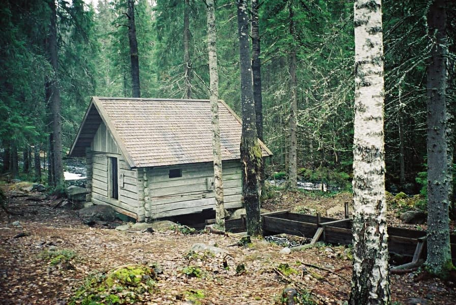
Seitseminen National Park cultural meaning and human context

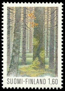
The human history of Seitseminen is embodied in the Kovero heritage farm (Koveron perinnetila), a tenant farm established in 1859 under the crown forest holding system that characterized Finnish rural land use during the nineteenth century. The farm represents a traditional settlement pattern where agricultural land, meadows, and forest pastures existed in conjunction with the surrounding wild landscape. The cultural landscape around Kovero includes maintained fields, meadows, and grazing areas that have been preserved through ongoing management including grazing and mowing, supporting a cultural meadow flora that includes species such as field scabious (ketosilmäruoho) and field madder (paimenmatara). The Finnish postal service released a stamp featuring Seitseminen National Park in 1982, reflecting the park's role in Finnish national identity and its recognition as a representative protected area.

Top sights and standout views in Seitseminen National Park

The Multiharju old-growth forest represents the park's crown jewel, with trees approaching 400 years of age and complex natural structures supporting diverse wildlife. The extensive mire landscape covering over half the park offers a distinctive Finnish wilderness experience, with boardwalk trails allowing visitors to traverse these unique wetland environments. The Seitsemisharju ridge provides scenic elevation and diverse trail experiences through drier forest terrain. The Kovero heritage farm offers cultural connection to Finnish rural history, with demonstrations and events available. The trail network, particularly the 18-kilometre Uittajanpolku circuit, provides one of Finland's longer day-hiking options within a national park setting.

Best time to visit Seitseminen National Park

Seitseminen can be visited year-round, with each season offering distinct experiences. The summer months from June through August bring fully accessible trail networks, long daylight hours, and active wildlife activity, particularly for birdwatching in the mires and observing species like the pine marten in the forest. Autumn (September to October) offers spectacular boreal forest coloration as the conifers stand against the changing light, and this season sees mushrooming activity in the forests. Winter transforms the landscape dramatically, with snow-covered mires creating cross-country skiing opportunities and the frozen terrain allowing access to areas that are wet during the warmer months. Spring (May to June) brings the awakening of boreal wildlife, with bird migration and the start of the visitor season. The park remains accessible throughout the year, though services at the nature centre and trail conditions vary seasonally.

Park location guide

Geography guide, regional context, and park location map for Seitseminen National Park

Seitseminen National Park park geography, regions, and map view in Finland
Understand where Seitseminen National Park sits in Finland through a broader geographic reading of the surrounding landscape, nearby location context, and its mapped position within the national park landscape.

How Seitseminen National Park fits into Finland

Finland, officially the Republic of Finland, is a Nordic country in Northern Europe with a population of 5.6 million. It borders Sweden, Norway, and Russia, with the Gulf of Bothnia to the west and the Gulf of Finland to the south. The country gained independence from Russia in 1917 and is a unitary parliamentary republic. Its landscape is characterized by extensive boreal forests and over 180,000 lakes.

Wider geography shaping Seitseminen National Park in Finland

Finland is located in Northern Europe, occupying a peninsula bordered by the Gulf of Bothnia to the west and the Gulf of Finland to the south. It shares land borders with Sweden to the northwest, Norway to the north, and Russia to the east. The terrain is predominantly flat with extensive forest coverage and numerous lakes.

Map view of Seitseminen National Park

Use this park location map to pinpoint Seitseminen National Park in Finland, understand its exact geographic position, and read its mapped placement within the surrounding landscape more clearly.

Pigeon | © OpenStreetMap contributors

Location context for Seitseminen National Park

Pirkanmaa

Visual Atlas of Seitseminen's Protected Landscapes: Exploring Boreal Forests and Mire Systems

Visual Guide to Seitseminen National Park: Landscapes, Old-Growth Forests, and Mires
Browse comprehensive Seitseminen National Park photos to visually explore its distinctive boreal forest landscapes, extensive mire systems, and unique old-growth woodland habitats. This curated imagery provides essential geographic context, helping you understand the park's varied terrain, ecological character, and protected-area features for deeper research.

Wooden trail signs with blue markers in a boreal forest with tall pine trees and moss-covered ground

Dirt trail winding through a dense forest with tall pine trees, moss-covered ground, and rocky terrain

Wooden farm implement structure on a platform with two traditional houses and greenery in the background

Finnish postage stamp showing a forest with tall trees and moss, labeled 'SUOMI·FINLAND 1,60'

A wooden watermill structure in a forested area with tall trees and a railway track nearby

Bog landscape with sparse coniferous trees and low-lying vegetation in Seitseminen National Park

Park atlas

Trace the regional spread of protected boreal forests and mire landscapes, comparing park geography.

Explore Additional National Parks and Protected Areas Near Seitseminen National Park, Finland
Users can explore a curated list of national parks and protected areas geographically near Seitseminen National Park, tracing their unique landscape features from old-growth boreal forests to extensive peatlands. Compare their defining characteristics, mapped terrain, and conservation status to understand the broader regional context of Finland's protected wilderness areas.
Watercolor painting depicting a landscape with hills, forests, and a river using muted colors
National parkPirkanmaa

Helvetinjärvi National Park: Protected Landscape and Geographic Context in Pirkanmaa

Mapped national park boundaries and regional natural terrain.

Delve into the details of Helvetinjärvi National Park, a protected area within the Pirkanmaa region of Finland. This atlas entry highlights the park's mapped geographic features and its identity as a national park. Understand the protected landscape and its place in the broader Finnish geography, offering structured insights for map-based discovery.

Area
49.8 km²
Established
1982
IUCN
II
Visitors
44K annual
National parkFinland

Lauhanvuori National Park: Finland's Protected Landscape and Geographic Identity

Mapped protected area within Finland's regional geography.

Delve into the protected landscape of Lauhanvuori National Park, a key national park in Finland. This atlas-focused entry details its geographic setting and mapped boundaries, offering structured insight into its protected area status and natural terrain. Understand how Lauhanvuori National Park contributes to Finland's broader conservation geography and landscape context.

Area
53 km²
Established
1982
IUCN
II
Visitors
21.7K annual
National park

Isojärvi National Park: Finland's Protected Landscape with Dynamic Beaver-Shaped Terrain

Central Finland's boreal forest, ravines, and lake district geography.

Isojärvi National Park offers a unique atlas perspective on Central Finland's protected natural landscapes. This national park is characterized by a dynamic boreal environment, featuring steep hills, deep ravines, and varied topography shaped by both ancient geological processes and contemporary beaver activity. Discover the mapped boundaries of this protected area, its central role in the Finnish lake district's geography, and the distinctive wetland habitats created by beavers that enhance its ecological diversity. It serves as a key point for understanding regional landscape context and protected land exploration.

Area
19 km²
Established
1982
IUCN
II
Visitors
24.4K annual
National parkPirkanmaa

Puurijärvi-Isosuo National Park: Protected Landscape Discovery in Pirkanmaa Region

Explore mapped protected areas and regional geography.

Puurijärvi-Isosuo National Park is a significant protected area in Finland's Pirkanmaa region. This entry provides detailed geographic context and maps the park's boundaries, offering a focused perspective for atlas-driven discovery of Finnish natural landscapes. Understand its place within the regional geography and the wider network of protected lands.

Area
27 km²
Established
1993
IUCN
II
Visitors
19.8K annual
National parkPäijät-Häme

Päijänne National Park: Mapped Island Archipelago in Finland's Päijät-Häme Region

Explore unique glacial geology and boreal island wilderness.

Päijänne National Park presents a compelling protected landscape for atlas discovery, focusing on its distinct archipelago character within Lake Päijänne, Southern Finland. This national park features numerous islands showcasing ancient geological formations, from rocky outcrops to sandy beach ridges and moraine formations. Its mapped terrain offers insights into glacial processes and the development of boreal island ecosystems. Navigate its unique island settings to understand the geographic context of this protected area in the Päijät-Häme region.

Area
14 km²
Established
1993
IUCN
II
Visitors
67K annual
Watercolor illustration of a landscape featuring a body of water, trees, and distant mountains
National parkKanta-Häme

Torronsuo National Park: Explore Finland's Exceptional Raised Bog Ecosystem and Kanta-Häme Geography

Discover mapped peatlands, unique birdlife, and protected boreal wilderness.

Torronsuo National Park stands as a testament to Finland's remarkable wetland conservation efforts, presenting a striking example of a raised bog ecosystem. Located within the Kanta-Häme region, this national park is celebrated for its vast, domed peat landscape, some of the thickest peat layers ever measured in Finland, and its status as a Ramsar-designated wetland. The park's protected status ensures the preservation of its unique natural terrain, which supports a rich diversity of northern bird species and specialized bog flora, making it a significant area for ecological and geographic exploration.

Area
25.5 km²
Established
1990
IUCN
II
Visitors
58.6K annual
National parkCentral Finland

Leivonmäki National Park: Mapped Protected Landscape in Central Finland

Detailed geographic context for this Finnish national park.

Leivonmäki National Park offers a specific focus on a single protected landscape within the broader geography of Central Finland. This page provides users with detailed information centered on the park's mapped boundaries and its role as a national park. It is designed to be a foundational entry within the MoriAtlas discovery platform, helping users understand the park's geographic setting and its protected area status for informed exploration.

Area
29 km²
Established
2003
IUCN
II
Visitors
29.1K annual
Watercolor painting showing a lake surrounded by vegetation with rolling hills in the background
National parkKanta-Häme

Liesjärvi National Park: Protected Landscape in Kanta-Häme's Finnish Lakeland

Explore its mapped geography and protected area context.

Liesjärvi National Park is a designated national park situated in the Kanta-Häme region, a landscape rich with the characteristic features of southern Finland's Finnish Lakeland. This page serves as a focused entry point for understanding the park's protected status, its unique geographic setting, and its contribution to the regional atlas of natural landscapes. By examining Liesjärvi National Park, users gain insight into the mapped terrain and conservation efforts that define this part of Finland, fostering a deeper appreciation for protected areas.

Area
22 km²
Established
1956
IUCN
II
Visitors
57.3K annual

Common questions about visiting, size, designation, and location context for Seitseminen National Park

Seitseminen National Park FAQs for park facts, access, geography, and protected area context
Find quick answers about Seitseminen National Park, including protected-area facts, park geography, trail and visitor context, and how the park fits into its surrounding country and regional landscape.
MoriAtlas Explorer

Continue Your Protected Areas Search Across the Global Atlas

Deepen your exploration by continuing the structured search for national parks and protected areas worldwide. Utilize the comprehensive filtering capabilities to compare different conservation landscapes and refine your understanding of global park geography. Discover more about the distribution and characteristics of protected natural areas.

Global natural geography