Mori Atlas logo
Nearby park discovery

Mapping the regional network of protected lands and volcanic terrain in central Mexico

Protected Areas and Geographic Landscapes Near Sierra de los Agustinos in Guanajuato

Trace the distribution of protected areas located near Sierra de los Agustinos to better understand the regional geography of the Bajío and the northern Trans-Mexican Volcanic Belt. This geographic overview highlights neighboring wilderness zones and conserved landscapes that share the complex volcanic geology and hydrological importance of the Lerma River basin.

Related tags

volcanic mountainsBajío regioncentral MexicoGuanajuatoprotected natural area

A volcanic mountain refuge in central Mexico, shaped by water, fire, and migration.

Sierra de los Agustinos

Sierra de los Agustinos is a mountain range in the state of Guanajuato, in central Mexico. It rises from the Bajío, the broad high plain that dominates the region's geography, and forms a distinctive volcanic landscape between the municipalities of Acámbaro, Jerécuaro, and Tarimoro. The range lies within the basin of the Lerma River and sits at the northern edge of the Trans-Mexican Volcanic Belt, making it part of a much larger system of volcanic terrain that defines central Mexico. The Sierra is recognized as a protected natural area, and its conservation value rests on the combination of varied elevations, porous volcanic geology, and well-preserved vegetation. Tropical deciduous forest covers the lower slopes, while oak-dominated forest extends into the higher elevations, creating a layered ecological profile. Beyond its biodiversity, the range supplies groundwater to surrounding lowlands through the Agustinos Aquifer and supports traditional uses such as firewood harvesting and recreation for nearby communities. The Sierra is also a key link in regional ecological processes, most notably the monarch butterfly migration route between eastern North America and the overwintering forests further south. Its blend of volcanic geology, oak and deciduous forest, aquifer function, and migration corridor status gives Sierra de los Agustinos a significance that extends well beyond its local footprint in Guanajuato.

Location
Mexico
Park type
Protected area
Established
2002
Area
191.7 km²
Sierra de los Agustinos Protected Area Map
Regional park map

See the ranked park cluster in its geographic setting

Nearby parks around Sierra de los Agustinos

This regional map shows the same 20 nearby parks ranked below around Sierra de los Agustinos. Select a ranked marker to highlight that park’s boundary where boundary data is available.
Reference park: Sierra de los AgustinosRanked nearby park20 nearby parks shown
20 nearby parks

Distance ranked collection and regional park geography for comparative environmental analysis

Parks and Protected Areas Geographically Near Sierra de los Agustinos

Explore nearby protected areas ranked by direct geographic proximity to Sierra de los Agustinos across the surrounding regional terrain. Each listed location provides structured environmental metrics and spatial context to support broader comparative analysis of protected landscapes.
National parkQuerétaro
About 47 km away#1 closest

Northeast

El Cimatario National Park: National Park Protected Landscape in Querétaro Region

Explore mapped boundaries and regional geography.

Investigate El Cimatario National Park, a protected national park located in Querétaro, Mexico. This entry offers detailed atlas-style insights into the park's protected landscape, its geographic setting within the region, and its clearly mapped boundaries. It serves as a focused point for understanding this specific natural area's place in broader geographic and conservation mapping.

Area
24.48 km²
Established
1982
IUCN
II
Relief
Mountain
National parkMexico
About 49 km away#2 closest

Northeast

Cerro de Las Campanas National Park: Detailed Protected Landscape and Geographic Context

Explore mapped boundaries and regional atlas information for this Mexican national park.

Cerro de Las Campanas National Park is a protected national park in Mexico, offering a specific focus for geographic discovery. Users can investigate its mapped boundaries and understand how this protected area fits into the larger atlas of Mexico's natural landscapes. This page serves as an authoritative entry point for appreciating the park's unique geographic identity and its significance as a protected natural entity within the country's conservation framework.

IUCN
II
A soft watercolor painting showing a panoramic view of rolling green hills, a winding waterway, and distant pinkish mountains under a light sky.
Protected areaGuanajuato
About 49 km away#3 closest

West

Lake Yuriria: Exploring the Protected Landscape and Volcanic Terrain of Guanajuato

A historic artificial wetland and Ramsar-recognized migratory bird habitat.

Lake Yuriria serves as a benchmark for landscape conservation in the Bajio region. Spanning an extensive wetland area within a volcanic basin, this protected zone provides essential habitat for over 140 bird species and remains a cornerstone of the regional geography for its water regulation and agricultural impact.

Area
72 km²
Established
1548
Relief
Lowland
Climate
Subtropical
A soft watercolor painting showing a rolling landscape of light green hills, gentle slopes, and sparse trees against a pale, distant mountain horizon.
Natural monumentGuanajuato
About 57 km away#4 closest

West

Siete Luminarias Natural Monument: Exploring Maar Volcanic Craters in Guanajuato

A protected volcanic landscape on the Mexican Plateau.

Siete Luminarias encompasses seven well-defined volcanic maars surrounding the town of Valle de Santiago. This natural monument illustrates a rare geological occurrence where ancient underground explosions created broad, flat-floored craters that remain as essential features of the local Bajio terrain and regional geologic identity.

Area
89.28 km²
Established
1997
Relief
Upland
Climate
Subtropical
National parkMichoacán
About 62 km away#5 closest

South

Cerro de Garnica National Park: Its Geography and Protected Landscape Identity

Explore mapped boundaries within Michoacán's natural terrain.

Cerro de Garnica National Park serves as a distinct protected area contributing to the geographic understanding of Michoacán. This page offers a focused view on its mapped boundaries and natural landscape characteristics, providing essential context for atlas exploration. Discover the park's specific identity as a national park and its place within the regional geography, highlighting its value for structured discovery.

Area
19.36 km²
Established
1936
IUCN
II
Relief
Mountain
National parkMichoacán
About 72 km away#6 closest

South

Insurgente José María Morelos y Pavón National Park: Mapped Protected Landscape in Michoacán

Discover its geographic context and protected area boundaries.

Explore Insurgente José María Morelos y Pavón National Park, a designated national park in Michoacán, Mexico. This page provides detailed insights into its protected status, mapped geographic features, and its role as a significant natural landscape within the regional atlas. Understand the park's protected boundaries and its contribution to the geographic understanding of Michoacán.

Area
71.92 km²
Established
1939
IUCN
II
Relief
Mountain
National parkState of Mexico
About 108 km away#7 closest

Southeast

Bosencheve National Park: National Park Protected Landscape within State of Mexico

Explore mapped boundaries and regional geographic context.

Bosencheve National Park, a key national park designation, offers a focused area for understanding protected landscapes and their geographic distribution. This entry provides detailed insights into its mapped boundaries and how it fits within the regional geography of the State of Mexico. It serves as a vital point for exploring Mexico's protected natural areas from a structured, atlas-driven perspective.

Area
146 km²
Established
1940
IUCN
II
Scope
Terrestrial
A watercolor illustration depicting a wide landscape with green fields, scattered bushes, and rolling hills in the background under a soft pink and yellow sky.
Protected areaMichoacán
About 119 km away#8 closest

West

Alberca de los Espinos: Volcanic Crater and Protected Wetland Geography in Michoacán

Highland crater lake within the Trans-Mexican Volcanic Belt

The protected basin of Alberca de los Espinos forms a striking volcanic landform. Deep within its 2,100-meter crater rim, the lake exhibits complex thermal stratification and seasonal color changes. This site serves as a vital component of the regional geography in Michoacán, blending geological character with recognized wetland status.

Area
1.42 km²
Established
2003
Relief
Upland
Climate
Temperate
A watercolor illustration of a wide lake landscape with distant hills, small green islands, and vegetation in the foreground, painted in soft muted tones.
Protected areaMichoacán
About 122 km away#9 closest

Southwest

Lake Pátzcuaro Protected Area: A Geographic Exploration of the Michoacán Volcanic Basin

Highland volcanic geography and protected wetland ecosystems

Located in a unique endorheic basin at 2,000 metres elevation, Lake Pátzcuaro stands as a landmark of central Mexico. The protected area encompasses dramatic volcanic ridges, expansive marshland fringes, and islands that define the regional geography. Explore the mapped terrain of these highland waters, which serve as a critical ecological corridor and a focal point for understanding the physical and environmental heritage of the Michoacán highlands.

Area
126.4 km²
Relief
Highland
Climate
Temperate
Access
Easy access
Protected areaMichoacán
About 124 km away#10 closest

West

Zacapu Lagoon Protected Area: Mapping the Highland Wetlands of Central Michoacán, Mexico

An endemic-rich spring-fed wetland within the Lerma River basin system

Located in the state of Michoacán, Zacapu Lagoon serves as a vital protected area and perennial wetland. This highland site is defined by its spring-fed waters and riparian vegetation, providing a crucial refuge for narrow-range endemic fish and amphibian species. The lagoon functions as a benchmark for understanding aquatic biodiversity within the complex hydrological network of the Mexican highlands.

Area
0.216 km²
Established
2003
Relief
Lowland
Scope
Terrestrial
Protected areaState of Mexico
About 131 km away#11 closest

Southeast

Zona Protectora Forestal los terrenos constitutivos de las cuencas de los ríos Valle de Bravo, Malacatepec, Tilostoc y Temascaltepec

Highland watershed and mountain forest reserve in the State of Mexico

Examine the expansive forested catchment area defined by the Trans-Mexican Volcanic Belt. This protected landscape is fundamental for regional hydrology and provides critical winter habitat within the mountainous geography of the State of Mexico.

Area
1,402.34 km²
Established
1941
IUCN
VI
Relief
Mountain
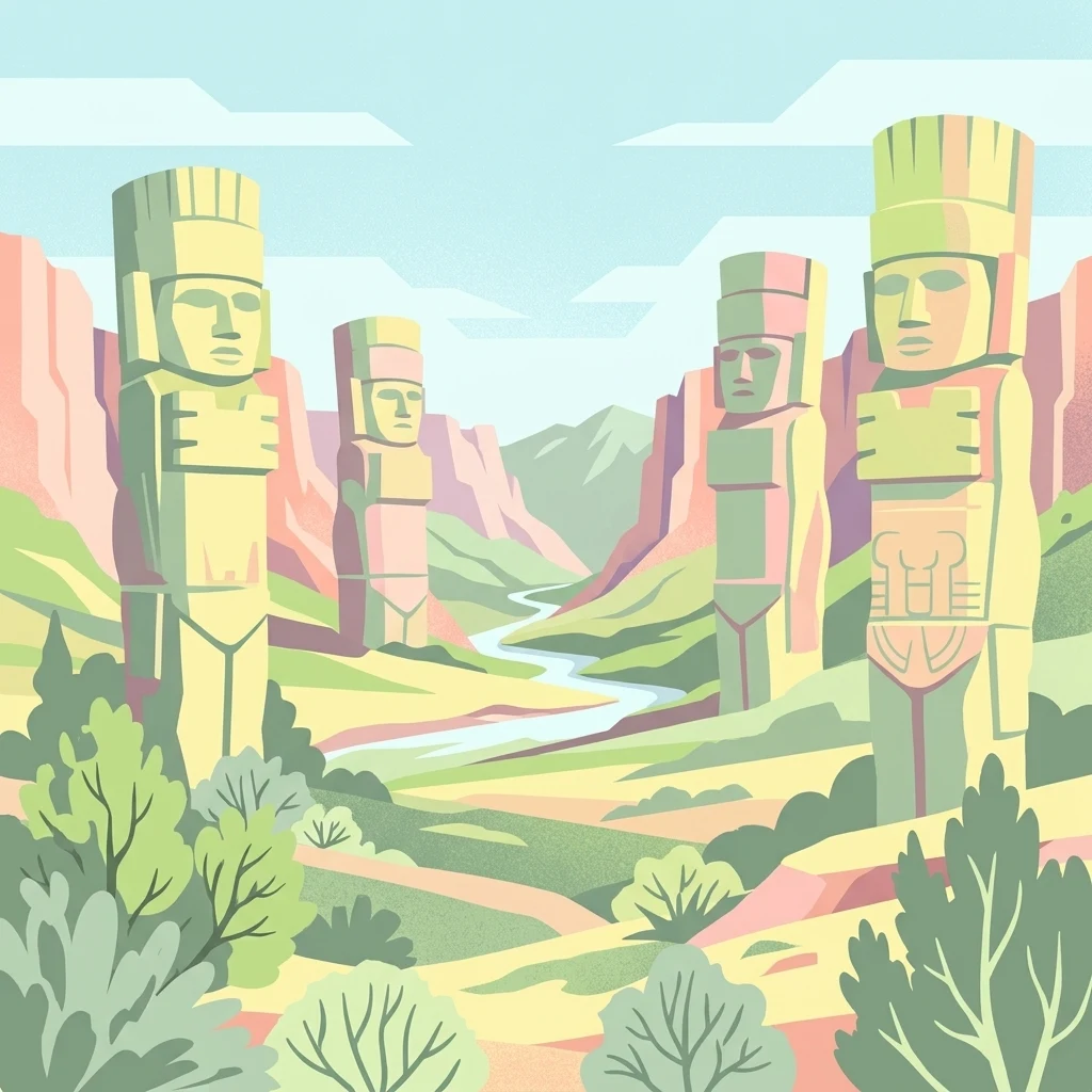
Stylized illustration showing four large stone statues in a valley landscape with a river, hills, and vegetation
Protected areaMexico
About 141 km away#12 closest

East

Tula National Park: Mapped Protected Landscape and Toltec Civilization Atlas

Explore iconic Toltec warrior sculptures and the surrounding geographic terrain.

Tula National Park in Mexico offers a detailed look at the Postclassic Toltec capital, Tollan-Xicocotitlan. As a protected area, its preserved ruins, including the striking Atlantes de Tula warrior columns and the serpent wall, provide crucial insights into Mesoamerican history and architecture. This site's geographic setting in the Tula River Valley, coupled with its architectural parallels to other major sites, makes it a focal point for understanding ancient regional dynamics and landscape utilization.

Area
1 km²
Established
1981
Relief
Upland
Climate
Arid
A soft watercolor painting of layered green and pink hills under a pale yellow sky.
Protected areaGuanajuato
About 157 km away#13 closest

Northwest

Sierra de Lobos Protected Area: Mountain Geography and Watershed Mapping in Guanajuato

An ecological transition zone between the Bajío and the Mexican Plateau

Sierra de Lobos stands as a complex mountain range and sustainable use area in Guanajuato, Mexico. Its unique physiographic location provides a habitat bridge for diverse wildlife and a necessary water source for regional communities. This profile maps its transition from tropical dry forest foothills to pine-oak forests at higher altitudes, highlighting its role as a core protected landscape.

Area
1,270.58 km²
Established
1997
Relief
Mountain
Climate
Subtropical
A watercolor illustration showing a misty mountain peak in the background and a grassy meadow with a winding path in the foreground.
Wildlife reserveEstado de México
About 158 km away#14 closest

Southeast

Área de protección de flora y fauna Nevado de Toluca: Geography and Protected Landscapes

High-altitude volcanic massif and hydrological protected area

Situated in the State of Mexico, this wildlife reserve preserves the dramatic volcanic slopes of the Nevado de Toluca. The protected area features significant elevation gradients, crater lakes, and transition forests that anchor the regional watershed and provide a habitat for a wide array of plant and animal species.

Area
467.84 km²
Established
1936
IUCN
II
Relief
Mountain
National parkMexico State
About 158 km away#15 closest

Southeast

Nevado de Toluca National Park: Protected Landscape Atlas and Geographic Context

Explore mapped boundaries and regional terrain within Mexico State.

Nevado de Toluca National Park serves as a key protected landscape for understanding the natural geography of Mexico State. This destination facilitates detailed exploration of its mapped territory, protected area identity, and the surrounding regional context. Discover how this national park fits into the larger geographic atlas through its distinct terrain and documented boundaries, offering a factual foundation for landscape research.

Area
510 km²
Established
1936
IUCN
VI
Relief
Mountain
National parkMichoacán
About 164 km away#16 closest

West

Lago de Camécuaro National Park: National Park Protected Landscape and Geographic Atlas

Mapped boundaries and regional natural landscape context for Michoacán.

Lago de Camécuaro National Park offers a focused exploration of a distinct protected area within Michoacán, Mexico. Understand its specific geographic identity through mapped boundaries and regional terrain context, suitable for atlas-based discovery of natural landscapes and conservation areas. This entry provides a factual overview of the park's protected status and its placement within the broader geography of the region.

Area
0.097 km²
Established
1941
IUCN
II
Relief
Upland
Protected landscapeEstado de México
About 167 km away#17 closest

Southeast

Ciénegas del Lerma: Protected Highland Wetland Landscape in the State of Mexico

Mapping the upper Lerma River basin and remnant marsh ecosystems.

Ciénegas del Lerma serves as a significant protected landscape in central Mexico, encompassing three main lakes and extensive marshland corridors. This atlas entry details the site's hydrological structure, encompassing open-water zones and alluvial soils that support diverse aquatic vegetation and endemic species within a human-influenced highland setting.

Area
30.23 km²
Established
2002
IUCN
VI
Relief
Upland
National parkMexico
About 168 km away#18 closest

Northeast

Los Mármoles National Park: Detailed Protected Landscape within Mexico's National Park Atlas

Explore the mapped boundaries and regional geography of this unique protected area.

Understand Los Mármoles National Park as a distinct protected landscape, integral to Mexico's atlas of natural areas. This park offers a unique geographic context, with its mapped boundaries providing a clear reference for its protected status. Delve into the regional landscape and discover the importance of this national park for conservation and geographic study.

IUCN
II
National parkMexico State
About 171 km away#19 closest

Southeast

Los Remedios National Park: Protected Landscape and Historical Geography of Mexico State

Mapped terrain and cultural heritage within this unique national park.

Delve into the protected landscape of Los Remedios National Park, a national park situated in Mexico State. This page provides detailed geographic context, focusing on its volcanic terrain, mapped boundaries, and the convergence of pre-Hispanic and colonial heritage. Understand its role as a protected area within the western Valley of Mexico and explore the mapped elements that define its cultural and natural identity.

Area
4 km²
Established
1938
IUCN
II
Relief
Mountain
National parkMichoacán
About 173 km away#20 closest

Southwest

Barranca del Cupatitzio National Park: National Park, Michoacán Protected Area

Mapped boundaries and regional geographic context.

Barranca del Cupatitzio National Park stands as a designated national park, providing critical geographic information for atlas exploration. Understand its specific mapped protected area boundaries and discover its role within the regional geography of Michoacán. This profile highlights the park's landscape identity and its significance as a key protected natural site for detailed geographic study.

Area
4.582 km²
Established
1938
IUCN
II
Visitors
255.2K annual
Distance methodology

Geographic measurements, not driving distances

How nearby park distances are calculated

Distances use park boundaries whenever the available geometry allows it. When one or both boundaries are missing, the mapped park locations provide a clearly labelled estimate. Every value represents straight-line geographic separation and does not use roads or routing.

Boundary distance

Calculated between the nearest points of both park boundaries.

Location-to-boundary estimate

Estimated from one mapped park location to the nearest boundary of the other park.

Mapped-location estimate

Estimated between the mapped locations of both parks.

MoriAtlas Explorer

Explore the Geographic Boundaries of the Sierra de los Agustinos Protected Area

Trace the volcanic terrain and ecological corridors of Sierra de los Agustinos within the MoriAtlas database. Gain a deeper understanding of how this mountain range shapes the regional geography of Guanajuato and supports critical migration paths for monarch butterflies.