Mori Atlas logo
National parkSkeleton Coast National Park

Discover the stark beauty and mapped geography of this unique desert-ocean protected area.

Skeleton Coast National Park: Namibia's Remote Protected Landscape and Shipwreck Atlas

Skeleton Coast National Park in Namibia protects a dramatic and exceptionally remote stretch of the Atlantic coastline, a stark environment where towering sand dunes meet the cold ocean. Established as one of Africa's largest national parks, it safeguards a unique desert-marine ecosystem, famously marked by the skeletal remains of countless shipwrecks that lie scattered along its shores. This page offers an atlas-style exploration of its unique geography, mapped boundaries, and profound sense of wilderness, providing essential context for understanding this legendary protected landscape.

Desert CoastShipwrecksRemote WildernessNamibiaAtlantic OceanFour Wheel Drive Access

Skeleton Coast National Park

National park

Park overview

Structured park overview, official facts, and landscape profile for Skeleton Coast National Park

Skeleton Coast National Park park facts, protected area profile, and essential visitor context

Review the core facts for Skeleton Coast National Park, including designation, size, terrain, visitor scale, habitats, and operating context in one park-focused overview.

About Skeleton Coast National Park

Skeleton Coast National Park represents one of Namibia's most distinctive protected landscapes, encompassing a vast expanse of desert coastline that has long captivated adventurous travelers and nature enthusiasts. The park's coastline stretches along the cold Atlantic waters of the Skeleton Coast, a name that evokes both the historical maritime tragedies and the eerie, otherworldly quality of the landscape. Access to the park remains extremely limited, contributing significantly to its wilderness character and ensuring that those who visit experience a form of remoteness increasingly rare in the modern world. The park's size of approximately 16,845 square kilometers places it among the larger national parks in Southern Africa, yet its terrain is so challenging that much of the area sees few human visitors. The park is bisected by the Ugab River, which serves as a natural boundary between the more accessible southern sector and the strictly controlled northern wilderness area.

Quick facts and research context for Skeleton Coast National Park

Skeleton Coast National Park is located in northwest Namibia along the cold Atlantic coastline. The park was established in 1971 and covers roughly 16,845 square kilometers, making it one of Namibia's most extensive protected areas. The park is administratively divided into northern and southern sectors, with the southern section accessible by four-wheel-drive vehicles up to the Ugab River Gate, while the northern sector can only be reached by aircraft. The coastline is famous for its shipwrecks, earning the area its haunting name, and features notable attractions including the South West Seal viewpoint, Huab lagoon, and a collapsed oil drilling rig.

Protection and recognition

Analyzing documented conservation boundaries and official management classification.

Skeleton Coast National Park Protection Status and Conservation Area Designations

Explorers can review the documented protection status, management framework, and conservation scope established for Skeleton Coast National Park. Gathering verified designation parameters and official records provides essential geographic context for understanding how fragile coastal desert habitats are classified.

Protection details

Protection scope
Mixed
Park context

Deeper park guide and search-rich context for Skeleton Coast National Park

Skeleton Coast National Park history, landscape, wildlife, and travel context

Explore Skeleton Coast National Park through its history, landscape character, ecosystems, wildlife, conservation priorities, cultural context, and seasonal travel timing in a structured park guide built for atlas discovery and search intent.

Why Skeleton Coast National Park stands out

Skeleton Coast National Park is best known for its legendary shipwrecks and extraordinary remoteness. The fog-shrouded coastline has claimed numerous vessels over centuries, and the skeletal remains of these ships have become iconic symbols of the park's character. The park also protects a unique desert-marine ecosystem where massive sand dunes meet the Atlantic Ocean, creating photographerically stunning scenes of contrast. The seal colonies at certain points along the coast, particularly at the South West Seal viewpoint, represent another major attraction, while the abandoned oil drilling rig provides an eerie man-made element amid the pristine wilderness.

Skeleton Coast National Park history and protected-area timeline

Skeleton Coast National Park was established in 1971 as part of Namibia's growing commitment to protecting its unique natural heritage. Prior to formal protection, this coastline had long been known to maritime travelers as an extremely dangerous stretch of ocean, with its fog, strong currents, and unpredictable weather contributing to numerous shipwrecks over the centuries. The establishment of the park formalized protection for both the coastal marine environment and the adjoining desert landscape. Management of the park is structured around the division between its northern and southern sectors, with the Ugab River serving as the boundary point. The southern sector was designed to accommodate limited vehicular access, while the northern sector was intentionally left accessible only by aircraft to preserve its pristine character and minimize human impact on the environment.

Skeleton Coast National Park landscape and geographic character

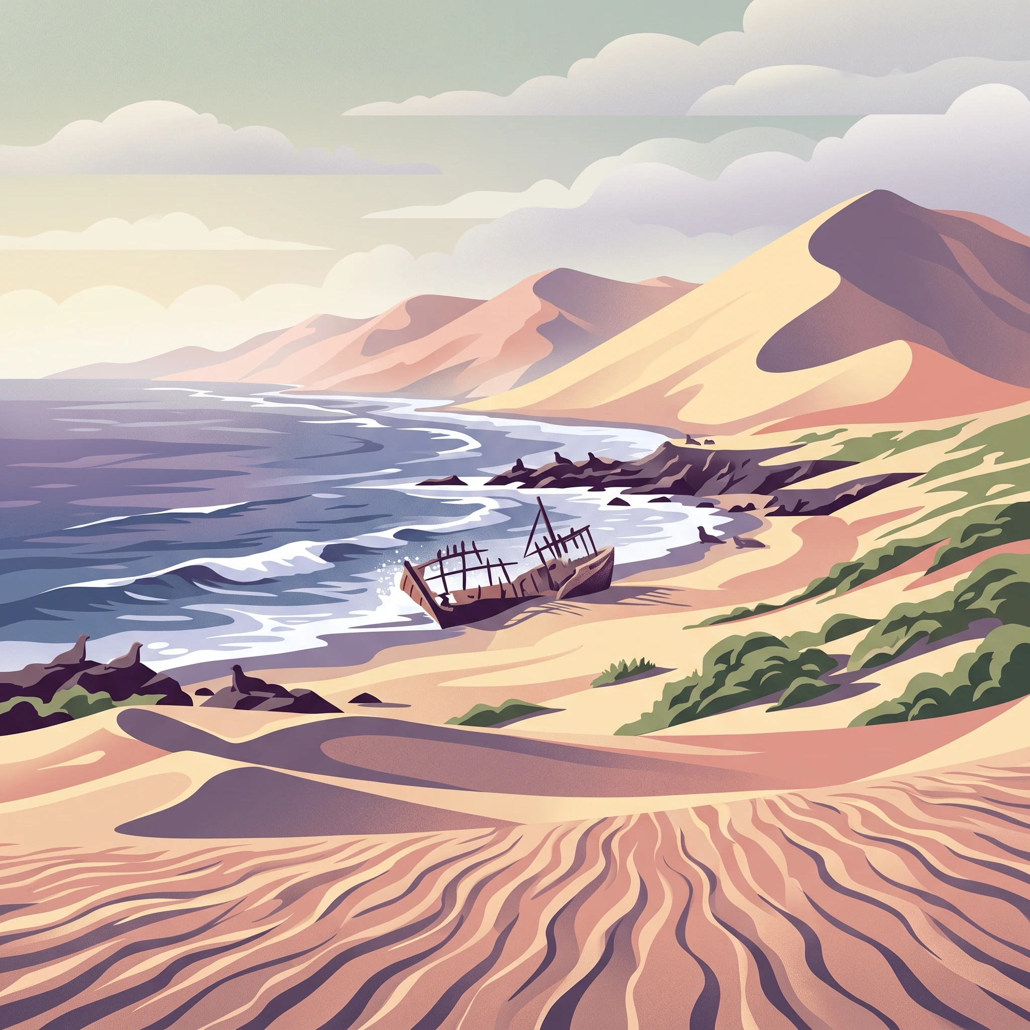
The landscape of Skeleton Coast National Park presents a striking interplay between desert and ocean. Massive sand dunes rise from the coastline, their shapes constantly reshaped by the persistent Atlantic winds, while the cold ocean waters crash against the shore in a dramatic contrast of temperature and texture. The coastline itself is characterized by rocky headlands, sandy beaches, and the scattered remains of shipwrecks that have become embedded in the landscape over centuries. Inland, the terrain transitions from the coastal dunes into the Namib Desert, one of the oldest deserts in the world, creating an environment of profound aridity and stark visual impact. The Ugab River, though often dry or reduced to seasonal flows, carves a significant course through the park, providing a natural dividing line between the northern and southern sectors.

Skeleton Coast National Park ecosystems, habitats, and plant life

The ecosystem of Skeleton Coast National Park represents a remarkable adaptation to extreme conditions. Despite the apparent hostility of the desert coastline, the area supports a surprising diversity of life, particularly where moisture from fog and occasional rainfall creates pockets of productivity. The marine environment along the coast is particularly rich, supported by the cold, nutrient-bearing waters of the Atlantic, which sustain important populations of marine mammals and seabirds. The interaction between the desert and the ocean creates a unique ecological tension, with species adapted to both maritime and arid conditions coexisting in this challenging environment. The park's inaccessibility has paradoxically served to protect many species and habitats from the pressures that affect more accessible areas.

Skeleton Coast National Park wildlife and species highlights

Wildlife in Skeleton Coast National Park is concentrated in areas where environmental conditions allow for greater productivity. Cape fur seals form significant colonies along the coastline, with the South West Seal viewpoint providing one of the most accessible opportunities to observe these animals in their natural habitat. Seabirds are abundant, taking advantage of the rich marine waters, while small desert-adapted mammals and reptiles occupy the inland areas. The marine environment supports various cetaceans that pass through the cold Atlantic waters adjacent to the park. The野生动物 that does persist in this harsh environment has evolved remarkable adaptations to survive the extreme aridity and the challenges of the coastal climate.

Skeleton Coast National Park conservation status and protection priorities

Skeleton Coast National Park plays a critical role in protecting one of Africa's most unusual coastal environments. The park safeguards a stretch of coastline that represents a transition between the Namib Desert and the Atlantic Ocean, preserving both terrestrial and marine habitats in a relatively natural state. The remote and inaccessible nature of much of the park has inherently provided a degree of protection from development pressures that affect more accessible regions. Conservation efforts focus on maintaining the park's wilderness character while managing visitor access to ensure that the unique ecological values remain intact. The park also contributes to broader regional conservation networks by protecting corridors of habitat that allow for the movement of species across the desert-coastal interface.

Skeleton Coast National Park cultural meaning and human context

The cultural context of Skeleton Coast National Park is deeply intertwined with maritime history and the narratives of survival along one of Africa's most dangerous coastlines. The name Skeleton Coast itself derives from the bones and shipwreck remains that have long marked this shoreline, creating a powerful sense of historical presence amid the stark landscape. The shipwrecks that dot the coast represent a human dimension to the park's story, reminding visitors of the risks that sailors have faced navigating these waters over centuries. Beyond maritime heritage, the indigenous peoples of the region have long maintained connections to this coastline, though the park's extreme conditions have limited permanent human settlement in most areas.

Top sights and standout views in Skeleton Coast National Park

The most compelling highlights of Skeleton Coast National Park include the haunting shipwrecks that give the park its name, the extraordinary landscape where massive sand dunes meet the cold Atlantic, and the profound sense of remoteness that defines the visitor experience. The South West Seal viewpoint offers one of the park's more accessible wildlife viewing opportunities, while the collapsed oil drilling rig provides an unexpected industrial artifact amid the pristine wilderness. The distinction between the accessible southern sector and the fly-in only northern sector creates two very different experiences within the same protected area, allowing visitors to choose their level of wilderness immersion.

Best time to visit Skeleton Coast National Park

The best time to visit Skeleton Coast National Park is during the dry winter months from May to October, when temperatures are milder and rainfall is minimal. The coastal fog that characterizes this region is most prevalent during the cooler months, creating an atmospheric quality that enhances the landscape's haunting beauty while also providing important moisture to the desert environment. Summer months can bring extreme heat and occasional rainfall that may affect access to certain areas. Visitors planning to explore the southern sector by vehicle should be aware that the experience requires a four-wheel-drive vehicle and a spirit of adventure, while those seeking to access the northern sector must arrange chartered flights as part of an organized safari operation.
Monthly climate preview

Long-term temperature cycles and dry desert precipitation averages in Namibia

Skeleton Coast National Park Climate Normals and Weather by Month

Long-term records from a representative elevation of 156 meters reveal an exceptionally arid environment with mean monthly temperatures spanning 16 to 21 degrees Celsius. Exploring the full historical dataset unlocks daily precipitation averages and maximum heat ranges for a complete monthly breakdown of the Namibian coastal strip.
Annual mean18 °C
16 °C21 °C
Jan20°
Feb21°
Mar21°
Apr20°
May19°
Jun18°
Jul18°
Aug16°
Sep16°
Oct17°
Nov18°
Dec19°
Warmest month
March

20.8 °C

Coolest month
September

16 °C

Wettest month
February

0.8 mm/day

Driest month
May

0 mm/day

Park location guide

Geography guide, regional context, and park location map for Skeleton Coast National Park

Skeleton Coast National Park park geography, regions, and map view in Namibia

Understand where Skeleton Coast National Park sits in Namibia through a broader geographic reading of the surrounding landscape, nearby location context, and its mapped position within the national park landscape.

How Skeleton Coast National Park fits into Namibia

Namibia is a sovereign country in Southern Africa that gained independence from South Africa in 1990. It is the driest country in sub-Saharan Africa, characterized by the Namib Desert along its coast. The population is approximately 3 million, with Windhoek as the capital and largest city. Namibia operates as a unitary semi-presidential republic with a multi-party system.

Wider geography shaping Skeleton Coast National Park in Namibia

Namibia occupies 825,615 km2 in Southern Africa, making it the 34th largest country in the world. It is bordered by the Atlantic Ocean to the west, Angola and Zambia to the north, Botswana to the east, and South Africa to the south. The country features the Namib Desert along its coastal region, with varied terrain including savannas, mountains, and plateaus inland. A notable geographic feature is that Zimbabwe lies less than 200 metres away along the Zambezi river near Kazungula in the northeast.

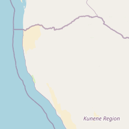
Map view of Skeleton Coast National Park

Use this park location map to pinpoint Skeleton Coast National Park in Namibia, understand its exact geographic position, and read its mapped placement within the surrounding landscape more clearly.

Pigeon | © OpenStreetMap contributors
Park atlas

Trace the regional geography of other protected areas, mapping their spread and contrasting landscapes near Skeleton Coast.

Explore Other National Parks and Protected Areas Near Skeleton Coast National Park

Browse a curated selection of other national parks and protected areas located geographically near Skeleton Coast National Park, including diverse desert and coastal conservation landscapes. Gaining this broader regional context allows for structured atlas-style comparisons, highlighting the varied terrain and protected status across Namibia and its adjacent wildernesses.
National parkNamibia
Park boundaries overlap#1 closest

Southeast

Dorob National Park: Namibia's Expansive Coastal Desert and Protected Bird Habitat

Explore mapped landscapes and regional geography.

Dorob National Park is a prime example of a protected coastal desert landscape, stretching along Namibia's Atlantic coast. This national park is renowned for its significant bird populations, making it an Important Bird Area with extensive mapped habitats supporting diverse species. Understand the park's geographic context, from its dramatic dunes to its ephemeral river systems, and its role as a key conservation area within the region.

Area
107,540 km²
Established
2010
IUCN
II
Relief
Lowland
National parkNamibe Province
Park boundaries overlap#2 closest

North

Iona National Park: Mapped Protected Landscape in Namibe Province, Angola

Explore the geographic extent and regional context of this national park.

Iona National Park stands as a protected natural area within the administrative region of Namibe Province, Angola. This atlas-focused entry provides detailed insights into the park's mapped boundaries, its regional geographic positioning, and its role as a conservation landscape. Users can engage with specific data to understand the terrain and protected land distribution within this significant Angolan national park.

Area
15,200 km²
Established
1964
IUCN
II
Relief
Mixed relief
National parkKunene Region
123 km away#3 closest

East

Etosha National Park National Park: Mapped Protected Landscape and Regional Geography

Discover its protected boundaries and geographic context.

Gain a structured understanding of Etosha National Park, a prominent national park within Namibia's Kunene Region. This entry focuses on the park's protected landscape identity, detailing its mapped boundaries and geographic significance. Explore Etosha National Park through the lens of atlas-driven discovery, appreciating its role as a key protected area and its contribution to the regional geography of the surrounding landscape.

Area
22,270 km²
Established
1907
IUCN
II
Visitors
200K annual
Wildlife reserveAngola
About 158 km away#4 closest

North

Namibe Partial Reserve: Mapping the Arid Landscapes and Conservation Areas of Angola

Southwestern Angola Wildlife Reserve Geography

Namibe Partial Reserve encompasses vast desert dunes and unique arid plains in southwestern Angola. The protected area offers a look at the ecological character of the Kaokoveld Desert, highlighting the natural geography and boundary context of this significant wildlife reserve within the region.

Area
4,450 km²
Established
1960
IUCN
IV
Relief
Lowland
National parkNamibia
193 km away#5 closest

Southeast

Namib-Naukluft National Park: Namibia's Iconic Desert Landscape and Protected Terrain

Explore its ancient dunes, Naukluft mountains, and coastal geography.

Namib-Naukluft National Park is a colossal protected area in Namibia, holding the distinction of being Africa's largest national park. This park is renowned for its iconic sand dunes, particularly at Sossusvlei, which are among the highest in the world and display dramatic colors due to iron oxidation. The landscape also features the rugged Naukluft Mountains and vital coastal fog zones, creating a diverse arid environment. Delve into the mapped geography and unique terrain of this ancient desert setting, understanding its protected landscape significance within Namibia's atlas.

Area
49,768 km²
Established
1907
IUCN
II
Relief
Mixed relief
Wildlife reserveOtjozondjupa
About 292 km away#6 closest

Southeast

Okonjati Game Reserve: Mapped Protected Landscapes and Wildlife Geography in Namibia

Ecological terrain and historical mountain setting in Otjozondjupa.

Situated in the heart of Namibia, Okonjati Game Reserve represents a significant private conservation effort centered on the Etjo massif. This 360 square kilometer protected landscape features a blend of rocky uplands and savanna plains, providing a unique habitat for rhinoceroses, elephants, and hippopotamuses while preserving fossilized dinosaur tracks and modern historical landmarks.

Area
360 km²
Established
1975
Relief
Upland
Climate
Arid
Protected areaNamibia
About 313 km away#7 closest

Southeast

Gross Barmen Protected Area: Landscape Geography and Thermal Spring Mapping in Namibia

Central Namibia thermal spring and historic natural monument

Gross Barmen is a state-managed recreation area in central Namibia, centered on a natural sulfurous spring that emerges within a flat thornveld landscape. This protected area acts as both a cultural heritage site and a geological feature, providing a clear window into the regional terrain of the Otjozondjupa area through its thermal waters and historical mission foundations.

Area
1 km²
Established
1968
Relief
Lowland
Climate
Arid
Wildlife reserveOshana Region
About 316 km away#8 closest

East

Oshana-System Wildlife Reserve: Mapping the Seasonal Wetlands of the Oshana Region

A complex network of drainage channels and savanna grasslands

The Oshana-System functions as an expansive inland wetland complex, defined by its flat, sandy terrain and cyclic flooding. This wildlife reserve spans significant portions of north-central Namibia, offering a distinct study in low-gradient hydrology and savanna-wetland transitions characterized by mopane woodland and makalani palms.

Area
30,000 km²
Relief
Lowland
Scope
Terrestrial
Water
Water-dominated

Common questions about visiting, size, designation, and location context for Skeleton Coast National Park

Skeleton Coast National Park FAQs for park facts, access, geography, and protected area context

Find quick answers about Skeleton Coast National Park, including protected-area facts, park geography, trail and visitor context, and how the park fits into its surrounding country and regional landscape.
MoriAtlas Explorer

Continue Your Protected Areas Search Across the Global Atlas

Deepen your exploration by continuing the structured search for national parks and protected areas worldwide. Utilize the comprehensive filtering capabilities to compare different conservation landscapes and refine your understanding of global park geography. Discover more about the distribution and characteristics of protected natural areas.

Global natural geography