Mori Atlas logo
National parkStara Planina National Park

Discover the mapped geography and dramatic mountain terrain of this expansive Balkan protected area.

Stara Planina National Park: Serbia's newest national park and protected landscape

Stara Planina National Park, established in 2022, represents Serbia's most recent national park designation, protecting approximately 120,000 hectares of rugged Balkan mountain terrain. Situated in eastern Serbia along the Bulgarian border, this expansive protected area is a key component of the Carpathian-Balkan mountain system. MoriAtlas maps the park's dramatic peaks, deep valleys, and the striking Kopren plateau, offering a structured view of its protected landscape and unique geography.

National ParkMountain LandscapeForest EcosystemBalkan MountainsTransboundary Protected AreaEastern Serbia
Illustrated multi-tiered waterfall surrounded by trees and mountains with a river flowing through a valley

Stara Planina National Park

National park

Park overview

Structured park overview, official facts, and landscape profile for Stara Planina National Park

Stara Planina National Park park facts, protected area profile, and essential visitor context
Review the core facts for Stara Planina National Park, including designation, size, terrain, visitor scale, habitats, and operating context in one park-focused overview.

About Stara Planina National Park

Stara Planina National Park protects one of Serbia's most significant mountain landscapes, representing the eastern extent of the Balkan Mountains within Serbian territory. The park's establishment in 2022 marked a historic moment for Serbian conservation, as it was the first new national park created in the country in four decades. The protected area spans approximately 120,000 hectares of diverse terrain, encompassing alpine meadows, forested slopes, rocky ridges, and river valleys that descend from the central mountain divide toward the surrounding lowlands.

The park lies at the intersection of several geographic regions, with its western boundary defined by the valleys of the Beli Timok and Trgoviški Timok rivers, which separate the mountains from the Zaječar basin and Knjaževac depression. To the southwest, the boundary follows the Temštica valley downstream from the village of Temš and the Nišava river corridor, which includes the Pirot valley basin. Along its eastern edge, the park follows the central mountain ridge that forms the border with Bulgaria, maintaining ecological connectivity with protected areas on the Bulgarian side of the border.

The protection regime within the park includes areas of first-degree protection covering specific localities of exceptional ecological or geological value. These strict protection zones encompass habitats critical for maintaining biodiversity and ecosystem integrity. The park's management focuses on preserving the natural values while acknowledging the tourism potential that the region offers for sustainable development.

Quick facts and research context for Stara Planina National Park

Stara Planina National Park occupies approximately 120,000 hectares in eastern Serbia, bordering Bulgaria along the central mountain ridge. The nearest major town is Pirot, situated in the Pirot valley basin to the southwest. The park was formally established in 2022, marking a significant expansion of Serbia's national park system. First-degree protection zones cover roughly 7,839 hectares, representing about 6.5 percent of the total protected area and include localities such as Janošica, Orlov-Hajdučki kamen, and Babin zub.

Park context

Deeper park guide and search-rich context for Stara Planina National Park

Stara Planina National Park history, landscape, wildlife, and travel context
Explore Stara Planina National Park through its history, landscape character, ecosystems, wildlife, conservation priorities, cultural context, and seasonal travel timing in a structured park guide built for atlas discovery and search intent.

Why Stara Planina National Park stands out

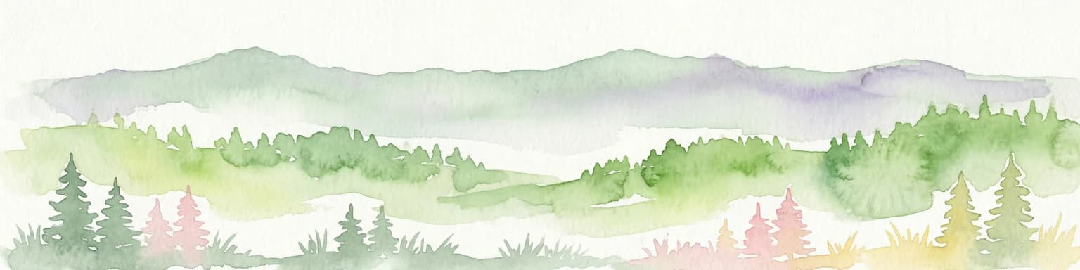
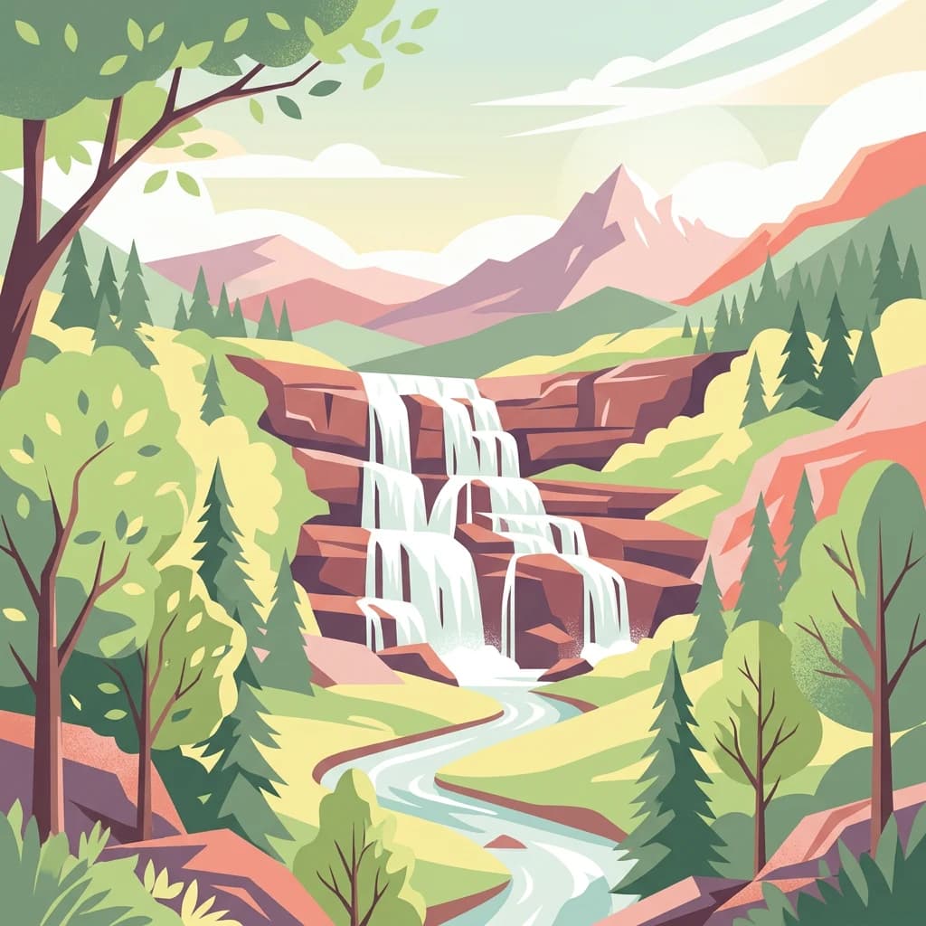
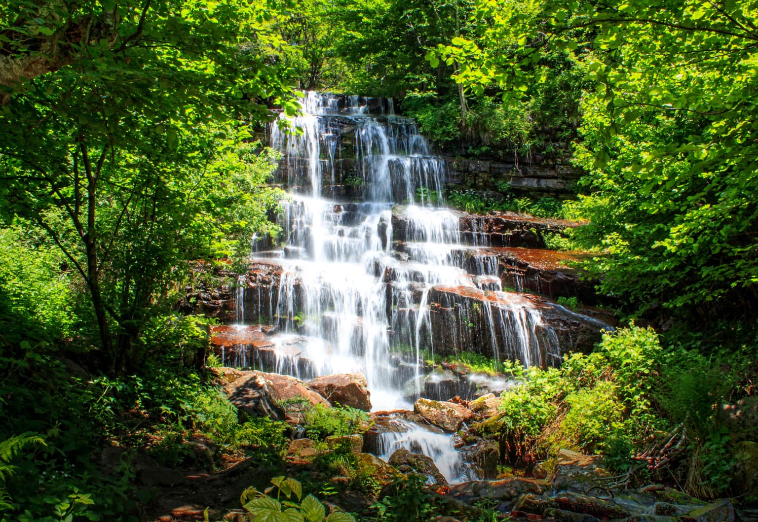
Stara Planina National Park is known for its dramatic mountain landscape characterized by rugged peaks, deep valleys, and the striking Kopren plateau. The park protects extensive forest ecosystems and the headwaters of several rivers that flow into the Timok and Nišava basins. Its transboundary position along the Serbian-Bulgarian border places it within a significant ecological corridor connecting protected areas across the Balkans. The park also features notable landmarks including the Tupavica waterfall and the Babin zub peak.

A multi-tiered waterfall cascading over rocks surrounded by lush green trees and vegetation
Tupavica Waterfall in Stara Planina National Park, Serbia

Stara Planina National Park history and protected-area timeline

Stara Planina National Park was officially established in 2022, representing the first new national park designation in Serbia in forty years. Prior to its elevation to national park status, the area existed as a nature park with the designation "Park prirode Stara planina," reflecting a lower tier of protection within Serbia's protected area system. The upgrade to national park status acknowledged the exceptional ecological, landscape, and cultural values of this mountain region, as well as its significance within Serbia's system of protected natural areas.

The creation of Stara Planina National Park was part of a broader expansion of Serbia's protected area network, with the declaration of two new national parks representing the country's commitment to nature conservation. This development reflected growing recognition of the need to protect representative samples of Serbia's diverse ecosystems and mountain landscapes. The park's establishment also acknowledged the region's biodiversity significance and the importance of transboundary conservation cooperation with Bulgaria.

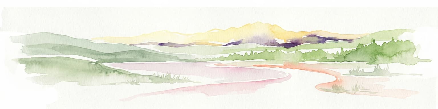
Stara Planina National Park landscape and geographic character

The landscape of Stara Planina National Park is characterized by the rugged, forested terrain of the eastern Balkan Mountains, a mountain range that forms a natural barrier between Serbia and Bulgaria. The terrain rises from the surrounding valley basins toward the central mountain divide, with elevations increasing as the landscape approaches the eastern border. The Kopren plateau represents one of the park's most distinctive geographic features, offering dramatic alpine scenery and panoramic views of the surrounding mountain landscape.

The park contains numerous valleys carved by rivers flowing from the mountain heights, including the headwaters of tributaries that feed into the Timok and Nišava river systems. These watercourses have cut deep corridors through the mountain terrain, creating diverse habitats and scenic valleys. Rock formations such as Orlov-Hajdučki kamen and Babin zub punctuate the mountain ridges, adding distinctive landmarks to the park's topography. The Tupavica waterfall exemplifies the park's hydrological features, cascading from the mountain slopes to create a notable natural attraction.

Stara Planina National Park ecosystems, habitats, and plant life

The ecosystems within Stara Planina National Park reflect the park's position within the Carpathian-Balkan biogeographical region, supporting forest communities, alpine meadows, and rocky habitats that characterize this mountain system. The forests cover substantial portions of the mountain slopes, representing diverse vegetation types adapted to the elevation gradient and varying microclimates found throughout the park. These forest ecosystems provide habitat for numerous species and play a critical role in watershed protection and soil conservation.

The park's diverse topography creates a range of microhabitats supporting different plant communities, from lower-elevation deciduous and mixed forests through coniferous forest zones to alpine meadows at higher elevations. The protection zones established within the park help maintain the most ecologically significant habitats in a relatively undisturbed state. The transboundary position of the park along the Serbian-Bulgarian border contributes to its ecological importance, as it forms part of a larger continuum of protected mountain habitats that support species movement and genetic exchange across the region.

Stara Planina National Park wildlife and species highlights

Stara Planina National Park provides habitat for diverse wildlife adapted to the mountain forest and alpine environments of the Balkan Mountains. The forest ecosystems support populations of medium and large mammals typical of Serbian mountain habitats, while the varied terrain and vegetation create conditions supporting a range of bird species. The park's position along a major biogeographical boundary contributes to its significance for species that occur at the limits of their distribution ranges in this region.

The protected status of the area helps maintain habitat conditions for wildlife populations, with the strict protection zones providing refuges where human disturbance is minimized. The connectivity with Bulgarian protected areas along the border supports transboundary wildlife movements and contributes to the viability of populations that require larger habitat areas. Specific species details would require more detailed documentation from Serbian biodiversity surveys and park management records.

Stara Planina National Park conservation status and protection priorities

Stara Planina National Park represents a significant addition to Serbia's system of national parks and contributes to the conservation of representative mountain ecosystems within the Carpathian-Balkan region. The park protects diverse habitats including forest communities, alpine zones, and river ecosystems that together support significant biodiversity. The designation of first-degree protection zones within the park ensures that the most ecologically valuable areas receive the highest level of protection.

The establishment of this national park reflects Serbia's commitment to expanding its protected area network and addressing gaps in the representation of different ecosystem types. The park's transboundary position adds importance from a regional conservation perspective, as it contributes to the network of protected areas along the Serbian-Bulgarian border. Conservation challenges include managing human activities that represent the primary threat to the park's natural values, including activities that could affect habitat integrity, water quality, and wildlife populations.

Stara Planina National Park cultural meaning and human context

The region encompassed by Stara Planina National Park has a long history of human presence and traditional land use, with communities in the surrounding valleys maintaining connections to the mountain landscape. The area around Pirot and the Nišava valley corridor has been inhabited for centuries, with traditional practices shaping the cultural landscape of the region. Place names and local knowledge reflect the historical relationship between communities and the mountain environment.

The protected area is closely associated with what was previously designated as the Nature Park Stara Planina, representing the continuation of protection for this mountain region under an enhanced legal framework. The tourism potential of the area has been recognized alongside its ecological significance, with sustainable tourism development offering opportunities for supporting local communities while maintaining natural values. The landscape contains elements of traditional infrastructure and land use patterns that reflect the historical relationship between human communities and this mountain environment.

Top sights and standout views in Stara Planina National Park

Stara Planina National Park stands as Serbia's first new national park in four decades, protecting a significant mountain landscape in the eastern Balkans. The park features the distinctive Kopren plateau with its dramatic alpine terrain, the Tupavica waterfall cascading from mountain slopes, and rocky landmarks such as Orlov-Hajdučki kamen and Babin zub. Extensive forests cover the mountain slopes, while first-degree protection zones preserve the most ecologically significant habitats. The park's position along the Bulgarian border connects it to a larger network of transboundary protected areas.

Best time to visit Stara Planina National Park

The summer and autumn seasons typically offer the most favorable conditions for exploring Stara Planina National Park. During summer, warmer temperatures make the higher elevations accessible for hiking and outdoor activities, while the forest environments provide opportunities for exploring the park's trails. Autumn brings changing foliage colors through the forest zones and generally stable weather conditions suitable for mountain exploration. Winter conditions in the higher elevations can be challenging, while spring may involve variable weather as snow melts and new growth begins.

Park location guide

Geography guide, regional context, and park location map for Stara Planina National Park

Stara Planina National Park park geography, regions, and map view in Serbia
Understand where Stara Planina National Park sits in Serbia through a broader geographic reading of the surrounding landscape, nearby location context, and its mapped position within the national park landscape.

How Stara Planina National Park fits into Serbia

Serbia is a landlocked country in Southeast and Central Europe, bordered by eight neighboring countries. With a population of approximately 6.6 million, it operates as a unitary parliamentary republic with Belgrade as its capital. The country has a rich history dating back to medieval statehood in the 7th century and has been independent since 2006 following the dissolution of Serbia and Montenegro.

Wider geography shaping Stara Planina National Park in Serbia

Serbia is a landlocked country in the Balkans, spanning parts of Southeast and Central Europe. It occupies a strategic position in the heart of the Balkan Peninsula, bordered by Hungary to the north, Romania to the northeast, Bulgaria to the southeast, North Macedonia to the south, Croatia to the northwest, Bosnia and Herzegovina to the west, and Montenegro to the southwest. The terrain varies from rolling plains in the north to mountainous regions in the south and east.

Map view of Stara Planina National Park

Use this park location map to pinpoint Stara Planina National Park in Serbia, understand its exact geographic position, and read its mapped placement within the surrounding landscape more clearly.

Pigeon | © OpenStreetMap contributors

Discover the varied habitats and protected-area character through stunning imagery of its Balkan Mountain environment and Kopren plateau.

Explore Stara Planina National Park Photos: Visualizing Mountain Landscapes, Scenery, and Terrain
Browse a visual collection of Stara Planina National Park, revealing its rugged mountain terrain, extensive forests, and significant river valleys. These images provide essential geographic context, showcasing the unique alpine scenery, diverse habitats, and overall protected landscape character of Serbia's newest national park.

A multi-tiered waterfall cascading over rocks surrounded by lush green trees and vegetation

Park atlas

Compare protected landscapes in the Carpathian-Balkan region, tracing the geographic spread of mountain parks and forest reserves.

Discover Other National Parks Near Stara Planina, Exploring Eastern Balkan Protected Areas
Explore national parks and protected areas geographically adjacent to Stara Planina National Park, tracing diverse mountain landscapes and forest ecosystems across the wider eastern Balkan range. This curated view helps compare conservation strategies and geographic features, providing deeper context for Serbia's newest national park within the broader Carpathian-Balkan mountain system.
Watercolor painting depicting a river flowing through rolling hills with green and yellow tones
Protected landscape

Sićevo Gorge Protected Landscape: Explore Serbia's Dramatic Karst Geography

Mapping the unique limestone cliffs and river valley terrain.

Delve into the atlas details of Sićevo Gorge, a protected landscape in Serbia defined by its spectacular limestone cliffs and the Nišava River canyon. This page provides a structured overview of its dramatic topography, intricate karst formations, and the regional geographic context. Understand the mapped boundaries and the unique geological character that makes this gorge a standout feature in Serbia's natural landscape.

IUCN
V
Scope
Terrestrial
Water
Minor water
Watercolor illustration of a lake surrounded by green hills and mountains with a pinkish rocky outcrop on the right
Protected area

Vlasina Ramsar Wetland: Protected Area Atlas and Geographic Context in Serbia

Discover its mountain lake ecosystem and mapped natural landscape.

Vlasina Ramsar Wetland is a critical protected area in Serbia, notable for its high-altitude mountain lake and river ecosystem within the Rhodopian Mountains. This page details its mapped geographic boundaries, unique terrain, and protected landscape identity, offering users a focused atlas exploration of a significant natural site. Delve into the specific geography and conservation context that define this internationally recognized wetland.

Established
2007
IUCN
V
Relief
Mountain
Scope
Terrestrial
Watercolor illustration of a river flowing through a valley with rolling hills and trees
National park

Đerdap National Park: Europe's Grandest River Gorge and Protected Landscape

Explore Serbia's largest national park along the Danube River.

Đerdap National Park is defined by the Iron Gate, Europe's longest and most dramatic river gorge, a geological marvel carved through the Carpathian Mountains. This protected area showcases a complex karst landscape with towering cliffs, deep river sections, and rich biodiversity, including vital Tertiary relict species. The park's vastness and unique terrain offer a profound geographic context for understanding regional natural landscapes and conservation efforts. Explore its mapped boundaries and ecological significance.

Area
637.87 km²
Established
1974
IUCN
II
Relief
Mountain
Watercolor illustration of mountainous landscape with forests and distant hills
National park

Kopaonik National Park: Serbia's Premier Protected Mountain Landscape

Explore Balkan biodiversity and unique geographic terrain.

MoriAtlas presents Kopaonik National Park, a key protected area celebrated for its extraordinary endemic plant species and its distinctive mountainous geography. This national park safeguards a significant biodiversity hotspot within the Balkans, characterized by a prominent mountain plateau and peaks exceeding 2,000 meters. Discover the park's varied terrain, from forested slopes to subalpine meadows, and understand its role in regional natural landscapes. Utilize our map-based exploration tools to grasp Kopaonik National Park's protected boundaries and its unique place in geographic context.

Area
118.1 km²
Established
1981
IUCN
II
Relief
Mountain
Watercolor painting of a mountainous landscape with a lake and green fields
National park

Rila National Park: Bulgaria's Largest National Park with Alpine Terrain and Glacial Lakes

Explore mapped boundaries and protected landscape features.

Rila National Park, situated in Bulgaria's Rila mountain range, stands as the country's largest national park and a vital protected landscape. Its territory is characterized by dramatic glacial topography, including the iconic Seven Rila Lakes, and ascends to Musala Peak, the highest summit in the Balkan Peninsula. This atlas entry details the park's extensive mapped boundaries and unique ecosystems, emphasizing its importance for understanding regional geography and protected area networks.

Area
810.46 km²
Established
1992
IUCN
II
Relief
Mountain
Watercolor illustration of a river flowing through a valley with mountains in the background
Protected landscapeRomania

Iron Gates Natural Park: Explore Romania's Protected Landscape and Geographic Context

Detailed atlas view of a protected landscape in Romania.

Uncover the geographic dimensions of Iron Gates Natural Park, a protected landscape situated in Romania. This detailed entry offers an atlas-centric exploration of its mapped boundaries and regional setting, facilitating a deeper understanding of its protected status and landscape features within the national geography. Discover the park's intrinsic value through structured geographic data and visual map context.

Area
1,156.66 km²
Established
2000
IUCN
V
Relief
Mixed relief
Watercolor painting showing a mountain range with green hills, a lake, and trees in the foreground
National parkLovech Province

Central Balkan National Park: Bulgaria's Majestic National Park and Protected Landscape

Explore mapped alpine terrain and ancient forests in Lovech Province.

Central Balkan National Park is a significant protected area in Bulgaria, renowned for its stunning mountain geography and exceptionally well-preserved ancient beech forests. Located within Lovech Province, the park's landscape is defined by dramatic peaks, including Botev Peak, deep canyons, and alpine meadows, offering a rich context for geographical exploration and understanding its protected status. Its ecosystem health and ecological value are underscored by multiple nature reserves and its recognition as part of a UNESCO World Heritage Site.

Area
716.69 km²
Established
1991
IUCN
II
Relief
Mountain
Watercolor illustration showing rolling hills, scattered trees, and a soft pink sky
Protected landscapeMehedinți County

Mehedinți Plateau Geopark Protected Landscape: Karst Geography and Regional Context

Explore Romania's unique limestone formations and karst landscapes.

The Mehedinți Plateau Geopark in Mehedinți County, Romania, is a significant protected landscape celebrated for its extensive karst features. This page offers detailed insights into the park's mapped boundaries, including its famous natural bridges like Podul lui Dumnezeu, vast limestone pavements, and cave systems. Understand its position within the broader regional geography of southwestern Romania, providing a solid foundation for atlas-driven exploration of this geologically rich area.

Area
1,065 km²
Established
2005
IUCN
V
Relief
Upland

Common questions about visiting, size, designation, and location context for Stara Planina National Park

Stara Planina National Park FAQs for park facts, access, geography, and protected area context
Find quick answers about Stara Planina National Park, including protected-area facts, park geography, trail and visitor context, and how the park fits into its surrounding country and regional landscape.
MoriAtlas Explorer

Continue Your Protected Areas Search Across the Global Atlas

Deepen your exploration by continuing the structured search for national parks and protected areas worldwide. Utilize the comprehensive filtering capabilities to compare different conservation landscapes and refine your understanding of global park geography. Discover more about the distribution and characteristics of protected natural areas.

Global natural geography