Mori Atlas logo
National parkTbilisi National Park

Mapped terrain and forest ecosystems within Mtskheta Municipality, Georgia.

Tbilisi National Park: Georgia's Oldest National Park and Protected Landscape

Discover Tbilisi National Park, a significant protected area and Georgia's oldest national park, situated north of the capital within Mtskheta Municipality. This page details the park's unique geographic position on the Saguramo Range, its varied terrain from 600 to 1,700 meters, and its role as a vital green space. Explore its mapped boundaries and forested slopes, which contribute to the regional landscape context and offer a window into Georgia's protected natural heritage.

National ParkDeciduous ForestCaucasusGeorgiaProtected AreaMountains
Illustration of a mountainous landscape featuring a waterfall, forest, and river under a sunny sky

Tbilisi National Park

National park

Park overview

Structured park overview, official facts, and landscape profile for Tbilisi National Park

Tbilisi National Park park facts, protected area profile, and essential visitor context
Review the core facts for Tbilisi National Park, including designation, size, terrain, visitor scale, habitats, and operating context in one park-focused overview.

About Tbilisi National Park

Tbilisi National Park represents Georgia's premier protected area established specifically to preserve forest ecosystems and natural landscapes in the immediate vicinity of the capital. The park spans the Saguramo-Yalno mountain ranges on the southern slopes of the Greater Caucasus, creating a diverse terrain of forested slopes, valleys, and ridgelines that separate the Kura and Iori river basins. The park's establishment in 1973 marked a significant milestone in Georgia's conservation history, building upon the earlier Saguramo National Reserve from 1946. The park underwent institutional changes over subsequent decades, losing and then regaining its national park status, with formal re-establishment occurring in 2007 through the integration of former park territory with the Saguramo State Reserve. Today, the park comprises multiple management zones including Saguramo, Gldani, Martkopi, Gulebi, and Gardabani areas, with the Tbilisi Sea forest sector removed from the park's jurisdiction in 2011. The park's proximity to Tbilisi and Mtskheta makes it a vital green infrastructure element for the metropolitan region.

Quick facts and research context for Tbilisi National Park

Tbilisi National Park covers approximately 380 square kilometers of mountainous terrain in eastern Georgia. The park is situated on the southern slopes of the Greater Caucasus, specifically on the Saguramo-Yalno mountain ranges between the Mtkvari (Kura) and Iori rivers. Its diverse topography supports mixed deciduous forests dominated by oak, hornbeam, and beech species. The park protects significant mammalian wildlife including red deer, lynx, Eurasian brown bear, red fox, and jackal. The park's administration falls under Georgia's Agency of Protected Areas.

Park context

Deeper park guide and search-rich context for Tbilisi National Park

Tbilisi National Park history, landscape, wildlife, and travel context
Explore Tbilisi National Park through its history, landscape character, ecosystems, wildlife, conservation priorities, cultural context, and seasonal travel timing in a structured park guide built for atlas discovery and search intent.

Why Tbilisi National Park stands out

Tbilisi National Park is best known as Georgia's oldest national park and its closest protected area to the capital city of Tbilisi. The park is recognized for its accessible forest ecosystems on the Saguramo Range, which provide recreational opportunities for visitors while preserving important biodiversity. The park encompasses historical-cultural monuments including ancient fortress-towers, churches, and monastery complexes that reflect the region's long human history. The park's location immediately adjacent to Mtskheta, one of Georgia's oldest and most historically significant towns, gives it particular cultural and landscape importance.

Tree branches covered in ice with clear blue sky visible through the branches
Georgia's first national park, established in 1973, re-established in 2007. Located on the southern slopes of the Greater Caucasus mountain range at an altitude of 600-1,700 meters. Covers an area of 21,036.14 hectares.

Tbilisi National Park history and protected-area timeline

Tbilisi National Park was established in March 1973 through a resolution by the Central Committee of the Communist Party of Georgia and the Council of Ministers of the Georgian SSR, aimed at expanding green zones around Tbilisi and Rustavi, improving the environment, and creating better rest conditions for workers. The park was formed by combining the Mamkoda Memorial Park with forest areas from Gldani, Martkopi, Gulebi, and Tskhratskaro (Sheep-eater) forestry units. The park's official borders were confirmed on January 1, 1974. During this initial period, recreational infrastructure was developed, including the construction of new towers in traditional style alongside older monastery complexes to enhance the park's landscape. The park later lost its national park status for a period before being re-established in 2007 by combining parts of the former national park with the Saguramo State Reserve. In 2011, the Tbilisi Sea forestry sector (425.53 hectares) and the Tbilisi Dendrological Park (300 hectares) were separated from the park's jurisdiction. Management is conducted in accordance with Georgia's law on the protected areas system.

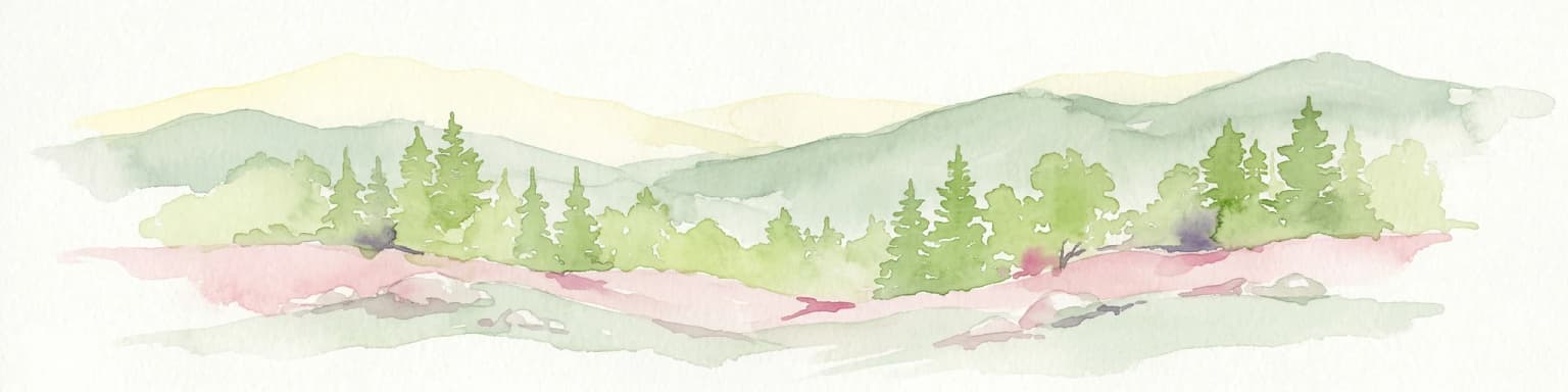
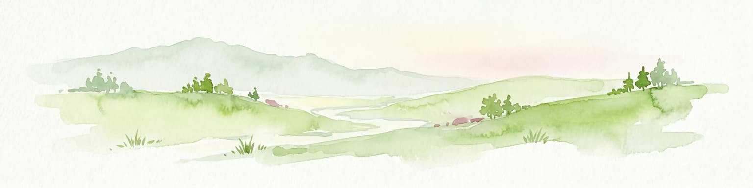
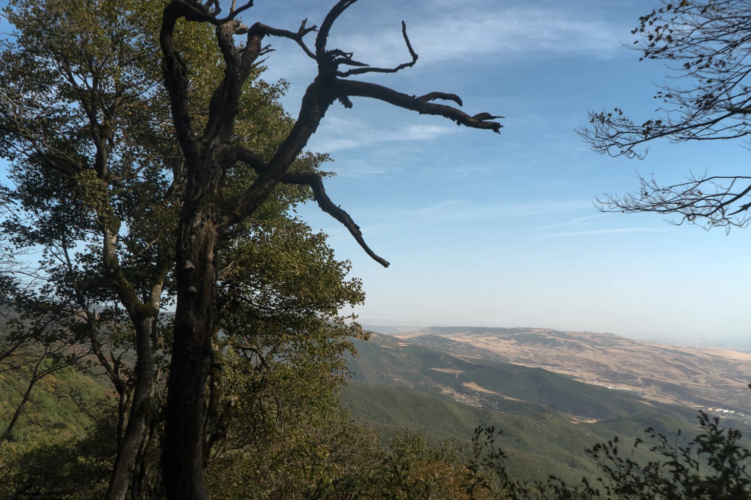
Tbilisi National Park landscape and geographic character

The landscape of Tbilisi National Park is characterized by mountainous terrain on the southern slopes of the Greater Caucasus mountain range. The park occupies the Saguramo-Yalno mountain ridges and their slopes, with elevation ranging from approximately 600 meters to 1,700 meters above sea level. The terrain features forested slopes descending from higher ridgelines, with the park's highest point at 1,385 meters. The area lies east of the Aragvi River and forms part of the Kura River drainage basin. The landscape supports mixed deciduous forest ecosystems that blanket the mountain slopes, creating a verdant backdrop visible from the metropolitan areas below. A paved road connecting Tbilisi to Tianeti traverses the central part of the park, crossing the Saguramo Range, while the Tbilisi bypass highway runs along the southwestern border.

Snow-covered trees in a forested area with sunlight filtering through branches against a clear blue sky
Tbilisi National Park was the first national park in Georgia, established in 1973. It was later re-established in 2007 on the basis of the former national park and Saguramo Reserve. It is located on the southern slopes of the Saguramo-Ialno range of the Greater Caucasus Mountains, 600-1700m above sea level. It spans from the Mtkvari River to the Iori River and consists of Saguramo, Glani, Martkopi, Ghulebi, and Gardabani sections, covering 21,036.14 hectares.

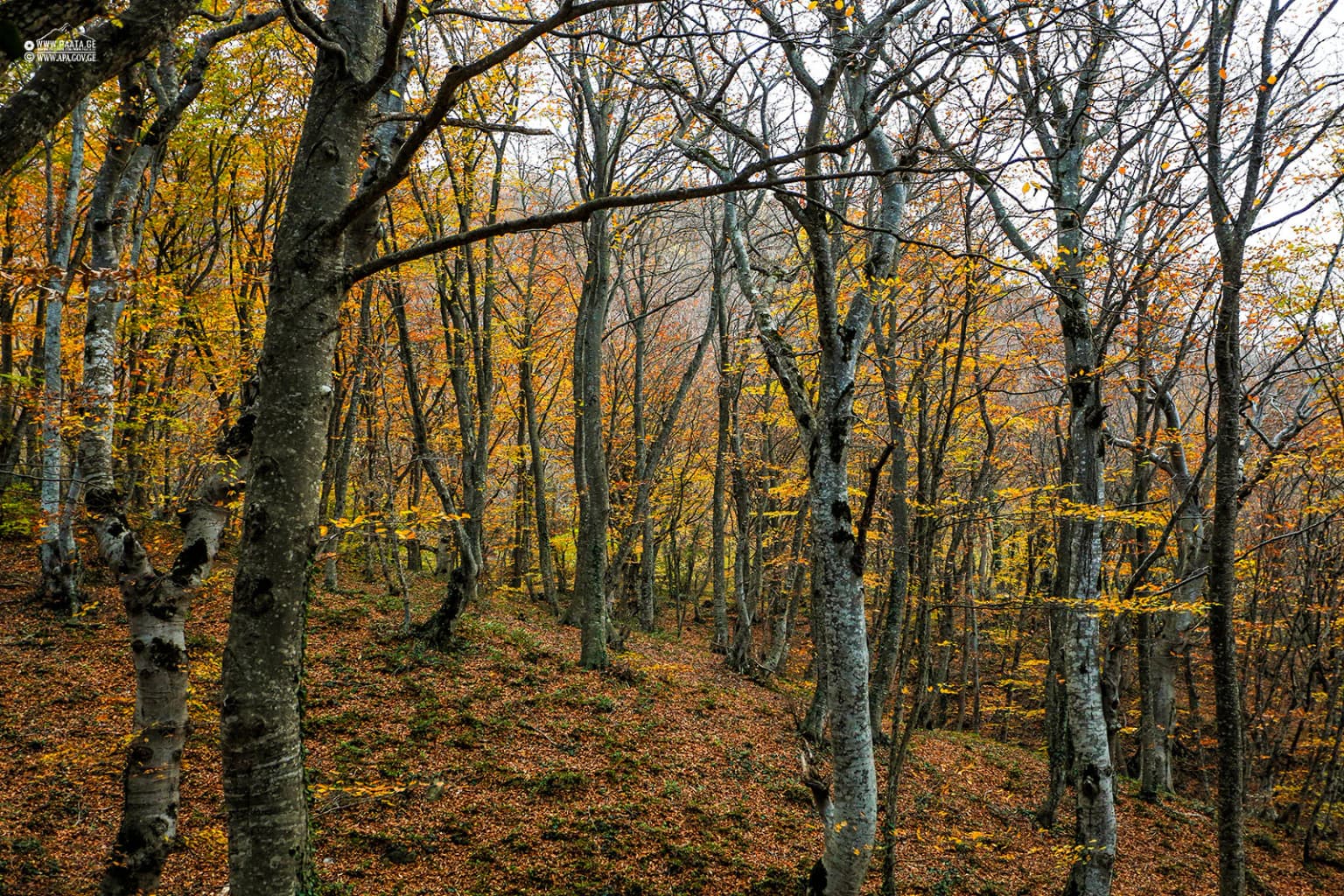
Tbilisi National Park ecosystems, habitats, and plant life

Tbilisi National Park supports rich deciduous forest ecosystems typical of the Caucasus region. The vegetation is dominated by broadleaf species including oak, hornbeam, and beech, which form the primary forest cover across the park's slopes. These forests provide habitat for diverse wildlife and contribute to the park's role in protecting watershed areas within the Kura River basin. The park's elevation gradient and varied aspect create diverse microhabitats supporting multiple plant communities. The forest ecosystems serve important watershed protection functions for the Mtkvari (Kura) and Iori river catchments, helping regulate water flow and protect soils on mountain slopes.

Snow-covered tree branches reaching upward against a blue sky with scattered clouds
Snow-covered tree branches reaching upward against a clear blue sky in Tbilisi National Park

Tbilisi National Park wildlife and species highlights

The mammalian fauna of Tbilisi National Park includes several notable species protected within the park's boundaries. Red deer (Caucasian noble deer) represent an important herbivore species in the park's ecosystems. Predators include the lynx, a secretive feline that inhabits the forested slopes, as well as the Eurasian brown bear. Additional mammalian species include red fox and jackal, which are more commonly encountered. The park's forests provide important habitat for these species, with the protected status helping maintain viable populations within the metropolitan region of Tbilisi.

Person standing in snow-covered forest with frost-covered trees
Snow-covered forest scene in Tbilisi National Park with a person standing amidst frost-laden trees

Tbilisi National Park conservation status and protection priorities

Tbilisi National Park serves as a critical conservation area within Georgia's protected areas network due to its proximity to the capital and its role in preserving forest ecosystems on the southern Caucasus slopes. The park protects representative samples of the region's deciduous forest communities and the wildlife they support, including rare species such as the Caucasian noble deer and lynx. As the oldest national park in Georgia, it carries historical significance in the development of the country's conservation framework. The park's watershed protection function within the Kura River basin adds to its environmental importance, helping protect water resources for the surrounding metropolitan area.

Tbilisi National Park cultural meaning and human context

The territory of Tbilisi National Park contains numerous historical-cultural monuments reflecting the region's ancient settlement and religious traditions. The park encompasses ancient fortress-towers, temples, and monastery complexes, including the significant religious sites of Mtskheta—the Svetitskhoveli Cathedral and the Jvari Monastery—which lie immediately adjacent to the park's western boundary. Within the park's boundaries, the Zedazeni Monastery (with numerous historical-cultural monuments including the Kasuri Cathedral, Brick Cathedral, and Darbazi) and the Martkopi Monastery of the Holy Mother of God represent important religious and architectural heritage. The historically significant Martkopi field also lies within the park's territory. These cultural elements demonstrate the long human occupation and use of this landscape over millennia.

A forest scene with tall trees, autumn foliage, and fallen leaves on the ground
Autumn forest landscape in Tbilisi National Park with fallen leaves and tall trees

Top sights and standout views in Tbilisi National Park

Tbilisi National Park offers a combination of natural and cultural attractions as Georgia's oldest protected area. The park's accessible forest landscapes on the Saguramo Range provide opportunities for hiking and nature observation close to Tbilisi. The presence of ancient monasteries, churches, and fortress-towers throughout the park creates a landscape where natural and cultural heritage intertwine. The park protects important wildlife including red deer and lynx within its forest ecosystems. Its role as the closest protected area to Tbilisi makes it a vital green space for the capital's residents and visitors seeking nature experiences without traveling far from the city.

A tall dead tree with twisted branches in the foreground, surrounded by green foliage, overlooking rolling hills and distant mountains under a clear blue sky
Panoramic view from Tbilisi National Park showing valley and distant mountains

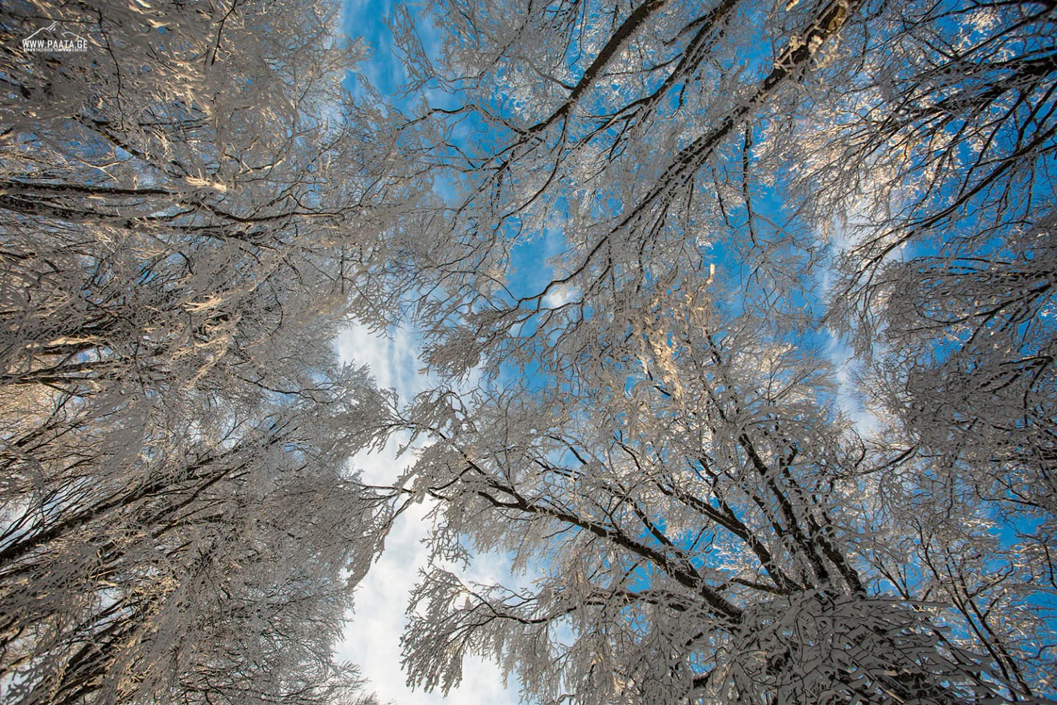
Best time to visit Tbilisi National Park

The park can be visited throughout the year, with each season offering different experiences. Spring and early summer bring lush green foliage and pleasant temperatures ideal for hiking on the forest trails. Autumn offers colorful deciduous forest scenery as leaves change, while winter provides a quieter atmosphere though higher elevations may have snow. The park's proximity to Tbilisi makes it accessible for day visits in any season, though spring through autumn typically offer the most comfortable conditions for extended exploration of the trails and cultural sites within the park.

Park location guide

Geography guide, regional context, and park location map for Tbilisi National Park

Tbilisi National Park park geography, regions, and map view in Georgia
Understand where Tbilisi National Park sits in Georgia through a broader geographic reading of the surrounding landscape, nearby location context, and its mapped position within the national park landscape.

How Tbilisi National Park fits into Georgia

Georgia is a transcontinental country spanning Eastern Europe and West Asia, situated in the Caucasus region along the Black Sea. It declared independence from the Soviet Union in 1991 and today functions as a unitary parliamentary republic with Tbilisi as its capital. The nation is notable for its distinctive Georgian language, Orthodox Christian traditions dating to the 4th century, and archaeological evidence of the world's earliest winemaking sites.

Wider geography shaping Tbilisi National Park in Georgia

Georgia occupies a strategic position at the crossroads of Eastern Europe and West Asia, bordered by Russia to the north and northeast, the Black Sea to the west, Turkey and Armenia to the south, and Azerbaijan to the southeast. The terrain is predominantly mountainous in the north with the Greater Caucasus range, transitioning to plains and valleys in the east. The country spans approximately 69,700 square kilometres.

Map view of Tbilisi National Park

Use this park location map to pinpoint Tbilisi National Park in Georgia, understand its exact geographic position, and read its mapped placement within the surrounding landscape more clearly.

Pigeon | © OpenStreetMap contributors

Location context for Tbilisi National Park

Mtskheta Municipality

Visually understand the mountainous terrain, deciduous forest ecosystems, and distinct protected-area character of Georgia's oldest national park.

Tbilisi National Park Photos: Explore Forested Terrain, Mountain Scenery, and Protected Landscapes
Explore a visual overview of Tbilisi National Park's diverse landscapes, showcasing its mountainous terrain, dense deciduous forests, and vital protected-area habitats. High-quality imagery helps clarify the park's geographic context, conservation value, and unique environmental character for deeper atlas-style discovery.

Tree branches covered in ice with clear blue sky visible through the branches

Aerial view of stone building complex with blue roofs surrounded by dense green forest on a hillside

Snow-covered trees in a forested area with sunlight filtering through branches against a clear blue sky

Snow-covered tree branches reaching upward against a blue sky with scattered clouds

Person standing in snow-covered forest with frost-covered trees

Aerial view of dense forest canopy showing autumn colors

A forest scene with tall trees, autumn foliage, and fallen leaves on the ground

A tall dead tree with twisted branches in the foreground, surrounded by green foliage, overlooking rolling hills and distant mountains under a clear blue sky

Wide view of dense green forests and rolling hills in Tbilisi National Park with clear sky

Aerial view of a forest path with autumn-colored trees

Two people walking on a dirt path surrounded by tall trees with fallen leaves

A landscape view of green mountain slopes with dense forests under a clear blue sky

Forest scene with tall trees showing autumn foliage in shades of green, yellow, and brown

Snow-covered road with tire tracks winding through a forest of tall, leafless trees with snow on branches

Aerial view of dense green forests covering rolling mountains with a small structure visible on a hilltop

A person walking on a paved road surrounded by autumn-colored trees

Park atlas

Compare protected landscapes and map regional park geography surrounding Georgia's oldest national park.

Discover Other National Parks and Protected Areas Near Tbilisi National Park, Georgia
Continue your discovery of protected areas by browsing other national parks and protected landscapes near Tbilisi National Park, tracing their geographic spread across the surrounding region. Compare the diverse terrain, conservation priorities, and regional context of Georgia's protected areas, deepening your understanding of the country's natural heritage beyond its oldest national park.
Watercolor illustration of a mountainous landscape with green forests, rolling hills, and distant mountains under a light sky
National parkGeorgia

Algeti National Park: Explore Georgia's Protected Coniferous Forest Landscape

Mountain terrain, protected forests, and regional geography.

Algeti National Park, located in Georgia's Kvemo Kartli region, serves as a critical protected area preserving the easternmost populations of Caucasian Spruce and Nordmann Fir. This national park features a dramatic mountainous landscape within the Trialeti Range, characterized by deeply incised valleys, flowing rivers, and extensive old-growth forest ecosystems. Users can explore the park's geographic context, mapped boundaries, and the ecological significance of its unique coniferous and mixed forests, contributing to a broader understanding of protected lands in the Caucasus.

Area
68.22 km²
Established
2007
IUCN
II
Visitors
8K annual
National parkGeorgia

Tusheti National Park National Park: Geographic Exploration of Caucasus Protected Landscapes

Mapped protected area boundaries and alpine terrain in Georgia.

Tusheti National Park offers a deep dive into the rugged geography of the Greater Caucasus. This national park, situated in a remote corner of Georgia, protects a dramatic landscape characterized by high mountain ridges, glacial valleys, and diverse ecosystems. The park's mapped boundaries encompass significant alpine terrain, providing essential habitat and serving as a critical area for understanding regional protected land distribution and landscape context. Explore the unique geographic identity of Tusheti National Park.

Area
1,276.43 km²
Established
2003
IUCN
II
Relief
Mountain
National parkMtskheta-Mtianeti

Kazbegi National Park: Georgia's Alpine Protected Landscape & Regional Geography

Explore its dramatic terrain and protected area boundaries.

Kazbegi National Park offers a unique glimpse into the dramatic alpine geography of the Greater Caucasus. As a protected national park in the Mtskheta-Mtianeti region, it showcases rugged terrain, high-altitude ecosystems, and significant natural features. MoriAtlas provides a structured way to understand the park's physical characteristics, its mapped presence, and its place within the broader regional atlas, highlighting the distinct landscape of this Georgian protected area.

Area
1,446.17 km²
Established
1976
IUCN
II
Relief
Mountain
Watercolor painting showing a landscape with green hills, trees, and distant mountains
National parkMtskheta-Mtianeti

Pshav-Khevsureti National Park: Protected Mountain Landscape and Regional Geography in Mtskheta-Mtianeti

Explore rugged terrain and alpine ecosystems in Georgia's Caucasus.

Pshav-Khevsureti National Park is a key protected area in Georgia's Mtskheta-Mtianeti region, recognized for its dramatic mountain terrain, deep river valleys, and alpine zones. Established as a national park, it safeguards the watersheds of major rivers, supporting significant wildlife and offering a compelling geographic context for atlas exploration. This protected landscape provides insight into the unique natural and cultural heritage of the Khevsureti region, making it a focal point for understanding Georgia's protected area network and mountainous geography.

Area
1,400.44 km²
Established
2014
IUCN
II
Relief
Mountain
National parkTavush Province

Dilijan National Park: Mapped Protected Landscape and Forested Terrain in Tavush Province

Explore ancient deciduous forests and medieval sites within this protected area.

Dilijan National Park offers a unique atlas perspective on Armenia's natural and cultural heritage. This protected landscape in Tavush Province is dominated by vast, ancient deciduous forests, including rare yew groves, making it a vital conservation area. Its mountainous terrain, carved by rivers and dotted with medieval monasteries like Haghartsin and Goshavank, provides a rich context for geographic discovery. Users can explore the park's mapped boundaries and understand its significance as a preserved woodland ecosystem within the Caucasus region through its detailed geographic information.

Area
240 km²
Established
2002
IUCN
II
Relief
Mixed relief
National parkShirak Province

Lake Arpi National Park: High-Altitude Wetland Protected Landscape in Shirak Province

Mapped boundaries of an important South Caucasus conservation area.

Lake Arpi National Park offers a unique window into high-altitude wetland ecosystems on the Shirak and Javakheti plateau, located at roughly 2000 meters above sea level. Established as a national park in 2009, it protects critical habitats, including the central Lake Arpi, and serves as a vital sanctuary for numerous bird species. This protected area is distinguished by its alpine meadows, significant bird populations, and its distinct geographic setting within Armenia's northwestern region, providing rich context for atlas-based exploration of protected lands.

Area
250 km²
Established
2009
IUCN
II
Relief
Mountain
Watercolor painting showing green hills, a river, and distant purple and orange mountains
National parkDedoplistsqaro Municipality

Vashlovani National Park: Georgia's Unique Lowland Desert and Badland Protected Landscape

Discover distinct semi-arid terrain and rare forest ecosystems.

Vashlovani National Park in Dedoplistsqaro Municipality represents a significant protected area preserving Georgia's rare lowland desert and semi-arid steppe ecosystems. This national park is characterized by its striking badland topography, known as the "Sharp Walls," wild pistachio forests, and riparian habitats along the Alazani River. Its unique geographic setting, far removed from Georgia's typical mountainous landscapes, makes Vashlovani a crucial site for understanding regional biodiversity and conservation within the Caucasus.

Area
442.51 km²
Established
1935
IUCN
II
Relief
Lowland
National parkGeorgia

Borjomi-Kharagauli National Park: Protected Landscape Atlas of Georgia's Lesser Caucasus

Explore its unique forests, wildlife, and mountain terrain.

Delve into Borjomi-Kharagauli National Park, a significant protected area in Georgia's Lesser Caucasus region. This national park is renowned for its extensive old-growth forests, including rare Colchian fragments, and a remarkable concentration of endemic species. The park's dramatic mountainous terrain, spanning over 1,000 square kilometers, offers a rich tapestry of landscapes from deep valleys to alpine meadows, providing critical habitat for large mammals and contributing significantly to the region's biodiversity. Explore its mapped boundaries and geographic context for a deeper understanding of this vital conservation landscape.

Area
1,093 km²
Established
1995
IUCN
II
Relief
Mountain

Common questions about visiting, size, designation, and location context for Tbilisi National Park

Tbilisi National Park FAQs for park facts, access, geography, and protected area context
Find quick answers about Tbilisi National Park, including protected-area facts, park geography, trail and visitor context, and how the park fits into its surrounding country and regional landscape.
MoriAtlas Explorer

Continue Your Protected Areas Search Across the Global Atlas

Deepen your exploration by continuing the structured search for national parks and protected areas worldwide. Utilize the comprehensive filtering capabilities to compare different conservation landscapes and refine your understanding of global park geography. Discover more about the distribution and characteristics of protected natural areas.

Global natural geography