
Why Timanfaya National Park stands out
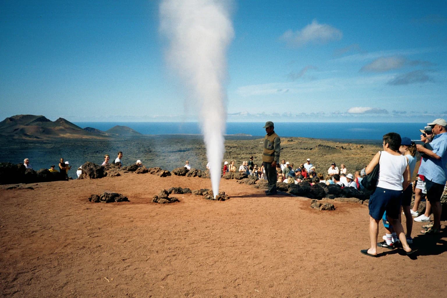
Timanfaya is best known for its extraordinary volcanic landscape, a vast expanse of craters, lava fields, volcanic cones, and solidified lava flows that create one of Europe's most visually striking protected areas. The park preserves the Montañas del Fuego, a dramatic volcanic complex where the earth's heat remains so intense that visitors can witness steam geysers created by pouring water into shallow boreholes. This living volcanic environment, where eruptions occurred as recently as 1824, provides an unparalleled natural laboratory for understanding volcanic processes. The contrast between the stark black and red volcanic terrain and the surrounding Lanzarote landscape creates a visually dramatic scene that has become iconic to the Canary Islands.
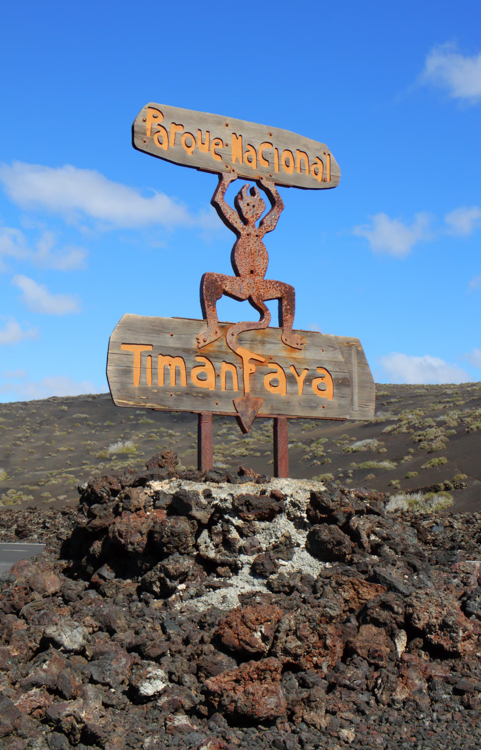
Timanfaya National Park history and protected-area timeline
Timanfaya's history is fundamentally the story of volcanic destruction and eventual preservation. The most transformative period began on September 1, 1730, when the earth erupted near the village of Yaiza, initiating what would become one of the longest documented volcanic eruptions in European history. Over the next six years, until April 16, 1736, volcanic activity continuously reshaped the southwestern landscape of Lanzarote. Nine villages—Tingafa, Mancha Blanca, Las Maretas, Santa Catalina, Jaretas, San Juan, Peña de Plomos, Testeina, and Rodeos—were entirely buried beneath volcanic flows. A quarter of the island became covered in lava, and ashfall devastated agricultural lands throughout the region. The human cost was catastrophic, with famines forcing mass emigration from the island. Volcanic activity returned briefly in 1824 with eruptions at Tinguatón, Tao, and Montaña del Fuego. Following these events, the landscape was left largely untouched, gradually gaining recognition for its extraordinary geological value. The park was officially established on August 9, 1974, through decree, making it the third national park in the Canary Islands and the first in what is now Las Palmas province. The designation recognized not just the geological significance but also the need to protect the delicate plant and animal life that had begun to colonize this harsh volcanic substrate.
Timanfaya National Park landscape and geographic character
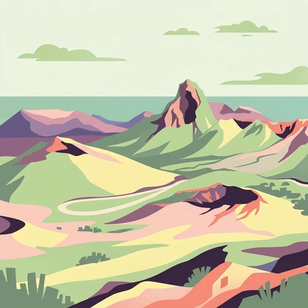
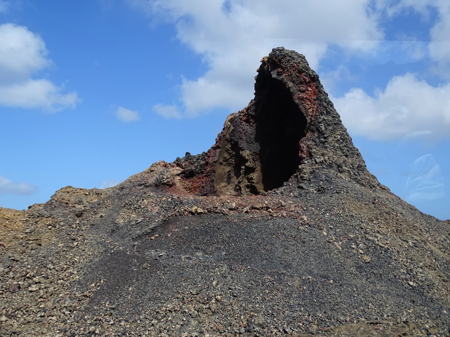
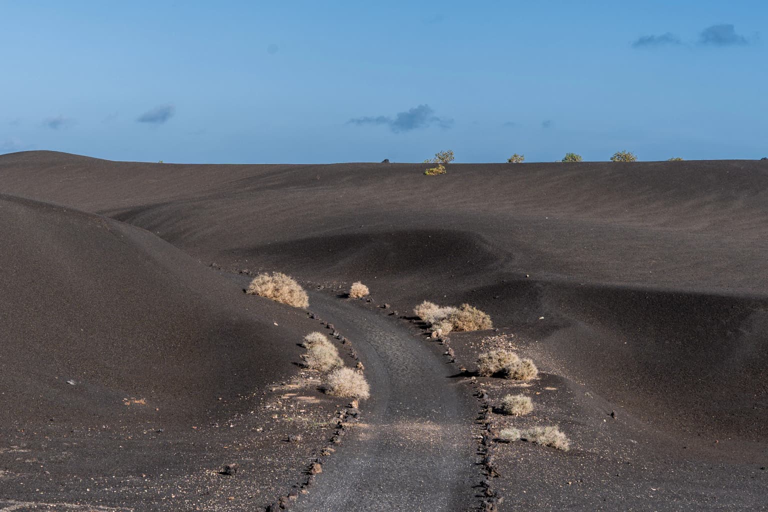
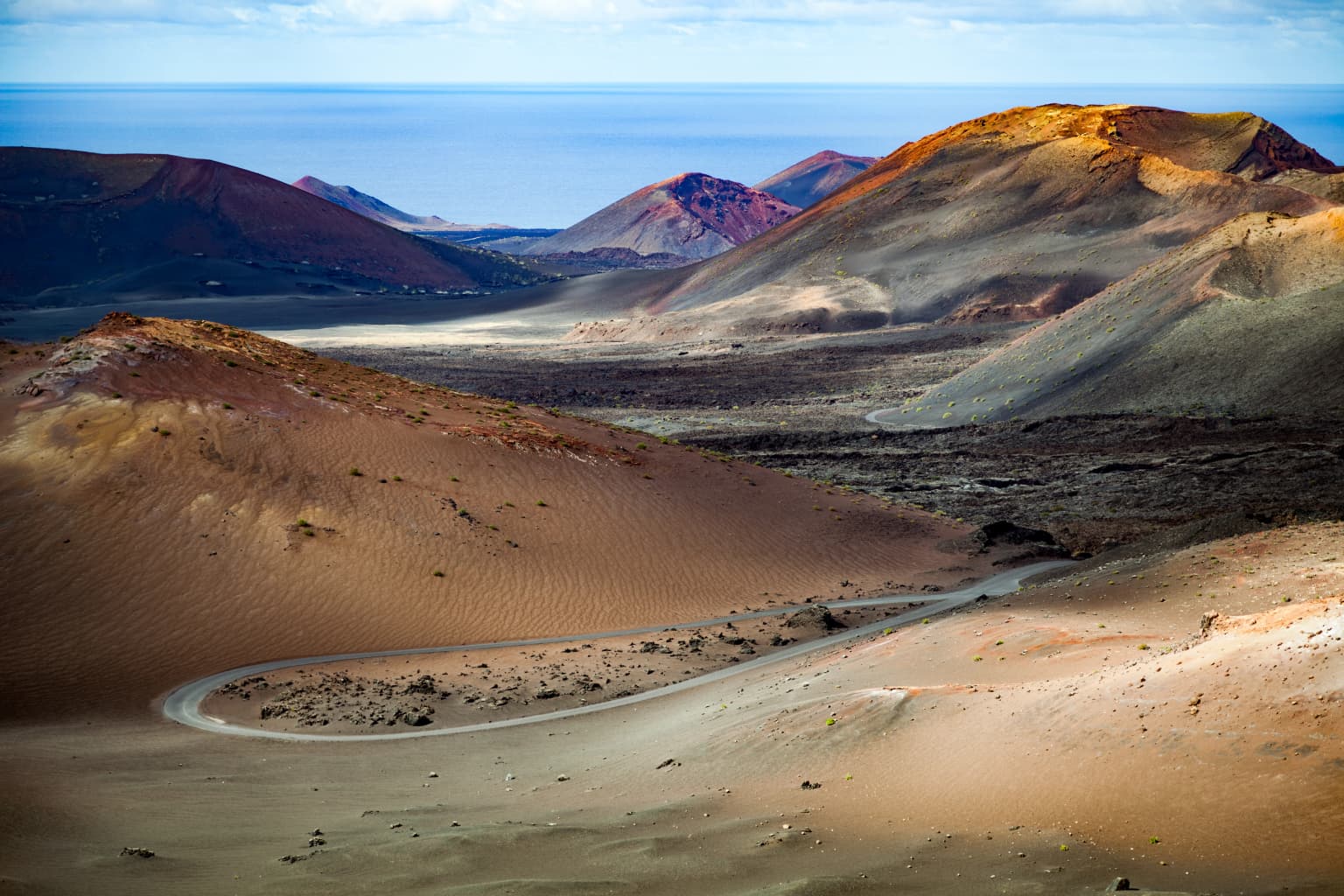
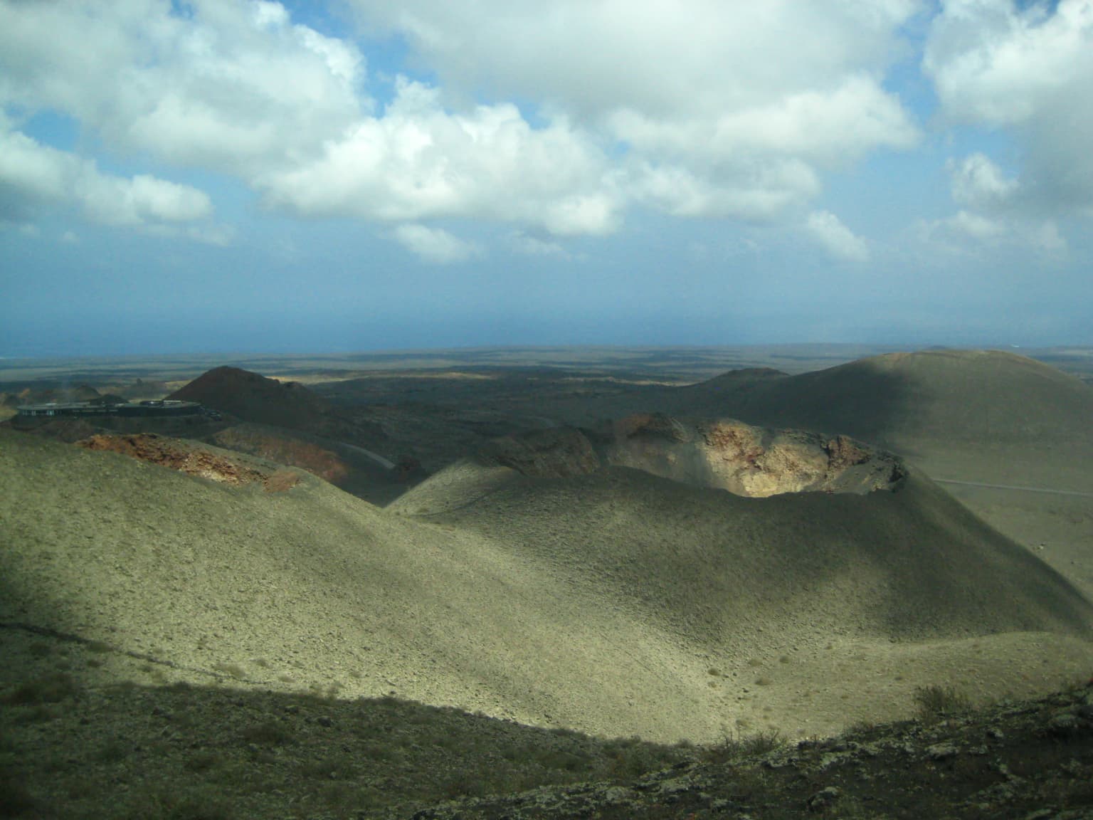
The landscape of Timanfaya National Park is a dramatic tableau of volcanic destruction frozen in time. The terrain is dominated by extensive lava fields, some appearing almost black while others display distinctive red and brown hues from iron oxidation. More than 25 volcanic cones rise from this lunar-like expanse, including the iconic Montañas del Fuego, Montaña Rajada with its split crater, and the Caldera del Corazoncillo. The volcanic formations exhibit remarkable variety—from steep-sided pyroclastic cones to gentle slopes of solidified lava flows, from crater rims to the unusual geological phenomenon of the Islote de Halcones, an older volcanic vent that predates the historical eruptions and stands as an island of older rock surrounded by younger lava flows. The maximum elevation reaches 530-540 meters, providing subtle but perceptible topographic variation across the park. The absence of permanent water bodies or significant vegetation in most areas emphasizes the raw geological character, though the volcanic colors—ranging from near-black through browns, oranges, and deep reds—create a visually stunning landscape particularly striking at sunrise and sunset when the low sun angles accentuate the relief and color variations.
Timanfaya National Park ecosystems, habitats, and plant life
Despite the harsh volcanic environment, Timanfaya supports a remarkable array of life that has colonized this apparently barren landscape. The park lies within the broader Canary Islands dry subtropical forest ecosystem, though the specific volcanic substrate creates unique conditions for specialized species. The vegetation that does manage to establish itself on the volcanic soils is predominantly xerophytic—drought-adapted plants that can survive with minimal moisture. The lapilli (volcanic lapilli—small porous rock fragments) that covers much of the landscape plays a crucial ecological role by capturing moisture from the prevailing trade winds (alisios winds), allowing plants to survive the otherwise arid conditions. Native plant species have developed specialized adaptations to thrive in this environment, with some areas showing surprisingly dense plant cover given the conditions. The park forms part of a larger network of protected areas in Lanzarote, recognized as a UNESCO Biosphere Reserve since 1993, where the national park serves as one of the core conservation areas.
Timanfaya National Park wildlife and species highlights
The wildlife of Timanfaya reflects the harsh but strategically important position of this volcanic landscape within the Canary Islands. The park provides critical habitat for bird species, particularly birds of prey that use the volcanic cones for nesting and hunting. The open lava fields and volcanic slopes support a specialized avifauna adapted to arid environments. The designation as a ZEPA (Special Protection Area for Birds) reflects the importance of the area for species conservation at the European level. Among the notable bird species present are various raptors that nest in the cliff faces and volcanic craters, as well as smaller bird species that have adapted to the scrub and open terrain. Invertebrates, particularly insects, represent the most diverse group of animals in the park, having colonized the volcanic terrain and adapted to the extreme conditions. The isolated nature of Lanzarote within the Atlantic also means that the park contributes to the conservation of species found nowhere else on Earth.
Timanfaya National Park conservation status and protection priorities
Timanfaya National Park represents a unique conservation model in Spain, being the only national park designated entirely for geological values. This distinction reflects both the extraordinary volcanic landscape and the ongoing geothermal activity that makes the area significant for scientific understanding. The park is nested within the larger UNESCO Biosphere Reserve that encompasses all of Lanzarote, designated in 1993, creating a layered approach to conservation that protects both the core volcanic area and the surrounding landscape. Beyond national park status, Timanfaya holds additional protection as a ZEPA (Special Protection Area for Birds) and ZEC (Special Area of Conservation), fulfilling the European Union's Natura 2000 requirements. Within the park, specific zones receive additional protection as natural monuments—the Islote de Halcones and the Montañas del Fuego—both recognized for their exceptional geological values. Access is strictly regulated to protect the delicate volcanic environment and the species that have colonized it, with visitors confined to designated viewing areas and only two walking trails available by special authorization with a guide.
Timanfaya National Park cultural meaning and human context
Timanfaya holds deep significance in the cultural memory of Lanzarote, representing both destruction and resilience. The volcanic eruptions of 1730-1736 buried nine villages and fundamentally altered the island's economy and population distribution. The memory of this catastrophe remains embedded in local oral traditions and historical accounts, including the detailed testimony of parish priest Lorenzo Curbelo who documented the initial eruption. Following the destruction, Lanzarote's population developed remarkable agricultural adaptations to survive in the volcanic landscape, including sophisticated techniques for cultivating crops on volcanic lapilli that capture moisture from the air. These techniques allowed agricultural recovery and remain visible in the landscape surrounding the park. The park also represents the intersection between natural phenomena and artistic interpretation—César Manrique, the celebrated Canarian artist and architect, created the iconic El Diablo sculpture that serves as the park's symbol, capturing the dramatic spirit of volcanic forces in a form that has become instantly recognizable across the islands.
Top sights and standout views in Timanfaya National Park
Timanfaya offers visitors one of Europe's most visually dramatic volcanic landscapes, where the raw power of geological forces remains tangibly present. The Montañas del Fuego area provides the park's most iconic scenery, with its cluster of volcanic cones and ongoing geothermal activity. Visitors can witness the unique demonstration of volcanic heat where water poured into ground holes creates dramatic steam eruptions—a living illustration of the geothermal energy still present beneath the surface. The El Diablo sculpture by César Manrique stands as both an artistic landmark and a symbol representing the park's identity. The park's status as Spain's only entirely geological national park makes it a unique conservation achievement, protecting not just scenery but an entire volcanic system. The dramatic contrast between the black and red volcanic terrain and the surrounding island landscape creates photographic opportunities that have made this one of the most photographed locations in the Canary Islands.
Best time to visit Timanfaya National Park
Timanfaya can be visited year-round, with each season offering a different perspective on this volcanic landscape. The summer months (June through September) bring the highest temperatures and strongest sunlight, which can make the volcanic colors particularly vivid but also make extended outdoor activities uncomfortable. Winter months (December through March) offer milder temperatures and often clearer atmospheric conditions, making it ideal for photography and walking. The shoulder seasons of spring and autumn provide a balance between comfortable temperatures and good light. Because the park's appeal is primarily geological and visual rather than biological, seasonal changes in vegetation are minimal, maintaining the stark volcanic character throughout the year. Early morning visits offer the best light for photography and the most comfortable conditions for viewing, while later in the day the interpretative center and facilities provide shade and information. The park's strict access controls and limited public areas mean that visits are consistently managed regardless of when you arrive.