
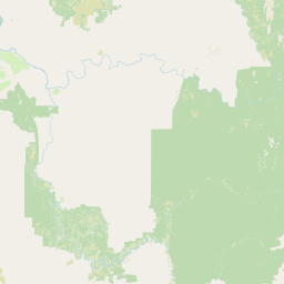
Rivers
Park geography
Detailed analysis of mountain terrain, boreal forest habitats, and regional landscape features.
Comprehensive Geographic Profile and Mapped Boundaries of Yugyd Va National Park
Discover the physical landscape of Yugyd Va National Park, spanning 18,917 square kilometers within the Komi Republic. This profile details the park topography, reaching a maximum elevation of 1,894 meters, alongside mapped rivers, glaciers, ridges, and boreal forest ecosystems preserved within these protected boundaries.
Related tags
Boreal forestNorthern UralsTaiga wildernessUNESCO World Heritage SiteMountain ecosystems
Europe's largest protected taiga wilderness in the northern Urals
Yugyd Va National Park
Yugyd Va National Park is a vast protected wilderness area situated in the Komi Republic of Russia, spanning approximately 18,917 square kilometers across the western slopes of the Polar Urals and Northern Ural mountains. Established in April 1994, it stands as Europe's largest national park and encompasses a remarkable diversity of landscapes, from ancient taiga forests to alpine tundra and dramatic mountain peaks. The park occupies a unique geographic position along the continental boundary between Europe and Asia, serving as a critical watershed where rivers originating on the western slopes of the Urals flow toward the Pechora River and ultimately the Barents Sea. This remote and largely undisturbed wilderness was recognized in 1995 as part of the UNESCO World Heritage Site known as the Virgin Komi Forests, one of the most extensive remaining areas of primeval boreal forest in Europe. The park's significance extends beyond its size, protecting some of the most northerly ecosystems on the European continent and preserving a landscape that has remained largely untouched by human development.
- Location
- Russia
- Park type
- National park
- Established
- 1994
- Area
- 18,917 km²
- Highest point
- 1,894 m
Location overview
Komi Republic regional territory, Russia country context, and transboundary scope
Yugyd Va National Park Geographic Setting and Regional Location Overview
Recorded location memberships place Yugyd Va National Park within the Komi Republic of Russia. Regional records confirm the protected area holds recognized transboundary geographic status.
- Countries
- Russia
- Regions
- Komi Republic
- Primary location
- Komi Republic
- Geographic setting
- Transboundary · Inland
Boundary and coordinates
Interactive boundary geometry and calculated area metrics
Yugyd Va National Park Boundary Map and Spatial Extent
Mapped park outlines establish spatial context for the protected territory. Derived measurement records provide structural facts regarding regional extent, coordinate limits, and total area.
- Boundary area
- 19,084.6 km²
- Boundary perimeter
- 1,300.2 km
- Northernmost point
- 65.7678° N
- Southernmost point
- 63.1784° N
- Easternmost point
- 61.365° E
- Westernmost point
- 57.4546° E
- Geographic centre
- 64.6611° N, 59.3679° E
- North–south span
- 288.7 km
- East–west span
- 188.1 km
Elevation and terrain
Mountain relief metrics and recorded natural features
Yugyd Va National Park Terrain and Elevation Summary
Recorded elevation records place the highest point at 1894 meters within the mountain terrain. Associated feature cards detail peaks, ridges, rivers, and glaciers located inside the protected area.
- Maximum elevation
- 1,894 m
- Highest point
- 1,894 m
Selected named natural features
Mountain saddles
Чёрный
1,090 m
Peaks
Медвежья Лапа
831 m
Mountain saddles
Долгий
820 m
Islands
Малый
Peaks
гора Блюхера
1,380 m
Environmental setting
Boreal forest, mountain relief, and major river networks across terrain
Environmental Classifications and Physical Setting of Yugyd Va National Park
Stored landscape and climate categories combine to frame the physical setting of Yugyd Va National Park. Recorded classifications link directly to relevant atlas destinations for regional comparison.
- Relief
- Mountain
- Climate
- Boreal
- Water
- Major water bodies
- Forest cover
- Mostly forested
- Seasonality
- Year-round
Landscape features
Mountains · Forest · Rivers
Habitat types
Boreal forest · Tundra habitat
Park atlas
Compare adjacent boreal wilderness reserves and mountain ecosystems in the surrounding region
Parks Near Yugyd Va National Park and Related Northern Ural Protected Areas
Browse nearby national parks and protected areas sharing the rugged boreal terrain of the Northern Urals. Extending your exploration provides wider geographic context for comparing subarctic ecosystems across the European continental boundary.
National parkKomi Republic
Park boundaries overlap#1 closest
North

Yugyd Va National Park in the Komi Republic: A Protected Atlas of Ural Wilderness
Virgin taiga forests, glacial peaks, and northern river basins
Yugyd Va serves as a critical conservation landscape in the Russian North, protecting a mosaic of ecosystems from dense coniferous forests to exposed glacial cirques. This expansive national park in the Komi Republic contains the highest summits of the Ural Mountains and hundreds of pristine lakes, offering a window into one of the least disturbed wilderness regions on the European continent.
- Area
- 18,917 km²
- Established
- 1994
- IUCN
- II
- Visitors
- 6.7K annual
National parkKomi Republic
About 592 km away#2 closest
Southwest
Koygorodskiy National Park: Geography and Protected Area Overview in the Komi Republic
Boreal forests and river ecosystems in southern Russia
Located in the Koygorodsky and Priluzsky districts, Koygorodskiy National Park represents a significant conservation effort in the southern Komi Republic. Established to protect diverse taiga and mixed forest habitats, the park serves as a hub for botanical research and regional landscape preservation. Its geography of forested hills and river valleys provides a unique look at the transitional ecosystems that border the vast northern wilderness of the Russian taiga.
- Area
- 567 km²
- Established
- 2019
- IUCN
- II
- Relief
- Lowland
National parkKomi Republic
About 612 km away#3 closest
Southwest
Koygorodsky National Park: Protected Landscape Exploration and Regional Geography
Mapped boundaries and natural landscape context.
Gain a structured understanding of Koygorodsky National Park, a designated national park within the Komi Republic. This entry facilitates exploration of its protected landscape, mapped geographic features, and its role within the broader regional atlas. Focus on the park's identity as a distinct protected area and its contribution to understanding Russian natural geography through detailed, map-centric data.
- Area
- 567 km²
- Established
- 2019
- IUCN
- II
- Relief
- Lowland
National parkSverdlovsk Oblast
About 734 km away#4 closest
Southeast
Pripyshminskiye Bory National Park: Explore its Protected Landscape and Geographic Setting
National Park with mapped boundaries in Sverdlovsk Oblast.
Pripyshminskiye Bory National Park stands as a notable protected area within the vast geography of Sverdlovsk Oblast, Russia. This page serves as a dedicated atlas entry for the park, detailing its protected landscape identity and its placement within the broader regional context. Users can investigate the park's mapped boundaries and understand its significance as a distinct national park, facilitating structured geographic discovery.
- Area
- 490 km²
- Established
- 1993
- IUCN
- II
- Relief
- Lowland

National parkUdmurtia
743 km away#5 closest
Southwest
Nechkinsky National Park: Protected Kama River Valley Geography and Landscape Atlas
Kama River valley protected areas and floodplain topography
Spanning the middle course of the Kama River and the Votkinsk Reservoir, Nechkinsky National Park protects a diverse mosaic of forest, wetland, and riverine habitats. The terrain features a sharp contrast between elevated forest slopes and flat alluvial floodplains, serving as a primary conservation landscape for the regional biodiversity of Udmurtia.
- Area
- 207.52 km²
- Established
- 1997
- IUCN
- II
- Relief
- Upland
National parkUdmurt Republic
About 782 km away#6 closest
Southwest
Nechkinsky National Park: Protected River Valleys and Wetlands in the Udmurt Republic of Russia
Geographic analysis of Kama River floodplains and forest-steppe terrain.
Nechkinsky National Park provides a critical study of river valley geography and protected ecosystems. Its unique terrain includes steep slopes; extensive floodplain terraces; and the coastal zones of the Votkinsk reservoir. This area serves as both a natural biological habitat for rare species and an important archaeological site preserving history from the Ananyino culture.
- Area
- 208 km²
- Established
- 1997
- IUCN
- II
- Relief
- Mixed relief
National parkRussia
About 884 km away#7 closest
South
Taganay National Park: Protected Landscape and Regional Geography Explorer
Explore mapped protected areas and natural landscapes.
Taganay National Park stands as a key protected area within Russia, offering unique geographic features and a distinct regional landscape identity. This entry serves as a gateway to understanding the park's role as a national park, providing context for its mapped boundaries and environmental setting. Utilize this resource for structured discovery of protected lands and their place within the broader atlas of natural geographies.
- IUCN
- II
- Scope
- Terrestrial
National parkTatarstan
About 901 km away#8 closest
Southwest
Nizhnyaya Kama National Park: Atlas of Tatarstan River Valley Landscapes
Examining protected forest and floodplain ecology
Nizhnyaya Kama National Park protects a significant portion of the lower Kama River valley, creating a sanctuary for diverse plant communities and wildlife. The landscape is marked by the interplay between aquatic habitats, expansive meadows, and dense upland forests, serving as a critical refuge within the industrial context of Tatarstan.
- Area
- 266.01 km²
- Established
- 1991
- IUCN
- II
- Relief
- Lowland
MoriAtlas Explorer
Continue Exploring the Protected Landscapes and Ural Geography of Yugyd Va National Park
Deepen your understanding of Yugyd Va National Park by examining its protected mountain terrain and boreal forest distribution. MoriAtlas provides a clear view of the park boundaries and natural features within the Komi Republic, helping you trace the significant watersheds and alpine summits that characterize this vast wilderness.
Browse next
Global natural geography
Explore related park routes
Explore MoriAtlas Global ParksBrowse All MoriAtlas ParksGlobal Park Map DiscoveryMoriAtlas: Browse All CountriesBrowse All MoriAtlas ContinentsNational Park Environment AtlasGrand Canyon National Park AtlasYellowstone National Park AtlasYosemite National Park Atlas and GeographySerengeti National Park AtlasGalápagos National Park Protected LandscapeBanff National Park Geography and AtlasKruger National Park Atlas EntryUluṟu-Kata Tjuṯa National Park AtlasExplore Uluru-Kata Tjuta National Park GeographyPlitvice Lakes National Park AtlasFiordland National Park Protected LandscapeGreat Smoky Mountains National Park AtlasAfghanistan National Parks and Protected AreasAlbania National Parks and Protected AreasAlgeria National Parks and Protected AreasAmerican Samoa National Parks and Protected AreasAndorra National Parks and Protected AreasAngola National Parks and Protected AreasAntarctica National Parks and Protected AreasAntigua and Barbuda Park List