Mori Atlas logo
Nearby park discovery

Regional mapping of natural landscapes and protected boundaries surrounding the gorge

Protected Areas and National Parks Situated Near Samaria National Park in Western Crete

Navigate the geographic distribution of national parks and protected lands adjacent to Samaria National Park in the White Mountains of Crete. This spatial overview provides context for the broader Mediterranean landscape and identifies nearby protected environments through direct mapped proximity.

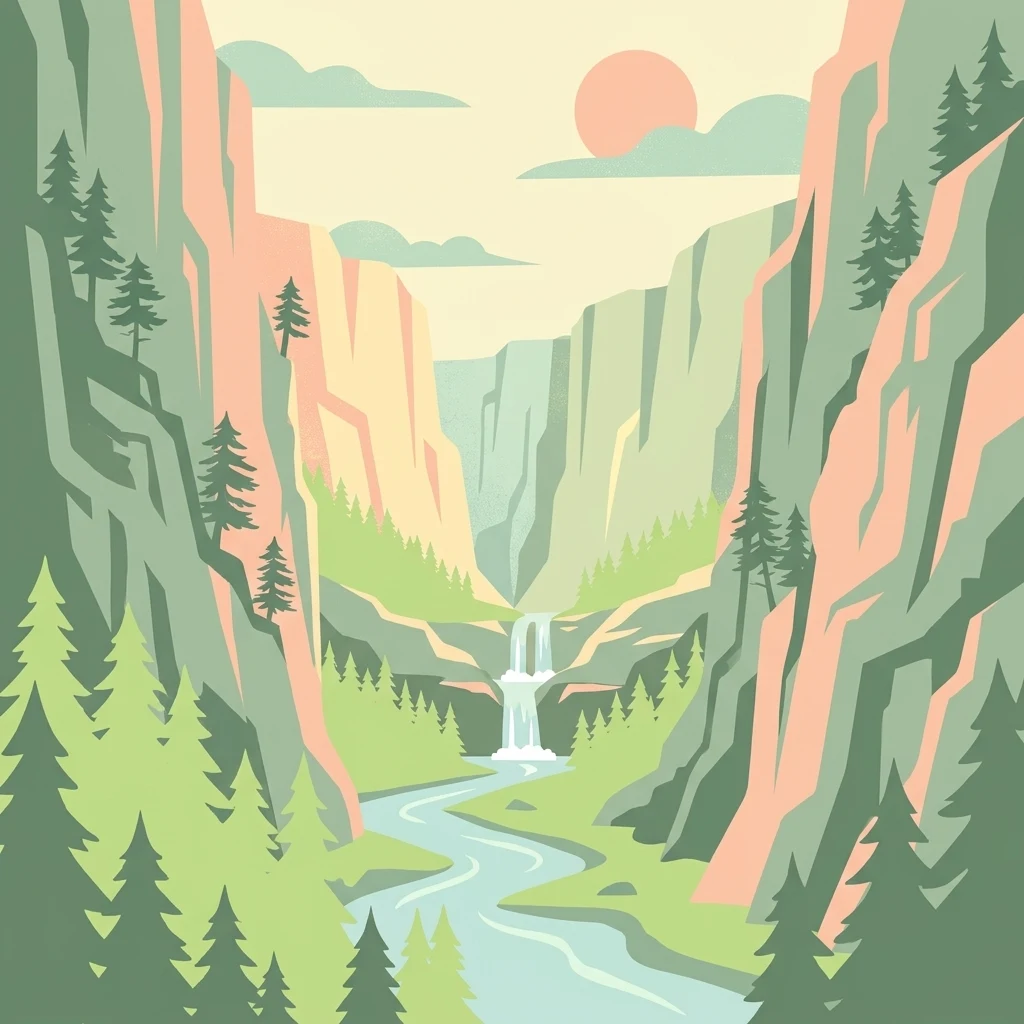
A flat-style vector illustration depicting a narrow canyon or gorge with steep cliff walls, pine trees clinging to the slopes, a small waterfall, and a winding river flowing through the center under a setting sun.

A long, narrow river gorge in western Crete, protected as one of Greece's earliest national parks.

Samaria National Park

Samaria National Park protects one of the longest and most dramatic gorges in Europe, cutting through the White Mountains of western Crete from the high Omalos plateau down to the Libyan Sea coast. The park was established in 1962 as one of Greece's earliest national parks and, alongside its surrounding buffer, was recognized by UNESCO as a biosphere reserve in 1981. The defining feature of the reserve is the Samaria Gorge itself, a roughly sixteen kilometer canyon carved through limestone and other rocks by tectonic movement and centuries of water erosion. Its walls rise several hundred meters in places, narrowing to a passage only a few meters wide at the famous Iron Gates. The gorge has been uninhabited since the small settlement of Samaria was depopulated in the 1960s, allowing its wild landscape and endemic species to recover in relative isolation. Beyond its scenic value, the park serves as a refuge for endemic Cretan flora, including at least fourteen plant species found nowhere else, and is the principal surviving habitat of the Cretan wild goat, known locally as the agrimi or kri-kri. As both a national park and a biosphere reserve, it represents an unusually direct blend of geological, ecological, and cultural significance on a single Mediterranean island.

Location
Greece
Park type
National park
Established
1962
Area
4.8 km²
Highest point
1,227 m
Samaria National Park Protected Landscape
Regional park map

See the ranked park cluster in its geographic setting

Nearby parks around Samaria National Park

This regional map shows the same 20 nearby parks ranked below around Samaria National Park. Select a ranked marker to highlight that park’s boundary where boundary data is available.
Reference park: Samaria National ParkRanked nearby park20 nearby parks shown
20 nearby parks

Distance-ranked collection and regional park geography for comparative environmental analysis

Parks and Protected Areas Geographically Near Samaria National Park

Geographic separation values and directional coordinates organize surrounding protected areas by linear proximity to Samaria National Park. Country context and recorded terrain characteristics establish structured comparison signals across neighboring conservation landscapes.
A soft watercolor illustration of green rolling hills and flat land against a pale, hazy background, representing a coastal island environment.
Nature reserveCrete
About 30 km away#1 closest

North

Agioi Theodoroi Nature Reserve: Protected Island Landscapes off the Coast of Crete

A vital wildlife sanctuary and historical island terrain

The nature reserve of Agioi Theodoroi comprises two small, rocky islands off the northwestern shore of Crete. Known for a long-established population of the rare kri-kri wild goat and breeding colonies of Eleonora's falcons, these islets maintain strict conservation status. Explore the mapped boundaries of this unique protected area and its significance within the coastal geography of the Chania region.

Area
0.697 km²
Established
1930
Relief
Upland
Climate
Mediterranean
Watercolor painting of a coastal landscape featuring green rolling hills, distant landmasses, and stylized shrubs and trees in the foreground against a white background.
Nature reserveCrete
About 39 km away#2 closest

West

Elafonisi Nature Reserve: Geography and Protected Landscape Analysis in Crete

Coastal dunes and limestone formations in southwestern Crete.

Elafonisi is a protected nature reserve situated in the southwestern reaches of Crete. This site encompasses a complex landscape of sand dunes, juniper-covered scrub, and rugged limestone terrain. By providing a clear look at the area, this atlas entry helps users understand the geographic setting, the ecological significance of the island, and the natural boundaries of this noteworthy Mediterranean conservation area.

Area
1.5 km²
Relief
Lowland
Climate
Mediterranean
Access
Easy access
A horizontal watercolor painting showing soft, rolling mountains and sparse desert-like shrubbery in shades of light green, pale pink, and yellow.
Biosphere reserveCrete
About 81 km away#3 closest

East

Psiloritis Natural Park: Protected Karstic Mountains and Cultural Landscapes in Crete

Geological exploration and regional mountain geography

Psiloritis Natural Park encompasses the central massif of Crete, featuring the famous Mount Ida range. Its protected territory serves as an essential site for understanding karstic geology, from deep underground cave systems to high-altitude steppes. The region perfectly highlights the intersection between large-scale tectonic history and the long-standing human traditions that shape the mountainous interior of the island.

Area
1,159 km²
Established
2001
Relief
Mountain
Climate
Mediterranean
A horizontal watercolor painting depicting a pale blue coastal landscape with low green vegetation in the foreground and soft mountainous ridges in the distance.
Protected areaLasithi
About 166 km away#4 closest

East

Chrysi Protected Area: Mapping the Juniper Forests and Beaches of Lasithi, Greece

A coastal island sanctuary in the Libyan Sea

Chrysi presents a distinct landscape characterized by a mature juniper forest and golden-sand beaches. Situated within the Lasithi regional unit, this island remains a primary example of a protected Mediterranean woodland environment, preserving a unique set of coastal terrain, shallow sea ecosystems, and archaeological history on a small geographic footprint.

Area
4.743 km²
Relief
Lowland
Climate
Mediterranean
Access
Easy access
A watercolor painting of a rolling mountainous landscape in Crete, featuring soft green hills, wildflowers, and pale mountain outlines against a light sky.
Biosphere reserveCrete
About 202 km away#5 closest

East

Sitia Nature Park: Geographic Atlas of Crete's Eastern Protected Mountain Landscapes

Mapping gorges, karst caves, and the eastern Cretan coastline.

Sitia Nature Park represents a vast protected territory across eastern Crete, characterized by its complex mountain spine and profound geological formations. This atlas entry provides geographic insights into the park's canyon systems, including the Valley of the Dead, and the karst caves that define its UNESCO Global Geopark status and regional natural terrain.

Established
2015
Relief
Mountain
Climate
Mediterranean
Access
Moderate access
A horizontal watercolor illustration showing soft, stylized green and pink layers representing rolling hills and distant land over a light foreground of scrubby vegetation.
Protected areaLasithi
About 202 km away#6 closest

East

Dionysades Protected Area: An Atlas Guide to the Islands of Northeastern Crete

Geography and protected island landscapes in Lasithi

The Dionysades archipelago comprises four rocky islets isolated in the shallow waters of the northeastern Cretan shelf. This protected area functions as a key seabird stronghold in the Aegean, characterized by its dramatic maritime silhouette, deep-water surroundings, and significant cultural history reaching back to classical antiquity.

Area
5.25 km²
Relief
Upland
Climate
Mediterranean
Access
Remote access
National parkCrete
About 209 km away#7 closest

East

Vai Aesthetic Forest National Park: Geographic and Protected Landscape Overview

Coastal palm woodland and regional Cretan geography

Investigate the landscape composition of Vai Aesthetic Forest, a protected national park in northeastern Crete. This site preserves a rare Mediterranean wetland ecosystem and a significant population of endemic date palms, offering deep insights into the region's geological and ecological heritage within the Sitia UNESCO Global Geopark framework.

Area
0.2 km²
Established
1985
Relief
Lowland
Climate
Mediterranean
National parkGreece
About 264 km away#8 closest

North

Sounio National Park: Protected Coastal Geography and Mediterranean Terrain in Greece

A rugged maritime landscape on the Attica headland

Sounio National Park occupies the dramatic southernmost tip of the Attica peninsula in Greece. The protected area features vertical limestone cliffs, scrub-covered coastal hills, and a strategic headland overlooking the Aegean. This atlas entry provides a detailed look at the park boundaries, surrounding maritime geography, and the unique integration of classical heritage sites within an exposed Mediterranean conservation zone.

Area
0.75 km²
Established
1974
Relief
Upland
Climate
Mediterranean
A horizontal watercolor painting showing a soft mountain landscape with green forests and a central light-colored area under a pale sky.
National parkGreece
About 323 km away#9 closest

North

Parc national du Parnès: Geographic Overview of the Attica Peninsula's Protected Massif

Explore the karst gorges, high-altitude fir forests, and protected red deer habitats

Parc national du Parnès dominates the northern skyline of Attica with a complex limestone massif featuring deep ravines like the Keladonas gorge. This atlas entry provides geographic insights into the park's summit network, karst features, and its critical role in Mediterranean forest resilience. Understand the rugged terrain and natural boundaries that define this essential protected area within Greece.

Area
38.16 km²
Established
1961
Relief
Mountain
Climate
Mediterranean
A watercolor painting showing a wide view of the Foloi plateau with rolling hills, a small grove of deciduous trees, and a winding stream, set against a pale background.
Protected areaElis
About 339 km away#10 closest

Northwest

Foloi Oak Forest Protected Area and Plateau Landscape in Elis, Greece

Deciduous mountain woodland and regional plateau geography

Examine the geographic profile of the Foloi Oak Forest, a rare seed-regenerated deciduous woodland spread across an elevated plateau in the Elis region. This protected landscape forms an essential ecological boundary in the western Peloponnese, featuring a dense canopy of Hungarian oak and deep gorges that define the surrounding mountain terrain and local drainage systems.

Area
42 km²
Relief
Upland
Climate
Mediterranean
Access
Moderate access
Wildlife reserveLibya
About 368 km away#11 closest

Southwest

Ain Elshakika Wetland: Protected Coastal Sabkha and Wildlife Habitat in Northern Libya

Coastal Mediterranean wetland and bird sanctuary

Ain Elshakika Wetland represents a distinctive coastal landscape in Libya, defined by its hypersaline salt flats and seasonal tidal connections. The reserve serves as a critical refuge for migratory waterbirds and features a rare ecological transition between saline mudflats and freshwater-fed vegetation zones, all integrated within the broader protected geography of the coastal Mediterranean.

Area
0.33 km²
Established
2000
Relief
Lowland
Climate
Mediterranean
National parkAydın Province
About 377 km away#12 closest

Northeast

Dilek Peninsula-Büyük Menderes Delta National Park: Protected Landscape and Geographic Context

Aydın Province's unique national park with diverse ecosystems.

Investigate Dilek Peninsula-Büyük Menderes Delta National Park, a key protected area in Turkey's Aydın Province. This page provides detailed geographic context, highlighting the park's remarkable coexistence of mountainous terrain and essential wetland habitats. Understand the mapped boundaries and landscape characteristics that define this significant national park.

Area
275.98 km²
Established
1966
IUCN
II
Visitors
700K annual
National parkLibya
About 379 km away#13 closest

Southwest

El-Kouf National Park: Protected Landscape Discovery within Libya's Geography

Explore the mapped natural terrain of this Libyan national park.

El-Kouf National Park serves as a significant protected area, offering a detailed look at its geographic identity within Libya and the wider North African region. This park detail page provides essential atlas-style context, highlighting its status as a national park and its contribution to the mapped protected landscapes. Users can explore its regional geographic placement and understand its unique natural terrain characteristics, serving as a vital point of discovery.

Area
350 km²
Established
1975
IUCN
II
Visitors
300K annual
A soft, watercolor painting of a mountain range in the distance, featuring a band of evergreen trees in the midground and a grassy foreground on a plain white background.
National parkGreece
About 381 km away#14 closest

North

Parc national du Mont Parnasse: Mapping the Limestone Massif and Alpine Geography of Greece

A protected national park blending karst geology and mountain ecosystems.

Parc national du Mont Parnasse stands as a prominent protected landscape in Central Greece, defined by its fractured limestone geology and subalpine forests. This national park serves as a vital ecological refuge that preserves karst terrain, sinkholes, and diverse Mediterranean mountain habitats rising toward steep alpine summits.

Relief
Mountain
Climate
Mediterranean
Scope
Terrestrial
Water
Minor water
Watercolor illustration of a mountain range with greenery and distant peaks under a light sky
Marine protected areaGreece
About 386 km away#15 closest

Northwest

National Marine Park of Zakynthos: Detailed Protected Marine Area & Geographic Context

Mapping Zakynthos's protected marine territory and regional geography

Investigate the National Marine Park of Zakynthos, a distinguished marine protected area situated in Greece. This dedicated page provides detailed insights into its protected landscape, focusing on its mapped geographic extent and its significance within the Mediterranean. Users can explore the specific boundaries of this protected marine territory and understand its place in the wider regional geography, enhancing atlas-based discovery of Greece's conservation areas.

IUCN
II
Scope
Marine
Water
Water-dominated
Watercolor illustration of a coastal landscape with hills, trees, and a body of water
Marine protected areaGreece
About 412 km away#16 closest

North

National Marine Park of Alonnisos Northern Sporades: Protected Marine Landscape and Aegean Geography

Explore Greece's largest marine protected area and its vital ecosystems.

Investigate the National Marine Park of Alonnisos Northern Sporades, an extensive marine protected area situated in the northern Aegean Sea. This protected landscape is internationally significant for its role in conserving the Mediterranean monk seal and for its healthy Posidonia oceanica seagrass meadows. Understanding this park's geographic scope and its protected marine terrain offers crucial insights into Mediterranean island ecosystems and conservation efforts within the region.

Area
2,260 km²
Established
1992
IUCN
II
Relief
Mixed relief
National parkMuğla Province
About 417 km away#17 closest

Northeast

Marmaris National Park: Mediterranean Forest Protected Landscape and Ancient Heritage

Discover its geography, mapped boundaries, and unique flora.

Marmaris National Park in Muğla Province offers a deep dive into a protected Mediterranean forest ecosystem and Carian history. Explore its rugged terrain, dramatic coastlines where pine forests meet the sea, and discover ancient sites like the Amos amphitheatre. This park is a key area for understanding regional geography, mapped natural landscapes, and the unique botanical diversity of Turkey's southwestern coast, supporting detailed atlas exploration.

Area
333.5 km²
Established
1996
IUCN
II
Visitors
8.5M annual
A watercolor painting showing a soft, atmospheric landscape with a pink-toned lagoon in the foreground, green hills in the midground, and a hazy purple mountain in the background.
National parkGrèce-Occidentale
About 421 km away#18 closest

Northwest

Parc national de Missolonghi-Etolikó: Coastal Lagoons and Limestone Geography

Protected wetlands and river delta landscapes in Western Greece

Tracing the interface of the Acheloos and Evinos river deltas with the Ionian Sea, this national park protects a mosaic of saltpans, reedbeds, and mountain massifs. Its mapped boundaries encompass the historic Missolonghi lagoon, the vertical limestone cliffs of Mount Varasova, and rare riverine woodlands, providing a detailed look at one of the most vital wetland complexes in the Mediterranean.

Area
360.73 km²
Established
2006
IUCN
VI
Protected areaAetolia-Acarnania
About 459 km away#19 closest

Northwest

Lake Amvrakia Protected Area: Atlas of a Tectonic Freshwater Basin in Aetolia-Acarnania

Mapped geography of a unique karstic semipolje in western Greece.

Lake Amvrakia is a distinct tectonic basin located in western Greece. This protected area represents a complex karstic landscape formed in Mesozoic limestone, supporting diverse birdlife and endemic species. The geography reveals a stark contrast between agricultural eastern shores and the preserved riparian zones of the west, marking it as a significant case of human-environment interaction in the region.

Area
13.6 km²
Relief
Lowland
Climate
Mediterranean
Access
Access unknown
Watercolor painting of a wide, rolling landscape with a forested horizon and distant mountains, rendered in soft, muted tones of pink, green, and gold on a white background.
Natural monumentLesvos
About 468 km away#20 closest

North

Lesvos Petrified Forest: Protected Volcanic Fossil Landscapes and Aegean Geological Atlas

Natural monument and ancient Miocene fossil forest zones in western Lesvos, Greece.

This protected natural monument preserves an early Miocene forest transformed into stone by volcanic activity. The landscape features fossilized coniferous trunks, including rare upright specimens, scattered throughout volcanic deposits and coastal andesite outcrops on the island of Lesvos. It serves as a vital reference for the geological history of the North Aegean region.

Area
150 km²
Established
1985
Relief
Upland
Climate
Subtropical
Distance methodology

Geographic measurements, not driving distances

How nearby park distances are calculated

Distances use park boundaries whenever the available geometry allows it. When one or both boundaries are missing, the mapped park locations provide a clearly labelled estimate. Every value represents straight-line geographic separation and does not use roads or routing.

Boundary distance

Calculated between the nearest points of both park boundaries.

Location-to-boundary estimate

Estimated from one mapped park location to the nearest boundary of the other park.

Mapped-location estimate

Estimated between the mapped locations of both parks.

MoriAtlas Explorer

Explore the Deep Geography and Protected Terrain of Samaria National Park

Continue discovering the natural landscape and environmental context of Samaria National Park through MoriAtlas. Examine how this gorge shapes the mountainous terrain of western Crete and supports a unique Mediterranean ecosystem across its protected boundaries.