Mori Atlas logo
Nearby park discovery

Geographic distribution and regional mapping of surrounding conservation zones

Protected Areas and Natural Landscapes Near 'Uruq Bani Ma'arid in Saudi Arabia

Discover the network of protected areas and natural environments situated in the vicinity of 'Uruq Bani Ma'arid. This view highlights the regional geography of the southern Saudi Arabian desert, mapping the spatial relationships between individual reserve boundaries and the broader arid terrain. Trace the distribution of surrounding conservation lands through a spatial lens focused on landscape connectivity and geographic proximity.

Related tags

UNESCO World Heritage SiteDesert ConservationWildlife ReintroductionArabian OryxRub' al Khali

Saudi Arabia's first natural World Heritage site protecting the edge of the Empty Quarter

'Uruq Bani Ma'arid

'Uruq Bani Ma'arid is a protected area in southern Saudi Arabia situated on the western edge of the Rub' al Khali, commonly known as the Empty Quarter, which is the largest contiguous sandy desert in the world. This vast protected region encompasses approximately 12,658 square kilometers of diverse desert terrain, including towering linear sand dunes that can reach heights of 150 meters, a dissected limestone plateau, gravel plains, wadis, and remnants of the Tuwaiq Escarpment. The reserve is strategically divided into three management zones: a core nature reserve where grazing is prohibited, a controlled grazing zone, and a hunting zone. The site holds exceptional significance as Saudi Arabia's first-ever natural World Heritage Site, successfully inscribed on the UNESCO World Heritage List in September 2023. Beyond its geological and ecological importance, the reserve has played a pivotal role in the conservation and recovery of endangered Arabian wildlife species. The protected area was specifically chosen for the reintroduction of the Arabian oryx, which had become extinct in the wild before a successful captive breeding program facilitated the return of herds to this desert landscape. The ecological character of 'Uruq Bani Ma'arid distinguishes it from typical desert perceptions, as the region supports a remarkable diversity of plant life that earns it recognition as an Important Plant Area. The corridors between dunes and the wadi systems support shrub communities, while the limestone escarpment and surrounding plains create distinct habitat mosaics that sustain both resident and migratory wildlife species.

Location
Saudi Arabia
Park type
Protected area
Area
12,765 km²
'Uruq Bani Ma'arid Protected Area
Regional park map

See the ranked park cluster in its geographic setting

Nearby parks around 'Uruq Bani Ma'arid

This regional map shows the same 20 nearby parks ranked below around 'Uruq Bani Ma'arid. Select a ranked marker to highlight that park’s boundary where boundary data is available.
Reference park: 'Uruq Bani Ma'aridRanked nearby park20 nearby parks shown
20 nearby parks

Ranked distance metrics and regional environmental comparisons across surrounding protected landscapes

Parks and Protected Areas Geographically Near 'Uruq Bani Ma'arid

Spatial proximity measurements establish a ranked collection of protected areas surrounding 'Uruq Bani Ma'arid based on direct geographic separation. Evaluating these neighboring locations alongside recorded environmental attributes provides structured insight into regional conservation patterns across the wider desert terrain.
Nature reserveRiyadh Province
About 460 km away#1 closest

North

Ibex Reserve Protected Area Nature Reserve: Mapped Boundaries and Regional Geography

Discover protected landscapes within Riyadh Province.

Ibex Reserve Protected Area stands as a key nature reserve, offering a distinct protected landscape within Saudi Arabia. This page delves into its precise geographic outlines and mapped terrain, providing essential context for understanding its place within Riyadh Province. Explore the atlas-level details of this protected area and its surrounding regional geography.

Area
2,369 km²
Established
1988
IUCN
II
Relief
Mixed relief
Protected areaSaudi Arabia
About 503 km away#2 closest

Northwest

Mahazat as-Sayd Protected Area: Saudi Arabia's Protected Area Identity and Geographic Setting

Explore the mapped boundaries and regional desert terrain.

Mahazat as-Sayd Protected Area serves as a focal point for understanding protected landscapes within Saudi Arabia. This page details its specific protected area designation, highlighting its place within the country's broader geography. Users can gain insights into the mapped extent and the natural terrain characteristic of this significant Saudi Arabian conservation landscape.

Area
2,200 km²
Relief
Lowland
Climate
Arid
Access
Highly restricted
Nature reserveSaudi Arabia
About 699 km away#3 closest

Northwest

Nafud al-'Urayq Natural Reserve: Saudi Arabia Nature Reserve with Arid Desert Landscape

Mapped protected area in the Najd region of Saudi Arabia.

Nafud al-'Urayq Natural Reserve is a significant protected desert wilderness in Saudi Arabia's central Najd region, spanning approximately 2,036 square kilometers. This nature reserve showcases characteristic Arabian Desert terrain, including sand sheets, dunes, and gravel plains, supporting specialized vegetation like Haloxylon salicornicum. Managed by the Saudi Wildlife Authority, it serves as a vital habitat and a key component of the Kingdom's conservation efforts, offering rich context for understanding desert ecosystems and protected landscapes.

Area
2,036.1 km²
Established
1995
IUCN
VI
Relief
Lowland
National parkEritrea
About 714 km away#4 closest

Southwest

Dahlak Marine National Park: Eritrea National Park Mapping and Protected Marine Landscape

Explore its Red Sea geography, coral ecosystems, and marine wildlife.

Delve into Dahlak Marine National Park, a premier protected marine area located off the coast of Eritrea. This national park preserves extensive coral reef formations, critical seabird nesting islands, and important mangrove zones within the Red Sea. It is renowned for supporting over 325 species of fish, providing sanctuary for nesting sea turtles, and being one of the few Red Sea locations where dugongs are found. The park's unique geography and marine biodiversity offer a compelling atlas-style exploration of protected landscapes in the Horn of Africa.

IUCN
II
Relief
Lowland
Access
Highly restricted
Scope
Marine
National parkSudan
About 752 km away#5 closest

West

Suakin Archipelago National Park: Sudan's Red Sea Marine Protected Area and Seabird Sanctuary

Explore the geography and mapped boundaries of this vital island ecosystem.

Suakin Archipelago National Park is a crucial protected area located in the Red Sea off Sudan's coast. This national park comprises a significant cluster of islets recognized for their abundant seabird nesting sites and as a critical habitat for marine fauna including sea turtles and dugongs. Its designation as an Important Bird Area underscores its international importance for coastal conservation, offering a distinct perspective on Sudan's natural geography and protected landscapes.

Area
1,500 km²
IUCN
II
Relief
Lowland
Climate
Arid
National parkEritrea
About 822 km away#6 closest

Southwest

Semenawi Bahri National Park: Eritrea's Highland Mountainous Protected Area

Explore the dramatic terrain and wildlife of Eritrea's highland national park.

Semenawi Bahri National Park represents a crucial protected landscape in Eritrea, characterized by its striking mountainous terrain. The park's elevation, ranging from 900 to 2400 meters, creates a distinctive highland environment with massive peaks and deep valleys. This unique geography supports a surprising diversity of wildlife, including species adapted to highland conditions, and makes it a compelling destination for exploring Eritrea's natural heritage through its mapped boundaries and regional context.

IUCN
II
Relief
Mountain
Access
Moderate access
Scope
Terrestrial
Nature reserveYemen
About 826 km away#7 closest

East

Hawf National Reserve: Protected Landscape and Mapped Nature Reserve in Yemen

Atlas exploration of Yemen's nature reserve geography.

Hawf National Reserve is a critical protected area within Yemen, recognized for its designation as a nature reserve. This detail page provides an atlas-driven perspective, focusing on the park's mapped boundaries, its unique landscape characteristics within the Arabian Peninsula, and its significance for protected area discovery. Understand the geographic context of Hawf National Reserve and its role in regional conservation through detailed map-based exploration.

Area
300 km²
IUCN
VI
Relief
Mountain
Climate
Tropical
Wildlife reserveQatar
About 876 km away#8 closest

Northeast

Al Wabra Wildlife Preservation Wildlife Reserve: Geographic Atlas and Landscape Context in Qatar

Mapped protected area for atlas discovery.

Delve into the specific geographic identity of Al Wabra Wildlife Preservation, a vital wildlife reserve located in Qatar. This dedicated page offers an atlas perspective on its mapped boundaries and its role within the broader landscape of the Arabian Peninsula. Understand the protected-area context and the unique natural geography that defines this significant Qatari conservation landscape, providing a foundation for structured geographic exploration.

Area
2.5 km²
Climate
Arid
Access
Highly restricted
Scope
Terrestrial
National parkTadjourah Region
About 893 km away#9 closest

South

Day Forest National Park: Ancient Juniper Woodland and Protected Landscape in Djibouti

Discover a rare East African forest refuge with unique endemic species.

Day Forest National Park represents a critical ecological island within Djibouti's predominantly semi-desert geography. As the nation's oldest national park, it protects the largest remaining East African juniper forest, a vital sanctuary for species found nowhere else on Earth. Located in the Goda Mountains of the Tadjourah Region, its existence relies on rare localized rainfall, creating a distinctive mountainous forest environment that offers profound insights into protected landscape dynamics and regional biodiversity.

Area
15 km²
Established
1939
IUCN
II
Relief
Mountain
Biosphere reserveUnited Arab Emirates
About 899 km away#10 closest

Northeast

Al Reem Biosphere Preserve: Protected Landscape Atlas and Geographic Context

Explore mapped boundaries and biosphere reserve status.

Gain a structured understanding of Al Reem Biosphere Preserve, a designated biosphere reserve located in the United Arab Emirates. This resource focuses on its geographic identity, mapped park boundaries, and the atlas-value of understanding protected landscapes. Explore the natural terrain context and its role as a significant conservation area within the UAE, providing essential data for geographic discovery.

Area
1,200 km²
Established
2005
Relief
Lowland
Climate
Arid
National parkEgypt
About 933 km away#11 closest

West

Gabal Elba National Park: Protected Landscape Geography in Egypt

Mapped terrain and regional context for this Egyptian national park.

Delve into the geographic identity of Gabal Elba National Park, a protected national park within Egypt. This resource supports atlas exploration by detailing its protected landscape, mapped boundaries, and how it fits into the broader regional geography. Understand the natural terrain and conservation significance of this distinct Egyptian protected area through detailed geographic information.

Area
35,600 km²
Established
1986
IUCN
II
Relief
Mountain
National parkDjibouti
About 946 km away#12 closest

Southwest

Yoboki National Park: Djibouti National Park Geographic Atlas Explorer

Discover its mapped boundaries and regional terrain.

Yoboki National Park is a key protected area within Djibouti, offering a distinct focus for geographic exploration. This entry provides structured information to understand the park's mapped landscape and its position within the Horn of Africa's regional geography. Delve into the park's protected land identity and terrain context, essential for atlas-based discovery and appreciating its natural features.

IUCN
II
Relief
Mixed relief
Climate
Arid
Scope
Terrestrial
National parkQatar
About 951 km away#13 closest

Northeast

Umm Tais National Park: A Protected National Park in Qatar for Geographic Exploration

Discover its mapped boundaries and regional landscape context.

Umm Tais National Park represents a key protected landscape entity within Qatar, serving as a focal point for understanding the nation's conservation efforts and regional geography. As a designated national park, it offers valuable context for atlas exploration, allowing users to trace its protected boundaries and appreciate its place within the natural terrain of the Arabian Peninsula. This page provides structured information to support discovery of the park's unique environmental identity and its contribution to Qatar's mapped protected areas.

Established
2006
Relief
Lowland
Scope
Mixed
Water
Major water bodies
Protected areaSaudi Arabia
About 993 km away#14 closest

Northwest

Jabal Aja Protected Area: Saudi Arabia's Protected Landscape Discovery

Mapped boundaries and regional natural terrain context.

Investigate Jabal Aja Protected Area as a significant protected landscape located in Saudi Arabia. This entry provides a foundation for exploring its mapped geographic extent and understanding its unique position within the broader atlas of protected areas. Gain insight into the natural terrain and regional context that define Jabal Aja Protected Area for those interested in the geography of the Arabian Peninsula.

Area
2,000 km²
Relief
Mountain
Climate
Arid
Scope
Terrestrial
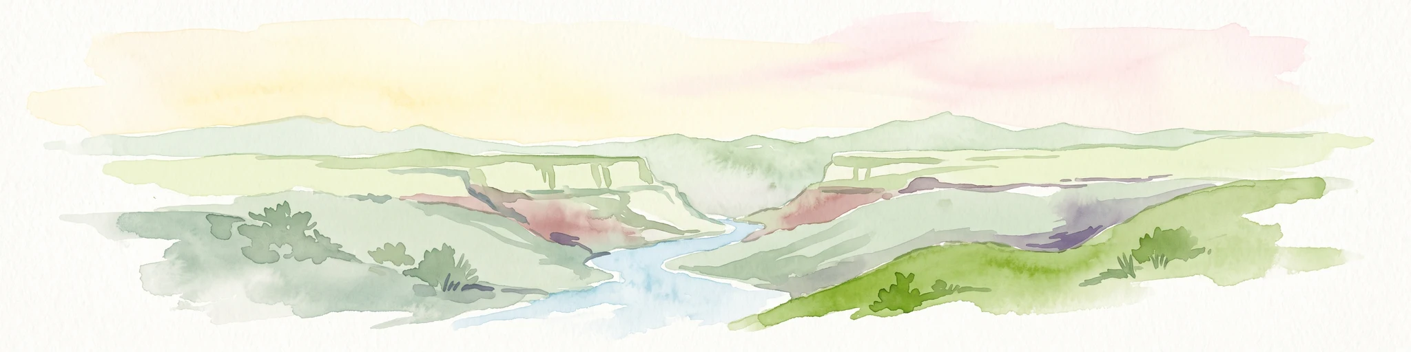
A watercolor painting showing a panoramic view of rolling hills and a winding valley in light, muted greens and earth tones.
Nature reserveDhofar Governorate
About 1,008 km away#15 closest

East

Jabal Samhan Nature Reserve: Mountain Geography and Protected Area Exploration

Rugged arid terrain in the Dhofar Governorate of southern Oman

Jabal Samhan Nature Reserve represents one of the most significant protected wilderness areas in Oman. Spanning vast escarpments and deep valleys, the reserve acts as a critical mountain habitat that supports a rare community of predators and prey. Explore the geographic boundaries and terrain features that define this remote stronghold within the Dhofar Mountains, a key anchor for conservation in the region.

Area
4,500 km²
Relief
Mountain
Water
Minor water
National parkAmhara Region
About 1,014 km away#16 closest

Southwest

Simien Mountains National Park: National Park Protected Landscape and Regional Geography

Explore Amhara Region's distinct mountain terrain and park boundaries.

Simien Mountains National Park serves as a key protected landscape within the Amhara Region of Ethiopia. This national park offers a distinct geographic identity, characterized by its unique terrain and mapped natural boundaries. Understanding this park provides valuable context for regional geography and the broader atlas of protected areas in northern Ethiopia.

Area
412 km²
Established
1969
IUCN
II
Visitors
26K annual
National parkAfar Region
About 1,026 km away#17 closest

Southwest

Yangudi Rassa National Park: Protected Semi-Desert National Park in Afar Region

Mapped landscape and dryland ecosystems.

Yangudi Rassa National Park represents a critical protected area within Ethiopia's Afar Region, covering extensive semi-desert and grassland terrains. The park's geography is marked by Mount Yangudi and the broad Rassa Plains, with the Awash River shaping its riverine forests and marshes. This national park offers a unique insight into dryland ecosystems and their conservation, providing a distinct mapped landscape for geographic study and exploration.

Area
4,731 km²
Established
1969
IUCN
II
Relief
Mixed relief
Nature reserveEastern Province
About 1,045 km away#18 closest

North

At-Taysiyah Natural Reserve: Saudi Arabia Nature Reserve, Eastern Province Protected Landscape

Mapped boundaries and regional geographic exploration.

At-Taysiyah Natural Reserve stands as a protected natural area within the Eastern Province of Saudi Arabia. This destination offers users an opportunity to explore its specific geographic features, mapped boundaries, and its role as a nature reserve. Dive into the regional context and understand the landscape character that defines this protected part of Eastern Province.

Area
4,272.2 km²
Established
1995
Relief
Lowland
Climate
Arid
National parkSomalia
About 1,055 km away#19 closest

South

Ga'an Libah National Park: A National Park's Protected Landscape and Geographic Context

Explore its mapped boundaries and regional geography.

Ga'an Libah National Park, designated as a national park, offers a distinct focus on its protected landscape and geographic identity. This resource details the mapped extent and regional context of the park, contributing to a structured understanding of its natural terrain and protected area significance. Users can explore its specific geography and atlas positioning without travel planning details.

National parkSomalia
About 1,162 km away#20 closest

Southeast

Ras Hafun National Park: Somalia's Protected Coastal Landscape and Geographic Atlas Entry

Explore mapped boundaries and regional natural landscapes.

Ras Hafun National Park serves as a focal point for understanding Somalia's protected natural areas and their geographic distribution. As a national park, it offers a distinct landscape entity to analyze within the atlas of the Horn of Africa. This MoriAtlas entry highlights the park's spatial definition and its significance as part of the country's conserved environments, providing essential context for regional geography and mapped terrain exploration.

Area
2,571 km²
Relief
Lowland
Climate
Arid
Access
Access unknown
Distance methodology

Geographic measurements, not driving distances

How nearby park distances are calculated

Distances use park boundaries whenever the available geometry allows it. When one or both boundaries are missing, the mapped park locations provide a clearly labelled estimate. Every value represents straight-line geographic separation and does not use roads or routing.

Boundary distance

Calculated between the nearest points of both park boundaries.

Location-to-boundary estimate

Estimated from one mapped park location to the nearest boundary of the other park.

Mapped-location estimate

Estimated between the mapped locations of both parks.

MoriAtlas Explorer

Continue Exploring 'Uruq Bani Ma'arid's Protected Landscape Geography

Deepen your understanding of 'Uruq Bani Ma'arid by examining its specific protected area attributes and geographic setting. This exploration supports a richer comprehension of its place within Saudi Arabia's mapped landscapes and the wider atlas. Continue to discover the detailed regional geography and mapped terrain that characterize this significant protected area.

Global natural geography