Mori Atlas logo
Countries

Browse the mapped distribution of protected landscapes across Mongolia's diverse natural terrain.

Mongolia National Parks and Protected Areas: A Geographic Atlas Explorer

Embark on a geographic exploration of Mongolia, a landlocked country renowned for its expansive steppe and Gobi Desert. This atlas provides a structured view of its national parks and protected areas, detailing their geographic scope and distribution across the vast Mongolian plateau. Understand the mapped boundaries and landscape context of protected lands, offering a unique perspective on the nation's natural heritage for atlas-based discovery.

Related tags

landlocked countryeast asiasteppenomadic culturemongol empire
About

Explore Mongolia's Vast Protected Landscapes, Mapping the Regional Spread of its Unique Steppe and Mountain Conservation Zones

Discover Mongolia's National Parks and Protected Areas: A Geographic Atlas of East Asia's Steppe Landscapes
Explore the national parks and protected areas of Mongolia, charting their geographic distribution across the vast steppe, Gobi desert, and Altai mountain regions. Use Mongolia's park atlas to discover regional conservation efforts and compare diverse protected landscapes, offering a direct entry point to individual park details.

Mongolia is a landlocked sovereign state in East Asia, known for its vast steppe landscapes, nomadic culture, and historical significance as the heartland of the Mongol Empire founded by Genghis Khan in 1206. The country has a population of approximately 3.5 million people and is the world's most sparsely populated sovereign state. Ulaanbaatar is the capital and largest city, home to roughly half the population.

Mongolia is a landlocked country in East Asia, situated on the Mongolian Plateau. Historically, it was the seat of the Mongol Empire founded by Genghis Khan in 1206, which became the largest contiguous land empire in history. After centuries of imperial rule and Qing dynasty control, Mongolia declared independence in 1911 and became the Mongolian People's Republic in 1924. The country transitioned to a multi-party system and market economy following the democratic revolution of 1990. Today, Mongolia is known for its nomadic traditions, horse culture, and preserved Buddhist heritage.

Largest city:Ulaanbaatar
Currency code:MNT
ISO code:MN
Parks count
6
Capital
Ulaanbaatar
Area
1,564,120 km²
Population
3,504,741 (2,023)

Coastal
Island
Mountainous
Landlocked
Park atlas6 parks

Browse Mongolia's diverse protected landscapes, mapping park geography across the Gobi Desert and Altai Mountains.

National Parks in Mongolia: Explore vast Steppe Protected Areas and Alpine Landscapes
Browse Mongolia's national parks and protected areas, covering vast steppe ecosystems, Gobi Desert terrain, and alpine mountain ranges like the Altai. Navigate detailed park geography to understand their distribution and conservation significance across this expansive East Asian country for comprehensive atlas discovery.
National parkZavkhan Province

Tarvagatai Nuruu National Park: Zavkhan Province Protected Landscape Atlas

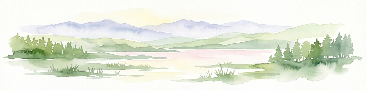
Unique steppe-to-forest transition and mountainous terrain.

Tarvagatai Nuruu National Park represents a critical protected area within Mongolia's Zavkhan Province, noted for its expansive mountainous terrain and significant ecological diversity. The park's landscape is defined by the Tarvagatai Range, featuring flat-topped ridges, glacial valleys, and dramatic elevation changes. It masterfully showcases the transition from semi-arid steppe to dense coniferous forests, highlighting a visually striking ecological boundary anchored by the prominence of Mount Otgontenger, the highest peak in the Khangai Mountains.

Area
5,467 km²
Established
2000
IUCN
II
Relief
Mountain
National parkKhentii Province

Onon-Balj National Park: A Protected River Valley in Mongolia's Khentii Province

Explore unique geography and diverse ecosystems at a steppe-forest transition.

Onon-Balj National Park safeguards a critical river valley area in Khentii Province, Mongolia, marking an important ecological transition zone between Siberian forests and the Daurian steppe. Discover the park's mapped landscape, characterized by mid-sized mountains and riparian habitats along the Onon and Balj rivers. This protected area offers insights into regional geography, biodiversity, and the unique natural heritage of northern Mongolia.

Area
4,158 km²
Established
2000
IUCN
II
Relief
Mountain
National parkKhovd Province

Bulgan Gol-Ikh Ongog National Park: Khovd Province's Vital Riparian Protected Landscape

Mapped geography of river valley, wetlands, and desert steppe.

Bulgan Gol-Ikh Ongog National Park is a designated national park situated in the Khovd Province of western Mongolia, focusing on the preservation of the Bulgan River valley. This protected landscape features a distinctive desert steppe environment interwoven with extensive riparian wetlands, islands, and river channels. The park is ecologically significant as a crucial migratory bird stopover point, supporting diverse habitats that highlight the transition from mountainous sources to the flatter valley floor, offering unique atlas-level geographic insight.

Area
2,461 km²
Established
2011
IUCN
II
Relief
Lowland
National parkBayan-Ölgii Province

Munkhkhairkhan National Park: Alpine Glacial Landscape & Protected Area

Explore the mapped geography of western Mongolia's high peaks.

Munkhkhairkhan National Park protects the dramatic alpine environment surrounding Mönkhkhairkhan Mountain, Mongolia's second-highest peak. This national park showcases spectacular glacial valleys and steep, rock-strewn slopes characteristic of the Mongol-Altai Mountains. As a key protected landscape in Bayan-Ölgii Province, it offers a distinct view into Mongolia's high-elevation ecosystems and their unique mapped boundaries for atlas exploration.

Area
5,061 km²
Established
2011
IUCN
II
Relief
Mountain
National parkMongolia

Khangai Nuruu National Park: Discover Mongolia's Protected Mountain Landscape and Atlas Context

Explore mapped boundaries and diverse ecosystems across its terrain.

Khangai Nuruu National Park stands as a vast national park in central Mongolia, characterized by its diverse protected landscapes and significant geographic scope. Spanning the Khangai Mountains, it presents a remarkable ecological transition from alpine meadows and taiga forests to steppe and riparian environments. This park offers a rich atlas exploration opportunity, highlighting its mapped boundaries and the unique regional geography that defines its protected status, making it a key point of discovery for understanding Mongolian conservation areas.

Area
8,885 km²
Established
1996
IUCN
II
National parkMongolia

Khustain Nuruu National Park: Mongolia's Steppe Wilderness & Przewalski's Horse Conservation Area

Explore its mapped protected landscape and regional geography.

Khustain Nuruu National Park is a protected area in Mongolia celebrated for its pivotal role in the conservation and reintroduction of the Przewalski's horse, the last truly wild horse species. This national park preserves the unique steppe terrain and rolling hills characteristic of the Mongolian Plateau, serving as a crucial habitat for native wildlife. Understanding Khustain Nuruu National Park provides a focused look into successful wildlife recovery efforts and the geographic context of Central Asian protected lands.

Established
1993
IUCN
II
Landscape and environment

Understand how Mongolia is shaped by terrain, ecosystems, and seasonal conditions

Mongolia geography, nature, climate, and landscape context for park-focused travel research
Explore the physical geography, natural setting, and climate patterns of Mongolia through a location-first overview built for travel research, national park discovery, and broader regional context. This section helps explain how landscapes, habitats, and environmental conditions shape what people search for, where they travel, and how they experience protected areas in Mongolia.

Mongolia geography and landscape

Mongolia is located in East Asia, landlocked between Russia to the north and China to the south. The country occupies the Mongolian Plateau and features diverse terrain including grassy steppe, mountains in the north and west, and the Gobi Desert in the south. It covers 1,564,116 km2, making it the second largest landlocked country in the world.

Mongolia nature and environment

Mongolia's natural environment features extensive grassy steppe covering much of the country, with mountain ranges in the north and west, and the Gobi Desert dominating the southern regions. The landscape supports nomadic pastoralism and diverse wildlife across its varied ecosystems.

Mongolia climate and seasonal conditions

Mongolia experiences a continental climate with extreme temperature variations between summer and winter, characterized by low precipitation and cold, harsh winters.

Explore this place

Related topics and popular queries

Ways to explore Mongolia
Useful phrases, related topics, and discovery prompts connected to Mongolia.
where is mongoliawhat is mongolia known formongolia geography and climateeast asia landlocked countriesmongolian plateaucapital of mongoliamongolia population densitymongolia countryeast asia landlockedgobi desertulaanbaatar capitalmongol empire historynomadic mongoliasteppe landscape
Park map

Visualize the distribution and mapped geography of Mongolia's protected areas, from steppe ecosystems to mountain ranges.

Mongolia National Parks Map: Explore Protected Areas and Vast Steppe Geography
Browse the national parks and protected areas of Mongolia, exploring their locations across the country's vast steppe, Gobi Desert, and Khangai Mountains. Explore the full country map to understand the regional context and spatial relationships of these crucial conservation landscapes, tracing their geographic spread.

Gain insight into the mapped geography and protected-area distribution of Mongolia's national parks.

Frequently Asked Questions About National Parks and Protected Areas in Mongolia
Discover essential information about national parks and protected areas throughout Mongolia, from the Gobi Desert to the Altai Mountains. These common questions provide valuable context for understanding Mongolia's conservation efforts, diverse ecosystems, and the overall spread of its protected landscapes, aiding in atlas-style geographic exploration.
Other countries

Explore Broader East Asian and Central Asian Protected Landscapes, Tracing Geographic Connections Beyond Mongolia's Steppe

Discover Nearby Countries with National Parks and Protected Areas from Mongolia
Continue your national park exploration by browsing other countries in the broader East Asian and Central Asian regions, identifying their unique protected areas and conservation landscapes. Expanding beyond Mongolia provides valuable comparative geographic context for mapping diverse ecosystems and understanding regional park distribution across the MoriAtlas.

Russia: National Parks and Protected Areas Atlas for Geographic Exploration

Investigate Russia's extensive network of national parks and protected areas through a structured geographic lens. This atlas entry point allows for detailed exploration of mapped landscapes and conservation zones, highlighting their regional context and distribution across the vast Russian Federation. Understand the breadth of protected natural territories from a country-wide perspective, facilitating deeper geographic discovery.

65 parks

Kazakhstan National Parks and Protected Areas: Browse Mapped Landscapes and Geography

Delve into the geographic richness of Kazakhstan with this structured atlas entry. Discover the mapped distribution of national parks and protected areas across the country, gaining insight into the diverse natural terrain and conservation landscapes. This resource facilitates a clear understanding of regional park geography, enabling navigation to detailed information about Kazakhstan's significant protected territories.

15 parks

China

7 parks

Bhutan's National Parks and Protected Areas: Mapped Geographic Overview

Bhutan's commitment to conservation is reflected in its network of national parks and protected areas, nestled within the dramatic Himalayan geography. This destination offers an atlas-style view of these significant natural landscapes, highlighting their geographic distribution and mapped boundaries. Users can navigate this structured data to understand the regional context of protected lands across the Kingdom of Bhutan.

6 parks

National Parks and Protected Areas of Kyrgyzstan: Mapped Geographic Explorer

Access a structured geographic overview of Kyrgyzstan's national parks and protected areas. Understand the distribution of these vital conservation landscapes across the country's dramatic mountain terrain. This atlas-style resource helps you explore the natural boundaries and regional context of protected areas within Kyrgyzstan, offering a clear entry point for geographic discovery.

5 parks

Explore Protected Natural Landscapes of Bangladesh: National Parks and Reserves

Navigate the geography of Bangladesh through its network of national parks and protected areas. This resource provides a structured approach to understanding the distribution of conservation landscapes, their mapped boundaries, and the regional context of their natural terrain. Discover the unique geographic features that define Bangladesh's protected lands, from the Sundarbans mangroves to the Chittagong Hill Tracts, offering a foundation for detailed exploration.

4 parks

South Korea

3 parks

Nepal National Parks and Protected Areas: Geographic Atlas Overview

Access a structured atlas of Nepal's national parks and protected areas, focusing on their geographic scope and distribution. This resource facilitates understanding the country's varied natural terrain, from alpine ecosystems to mountainous protected areas. Discover the mapped boundaries of conservation landscapes, providing a clear geographic context for each protected region within Nepal.

3 parks
MoriAtlas Explorer

Continue Your Global Geographic Exploration with MoriAtlas Park Discovery

Dive deeper into the world's protected landscapes and national parks through MoriAtlas's structured atlas interface. Discover how continents and countries are organized, and how individual park geography fits into the broader map. Our platform is built for understanding the distribution and context of protected areas worldwide, facilitating your journey through global natural geography.

Global natural geography