Mori Atlas logo
Countries

Discover the mapped distribution of protected lands and natural landscapes across Mozambique.

Mozambique National Parks and Protected Areas: A Geographic Atlas Explorer

Delve into the geographic landscape of Mozambique, a nation offering a rich tapestry of protected areas and national parks. This atlas entry point provides a structured overview of the country's conservation landscapes, enabling users to explore their distribution, boundaries, and regional context across Southeast Africa. Navigate through mapped natural terrain and understand where Mozambique's significant protected lands are situated for comprehensive geographic discovery.

Related tags

southeast africacountrycoastal countryportuguese-speakingformer portuguese colony
About

Explore the Mapped Geography and Regional Spread of Mozambique's Extensive Protected Landscapes

Discover Mozambique's National Parks and Protected Areas: An Atlas of Southeast African Conservation Landscapes
Browse a comprehensive atlas of Mozambique's national parks and diverse protected areas, spanning its expansive Indian Ocean coastline and inland regions of Southeast Africa. Utilize this country-level overview to understand the geographic distribution of conservation landscapes and navigate detailed information for each park entity.

Mozambique is a sovereign state in Southeast Africa spanning approximately 801,590 km² along the Indian Ocean. It borders Tanzania, Malawi, Zambia, Zimbabwe, Eswatini, and South Africa. The country gained independence in 1975 after Portuguese colonial rule and experienced a civil war from 1977 to 1992. Today it operates as a semi-presidential republic with a population of approximately 35 million people.

Mozambique is a large East African nation with a rich colonial and pre-colonial history. The region saw the development of Swahili port towns between the 7th and 11th centuries, followed by Portuguese colonization beginning in 1505. After independence in 1975, the country went through a turbulent period including a civil war that lasted until 1992. The country possesses significant natural resources including fisheries, minerals, and arable land. Despite economic growth since the early 2000s, Mozambique remains one of the poorest countries globally with low GDP per capita and human development indicators.

Largest city:Maputo
Currency code:MZN
ISO code:MZ
Parks count
6
Capital
Maputo
Area
801,590 km²
Population
34,881,007 (2,024)

Coastal
Island
Mountainous
Landlocked
Park atlas6 parks

An atlas of Mozambique's protected landscapes, from northern archipelagos to southern transfrontier conservation areas.

National Parks in Mozambique: Mapped Protected Areas and Coastal Wilderness for Discovery
Browse a detailed list of national parks and significant protected areas found across Mozambique, including coastal reserves like Quirimbas and vast inland wilderness such as Niassa Reserve. Utilize this structured geographic view to map their distribution, compare distinct conservation landscapes, and navigate deeper into each park's unique features and regional context.
National parkMozambique

Gorongosa National Park: Mozambique National Park with Diverse Rift Valley Ecosystems

Mapped protected area, savanna, and montane rainforest landscapes.

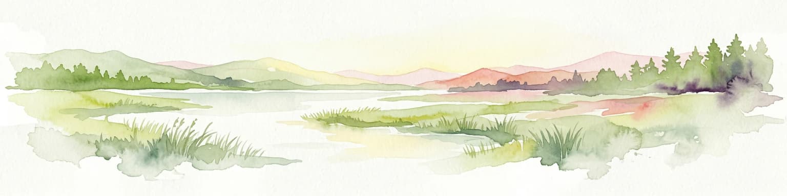
Gorongosa National Park is a premier protected area situated in Mozambique's Great African Rift Valley. This vast national park showcases an extraordinary range of natural landscapes, including extensive floodplains, acacia savannas, and rare montane rainforests within dramatic limestone gorges. Its geographic diversity is matched by its compelling narrative of ecological restoration, making it a significant site for understanding protected land dynamics and regional geography.

Area
3,770 km²
Established
1960
IUCN
II
Relief
Mixed relief
National parkMozambique

Limpopo National Park: Mozambique's Savanna Ecosystem and Protected Landscape

Explore its mapped boundaries and transfrontier park significance.

Limpopo National Park is a protected national park in Mozambique, distinguished by its savanna ecosystem and its critical role as the eastern segment of the Great Limpopo Transfrontier Park. This page offers an atlas-driven exploration of its geographic scope, mapped protected area boundaries, and its function as a key wildlife migration corridor, providing essential context for understanding this significant conservation landscape.

Area
10,000 km²
IUCN
II
Nature reserveMozambique

Niassa Reserve Nature Reserve: Mozambique's Expansive Protected Wilderness

Mapping the vast miombo woodlands and endemic species.

Niassa Reserve, a sprawling nature reserve in northern Mozambique, represents one of the largest miombo woodland ecosystems on Earth. Its diverse terrain encompasses dense forests, open savannahs, and riparian zones, making it a vital habitat for unique wildlife and a significant landmark in regional geography. The reserve's protected status and immense scale offer unparalleled opportunities for atlas-style exploration of its landscape and conservation importance.

Area
42,000 km²
Established
1954
IUCN
IV
Relief
Mixed relief
National parkMozambique

Zinave National Park: A Mozambique National Park with Diverse Woodland and Savanna Landscapes

Explore its mapped terrain, riverine forests, and savanna ecosystems.

Zinave National Park in Mozambique is a significant protected area spanning 4,000 square kilometers. Its landscape comprises a rich variety of ecosystems, including miombo woodlands, mopane-dominated areas, acacia savannas, and distinct riverine forests along the Save River. This national park is strategically positioned within the Greater Limpopo Transfrontier Park, highlighting its importance for regional wildlife corridors and conservation geography. The terrain offers a unique insight into the transitional ecological zones of southern Africa, showcasing diverse natural habitats and mapping potential for its protected boundaries.

Area
4,000 km²
Established
1973
IUCN
II
Relief
Lowland
National parkCabo Delgado Province

Quirimbas National Park: Coastal Protected Landscape and Island Archipelago Atlas

Discover marine conservation and inselberg terrain in Cabo Delgado.

Quirimbas National Park, located in Cabo Delgado Province, Mozambique, is a key protected area defined by its exceptional combination of marine and terrestrial environments. The park's geography includes eleven islands, extensive mangrove forests, and vibrant coral reefs, alongside a mainland characterized by striking inselberg formations. This national park is a vital site for understanding coastal landscape diversity, marine ecosystems, and protected-area geography within East Africa.

Area
1,430 km²
Established
1971
IUCN
II
National parkManica Province

Chimanimani National Park: Map of Mozambique's Highest Mountain Landscape

Explore protected highland terrain and transfrontier conservation geography.

Chimanimani National Park stands as a vital protected area in Mozambique's Manica Province, celebrated for its rugged mountain landscape and the presence of Monte Binga, the country's highest point. As the Mozambican portion of the Chimanimani Transfrontier Park, it offers critical insights into cross-border conservation efforts and the preservation of unique montane ecosystems. Discover the park's geographic context, its elevation extremes, and the significance of its protected boundaries within the regional atlas.

Area
656 km²
Established
2020
IUCN
II
Relief
Mountain
Landscape and environment

Understand how Mozambique is shaped by terrain, ecosystems, and seasonal conditions

Mozambique geography, nature, climate, and landscape context for park-focused travel research
Explore the physical geography, natural setting, and climate patterns of Mozambique through a location-first overview built for travel research, national park discovery, and broader regional context. This section helps explain how landscapes, habitats, and environmental conditions shape what people search for, where they travel, and how they experience protected areas in Mozambique.

Mozambique geography and landscape

Mozambique occupies a coastal position along the Indian Ocean in southeastern Africa. The country shares borders with Tanzania to the north, Malawi and Zambia to the northwest, Zimbabwe to the west, and Eswatini and South Africa to the southwest. The terrain ranges from coastal plains to highlands in the west. The Mozambique Channel separates the country from Madagascar, Comoros, and Mayotte to the east.

Mozambique nature and environment

Mozambique features diverse ecosystems including coastal mangroves, savanna grasslands, and forest areas. The coastline supports significant marine biodiversity and fishing industries. The country has several protected areas and wildlife populations including elephants, crocodiles, and various bird species.

Mozambique climate and seasonal conditions

Mozambique has a tropical climate with a wet season from November to March and dry season from April to October. Coastal areas experience higher humidity while inland regions show more variation between wet and dry conditions.

Explore this place

Related topics and popular queries

Ways to explore Mozambique
Useful phrases, related topics, and discovery prompts connected to Mozambique.
where is mozambique locatedwhat is the capital of mozambiquemozambique population and areamozambique neighbors and bordersmozambique history independencemozambique official languagemozambique currency meticalmozambique countrysoutheast africa nationmaputo capitalmozambique geographymozambique independence 1975mozambique populationmozambique bordersindian ocean coastmozambique economymozambique languages
Park map

Visualize the distribution of Mozambique's key protected landscapes, from coastal reserves to inland conservation areas, with a detailed geographic overview.

Mozambique National Parks Map: Trace Protected Areas Across Southeast Africa
Preview the mapped geography of national parks and other protected areas across Mozambique, understanding their locations relative to the Indian Ocean coast and neighboring countries. Explore the spatial arrangement of significant conservation landscapes within this Southeast African nation, gaining geographic context before deeper atlas exploration.

Understanding Mozambique's Park Geography, Protected Landscape Distribution, and Regional Conservation Context

Frequently Asked Questions About National Parks and Protected Areas in Mozambique
Explore essential details about the national parks and protected areas across Mozambique, from its Indian Ocean coastline to its interior Miombo woodlands. These frequently asked questions offer a geographic lens to understand conservation efforts, park distribution, and the unique natural landscapes found within this southeast African nation.
Other countries

Compare protected area geography, conservation landscapes, and regional park networks surrounding Mozambique.

Discover National Parks in Countries Near Mozambique and Across Southeast Africa
Explore national parks and protected areas in neighboring countries like Tanzania, South Africa, and Zimbabwe, expanding your understanding of Southeast African conservation landscapes. This atlas view allows you to trace shared ecological zones, compare distinct park management approaches, and deepen your regional geographic context beyond Mozambique's borders.

Zambia National Parks and Protected Areas: Mapped Landscapes and Geographic Context

Delve into the geography of Zambia with this comprehensive atlas of its national parks and protected areas. Understand the spatial relationships between diverse landscapes, from floodplains to woodlands, and how conservation efforts are mapped across the country. This resource provides essential context for exploring the natural terrain and protected regions of this Southern Africa nation, offering a foundation for detailed geographic discovery.

11 parks

Madagascar National Parks and Protected Areas Atlas: Geographic Distribution and Landscape Context

Delve into the geography of Madagascar's protected areas and national parks. This section offers an atlas-style view of the island's conservation landscapes, highlighting their distribution and natural context. Understand how Madagascar's unique biodiversity is represented across its mapped regions and protected territories, providing a foundation for broader geographic exploration.

7 parks

Botswana National Parks and Protected Areas: Mapped Geographic Discovery

Botswana's protected areas represent significant natural landscapes, from vast desert wildernesses to critical conservation zones. This atlas entry provides a geographic overview, highlighting the mapped distribution of national parks and transfrontier conservation areas. Understand the regional context of Botswana's protected lands and prepare for detailed exploration of its diverse natural terrain.

5 parks

Zimbabwe National Parks and Protected Areas Atlas: Geographic Discovery

Navigate Zimbabwe's significant national parks and protected areas through a detailed geographic lens. This atlas entry provides context on the distribution of protected lands, showcasing the varied natural terrain and conservation landscapes across the nation. It serves as a foundational resource for understanding the country's protected area network and planning further map-based discovery.

4 parks

Explore National Parks and Protected Areas in Malawi: A Geographic Atlas

Delve into the structured geographic data for Malawi's national parks and protected areas. This atlas provides clear insights into the mapped boundaries and regional spread of conservation lands, highlighting the country's unique natural terrain. Understand the distribution of protected sites and enhance your geographic comprehension of Malawi's conservation efforts and diverse landscapes.

3 parks

Comoros National Parks and Protected Areas Geographic Atlas and Map Explorer

Access a structured overview of national parks and protected natural areas within Comoros. This atlas entry details the geographic spread and landscape context of conservation lands across the islands, aiding in the discovery of volcanic island environments and Indian Ocean marine protected areas. Understand how each protected area fits into the broader regional geography of this unique nation.

3 parks

Lesotho

3 parks

Eswatini National Parks and Protected Areas: Mapped Landscape Exploration

Navigate Eswatini's protected lands with this atlas-focused guide. Understand the geographic spread and mapped boundaries of national parks and conservation areas, providing a solid foundation for exploring the country's natural regions and landscapes. This is your starting point for a structured exploration of Eswatini's diverse geography.

1 park
MoriAtlas Explorer

Continue Your Global Geographic Exploration with MoriAtlas Park Discovery

Dive deeper into the world's protected landscapes and national parks through MoriAtlas's structured atlas interface. Discover how continents and countries are organized, and how individual park geography fits into the broader map. Our platform is built for understanding the distribution and context of protected areas worldwide, facilitating your journey through global natural geography.

Global natural geography