Mori Atlas logo
Nearby park discovery

Mapping the surrounding natural terrain and protected island environments of coastal New South Wales

Regional Protected Landscapes and Geographic Areas Near Cabbage Tree Island John Gould Nature Reserve

Trace the geographic distribution of protected sites and wilderness areas situated in the vicinity of Cabbage Tree Island, John Gould Nature Reserve. This regional survey illustrates how local coastal formations and nature reserves align across the broader landscape of New South Wales, providing a clear perspective on the spatial relationship between individual protected habitats.

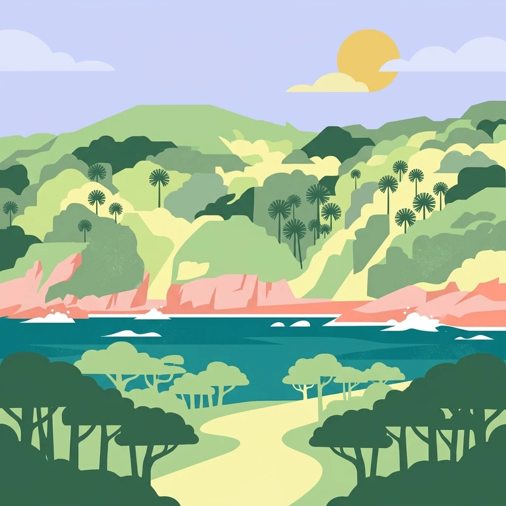
A flat-style digital illustration of Cabbage Tree Island showing a path leading through forest towards a coastal bay with hilly terrain and palms in the background under a sunny sky.

A small offshore island nature reserve protecting one of Australia's rarest seabird colonies.

Cabbage Tree Island (John Gould Nature Reserve)

Cabbage Tree Island, also known as the John Gould Nature Reserve, is a small uninhabited continental island lying roughly 1.4 kilometres off the mouth of Port Stephens on the New South Wales coast of Australia. The island is about one kilometre long and rises abruptly to a rocky ridge, supporting a distinctive vegetation community dominated by cabbage-tree palms and a mix of hardy coastal trees. The reserve is most widely known for its role in the conservation of Gould's petrel, a rare seabird whose main breeding population once faced serious decline due to introduced rabbits, habitat degradation, and predation. Active management since the early 1990s has transformed the island from a fragile remnant colony into one of the most important seabird recovery sites in eastern Australia. Together with neighbouring Boondelbah Island, Cabbage Tree Island is protected as an IUCN Category IV habitat and species management area, with access restricted to scientific and conservation purposes only. Its combination of rugged island geography, specialised vegetation, and globally significant seabird breeding habitat gives it a strong place in Australian offshore island conservation.

Location
Australia
Park type
Nature reserve
Area
0.3 km²
Highest point
123 m
Cabbage Tree Island (John Gould Nature Reserve) Atlas
Regional park map

See the ranked park cluster in its geographic setting

Nearby parks around Cabbage Tree Island (John Gould Nature Reserve)

This regional map shows the same 20 nearby parks ranked below around Cabbage Tree Island (John Gould Nature Reserve). Select a ranked marker to highlight that park’s boundary where boundary data is available.
Reference park: Cabbage Tree Island (John Gould Nature Reserve)Ranked nearby park20 nearby parks shown
20 nearby parks

Distance-ranked collection of surrounding protected landscapes and regional coastal geography

Parks and Protected Areas Geographically Near Cabbage Tree Island (John Gould Nature Reserve)

Explore a distance-ranked collection of protected areas situated geographically near Cabbage Tree Island (John Gould Nature Reserve). Evaluating these surrounding locations provides structured comparison signals across regional park geography, conservation status, and recorded environmental traits.
National parkNew South Wales
About 2.9 km away#1 closest

Northeast

Myall Lakes National Park National Park: Mapped Boundaries and Protected Landscape Exploration

Discover its regional geography and natural terrain context.

Delve into the specific protected landscape and geographic features of Myall Lakes National Park. As a national park located in New South Wales, it provides critical atlas context for understanding protected areas and their distribution. Explore its mapped terrain and boundaries to gain a deeper appreciation for this significant natural area within Australia's geography.

Area
448 km²
Established
1972
IUCN
II
Relief
Lowland
A soft, watercolor painting of a green, rolling island landscape with misty hills under a pale, warm sky.
Nature reserveNew South Wales
About 3.7 km away#2 closest

South

Boondelbah Island Nature Reserve: Geography and Coastal Conservation Profile

A rugged island reserve within the New South Wales coastal landscape

Discover the physical terrain and protected-area status of Boondelbah Island, located off the coast of New South Wales. This reserve features sheer cliffs and coastal shrubland, serving as a vital, highly controlled sanctuary for threatened seabird breeding programmes. Its geographic placement and restricted status make it a foundational element in regional conservation, highlighting the importance of protected marine-adjacent landscapes.

Area
0.14 km²
IUCN
Ia
Relief
Lowland
Climate
Subtropical
National parkNew South Wales
About 5.5 km away#3 closest

Southwest

Tomaree National Park: New South Wales National Park with Defined Protected Boundaries

Explore its mapped geography and regional landscape context.

Tomaree National Park represents a significant protected landscape within New South Wales, Australia. This national park entry focuses on its distinct geographic features and mapped boundaries, offering a clear point of reference for atlas-based exploration. Understand its place in the regional geography of New South Wales and its identity as a conserved natural area. The detailed mapping and contextual data provide a solid foundation for appreciating this protected landscape.

Area
23.18 km²
Established
1984
IUCN
II
Relief
Lowland
National parkNew South Wales
About 40 km away#4 closest

Northeast

Wallingat National Park: Explore Protected Landscape and Regional Geography in New South Wales

Discover mapped park boundaries and terrain context.

Wallingat National Park in New South Wales is a protected landscape crucial for understanding Australia's natural geography. This canonical page detail provides essential information for atlas exploration, focusing on the park's protected status, mapped contours, and its place within the regional context. Discover the unique geographic features that distinguish this national park from others in the atlas.

Area
65.57 km²
Established
1999
IUCN
II
Relief
Lowland
National parkNew South Wales
About 41 km away#5 closest

North

Ghin-Doo-Ee National Park: National Park Protected Area Exploration in New South Wales

Mapped landscape and regional geography for Ghin-Doo-Ee National Park.

Ghin-Doo-Ee National Park represents a key component of Australia's protected lands, situated within the diverse geography of New South Wales. This park offers a structured point of entry for understanding its specific mapped boundaries, terrain characteristics, and its role as a national park. Users can delve into its unique landscape features and regional geographic context, contributing to a broader appreciation of conservation areas and natural atlas exploration.

Area
47.936 km²
Established
1999
IUCN
II
Relief
Upland
National parkNew South Wales
About 48 km away#6 closest

Northeast

Booti Booti National Park: New South Wales National Park Protected Landscape Atlas

Mapped boundaries and regional geography for this Australian national park.

Delve into the specifics of Booti Booti National Park, a designated national park within New South Wales, Australia. This resource facilitates a detailed understanding of its protected area status, landscape characteristics, and precise geographic placement. Explore its mapped features and regional context to enrich your atlas-based discovery of Australia's protected lands.

Area
15.67 km²
Established
1992
IUCN
II
Relief
Highland
Watercolor painting of rolling green hills, grassy foreground, and soft, hazy mountains in the background, set against a plain white background.
State or regional parkNew South Wales
About 54 km away#7 closest

Southwest

Glenrock State Conservation Area: Coastal Reserve and Geological Atlas Exploration

Protected coastal landscapes and rare remnant vegetation near Newcastle

Glenrock State Conservation Area encompasses 534 hectares of protected coastline, ranging from steep cliffs and exposed headlands to sheltered forested gullies and lagoon systems. This reserve functions as a critical ecological refuge, housing nationally significant plant communities and unique Permian-aged soil substrates. Its terrain documents both deep geological history and the cultural heritage of the Awabakal people, balanced with early industrial relics that reflect the colonial history of the lower Hunter region.

Area
5.34 km²
Established
1974
Relief
Upland
Climate
Temperate
A horizontal watercolor painting showing rolling green hills and a forest with soft pink and green tones.
Nature reserveNew South Wales
About 56 km away#8 closest

Northwest

Black Bulga State Conservation Area: Forest Geography and Protected Area Overview

A vital ecological refuge in the Hunter Region of New South Wales

Black Bulga State Conservation Area encompasses a diverse bushland mosaic of Sydney blue gum, tallowwood, and subtropical rainforest patches. This reserve highlights the abrupt shifts in terrain and vegetation typical of the Barrington Tops foothills, providing a stable habitat for koalas and various marsupials within its protected boundaries.

Area
15.54 km²
Established
2003
IUCN
Ia
Relief
Upland
Nature reserveNew South Wales
About 57 km away#9 closest

Northeast

Wallis Island Nature Reserve: Estuarine Protected Landscapes of the New South Wales Coast

Coastal heath, lagoon systems, and wetland habitat geography

Spanning over 580 hectares, Wallis Island Nature Reserve anchors the protective network around Wallis Lake. The site is defined by its characteristic wet heathland and swamp terrain, offering a clear geographic look at Australia's estuarine island environments and the layered history of coastal land management.

Area
5.84 km²
Established
1983
Relief
Lowland
Scope
Terrestrial
Nature reserveNew South Wales
About 57 km away#10 closest

Southwest

Blackbutt Reserve: Protected Eucalyptus Woodland and Urban Nature Reserve in Newcastle

Geography and landscape mapping of a New South Wales nature reserve

Blackbutt Reserve stands as a notable 182-hectare nature reserve within Newcastle, New South Wales, protecting a diverse stretch of undulating eucalyptus forest. This protected area serves as an essential green space, offering a unique look at local topography and regenerating woodland ecosystems preserved through decades of community effort.

Area
1.82 km²
Established
1938
Relief
Upland
Climate
Temperate
Nature reserveNew South Wales
About 60 km away#11 closest

North

The Glen Nature Reserve: Protected Forest Geography and Mapped Sanctuary in New South Wales

Conservation-focused landscape in the Hunter Region

Covering over 2,700 hectares, The Glen Nature Reserve protects a rich mosaic of sub-tropical sclerophyll forest and creek-lined gullies in the Hunter Region. The reserve provides essential habitat for threatened wildlife and represents a key node in the protected land network of eastern New South Wales, highlighting the intersection of forest types and local watershed topography.

Area
27.5 km²
Established
1999
IUCN
Ia
Relief
Upland
Protected areaNew South Wales
About 67 km away#12 closest

Southwest

Lake Macquarie State Conservation Area: Geography and Protected Landscape Map Details

Coastal lagoon bushland across six protected foreshore sections

Situated along the saltwater shores of a major coastal lagoon in New South Wales, this protected area features a distinctive fragmented design. The reserve safeguards rare coastal forest and wetland vegetation, providing a vital snapshot of the region's original shoreline ecosystem. Through its unique distribution of six shoreline blocks, the park offers significant insight into the interplay between protected bushland and the surrounding developed landscape.

Area
7.6 km²
Established
1996
IUCN
II
Scope
Terrestrial
Watercolor illustration of a river flowing through hills with distant mountains and pink trees
National parkNew South Wales
About 68 km away#13 closest

Northwest

Barrington Tops National Park: A Protected National Park in New South Wales

Explore ancient Gondwana rainforests and dramatic volcanic terrain.

Barrington Tops National Park represents a significant protected landscape in New South Wales, Australia, offering a deep dive into diverse ecosystems. Its unique altitudinal vegetation gradient supports the southernmost subtropical rainforests in Australia and showcases geological formations dating back millions of years. This park is crucial for understanding Australia's natural heritage, providing a rich context for landscape exploration and the study of ancient flora within a mapped geographic setting.

Area
765.12 km²
Established
1969
IUCN
Ib
Relief
Mountain
Watercolor painting of a coastal scene with sandy dunes, low green coastal vegetation, and distant hills overlooking a bay.
State or regional parkNew South Wales
About 75 km away#14 closest

Southwest

Munmorah State Conservation Area: Coastal Geography and Protected Landscape Atlas

Exploring the dune systems and habitat corridors of the NSW Central Coast

Munmorah State Conservation Area is a protected coastal reserve featuring a complex mosaic of perched sand dunes, beach fronts, and wetland systems. This overview examines the park's structural role within the Tuggerah Important Bird Area, mapping its diverse vegetation zones and significant topographic features that anchor this regional refuge against the urbanized Central Coast of New South Wales.

Area
15.3 km²
Established
1977
IUCN
IV
Relief
Lowland
National parkNew South Wales
About 75 km away#15 closest

West

Werakata National Park: Protected Area Exploration and Eucalypt Forest Atlas

Mapping New South Wales' unique spotted gum-ironbark woodlands.

Werakata National Park is a significant protected area in New South Wales, Australia, dedicated to conserving the valuable spotted gum-ironbark vegetation communities of the Lower Hunter Region. This national park offers insight into the region's natural landscape, featuring undulating terrain with eucalypt forests and woodlands that are crucial for threatened species and avian biodiversity. Its distinct geographic character and mapped boundaries provide a clear focus for atlas-driven discovery of protected lands and their ecological significance.

Area
33.37 km²
Established
1999
IUCN
II
Relief
Lowland
National parkNew South Wales
About 82 km away#16 closest

Southwest

Watagans National Park: National Park Protected Landscape in New South Wales

Explore its mapped boundaries and regional geography.

Watagans National Park stands as a key protected area within New South Wales, Australia. This detail page focuses on its specific role as a national park, offering insights into its mapped geographic boundaries and its place within the regional landscape. Understand the protected natural identity of Watagans National Park through a structured, atlas-informed lens.

Area
77.51 km²
Established
1999
IUCN
II
Climate
Temperate
A soft watercolor painting of a forest landscape with slender trees and grasses, rendered in light green, pink, and neutral tones.
State or regional parkNew South Wales
About 84 km away#17 closest

Northwest

Copeland Tops State Conservation Area: Geography and Protected Land Overview in New South Wales

Mapping forest ecosystems and historic industrial relic landscapes.

Copeland Tops State Conservation Area provides a distinct look at the Hunter Region landscape, offering an unusual blend of dry rainforests with massive Moreton Bay figs and red cedar alongside expansive wet sclerophyll forests. The reserve functions as an essential habitat for koalas, wombats, and greater gliders, while the Mountain Maid gold mine remnants offer insight into the local nineteenth century history hidden within these sheltered valleys.

Area
22.01 km²
Established
2003
Relief
Upland
Scope
Terrestrial
A soft watercolor painting of a serene coastal scene with rolling green hills in the distance, a calm body of water in the middle ground, and small rocky islands.
Nature reserveNew South Wales
About 85 km away#18 closest

Southwest

Bird Island Nature Reserve: Protected Offshore Landscapes and Tasman Sea Geographic Context

A sedimentary nature reserve off the Central Coast of New South Wales.

Bird Island Nature Reserve represents a key protected area of the New South Wales coastline, characterized by steep sedimentary cliffs and limited accessibility. The island serves as a vital refuge for shearwater breeding colonies and diverse marine life. Its unique geological history as a once-attached mainland landform and its current isolation create a specialized protected environment for shorebirds, migratory species, and offshore marine ecosystems.

Established
1960
IUCN
Ia
Relief
Lowland
Climate
Temperate
National parkAustralia
About 87 km away#19 closest

West

Belford National Park: Strict Nature Reserve and Endangered Forest Landscape in Australia

Mapped boundaries and ecological context for a vital protected area.

Belford National Park, located in Australia's Hunter Valley, functions as a strict nature reserve focused on preserving the endangered Central Hunter Ironbark-Spotted Gum-Grey Box Forest. This protected area, though modest in size, is crucial for safeguarding vulnerable wildlife species and maintaining a significant example of a rare ecological community. Its clearly defined mapped boundaries highlight its role as a dedicated conservation landscape, offering essential habitat and serving as a reference point for the region's natural geography and biodiversity.

Area
2.88 km²
Established
2003
IUCN
Ia
Access
Highly restricted
A soft watercolor painting of a riverbank scene with trees along a shoreline and rolling hills in the background.
Nature reserveNew South Wales
About 87 km away#20 closest

North

Coocumbac Island Nature Reserve: Mapping Rare Rainforest on the Manning River

Protected island geography in New South Wales

Coocumbac Island Nature Reserve represents a key protected area on the mid-north coast of New South Wales, safeguarding a distinct subtropical lowland rainforest community. The reserve features a dense canopy of strangler figs, mangroves, and alluvial river terrain that serves as a sanctuary for rainforest-dependent wildlife. Its geography provides a clear window into the ecological history of the Manning River and its traditional significance as an Indigenous meeting place.

Area
0.06 km²
Established
1981
IUCN
IV
Water
Water-dominated
Distance methodology

Geographic measurements, not driving distances

How nearby park distances are calculated

Distances use park boundaries whenever the available geometry allows it. When one or both boundaries are missing, the mapped park locations provide a clearly labelled estimate. Every value represents straight-line geographic separation and does not use roads or routing.

Boundary distance

Calculated between the nearest points of both park boundaries.

Location-to-boundary estimate

Estimated from one mapped park location to the nearest boundary of the other park.

Mapped-location estimate

Estimated between the mapped locations of both parks.

MoriAtlas Explorer

Map and Analyze the Geography of Cabbage Tree Island (John Gould Nature Reserve)

Explore the structural boundaries and ecological terrain of Cabbage Tree Island (John Gould Nature Reserve). MoriAtlas provides a clear geographic view of this protected New South Wales nature reserve, highlighting the rugged island features and conservation landscape that define its status as a vital habitat.