Mori Atlas logo
National parkCharyn National Park

Discover mapped canyon formations and ancient relict forests within Kazakhstan's protected areas.

Charyn National Park: Protected Landscape Atlas and Regional Geography in Almaty Region

(Charyn State National Nature Park)

Charyn National Park represents a significant protected area within Kazakhstan's Almaty Region, famed for its breathtaking geological formations along the Charyn River. This national park showcases a dramatic canyon system characterized by towering red rock walls and unique erosional features, offering a profound landscape context for atlas exploration. Beyond the visual spectacle of its canyons, the park preserves a rare relict forest of Sogdian ash trees, providing a unique glimpse into ancient vegetation patterns. Its location in the foothills of the Tian Shan Mountains and its semi-arid ecosystem contribute to a distinctive natural terrain that invites detailed geographic study and protected landscape discovery.

Canyon landscapesProtected forestsCentral Asian natureGeological heritageSogdian ash grovesSemi-arid ecosystems
Illustration of Charyn Canyon with pink and orange rock formations, green trees, and a winding river under a pastel sky

Charyn National Park

National park

Park overview

Structured park overview, official facts, and landscape profile for Charyn National Park

Charyn National Park park facts, protected area profile, and essential visitor context
Review the core facts for Charyn National Park, including designation, size, terrain, visitor scale, habitats, and operating context in one park-focused overview.

About Charyn National Park

Charyn State National Nature Park was established in February 2004 to protect a remarkable landscape where the Charyn River has carved an intricate canyon system through millions of years of erosion. The park occupies a strategic position in the transition zone between the high Tian Shan mountains to the south and the semi-arid plains of southeastern Kazakhstan, creating a landscape of remarkable diversity within its approximately 125,000 hectares. The canyon itself is the park's centerpiece—a labyrinth of red and orange-hued cliffs, narrow gorges, and isolated rock towers that have been shaped by wind, water, and the relentless work of the river cutting through layers of clay, marl, gritstone, and sandstone. The park's protection extends beyond the dramatic scenery to include the ecological balance of the river system and surrounding desert habitats, as well as significant archaeological sites that attest to human presence in this landscape over millennia. A unique feature of the park is the Charyn Ash Grove, a remnant forest of Sogdian ash trees that represents an ancient ecosystem type. These trees, capable of withstanding dramatic swings in soil salinity and dryness, now cover only about 5,000 hectares—a shadow of the extensive forest belt that once covered the northern slopes of the Tian Shan. The park is sometimes called the 'Little Grand Canyon' due to its geological similarities to the famous American landmark, and its 'Valley of the Castles' section is named for the striking rock formations that resemble medieval fortress architecture.

Quick facts and research context for Charyn National Park

Charyn National Park occupies a long, narrow corridor along the Charyn River in the southeastern foothills of the Tian Shan Mountains. The park spans three districts of Almaty Region—Enbekshikazakh, Raiymbek, and Uygur—and sits approximately 200 kilometers east of Kazakhstan's largest city, Almaty. The park features four main protected zones: a strict reserve area, an environmental stabilization zone, a tourism and recreation zone, and a limited economic activity zone. The Charyn Canyon reaches 370 meters in depth with its base at approximately 1,100 meters above sea level. The park is home to the Charyn Ash Grove, a remnant of what was once a much larger forest belt of Sogdian ash trees stretching across the northern Tian Shan slopes. Scientists have documented 32 species of mammals, 18 reptiles, 4 amphibians, and over 100 bird species within the park's boundaries.

Park context

Deeper park guide and search-rich context for Charyn National Park

Charyn National Park history, landscape, wildlife, and travel context
Explore Charyn National Park through its history, landscape character, ecosystems, wildlife, conservation priorities, cultural context, and seasonal travel timing in a structured park guide built for atlas discovery and search intent.

Why Charyn National Park stands out

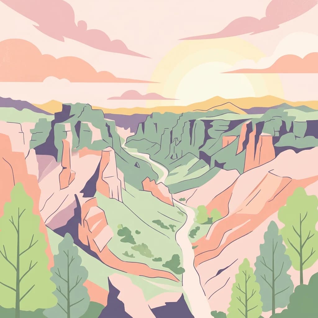
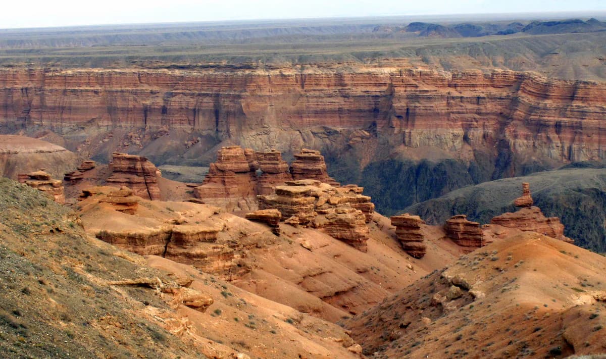
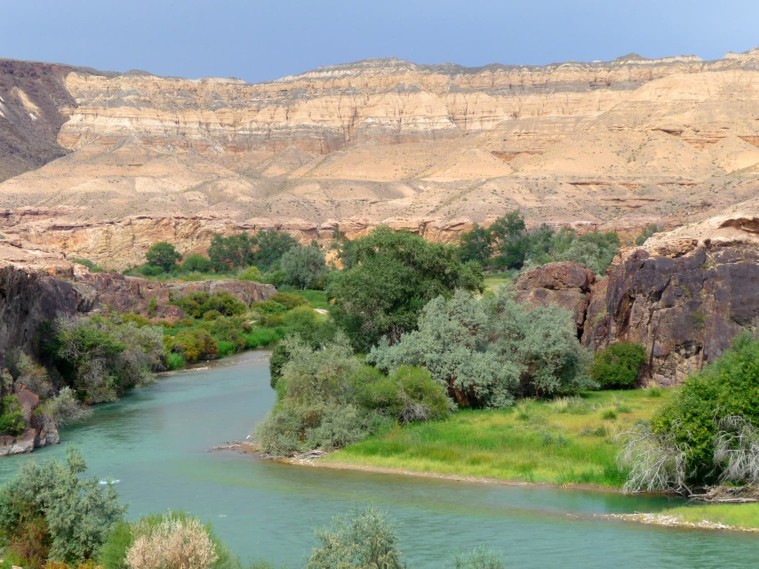
Charyn National Park is best known for its spectacular canyon system, particularly the Charyn Canyon with its towering red rock walls and the distinctive Valley of the Castles, where erosion has carved unusual castle-like formations from layered sedimentary rock. The park also contains one of the world's northernmost stands of Sogdian ash trees (Fraxinus sogdiana), a relict species that survives in the floodplain and represents ancient vegetation dating to the Paleogene period. The combination of dramatic geological scenery, unique ancient forests, and the desert-river ecosystem makes this one of Kazakhstan's most distinctive protected areas.

Panoramic view of Charyn Canyon with layered red rock formations, deep valleys, and sparse vegetation under a clear sky
Charyn Canyon in Kazakhstan featuring layered red rock formations and deep valleys

Charyn National Park history and protected-area timeline

Charyn National Park was officially established on February 23, 2004, through a government decree aimed at protecting the unique geological and ecological treasures of the Charyn Canyon region. However, the park's most notable feature—the Charyn Ash Grove—received protection much earlier, having been designated as a republic-level nature reserve monument in 1964. The ash grove's scientific and conservation significance was recognized decades before the broader canyon area received national park status. The park was subsequently expanded in February 2009 through another government decree that added approximately 32,900 hectares of state land to the protected area, bringing the total to its current extent. The creation of the national park reflected Kazakhstan's growing commitment to biodiversity conservation and the recognition that the Charyn Canyon region required formal protection to preserve its geological heritage, unique ecosystems, and archaeological resources for future generations.

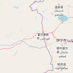
Charyn National Park landscape and geographic character

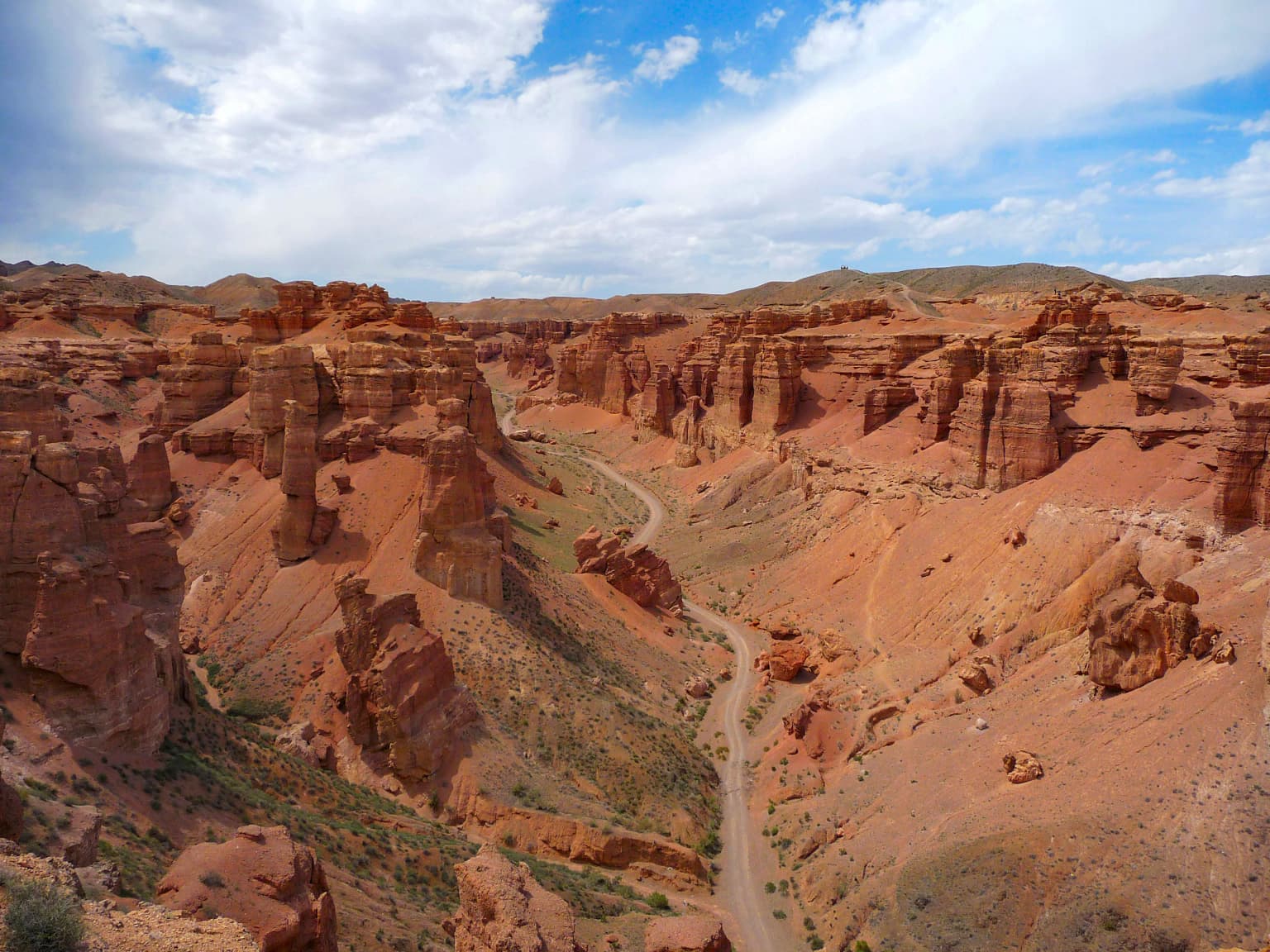
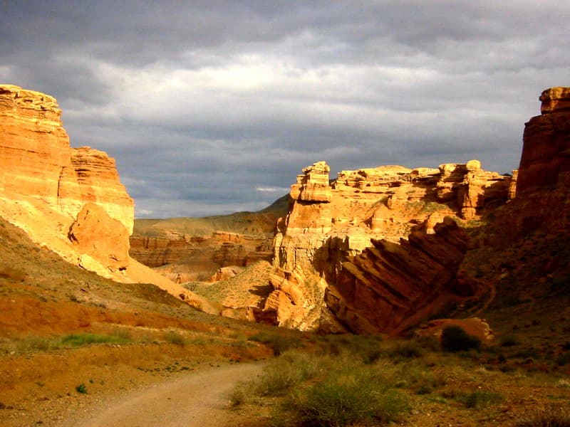
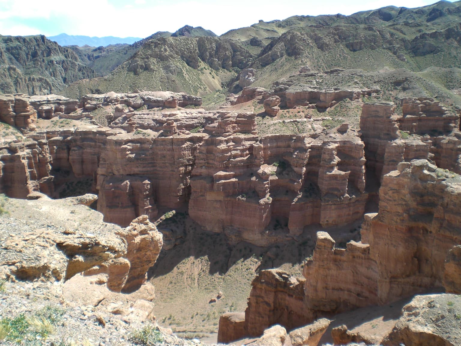
The Charyn National Park landscape is defined by one of Central Asia's most impressive canyon systems. The Charyn River has cut a deep gorge through the semi-arid foothills, creating walls that reach 370 meters in height with the canyon floor sitting at approximately 1,100 meters above sea level. The terrain is long and narrow, extending along both banks of the river for roughly 50 kilometers but rarely exceeding 3 kilometers in width. The rock formations display remarkable layering, with visible bands of orange-grey clays, marl, gritstone, and sandstone that tell a geological story spanning millions of years. The Valley of the Castles is a particularly striking sub-canyon—a side gorge roughly 3 kilometers long and 200 to 700 meters wide where erosion has produced an array of tower-like formations and castle-shaped pillars. Beyond the canyon itself, the park encompasses several distinct landscape zones: the northeastern foothills of the Ulken Buguty mountain range with its mineral-rich terrain, the Kyzyl Karasai area with its relic ash forest, and the Aktogay Canyon downstream from the main Charyn Canyon. The landscape transitions from the rocky canyon walls down to the river floodplain and then to the surrounding desert and semi-desert terrain of the broader region.

Red rock canyon landscape with winding road, sparse vegetation, and blue sky with clouds
Panoramic view of Charyn National Park's Valley of Castles featuring red rock formations and winding road

Charyn National Park ecosystems, habitats, and plant life

The nature of Charyn National Park represents a fascinating blend of ancient relict species and specialized desert-adapted organisms. The Charyn Ash Grove is the park's most botanically significant feature—a remnant stand of Sogdian ash trees (Fraxinus sogdiana) that once formed an extensive forest belt across the northern slopes of the Tian Shan mountains during the Paleogene period. These ancient trees have adapted to survive in the challenging floodplain environment, where they must tolerate wide fluctuations in soil salinity and moisture levels. Above the floodplain, the vegetation shifts to a unique desert community dominated by saxaul (Haloxylon), Eurotia, and Ephedra, creating a striking contrast between the green riparian corridor and the arid surrounding terrain. The park supports remarkable biodiversity given its semi-arid setting, with scientists recording over 1,000 plant species, including approximately 50 that are considered rare or endemic to the region. Twenty-one plant species found in the park are protected and listed in Kazakhstan's Red Book. The park's location at the intersection of different ecological zones—the Tian Shan mountain system and the desert environments of the Kazakh steppe—contributes to its biological diversity.

Red rock canyon with layered rock formations, winding dirt road, sparse vegetation, and overcast sky
Sharyn River Canyon landscape featuring red rock formations and a winding dirt road under a cloudy sky

Charyn National Park wildlife and species highlights

Despite its harsh semi-arid environment, Charyn National Park supports a surprising diversity of wildlife. The park has documented 32 species of mammals, including gazelles that inhabit the rocky terrain and foothills, as well as various small mammals adapted to the desert and canyon environments. The reptile population is particularly well-represented with 18 species recorded, reflecting the favorable warm conditions of the canyon microclimate. Four amphibian species have been documented, likely concentrated around the river and any seasonal water sources. Bird life includes approximately 100 species, with the Kyzyl Karasai area specifically protecting habitat for rare birds including bustards and eagles. The diverse habitats—from riparian corridors along the river to rocky cliffs and desert plains—support different communities of wildlife, creating a relatively rich fauna for this part of Central Asia. The protection of these species is a key function of the park, particularly for those species that are rare, endemic, or otherwise vulnerable.

Wide view of Charyn Canyon showing red rock formations, steep cliffs, and distant hills under a partly cloudy sky
Red rock canyon formations in Charyn National Park

Charyn National Park conservation status and protection priorities

Charyn National Park serves multiple conservation functions in southeastern Kazakhstan. The park protects one of the region's most geologically significant landscapes—the Charyn Canyon system—and ensures the preservation of irreplaceable geological features that took millions of years to form. Perhaps equally important is the protection of the Charyn Ash Grove, which represents a relict ecosystem of global significance. The Sogdian ash trees in the park are the northernmost survivors of a species that once dominated much of the Tian Shan region, and their conservation is critical for maintaining genetic diversity and understanding ancient forest ecosystems. The park's multiple-zone management approach allows for different levels of protection: strict reserves, environmental stabilization zones, and areas designated for sustainable tourism and limited economic activity. This zoning enables the park to balance conservation objectives with public access and controlled development. The designation of certain areas for gazelle habitat expansion and the protection of mineral water sources further demonstrates the park's comprehensive approach to conservation.

Charyn National Park cultural meaning and human context

The Charyn Canyon area has been inhabited by humans for thousands of years, as evidenced by the archaeological sites within the park. Scattered cemeteries and burial mounds located along the Charyn River and near the Chundzha-Almaty highway attest to the long human history in this landscape. These archaeological sites, some dating to ancient periods, represent the park's cultural heritage dimension. The region has been part of the broader cultural landscape of southeastern Kazakhstan, historically inhabited by various Turkic peoples and lying along trade routes connecting Central Asia with eastern regions. The park's creation and management involve local communities in the Almaty Region, particularly in the districts of Enbekshikazakh, Raiymbek, and Uygur. The park provides not only ecological value but also supports local identity through the preservation of a landscape that has been significant to regional communities for generations.

Charyn River flowing through a canyon with layered rock formations, green shrubs, and trees under a clear sky
Charyn River winding through a canyon with rocky cliffs and green vegetation

Top sights and standout views in Charyn National Park

Charyn National Park offers visitors the opportunity to experience one of Central Asia's most dramatic landscapes. The Charyn Canyon, sometimes called the 'Little Grand Canyon,' features spectacular layered rock formations and towering walls that change color throughout the day. The Valley of the Castles provides an especially memorable hiking experience, where visitors can wander among towering rock pillars and castle-shaped formations. The Charyn Ash Grove walk allows visitors to walk among ancient Sogdian ash trees that have survived for millions of years—a living connection to prehistoric forests. The park supports three main tourist routes: the Charyn Ash Grove trail with its visitor facilities, the Valley of the Castles route with parking areas and recreational gazebos, and an archaeological route visiting ancient cemeteries and burial mounds. The park's combination of geological wonders, ancient forests, and rich biodiversity makes it a destination of national and international significance.

Red rock canyon landscape with steep cliffs, rocky formations, and distant mountains under a partly cloudy sky
Charyn Canyon landscape with red rock formations and rugged terrain

Best time to visit Charyn National Park

The best time to visit Charyn National Park is during the warmer months from late spring through early autumn, when the park's trails and scenic areas are most accessible. The climate features cold winters and warm, relatively dry summers, with the peak precipitation occurring in summer months. Summer temperatures in the canyon can be quite high, so visiting during the cooler parts of the day is advisable. The winter months bring cold conditions and potential snow in the higher elevations, which may limit access to some areas. Spring and autumn offer moderate temperatures and are particularly beautiful times to experience the park's landscapes, with spring bringing water flow from melting snow and ice in the surrounding mountains. The park can be visited year-round, but the most comfortable conditions for hiking and sightseeing occur from May through September.

Park location guide

Geography guide, regional context, and park location map for Charyn National Park

Charyn National Park park geography, regions, and map view in Kazakhstan
Understand where Charyn National Park sits in Kazakhstan through a broader geographic reading of the surrounding landscape, nearby location context, and its mapped position within the national park landscape.

How Charyn National Park fits into Kazakhstan

Kazakhstan is a Central Asian country spanning vast steppes and plains, bordered by Russia, China, Kyrgyzstan, Uzbekistan, and Turkmenistan, with a coastline along the Caspian Sea. It gained independence from the Soviet Union in 1991 and has a population of approximately 20.5 million people. The country is officially secular but predominantly Muslim, with Kazakh and Russian as official languages.

Wider geography shaping Charyn National Park in Kazakhstan

Kazakhstan occupies a vast territory in Central Asia, extending into Eastern Europe. Its terrain consists largely of hilly plateaus and plains, with lowlands covering about a third of the area. The southern and eastern regions are mountainous. The country borders Russia to the north and west, China to the east, Kyrgyzstan to the southeast, Uzbekistan to the south, and Turkmenistan to the southwest. It has a coastline along the Caspian Sea.

Map view of Charyn National Park

Use this park location map to pinpoint Charyn National Park in Kazakhstan, understand its exact geographic position, and read its mapped placement within the surrounding landscape more clearly.

Pigeon | © OpenStreetMap contributors

Location context for Charyn National Park

Almaty Region

Visual Journey Through Kazakhstan's Iconic Canyon System and Unique Sogdian Ash Groves

Charyn National Park Photos: Explore Dramatic Canyon Landscapes and Ancient Forests
Browse imagery to understand the striking landscapes of Charyn National Park, featuring its dramatic canyon system, towering red rock formations, and the unique ancient Sogdian ash groves. These visual insights offer clear context on the park's geological heritage, semi-arid habitats, and protected-area character within Kazakhstan's Central Asian terrain.

Panoramic view of Charyn Canyon with layered red rock formations, deep valleys, and sparse vegetation under a clear sky

Winding road through rugged canyon landscape with red rock formations under clear blue sky

Red rock canyon landscape with winding road, sparse vegetation, and blue sky with clouds

Red rock canyon with layered rock formations, winding dirt road, sparse vegetation, and overcast sky

Wide view of Charyn Canyon showing red rock formations, steep cliffs, and distant hills under a partly cloudy sky

Rocky canyon slopes with layered red rock formations under a clear blue sky with scattered clouds

Charyn River flowing through a canyon with layered rock formations, green shrubs, and trees under a clear sky

Red rock canyon landscape with steep cliffs, rocky formations, and distant mountains under a partly cloudy sky

Red rock formations and canyon landscape with layered cliffs and green terrain under a partly cloudy sky

Park atlas

Compare protected landscapes in the Almaty Region, tracing geographic context and conservation efforts.

Explore Other National Parks and Protected Areas Near Charyn National Park, Kazakhstan
Explore additional national parks and protected areas situated near Charyn National Park and throughout the diverse Almaty Region of Kazakhstan. Compare their unique canyon landscapes, ancient forests, and semi-arid ecosystems to understand the broader regional geography and conservation efforts.
Watercolor illustration of a mountain lake with forests, distant mountains, and calm water reflecting the scenery
National parkAlmaty Region

Kolsay Lakes National Park: Discover Protected Alpine Lakes in Almaty Region

Mapped Tian Shan mountain geography and glacial lake context.

Kolsay Lakes National Park is a significant protected area within the Almaty Region, celebrated for its breathtaking chain of three alpine lakes, often referred to as the 'Pearls of Tien Shan.' This national park showcases the rugged beauty of the Tian Shan mountains, with dramatic valleys, dense spruce forests, and pristine glacial waters. Understanding its geographic setting and mapped boundaries reveals the unique ecological and landscape value of this protected natural area.

Area
1,619 km²
Established
2007
IUCN
II
Relief
Mountain
Watercolor illustration showing rolling hills, distant mountains, and sparse vegetation
National parkAlmaty Region

Altyn-Emel National Park: A Protected Landscape of Singing Dunes and Lunar Mountains

Explore unique geological wonders and ancient Saka history.

Discover Altyn-Emel National Park, a prominent national park located in Kazakhstan's Almaty Region. This protected area showcases an extraordinary diversity of landscapes, from the echoing Singing Dunes to the otherworldly Aktau mountains, often referred to as the 'lunar mountains' due to their vivid mineral hues. As a vital conservation zone, it safeguards Central Asian steppe ecosystems and significant Iron Age archaeological sites, offering a rich tapestry of natural beauty and historical depth for atlas exploration.

Area
4,600 km²
Established
1996
IUCN
II
Relief
Mixed relief
Watercolor painting of a river, hills, and trees with pink and yellow sky tones
National parkAlmaty Region

Ile-Alatau National Park: Protected Landscape Atlas and Almaty Region Geography

Mapped boundaries, diverse ecosystems, and mountain wilderness.

Ile-Alatau National Park is a key protected area in the Almaty Region of Kazakhstan, preserving a vast expanse of the Tian Shan mountain system. This national park showcases a dramatic vertical landscape, encompassing everything from lowland woodlands and relict spruce forests to expansive alpine meadows and glacial terrains. Its mapped boundaries define critical habitat for diverse wildlife and offer a profound insight into the complex ecological dynamics of high-altitude environments, making it an essential destination for atlas-based geographic discovery.

Area
2,000 km²
Established
1996
Relief
Mixed relief
Climate
Alpine
Watercolor painting depicting a mountain range, lake, and grassy foreground under a pale sky
National parkAlmaty Region

Zhongar-Alatau National Park: Protected Mountain Landscape and Genetic Heritage Atlas

Almaty Region's critical wild apple forest and glaciated terrain.

Zhongar-Alatau National Park in Kazakhstan's Almaty Region is a significant protected landscape renowned for its role in conserving the genetic origins of cultivated apples. The park encompasses dramatic glaciated mountain ranges, deep canyons, and diverse ecosystems within the Dzungarian Alatau. Its mapped boundaries define an area vital for protecting unique wild fruit tree species, including the Sievers apple, and preserving the distinctive alpine terrain of southeastern Kazakhstan, offering rich context for geographic exploration.

Area
36 km²
Established
2010
IUCN
II
Relief
Mountain
National parkEast Kazakhstan Region

Tarbagatai National Park: Protected Landscape and Wild Fruit Tree Forests in East Kazakhstan Region

Explore the mapped boundaries and ecosystem of this national park.

Tarbagatai National Park is a protected area in East Kazakhstan recognized for its unique role in conserving wild fruit tree forests that have maintained genetic isolation. This national park provides a detailed view of a mountain-steppe ecosystem across the Tarbagatai mountain range, Karabas Mountains, and Arkaly Mountains, along with the Urzhar and Emel river valleys. Its establishment in 2018 highlights its importance for biodiversity and the study of natural forest genetics, offering significant geographic context for regional protected land exploration.

Area
1,364 km²
Established
2018
IUCN
II
Relief
Mountain
Watercolor illustration of a mountainous landscape with green hills, trees, and a river in the foreground
National parkKazakhstan

Karkaraly State National Nature Park: Kazakhstan's Mountain-Forest Protected Area

Discover unique geology, archaeology, and regional landscape context.

Delve into the distinctive protected landscape of Karkaraly State National Nature Park, situated in Kazakhstan's Karaganda Region. This park preserves a rare mountain-forest ecosystem with dramatic granite formations, ancient archaeological sites, and lakes, presenting a rich geographic contrast to the surrounding Kazakh Steppe. MoriAtlas provides structured insights into Karkaraly State National Nature Park's unique terrain, its conservation value, and its position within the broader regional geography of Central Asia.

Area
1,121.2 km²
Established
1998
IUCN
II
Relief
Mountain
Watercolor painting of a landscape featuring green hills, grassy foreground, and distant mountains under a soft sky
National parkSouth Kazakhstan Region

Sayram-Ugam National Park: Protected Landscape and Geographic Context in South Kazakhstan

Explore dramatic alpine terrain and ancient juniper forests.

Delve into Sayram-Ugam National Park, a protected national park situated in the South Kazakhstan Region. This expansive area showcases striking mountain topography with seven natural altitude zones, from mountain steppe to permanent snowfields. It is distinguished by its vast juniper forests and serves as a crucial conservation site for wild fruit and nut tree genetic diversity, offering a unique lens for understanding Central Asian mountain ecology and landscape context.

Area
1,490 km²
Established
2007
IUCN
II
Relief
Mountain
National parkKazakhstan

Bayanaul National Park: Kazakhstan's First National Park Mapped Landscape

Explore granite mountains, unique lakes, and striking rock formations.

Bayanaul National Park, situated in Kazakhstan's Pavlodar Province, represents a significant protected area renowned for its extraordinary granite mountain landscape. Established as the country's first national park, it showcases unique erosion-shaped rock formations, diverse vegetation including rare pines, and four significant freshwater lakes. This park offers a distinct visual tapestry of mountainous terrain and geological wonders within the broader Central Asian geography, making it a key destination for atlas-based discovery.

Area
684.53 km²
Established
1985
IUCN
II

Common questions about visiting, size, designation, and location context for Charyn National Park

Charyn National Park FAQs for park facts, access, geography, and protected area context
Find quick answers about Charyn National Park, including protected-area facts, park geography, trail and visitor context, and how the park fits into its surrounding country and regional landscape.
MoriAtlas Explorer

Continue Your Protected Areas Search Across the Global Atlas

Deepen your exploration by continuing the structured search for national parks and protected areas worldwide. Utilize the comprehensive filtering capabilities to compare different conservation landscapes and refine your understanding of global park geography. Discover more about the distribution and characteristics of protected natural areas.

Global natural geography