Mori Atlas logo
National parkFemundsmarka National Park

Discover mapped boundaries, regional geography, and protected area identity in Innlandet.

Femundsmarka National Park: Norway's Premier Wetland Wilderness and Boreal Landscape

(Femundsmarka nasjonalpark)

Femundsmarka National Park represents a significant protected wilderness area within Norway's Innlandet region, characterized by an expansive wetland landscape shaped by marshes, lakes, and sparse boreal forests. This national park, established to preserve the unique ecosystem surrounding Norway's second-largest lake, Femunden, offers a distinctive geographic profile for atlas-based exploration. Users can investigate the park's mapped boundaries and its position within the broader regional geography of eastern Norway, understanding its value as a preserved boreal ecosystem and a key protected landmass.

national parksNorwayboreal forestsmarshlandswetlandsmusk oxen

Femundsmarka National Park

National park

Park overview

Structured park overview, official facts, and landscape profile for Femundsmarka National Park

Femundsmarka National Park park facts, protected area profile, and essential visitor context
Review the core facts for Femundsmarka National Park, including designation, size, terrain, visitor scale, habitats, and operating context in one park-focused overview.

About Femundsmarka National Park

Femundsmarka National Park represents one of Norway's most distinctive protected wilderness areas, protecting a vast expanse of marshland, lake, and boreal forest in the country's eastern highlands. The park lies adjacent to Femunden, Norway's second-largest natural lake, and extends eastward across a landscape characterized by gently undulating terrain covered in wetlands and scattered with numerous smaller lakes. This terrain was formed through glacial activity, leaving behind a landscape of shallow depressions filled with peat bogs, marshes, and glacial lakes that define the park's character.

The sparse forest that covers higher ground within the park consists primarily of pine and birch, species that have adapted to the continental climate and relatively poor soils of this region. The forest is not dense but rather scattered across the landscape, giving the park an open character quite different from the denser forests found in western Norway. This combination of open marshland, clear lakes, and scattered trees creates a landscape of considerable scenic beauty, particularly in the soft light of northern summers.

The park's establishment in 1971 reflected growing recognition of the need to protect this distinctive landscape and its associated wildlife. The creation of the national park was specifically aimed at preserving both the Femunden lake system and the forests extending eastward toward Sweden. Today, the park serves as an important conservation area for boreal ecosystems and as a wilderness destination for those seeking to experience one of Norway's less-visited but equally remarkable natural areas.

Quick facts and research context for Femundsmarka National Park

Femundsmarka National Park covers 573 square kilometers in eastern Norway, straddling the border between Innlandet and Trøndelag counties within Røros and Engerdal municipalities. The park protects a landscape dominated by marshland and lakes adjacent to Femunden, Norway's second-largest natural lake. The boreal forest here is sparse, consisting primarily of pine and birch trees adapted to the harsh northern climate. The park is notable for its population of approximately 30 musk oxen that graze along the Røa and Mugga Rivers during summer, a herd that migrated from the Dovrefjell area. Wild reindeer also inhabit the higher elevations. The park was established in 1971 and is managed by the Norwegian Directorate for Nature Management.

Park context

Deeper park guide and search-rich context for Femundsmarka National Park

Femundsmarka National Park history, landscape, wildlife, and travel context
Explore Femundsmarka National Park through its history, landscape character, ecosystems, wildlife, conservation priorities, cultural context, and seasonal travel timing in a structured park guide built for atlas discovery and search intent.

Why Femundsmarka National Park stands out

Femundsmarka National Park is best known for its extraordinary musk oxen population, one of only a few herds in Norway. The park's defining characteristic is its vast expanse of marshland and lakes surrounding Femunden, creating a distinctive wetland wilderness that is rare in the Norwegian landscape. The area has a centuries-old association with falconry, and the presence of wild reindeer in the higher elevations adds to the park's wildlife significance. The park is also renowned as a premier destination for canoeing and fishing, with its network of interconnected lakes and rivers providing exceptional paddling opportunities through a remote boreal landscape.

Femundsmarka National Park history and protected-area timeline

Femundsmarka National Park was established in 1971 as part of Norway's expanding network of protected areas during the latter half of the twentieth century. The park's creation was driven by recognition of the unique character of the Femunden lake system and the surrounding forests, which represented a landscape type increasingly rare in Norway's more densely populated western regions. The specific goal was to protect both the lake itself and the eastern forests extending toward the Swedish border, preserving a coherent ecosystem rather than protecting isolated features.

The area has a longer human history reflected in place names associated with falconry, suggesting that the region has been valued for its wildlife resources for centuries. The locations known as Falkfangerhøgda, or "falcon hunters' height," indicate that falcons were harvested from this area for use in the traditional sport of falconry, which was practiced across Europe and Asia. This historical use of falcons reflects the ecological richness of the region and the park's position as a significant habitat for birds of prey.

The establishment of the national park also reflected growing awareness of the importance of protecting representative examples of Norway's diverse landscapes. As one of the country's easternmost national parks, Femundsmarka preserves a landscape type quite different from the mountainous parks of central Norway or the coastal parks of the west, ensuring that Norway's protected area network encompasses the full diversity of the nation's natural heritage.

Femundsmarka National Park landscape and geographic character

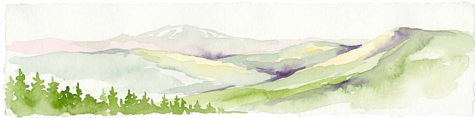
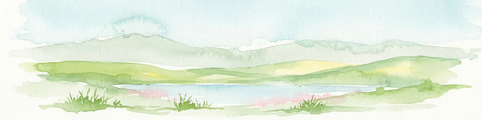
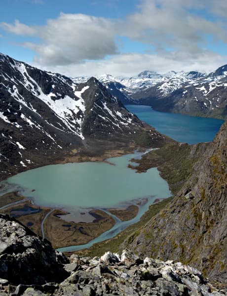
The landscape of Femundsmarka National Park is dominated by an extensive system of marshes, lakes, and wetlands that characterize the eastern Norwegian uplands. The park lies adjacent to Femunden, Norway's second-largest natural lake, and encompasses the lakes and marshes that extend eastward from its shores toward the Swedish border. This terrain is largely flat or gently rolling, shaped by glacial processes that left behind a landscape of shallow depressions filled with water and peat-forming vegetation.

The marshlands form the most distinctive element of the park's scenery, covering vast areas with a complex pattern of wet meadows, peat bogs, and shallow lakes. These wetlands support specialized vegetation adapted to waterlogged conditions and contribute significantly to the park's ecological character. Between the marshes, areas of higher ground support the sparse boreal forest that gives the park its name, with pine and birch trees growing in a scattered pattern across the landscape.

The park's waterways, including the Røa and Mugga Rivers, provide natural corridors through the marshland, offering paddling routes that are among the park's most popular recreational features. The rivers and lakes support fishing, particularly for Arctic char and other cold-water species, while the open marshes and forest margins provide habitats for diverse birdlife. The overall impression is of a wild, open landscape where water and forest intermingle across a vast expanse of northern wilderness.

Femundsmarka National Park ecosystems, habitats, and plant life

The nature of Femundsmarka National Park reflects the boreal forest zone that covers much of inland Scandinavia, adapted to the continental climate and relatively short growing season of this region. The park's wetlands represent one of its most ecologically significant features, with extensive marshes and peat bogs forming a complex hydrological system that supports specialized plant communities. These wetlands play important roles in water filtration, carbon storage, and habitat provision for wildlife.

The sparse forest that occupies higher ground within the park consists primarily of Scots pine and birch, the two tree species best adapted to the harsh northern climate and poor soils of the eastern Norwegian uplands. The forest is not dense but rather open and park-like, with trees scattered across the landscape rather than forming the closed canopy typical of more southerly forests. This open character allows light to reach the forest floor, supporting a layer of shrubs, grasses, and herbs that add to the park's biodiversity.

The wetland habitats are particularly important for biodiversity, providing breeding grounds for waterfowl, feeding areas for migratory birds, and habitat for a range of species adapted to marsh environments. The lake system supports fish populations and provides foraging areas for birds including osprey and common merganser. The combination of wetland, forest, and lake creates a mosaic of habitats that supports ecological diversity across the park.

Femundsmarka National Park wildlife and species highlights

The wildlife of Femundsmarka National Park is highlighted by the presence of musk oxen, a remarkable species that was reintroduced to Norway as part of conservation efforts beginning in the early twentieth century. The park's herd of approximately 30 individuals represents one of several populations established across Norway, with this particular group originally migrating from the Dovrefjell area. These massive Arctic ungulates graze along the Røa and Mugga Rivers during the summer months, providing one of the park's most distinctive wildlife viewing opportunities.

Wild reindeer also inhabit the higher elevations of the park, moving between summer grazing areas on the heights and winter ranges in lower terrain. These native deer have been part of the Norwegian fauna since the post-glacial period and continue to follow traditional migration routes across the landscape. The presence of both musk oxen and reindeer gives the park significance as a location for observing Arctic megafauna in their natural habitat.

The park's wetlands and forests support diverse birdlife, including species associated with northern boreal ecosystems. The raptors, including the falcons that gave the park its historical connection to falconry, remain present in the area. Waterfowl nest on the lakes and marshes, while passerines occupy the forest and shrubland habitats. The waterways support fish populations including Arctic char, a cold-water species that thrives in the lake and river systems of the park.

Femundsmarka National Park conservation status and protection priorities

Femundsmarka National Park plays an important role in Norway's conservation framework, protecting a representative example of the boreal wetland and forest ecosystems that characterize the country's eastern interior. The park's designation as an IUCN Category II protected area reflects its primary purpose of preserving natural ecosystems while allowing for sustainable recreational use. The establishment of the park in 1971 ensured protection for the Femunden lake system and the forests extending toward Sweden, creating a coherent protected area that maintains ecological connectivity across the landscape.

The wetland habitats within the park hold particular conservation significance, as they store carbon in peat deposits and provide ecosystem services including water filtration and flood regulation. These marshes also serve as important habitats for breeding waterfowl and migratory birds, contributing to broader conservation goals for Nordic bird populations. The protection of these wetlands within a national park framework ensures their long-term preservation.

The management of the park by the Norwegian Directorate for Nature Management balances conservation objectives with opportunities for outdoor recreation, particularly canoeing and fishing which have long traditions in the area. The musk oxen population receives specific attention in management planning, ensuring that the herd has access to suitable grazing areas while minimizing potential conflicts with other uses of the park. This approach reflects Norway's broader commitment to maintaining viable populations of large mammals within appropriately managed protected areas.

Femundsmarka National Park cultural meaning and human context

The cultural context of Femundsmarka National Park is most clearly reflected in the place names associated with falconry that persist in the landscape. The locations known as Falkfangerhøgda, or "falcon hunters' height," indicate that the park's falcons were historically harvested for use in falconry, a sport with deep roots in European and Asian aristocratic traditions. This historical connection suggests that the area was recognized for its wildlife resources over many centuries, even if the specific history of human activity in the area remains less documented than in more populated regions.

The name Femundsmarka itself reflects the park's geography and naming conventions, combining the genitive form of the lake name Femund with "mark," the Norwegian term for woodland or forest. This naming reflects the traditional way in which Norwegians identified landscapes by their relationship to prominent natural features, particularly lakes and forests. The name captures the park's essential character as a forested area associated with a major lake, a relationship that has defined the landscape for generations.

The Røros region, of which Femundsmarka is part, has historical connections to mining and metallurgy that have shaped the broader cultural landscape of eastern Norway. While the park itself was not directly affected by mining, the regional context influences the park's identity and the communities that surround it. The municipalities of Røros and Engerdal maintain connections to this heritage while also embracing the recreational and conservation values represented by the national park.

Top sights and standout views in Femundsmarka National Park

Femundsmarka National Park offers visitors the opportunity to experience one of Norway's most distinctive wilderness landscapes, where vast marshes and interconnected lakes create a paddling paradise through remote boreal terrain. The highlight for many visitors is the chance to observe musk oxen grazing along the river valleys during summer, an encounter with Arctic wildlife that ranks among Norway's most memorable wildlife experiences. The park's network of waterways provides exceptional canoeing routes, allowing paddlers to navigate through a landscape of islands, inlets, and open lakes surrounded by marshland and sparse forest.

The park's falconry heritage, reflected in names like Falkfangerhøgda, adds a cultural dimension to the natural landscape, connecting contemporary visitors to centuries of human interaction with the area's wildlife. The proximity to Femunden, Norway's second-largest lake, ensures that the park protects one of the country's most significant lake systems, preserving not only the water body itself but also the wetlands and forests that contribute to its ecological health. Whether exploring by canoe, fishing in the clear waters, or simply walking through the open forest and marshland, visitors to Femundsmarka experience a wilderness character quite different from Norway's more famous mountain parks.

Best time to visit Femundsmarka National Park

The best time to visit Femundsmarka National Park depends on what visitors hope to experience, with each season offering distinct character. Summer months, particularly July and August, bring the warmest conditions and longest days, making this the prime season for canoeing and wildlife viewing. The musk oxen are most easily observed along the Røa and Mugga Rivers during summer when they graze in the river valleys, and the extended daylight allows for full days of exploration. This is also the best season for fishing, with open water access to the lake and river systems.

Autumn brings changing colors to the birch forests and reduced visitor numbers, offering a quieter experience of the park's wilderness character. The marshland takes on golden hues as vegetation dies back, and migratory birds pass through the area heading south. Winter transforms the park into a snow-covered landscape, though access is more challenging and the park sees fewer visitors during this season. The cold climate means that wildlife is less visible, though tracks in the snow can reveal the presence of reindeer and other species. Spring, with its meltwater and returning birdlife, offers another distinctive season, though the wet conditions underfoot can make some areas difficult to access.

Park location guide

Geography guide, regional context, and park location map for Femundsmarka National Park

Femundsmarka National Park park geography, regions, and map view in Norway
Understand where Femundsmarka National Park sits in Norway through a broader geographic reading of the surrounding landscape, nearby location context, and its mapped position within the national park landscape.

How Femundsmarka National Park fits into Norway

Norway, officially the Kingdom of Norway, is a Nordic country in Northern Europe located on the Scandinavian Peninsula. It encompasses mainland Norway, the Arctic islands of Svalbard and Jan Mayen, and maintains dependencies including Bouvet Island and Antarctic claims. The country has a population of about 5.6 million and is bordered by Sweden, Finland, and Russia. Norway is a unitary parliamentary constitutional monarchy with Oslo as its capital and largest city.

Wider geography shaping Femundsmarka National Park in Norway

Norway occupies the western and northern portions of the Scandinavian Peninsula in Northern Europe. The country shares a long eastern border with Sweden, and borders Finland and Russia to the northeast. Norway has an extensive coastline facing the Skagerrak, North Sea, Norwegian Sea, and Barents Sea. The terrain is predominantly mountainous with numerous fjords along the coastline.

Map view of Femundsmarka National Park

Use this park location map to pinpoint Femundsmarka National Park in Norway, understand its exact geographic position, and read its mapped placement within the surrounding landscape more clearly.

Pigeon | © OpenStreetMap contributors

Location context for Femundsmarka National Park

InnlandetTrøndelag
Park atlas

Compare protected landscapes and map regional park geography within Innlandet County and beyond.

Explore National Parks and Protected Areas Near Femundsmarka National Park in Eastern Norway
After exploring Femundsmarka National Park's unique marshlands and boreal forests, browse other national parks and protected areas across Innlandet County, including adjacent wilderness areas and significant natural reserves. This expanded atlas view allows for geographic comparison of different conservation landscapes and diverse park ecosystems in eastern Norway.
National parkDalarna County

Töfsingdalen National Park: Ancient Old-Growth Forest in Rugged Terrain

Remote protected landscape within Dalarna County, Sweden.

Töfsingdalen National Park showcases a rare example of an ancient, up-to-500-year-old pine forest thriving in extremely rugged, boulder-strewn valley terrain. This protected area, located in Sweden's Dalarna County, offers a glimpse into a near-wilderness landscape shaped by glacial forces and defined by its remoteness and ecological integrity. Discover the mapped park boundaries and the unique geographic context of this remarkably untouched natural reserve.

Area
16.15 km²
Established
1930
IUCN
II
Relief
Lowland
National parkInnlandet

Gutulia National Park: Protected Southernmost Mountain Birch Forest Landscape Atlas

Explore Norway's unique subarctic forest geography and park boundaries.

Gutulia National Park stands as a key protected area within Norway's Innlandet region, distinguished by its role in preserving the country's southernmost mountain birch forest ecosystem. Covering approximately 23 square kilometers, this national park provides critical insights into subarctic forest ecology at the southern extent of its natural range. MoriAtlas enables detailed exploration of its mapped terrain and geographic context, offering a valuable resource for understanding this significant protected landscape.

Area
23 km²
Established
1968
IUCN
II
Scope
Terrestrial
National park

Sonfjället National Park: Mapped Alpine Terrain and Protected Landscape in Sweden

Explore the glacial geography and subalpine transition zones.

Sonfjället National Park is a key protected area in central Sweden, offering a unique glimpse into an alpine environment shaped by glacial forces. The park's landscape is characterized by the prominent Sånfjället mountain, steep glacial valleys, mires, and small lakes, showcasing raw, natural terrain. As a southern outpost for subalpine ecosystems, it presents a distinct ecological transition zone valuable for geographic discovery and understanding protected nature.

Watercolor illustration showing mountains, forests, and a river
National parkDalarna County

Fulufjället National Park: Protected Plateau Landscape and Transboundary Conservation in Dalarna County

Sweden's southernmost alpine plateau, mapped geography, and natural wonders.

Fulufjället National Park in Dalarna County, Sweden, protects a significant high plateau landscape, notable for its ancient sandstone geology and unique lichen-heath environments. This national park is home to Njupeskär, Sweden's tallest waterfall, and is part of a transboundary protected area with Norway. Explore the mapped terrain and distinct natural features of this important conservation area within the Scandinavian Mountains.

Area
385 km²
Established
2002
IUCN
II
Visitors
53K annual
National park

Forollhogna National Park: Norway's Gently Rolling Alpine Protected Landscape Atlas

Explore unique terrain and vital wild reindeer habitat in Central Norway.

MoriAtlas provides structured geographic context for Forollhogna National Park, Norway's nineteenth national park. This area is best known for its distinctively gentle, rolling alpine terrain, a contrast to other Norwegian mountain ranges, and as a critical habitat for wild reindeer. Discover the park's unique landscape character, its role as a protected area, and the ongoing cultural traditions tied to its mountain pastures, all visualized within a comprehensive atlas framework.

Area
1,062 km²
Established
2001
IUCN
II
Watercolor illustration of a mountainous landscape with a lake, green fields, and pink flowers
National park

Fulufjellet National Park: Protected Boreal Forest Landscape and Regional Geography

Explore mapped boundaries, rolling terrain, and transboundary conservation.

Fulufjellet National Park offers a detailed look at a protected boreal forest ecosystem in southeastern Norway. This page details the park's gently rolling hills, dominated by Norway spruce and Scots pine, interspersed with lakes and peat bogs. It highlights the park's designation as a national park, its establishment in 2012, and its contiguous protected status with Sweden's Fulufjället National Park, contributing to a significant transboundary conservation area. Users can explore its geographic features and protected landscape context within Scandinavia.

Area
82.5 km²
Established
2012
IUCN
II
Relief
Mountain
Watercolor illustration of mountains and valleys with green and purple terrain and pink-hued peaks
National parkTrøndelag

Skarvan and Roltdalen National Park: Protected Wilderness and Trøndelag Landscape Atlas

Explore extensive peatlands, alpine terrain, and regional geography.

The Skarvan and Roltdalen National Park detail page offers an atlas-driven exploration of this protected landscape in Norway's Trøndelag region. Discover its vast peatland systems, the intact Roltdalen valley, and its alpine environments. This page provides detailed geographic context and mapped features, highlighting the park's significance within the regional natural heritage.

Area
441.5 km²
Established
2004
IUCN
II
Relief
Mountain
National parkInnlandet

Dovre National Park: Mapped Alpine Terrain & Protected Reindeer Habitat in Innlandet

Norway's protected mountain plateau landscape and wildlife corridor.

Dovre National Park is a significant protected area in Innlandet, Norway, characterized by its expansive alpine plateau terrain and role as a vital ecological corridor for wild reindeer. This national park offers users an atlas-level view of its mapped natural boundaries, focusing on the unique subarctic mountain landscape and its conservation importance. Understand Dovre National Park's geographic identity and its contribution to a contiguous network of protected lands.

Area
289 km²
Established
2003
IUCN
II
Relief
Mountain

Common questions about visiting, size, designation, and location context for Femundsmarka National Park

Femundsmarka National Park FAQs for park facts, access, geography, and protected area context
Find quick answers about Femundsmarka National Park, including protected-area facts, park geography, trail and visitor context, and how the park fits into its surrounding country and regional landscape.
MoriAtlas Explorer

Continue Your Protected Areas Search Across the Global Atlas

Deepen your exploration by continuing the structured search for national parks and protected areas worldwide. Utilize the comprehensive filtering capabilities to compare different conservation landscapes and refine your understanding of global park geography. Discover more about the distribution and characteristics of protected natural areas.

Global natural geography