Mori Atlas logo
National parkJotunheimen National Park

Discover the mapped terrain and glacial geography of Norway's iconic mountain realm.

Jotunheimen National Park: Norway's Premier Alpine Protected Landscape and Geographic Atlas

(Jotunheimen nasjonalpark)

Jotunheimen National Park represents the heart of Norway's most dramatic alpine terrain, a vast protected landscape spanning over 1,151 square kilometers. This page serves as your entry point to understanding the park's unique geographic identity, from its towering peaks, including the three highest in Northern Europe, to its deeply carved glacial valleys and pristine mountain lakes. Explore the mapped boundaries and terrain that define this home of giants, offering an unparalleled look into Norway's natural heritage.

Alpine MountainsNational ParksGlacial LandscapesHiking DestinationsNorthern EuropeNorway Wilderness
Illustration of mountain range with lake reflection, pine trees in foreground, and sunset sky

Jotunheimen National Park

National park

Park overview

Structured park overview, official facts, and landscape profile for Jotunheimen National Park

Jotunheimen National Park park facts, protected area profile, and essential visitor context
Review the core facts for Jotunheimen National Park, including designation, size, terrain, visitor scale, habitats, and operating context in one park-focused overview.

About Jotunheimen National Park

Jotunheimen National Park occupies the heart of the Jotunheimen mountain region in southern Norway, a landscape of extraordinary alpine grandeur shaped by hundreds of millions of years of geological history and the erosive power of glaciers. The Precambrian bedrock of gabbro and related intrusive rocks has been carved by glacial action into a dramatic terrain of steep-walled valleys, knife-edge ridges, and towering peaks that define one of Scandinavia's most spectacular mountain landscapes. The park spans the boundary between two counties – Vestland to the west and Innlandet to the east – and encompasses the most spectacular portions of this mountain region, including the Galdhø plateau, the Glittertind massif, the Hurrungane range, and the Gjende lake area. Despite its vast extent of over 1,150 square kilometres, the national park itself is largely roadless, with vehicle access limited to a few gravel roads at the periphery. The interior is accessible only by foot or via the network of mountain huts that has made this one of Europe's most celebrated wilderness trekking destinations. The name Jotunheimen, meaning "Home of the Giants," reflects the mythic scale of the landscape and was popularized by the poet Aasmund Olavsson Vinje in the mid-19th century as part of Norway's romantic national identity movement.

Quick facts and research context for Jotunheimen National Park

Jotunheimen National Park covers 1,151 km² of high mountain terrain in central southern Norway, straddling the boundary between Vestland and Innlandet counties. The park contains over 250 peaks exceeding 1,900 metres, including the three tallest mountains in Northern Europe. The area has been used for hunting since prehistoric times, with Stone Age remains found near lakes Gjende and Russvatnet extending through the Bronze and Iron Age. The region has been a significant travel corridor for centuries, with a 15th-century royal road decree requiring residents of Lom to maintain mountain passes connecting Gudbrandsdal to Bergen. The park was formally established in 1980 and is managed by the Norwegian Directorate for Nature Management. The Norwegian name is Jotunheimen nasjonalpark, translating literally as "Home of the Giants."

Park context

Deeper park guide and search-rich context for Jotunheimen National Park

Jotunheimen National Park history, landscape, wildlife, and travel context
Explore Jotunheimen National Park through its history, landscape character, ecosystems, wildlife, conservation priorities, cultural context, and seasonal travel timing in a structured park guide built for atlas discovery and search intent.

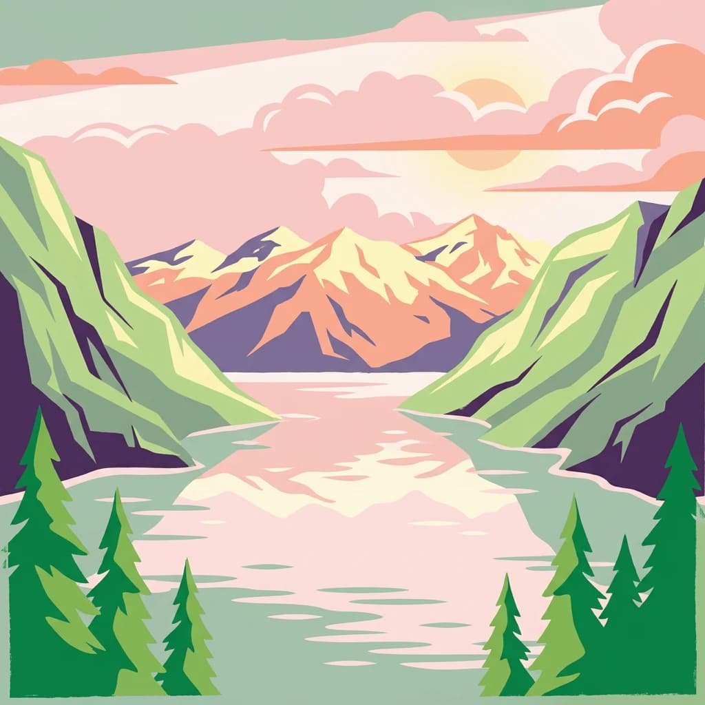
Why Jotunheimen National Park stands out

Jotunheimen is renowned as the premier alpine hiking destination in Norway and all of Northern Europe. The park protects the three highest peaks on the continent north of the Alps, Galdhøpiggen, Glittertind, and Store Skagastølstind, making it an iconic destination for mountaineering and peak-bagging. The dramatic landscape of sharp granite peaks, glacial valleys, and pristine mountain lakes has inspired Norwegian literature for centuries, most notably in Henrik Ibsen's drama Peer Gynt, which describes the famous Besseggen ridge traverse. The park contains an extensive network of staffed tourist huts operated by the Norwegian Mountain Touring Association (DNT), making multi-day hut-to-hut hiking treks through the high mountains accessible and well-supported. The fishing in the park's lakes and rivers, particularly for trout, has been celebrated since the Victorian era, drawing anglers from across Europe.

Panoramic view of mountain peaks with patches of snow, a turquoise lake, and rocky terrain under a partly cloudy sky
Panoramic view from Knutshøi towards central Jotunheimen National Park showing snow-capped mountains, turquoise lake, and rocky terrain

Jotunheimen National Park history and protected-area timeline

Human activity in Jotunheimen dates back thousands of years, with archaeological evidence of Stone Age hunting camps found near lakes Gjende and Russvatnet. These hunter-gatherer sites continued through the Bronze Age and Iron Age, demonstrating continuous use of the high mountain environment well into recorded history. The high summer pastures have been used as traditional seter alpine farms for at least a thousand years, establishing patterns of seasonal mountain use that continue in surrounding areas. During the 15th century, a royal decree required residents of Lom municipality to maintain the mountain crossing passes through the Sognefjell road, enabling trade between Gudbrandsdal in the east and Bergen on the western coast. Caravans transported farm products down to the lowlands while returning with salt, iron, cloth, and lutefisk. The modern concept of Jotunheimen as a named destination emerged in the 19th century when poet Aasmund Olavsson Vinje coined the name in 1862, drawing on Keilhau's earlier "Jotunfjellene" (mountains of the giants). A memorial to Vinje was erected in 1909 at Eidsbugarden on Lake Bygdin, where he had maintained a private hut and which remains today as a significant mountain tourist centre. The Norwegian Mountain Touring Association began building huts in 1869 and now maintains an extensive network that makes the area one of Europe's best-developed trekking regions. Jotunheimen National Park was formally established by royal decree in December 1980, covering 1,145 square kilometres of the most valuable mountain terrain.

Jotunheimen National Park landscape and geographic character

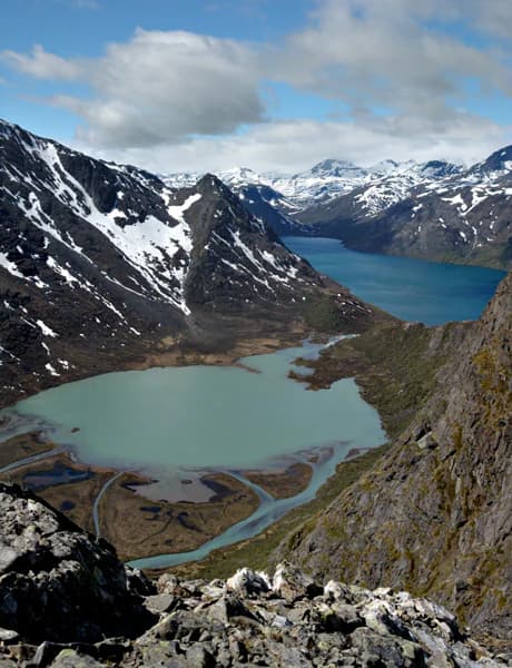
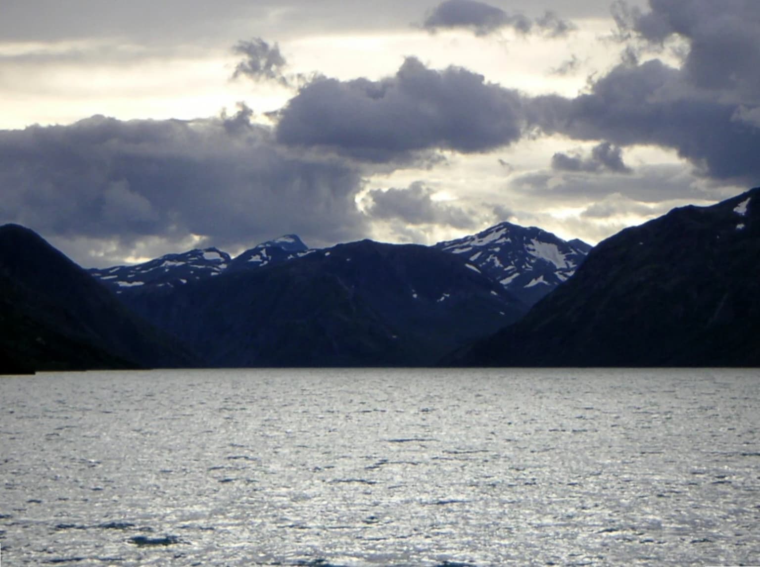
The landscape of Jotunheimen is a textbook example of alpine glaciation, with the characteristic features of a high mountain environment carved into ancient Precambrian crystalline rocks. The dominant geological material is gabbro, a coarse-grained igneous rock that forms the massive, steep-sided peaks and ridges that give Jotunheimen its distinctive silhouette. Glaciers have carved deep U-shaped valleys, sharp arêtes, and dramatic cirques, leaving behind a landscape of extraordinary topographic relief. More than 250 peaks exceed 1,900 metres in elevation, with the three highest summits in Northern Europe rising from the heart of the park. The landscape includes numerous glacial lakes, with Lake Gjende being among the most prominent, its dark waters reflecting the surrounding peaks. The terrain varies from gentle high-altitude plateaus to near-vertical rock faces, with the famous Besseggen ridge offering one of Norway's most iconic traverses. Hurrungane, at the western edge of the park, contains some of the most dramatic and challenging peaks for climbers.

A lake with calm water reflecting light under a cloudy sky, surrounded by dark mountains with snow patches
Gjende Lake in Jotunheimen National Park with snow-capped mountains under a cloudy sky

Jotunheimen National Park ecosystems, habitats, and plant life

The ecological character of Jotunheimen is defined by its high-altitude alpine environment, where harsh conditions limit vegetation to specialized communities adapted to short growing seasons, extreme cold, and strong winds. The park lies within the transition zone between boreal forest and alpine tundra, with the tree line varying by exposure and topography. Below the tree line, birch woodland and scrub vegetation dominates, while the higher zones feature alpine meadows, heath, and exposed rock. The fragile alpine ecosystems are slow to recover from disturbance, making the protected status particularly important. The park forms part of a larger network of protected areas in southern Norway that connects to Utladalen Nature Reserve and extends toward the Breheimen National Park, creating a significant corridor of protected mountain habitat.

Jotunheimen National Park wildlife and species highlights

Jotunheimen supports a range of boreal and Arctic wildlife species adapted to the mountainous environment. Large mammals include the lynx, moose, Norwegian red deer, reindeer, roe deer, and wolverine, representing both forest-dwelling and open-country species. The reindeer population has historical significance, with the park's mountainous terrain providing summer grazing grounds for semi-domesticated reindeer herds. The lakes and rivers within the park hold populations of trout, which have supported fishing as a recreational activity for centuries and were celebrated in Victorian-era travel literature describing the exploits of English anglers in the region. Birdlife includes species typical of alpine and boreal environments, though the source material focuses primarily on mammalian fauna and fish. The combination of forest and alpine habitats supports a diverse community, though the harsh winter conditions limit the overall carrying capacity of the environment.

Jotunheimen National Park conservation status and protection priorities

Jotunheimen National Park is designated as an IUCN Category II protected area, reflecting its primary purpose of protecting natural ecosystems while allowing for sustainable recreation and research. The establishment of the national park in 1980 formalized protection for one of Norway's most significant mountain landscapes, preserving not only the dramatic terrain but also the ecological communities that depend on the alpine environment. The park is linked to the Utladalen Nature Reserve, creating an expanded protected area of approximately 300 square kilometres that encompasses diverse habitats. The management approach balances wilderness preservation with the long tradition of sustainable outdoor recreation, particularly the network of hiking huts that have allowed visitors to experience this landscape without the environmental impact of extensive road development or intensive tourism infrastructure. The protection of this alpine ecosystem is particularly important given the sensitivity of high mountain environments to climate change, as evidenced by the discovery of a 1,500-year-old Viking arrowhead emerging from a melting glacier in 2020.

Jotunheimen National Park cultural meaning and human context

Jotunheimen holds a special place in Norwegian cultural identity, having been immortalized in literature, music, and the broader romantic nationalist movement of the 19th century. The poet Aasmund Olavsson Vinje, a pioneer of nynorsk language and an advocate for Norwegian national identity, coined the name "Jotunheimen" in 1862, transforming the raw mountain landscape into a symbol of Norwegian natural grandeur. His poetry collection of 1864 celebrated the mountains, and his memorial at Eidsbugarden remains a site of cultural pilgrimage. Henrik Ibsen's drama Peer Gynt (1867) features the mountains prominently, with the famous scene of Peer riding a wild reindeer along the Gjendin ridge on the narrow Besseggen. The composer Frederick Delius was inspired to write his symphonic poem "On the Mountains" after a walking holiday in the Jotunheimen with Edvard Grieg and Christian Sinding in 1889. Victorian travel writers J.A. Lees and W.J. Clutterbuck documented their fishing and hunting experiences in "Three in Norway, by Two of Them," bringing international attention to the area's recreational opportunities. The tradition of mountain tourism and hut-based trekking that developed in the late 19th century remains central to how visitors experience the park today, with Eidsbugarden still serving as a mountain centre with hotel, DNT cabin, and private huts.

Top sights and standout views in Jotunheimen National Park

The crown jewels of Jotunheimen are the three highest peaks in Northern Europe – Galdhøpiggen, Glittertind, and Store Skagastølstind – which draw mountaineers and peak-baggers from around the world. The Besseggen ridge traverse, made famous in Peer Gynt, offers one of Norway's most celebrated day hikes, with views down to the contrasting waters of Lake Gjende. The extensive network of DNT mountain huts enables multi-day trekking through the high terrain, making extended wilderness exploration accessible without camping gear. Lake Gjende and Lake Bygdin provide scenic anchors for explorations, with boat access at several points. The dramatic Hurrungane peaks present challenging climbing on some of the most impressive granite in Norway. Fishing for native trout in the park's lakes has been a celebrated tradition for centuries. The memorial to poet Aasmund Olavsson Vinje at Eidsbugarden connects the landscape to Norway's literary heritage.

Best time to visit Jotunheimen National Park

The optimal visiting season for Jotunheimen runs from mid-June through September, when the mountain trails are snow-free and the DNT mountain huts are fully staffed. July and August typically offer the most reliable weather and the warmest conditions for high-altitude hiking, though afternoon thunderstorms are common in the mountains. Early September can be spectacular, with autumn colours appearing on the birch slopes and fewer crowds on the trails, though some huts begin to close for the season. Winter access is limited to cross-country skiing and snowmobile travel to facilities like Eidsbugarden, with the harsh conditions suitable only for experienced winter mountaineers. The shoulder seasons of June and September offer the advantage of fewer visitors and the possibility of experiencing the mountains in more solitude, though weather uncertainty is greater. The park's high elevation means that even summer temperatures can be cool, and visitors should be prepared for rapid weather changes regardless of the season.

Park location guide

Geography guide, regional context, and park location map for Jotunheimen National Park

Jotunheimen National Park park geography, regions, and map view in Norway
Understand where Jotunheimen National Park sits in Norway through a broader geographic reading of the surrounding landscape, nearby location context, and its mapped position within the national park landscape.

How Jotunheimen National Park fits into Norway

Norway, officially the Kingdom of Norway, is a Nordic country in Northern Europe located on the Scandinavian Peninsula. It encompasses mainland Norway, the Arctic islands of Svalbard and Jan Mayen, and maintains dependencies including Bouvet Island and Antarctic claims. The country has a population of about 5.6 million and is bordered by Sweden, Finland, and Russia. Norway is a unitary parliamentary constitutional monarchy with Oslo as its capital and largest city.

Wider geography shaping Jotunheimen National Park in Norway

Norway occupies the western and northern portions of the Scandinavian Peninsula in Northern Europe. The country shares a long eastern border with Sweden, and borders Finland and Russia to the northeast. Norway has an extensive coastline facing the Skagerrak, North Sea, Norwegian Sea, and Barents Sea. The terrain is predominantly mountainous with numerous fjords along the coastline.

Map view of Jotunheimen National Park

Use this park location map to pinpoint Jotunheimen National Park in Norway, understand its exact geographic position, and read its mapped placement within the surrounding landscape more clearly.

Pigeon | © OpenStreetMap contributors

Location context for Jotunheimen National Park

InnlandetVestland

Visualize the dramatic peaks, deep glacial valleys, and unique high-alpine environments that define Norway's premier wilderness area.

Jotunheimen National Park Photos: Explore Norway's Alpine Mountain Landscapes
Browse comprehensive imagery from Jotunheimen National Park, visually exploring the iconic alpine mountains, glacial valleys, and the diverse high-country habitats of this renowned Norwegian protected area. Understanding the park's rugged terrain, pristine lakes, and distinct environmental character through photographs offers essential context for geographical study and wilderness planning.

Panoramic view of mountain peaks with patches of snow, a turquoise lake, and rocky terrain under a partly cloudy sky

A mountain landscape with rocky peaks, patches of snow, and green slopes under a clear blue sky

A lake with calm water reflecting light under a cloudy sky, surrounded by dark mountains with snow patches

Park atlas

Compare more Norwegian protected areas, tracing mountain ranges and glacial landscapes adjacent to Jotunheimen's alpine peaks.

Explore Nearby National Parks and Protected Areas Surrounding Jotunheimen National Park
Continue your exploration from Jotunheimen National Park by browsing other national parks and protected areas across Norway's stunning high-alpine and glacial landscapes. This geographic overview allows for structured comparison of diverse mountain environments and conservation efforts within the broader Scandinavian region.
National parkInnlandet

Langsua National Park: Protected Mountain Forests and Inland Wilderness in Innlandet, Norway

Discover mapped boundaries and regional geographic context.

Langsua National Park, a designation expanded in 2011, is a prominent protected area in Norway's Innlandet county. This national park encompasses 537.1 square kilometers of diverse mountainous terrain, characterized by extensive mountain forests and inland wilderness habitats. Its creation consolidates fragmented nature reserves into a significant contiguous protected landscape, offering valuable insight into Norway's conservation strategies and the geographic context of its eastern mountain regions.

Area
537.1 km²
Established
2011
IUCN
II
Relief
Mixed relief
National parkInnlandet

Reinheimen National Park: Norway's Vast Protected Wilderness Landscape and Alpine Geography

Map of protected boundaries and diverse mountain terrain.

Reinheimen National Park is a cornerstone of Norway's protected areas, encompassing a substantial portion of Western Norway's alpine wilderness. This national park protects a dynamic landscape characterized by dramatic western peaks and gentler eastern plateaus, providing critical habitat for wild reindeer and other wildlife. Its extensive mapped boundaries and varied natural terrain offer a rich subject for geographic discovery and atlas exploration, highlighting the ecological significance of well-preserved mountain ecosystems within Innlandet.

Area
1,969 km²
Established
2006
IUCN
II
Relief
Mountain
Watercolor painting of mountain peaks with green valleys and grassy foreground
National parkInnlandet

Rondane National Park: Norway's Premier Alpine Protected Landscape and Historic National Park

Mapped glacial terrain, iconic peaks, and wild reindeer sanctuary.

As Norway's first national park, Rondane offers a profound exploration of a protected alpine environment. Situated in Innlandet county, its 963 square kilometers showcase a landscape sculpted by glaciers, featuring a striking array of ten peaks exceeding 2,000 meters. This page details Rondane National Park's distinct mapped boundaries, dramatic mountain geography, and its ecological significance as a refuge for wild reindeer, making it a cornerstone of Scandinavian natural heritage.

Area
963 km²
Established
1962
IUCN
II
Relief
Mountain
National parkInnlandet

Breheimen National Park: Protected Glacial Landscapes and Mountain Terrain in Innlandet

Norway's prominent national park featuring active glaciers and alpine geography.

Breheimen National Park represents a significant protected landscape within Norway's Innlandet region, dedicated to conserving its unique glacial formations and dramatic alpine terrain. The park's vast area encompasses active glaciers, soaring peaks, and a notable diversity of natural environments, from lush valleys to barren plateaus. MoriAtlas facilitates a detailed exploration of Breheimen National Park, highlighting its mapped protected boundaries and its integral role in the regional geography and protected areas atlas.

Area
1,671 km²
Established
2009
IUCN
II
Relief
Mountain
National parkVestland

Jostedalsbreen National Park: Europe's Premier Glacial Protected Landscape

Mapped terrain and protected area discovery in Vestland, Norway.

Jostedalsbreen National Park represents a unique geographic entity, safeguarding the largest glacier on the European mainland. This national park, situated in Norway's Vestland region, offers profound insights into glacial landscapes and mountain geography. Users can explore the vast ice mass that dominates the terrain, observe the U-shaped valleys carved by its movement, and understand the geological processes shaping this dynamic environment. The park's protected status highlights its importance for understanding glacial science and preserving a critical component of Norway's natural heritage.

Area
1,310 km²
Established
1991
IUCN
II
Relief
Mountain
National parkInnlandet

Dovre National Park: Mapped Alpine Terrain & Protected Reindeer Habitat in Innlandet

Norway's protected mountain plateau landscape and wildlife corridor.

Dovre National Park is a significant protected area in Innlandet, Norway, characterized by its expansive alpine plateau terrain and role as a vital ecological corridor for wild reindeer. This national park offers users an atlas-level view of its mapped natural boundaries, focusing on the unique subarctic mountain landscape and its conservation importance. Understand Dovre National Park's geographic identity and its contribution to a contiguous network of protected lands.

Area
289 km²
Established
2003
IUCN
II
Relief
Mountain
Abstract watercolor landscape with soft pastel hues of green, pink, yellow, and purple
National park

Hallingskarvet National Park: Norway's High Mountain Plateau and Protected Wilderness

Mapping glacial terrain, alpine environments, and wild reindeer habitat.

Hallingskarvet National Park offers a unique window into Norway's geological history and alpine ecology. This protected landscape encompasses the striking Hallingskarvet plateau and the Vargebreen glacier, along with deep valleys carved by ancient ice. Users can explore the park's mapped boundaries, understand its regional geographic setting in Scandinavia, and appreciate its conservation value as a habitat for wild reindeer. The park's terrain provides a concrete example of glacial shaping and high-altitude ecosystems within the Nordic context.

Area
450 km²
Established
2006
IUCN
II
Relief
Mountain
Watercolor painting showing a mountainous landscape with a waterfall, grassy fields, and wildflowers
National parkInnlandet

Dovrefjell, Sunndalsfjella National Park: Mapping Norway's Largest Alpine Protected Landscape

Explore its protected boundaries, mountain terrain, and unique ecological significance.

Dovrefjell, Sunndalsfjella National Park is a cornerstone of Norwegian protected areas, offering an expansive alpine wilderness with dramatic mountain scenery. This page details the park's geographic context, mapped landscape features, and its importance as a refuge for unique wildlife like wild reindeer and muskox. Users can investigate the park's protected boundaries and understand its role within the regional geography of Innlandet, contributing to a structured atlas of Scandinavia's natural heritage.

Area
1,693 km²
Established
2002
IUCN
II
Relief
Mountain

Common questions about visiting, size, designation, and location context for Jotunheimen National Park

Jotunheimen National Park FAQs for park facts, access, geography, and protected area context
Find quick answers about Jotunheimen National Park, including protected-area facts, park geography, trail and visitor context, and how the park fits into its surrounding country and regional landscape.
MoriAtlas Explorer

Continue Your Protected Areas Search Across the Global Atlas

Deepen your exploration by continuing the structured search for national parks and protected areas worldwide. Utilize the comprehensive filtering capabilities to compare different conservation landscapes and refine your understanding of global park geography. Discover more about the distribution and characteristics of protected natural areas.

Global natural geography