Mori Atlas logo
Nearby park discovery

Geographic analysis of surrounding park boundaries and regional landscape distribution

Protected Areas and National Parks Near Karkaraly State National Nature Park, Kazakhstan

Explore the broader geography of protected lands situated near Karkaraly State National Nature Park in the Karaganda Region. This regional mapping provides context for neighboring mountain-forest ecosystems and the diverse natural terrain characteristics found within the surrounding Kazakh Steppe.

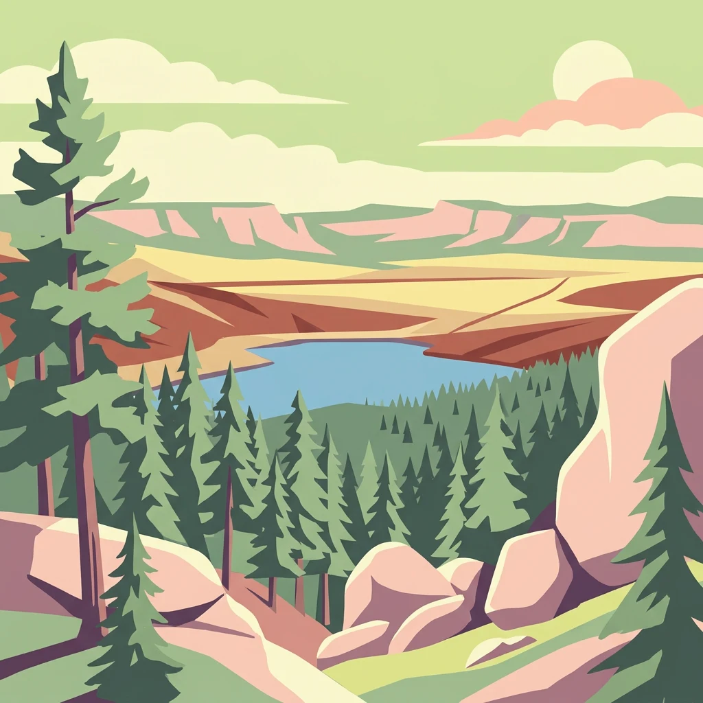
Illustration of a mountainous landscape featuring coniferous trees, a lake, rocks, and distant hills under a partly cloudy sky

Mountain-forest preserve in central Kazakhstan's Kazakh Steppe

Karkaraly National Park

Karkaraly State National Nature Park is a protected mountain-forest area in central Kazakhstan, located in the Karkaraly and Kent mountain ranges within the Karaganda Region. The park was established as a national park on December 1, 1998, though the area has held protected status since 1884 when it was designated as the Karkaralinsk Forest Reserve. The park encompasses approximately 90,000 hectares of rare mountain-forest ecosystem rising from the surrounding Kazakh Steppe, making it a distinctive island of forested mountains in one of the world's most extensive flat grasslands. The landscape features dramatic granite peaks, rock formations, glacial lakes, and deep canyons, with Zhirensakal Peak reaching 1,403 meters as the highest point. The area holds exceptional archaeological significance with over 30 documented sites spanning prehistoric through medieval periods, including the Bronze Age settlement of Kent and 17th-century Buddhist monastery ruins.

Location
Kazakhstan
Park type
National park
Established
1998
Area
1,121.2 km²
Highest point
1,403 m
Karkaraly State National Nature Park Atlas
Regional park map

See the ranked park cluster in its geographic setting

Nearby parks around Karkaraly National Park

This regional map shows the same 20 nearby parks ranked below around Karkaraly National Park. Select a ranked marker to highlight that park’s boundary where boundary data is available.
Reference park: Karkaraly National ParkRanked nearby parkSelected boundary: Karkaraly National Park20 nearby parks shown
20 nearby parks

Ranked distance and environmental comparison across surrounding regional park geography

Parks and Protected Areas Geographically Near Karkaraly State National Nature Park

Spatial proximity rankings evaluate surrounding protected areas based on direct geographic separation from Karkaraly State National Nature Park. Structured environmental attributes provide reliable comparison metrics across neighboring regional landscapes without relying on travel routes.
National parkKazakhstan
135 km away#1 closest

North

Bayanaul National Park: Kazakhstan's First National Park Mapped Landscape

Explore granite mountains, unique lakes, and striking rock formations.

Bayanaul National Park, situated in Kazakhstan's Pavlodar Province, represents a significant protected area renowned for its extraordinary granite mountain landscape. Established as the country's first national park, it showcases unique erosion-shaped rock formations, diverse vegetation including rare pines, and four significant freshwater lakes. This park offers a distinct visual tapestry of mountainous terrain and geological wonders within the broader Central Asian geography, making it a key destination for atlas-based discovery.

Area
684.53 km²
Established
1985
IUCN
II
Relief
Mountain
A pale, minimalist watercolor illustration of a soft, rolling landscape with light green and pink washes against a white background.
Wildlife reserveKaraganda Region
About 161 km away#2 closest

West

Bugyly Sanctuary Wildlife Reserve and Protected Mountain Terrain in Karaganda Region

A protected zoological landscape in the heart of central Kazakhstan

Bugyly Sanctuary is a specialized wildlife reserve defined by its low mountain topography, rocky outcrops, and narrow stream-side groves. Situated in the Karaganda Region, the protected area functions as a vital refuge for argali sheep, roe deer, and various ground-nesting birds, standing as a testament to the diverse interior uplands of the Sarysu River basin.

Area
85 km²
Relief
Lowland
Water
Minor water
Watercolor illustration of a landscape with green forests, rolling hills, and distant mountains under a soft sky
National parkAkmola Region
About 249 km away#3 closest

Northwest

Buiratau State National Nature Park: Kazakhstan National Park within Akmola Region

Explore unique steppe-forest transition ecosystems and geography.

Buiratau State National Nature Park in Kazakhstan's Akmola Region protects a significant transitional zone between dry steppe and semi-arid forest. This national park showcases a diverse landscape of low ridges, plains, and salt lakes, contributing to its rich biodiversity. Discover the mapped boundaries and the unique ecological character of this protected area within the context of the Kazakh Uplands atlas and its regional geography.

Area
890 km²
Established
2011
IUCN
II
Relief
Upland
A pale, soft-toned watercolor illustration of a winding stream moving through a grassy meadow with scattered trees and distant hills.
Nature reserveAbai Region
About 305 km away#4 closest

Northeast

Semey Ormany Nature Reserve: Protected Ribbon Pine Forests in Abai Region

Mapped forest corridors and steppe ecological boundaries.

Semey Ormany protects extensive ribbon pine forests that stretch through the sandy plains of the Abai Region. This reserve serves as a vital ecological buffer, bridging the gap between desert-like semi-steppes and dense woodland strips, home to diverse wildlife and rare plant communities across the Irtysh river basin.

Area
6,541.8 km²
Established
2003
IUCN
VI
Relief
Mixed relief
A watercolor painting showing a wide, marshy landscape with scattered pools of water, green vegetation, and distant soft purple hills under a pale sky.
Nature reserveAlmaty Region
About 314 km away#5 closest

South

Ile-Balkhash Nature Reserve: Protected Delta and Steppe Landscapes in Almaty Region

Central Asian conservation and regional geographic mosaic

Ile-Balkhash Nature Reserve protects the junction of the Ili River delta and the semi-arid plains of Lake Balkhash. As a major landscape restoration project, the reserve manages a complex terrain of river channels, flood meadows, and arid corridors, serving as an important site for regional wildlife recovery and ecological research in southeastern Kazakhstan.

Area
4,151.64 km²
Established
2018
IUCN
VI
Scope
Terrestrial
Nature reserveKaraganda Region
About 316 km away#6 closest

West

Karaagash Nature Reserve: Granite Ridge Landscapes in Central Kazakhstan

Protected forest-steppe habitat in the Karaganda region

Karaagash Nature Reserve stands as a sentinel of central Kazakhstan's geography, protecting a rugged area where granite uplands meet ridge-and-valley plains. This reserve supports a diverse array of flora and fauna, offering a representative look at the forest-steppe transition zone and its role in regional conservation.

Area
68 km²
Established
1986
IUCN
IV
Relief
Mountain
Natural monumentPavlodar Region
About 329 km away#7 closest

North

Gusiny Perelet Natural Monument: Geological Geography and Fossil Site Mapping in Pavlodar Region

An iconic Irtysh River protected area and Neogene research locality

Situated along the Irtysh River bank, Gusiny Perelet functions as a vital reference point for Neogene mammal evolution in Central Asia. The protected site showcases an exposed geological face, providing scientific insight into ancient ecosystems once dominated by Hipparion fauna. Its preserved fossil assemblage and riverside location offer a tangible connection to the region's deep natural history.

Established
1971
Relief
Lowland
Climate
Temperate
Access
Easy access
A horizontal watercolor painting depicting a sparse forest in the midground and low hills in the background with a pale, misty sky.
Nature reservePavlodar Region
About 333 km away#8 closest

Northeast

Ertis Ormany Nature Reserve: A Geographical Overview of Kazakhstan's Pine Belts

Protected forested corridors within the Kulunda Plain steppe.

Covering over 278,000 hectares, Ertis Ormany is a premier protected area in Kazakhstan's Pavlodar Region. The reserve manages unique ribbons of pine forest growing on sandy soils, forming an essential forest-steppe ecosystem that supports biodiversity and provides a natural barrier against desertification in the southwestern Kulunda Plain.

Area
2,779.61 km²
Established
2003
IUCN
VI
Relief
Lowland
National parkEast Kazakhstan Region
394 km away#9 closest

Southeast

Tarbagatai National Park: Protected Landscape and Wild Fruit Tree Forests in East Kazakhstan Region

Explore the mapped boundaries and ecosystem of this national park.

Tarbagatai National Park is a protected area in East Kazakhstan recognized for its unique role in conserving wild fruit tree forests that have maintained genetic isolation. This national park provides a detailed view of a mountain-steppe ecosystem across the Tarbagatai mountain range, Karabas Mountains, and Arkaly Mountains, along with the Urzhar and Emel river valleys. Its establishment in 2018 highlights its importance for biodiversity and the study of natural forest genetics, offering significant geographic context for regional protected land exploration.

Area
1,364 km²
Established
2018
IUCN
II
Relief
Mountain
Watercolor painting of a landscape with green forests, hills, and a body of water
National parkAqmola Region
496 km away#10 closest

Northwest

Burabay State National Nature Park: Mapped Granite Hills and Forested Terrain Atlas

Explore protected landscapes in Kazakhstan's Aqmola Region.

Burabay State National Nature Park presents a unique protected landscape within the Kokshetau Massif of Kazakhstan's Aqmola Region. This atlas-focused entry details the park's distinctive terrain, featuring ancient granite outcrops and rolling hills draped in pine and birch forests. Understand the mapped boundaries and geographic setting of this national park, renowned for its scenic lakes and significant geological formations, offering rich context for protected-area discovery.

Area
1,299.35 km²
Established
2000
IUCN
II
Relief
Mixed relief
A soft watercolor illustration depicting a landscape of rolling green hills meeting a large body of water under a light sky.
Nature reserveKazakhstan
About 518 km away#11 closest

Southeast

Alakol Nature Reserve: Mapped Protected Landscapes and Wetland Geography in Kazakhstan

Protected lake basin and avian flyway conservation site.

Alakol Nature Reserve offers a deep look into the desert-wetland interface of southeastern Kazakhstan. Centered on the Tentek River delta and Lake Alakol islands, the reserve safeguards rare colonial bird habitats within a striking arid tectonic basin. Discover the geographic interplay between saline flats, riparian vegetation, and expansive lake environments that define this international conservation site.

Area
656.72 km²
Established
1998
IUCN
Ia
Relief
Lowland
Watercolor painting depicting a mountain range, lake, and grassy foreground under a pale sky
National parkAlmaty Region
About 525 km away#12 closest

Southeast

Zhongar-Alatau National Park: Protected Mountain Landscape and Genetic Heritage Atlas

Almaty Region's critical wild apple forest and glaciated terrain.

Zhongar-Alatau National Park in Kazakhstan's Almaty Region is a significant protected landscape renowned for its role in conserving the genetic origins of cultivated apples. The park encompasses dramatic glaciated mountain ranges, deep canyons, and diverse ecosystems within the Dzungarian Alatau. Its mapped boundaries define an area vital for protecting unique wild fruit tree species, including the Sievers apple, and preserving the distinctive alpine terrain of southeastern Kazakhstan, offering rich context for geographic exploration.

Area
36 km²
Established
2010
IUCN
II
Relief
Mountain
Wildlife reserveAkmola Region
About 541 km away#13 closest

Northwest

Atbasar Wildlife Reserve: Protected Steppe Grasslands and Wildlife Habitat in the Akmola Region

Mapping conservation landscapes of northern Kazakhstan

Explore the geographic scope of Atbasar Wildlife Reserve, a significant sanctuary in northern Kazakhstan. This protected area preserves key steppe ecosystems and habitat for marmots and migratory birds within a unique terrain of rocky spurs and open feather grass plains.

Area
751 km²
Established
1976
IUCN
IV
Relief
Upland
Watercolor illustration showing rolling hills, distant mountains, and sparse vegetation
National parkAlmaty Region
541 km away#14 closest

Southeast

Altyn-Emel National Park: A Protected Landscape of Singing Dunes and Lunar Mountains

Explore unique geological wonders and ancient Saka history.

Discover Altyn-Emel National Park, a prominent national park located in Kazakhstan's Almaty Region. This protected area showcases an extraordinary diversity of landscapes, from the echoing Singing Dunes to the otherworldly Aktau mountains, often referred to as the 'lunar mountains' due to their vivid mineral hues. As a vital conservation zone, it safeguards Central Asian steppe ecosystems and significant Iron Age archaeological sites, offering a rich tapestry of natural beauty and historical depth for atlas exploration.

Area
4,600 km²
Established
1996
IUCN
II
Relief
Mixed relief
Watercolor illustration of a landscape with green hills, a body of water, and grassy foreground under a pink-hued sky
National parkAqmola Region
545 km away#15 closest

Northwest

Kokshetau National Park: A Protected Granite Mountain and Forest-Steppe Landscape in Kazakhstan

Explore Aqmola Region's unique protected geography and mapped terrain.

Kokshetau National Park stands as a remarkable protected landscape within Kazakhstan, defined by its ancient granite mountains and its unique position as a forest-steppe island surrounded by open plains. This national park preserves a rich tapestry of boreal forests, lake-filled depressions, and geological wonders, including some of the planet's most ancient rock formations. MoriAtlas provides a structured view of Kokshetau National Park, detailing its mapped boundaries and geographic context within the Aqmola Region, offering users a deep dive into its protected area identity and ecological significance.

Area
1,821 km²
Established
1996
IUCN
II
Relief
Upland
Nature reserveXinjiang
About 555 km away#16 closest

Southeast

Xinjiang Wenquan Xinjiang Salamander National Nature Reserve Protected Landscape and Atlas Geography

A vital montane spring and alpine grassland protected area in the Western Tianshan.

The Xinjiang Wenquan Xinjiang Salamander National Nature Reserve serves as a dedicated refuge for relict amphibian populations within the Tianshan mountain system. Its small footprint concentrates on preserving the integrity of cold-water spring brooks and snowmelt-driven seepage zones that form the backbone of this regional ecosystem. The reserve provides a clear example of targeted habitat management within the diverse topography of northwestern China.

Area
6.95 km²
Established
1997
Relief
Mountain
Climate
Arid
A wide, panoramic watercolor illustration showing a mountain range with purple and yellow hues in the background, a green grassy meadow in the middle ground, and small pine trees and wildflowers in the foreground against a white background.
Nature reserveKazakhstan
About 577 km away#17 closest

East

West Altai State Nature Reserve: Protected Mountain Taiga and Alpine Geography in Kazakhstan

An ecological atlas of the Western Altai mountain system

Spanning the Ivanovsky and Uba ranges, this nature reserve protects a diverse terrain of mountain taiga, glacial cirques, and high-mountain bogs. It remains a key conservation landscape for Central Asian biodiversity, anchoring the headwaters of the Uba River within a striking environment of granite pillars and alpine meadows.

Area
861.22 km²
Established
1992
Relief
Mountain
Climate
Boreal
A watercolor illustration of a rolling, grassy landscape with gentle hills and light vegetation in pastel tones.
Natural monumentAlmaty Region
About 593 km away#18 closest

Southeast

Singing Dune (Поющий бархан) Natural Monument in the Almaty Region of Kazakhstan

A stationary desert landmark within the Dzungarian Alatau foothills.

Singing Dune (Поющий бархан) is a prominent geological landmark in the Altyn-Emel National Park of the Almaty Region. This massive sand barchan, anchored between two mountain ridges, is recognized for its unique ability to produce resonant organ-like sounds. The surrounding terrain blends arid desert dunes with the striking silhouettes of the Dzungarian Alatau foothills and the distant Ili River valley.

Relief
Upland
Scope
Terrestrial
Water
Minor water
Nature reserveTacheng Prefecture
About 600 km away#19 closest

Southeast

Xinjiang Barkol Mountain National Nature Reserve: Protected Terrain and Regional Geography

Mountain forest sanctuary in Tacheng Prefecture, Xinjiang

The Xinjiang Barkol Mountain National Nature Reserve protects a diverse mountain environment where the Barkol range captures moisture-bearing winds. Known for its globally significant stands of wild almond and Xinjiang wild apple, the reserve features a complex landscape of rocky ridges, forested slopes, and deep river valleys that sustain rare montane species and resilient endemic flora.

Area
1,150.37 km²
Established
1980
Relief
Mountain
Climate
Temperate
National parkUlytau Region
About 613 km away#20 closest

West

Ulytau National Park: Mapping the Mountain-Steppe Ecosystems of Central Kazakhstan

Protected rocky uplands and sacred steppe landscapes

Ulytau National Park stands as a major protected area in central Kazakhstan, established to unify the management of the Ulytau massif. The park preserves a unique interplay of low mountain ridges, deep intermountain hollows, and semi-arid steppe. It represents a significant effort to secure the geographic and historical integrity of the region, offering a window into the transition between Kazakhstan's open grasslands and its isolated, rugged upland systems.

Area
589.12 km²
Established
2022
IUCN
II
Scope
Terrestrial
Distance methodology

Geographic measurements, not driving distances

How nearby park distances are calculated

Distances use park boundaries whenever the available geometry allows it. When one or both boundaries are missing, the mapped park locations provide a clearly labelled estimate. Every value represents straight-line geographic separation and does not use roads or routing.

Boundary distance

Calculated between the nearest points of both park boundaries.

Location-to-boundary estimate

Estimated from one mapped park location to the nearest boundary of the other park.

Mapped-location estimate

Estimated between the mapped locations of both parks.

MoriAtlas Explorer

Continue Exploring Karkaraly State National Nature Park's Protected Landscape and Geography

Deepen your understanding of Karkaraly State National Nature Park by exploring its mapped boundaries, specific terrain features, and surrounding regional geography. MoriAtlas facilitates a structured discovery of this unique mountain-forest protected area, connecting its distinct landscape elements to the broader atlas of Kazakhstan's natural and cultural heritage. Discover the geographic significance of this protected zone and its place within Central Asian landscapes.