Mori Atlas logo
National parkPantelleria National Park

Explore the mapped boundaries and regional context of Pantelleria National Park.

Pantelleria National Park: Protected Landscape Atlas and Italian Geography

(Parco Nazionale Isola di Pantelleria)

Pantelleria National Park stands as a significant protected area within Italy's geographic atlas. This page offers a structured view of the park's protected landscape, focusing on its mapped boundaries and its role in the regional geography. Understand the unique setting of this national park and how it fits into a broader landscape exploration.

Mediterranean islandsVolcanic landscapesNational parksSicilyItalian parksIsland conservation
Illustration of Pantelleria National Park featuring coastal cliffs, a sea arch, turquoise water, and vegetation with a green volcanic hill in the background under a partly cloudy sky

Pantelleria National Park

National park

Park overview

Structured park overview, official facts, and landscape profile for Pantelleria National Park

Pantelleria National Park park facts, protected area profile, and essential visitor context
Review the core facts for Pantelleria National Park, including designation, size, terrain, visitor scale, habitats, and operating context in one park-focused overview.

About Pantelleria National Park

Pantelleria National Park protects the volcanic island of Pantelleria in the Sicily channel, representing Sicily's first national park and one of Italy's most recently established protected areas. The park's creation marked the culmination of a decade-long process that began with Italian legislation in 2007 and resolved a jurisdictional dispute between the national government and the Sicilian regional authority through a Constitutional Court ruling in 2009. The park's territory encompasses the overwhelming majority of the island's land area, with management divided into three zones that reflect varying degrees of naturalness and human influence. The landscape features volcanic peaks, coastal formations including the notable Arch of the Elephant, and the characteristic Mediterranean maquis that covers the island's slopes. The park is administered by the Ente Parco Nazionale dell'Isola di Pantelleria, which operates under the Italian Ministry of Environment and has evolved through several leadership transitions since its establishment, with current governance provided by an extraordinary commissioner.

Quick facts and research context for Pantelleria National Park

Pantelleria National Park covers 66.4 square kilometers across an island of volcanic origin located in the Sicily channel. The park is divided into three management zones reflecting different levels of protection and human activity. The island's position just 100 kilometers from Tunisia gives it a unique biogeographic character, with species from both European and African regions. The park succeeded a former oriented nature reserve and represents Sicily's first national park, established in 2016 as the second-to-last national park created in Italy.

Park context

Deeper park guide and search-rich context for Pantelleria National Park

Pantelleria National Park history, landscape, wildlife, and travel context
Explore Pantelleria National Park through its history, landscape character, ecosystems, wildlife, conservation priorities, cultural context, and seasonal travel timing in a structured park guide built for atlas discovery and search intent.

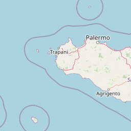
Why Pantelleria National Park stands out

Pantelleria National Park is best known for its volcanic island landscape dominated by Mediterranean maquis vegetation, its dramatic coastal cliffs, and the Monte Gibèle area that forms the island's visual centerpiece. The park is notable for preserving endemic species including the Pantesco donkey, a historic donkey breed now near extinction that was once widespread across the island. The park also serves as an important stopping point for migratory birds traversing the Mediterranean, and protects distinctive geological features formed by ancient volcanic activity.

Tree Pipit bird with brown and white plumage perched on a thin branch
Tree Pipit perched on a branch in Pantelleria National Park

Pantelleria National Park history and protected-area timeline

The establishment of Pantelleria National Park followed a complex legislative and administrative journey. The enabling legislation came through article 26, paragraph 4-septies of Italian law number 222/2007, which mandated the creation of four national parks in Sicily. The proposed parks included the Egadi Islands and Trapanese coast, the Aeolian Islands, Pantelleria, and the Iblei Mountains. A jurisdictional dispute arose when the Sicilian Regional government claimed exclusive authority over environmental matters, leading to a Constitutional Court ruling in 2009 that confirmed national-level competence for national parks even in special-status regions like Sicily. The formal establishment process concluded in June 2016 when the Regional Council of Sicily gave its assent, followed by the Council of Ministers approval. The Presidential Decree establishing the park was issued on July 28, 2016, and published in the Official Gazette on October 7, 2016. The decree also established the managing park authority and incorporated the former Riserva naturale orientata Isola di Pantelleria into the new national park structure.

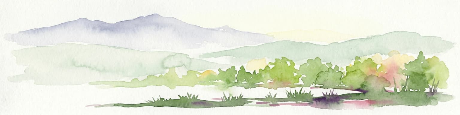
Pantelleria National Park landscape and geographic character

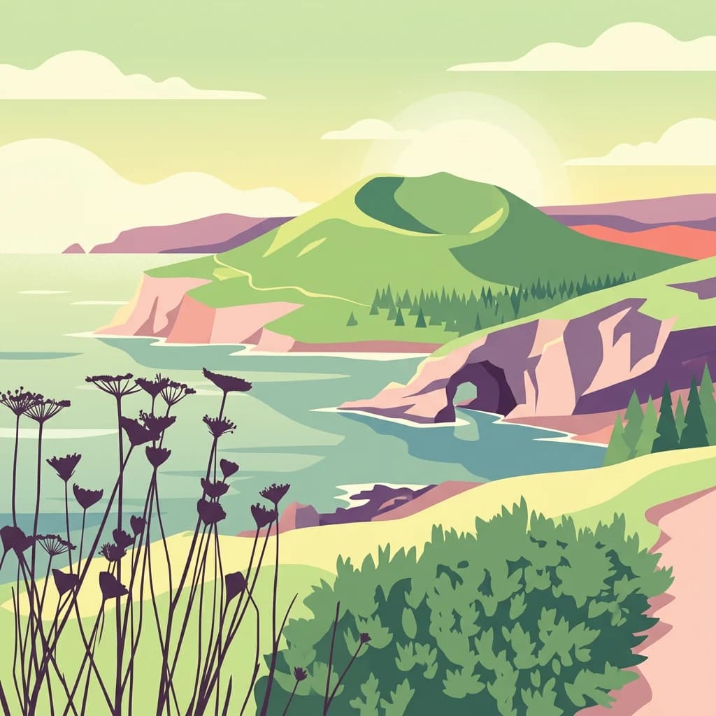
The landscape of Pantelleria National Park is defined by its volcanic origins and Mediterranean setting. The island rises from the sea with volcanic peaks and craters, with Monte Gibèle standing as the most prominent feature visible from many points on the island. The terrain includes dramatic coastal cliffs, rocky shores, and the distinctive volcanic formations that punctuate the island's interior. The landscape transitions from the more arid coastal zones with sparse vegetation to denser maquis cover in the island's interior and higher elevations. The Arch of the Elephant represents one of the most distinctive geological attractions, a natural rock formation on the coast that has become an iconic image associated with the park. The volcanic substrate creates distinctive soil conditions that influence the types of vegetation that can thrive across different parts of the island.

Panoramic view of a green mountain with rocky outcrops, distant hills, and a winding path under a partly cloudy sky
Panoramic view of Monte Gibelè from Montagna Grande in Pantelleria National Park

Pantelleria National Park ecosystems, habitats, and plant life

The ecological character of Pantelleria National Park reflects its position at the crossroads of European and African biogeographic regions. The vegetation is dominated by Mediterranean maquis, a characteristic shrubland formation that includes euphorbia, juniper, and myrtle. At higher elevations and further inland, the maquis gives way to holm oak, heather, strawberry tree, and maritime pine forests. The drier coastal cliffs support more sparse vegetation including lentisk and broom. The island's isolation has allowed for the development of unique ecological relationships and species adaptations, while its position along major migratory flyways makes it an important seasonal habitat for birds moving between Europe and Africa. The park's three-zone management system reflects ecological sensitivity, with the most stringent protection applied to areas of highest natural value and minimal human presence.

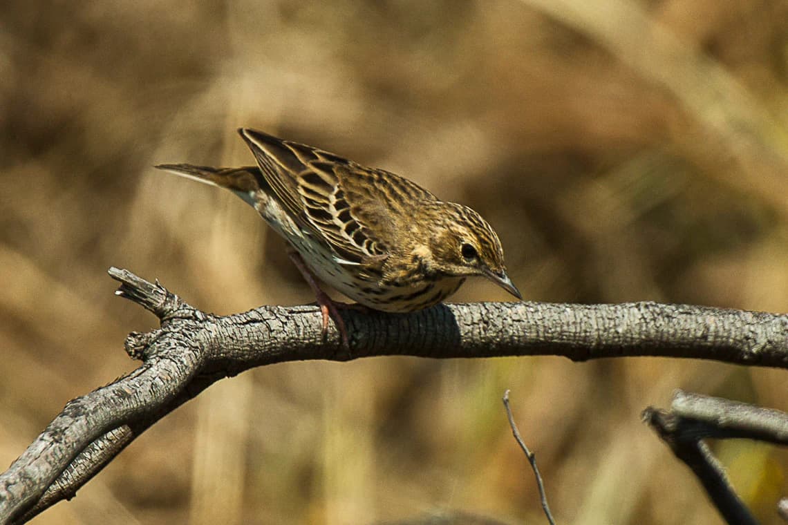
Pantelleria National Park wildlife and species highlights

The wildlife of Pantelleria National Park showcases the island's dual biogeographic connections to Europe and North Africa. Birdlife is particularly notable, with species including the sardinian warbler and great tit resident on the island, while numerous migratory species use Pantelleria as a stopover during their trans-Mediterranean journeys. The tree pipit, a trans-Saharan migrant, has been documented on the island. Among reptiles, the horseshoe whip snake represents an interesting species present in the park. Perhaps most distinctive is the Pantesco donkey, an endemic donkey breed that developed on the island over centuries and was once a common sight throughout Pantelleria. This breed has now reached the brink of extinction, making its preservation within the park context particularly significant for biodiversity conservation.

Pantelleria National Park conservation status and protection priorities

Pantelleria National Park represents a significant conservation achievement as Sicily's first national park and a critical protected area for Mediterranean island biodiversity. The park was designed to protect the island's natural values while allowing for sustainable human use through its zone-based management system. The protection extends to geological features, habitats, and species, with particular attention to endemic and threatened populations. The inclusion of the Pantesco donkey within the park's conservation mandate addresses the preservation of a culturally and genetically significant breed that faces imminent extinction. The park's establishment also consolidated and strengthened the protection previously afforded by the oriented nature reserve that preceded it, providing a more robust institutional framework for long-term conservation of Pantelleria's unique natural heritage.

Pantelleria National Park cultural meaning and human context

Pantelleria has been inhabited for millennia, with human presence shaping the island's landscape and contributing to its cultural character. The traditional agricultural practices, including the cultivation of capers and vines, have influenced the island's appearance and remain important to local identity. The Pantesco donkey breed embodies the long relationship between island inhabitants and their environment, serving as both a working animal and a living heritage. The park's management approach acknowledges human presence through its zone system, which accommodates varying levels of activity while prioritizing conservation of natural values. The volcanic terrain and strategic Mediterranean position have given Pantelleria a distinctive place in regional history, with the landscape reflecting both natural processes and centuries of human use and modification.

Top sights and standout views in Pantelleria National Park

Pantelleria National Park offers visitors dramatic volcanic landscapes dominated by Monte Gibèle, the iconic Arch of the Elephant coastal formation, and extensive Mediterranean maquis covering the island's slopes. The park provides access to coastal cliffs, volcanic terrain, and the unique opportunity to observe the endangered Pantesco donkey in its native habitat. Birdwatchers can observe both resident species and migratory visitors along the Mediterranean flyway. The park's recent establishment in 2016 makes it one of Italy's newest protected areas, offering visitors a relatively untouched island environment where conservation and natural beauty remain the defining characteristics.

Best time to visit Pantelleria National Park

The best time to visit Pantelleria National Park is during the spring and fall seasons when temperatures are moderate and the landscape displays its most vibrant colors. Spring brings flowering maquis and excellent birdwatching opportunities as migratory species pass through the island. Summer offers warm conditions but can be hot for extensive outdoor exploration. The fall season provides pleasant temperatures and the chance to observe migratory bird activity. Winter brings cooler temperatures and quieter conditions, though some facilities may have reduced services. The island's Mediterranean climate makes it a year-round destination, though the shoulder seasons generally offer the most comfortable conditions for hiking and wildlife observation within the park.

Park location guide

Geography guide, regional context, and park location map for Pantelleria National Park

Pantelleria National Park park geography, regions, and map view in Italy
Understand where Pantelleria National Park sits in Italy through a broader geographic reading of the surrounding landscape, nearby location context, and its mapped position within the national park landscape.

How Pantelleria National Park fits into Italy

Italy is a unitary parliamentary republic in Southern and Western Europe, located on the Italian Peninsula with the Alps to the north. It borders France, Switzerland, Austria, Slovenia, Vatican City, and San Marino, and shares maritime boundaries with several Mediterranean countries. The country has approximately 59 million residents and uses the Euro as its currency.

Wider geography shaping Pantelleria National Park in Italy

Italy occupies a boot-shaped peninsula in southern Europe, bordered by the Alps to the north. It shares land borders with France, Switzerland, Austria, Slovenia, Vatican City, and San Marino. The country includes the Mediterranean islands of Sicily and Sardinia, along with approximately 800 smaller islands.

Map view of Pantelleria National Park

Use this park location map to pinpoint Pantelleria National Park in Italy, understand its exact geographic position, and read its mapped placement within the surrounding landscape more clearly.

Pigeon | © OpenStreetMap contributors

Location context for Pantelleria National Park

Pantelleria

Visualize the dramatic volcanic terrain, rugged coastal cliffs, and unique Mediterranean island habitats of this Italian protected area.

Pantelleria National Park Photos: Explore Volcanic Landscapes and Island Protected Area Scenery
Visually understand Pantelleria National Park through a curated collection of imagery showcasing its distinctive volcanic landscapes, rugged coastal cliffs, and native Mediterranean maquis vegetation. These compelling views offer a deeper comprehension of the park's unique island ecosystem, diverse habitats, and overall protected area character.

Tree Pipit bird with brown and white plumage perched on a thin branch

Natural rock arch on coastal cliffs overlooking blue sea with dry vegetation and clear sky

Panoramic view of a green mountain with rocky outcrops, distant hills, and a winding path under a partly cloudy sky

Park atlas

Browse surrounding protected landscapes, comparing volcanic terrain and island ecosystems across the wider Sicilian and Mediterranean regions.

Discover Nearby Mediterranean Island National Parks and Protected Areas from Pantelleria National Park
Browse national parks and protected areas geographically near Pantelleria National Park, tracing similar volcanic landscapes and unique island ecosystems. Compare distinct protected areas across the broader Sicilian channel, expanding your atlas exploration of similar island environments and conservation landscapes.
National park

Ta' Qali National Park: Malta's Largest Urban Protected Landscape and Recreation Hub

Mapped Gardens, Event Venues, and Recreational Zones

Ta' Qali National Park serves as a vital green lung in central Malta, showcasing a landscape transformed from a wartime airfield into a modern urban protected area. This national park is recognized for its extensive recreational zones, meticulously designed formal gardens, and a prominent open-air concert venue that hosts major cultural events. Its relatively flat terrain and planned infrastructure offer a distinct map-based perspective on urban parkland, highlighting its significance as a major public amenity and a key feature of Malta's landscape.

Area
0.35 km²
Relief
Lowland
Climate
Mediterranean
Access
Easy access
National parkItaly

National Park of the Gulf of Orosei and Gennargentu: Italy's Coastal and Mountain Protected Terrain

Mapped geography of a unique Sardinian protected landscape.

Delve into the atlas-level details of the National Park of the Gulf of Orosei and Gennargentu, a protected area in Italy renowned for its stark contrast between dramatic coastal cliffs bordering the Gulf of Orosei and the wild, mountainous interior of the Gennargentu massif. This page provides structured geographic context, mapping the park's boundaries and showcasing its distinctive karst landscape, hidden beaches, and rugged peaks for comprehensive protected-area exploration.

Watercolor painting showing mountains, a lake, and grassy fields
National park

Cilento, Vallo di Diano and Alburni National Park: An Italian National Park's Geographic and Protected Landscape Identity

Mapped protected area boundaries and regional context.

Delve into the core geographic and protected-area characteristics of Cilento, Vallo di Diano and Alburni National Park. As a designated National Park in Italy, its mapped boundaries and landscape context are essential for atlas exploration. This entry provides the foundational geographic understanding needed to place this protected land within a broader map-based discovery framework, highlighting its significance as a natural landscape.

Area
1,810.48 km²
Established
1991
IUCN
II
Relief
Mountain
Watercolor illustration of a lake surrounded by green landscape with mountains in the background
National parkCalabria

Sila National Park: Protected Landscape and Geographic Context in Calabria

Explore its mapped boundaries and regional natural area.

Sila National Park represents a vital protected landscape within the Calabria region, situated in southern Italy. This page details its specific geographic features and mapped park boundaries, offering a focused view of its place within the broader Italian atlas. Understanding Sila National Park provides insight into the region's natural terrain and the distribution of its protected lands, serving as a key point for geographic discovery.

Area
736.95 km²
Established
2002
IUCN
II
Relief
Mixed relief
Watercolor illustration of a mountainous landscape with green hills, a valley with a river, and distant mountains under a pink and yellow sky
National parkCampania

Vesuvius National Park: Protected Volcanic Landscape in Campania, Italy

Explore mapped boundaries and regional geography.

Discover Vesuvius National Park, a vital protected area safeguarding Italy's iconic active volcano. This page provides essential geographic context, detailed mapped terrain, and insights into the park's unique volcanic landscape within the Campania region. It serves as a key entry point for understanding the park's protected status and its geological significance for structured atlas exploration.

Area
72.59 km²
Established
1995
IUCN
II
Relief
Mountain
Watercolor illustration showing green hills, a valley, and pink rock formations under a pale sky
National parkBasilicata

Pollino National Park: Protected Landscape of Ancient Forests and Alpine Terrain

Italy's largest national park and UNESCO Global Geopark

Pollino National Park, located in the Basilicata region, is a significant protected landscape renowned for its extensive ancient forests, particularly its rare Bosnian pines, and its dramatic, high-altitude mountain geography. Covering over 1,925 square kilometers, this national park is also recognized as a UNESCO Global Geopark, highlighting its exceptional geological heritage and unique ecosystems. The park's rugged terrain, soaring peaks, and rare ancient trees offer rich opportunities for understanding regional protected areas and mapped natural landscapes in southern Italy.

Area
1,925.65 km²
Established
1992
IUCN
II
Relief
Mountain
Watercolor illustration showing a landscape with mountains, green forests, and a river under a soft sky
National parkBasilicata

Appennino Lucano - Val d'Agri - Lagonegrese National Park: Protected Mountain Landscape in Basilicata, Italy

Explore its geography, mapped terrain, and ecological role.

Gain insight into Appennino Lucano - Val d'Agri - Lagonegrese National Park, a significant protected mountain landscape in the heart of Basilicata. This detailed page focuses on the park's distinct geographic features, its role as a crucial ecological corridor connecting major southern Italian protected areas, and the mapped contours of its diverse terrain. Understand its place within the Lucano Apennine range and the broader natural atlas of Italy.

Area
689.96 km²
Established
2007
IUCN
II
Relief
Mountain
National park

Arcipelago di La Maddalena National Park: An Italian National Park Defined by Archipelago Geography

Discover mapped protected boundaries and regional landscape context.

Arcipelago di La Maddalena National Park stands as a vital protected area within Italy, characterized by its distinctive archipelago geography. This national park offers a unique lens through which to explore mapped natural landscapes, understand protected land distribution, and contextualize its regional geographic significance. Dive into the detailed mapping of its protected territories to appreciate the full scope of this significant natural asset for structured atlas discovery.

Area
201.46 km²
Established
1994
IUCN
II
Relief
Lowland

Common questions about visiting, size, designation, and location context for Pantelleria National Park

Pantelleria National Park FAQs for park facts, access, geography, and protected area context
Find quick answers about Pantelleria National Park, including protected-area facts, park geography, trail and visitor context, and how the park fits into its surrounding country and regional landscape.
MoriAtlas Explorer

Continue Your Protected Areas Search Across the Global Atlas

Deepen your exploration by continuing the structured search for national parks and protected areas worldwide. Utilize the comprehensive filtering capabilities to compare different conservation landscapes and refine your understanding of global park geography. Discover more about the distribution and characteristics of protected natural areas.

Global natural geography