Mori Atlas logo
Nearby park discovery

Regional geography and mapped park distribution around this woodland site

Protected Areas and Natural Landscapes Near Buskett Gardens in the Maltese Countryside

Examine the geographic distribution of protected lands and natural landscapes situated in proximity to Buskett Gardens. This regional overview highlights the spatial arrangement of parks and reserves within the central Maltese landscape. Users can trace the relationship between this woodland valley and surrounding conservation areas through mapped terrain and regional context.

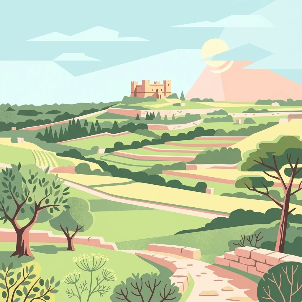
A flat-style vector illustration depicting a Mediterranean landscape with terraced hills, trees, a stone pathway, and a historic palace on a hilltop under a pale sun.

A rare wooded valley in Malta, planted by the Knights and still cherished for shade, birdsong, and midsummer tradition.

Buskett Gardens

Buskett Gardens is a compact but ecologically significant woodland located in the fertile valley of Wied il-Luq, on the western edge of Siġġiewi in central Malta. The site covers roughly 30 hectares and forms one of the very few substantial wooded areas in a country where indigenous forests were largely lost centuries ago. Its mix of broadleaved trees, native conifers, Mediterranean shrubland, and fruit groves gives it a layered, park-like character that is unusually green within the broader Maltese landscape. The gardens were established as a hunting reserve by the Knights Hospitaller and remain a popular recreational area for the local population, who visit for walks, picnics, and shade, especially during hot summer months. The gardens also carry deep cultural meaning: they have long been the site of a midsummer festival connected to the Feast of Saints Peter and Paul, locally known as Imnarja, which blends religious observance, folk music, traditional food, and an agricultural show. Ecologically, Buskett has been recognized by BirdLife International as an Important Bird Area, supporting resident and migratory species, as well as reptile life such as the Maltese painted frog. The nearby Verdala Palace, originally a Knights-era hunting lodge and now a presidential residence, overlooks the gardens and reinforces the site's long historical presence as a place of retreat, leisure, and conservation within the Maltese countryside.

Location
Malta
Park type
Wildlife reserve
Area
0.5 km²
Explore Buskett Gardens Wildlife Reserve
Regional park map

See the ranked park cluster in its geographic setting

Nearby parks around Buskett Gardens

This regional map shows the same 20 nearby parks ranked below around Buskett Gardens. Select a ranked marker to highlight that park’s boundary where boundary data is available.
Reference park: Buskett GardensRanked nearby park20 nearby parks shown
20 nearby parks

Distance-ranked collection and regional park geography for comparative environmental analysis

Parks and Protected Areas Geographically Near Buskett Gardens

Geographic proximity measurements establish a ranked sequence of protected areas surrounding Buskett Gardens for structured comparison. Country context and recorded environmental attributes help reveal wider regional patterns across neighboring natural landscapes.
National parkMalta
About 4 km away#1 closest

Northeast

Ta' Qali National Park: Malta's Largest Urban Protected Landscape and Recreation Hub

Mapped Gardens, Event Venues, and Recreational Zones

Ta' Qali National Park serves as a vital green lung in central Malta, showcasing a landscape transformed from a wartime airfield into a modern urban protected area. This national park is recognized for its extensive recreational zones, meticulously designed formal gardens, and a prominent open-air concert venue that hosts major cultural events. Its relatively flat terrain and planned infrastructure offer a distinct map-based perspective on urban parkland, highlighting its significance as a major public amenity and a key feature of Malta's landscape.

Area
0.35 km²
IUCN
V
Relief
Lowland
Climate
Mediterranean
A horizontal watercolor painting depicting a soft-toned, abstract coastal landscape with gentle green hills, grassy foreground patches, and a calm, pale pool of water against a white background.
Marine protected areaMalta
About 8.1 km away#2 closest

Northwest

Ras ir-Raħeb Marine Protected Area: Geographic Profile and Mapped Coastal Landscape

Coastal cliffs and protected marine zones in north western Malta.

Ras ir-Raħeb serves as a pivotal marine protected area along the Malta coastline, where high limestone cliffs meet complex underwater habitats. This site links historical archaeological remnants with modern ecological conservation, offering a unique geographic snapshot of the Rabat plateau edge. Its mapped boundaries encompass both the terrestrial promontory and the essential seagrass meadows beneath the surface, providing a critical reference point for Mediterranean coastal geography and protected land status.

Established
2005
Relief
Upland
Climate
Mediterranean
Access
Moderate access
A pale, minimalist watercolor illustration showing soft, rolling green and yellow hills against a white background.
Nature reserveMalta
About 8.3 km away#3 closest

South

Filfla Nature Reserve: The Protected Limestone Plateau and Geography of Malta

Tracing the limestone cliffs and seabird sanctuary of the Maltese archipelago

Filfla is a small, uninhabited limestone islet lying 4.5 kilometres south of the main island of Malta. Defined by its 60-metre sea cliffs and flat plateau, this protected nature reserve functions as a crucial Important Bird Area and a landmark for regional Mediterranean biodiversity. Examine the mapped boundaries and geological profile of this site to understand its status as the southernmost extremity of the Maltese archipelago.

Area
0.06 km²
Established
1980
Relief
Upland
Climate
Mediterranean
A pale, minimalist watercolor painting depicting St Paul's Island in Malta, showing green rolling landforms and a hint of a structure against a light background.
Protected areaMalta
About 12 km away#4 closest

North

St Paul's Island Protected Landscape and Maltese Coastal Geography Overview

Uninhabited Mediterranean island and heritage landmark

St Paul's Island represents a unique Mediterranean limestone islet featuring maritime garigue habitat and historic ruins. Located near the Mellieħa coastline, this protected area provides a compact example of Maltese coastal geography, defined by exposed cliffs and an enduring connection to local maritime history.

Area
0.101 km²
Relief
Lowland
Scope
Mixed
Water
Water-dominated
A horizontal watercolor illustration showing soft, blended washes of green, yellow, and pale pink depicting an abstract rolling landscape or horizon line against a white background.
Natural monumentMalta
About 12 km away#5 closest

East

Għar Dalam Natural Monument: A Protected Maltese Cave and Paleontological Landmark

Geological and prehistoric landscape context in southeastern Malta

Għar Dalam is a protected natural monument in Malta that preserves a complex phreatic cave passage and essential fossil records of extinct dwarf species. This cave site acts as a major cornerstone for understanding the prehistoric Mediterranean, documenting the arrival of early Neolithic cultures and the long-term evolution of island-bound animal life through stratified sediment analysis.

Established
1933
Relief
Lowland
Climate
Mediterranean
Access
Easy access
A watercolor painting showing a soft landscape with green rolling hills, low vegetation, and a calm water surface against a pastel sky.
Nature reserveSouth Eastern Region
About 14 km away#6 closest

East

Il-Ballut ta' Marsaxlokk Nature Reserve: Geography and Protected Wetland Landscapes

Essential salt marsh habitat in Malta's South Eastern Region

Il-Ballut ta' Marsaxlokk serves as a critical protected area, preserving a rare salt marsh landscape within the coastal environment of Malta. This reserve features a compact mosaic of muddy canals, halophytic vegetation, and Mediterranean coastal terrain. Its inclusion in the Natura 2000 network highlights its regional importance as a refuge for migratory birds and a focal point for environmental conservation in the South Eastern Region.

Area
0.23 km²
Established
2018
IUCN
IV
Relief
Lowland
Nature reserveMarsaxlokk
About 16 km away#7 closest

East

Xrobb l-Għaġin Nature Park: Protected Coastal Landscape in Marsaxlokk, Malta

A compact peninsula of protected cliffs and historic archaeological sites

Xrobb l-Għaġin Nature Park spans a low-lying coastal peninsula near Marsaxlokk, combining rocky Mediterranean shoreline with significant prehistoric temple remains. This protected area serves as a focal point for environmental education and coastal terrain analysis, showcasing the integration of natural heritage and historical coastal defense within a compact geographic boundary.

Area
0.155 km²
Relief
Lowland
Scope
Terrestrial
Water
Minor water
A horizontal watercolor painting showing soft green hills, grassy marshland, and a calm water channel under a light, hazy sky.
Nature reserveGozo
About 18 km away#8 closest

North

Comino Nature Reserve: Geography, Protected Marine Areas, and Karst Terrain in Gozo

Island ecology and coastal landscape mapping

Examine the protected geography of Comino, an island nature reserve near Gozo defined by limestone plateaus and sheltered bays. This overview covers the ecological boundaries of the Natura 2000 marine area, the distribution of coastal sea caves, and the topographic patterns of this Important Bird Area.

Area
3.5 km²
Relief
Lowland
Climate
Mediterranean
Access
Moderate access
A flat-style vector illustration depicting a coastal beach scene with reddish sand, rolling green hills in the background, a blue ocean with gentle waves, and a few beach umbrellas in the foreground.
Protected areaGozo
About 25 km away#9 closest

Northwest

Ramla Bay: Geographic Mapping and Protected Landscape Analysis of the Gozo Coast

Coastal terrain, red-sand geology, and Mediterranean rural landscapes.

Ramla Bay represents a significant protected coastal pocket on the island of Gozo. Beyond its well-known red-sand beach, the area encompasses a wider valley landscape defined by limestone headlands and agricultural plateaus. Use this mapped overview to understand the interaction between the Mediterranean coastline and the rugged rural hinterland of the Maltese islands.

Relief
Lowland
Climate
Mediterranean
Access
Easy access
Scope
Terrestrial
Watercolor painting of a reddish limestone sea arch or islet surrounded by water and faint coastal hills.
Nature reserveGozo
About 28 km away#10 closest

Northwest

Fungus Rock: A Protected Limestone Nature Reserve on the Western Coast of Gozo

Geographic landmark and protected coastal terrain

Fungus Rock represents a critical protected landscape at the entrance to Dwejra bay, offering a unique look at Mediterranean limestone geology. Known for its vertical cliff faces and historical botanical significance, this nature reserve remains a defining feature of the Gozitan coastline and the surrounding marine environment.

Area
0.007 km²
Relief
Upland
Climate
Mediterranean
Access
Easy access
Watercolor painting of a landscape with rolling hills, pink wildflowers, and scattered trees
National parkItaly
About 233 km away#11 closest

Northwest

Pantelleria National Park: A Protected Landscape within Italy's Atlas

Mapped boundaries and regional geographic context.

Pantelleria National Park is a designated national park in Italy offering a distinct protected landscape for exploration. This page provides essential geographic context, highlighting the park's mapped boundaries and its significance within the regional atlas. Understand the terrain and protected land features that define this important natural area.

Area
66.4 km²
Established
2016
IUCN
II
Relief
Highland
Watercolor illustration of a mountainous landscape featuring a winding river, trees, and grass.
National parkCalabria
About 269 km away#12 closest

Northeast

Aspromonte National Park: A Protected National Park within Calabria's Geographic Atlas

Explore its mapped terrain and regional landscape context.

Aspromonte National Park represents a crucial element within the protected landscapes of the Calabria region. This page serves as an in-depth atlas entry, detailing the park's geographic features and its specific context within southern Italy's broader natural terrain. Users can explore the park's mapped boundaries and understand its significance as a protected area within the Italian peninsula's rich geography.

Area
641.53 km²
Established
1989
IUCN
II
Relief
Mountain
National parkLibya
About 345 km away#13 closest

South

El Naggaza National Park: A Protected Landscape in Libya's Geographic Atlas

Mapped boundaries and regional terrain of a Libyan national park.

Delve into the specifics of El Naggaza National Park, a designated national park in Libya. This entry focuses on its geographic setting, providing details relevant to atlas exploration and understanding protected land distribution in North Africa. Examine its mapped features and its place within the broader landscape context of the region.

Area
40 km²
Established
1993
IUCN
II
Scope
Terrestrial
National parkTunisia
About 351 km away#14 closest

Northwest

Zembra National Park: A Protected Island Landscape in Tunisia's Mediterranean Waters

Explore its unique geography and mapped protected area boundaries.

Zembra National Park safeguards a rugged, mountainous island environment characterized by dramatic limestone cliffs plunging into the Mediterranean Sea. This national park is renowned for its exceptional avian populations, including the endangered Eleonora's falcon, and its preserved Mediterranean maquis ecosystem, supporting endemic plant species. The park's geographic isolation contributes to its status as a significant biodiversity hotspot, offering a distinct lens for understanding island ecosystems and conservation efforts within the broader Tunisian geography.

IUCN
II
National parkTunisia
About 372 km away#15 closest

West

Boukornine National Park: A Protected Mediterranean Mountain Landscape in Tunisia

Explore its mapped terrain and unique protected ecosystem.

Boukornine National Park in Tunisia represents a significant protected landscape, notable for its central granite peak, Jebel Boukornine, which rises sharply above the surrounding coastal plains. This national park, covering approximately 1,939 hectares, preserves a distinctive Mediterranean mountain ecosystem. Its rugged terrain, rocky slopes, and the presence of Aïn Zargua spring support a unique concentration of species, including notable flora and fauna. Understanding Boukornine National Park provides insight into the regional geography and the importance of conserving these mountainous protected areas within Tunisia.

Area
19.39 km²
Established
1987
IUCN
II
Relief
Mountain
National parkLibya
About 388 km away#16 closest

Southwest

Sirman National Park National Park: Geographic Atlas and Protected Landscape

Explore the mapped terrain and park boundaries.

Sirman National Park is presented here as a distinct national park entity, focusing on its geographic significance and protected landscape characteristics. Users can examine its mapped boundaries, understand its place within the broader regional geography, and explore its natural terrain through an atlas-driven approach. This detailed view supports a structured understanding of the park's conservation status and its unique environmental context, offering factual geographic discovery.

Watercolor illustration of a lake surrounded by green landscape with mountains in the background
National parkCalabria
About 401 km away#17 closest

Northeast

Sila National Park: Protected Landscape and Geographic Context in Calabria

Explore its mapped boundaries and regional natural area.

Sila National Park represents a vital protected landscape within the Calabria region, situated in southern Italy. This page details its specific geographic features and mapped park boundaries, offering a focused view of its place within the broader Italian atlas. Understanding Sila National Park provides insight into the region's natural terrain and the distribution of its protected lands, serving as a key point for geographic discovery.

Area
736.95 km²
Established
2002
IUCN
II
Relief
Mixed relief
National parkLibya
About 418 km away#18 closest

South

Abughilan National Park: National Park Protected Landscape and Geographic Context

Explore Libya's protected area and mapped landscape.

Abughilan National Park stands as a designated national park, offering significant value for geographic discovery and understanding protected landscapes. This entry provides context on its mapped boundaries and its role within the regional geography of Libya, Northern Africa. It serves as a detailed point of reference for anyone exploring national parks and protected areas through an atlas-driven lens, focusing on the park's unique environmental context and its position in the landscape.

Area
40 km²
Established
1992
IUCN
II
Scope
Terrestrial
Watercolor illustration showing green hills, a valley, and pink rock formations under a pale sky
National parkBasilicata
About 436 km away#19 closest

North

Pollino National Park: Protected Landscape of Ancient Forests and Alpine Terrain

Italy's largest national park and UNESCO Global Geopark

Pollino National Park, located in the Basilicata region, is a significant protected landscape renowned for its extensive ancient forests, particularly its rare Bosnian pines, and its dramatic, high-altitude mountain geography. Covering over 1,925 square kilometers, this national park is also recognized as a UNESCO Global Geopark, highlighting its exceptional geological heritage and unique ecosystems. The park's rugged terrain, soaring peaks, and rare ancient trees offer rich opportunities for understanding regional protected areas and mapped natural landscapes in southern Italy.

Area
1,925.65 km²
Established
1992
IUCN
II
Relief
Mountain
National parkTunisia
About 438 km away#20 closest

West

Jebel Serj National Park: Central Tunisia's Distinctive Mountain Protected Area

Explore its terrain and protected landscape context.

Jebel Serj National Park, established in 2010, safeguards a significant mountainous territory in central Tunisia, distinguishing itself from the broader semi-arid plains. This protected landscape showcases the Djebel Serj massif, a unique topographical feature that serves as an ecological bridge between Tunisia's northern and southern regions. Users exploring this page can gain an atlas-level understanding of the park's mapped boundaries, its geological character, and its contribution to the conservation of representative natural diversity within North Africa's transitional ecosystems.

Area
17.2 km²
Established
2010
IUCN
II
Scope
Terrestrial
Distance methodology

Geographic measurements, not driving distances

How nearby park distances are calculated

Distances use park boundaries whenever the available geometry allows it. When one or both boundaries are missing, the mapped park locations provide a clearly labelled estimate. Every value represents straight-line geographic separation and does not use roads or routing.

Boundary distance

Calculated between the nearest points of both park boundaries.

Location-to-boundary estimate

Estimated from one mapped park location to the nearest boundary of the other park.

Mapped-location estimate

Estimated between the mapped locations of both parks.

MoriAtlas Explorer

Discover the Protected Woodland Geography of Buskett Gardens in Malta

Continue exploring the unique landscape of Buskett Gardens through the MoriAtlas dataset. Analyze the valley terrain, mapped boundaries, and ecological role of this significant Maltese woodland, a rare green refuge within the central Mediterranean islands.