Mori Atlas logo
Nearby park discovery

Mapping regional landscapes and surrounding conservation zones in central Angola

Geographic Distribution of Protected Areas and National Parks Near Cangandala National Park

Identify protected areas and natural landscapes situated in the vicinity of Cangandala National Park. This geographic map reveals regional proximity patterns, comparing nearby conservation zones within Malanje Province and the broader Angolan savanna environment.

Related tags

national parksavanna ecosystemmiombo woodlandgiant sable antelope conservationriverine habitat

Angola's sanctuary for the critically endangered giant sable antelope

Cangandala National Park

Cangandala National Park is a protected area in Malanje Province, central Angola, established specifically to safeguard one of Africa's most threatened antelope species. The park covers approximately 600 square kilometers of savanna landscape situated between the Cuanza River and its tributaries, the Maúndo and Cuije rivers. Its mission centers on protecting the giant sable antelope, a critically endangered subspecies endemic to this region of Angola. The park features a characteristic mix of miombo woodlands and open grasslands, with denser forest patches concentrated along the river corridors. This habitat supports not only the flagship giant sable but also various other antelope species, zebras, and diverse birdlife. The park's history is deeply connected to Angola's modern turbulent past, having been创建 during the civil war period and suffering significant wildlife declines due to poaching and habitat disruption.

Location
Angola
Park type
National park
Established
1970
Area
600 km²
Cangandala National Park Protected Area
Regional park map

See the ranked park cluster in its geographic setting

Nearby parks around Cangandala National Park

This regional map shows the same 20 nearby parks ranked below around Cangandala National Park. Select a ranked marker to highlight that park’s boundary where boundary data is available.
Reference park: Cangandala National ParkRanked nearby park20 nearby parks shown
20 nearby parks

Distance ranked regional park geography and surrounding protected landscapes

Parks and Protected Areas Geographically Near Cangandala National Park

Examine the ranked collection of protected areas situated closest to Cangandala National Park based on direct geographic separation. Analyze surrounding landscape patterns and regional environmental data to compare diverse conservation zones across the territory.
National parkAngola
About 348 km away#1 closest

West

Quiçama National Park: A National Park in Angola's Protected Landscape Atlas

Explore its mapped geography and regional natural context.

Quiçama National Park represents a significant protected area within Angola, contributing to the nation's atlas of natural landscapes. This page provides detailed geographic information, focusing on the park's protected status and its integration within the broader regional geography. Users can explore the mapped terrain and understand the specific landscape characteristics that define this important national park, facilitating structured discovery of Angola's protected lands.

Area
9,960 km²
Established
1957
IUCN
II
Access
Access unknown
National parkMoxico Leste Province
About 485 km away#2 closest

Southeast

Cameia National Park: Unique Zambezi Basin Wetlands and Miombo Woodlands in Angola

Explore the mapped geography of Angola's sole Zambezi basin ecological sample.

Cameia National Park is a significant protected area in Moxico Leste Province, Angola, distinguished by its status as the country's only representation of Zambezi River basin ecosystems. The park features extensive seasonally inundated plains and characteristic miombo woodlands, offering a unique mosaic of wetland and forest landscapes. Understanding its geographic setting, hydrological connections to the Chifumage, Lumege, and Luena rivers, and its position within the broader Zambezi drainage system provides essential context for this irreplaceable protected territory.

Area
1,445 km²
Established
1938
IUCN
II
Relief
Lowland
National parkAngola
About 566 km away#3 closest

Southeast

Mavinga National Park: Protected Landscape Identity and Geographic Mapping in Angola

Explore mapped boundaries and regional context of this national park.

Mavinga National Park stands as a designated protected area within Angola, offering insights into the nation's natural landscapes and conservation efforts. This entry details the park's geographic footprint and its role as a national park. It provides users with essential map-based discovery tools to understand the park's setting, its physical geography, and its significance as a protected natural landscape in southern Africa.

Area
46,076 km²
Established
2011
IUCN
II
Relief
Lowland
National parkDemocratic Republic of the Congo
About 629 km away#4 closest

Northwest

Mangroves National Park: Geographic Boundaries and Regional Landscape Discovery

Coastal wetland and estuarine protected area in the Democratic Republic of the Congo

Access a structured geographic overview of Mangroves National Park, an essential coastal protected area in the Democratic Republic of the Congo. This analysis covers the park's wetland habitat, delta geography, and the broader environmental context of this tropical maritime landscape for focused regional exploration.

IUCN
II
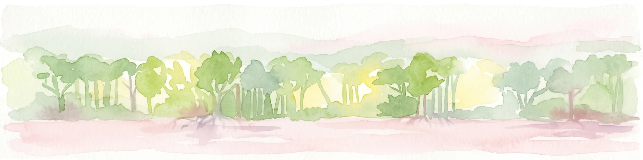
Watercolor painting showing mangrove trees and a shoreline under a light sky.
National parkDemocratic Republic of the Congo
About 629 km away#5 closest

Northwest

Mangroves National Park: Protected Marine and Coastal Ecosystems of the Democratic Republic of the Congo

A vital Ramsar wetland at the Congo River mouth

This protected area captures the unique interplay between the Atlantic Ocean and the Congo River delta. Known for its extensive mangrove forests, the park maintains vital ecological functions including sediment stabilization and carbon sequestration. Its complex network of tidal channels and brackish lagoons supports diverse populations of hippopotamuses, crocodiles, and the rare African manatee within a compact, distinctive landscape.

Area
768 km²
Established
1992
IUCN
II
Relief
Lowland
National parkAngola
About 643 km away#6 closest

South

Bicuar National Park National Park: Explore Protected Landscape and Regional Geography in Angola

Mapped boundaries and geographic context for Bicuar National Park.

Bicuar National Park represents a distinct protected area within Angola, offering valuable insights into the nation's natural geography. As a designated national park, its mapped boundaries are crucial for understanding its spatial extent and ecological significance. This resource supports detailed atlas exploration, allowing for a deeper appreciation of the park's landscape and its role within the regional context of Southern Africa.

National parkAfrica
About 643 km away#7 closest

South

Bicuari National Park: An African National Park with Distinct Protected Landscape Identity

Explore its mapped geographic boundaries and regional terrain.

Bicuari National Park represents a vital component of Africa's protected lands network. This national park offers a specific focus on its unique geographic setting and the mapped extent of its protected boundaries. As an atlas entry, it provides critical context for understanding the park's landscape within the broader regional geography of the African continent, ideal for detailed geographic exploration.

National parkCunene Province
About 688 km away#8 closest

South

Mupa National Park National Park: Exploring Protected Landscapes and Geographic Context

Discover the mapped terrain and boundaries in Cunene Province.

Mupa National Park is a vital protected area within Cunene Province, Angola, serving as a key component of the region's conservation atlas. This national park represents a distinct geographic entity, offering detailed insights into its mapped landscape and protected boundaries. Users can explore Mupa National Park to understand its specific contribution to the protected lands of southern Angola and to appreciate its unique position within the broader regional geography and natural terrain.

Area
6,600 km²
Established
1964
Access
Access unknown
Scope
Terrestrial
National parkWestern Province
About 778 km away#9 closest

Southeast

Liuwa Plain National Park National Park: Mapped Protected Landscape Explorer

Explore regional geography and protected park boundaries.

Liuwa Plain National Park, designated as a national park in Zambia's Western Province, serves as a crucial point for understanding protected land distribution and regional geography. This dedicated page provides detailed insights into its mapped protected landscape, allowing for focused atlas-style exploration. Discover the park's role within the larger geographic context of Western Province and its significance as a conservation area through structured mapping and landscape analysis.

Area
3,369 km²
Established
1972
IUCN
II
Relief
Lowland
National parkAngola
About 800 km away#10 closest

Southeast

Longa-Mavinga National Park: Detailed Atlas and Protected Landscape Context in Angola

Explore its mapped boundaries and regional geographic significance.

Longa-Mavinga National Park serves as a crucial point for understanding protected areas and natural landscapes within Angola. This page details its identity as a national park, focusing on its mapped geographic features and protected land status. Users can delve into the specific landscape context and regional distribution of this significant protected area, enhancing their grasp of Angola's natural geography.

IUCN
II
Wildlife reserveAngola
About 811 km away#11 closest

Southwest

Namibe Partial Reserve: Mapping the Arid Landscapes and Conservation Areas of Angola

Southwestern Angola Wildlife Reserve Geography

Namibe Partial Reserve encompasses vast desert dunes and unique arid plains in southwestern Angola. The protected area offers a look at the ecological character of the Kaokoveld Desert, highlighting the natural geography and boundary context of this significant wildlife reserve within the region.

Area
4,450 km²
Established
1960
IUCN
IV
Relief
Lowland
National parkDemocratic Republic of the Congo
About 829 km away#12 closest

Northeast

Salonga National Park: Africa's Largest Tropical Rainforest Protected Landscape

Discover its vast mapped boundaries and riverine geography.

Salonga National Park is recognized as Africa's largest tropical rainforest, a UNESCO World Heritage Site vital for the conservation of bonobos and other endemic species. Its protected landscape is defined by extensive lowland forests and intricate river networks, with access primarily through waterways. This park offers profound insights into the geography of the Congo Basin and the conservation of endangered primates within a vast, remote wilderness.

Area
36,000 km²
Established
1970
IUCN
II
Relief
Lowland
National parkAngola
About 852 km away#13 closest

Southeast

Luengue-Luiana National Park: Angola's Premier Protected Woodland and Floodplain Ecosystem

Mapping crucial habitats for large mammals and avian wildlife.

Luengue-Luiana National Park is a vital protected landscape in southeastern Angola, covering an immense area that transitions from open woodland ecosystems to vast, seasonal floodplain grasslands. As a cornerstone of the Kavango-Zambezi Transfrontier Conservation Area, it facilitates critical wildlife movements and supports significant populations of large mammals. Its geography provides essential habitat, particularly within the extensive wetland wilderness and riparian zones along the Cuando River, making it a significant site for regional biodiversity and atlas exploration.

Area
42,000 km²
Established
2011
IUCN
II
Relief
Lowland
National parkNamibe Province
About 859 km away#14 closest

Southwest

Iona National Park: Mapped Protected Landscape in Namibe Province, Angola

Explore the geographic extent and regional context of this national park.

Iona National Park stands as a protected natural area within the administrative region of Namibe Province, Angola. This atlas-focused entry provides detailed insights into the park's mapped boundaries, its regional geographic positioning, and its role as a conservation landscape. Users can engage with specific data to understand the terrain and protected land distribution within this significant Angolan national park.

Area
15,200 km²
Established
1964
IUCN
II
Relief
Mixed relief
Watercolor painting showing a river with green hills and pink flowers in the foreground
National parkKouilou Department
About 875 km away#15 closest

Northwest

Conkouati-Douli National Park: Mapping Protected Landscape Boundaries and Regional Geography

Explore its national park status and geographic context.

Conkouati-Douli National Park is a protected area situated in the Kouilou Department, offering a focused point for geographic and landscape discovery. This detail provides an atlas-style perspective on its mapped boundaries and its contribution to the regional geography. Understand the park as a distinct natural landscape and a key component of conservation within its geographic setting.

Area
7,955 km²
Established
1999
IUCN
II
Relief
Lowland
National parkHaut-Ogooué Province
About 894 km away#16 closest

North

Batéké Plateau National Park: Mapped Geography of a Central African Forest-Savanna Mosaic

Discover the terrain and protected landscape of Haut-Ogooué Province.

Batéké Plateau National Park is defined by its expansive forest-savanna mosaic, a rare ecological formation across Central Africa. Located within Haut-Ogooué Province, this national park showcases unique terrain characterized by savanna grasslands interspersed with woodlands and forested corridors. Understanding its geographic context and protected boundaries provides valuable insight into the region's natural heritage and conservation significance.

Area
2,034 km²
Established
2002
IUCN
II
Relief
Upland
Wildlife reserveOshana Region
About 914 km away#17 closest

South

Oshana-System Wildlife Reserve: Mapping the Seasonal Wetlands of the Oshana Region

A complex network of drainage channels and savanna grasslands

The Oshana-System functions as an expansive inland wetland complex, defined by its flat, sandy terrain and cyclic flooding. This wildlife reserve spans significant portions of north-central Namibia, offering a distinct study in low-gradient hydrology and savanna-wetland transitions characterized by mopane woodland and makalani palms.

Area
30,000 km²
Relief
Lowland
Scope
Terrestrial
Water
Water-dominated
National parkGabon
About 918 km away#18 closest

Northwest

Mayumba National Park: Gabon's Equatorial Protected Area and Geographic Atlas

Explore mapped park boundaries and regional landscape context.

Delve into the geographic identity of Mayumba National Park, a significant protected area situated in Gabon. This detail page provides atlas-style insights into the park's mapped boundaries, its position within the equatorial geography of Central Africa, and its role as a national park. Understand the protected landscape's environmental context and its atlas significance.

Area
870 km²
Established
2002
IUCN
II
Relief
Lowland
National parkGabon
About 930 km away#19 closest

North

Ogooué-Leketi National Park National Park: A Protected Landscape in Gabon's Geography

Mapped boundaries and regional protected-area context.

Delve into the protected landscape of Ogooué-Leketi National Park, a national park situated in Gabon. This entry provides crucial context for understanding the park's geographic footprint and its role as a conservation area. Examine the mapped terrain and discover how Ogooué-Leketi National Park fits into the regional geography of Central Africa, offering an atlas-driven perspective on its protected status.

National parkZambia
About 934 km away#20 closest

East

West Lunga National Park: Exploring Zambia's Sole Evergreen Forest Protected Area

Discover rare Cryptosepalum dry forests and unique mapped geography.

West Lunga National Park offers a distinct atlas exploration opportunity as Zambia's only national park primarily defined by its forest cover. This remote protected area safeguards the largest evergreen forest in Africa outside the equatorial zone, characterized by dense Cryptosepalum trees forming a closed canopy over sandy terrain. Understand the park's unique landscape, its geographic position within the region, and its importance as a conservation area with mapped protected boundaries.

Area
1,700 km²
IUCN
II
Relief
Lowland
Access
Remote access
Distance methodology

Geographic measurements, not driving distances

How nearby park distances are calculated

Distances use park boundaries whenever the available geometry allows it. When one or both boundaries are missing, the mapped park locations provide a clearly labelled estimate. Every value represents straight-line geographic separation and does not use roads or routing.

Boundary distance

Calculated between the nearest points of both park boundaries.

Location-to-boundary estimate

Estimated from one mapped park location to the nearest boundary of the other park.

Mapped-location estimate

Estimated between the mapped locations of both parks.

MoriAtlas Explorer

Continue Exploring Cangandala National Park's Geography and Boundaries

Delve deeper into the specific landscape features and mapped terrain surrounding Cangandala National Park. Understanding its protected area status and its position within Malanje Province enhances your exploration of Angola's natural geography. Utilize this entry point to gain structured insights into the park's identity and its cartographic representation for comprehensive atlas discovery.