Mori Atlas logo
Nearby park discovery

Geographic landscape context and regional distribution of conserved terrain in Northern Siberia

Protected Areas and National Parks Situated Near Гыданский национальный парк in the Russian Arctic

Examine the surrounding geographic context of Гыданский национальный парк, tracing the distribution of protected landscapes across the Gydan Peninsula and the Kara Sea. This analysis offers a spatial perspective on regional conservation, mapping the proximity of various protected natural units that define the Arctic tundra environment of Western Siberia.

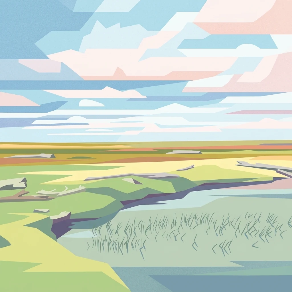
A digital illustration of a flat tundra landscape featuring patches of grass, a shallow pool with reeds in the foreground, and a vast sky with geometric clouds.

Russia's northernmost protected area in Western Siberia, safeguarding Arctic tundra, coastal islands, and migrating bird flyways on the Gydan Peninsula.

Gydansky National Park

Gydansky National Park is a vast Russian protected area on the Gydan Peninsula and surrounding islands of the Kara Sea, in the Tazovsky District of the Yamalo-Nenets Autonomous Okrug. It is the northernmost natural conservation complex in Western Siberia, covering an enormous expanse of Arctic tundra, low-lying coastline, and offshore islands where the Ob and Yenisei influence the regional environment. The park protects representative Arctic ecosystems and a critical stretch of the East Atlantic Flyway, a major migratory route for waterbirds and shorebirds travelling along the northern coast of Eurasia. Its landscape is shaped by permafrost, tundra vegetation, river systems, and the transitional zones between land and the Kara Sea. Beyond its ecological importance, the territory also supports the traditional way of life of indigenous peoples tied to the land for generations. Originally established as the Gydansky Nature Reserve in 1996, the area was converted into a national park in late 2024. This administrative change broadened the categories of permitted land use within its boundaries, allowing regulated traditional activities alongside conservation, while also reflecting the growing tension between expanding industrial development in the region and the long-term protection of its natural and cultural values.

Location
Russia
Park type
National park
Established
1996
Area
8,981.7 km²
Гыданский национальный парк Protected Area Atlas
Regional park map

See the ranked park cluster in its geographic setting

Nearby parks around Gydansky National Park

This regional map shows the same 20 nearby parks ranked below around Gydansky National Park. Select a ranked marker to highlight that park’s boundary where boundary data is available.
Reference park: Gydansky National ParkRanked nearby park20 nearby parks shown
20 nearby parks

Distance ranked regional geography and surrounding protected landscapes

Parks and Protected Areas Geographically Near Гыданский национальный парк

Explore nearby protected areas ranked by direct geographic proximity to Гыданский национальный парк across the surrounding northern Siberian landscape. Compare recorded environmental characteristics and regional contexts to understand wider conservation patterns.
Watercolor illustration of rolling green hills with distant mountains and a light sky
National parkRussia
About 554 km away#1 closest

Northwest

Russian Arctic National Park: Russia's Premier Northernmost Protected Landscape

Arctic Islands, Glacial Terrain, and Marine Mammal Habitats

Russian Arctic National Park preserves some of the planet's most remote and pristine Arctic environments across the Novaya Zemlya and Franz Josef Land archipelagos. This protected area offers unparalleled insight into Arctic geography, showcasing dramatic glacial landscapes, extensive seabird colonies, and critical feeding grounds for polar bears and bowhead whales. Explore the park's unique protected landscape and its significance within the broader atlas of global conservation efforts.

Area
14,260 km²
Established
2009
IUCN
II
Relief
Lowland
National parkKomi Republic
About 976 km away#2 closest

Southwest

Yugyd Va National Park: Protected Boreal Wilderness and Mountain Geography in the Komi Republic

Exploring Europe's largest protected taiga and Ural mountain ecosystems.

Yugyd Va National Park offers a comprehensive look at the high-altitude geography of the Ural Mountains and the surrounding boreal taiga. As the largest protected wilderness area in Europe, this site showcases a dramatic transition from ancient lowland forest floors to alpine tundra summits. The park map highlights significant river corridors and granite mountain ranges that define this remote, undisturbed ecological landscape in the Russian north.

Area
18,917 km²
Established
1994
IUCN
II
Visitors
4K annual
National parkKomi Republic
About 976 km away#3 closest

Southwest

Yugyd Va National Park in the Komi Republic: A Protected Atlas of Ural Wilderness

Virgin taiga forests, glacial peaks, and northern river basins

Yugyd Va serves as a critical conservation landscape in the Russian North, protecting a mosaic of ecosystems from dense coniferous forests to exposed glacial cirques. This expansive national park in the Komi Republic contains the highest summits of the Ural Mountains and hundreds of pristine lakes, offering a window into one of the least disturbed wilderness regions on the European continent.

Area
18,917 km²
Established
1994
IUCN
II
Visitors
6.7K annual
Watercolor painting of a mountainous landscape with green, purple, and yellow tones
National parkMurmansk Oblast
About 1,707 km away#4 closest

West

Khibiny National Park: Arctic National Park with Mapped Protected Boundaries in Murmansk Oblast

Explore Murmansk Oblast's unique protected landscape and regional geography.

Delve into the geography and protected landscape of Khibiny National Park, a significant national park situated in Russia's Murmansk Oblast. This resource provides essential details for understanding the park's mapped boundaries, its arctic terrain, and its position within the broader context of the Kola Peninsula's natural geography. Explore Khibiny National Park as a key protected area and a crucial element for atlas-based discovery of Russia's northwestern regions.

Area
848 km²
Established
2018
IUCN
II
Relief
Mountain
National parkFinnmark
About 1,718 km away#5 closest

West

Varangerhalvøya National Park: Explore Finnmark's Unique Subarctic Protected Landscape

Mapped tundra, wetlands, and Arctic fox conservation.

Varangerhalvøya National Park offers a compelling atlas exploration of Norway's northeasternmost protected landscapes. This national park in Finnmark is distinguished by its subarctic terrain, featuring expansive tundra, diverse wetlands, and a unique ecological position where multiple biomes converge. It is a critical habitat for the Arctic fox and a vital Important Bird Area, providing deep insights into protected area geography and landscape context for those studying regional conservation and natural formations.

Area
1,804.1 km²
Established
2006
IUCN
II
Relief
Lowland
Watercolor painting of a lake with pine-covered islands and rolling hills in the background.
National parkArkhangelsk Oblast
About 1,781 km away#6 closest

West

Onezhskoye Pomorye National Park: An Atlas of Protected Northern Taiga and Coastal Terrains

Exploring the glacial landscapes of Arkhangelsk Oblast

Onezhskoye Pomorye National Park serves as a significant protected corridor where large tracts of old-growth spruce and pine forest extend directly to the White Sea shoreline. The mapped terrain transitions from elevated glacial plains and moraine ridges to low-lying glacio-marine terraces, dunes, and migratory wetlands. This geographic record highlights the park's role in conserving boreal wilderness, salmon-rich rivers, and the historic cultural legacy of the Pomor people along the northern coast.

Area
2,016.68 km²
Established
2013
IUCN
II
Relief
Mixed relief
Watercolor painting of a coastal landscape featuring rolling hills, green vegetation, and a body of water under a soft sky
National parkSverdlovsk Oblast
About 1,785 km away#7 closest

Southwest

Pripyshminskiye Bory National Park: Explore its Protected Landscape and Geographic Setting

National Park with mapped boundaries in Sverdlovsk Oblast.

Pripyshminskiye Bory National Park stands as a notable protected area within the vast geography of Sverdlovsk Oblast, Russia. This page serves as a dedicated atlas entry for the park, detailing its protected landscape identity and its placement within the broader regional context. Users can investigate the park's mapped boundaries and understand its significance as a distinct national park, facilitating structured geographic discovery.

Area
490 km²
Established
1993
IUCN
II
Relief
Lowland
National parkSvalbard
About 1,788 km away#8 closest

Northwest

Sassen, Bünsow Land National Park: A Mapped Arctic Glacial Landscape in Svalbard

Explore protected boundaries and polar terrain.

Sassen, Bünsow Land National Park, located in the heart of Spitsbergen, Norway, showcases a quintessential Arctic wilderness defined by its expansive glacial features and deeply incised valleys. This protected area, part of the Svalbard archipelago, offers rich geographic context through its mapped terrain, highlighting glacial processes that have shaped the landscape. Discover the unique polar environment and the significance of this national park within the broader Norwegian Arctic atlas.

Area
1,230 km²
Established
2003
IUCN
II
Relief
Mountain
National parkNorway
About 1,805 km away#9 closest

Northwest

Indre Wijdefjorden National Park: Arctic Steppe and Fjord Protected Landscape Exploration

Mapped protected boundaries and unique terrain in Svalbard.

Discover the unique High Arctic steppe and dramatic fjord landscape of Indre Wijdefjorden National Park, a protected area in Svalbard, Norway. This park safeguards a rare ecosystem with endemic plant species, offering exceptional insights into Arctic geography and protected land conservation. Explore its mapped boundaries and distinct terrain, a key destination for atlas-based landscape discovery.

Area
1,127 km²
Established
2005
IUCN
II
Relief
Mountain
National parkSvalbard
About 1,809 km away#10 closest

Northwest

Nordvest-Spitsbergen National Park: Protected Arctic Landscape and Geographic Atlas

Explore unique hot springs, glacial terrain, and polar expedition history.

Nordvest-Spitsbergen National Park, a protected national park in Norway's Svalbard archipelago, showcases dramatic Arctic geography. This page details its mapped landscapes, from volcanic terrains and glacial valleys to its famed northernmost hot springs. Discover the park's protected area status, its role in regional geography, and its historical significance for polar exploration, providing a rich context for atlas-based exploration.

Area
9,914 km²
Established
1973
IUCN
II
Relief
Mixed relief
National parkNorway
About 1,814 km away#11 closest

West

Øvre Pasvik National Park: Norway's Pristine Siberian Taiga & Mapped Boreal Geography

Explore ancient forests, wetlands, and transboundary protected landscapes.

Øvre Pasvik National Park is a landmark protected area in Northern Norway, showcasing a remarkably intact Siberian taiga ecosystem characterized by ancient Scots pine forests and extensive wetlands. This national park offers a unique geographic perspective with its notably flat terrain, distinguishing it within the broader Norwegian atlas. As part of the Pasvik, Inari Trilateral Park, it highlights significant transboundary conservation efforts and provides a valuable mapped resource for understanding European boreal landscapes and their unique wildlife habitats.

Area
119 km²
Established
1970
IUCN
II
Relief
Lowland
Watercolor painting showing a river flowing through a grassy field with trees and hills in the background
National parkArkhangelsk Oblast
About 1,815 km away#12 closest

West

Onezhskoye Pomorye National Park: A Geographic Profile of Northern Russian Protected Lands

Tracing the coastal and boreal landscape boundaries in Arkhangelsk Oblast

Onezhskoye Pomorye National Park preserves an isolated wilderness of immense ecological importance. The territory encompasses ancient taiga forests that descend directly into the White Sea, showcasing a rare transition zone between inland boreal ecosystems and marine coastal environments. This protected area offers a look into northern Russian geography, characterized by its glaciated terrain and historic maritime heritage sites.

Area
2,016.68 km²
Established
2013
IUCN
II
Relief
Lowland
National parkKomi Republic
About 1,816 km away#13 closest

Southwest

Koygorodskiy National Park: Geography and Protected Area Overview in the Komi Republic

Boreal forests and river ecosystems in southern Russia

Located in the Koygorodsky and Priluzsky districts, Koygorodskiy National Park represents a significant conservation effort in the southern Komi Republic. Established to protect diverse taiga and mixed forest habitats, the park serves as a hub for botanical research and regional landscape preservation. Its geography of forested hills and river valleys provides a unique look at the transitional ecosystems that border the vast northern wilderness of the Russian taiga.

Area
567 km²
Established
2019
IUCN
II
Relief
Lowland
National parkKomi Republic
About 1,834 km away#14 closest

Southwest

Koygorodsky National Park: Protected Landscape Exploration and Regional Geography

Mapped boundaries and natural landscape context.

Gain a structured understanding of Koygorodsky National Park, a designated national park within the Komi Republic. This entry facilitates exploration of its protected landscape, mapped geographic features, and its role within the broader regional atlas. Focus on the park's identity as a distinct protected area and its contribution to understanding Russian natural geography through detailed, map-centric data.

Area
567 km²
Established
2019
IUCN
II
Relief
Lowland
National parkNorway
About 1,838 km away#15 closest

Northwest

Sør-Spitsbergen National Park: Mapping Norway's Pristine Arctic Protected Landscape

Explore glacial terrain, tundra ecosystems, and significant seabird colonies.

Delve into Sør-Spitsbergen National Park, a cornerstone of Arctic protected areas within Norway's Svalbard archipelago. This extensive national park showcases raw glacial terrain, expansive ice caps, and sparse tundra valleys, offering a unique geographic context. It is globally recognized for its vast seabird colonies, particularly the dense nesting sites of thick-billed guillemots, and Ramsar-protected wetlands. Understanding Sør-Spitsbergen National Park through its mapped boundaries and landscape features provides critical insight into Arctic conservation and natural processes.

Area
8,504 km²
Established
1973
IUCN
II
Relief
Mixed relief
National parkNorway
About 1,839 km away#16 closest

Northwest

Van Mijenfjorden National Park: Protected Arctic Fjord Landscape and Geography

Explore Svalbard's mapped glacial terrain and coastal ecosystems.

Van Mijenfjorden National Park offers a vital look into Svalbard's protected natural heritage, focusing on the prominent Van Mijenfjorden. This national park preserves a quintessential Arctic fjord landscape, characterized by dramatic glacial valleys, treeless tundra, and rugged mountain slopes meeting the Barents Sea. Use this atlas entry to comprehend the park's geographic scope, its mapped protected boundaries, and its representative value as a sub-Arctic conservation area within Norway.

IUCN
II
Scope
Mixed
Water
Major water bodies
Watercolor illustration of a fjord with mountains, trees, and water bodies
National parkSpitsbergen
About 1,851 km away#17 closest

Northwest

Nordre Isfjorden National Park: Arctic Coastal Protected Landscape

Discover Spitsbergen's mapped fjord geography and wildlife.

Nordre Isfjorden National Park on Spitsbergen offers a compelling view into a pristine Arctic environment. This protected national park encompasses dramatic coastal cliffs, tundra terrain, and the biologically rich waters of Isfjorden. It is renowned for supporting immense seabird colonies that rely on the nutrient-dense fjord, making it a significant site for understanding high Arctic ecosystems and marine protected areas.

Area
2,954 km²
Established
2003
IUCN
II
Relief
Lowland
Watercolor painting of a lake surrounded by hills and vegetation
National parkLapland
About 1,860 km away#18 closest

West

Urho Kekkonen National Park: Detailed Map and Protected Landscape Exploration in Lapland

Discover Finland's expansive Arctic wilderness and fell terrain.

Urho Kekkonen National Park represents a significant portion of Finland's protected Arctic landscape, offering a rich opportunity for geographic and atlas-based discovery. This national park in Lapland showcases dramatic fell formations, boreal forests, and extensive wetlands, with mapped boundaries that define its wild eastern reaches and more accessible western trails. Users can explore the unique terrain and understand its place within the broader regional geography, appreciating the vastness of this protected natural area.

Area
2,550 km²
Established
1983
IUCN
II
Visitors
435.9K annual
National parkNorway
About 1,886 km away#19 closest

West

Stabbursdalen National Park: Protected Arctic Landscape and Northernmost Pine Forest Atlas

Explore Finnmark's unique geography and protected terrain.

Stabbursdalen National Park preserves a remarkable ecological boundary, featuring the planet's northernmost Scots pine woodland within a dramatic Arctic landscape. This protected area offers a deep dive into rugged mountain terrain, river valley formations, and vital wetland habitats. As a key component of Norway's protected lands, it provides essential context for understanding regional geography and the limits of forest ecosystems on the mapped landscape.

Area
747 km²
Established
1970
IUCN
II
Relief
Mixed relief
Watercolor painting showing pinkish rock pillars, green forests, and distant mountains in a landscape
National parkKrasnoyarsk Krai
About 1,896 km away#20 closest

Southeast

Krasnoyarsk Pillars National Park: Geographic Atlas and Protected Landscape Exploration

Discover mapped terrain and regional park context in Siberia.

This detailed entry for Krasnoyarsk Pillars National Park offers an in-depth look at its identity as a protected landscape within Krasnoyarsk Krai. It provides structured geographic information, focusing on mapped boundaries and the park's position within the vast Siberian terrain. Users can leverage this data for atlas exploration, gaining a clear understanding of the park's physical dimensions and its role in the regional geography of Russia. Explore the unique landscape character and mapped context of this significant national park.

Area
471.54 km²
Established
2019
IUCN
II
Visitors
200K annual
Distance methodology

Geographic measurements, not driving distances

How nearby park distances are calculated

Distances use park boundaries whenever the available geometry allows it. When one or both boundaries are missing, the mapped park locations provide a clearly labelled estimate. Every value represents straight-line geographic separation and does not use roads or routing.

Boundary distance

Calculated between the nearest points of both park boundaries.

Location-to-boundary estimate

Estimated from one mapped park location to the nearest boundary of the other park.

Mapped-location estimate

Estimated between the mapped locations of both parks.

MoriAtlas Explorer

Continue Exploring the Geographic Landscape of Гыданский национальный парк

Deepen your understanding of the Arctic tundra and protected coastal zones found within Гыданский национальный парк. This MoriAtlas destination provides essential data on the regional geography, island configurations, and conservation boundaries that define this remote corner of the Western Siberian environment.