Mori Atlas logo
Nearby park discovery

Regional map and geographic comparison of protected landscapes surrounding the reserve

Protected Areas and Parks near Mont Grand Matoury Nature Reserve in French Guiana

Explore the diverse protected areas surrounding Mont Grand Matoury Nature Reserve in the coastal regions of French Guiana. This mapping resource presents the geographic context and distribution of nearby conservation lands, highlighting the varied terrain from coastal mangroves to inland tropical mountain habitats.

Related tags

Tropical RainforestGranite MountainBiodiversity HotspotCoastal WetlandsBirdwatching

Coastal-lowland and highland-forest transition zone protecting biodiversity in French Guiana

Mont Grand Matoury Nature Reserve

Mont Grand Matoury Nature Reserve is a protected area in French Guiana, France, located approximately eight kilometres south of the capital Cayenne within the commune of Matoury. The reserve is centered on the eponymous Mont Grand Matoury, a granite inselberg rising 234 metres above sea level. Established initially in 1942 as a smaller protected zone of 166 hectares, the reserve was significantly expanded in 2006 to its current extent of 2,123 hectares, receiving formal designation as a national nature reserve. The reserve occupies a remarkable ecological position where the coastal lowlands with their mangrove forests meet the old-growth forests of the highlands, creating a mosaic of distinct habitats within a relatively compact area. Numerous creeks traverse the terrain, while the reserve is bordered by swamps and savannahs, making it a biodiversity hotspot in the region.

Location
France
Park type
Nature reserve
Established
2006
Area
21.2 km²
Highest point
234 m
Mont Grand Matoury Nature Reserve Nature Reserve
Regional park map

See the ranked park cluster in its geographic setting

Nearby parks around Mont Grand Matoury Nature Reserve

This regional map shows the same 20 nearby parks ranked below around Mont Grand Matoury Nature Reserve. Select a ranked marker to highlight that park’s boundary where boundary data is available.
Reference park: Mont Grand Matoury Nature ReserveRanked nearby park20 nearby parks shown
20 nearby parks

Ranked regional park geography and surrounding protected landscapes

Parks and Protected Areas Geographically Near Mont Grand Matoury Nature Reserve

Geographic distance measurements establish a structured ranking of protected areas situated near Mont Grand Matoury Nature Reserve. Comparing these surrounding territories reveals broader regional conservation patterns and environmental characteristics across the local terrain.
Nature reserveFrench Guiana
About 20 km away#1 closest

Southeast

Kaw-Roura Marshland Nature Reserve: A Protected Marshland Landscape in French Guiana

Explore its mapped terrain and regional geographic context.

Kaw-Roura Marshland Nature Reserve represents a distinct protected landscape within the tropical rainforests of French Guiana. This nature reserve offers detailed insights into marshland geography and terrain, contributing vital data for map-based exploration and understanding regional conservation patterns. Discover the specific protected boundaries and landscape character that define this important natural area, anchoring its identity within the larger geographic context of French Guiana.

Area
947 km²
Established
1998
IUCN
IV
Nature reserveFrench Guiana
About 29 km away#2 closest

South

Trésor Regional Nature Reserve: Protected Nature Reserve in French Guiana's Guianas Region

Mapped Protected Landscape and Regional Geography

Investigate Trésor Regional Nature Reserve, a vital protected nature reserve located in French Guiana. This reserve is mapped as a significant component of the region's protected areas, contributing to the understanding of its unique tropical rainforest geography. Its designation underscores its importance for atlas exploration, offering structured insights into the natural landscapes that characterize this South American territory.

Area
24.64 km²
Established
2010
IUCN
IV
Relief
Mountain
A watercolor depiction of a river with islands and green vegetation.
Nature reserveFrench Guiana
About 47 km away#3 closest

East

Île du Grand Connétable National Nature Reserve: A Vital Seabird Colony and Marine Protected Landscape in French Guiana

Discover its stark granite islands and rich avian life off French Guiana.

Explore the Île du Grand Connétable National Nature Reserve, French Guiana's first nature reserve, focusing on its role as a crucial breeding habitat for seabirds like the Magnificent Frigatebird. This protected area encompasses dramatic, treeless granite islands and a five-kilometer marine perimeter, highlighting a distinctive coastal landscape and its integrated ecosystem supporting marine life and offering significant geographic context for the region's protected lands.

Area
78.5 km²
Established
1992
IUCN
IV
Relief
Lowland
Nature reserveFrench Guiana
About 93 km away#4 closest

Southwest

Nouragues Nature Reserve: Protected Nature Reserve Landscape within French Guiana's Amazon

Mapped geography featuring a distinct inselberg formation.

Nouragues Nature Reserve stands as a critical protected area within French Guiana, safeguarding a significant expanse of pristine lowland tropical rainforest. Its most defining characteristic is the Nouragues Inselberg, a colossal granite formation that dramatically punctuates the dense forest canopy. This reserve is not only a testament to conservation efforts but also a globally recognized hub for tropical forest ecology research. Exploring Nouragues Nature Reserve offers a unique lens into the natural processes and geological features of the Guiana Shield ecosystems.

Area
1,000 km²
Established
1995
IUCN
IV
Relief
Mixed relief
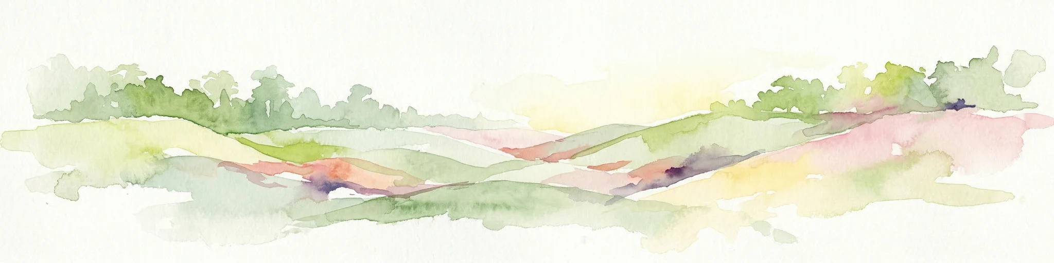
Watercolor painting of a landscape with rolling hills, green trees, and soft color gradients
National parkFrench Guiana
About 102 km away#5 closest

Southwest

Guiana Amazonian Park National Park: French Guiana's Expansive Protected Rainforest

Explore mapped boundaries and regional geographic context.

Guiana Amazonian Park, a cornerstone of protected land in French Guiana, offers a profound exploration of untamed Amazonian rainforest. As the largest national park in the European Union, it showcases a vast, remote ecosystem characterized by towering trees and intricate river systems. This page provides detailed context on its geographic placement within French Guiana and its significance as a major protected landscape for atlas-based discovery and understanding of tropical forest conservation.

Area
20,300 km²
Established
2007
IUCN
II
Relief
Lowland
Nature reserveFrench Guiana
About 109 km away#6 closest

West

La Trinité National Nature Reserve: French Guiana Protected Landscape & Nature Reserve Atlas

Mapping the natural terrain and protected boundaries.

Delve into the protected landscape of La Trinité National Nature Reserve, an integral part of French Guiana's extensive natural terrain. This explorer view provides specific insights into the reserve's mapped boundaries and its geographic context within the South American region. Understand its identity as a designated nature reserve and its contribution to the broader protected areas atlas for French Guiana.

Area
769.03 km²
Established
1996
IUCN
IV
Relief
Mountain
Nature reserveFrench Guiana
About 196 km away#7 closest

Northwest

Amana Nature Reserve Nature Reserve: French Guiana's Mapped Protected Landscape

Explore the geographic context and protected area identity.

Amana Nature Reserve is a vital protected area situated in French Guiana, a region renowned for its extensive tropical rainforests. As a nature reserve, it contributes significantly to the atlas of protected lands in South America, offering a distinct geographic identity. Understanding Amana Nature Reserve involves exploring its mapped boundaries and its place within the unique natural terrain of the Guianas, providing essential context for geographic discovery.

Area
148 km²
Established
1998
IUCN
IV
Relief
Lowland
National parkSuriname
About 313 km away#8 closest

West

Brownsberg Nature Park: Suriname National Park with Tropical Forest and Waterfall Landscapes

Mapped geography and protected landscape context.

Brownsberg Nature Park stands as a vital protected landscape within Suriname, distinguished by its central mountain, tropical forest ecosystems, and scenic waterfalls such as Leo Waterfall. The park's location overlooking the vast Brokopondo Reservoir provides a unique geographic setting, making it an important destination for atlas and map-based exploration of Suriname's natural heritage. Understanding Brownsberg Nature Park offers insight into the Neotropical biodiversity and terrain characteristic of the Guianan moist forests.

Area
122 km²
Established
1969
IUCN
II
Visitors
20K annual
Nature reserveSipaliwini District
About 388 km away#9 closest

West

Central Suriname Nature Reserve: Protected Nature Reserve with Mapped Geographic Context

Explore the landscape boundaries within Sipaliwini District's protected areas.

Central Suriname Nature Reserve is a significant protected area situated in Suriname's Sipaliwini District. As a designated nature reserve, it offers critical insights into regional geography and conservation landscapes. This page provides focused information on its mapped boundaries and its contribution to the broader atlas of protected lands, enabling detailed geographic discovery.

Area
16,000 km²
Established
1998
Relief
Mixed relief
Climate
Tropical
National parkPotaro-Siparuni
About 777 km away#10 closest

West

Kaieteur National Park: Iconic South American Waterfall and Protected Forest Landscape

Discover the unique geography and mapped boundaries of this Guiana Shield natural wonder.

Kaieteur National Park is a significant protected area in Guyana, celebrated globally for Kaieteur Falls, the world's largest single-drop waterfall by volume. This national park preserves over 242 square miles of untouched tropical rainforest, offering critical habitat for endemic species and a profound example of the Guiana Shield's ancient geological formations and diverse ecosystems. Its location deep within the Potaro-Siparuni Region underscores its role as a vital bastion of wilderness and a landmark in South American protected landscapes.

Area
630 km²
Established
1929
IUCN
II
Relief
Mixed relief
Protected areaGuyana
About 786 km away#11 closest

Southwest

Kanashen Protected Area: Geographic Identity and Mapped Boundaries in Guyana

Explore the mapped landscape and protected land context.

Kanashen Protected Area serves as a critical point of geographic discovery within Guyana, offering detailed insights into its protected boundaries and natural landscape. This entry focuses on providing a structured, atlas-driven understanding of Kanashen, emphasizing its role within the regional geography of South America. Users can explore how this protected area fits into the larger mapped context, appreciating its specific terrain and conservation significance.

Area
6,485.67 km²
IUCN
VI
Relief
Mixed relief
Climate
Tropical
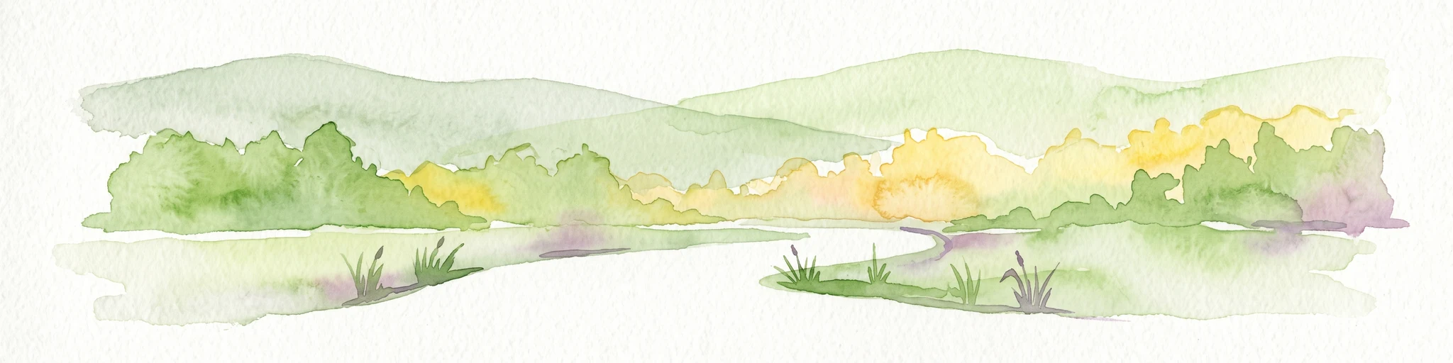
A horizontal watercolor illustration showing soft, green rolling hills, a central path or waterway, and marshy grasses in the foreground.
Protected areaBarima-Waini
About 882 km away#12 closest

Northwest

Shell Beach: Coastal Protected Area Geography and Barima-Waini Map Context

Atlantic shoreline nesting habitats and regional ecological boundaries.

Spanning 120 kilometers of Guyana's northern coast, Shell Beach represents a significant protected area dedicated to marine conservation. Its geography features a continuous chain of sandy beaches, offshore foraging waters, and adjacent coastal forest ecosystems, all managed through a community-based model within the Barima-Waini Region.

Area
31.77 km²
Established
2011
IUCN
VI
Relief
Lowland
Nature reserveEstado Bolívar
About 906 km away#13 closest

West

Reserva forestal de Imataca: Geographic Overview of a Major Venezuelan Nature Reserve

Mapping the Sierra de Imataca and regional forest ecosystems

Reserva forestal de Imataca serves as a key conservation zone, characterized by the Sierra de Imataca and a dense network of major rivers. This large-scale protected area provides an essential look at the tropical wilderness and upland forest terrain found within Estado Bolivar, mapping out a significant slice of the Venezuelan Guayana region.

Area
38,219 km²
Established
1961
Relief
Mountain
Climate
Tropical
National parkBolívar State
About 923 km away#14 closest

West

Canaima National Park: Detailed Geographic Atlas and Protected Landscape Overview

Explore mapped boundaries and natural terrain in Bolívar State.

Delve into the protected landscape of Canaima National Park, a significant natural area located in the expansive Bolívar State of Venezuela. This page provides a focused view on the park's geography, mapped terrain, and its position within the Guiana Highlands, offering critical context for understanding protected areas. Users can investigate the park's boundaries and its contribution to the regional geographic atlas, appreciating its distinct natural characteristics.

Area
30,000 km²
Established
1962
IUCN
II
Visitors
100K annual
National parkDelta Amacuro
About 1,101 km away#15 closest

Northwest

Parque nacional Mariusa: A Detailed Geographic Study of Orinoco Delta Wetlands

Mapped tidal channels and protected wetland geography

Located in Delta Amacuro, Parque nacional Mariusa represents a key protected area where the Orinoco River meets the Atlantic. Its geography is defined by a dynamic system of caños, seasonally flooded rainforests, and mangrove forests that support high ecological complexity. This atlas entry provides an overview of the park boundaries and the physical terrain that shapes this critical Venezuelan protected landscape.

Area
3,310 km²
Established
1991
IUCN
II
Water
Water-dominated
National parkVenezuela
About 1,126 km away#16 closest

Northwest

Mariusa National Park: Protected Orinoco Delta Wetlands and River Geography

A vast tidal river delta ecosystem in eastern Venezuela.

Mariusa National Park protects an essential segment of the Orinoco River Delta, characterized by its labyrinthine network of tidal channels and dense swamp forests. This protected area spans approximately 3,310 square kilometers of flooded landscape, where freshwater river systems interact with daily Atlantic tidal flows to maintain a globally significant wetland environment.

Area
3,310 km²
Established
1991
Relief
Lowland
Climate
Tropical
National parkDiego Martin
About 1,208 km away#17 closest

Northwest

Chaguaramas National Park in Diego Martin: Coastal Landscape and Protected Area Geography

Mapping the peninsular terrain and northern coastal boundaries of Trinidad

Chaguaramas National Park is defined by its strategic coastal position between the Caribbean Sea and the Gulf of Paria. As a significant protected area in the Diego Martin region, it features a blend of coastal flats and forested foothills that extend from the Northern Range. This overview examines the geographic layout, terrain features, and protected boundaries that define the identity of this unique Trinidadian landscape.

Established
1961
Scope
Terrestrial
Water
Major water bodies
National parkSucre
About 1,226 km away#18 closest

Northwest

Península de Paria National Park: Venezuela's Protected Landscape Geography and Atlas Context

Explore mapped park boundaries and regional geographic setting.

Discover Península de Paria National Park, a vital protected area within the Sucre region of Venezuela. This page offers a detailed look at the park's geographic identity, focusing on its mapped boundaries and its significance as a national park for atlas-based exploration. Understand its landscape context and its contribution to Venezuela's network of protected lands, providing a clear geographic overview for researchers and explorers.

Area
375 km²
Established
1978
IUCN
II
Relief
Mountain
National parkAmazonas
About 1,252 km away#19 closest

West

Parima Tapirapecó National Park: Venezuela's Largest Protected Area within the Guayanan Highlands

Explore its vast geographic extent and critical Orinoco River basin landscape.

Parima Tapirapecó National Park is an expansive protected territory in Venezuela's Amazonas region, holding the title of the country's largest national park and ranking among the world's most significant protected lands. Its geography is defined by the ancient Guayanan Highlands, protecting the vital headwaters of the Orinoco River and a mosaic of tropical forests and savannas. This park offers deep insights into landscape preservation on a grand scale, crucial for understanding regional geography and protected area distribution.

Area
38,290 km²
Established
1991
IUCN
II
Scope
Terrestrial
National parkSucre State
About 1,292 km away#20 closest

Northwest

Turuépano National Park: National Park Protected Landscape and Geographic Context

Explore the mapped boundaries and natural terrain of Sucre State's national park.

Investigate Turuépano National Park, a protected national park situated within Sucre State, Venezuela. This entry provides detailed geographic context and information on its mapped protected-area boundaries, essential for understanding its role in the region's natural landscape atlas. Explore the specific terrain and protected land features that define this significant Venezuelan park.

Area
726 km²
Established
1991
IUCN
II
Relief
Lowland
Distance methodology

Geographic measurements, not driving distances

How nearby park distances are calculated

Distances use park boundaries whenever the available geometry allows it. When one or both boundaries are missing, the mapped park locations provide a clearly labelled estimate. Every value represents straight-line geographic separation and does not use roads or routing.

Boundary distance

Calculated between the nearest points of both park boundaries.

Location-to-boundary estimate

Estimated from one mapped park location to the nearest boundary of the other park.

Mapped-location estimate

Estimated between the mapped locations of both parks.

MoriAtlas Explorer

Continue Exploring Mont Grand Matoury Nature Reserve's Mapped Geography and Protected Landscape

Deepen your understanding of Mont Grand Matoury Nature Reserve by examining its precise geographic features and protected area boundaries. This structured approach reveals how the reserve fits into the broader regional context of French Guiana, providing valuable insights for atlas exploration and landscape analysis. Continue to uncover the factual details that define this important natural reserve and its unique place within the continent's protected lands.