Mori Atlas logo
Countries

Browse mapped protected landscapes and discover the geographic distribution of natural areas across Nepal.

Nepal National Parks and Protected Areas: A Geographic Atlas for Exploration

Embark on a geographic exploration of Nepal, a landlocked nation spanning the Himalayas, rich with national parks and protected areas. This atlas provides structured access to Nepal's natural landscapes, detailing their mapped boundaries and regional geographic context. Understand the distribution of protected lands from the mountainous terrain to alpine ecosystems, offering a comprehensive view for anyone interested in the country's conservation geography and natural terrain.

Related tags

landlocked countrysouth asiahimalayan regionfederal republicmountainous country
About

Browse Nepal's diverse conservation regions, mapping high-altitude peaks and lowland forest reserves across the country.

Explore Nepal's National Parks and Protected Areas: A Geographic Atlas of Himalayan Landscapes
Discover Nepal's national parks and protected areas, a comprehensive atlas showcasing the country's unique Himalayan, alpine, and lowland conservation landscapes. Uncover the geographic distribution of these significant natural reserves, providing essential context for understanding Nepal's rich biodiversity across its varied terrain.

Nepal is a federal parliamentary republic in South Asia, landlocked between China and India. It spans the Himalayas and includes eight of the world's ten highest mountains. Kathmandu is the capital and largest city.

Nepal is a landlocked South Asian country positioned mainly in the Himalayas with some territory in the Indo-Gangetic Plain. It shares borders with China to the north and India to the south, east, and west. The country features diverse geography including the Terai plains, subalpine forested hills, and the Himalayan mountain range containing eight of the world's ten highest peaks. Nepal operates as a federal parliamentary republic with Kathmandu as its capital and largest city.

Largest city:Kathmandu
Currency code:NPR
ISO code:NP
Parks count
3
Capital
Kathmandu
Area
147,516 km²
Population
31,122,387 (2,024)

Coastal
Island
Mountainous
Landlocked
Park atlas3 parks

Trace Nepal's vast network of protected areas, from high Himalayan peaks to critical lowland conservation zones.

National Parks in Nepal: Discover Himalayan Protected Areas and Conservation Landscapes
Browse Nepal's stunning national parks and protected areas, mapping their distribution across the diverse Himalayan and Terai regions. This comprehensive country-level view provides essential geographic context for each conservation landscape, facilitating detailed exploration of its unique terrain and ecosystems.
National parkNepal

Shey Phoksundo National Park: Nepal's Largest Trans-Himalayan Protected Landscape with Phoksundo Lake

Explore alpine terrain and unique protected ecosystems.

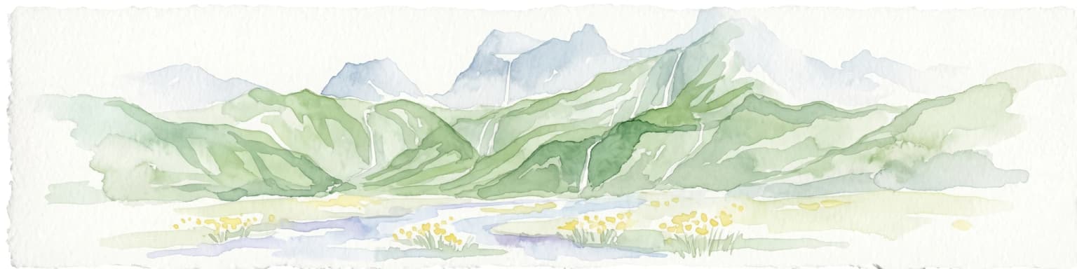
Delve into the geographical distinctiveness of Shey Phoksundo National Park, Nepal's expansive protected area. This park is defined by its dramatic elevation changes and the striking Phoksundo Lake, a vivid turquoise alpine reservoir set against barren, mountainous terrain. Understanding its trans-Himalayan setting and protected landscape context reveals its importance within the broader atlas of global natural areas.

Area
3,555 km²
Established
1984
IUCN
II
National parkNepal

Langtang National Park: Nepal's Pioneer Himalayan Protected Landscape and Alpine Atlas

Mapped glaciated terrain, sacred lakes, and towering peaks define this national park.

Langtang National Park, established as Nepal's first Himalayan national park, offers a unique window into high-altitude protected landscapes. Its geography is characterized by dramatic glaciated valleys, soaring mountain peaks including Langtang Lirung, and a rich diversity of alpine ecosystems. This page provides an atlas-centric view of the park's boundaries and its significance within the broader Himalayan conservation context.

Area
1,710 km²
Established
1976
IUCN
II
Relief
Mountain
National parkBardiya District

Bardiya National Park: Nepal's Expansive Terai Protected Landscape and Atlas

Mapped geography, tiger habitat, and rhino conservation in Bardiya District.

Bardiya National Park represents a significant protected area within Nepal's Terai lowlands, providing an exceptional resource for geographic discovery. Its diverse terrain, including vast grasslands and dense forests bisected by major river systems like the Karnali and Babai, creates unique ecosystems. As the largest national park in Nepal, it is instrumental in mapping wildlife corridors and understanding regional landscape dynamics, particularly for endangered species such as Bengal tigers and Indian rhinoceroses. This park offers a profound glimpse into the mapped natural heritage of the Bardiya District.

Area
968 km²
Established
1988
IUCN
II
Landscape and environment

Understand how Nepal is shaped by terrain, ecosystems, and seasonal conditions

Nepal geography, nature, climate, and landscape context for park-focused travel research
Explore the physical geography, natural setting, and climate patterns of Nepal through a location-first overview built for travel research, national park discovery, and broader regional context. This section helps explain how landscapes, habitats, and environmental conditions shape what people search for, where they travel, and how they experience protected areas in Nepal.

Nepal geography and landscape

Nepal is located in South Asia, landlocked between China to the north and India to the south, east, and west. The country occupies the Himalayan region in the north and extends into the Indo-Gangetic Plain in the south. Terrain includes the Terai lowlands, subalpine hills, and the Himalayas with peaks including Mount Everest.

Nepal nature and environment

Nepal's geography is dominated by the Himalayan mountain range, containing eight of the world's ten highest mountains including Mount Everest. The country also includes fertile plains in the Terai region and subalpine forested hills.

Explore this place

Related topics and popular queries

Ways to explore Nepal
Useful phrases, related topics, and discovery prompts connected to Nepal.
where is nepal locatedwhat is nepal countrynepal geography and terrainmount everest nepalnepal capital citynepal population and sizenepal countrysouth asia nationhimalayasmount everestlandlocked countrynepal geographykathmandu capital
Park map

Visualize the geographic spread of Nepal's protected landscapes and their unique positions across the dramatic Himalayan terrain.

Mapped National Parks and Protected Areas of Nepal: Discover Himalayan Geography
Browse the mapped locations of Nepal's national parks and protected areas, tracing their distribution across the diverse South Asian and Himalayan region. Explore the full country park map to understand the spatial context of these conservation landscapes and compare their positions within Nepal's mountainous geography.

Key insights into Nepal's diverse protected landscapes, park geography, and conservation context.

Frequently Asked Questions: Understanding Nepal's National Parks and Protected Areas
Discover essential information regarding the national parks and protected areas across Nepal, including their geographic spread and regional significance. These frequently asked questions provide clarity on park locations, types of protected landscapes, and their role in the country's unique Himalayan environment.
Other countries

Compare mapped park geographies and trace protected landscapes across the broader South Asian atlas.

Explore National Parks in Countries Beyond Nepal and the Himalayan Region
After exploring Nepal's Himalayan national parks and mountainous protected areas, continue your geographic discovery by browsing detailed park lists and conservation landscapes in nearby countries. Examining these distinct national park collections helps users understand regional protected area patterns, compare diverse ecosystems, and trace transboundary conservation across the wider South Asian atlas.

India National Parks and Protected Areas: Geographic Atlas Explorer

Navigate India's significant protected areas and national parks through a structured geographic lens. This atlas-focused exploration reveals the country's diverse natural landscapes and the geographical context of its conservation efforts. Understand the distribution of protected lands and gain insights into the regional geography that shapes these vital natural reserves.

40 parks

Pakistan National Parks and Protected Areas: Geographic Atlas Explorer

Navigate the geography of Pakistan's protected areas and national parks. This atlas provides a structured overview of the country's conservation landscapes, highlighting their geographic spread and key natural terrain features. Understand the regional context of protected lands, offering a clear map-based discovery experience for researchers and explorers alike.

34 parks

China

7 parks

Bhutan's National Parks and Protected Areas: Mapped Geographic Overview

Bhutan's commitment to conservation is reflected in its network of national parks and protected areas, nestled within the dramatic Himalayan geography. This destination offers an atlas-style view of these significant natural landscapes, highlighting their geographic distribution and mapped boundaries. Users can navigate this structured data to understand the regional context of protected lands across the Kingdom of Bhutan.

6 parks

National Parks and Protected Areas of Kyrgyzstan: Mapped Geographic Explorer

Access a structured geographic overview of Kyrgyzstan's national parks and protected areas. Understand the distribution of these vital conservation landscapes across the country's dramatic mountain terrain. This atlas-style resource helps you explore the natural boundaries and regional context of protected areas within Kyrgyzstan, offering a clear entry point for geographic discovery.

5 parks

Explore Protected Natural Landscapes of Bangladesh: National Parks and Reserves

Navigate the geography of Bangladesh through its network of national parks and protected areas. This resource provides a structured approach to understanding the distribution of conservation landscapes, their mapped boundaries, and the regional context of their natural terrain. Discover the unique geographic features that define Bangladesh's protected lands, from the Sundarbans mangroves to the Chittagong Hill Tracts, offering a foundation for detailed exploration.

4 parks

Afghanistan National Parks and Protected Areas: Geographic Atlas Explorer

Navigate the protected natural areas of Afghanistan through a structured geographic lens. This resource provides an atlas view of national parks and conservation landscapes, detailing their locations and geographic context within the country's diverse terrain. Understand the regional spread and mapped boundaries of Afghanistan's protected lands, offering a foundation for landscape exploration.

3 parks

Myanmar National Parks and Protected Areas: Browse Mapped Landscapes and Regional Geography

This section provides a structured atlas view of Myanmar's national parks and protected lands. Users can explore the geographic distribution and mapped boundaries of these significant natural areas. Understand the regional context and landscape diversity across Myanmar, from mountain parks to conservation areas, facilitating a deeper geographic discovery.

2 parks
MoriAtlas Explorer

Continue Your Global Geographic Exploration with MoriAtlas Park Discovery

Dive deeper into the world's protected landscapes and national parks through MoriAtlas's structured atlas interface. Discover how continents and countries are organized, and how individual park geography fits into the broader map. Our platform is built for understanding the distribution and context of protected areas worldwide, facilitating your journey through global natural geography.

Global natural geography