Mori Atlas logo
Nearby park discovery

Regional geography and mapped surroundings in the Grand Est area

Protected Areas and Natural Landscapes Near Réserve naturelle nationale de la forêt d'Orient

Discover a geographic collection of protected environments surrounding the Réserve naturelle nationale de la forêt d'Orient. This map-centered resource traces the distribution of nearby conservation lands and wetlands within the Grand Est region to provide context for the local terrain and regional landscape connectivity.

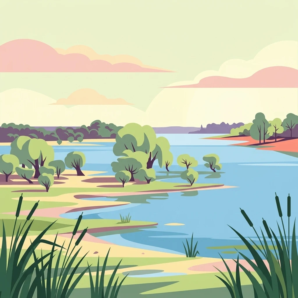
A flat-style digital illustration showing a calm lake with marshy sandy banks, scattered green trees, and tall reeds in the foreground under a soft pastel sky.

Lacustrine and forest reserve in the Champagne wetlands east of Troyes.

Réserve naturelle nationale de la forêt d'Orient

The Réserve naturelle nationale de la forêt d'Orient is a French national nature reserve located in the Aube department of the Grand Est region. Created in 2002, it sits within the broader Parc naturel régional de la forêt d'Orient, covering roughly 1,560 hectares of lakes, marshes, reedbeds, meadows, and oak-hornbeam forest. The reserve protects a mosaic of wetland habitats shaped by the Grands Lacs de Seine, large artificial reservoirs built from the 1960s onward to help prevent flooding around Paris. The reserve's ecological value rests largely on its position along major waterbird migration routes. Fluctuating lake levels expose mudflats and shallow water zones that support a rich avifauna, while the surrounding terrestrial habitats shelter amphibians, bats, woodland mammals, and a long list of invertebrates. Public access inside the reserve is restricted, but a network of observation sites, educational facilities, and the Maison du Parc allow visitors to experience the area without disturbing sensitive habitats.

Location
France
Park type
Nature reserve
Established
2002
Area
15.6 km²
Explore Réserve naturelle nationale de la forêt d'Orient Geography
Regional park map

See the ranked park cluster in its geographic setting

Nearby parks around Réserve naturelle nationale de la forêt d'Orient

This regional map shows the same 20 nearby parks ranked below around Réserve naturelle nationale de la forêt d'Orient. Select a ranked marker to highlight that park’s boundary where boundary data is available.
Reference park: Réserve naturelle nationale de la forêt d'OrientRanked nearby park20 nearby parks shown
20 nearby parks

Geographic proximity ranking, regional separation, and comparative protected landscape context

Ranked Protected Areas and Parks Near Réserve Naturelle Nationale de la Forêt d'Orient

Spatial proximity measurements establish a structured ranking of nearby protected areas surrounding Réserve naturelle nationale de la forêt d'Orient. Evaluating surrounding regional park geography and recorded environmental traits provides meaningful comparative context across broader conservation landscapes.
Nature reserveGrand Est
About 13 km away#1 closest

West

Réserve naturelle régionale des prairies humides de Courteranges: Protected Landscape Map

Barse Valley wetlands and meadow mosaic in Grand Est

This protected area preserves an intricate network of humid grasslands and traditional hay meadows along the Barse river. Its geography showcases a rare mosaic of wetland vegetation and managed habitats that provide critical ecological continuity within the Grand Est natural network.

Area
0.277 km²
Established
2010
IUCN
IV
Relief
Lowland
A horizontal watercolor illustration showing a pond with green trees, reeds, and low hills in the background against a white backdrop.
Nature reserveGrand Est
About 18 km away#2 closest

East

Réserve naturelle régionale de l'étang de Ramerupt: Geography and Protected Wetland Atlas

Mapping the historic Champagne humide pond landscape in Grand Est

Examine the dense wetland mosaic of Réserve naturelle régionale de l'étang de Ramerupt, a 33-hectare sanctuary in the Aube department. This resource traces the pond edges, reedbed structures, and wet woodland terrain that comprise this essential regional nature reserve, highlighting the intersection of human water management and natural marshland succession in the French countryside.

Area
0.336 km²
Established
2010
IUCN
IV
Relief
Lowland
Watercolor painting of an open, undulating rural landscape with patches of green vegetation, trees, and golden fields under a soft white sky.
Nature reserveGrand Est
About 20 km away#3 closest

Southeast

Réserve naturelle régionale de la pelouse de la côte de l'étang: Regional Nature Reserve Geography

Calcareous grassland protected area in the Grand Est region of France

Discover the geographic character of Réserve naturelle régionale de la pelouse de la côte de l'étang. This reserve showcases a specialized dry grassland landscape on a sun-drenched slope, providing a critical haven for rare flora and fauna in the heart of the Barrois champenois territory.

Area
0.108 km²
Established
2010
IUCN
IV
Relief
Upland
A horizontal watercolor illustration featuring a soft green and yellow landscape of a pond and wetland area with shrubs and meadow grass.
Nature reserveGrand Est
About 43 km away#4 closest

Northeast

Réserve naturelle régionale de l'étang et prairie humide des Paquis: Regional Nature Reserve Geography

Wetland habitat mapping in the Marne department of Grand Est, France

This regional nature reserve encompasses a compact 8.31 hectare wetland complex comprising an étang and a surrounding prairie humide. Its significance lies in its role as a concentrated biodiversity node amidst the open agricultural landscape of the Champagne region, managed primarily for habitat conservation and avian protection.

Area
0.083 km²
Established
2014
IUCN
IV
Watercolor illustration of a forested landscape with rolling hills, distant mountains, and a sky with soft pastel colors
National parkFrance
About 51 km away#5 closest

Southeast

Forêts National Park: A Protected Landscape of Lowland Deciduous Forests

Explore its unique geography and protected forest ecosystems.

Delve into Forêts National Park, a significant protected area in northeastern France dedicated to preserving lowland deciduous forests and their associated biodiversity. This park represents a unique atlas entry for understanding mapped protected lands, featuring extensive broad-leaved forest tracts, diverse wetlands, and limestone grasslands across the Grand Est and Bourgogne-Franche-Comté regions. Discover the geographic identity of this conservation landscape and its role within the Paris Basin's terrain.

Area
560 km²
Established
2019
IUCN
II
Relief
Lowland
A soft watercolor illustration of a wetland scene with a small pool of water in the foreground, grassy meadows, and distant hills and trees in the background.
Nature reserveGrand Est
About 69 km away#6 closest

Northwest

Réserve naturelle régionale du marais de Reuves: Protected Wetland and Geography

A vital ecological enclave within the Grand Est region of France.

The Réserve naturelle régionale du marais de Reuves provides a detailed look at the hydrology and terrain of the Marais de Saint-Gond. This nature reserve protects varied habitats including open ponds, peatlands, and alluvial forests. Understanding its boundaries reveals how localized conservation efforts preserve essential wetland character against surrounding intensive agricultural development.

Area
0.64 km²
Established
2008
IUCN
IV
Relief
Lowland
Nature reserveGrand Est
About 74 km away#7 closest

North

Réserve naturelle régionale du Savart de la Folie: Regional Protected Landscape Analysis

Tracing the dry grassland ecosystems of the Grand Est region

Deep dive into the geography of the Réserve naturelle régionale du Savart de la Folie in France. This site highlights the preservation of steppe-like savart habitats within the Champagne region, showcasing the importance of regional nature reserves in protecting specific dry, chalky grasslands.

Area
0.636 km²
Established
2026
IUCN
IV
Scope
Terrestrial
Nature reserveHaute-Marne
About 75 km away#8 closest

Tufière de Rolampont Nature Reserve: Travertine Cascades and Geological Heritage in Haute-Marne

A rare living limestone formation in the Grand Est region of France

Tufière de Rolampont offers a window into the evolution of calcareous wetland ecosystems within the Champagne plateau. Visitors observe a process of natural stone creation where mineral-rich water encrusts living mosses, resulting in the stepped terraces that define this protected landscape. This site serves as a vital laboratory for understanding the intersection of hydrological heritage and unique botanical habitats.

Area
0.126 km²
Established
1982
Relief
Lowland
Climate
Temperate
A soft, horizontal watercolor painting depicting a calm wetland landscape with grassy banks, distant forested hills, and a pale, misty sky.
Nature reserveFrance
About 82 km away#9 closest

Northeast

Réserve naturelle régionale des étangs de Belval-en-Argonne: Protected Area and Wetland Geography

Mapped pond systems in the Marne department of France.

This protected area features a unique mosaic of five historic pond basins set within a gentle plateau landscape. The site is a cornerstone of the Champagne humide wetland system, defined by its interconnected open water, reedbed margins, and wet woodland habitats that support diverse waterbird and amphibian populations across the Argonne region.

Area
2.037 km²
Established
2012
Relief
Lowland
Climate
Temperate
A watercolor painting of a rolling rural landscape with grassy hills, woodlands, and a winding stream, rendered in soft pastel greens, yellows, and pinks.
Nature reserveGrand Est
About 89 km away#10 closest

Southeast

Réserve naturelle régionale des pelouses et bois de Villemoron: Protected Area and Map

Regional nature reserve in the Grand Est, France

This protected area provides a rare glimpse into the limestone-based geography of the Haute-Marne department. Featuring a structured mix of oak forests and open calcareous grasslands, the reserve serves as an essential habitat refuge within the larger landscape of the Grand Est region. Use our mapped data to trace the boundaries and features of this uniquely managed natural environment.

Area
0.87 km²
Established
2015
IUCN
IV
Relief
Upland
A minimalist watercolor painting showing rolling green hills and a gentle landscape under a light sky.
Nature reserveGrand Est
About 100 km away#11 closest

East

Réserve naturelle régionale des éboulis et pelouses calcaires de Pagny-la-Blanche-Côte et Champougny Landscape Overview

Geographic protected area in the Meuse department

Analyze the limestone scree and calcareous grassland habitats of this 49-hectare reserve. The site provides a focused look at the unique Jurassic-age formations and open-terrain conservation efforts managed within the Grand Est region, offering a clear map of its protected perimeter.

Area
0.493 km²
Established
2021
IUCN
IV
Nature reserveBourgogne-Franche-Comté
About 103 km away#12 closest

Southeast

Réserve naturelle régionale du Peuptu de la Combe Chaignay: Regional Nature Reserve Profile

Protected calcareous habitats in the Burgundy limestone uplands.

Spanning 36.6 hectares in the Côte-d'Or, this reserve protects a characteristic combe landform carved into Jurassic limestone plateaus. It serves as a vital example of site-specific conservation within the Bourgogne-Franche-Comté region, focusing on the management of habitats essential to the northern French countryside.

Area
0.366 km²
Established
2025
IUCN
IV
Relief
Mixed relief
A horizontal watercolor illustration showing a serene wetland landscape with a winding stream, soft green grassy banks, and distant tree lines in light pastels.
Nature reserveGrand Est
About 103 km away#13 closest

North

Réserve naturelle régionale du marais « Les trous de Leu » Protected Area Map

Wetland geography and alluvial habitats in Grand Est, France

Investigate the layered terrain and diverse marshland habitats of Réserve naturelle régionale du marais « Les trous de Leu ». This regional reserve showcases the importance of base-rich alkaline peatlands and alluvial woodlands situated between the Vesle river and the historic Aisne-à-la-Marne canal.

Area
0.33 km²
Established
2014
IUCN
IV
Nature reserveÎle-de-France
About 106 km away#14 closest

West

Réserve naturelle régionale de la colline Saint-Martin et des Rougeaux: Protected Area Atlas

Mapping limestone hill and dry valley habitats in Seine-et-Marne

Spanning roughly 28 hectares near the Seine valley, this nature reserve showcases a complex intersection of former quarry lands and limestone ecosystems. The site provides a critical protected corridor for bat fauna and diverse botanical species, serving as a distinct example of peri-urban conservation in north-central France.

Area
0.277 km²
Established
2024
IUCN
IV
Relief
Upland
A watercolor painting of a pastoral landscape featuring a calm river winding through green fields and forests with rolling mountains in the background, set against a soft sunset sky.
Nature reserveBourgogne-Franche-Comté
About 107 km away#15 closest

Southeast

Réserve naturelle régionale du Val-Suzon: Protected Landscape and Geographic Atlas

Wooded limestone valleys in the Bourgogne-Franche-Comté region

Spanning the meandering Suzon river, this large regional nature reserve provides a essential look at the limestone plateaus and deciduous woodlands of Côte-d'Or. The area serves as a primary reference for regional biodiversity, containing dry grasslands, rocky slopes, and sensitive tufa springs protected within its defined borders. This resource outlines the physical terrain and conservation significance of the territory for those mapping the natural landscape of eastern France.

Area
29.806 km²
Established
2011
Relief
Upland
Climate
Temperate
Nature reserveBourgogne-Franche-Comté
About 116 km away#16 closest

South

Réserve naturelle régionale de la grotte du Contard: Protected Karst and Cave Geography

Regional natural reserve in the Bourgogne-Franche-Comté landscape

Located near Dijon, the Réserve naturelle régionale de la grotte du Contard is a protected area focused on preserving the karst features and geological heritage of the Côte-d'Or. This site serves as a vital example of subterranean habitat conservation, showcasing the unique interaction between water-sculpted limestone cavities and the surrounding plateau terrain. Explore the geographic extent of this reserve and understand its role within the regional natural reserve network.

Area
0.259 km²
Established
2025
IUCN
IV
Climate
Temperate
Nature reserveHauts-de-France
About 129 km away#17 closest

North

Réserve naturelle régionale des coteaux du Chemin des Dames Protected Landscape Atlas

Mapped limestone coteaux and grassland mosaic in Aisne

Covering roughly 47 hectares across nine communes, this nature reserve protects the chalky hillslopes characteristic of the Picardy landscape. Its fragmented site structure serves as a key focus for regional biodiversity, maintaining dry calcareous grasslands and scrubland corridors within a wider agricultural matrix.

Area
0.476 km²
Established
2015
IUCN
IV
Scope
Terrestrial
Watercolor painting of a green, rolling landscape showing forested hills in varying shades of light green and soft earth tones against a white background.
Nature reserveBourgogne-Franche-Comté
About 129 km away#18 closest

South

Réserve naturelle nationale de la combe Lavaux-Jean Roland Protected Area Geography

Limestone cliff landscapes in Bourgogne-Franche-Comté

Spanning over 400 hectares, this nature reserve showcases a dramatic interplay of steep limestone walls and scree slopes. The geographic profile highlights the contrast between north-facing forest and sunlit grasslands, creating a vital corridor for endemic species within the Burgundy landscape.

Area
4.87 km²
Established
2004
IUCN
IV
Relief
Upland
A watercolor painting showing a soft, panoramic view of a marshland with a winding stream, a small island of reeds, and distant trees on a pale background.
Nature reserveGrand Est
About 130 km away#19 closest

Northeast

Réserve naturelle régionale de Lachaussée: Geography, Wetlands, and Protected Map Data

Protected landscape and historic pond geography in the Meuse department

Focusing on the Étang de Lachaussée, this entry maps the protected boundaries and wetland terrain of a significant regional nature reserve in northeastern France. Observe the intersection of medieval engineering and contemporary ecological conservation through a detailed look at the pond, reedbeds, and surrounding mosaic of habitats that define the Woëvre plain landscape.

Area
6.072 km²
Established
2009
IUCN
IV
Relief
Lowland
A horizontal watercolor painting showing a small pond surrounded by soft green trees, grass, and a few small red flowers against a pale sky.
Nature reserveBourgogne-Franche-Comté
About 131 km away#20 closest

South

Réserve naturelle régionale des tourbières du Morvan: A Geographic Study of Peatland Protection

Regional Nature Reserve in the Bourgogne-Franche-Comté landscape

This expansive network reserve protects twelve notable peatlands across the departments of Nièvre and Saône-et-Loire. From the rare raised bog at Champgazon to the peat-fringed ponds of Étang Taureau, the reserve acts as a critical conservation mosaic that maintains the ecological connectivity of diverse sphagnum habitats within the greater Morvan regional landscape.

Area
2.66 km²
Established
2015
IUCN
IV
Relief
Mountain
Distance methodology

Geographic measurements, not driving distances

How nearby park distances are calculated

Distances use park boundaries whenever the available geometry allows it. When one or both boundaries are missing, the mapped park locations provide a clearly labelled estimate. Every value represents straight-line geographic separation and does not use roads or routing.

Boundary distance

Calculated between the nearest points of both park boundaries.

Location-to-boundary estimate

Estimated from one mapped park location to the nearest boundary of the other park.

Mapped-location estimate

Estimated between the mapped locations of both parks.

MoriAtlas Explorer

Continue Exploring the Protected Landscapes of Réserve naturelle nationale de la forêt d'Orient

Trace the boundaries and ecological zones of Réserve naturelle nationale de la forêt d'Orient through our integrated atlas database. Use these resources to better understand how this nature reserve functions within the broader geography of Grand Est. MoriAtlas provides clear, structured insights into the mosaic of lakes, marshes, and forests that characterize this vital protected area.