Mori Atlas logo
Nearby park discovery

Regional landscape context and nearby protected terrain in the West Karelian Upland

Geographic Distribution of Protected Natural Areas and Parks Surrounding Vottovaara

Identify the geographical spread of protected lands and national parks adjacent to the Vottovaara massif. This resource provides a spatial overview of nearby natural monuments and forested regions within the Republic of Karelia, allowing for a structured comparison of mapped territories across the West Karelian Upland.

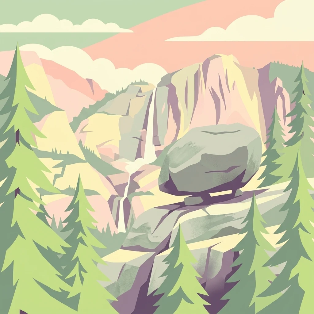
A stylized vector illustration featuring a large, balanced boulder perched on a cliff edge, surrounded by evergreen trees and a distant mountain waterfall.

A remote Karelian mountain of quartzite ridges, glacial boulders, and contested ancient stone structures.

Vottovaara

Vottovaara is a prominent rocky massif on the West Karelian Upland in central Karelia, Russia. It rises as a roughly north-south oriented ridge of jatulic quartzites and quartzite sandstones, dissected by numerous faults that may have been reactivated in post-glacial time. The summit area, around 417 meters above sea level, hosts an extraordinary landscape of large boulder fields and balancing stones that have attracted both scientific and popular attention. The site first drew wider interest in the late 1970s and early 1990s, when local and archaeological enthusiasts argued that the stone arrangements were man-made cult sites linked to ancient Saami ritual practice. Mainstream archaeology treats most of the structures as natural formations or modern fabrications, and this controversy is itself part of Vottovaara's identity. In 2011 the Republic of Karelia designated the mountain complex as a landscape natural monument, and in 2023 the Russian federal government established the Vottovaara National Park, grouping the massif together with surrounding lake and forest territories.

Location
Russia
Park type
Natural monument
Established
2023
Area
140.6 km²
Highest point
417 m
Vottovaara National Park Geography
Regional park map

See the ranked park cluster in its geographic setting

Nearby parks around Vottovaara

This regional map shows the same 20 nearby parks ranked below around Vottovaara. Select a ranked marker to highlight that park’s boundary where boundary data is available.
Reference park: VottovaaraRanked nearby park20 nearby parks shown
20 nearby parks

Geographic proximity and regional environment signals surrounding the Vottovaara massif

Ranked Parks and Protected Areas Geographically Near Vottovaara

Explore a distance ranked collection of protected areas situated close to Vottovaara based on direct geographic separation and regional coordinates. These comparative landscape metrics reveal broader patterns across surrounding taiga ecosystems without relying on travel routes or driving distances.
Natural monumentRepublic of Karelia
About 0 km away#1 closest

Southwest

Mount Vottovaara Natural Monument: Explore Protected Landscape and Geographic Context in Karelia

Mapped protected area boundaries and regional terrain in the Republic of Karelia.

Mount Vottovaara represents a significant natural monument within the Republic of Karelia, offering a focal point for structured geographic exploration. This protected landscape's mapped boundaries and its setting within the region's broader geography are key to understanding its atlas value. MoriAtlas provides the framework to examine the specific identity of Mount Vottovaara as a protected area, encouraging detailed study of its natural features and regional context.

Area
15 km²
Established
2011
IUCN
III
Relief
Mixed relief
Watercolor illustration of a bog landscape with green trees, a body of water, and rolling hills in the background
National parkNorth Karelia
About 84 km away#2 closest

West

Patvinsuo National Park: Protected Landscape Geography and Map Context

National park exploration in North Karelia, Finland.

Patvinsuo National Park stands as a vital protected area within North Karelia, Finland. This page serves as an atlas entry point, detailing the park's geographic scope, mapped boundaries, and its significance as a protected landscape. Users can explore the regional context and understand the natural terrain that characterizes this important Finnish national park, facilitating structured geographic discovery.

Area
105 km²
Established
1982
IUCN
II
Visitors
18.6K annual
Watercolor illustration of a river flowing through a wetland area with grassy banks, trees, and distant hills
National parkNorth Karelia
About 92 km away#3 closest

Southwest

Petkeljärvi National Park: Distinct Protected Landscape and Esker Formations in North Karelia

Discover Finland's unique esker ridges and boreal forests.

Petkeljärvi National Park represents a distinctive protected landscape in North Karelia, Finland, celebrated for its prominent esker formations that define its topography. The park showcases light Scots pine forests growing on sandy soils, creating an open forest character that sets it apart. Visitors can explore the mapped geography, including winding ridges, wetlands, and lake scenery, alongside preserved historical fortifications from the Continuation War, offering a rich blend of natural and cultural heritage within this compact national park.

Area
7 km²
Established
1956
IUCN
II
Visitors
17.3K annual
Watercolor illustration of a landscape featuring green vegetation, rolling hills, and a body of water under a pastel sky
National parkNorth Karelia
About 132 km away#4 closest

West

Koli National Park: Protected National Park in North Karelia, Finland

Explore mapped landscape and regional geography.

Koli National Park represents a significant protected area within the eastern Finnish region of North Karelia. This page offers detailed geographic context and insight into the park's mapped landscape, essential for understanding its place within the broader atlas of Finland's natural terrain. Discover the protected boundaries and regional setting of this key national park.

Area
30 km²
Established
1991
IUCN
II
Visitors
249.8K annual
Watercolor illustration showing a lake with forested shores and mountains in the background
National parkRepublic of Karelia
About 165 km away#5 closest

Southwest

Ladoga Skerries National Park: National Park Protected Landscape & Geography

Mapped boundaries and regional context in the Republic of Karelia.

Discover Ladoga Skerries National Park, a key protected area recognized as a national park within the Republic of Karelia. This page provides essential context for understanding its mapped boundaries, the natural terrain it encompasses, and its geographical significance within the broader regional landscape. Utilize this information for structured atlas exploration of protected natural environments, focusing on the distinct identity of Ladoga Skerries National Park.

Area
1,220 km²
Established
2017
IUCN
II
Relief
Lowland
A soft, pale green and blue watercolor illustration showing several rocky islands with sparse vegetation surrounded by water, with faint hills in the background.
National parkЯмало-Ненецкий автономный округ
About 165 km away#6 closest

Southwest

Ладожские шхеры National Park: Mapped Geography and Protected Archipelago Boundaries

Coastal skerry landscapes and Lake Ladoga regional terrain

Defined by the ancient Baltic Shield, Ладожские шхеры National Park protects a dense network of rocky islands and glacially carved inlets. This landscape serves as a vital ecological hotspot within Karelia, preserving clean lake waters and forested summits that stand as a geographic exception in the European Russian landscape.

Area
1,220.08 km²
Established
2017
IUCN
II
Relief
Lowland
Watercolor painting depicting a lake surrounded by trees and hills under a soft sky
National parkArkhangelsk Oblast
About 183 km away#7 closest

East

Vodlozersky National Park: A Protected National Park within Arkhangelsk Oblast's Geography

Explore the mapped boundaries and natural landscape of this national park.

Vodlozersky National Park serves as a significant protected landscape within the Arkhangelsk Oblast region. This national park detail page provides focused access to its geographic identity, mapped terrain, and protected area status. Utilize MoriAtlas to understand the specific context of Vodlozersky National Park and its role in the regional atlas of natural areas, enhancing your geographic discovery.

Area
4,280 km²
Established
1991
IUCN
II
Visitors
1K annual
National parkKainuu
About 199 km away#8 closest

Northwest

Hiidenportti National Park: Kainuu Protected Area and Geographic Landscape Context

Explore mapped boundaries and regional geography in eastern Finland.

This MoriAtlas entry details Hiidenportti National Park, a designated national park situated in the Kainuu region of Finland. It serves as a vital hub for understanding the protected area's mapped landscape, its specific geographic characteristics, and its position within the regional atlas of eastern Finland's natural terrain. Dive into the structured details that define Hiidenportti National Park's protected identity and its contribution to the geographic understanding of the taiga-forested regions.

Area
45 km²
Established
1982
IUCN
II
Visitors
11.3K annual
National parkEtelä-Savo
About 215 km away#9 closest

Southwest

Kolovesi National Park: Mapped Protected Landscape in Etelä-Savo, Finland

Explore its geographic identity and mapped park boundaries.

Kolovesi National Park is a significant protected area located in the Etelä-Savo region of Finland, characterized by its presence within the Finnish lake district. This detailed page provides an atlas-centric view, emphasizing the park's mapped geographic features and its status as a protected natural landscape. Users engaging with MoriAtlas can understand Kolovesi National Park's unique landscape context and its precise location within the regional geography of southeastern Finland.

Area
61 km²
Established
1990
IUCN
II
Visitors
17.2K annual
Watercolor painting of a lake surrounded by forests with mountains in the background and a sunset sky
National parkFinland
About 226 km away#10 closest

West

Tiilikkajärvi National Park: Finland's Unique Protected Landscape with Sandy Shores and Eskers

Mapped geography of a distinctive Finnish national park.

Tiilikkajärvi National Park showcases a unique combination of natural features within Finland's protected lands. The park's core is the Tiilikkajärvi lake, almost entirely encircled by expansive sandy beaches and dramatic esker peninsulas. These glacial landforms create a striking visual contrast with the surrounding boreal forests and rare undrained aapa bogs. Explore the mapped landscape context and protected area identity of this significant Finnish natural environment.

Area
72 km²
Established
1982
IUCN
II
Visitors
26.1K annual
National parkRepublic of Karelia
About 228 km away#11 closest

East

Vodlozero National Park: Geographic Profile of Russia's Pristine Taiga and Wetland Landscapes

Protected boreal ecosystems in the Republic of Karelia

Vodlozero National Park protects a significant expanse of pristine boreal forest, lake systems, and river basins in the Russian North. This entry provides a structured look at the park geography, covering its status as a biosphere reserve, its sprawling taiga terrain, and the cultural landscape that defines its remote northern boundaries.

Area
4,683 km²
Established
1991
IUCN
II
Relief
Lowland
Watercolor illustration showing a lake with islands and forested shores, distant hills, and soft pastel colors
National parkSouth Savo
About 232 km away#12 closest

Southwest

Linnansaari National Park: South Savo's Protected Landscape and Geography

Explore the mapped boundaries of this Finnish national park.

Discover Linnansaari National Park, a distinct national park located in South Savo, Finland. This page provides detailed information focused on its protected landscape identity, mapped geography, and atlas context. Understand its significance as a conservation area and how its boundaries contribute to the regional natural landscape. Explore the geographic positioning of Linnansaari National Park within South Savo, offering insights for structured map-based discovery.

Area
38 km²
Established
1956
IUCN
II
Visitors
31.6K annual
National parkRepublic of Karelia
About 243 km away#13 closest

Northwest

Kalevalsky National Park: Boreal Wilderness and Protected Landscapes in the Republic of Karelia

Ancient taiga ecosystems and glacial terrain mapped.

Located near the Russian-Finnish border, Kalevalsky National Park encompasses 74,400 hectares of rare primeval boreal forest. The park offers insight into the Baltic Shield's geological history and provides a map of extensive marshlands and lake basins that define this remote Karelian region.

Area
744 km²
Established
2007
IUCN
II
Relief
Lowland
National parkRepublic of Karelia
About 244 km away#14 closest

Northwest

Kalevalsky National Park: Protected Taiga and Boreal Landscapes in the Republic of Karelia

Ancient old-growth pine forests and glacial terrain.

Kalevalsky National Park protects one of the last remaining large, intact stretches of virgin taiga in Northern Europe. Situated along the border of the Republic of Karelia, this landscape includes dense coniferous forest, complex drainage networks, and peatland mires. The park functions as a major habitat for forest-dwelling mammals and maintains the ecological integrity of the Fennoscandian Shield region through its preserved forest cover and diverse freshwater environments.

Area
744 km²
Established
2007
IUCN
II
Relief
Lowland
Watercolor painting showing a river flowing through a grassy field with trees and hills in the background
National parkArkhangelsk Oblast
About 298 km away#15 closest

Northeast

Onezhskoye Pomorye National Park: A Geographic Profile of Northern Russian Protected Lands

Tracing the coastal and boreal landscape boundaries in Arkhangelsk Oblast

Onezhskoye Pomorye National Park preserves an isolated wilderness of immense ecological importance. The territory encompasses ancient taiga forests that descend directly into the White Sea, showcasing a rare transition zone between inland boreal ecosystems and marine coastal environments. This protected area offers a look into northern Russian geography, characterized by its glaciated terrain and historic maritime heritage sites.

Area
2,016.68 km²
Established
2013
IUCN
II
Relief
Lowland
Watercolor painting of a lake with trees and distant mountains under a soft sky
National parkFinland
About 303 km away#16 closest

Northwest

Hossa National Park: Detailed National Park and Protected Landscape Geography

Explore mapped boundaries and regional context within Finland.

Delve into the protected landscape of Hossa National Park, a designated national park in Finland. This page provides structured geographic information, focusing on its mapped boundaries and position within the country's natural terrain. Understand how Hossa National Park contributes to the atlas of protected areas in Northern Europe, offering insights into its specific landscape character and regional significance for geographic discovery.

Established
2017
IUCN
II
Scope
Terrestrial
Watercolor painting showing a lake surrounded by forests with mountains in the background
National parkRussia
About 307 km away#17 closest

East

Kenozersky National Park: Geography, Glacial Landscapes, and Protected Taiga Forests in Russia

Exploring the lake-studded terrain of the Arkhangelsk Oblast

Kenozersky National Park offers a profound look at the glacial geology of northern Russia. The area encompasses an integrated network of streams, wetlands, and spruce-dominated forests, providing essential habitat and reflecting centuries of human interaction with the natural terrain.

IUCN
II
Watercolor painting of a lake landscape with islands, rolling green hills, and light atmospheric washes, featuring soft green and pale tones on a white background.
National parkArkhangelsk Oblast
About 307 km away#18 closest

East

Kenozersky National Park: Geography and Protected Heritage in Arkhangelsk Oblast

A UNESCO-listed cultural and natural landscape.

Located in the Arkhangelsk Oblast, Kenozersky National Park protects a distinctive middle taiga environment defined by ancient crustal fracture basins and significant watershed features like the Maselga esker. The area serves as a primary example of a cultural-natural landscape, merging intact boreal wilderness with the preserved architectural history of the Russian North, including traditional churches, villages, and sacred groves that have persisted for centuries.

Area
1,413.54 km²
Established
1991
IUCN
II
Relief
Upland
Watercolor painting depicting a lake, grassy foreground, and mountains under a pink and yellow sky
National parkCentral Finland
About 310 km away#19 closest

West

Southern Konnevesi National Park: National Park Protected Landscape Atlas

Mapped boundaries and regional geography within Central Finland.

Southern Konnevesi National Park is a vital protected area within Central Finland, distinguished by its national park status and its inclusion in the vast Finnish Lakeland. This entry provides a detailed geographic context for the park, emphasizing its mapped boundaries and its role within the region's natural landscape. Users can leverage this structured information for atlas-based discovery and to understand the park's specific environmental setting. Explore the terrain and protected land features that define this significant Finnish protected area.

Area
15 km²
Established
2014
IUCN
II
Visitors
30.4K annual
Watercolor painting of a lake with pine-covered islands and rolling hills in the background.
National parkArkhangelsk Oblast
About 334 km away#20 closest

Northeast

Onezhskoye Pomorye National Park: An Atlas of Protected Northern Taiga and Coastal Terrains

Exploring the glacial landscapes of Arkhangelsk Oblast

Onezhskoye Pomorye National Park serves as a significant protected corridor where large tracts of old-growth spruce and pine forest extend directly to the White Sea shoreline. The mapped terrain transitions from elevated glacial plains and moraine ridges to low-lying glacio-marine terraces, dunes, and migratory wetlands. This geographic record highlights the park's role in conserving boreal wilderness, salmon-rich rivers, and the historic cultural legacy of the Pomor people along the northern coast.

Area
2,016.68 km²
Established
2013
IUCN
II
Relief
Mixed relief
Distance methodology

Geographic measurements, not driving distances

How nearby park distances are calculated

Distances use park boundaries whenever the available geometry allows it. When one or both boundaries are missing, the mapped park locations provide a clearly labelled estimate. Every value represents straight-line geographic separation and does not use roads or routing.

Boundary distance

Calculated between the nearest points of both park boundaries.

Location-to-boundary estimate

Estimated from one mapped park location to the nearest boundary of the other park.

Mapped-location estimate

Estimated between the mapped locations of both parks.

MoriAtlas Explorer

Continue Exploring the Protected Landscapes of Vottovaara National Park

MoriAtlas provides a structured view of Vottovaara, detailing the geographic boundaries and natural features of this Karelian mountain complex. Examine the geological terrain and protected status of this unique massif to understand its place within the broader regional geography of Russia.

Global natural geography