Mori Atlas logo
Nearby park discovery

Mapping the geographic distribution of protected lands in the eastern Baikal region.

Regional Protected Areas and Landscape Geography Near Zabaykalsky National Park in Buryatia

Trace the geographic relationship between Zabaykalsky National Park and surrounding protected areas across the Republic of Buryatia. This analysis outlines the spatial distribution of regional landscapes, from high mountain taiga ridges to the unique coastal features along the eastern shore of Lake Baikal, providing a clearer understanding of the terrain in this protected corridor.

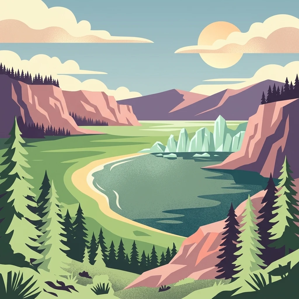
A digital illustration of a scenic bay with a sandy shoreline, pine forests, high rocky cliffs, and jagged ice or rock formations in the water under a sunny sky.

Protecting the wild eastern shore of Lake Baikal across peninsulas, mountains, and islands.

Zabaykalsky National Park

Zabaykalsky National Park is a large protected area on the eastern shore of Lake Baikal in the Republic of Buryatia, Russia. Established in 1986, the park combines a mountainous mainland coastline with two striking peninsulas, the Sviatoy Nos peninsula and the Chivyrkuysky isthmus, as well as several islands in the lake itself. Its terrain ranges from the high ridges of the Barguzin Range down to sheltered bays, sandy spits, and forested lowlands along the lake. The park protects one of the most ecologically diverse sections of the Baikal shoreline, encompassing taiga forests dominated by pine, Siberian cedar, Siberian fir, and Gmelin larch, along with unique communities of Siberian dwarf pine and steppe relicts. Its waters are home to the endemic Baikal seal, whose most important rookery on the lake lies on the Ushkan Islands within the park. Recognized as one of the few protected areas in Russia that fully meets UNESCO recommendations for the national park category, Zabaykalsky occupies a special place in the Baikal conservation system. It combines strict protection with regulated recreation, making it both a working ecological reserve and an accessible landscape for visitors exploring the eastern shore of the world's deepest lake.

Location
Russia
Park type
National park
Established
1986
Area
2,690 km²
Highest point
2,376 m
Zabaykalsky National Park Geography
Regional park map

See the ranked park cluster in its geographic setting

Nearby parks around Zabaykalsky National Park

This regional map shows the same 20 nearby parks ranked below around Zabaykalsky National Park. Select a ranked marker to highlight that park’s boundary where boundary data is available.
Reference park: Zabaykalsky National ParkRanked nearby park20 nearby parks shown
20 nearby parks

Ranked distance relationships and surrounding regional park geography in eastern Russia

Parks and Protected Areas Geographically Near Zabaykalsky National Park

Geographic distance measurements rank surrounding protected areas and regional park geography relative to Zabaykalsky National Park for structured comparison. Recorded environmental attributes and boundary coordinates establish meaningful conservation patterns across nearby protected landscapes.
Watercolor painting depicting a lake with mountain ranges, green hills, and scattered trees.
National parkBuryatia
About 0 km away#1 closest

Northeast

Zaybaykalsky National Park: Geographic Atlas of Lake Baikal Protected Terrain

Mapping the Svyatoy Nos peninsula and Barguzin mountain landscapes

Spanning over 269,000 hectares, Zaybaykalsky National Park protects a dramatic transition from the shores of Lake Baikal to high-altitude mountain complexes. This atlas resource details the park's steep topography, characterized by ancient taiga forests and geological features like the Academician Ridge and marble-limestone islands, offering a structured view of this significant Siberian protected area.

Area
2,690 km²
Established
1986
IUCN
II
Relief
Mountain
Watercolor illustration showing a lake, green vegetation, and mountains under a light sky
National parkIrkutsk Oblast
About 83 km away#2 closest

Southwest

Pribaikalsky National Park: Geographic Context and Protected Landscape Boundaries

Coastal mountain terrain and the freshwater ecosystems of Irkutsk Oblast.

Located in Russia, Pribaikalsky National Park represents a primary protected area within the Lake Baikal basin. The region features dramatic topographical transitions from the Primorsky Range to the inland expanse of Olkhon Island. This record provides a detailed look at the park's physical geography, including its forest cover, coastal cliffs, and the significant role of the Angara River outflow in shaping the surrounding Siberian terrain.

Area
4,173 km²
Established
1986
IUCN
II
Visitors
400K annual
Soft watercolor painting of a lakeshore with rolling hills, coniferous trees, and a distant mountain horizon.
National parkIrkutsk Oblast
About 230 km away#3 closest

Southwest

Pribaikalsky National Park: Atlas and Geographic Overview of Lake Baikal Shoreline

Protected taiga, rift valleys, and Olkhon Island topography

Pribaikalsky National Park serves as a critical protected landscape featuring 470 kilometers of western shoreline along Lake Baikal. Its geography is defined by the steep scarps of the Obruchev fault, the dense taiga of the Primorsky Range, and the unique steppe environments of Olkhon Island. This atlas entry provides essential context on the physical relief and regional characteristics of this landmark Siberian protected area.

Area
4,173 km²
Established
1986
IUCN
II
Visitors
400K annual
Watercolor painting of a river winding through a grassy plain toward distant rolling hills under a soft light.
National parkZabaykalsky Krai
About 430 km away#4 closest

Southeast

Alkhanay National Park: Protected Mountain Terrain and Volcanic Landscapes of Zabaykalsky Krai

Mapping Siberia's forest-steppe transition and sacred mountain geography

Alkhanay National Park preserves an unusual assembly of Siberian mountain taiga, volcanic geology, and Buddhist heritage sites within the Zabaykalsky Krai region. The protected territory spans mid-elevation ranges and river valleys, offering deep insights into the intersection of ecological watershed protection and spiritual land preservation in the Russian Far East.

Area
1,382.34 km²
Established
1999
IUCN
II
Visitors
30K annual
Watercolor illustration depicting layered mountains, green hills, and forested areas with purple and pink tones
National parkZabaykalsky Krai
About 430 km away#5 closest

Southeast

Alkhanay National Park: A Study of Sacred Peaks and Daurian Forest Steppe Geography

Protected mountain landscapes in Russia's Zabaykalsky Krai

Alkhanay National Park preserves a unique transitional landscape where rugged mountain terrain meets the expansive Siberian steppe. Focused on the sacred Mount Alkhanai, the area features dramatic rock landforms, pine-covered canyons, and mineral springs. This protected zone provides a deep look into the geological and ecological history of the Mogotuyskogo Range and surrounding border regions.

Area
1,382 km²
Established
1999
IUCN
II
Relief
Mountain
Watercolor painting of a river winding through hills with trees and vegetation
National parkZabaykalsky Krai
About 446 km away#6 closest

South

Chikoy National Park: Protected National Park with Highland Landscape and River Basin Geography

Explore its protected boundaries and unique taiga-steppe transition in Zabaykalsky Krai.

Chikoy National Park, a protected area in Russia's Zabaykalsky Krai, showcases the rugged geography of the Khentei-Daur Highlands. As a national park, it preserves the upper Chikoy River basin and represents a significant ecological borderland, marking the transition from Siberian taiga to Mongolian steppe. This page facilitates a structured understanding of the park's mapped landscape, its prominent natural monument Bystrinsky Golets, and its role within the broader atlas of protected natural areas.

Area
6,665 km²
Established
2014
IUCN
II
Relief
Mountain
National parkBuryatia
About 529 km away#7 closest

West

Tunkinsky National Park National Park: Protected Landscape and Geographic Context in Buryatia

Discover mapped park boundaries and regional terrain.

Delve into Tunkinsky National Park, a significant protected national park situated in the Buryatia region of Russia. This detail page provides a geographic overview, highlighting the park's mapped boundaries and its place within the surrounding natural landscape. Understand its designation as a protected area, offering a focused entry point for atlas-based discovery of its specific terrain and regional importance.

Area
11,837 km²
IUCN
II
Relief
Mountain
Climate
Boreal
Wildlife reserveKhentii Province
About 535 km away#8 closest

South

Khan Khentii Strictly Protected Area: Geographic Overview and Protected Landscape Mapping

Eastern Mongolia wilderness and Khentii mountain terrain

Explore the expansive reaches of Khan Khentii Strictly Protected Area, a cornerstone of Mongolian conservation. This reserve shields intact taiga forests, river valley habitats, and the historic Burkhan Khaldun mountain from industrial activity, preserving one of the most significant mountain wilderness regions in the province of Khentii.

Area
12,270 km²
Established
1992
IUCN
Ib
Relief
Mountain
Watercolor illustration showing a mountainous landscape with green valleys and a river, rendered in soft pink and green hues
National parkKhentii Province
About 543 km away#9 closest

South

Onon-Balj National Park: A Protected River Valley in Mongolia's Khentii Province

Explore unique geography and diverse ecosystems at a steppe-forest transition.

Onon-Balj National Park safeguards a critical river valley area in Khentii Province, Mongolia, marking an important ecological transition zone between Siberian forests and the Daurian steppe. Discover the park's mapped landscape, characterized by mid-sized mountains and riparian habitats along the Onon and Balj rivers. This protected area offers insights into regional geography, biodiversity, and the unique natural heritage of northern Mongolia.

Area
4,158 km²
Established
2000
IUCN
II
Relief
Mountain
Nature reserveDornod Province
About 604 km away#10 closest

Southeast

Mongol Daguur Nature Reserve: Steppe and Wetland Geography in Eastern Mongolia

Protected landscape boundaries within Dornod Province

An authoritative overview of the Mongol Daguur protected area, focusing on its role as a core element of the Daurian landscape. Discover the spatial distribution of its steppe habitats, wetland systems, and mountain-grassland terrain that define this eastern Mongolian region.

Area
156 km²
Established
1998
IUCN
Ib
Relief
Lowland
National parkTöv Province
About 630 km away#11 closest

South

Gorkhi-Terelj National Park: Mapped Protected Landscape in Töv Province

Explore the geographic context and park boundaries.

Gorkhi-Terelj National Park is a designated national park offering rich opportunities for geographic exploration and protected landscape discovery. This entity page provides detailed insights into its mapped boundaries and its position within the regional geography of Töv Province. Understand the specific landform and terrain characteristics that define this protected natural area, central to understanding Mongolia's conservation landscapes.

Area
2,920 km²
Established
1993
IUCN
II
Relief
Mountain
Watercolor painting of a mountain range with green foothills and a central valley, set against a plain white background.
National parkZabaykalsky Krai
About 634 km away#12 closest

Northeast

Kodar National Park: Geography and Protected Wilderness in Zabaykalsky Krai

Mapped mountain taiga and alpine ranges of Siberia

Kodar National Park is a federally protected area in southern Siberia, defined by its rugged alpine peaks and expansive mountain taiga forests. Centered on the Kodar Range, this protected region offers an essential look at the subarctic ecosystems, rare high-altitude flora, and river corridors of Zabaykalsky Krai. Users can examine the park's two-cluster configuration and its role as a remote stronghold for endemic species within the broader Russian Far East.

Area
4,917.1 km²
Established
2018
IUCN
II
Relief
Mountain
A horizontal watercolor painting showing a soft landscape with distant purple mountains, a calm lake in the midground, and green grassy shores in the foreground.
National parkKhövsgöl Province
About 660 km away#13 closest

Southwest

Lake Khövsgöl National Park: Geography and Protected Area Landscape Analysis

Highland taiga and ancient freshwater basin in Khövsgöl Province

Analyze the complex geography of Lake Khövsgöl National Park, which protects a massive, ultraoligotrophic waterbody surrounded by the rugged Sayan Mountains. The area serves as a vital ecological transition zone, containing diverse alpine, forest, and aquatic terrains that form a central part of Mongolia's natural heritage.

Area
2,760 km²
Relief
Mountain
Climate
Alpine
Access
Remote access
Watercolor illustration showing a river winding through a valley with mountains and forests
National parkZabaykalsky Krai
About 675 km away#14 closest

Northeast

Kodar National Park: Geographic Map & Protected Landscape Analysis

Analyzing alpine terrain and Siberian taiga ecosystems

Kodar National Park presents a striking array of Siberian ecosystems, including the northernmost desert environment known as the Chara Sands, extensive taiga forests, and rugged volcanic terrain on the Udokan Plateau. This geographic resource details the park's distinct sectors, tracing the boundaries of its alpine cirques, glaciers, and mountainous corridors that characterize the Zabaykalsky Krai landscape.

Area
4,917 km²
Established
2016
IUCN
II
Relief
Mountain
A horizontal watercolor painting depicting a soft-toned mountain range with layered green hills and distant, hazy peaks in pastel pink and purple hues.
Biosphere reserveUlaanbaatar
About 676 km away#15 closest

South

Bogd Khan Uul Biosphere Reserve: Mapped Protected Landscapes and Geographic Overview

Highland ecosystems and forest steppe in the Khentii Mountains.

Rising directly south of Ulaanbaatar, Bogd Khan Uul Biosphere Reserve protects a compact mosaic of habitats including larch forests, Siberian pine stands, and alpine rock. The reserve serves as a critical geographic marker, illustrating the rapid shift from urban fringes to subalpine wilderness while maintaining a history of sacred environmental protection that informs its current status as a biosphere reserve.

Area
673 km²
Established
1996
Relief
Mountain
Climate
Boreal
National parkTöv Province
About 691 km away#16 closest

South

Hustai National Park: Geographic and Protected Landscape Profile in Töv Province

Steppe, mountain, and riverine ecosystem mapping

Hustai National Park serves as a landmark conservation site in Töv Province, protecting a distinct gradient between the Khustai mountain ridges and the surrounding Mongolian plains. The area is defined by its role in steppe ecology, featuring varied slopes, riverine woodlands, and expansive grasslands that support a unique assembly of wildlife within the broader central Mongolian region.

Area
506 km²
Established
2003
IUCN
II
Relief
Mountain
National parkMongolia
About 703 km away#17 closest

South

Khustain Nuruu National Park: Mongolia's Steppe Wilderness & Przewalski's Horse Conservation Area

Explore its mapped protected landscape and regional geography.

Khustain Nuruu National Park is a protected area in Mongolia celebrated for its pivotal role in the conservation and reintroduction of the Przewalski's horse, the last truly wild horse species. This national park preserves the unique steppe terrain and rolling hills characteristic of the Mongolian Plateau, serving as a crucial habitat for native wildlife. Understanding Khustain Nuruu National Park provides a focused look into successful wildlife recovery efforts and the geographic context of Central Asian protected lands.

Established
1993
IUCN
II
Relief
Mountain
Scope
Terrestrial
National parkMongolia
About 799 km away#18 closest

Southwest

Khogno Khan National Park: A National Park with Distinct Mongolian Landscape Identity

Explore its mapped terrain and regional geographic context.

Khogno Khan National Park is a designated national park offering a specific focus for protected landscape discovery. Users can explore its geographic placement within Mongolia and understand its role as a mapped natural area. The park's identity as a protected territory provides critical context for those interested in the atlas of East Asian landscapes and regional geography, highlighting a distinct area for geographic study.

Area
841 km²
Established
2003
IUCN
II
Relief
Mountain
A horizontal watercolor illustration depicting a soft, green landscape with distant rolling hills, foreground meadows, and flowering bushes under a pale sky.
Protected areaArkhangai Province
About 802 km away#19 closest

Southwest

Ögii Lake Protected Area: A Comprehensive Geographic Overview of the Mongolian Steppe

Freshwater basin and wetland geography in Arkhangai Province

Ögii Lake represents a pivotal protected landscape in central Mongolia, defined by its 25 square kilometer surface area and gentle, shallow underwater topography. This site functions as an ecological nexus for migratory waterbirds and is essential for understanding the transition between open grassland and the mountainous terrain of the Khangai region.

Area
25.7 km²
Established
2006
Relief
Lowland
Access
Access unknown
Protected areaDornod Province
About 888 km away#20 closest

Southeast

Buir Lake Protected Area: Geographic Overview and Steppe Landscape Context

Mapping the transboundary freshwater wetlands of Dornod Province

Buir Lake occupies a expansive depression in the eastern Mongolian steppe, characterized by its shallow seasonal hydrology and fringing marshlands. This protected area serves as a primary geographic feature within Dornod Province, linking regional steppe systems and migratory bird corridors. The site offers a clear look at the interplay between water and grassland in a unique transboundary setting.

Established
2004
Relief
Lowland
Scope
Terrestrial
Water
Water-dominated
Distance methodology

Geographic measurements, not driving distances

How nearby park distances are calculated

Distances use park boundaries whenever the available geometry allows it. When one or both boundaries are missing, the mapped park locations provide a clearly labelled estimate. Every value represents straight-line geographic separation and does not use roads or routing.

Boundary distance

Calculated between the nearest points of both park boundaries.

Location-to-boundary estimate

Estimated from one mapped park location to the nearest boundary of the other park.

Mapped-location estimate

Estimated between the mapped locations of both parks.

MoriAtlas Explorer

Analyze the Mapped Boundaries and Terrain of Zabaykalsky National Park

Continue your geographic exploration of the Lake Baikal region by examining the detailed protected-area profile of Zabaykalsky National Park. MoriAtlas provides a clear look at the mountain ridges, coastal spits, and island ecosystems that define this significant Russian protected landscape.

Global natural geography