Mori Atlas logo
Countries

Browse the geographic distribution of South Africa's protected lands and natural terrain.

South Africa National Parks and Protected Areas: An Atlas of Mapped Landscapes and Regional Geography

South Africa offers a diverse array of national parks and protected areas, each contributing to the country's rich natural landscape. This atlas entry point allows for a structured exploration of these significant conservation zones, highlighting their mapped boundaries and regional geographic context. Discover the spread of protected lands across South Africa, from its iconic wildlife reserves to its unique biomes, providing a comprehensive overview for geographic discovery.

Related tags

southern africacoastal countrywildlife destinationmegadiverse countryparliamentary republic
About

Browse South Africa's extensive national park geography, outlining the diverse protected landscapes and their regional distribution.

Discover National Parks in South Africa: An Atlas of Protected Areas and Wildlife Landscapes
Browse the diverse national parks and protected areas across South Africa, encompassing vibrant coastal reserves and expansive inland conservation landscapes. A country-level atlas provides a structured entry point for navigating individual park pages and understanding the unique geographic distribution of protected terrain.

South Africa is the southernmost country in Africa, spanning 1.22 million km² with a population of over 63 million. The country operates with three capital cities—Pretoria (executive), Cape Town (legislative), and Bloemfontein (judicial)—and is renowned for its biodiversity, national parks, and multicultural society.

South Africa, officially the Republic of South Africa, is a parliamentary republic located at the southern tip of the African continent. It comprises nine provinces and maintains one of the most diverse populations in the world, with eleven official languages reflecting its rich multicultural heritage. The country transitioned to democratic rule in 1994, ending the apartheid era, and now serves as a regional economic and political powerhouse.

Largest city:Johannesburg
Currency code:ZAR
ISO code:ZA
Parks count
12
Capital
Pretoria
Area
1,221,040 km²
Population
63,015,904 (2,024)

Coastal
Island
Mountainous
Landlocked
Park atlas12 parks

Discover the regional distribution of South Africa's key national parks, from coastal reserves to inland wildlife areas.

National Parks in South Africa: Explore Diverse Protected Areas and Conservation Landscapes
Explore an essential list of South Africa's national parks and key protected areas, covering diverse landscapes from its coastal regions to the expansive inland bushveld. The structured country-level view offers vital geographic context, enabling users to map park distribution and navigate directly into detailed facts for each conservation landscape.
National parkSouth Africa

Kruger National Park: South Africa's Iconic National Park for Geographic Discovery

Explore savanna landscapes and mapped protected area boundaries.

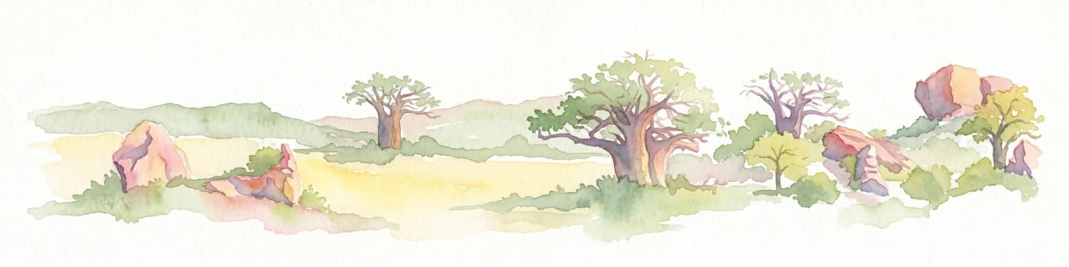
Kruger National Park serves as a paramount example of a protected landscape, offering a rich tapestry of savanna ecosystems and varied terrain across South Africa's Lowveld. This canonical entry details its vast geographic scope, approximately 19,623 square kilometres, and its status as the nation's first national park. Understand the park's environmental context, from the Lebombo Mountains to the Limpopo River, and its integral role within larger transfrontier conservation initiatives, providing critical insight for atlas-based geographic exploration.

Area
19,623 km²
Established
1926
IUCN
II
National parkKgalagadi District

Kgalagadi Transfrontier Park National Park: Explore Its Mapped Protected Landscape

Discover the desert geography and unique terrain of the southern Kalahari.

Kgalagadi Transfrontier Park is a monumental protected area within the Kgalagadi District, embodying the vastness and stark beauty of the Kalahari Desert. This national park page offers an atlas-centric view of its sweeping red dunes, sparse vegetation, and the crucial dry river systems that shape its arid environment. Understand the geographic scope and the protected landscape character of this significant cross-border conservation area, perfect for detailed map exploration and understanding regional desert ecosystems.

Area
38,000 km²
Established
2000
IUCN
II
Visitors
52.5K annual
National parkSouth Africa

Tsitsikamma National Park: South Africa's Protected Coastal Forest and Terrain

Explore the unique mapped landscape and protected area boundaries.

Tsitsikamma National Park in South Africa is defined by its striking coastal geography, where ancient indigenous forests descend towards rugged shores. This national park is a prime example of a protected landscape that showcases the dynamic interface between land and sea, featuring dramatic cliffs and iconic river mouths. Understanding its mapped boundaries and diverse terrain provides critical context for regional geographic exploration and the study of conservation areas within South Africa.

Established
2009
IUCN
II
Relief
Mixed relief
Climate
Mediterranean
National parkLimpopo

Mapungubwe National Park: National Park with Rich Iron Age Archaeology and Savanna Landscapes

Explore Limpopo's unique protected area at the three-nation border.

Mapungubwe National Park is a vital protected area in South Africa's Limpopo region, renowned for its dual significance as a major archaeological site and a diverse natural landscape. This national park protects a significant portion of savanna ecosystems, including unique riparian forests and mopane woodlands, surrounding the historic Mapungubwe Hill. As part of the Greater Mapungubwe Transfrontier Conservation Area, it plays a crucial role in regional conservation, offering a distinct geographic perspective at the confluence of South Africa, Botswana, and Zimbabwe, and serving as a focal point for atlas-based discovery of protected lands.

Area
280 km²
Established
1998
IUCN
II
Relief
Lowland
National parkEastern Cape

Addo Elephant National Park: South African National Park with Diverse Protected Landscapes

Explore its geographic context and unique Big Seven megafauna habitats.

Addo Elephant National Park is a crucial protected landscape within South Africa's Eastern Cape, covering approximately 1,640 square kilometers of varied terrain including karoo plains, coastal dunes, and marine protected areas. Its identity is deeply tied to the successful recovery of elephant populations and its distinction as the only African national park where all Big Seven megafauna can be observed in their natural surroundings. Discover the park's geographic spread, landscape diversity, and its role as a premier conservation area.

Area
1,640 km²
Established
1931
IUCN
II
Visitors
305.5K annual
National parkNorthern Cape

Augrabies Falls National Park: A South African National Park Defined by Granite Gorge and Semi-Desert Terrain

Explore the mapped natural landscape and protected boundaries.

Augrabies Falls National Park in South Africa's Northern Cape Province is a key protected area known for its thundering waterfall on the Orange River and the profound granite gorge carved over millennia. The park's semi-desert environment showcases the distinctive quiver trees and geological landmarks like Moon Rock, offering a unique landscape context. Understand its protected status and geographic significance within the arid Nama-Karoo biome through detailed mapping and landscape information.

Area
820 km²
Established
1966
IUCN
II
National parkSouth Africa

Garden Route National Park: South Africa's Protected Landscape and Forest Atlas

Explore indigenous forests, coastal cliffs, and lake systems.

Garden Route National Park is a key national park in South Africa, celebrated for its rich indigenous forests and dramatic coastline. As a protected landscape, it offers a unique geographic profile, blending ancient woodlands with rugged coastal terrain and interconnected lake systems. This page serves as an atlas entry, detailing the park's spatial extent and its significance as a conservation area within the broader geography of South Africa.

Area
1,210 km²
Established
2009
IUCN
II
National parkWestern Cape

Bontebok National Park: A Unique Protected Landscape in South Africa's Western Cape

Mapping the endemic bontebok's habitat and diverse fynbos.

Bontebok National Park represents a singular achievement in conservation, dedicated to protecting the rare bontebok antelope and showcasing the extraordinary biodiversity of the Cape Floristic Region. Located in the Western Cape, this smallest of South Africa's national parks features a landscape of fynbos-covered foothills beneath the Langeberg Mountains, with the Breede River defining its southern edge. Explore its mapped boundaries and unique ecosystems, offering a concentrated natural discovery experience within a UNESCO World Heritage Site.

Area
27.86 km²
Established
1931
IUCN
II
Relief
Mixed relief
National parkEastern Cape

Mountain Zebra National Park: A National Park within Eastern Cape's Geography

Explore its mapped protected boundaries and regional landscape context.

Mountain Zebra National Park serves as a key protected area within South Africa's Eastern Cape region. This page offers an atlas-driven perspective, detailing the park's geographic scope and mapped boundaries. Understand its role as a national park and its contribution to the regional landscape context, providing structured data for those interested in protected land distribution and natural terrain.

Area
284 km²
Established
1937
IUCN
II
Visitors
31.2K annual
National parkSouth Africa

Blue Lagoon National Park: National Park Atlas and Mapped Wetland Geography

Discover the protected landscape and fauna of Zambia's Kafue Flats.

Blue Lagoon National Park is a critical protected area recognized for its unique wetland and floodplain environment within South Africa's extensive Kafue Flats system. Established in 1976, this national park offers significant opportunities for atlas-driven exploration of its mapped geography and protected landscape. Visitors can learn about the park's ecological significance, its characteristic terrain of lagoons and marshes, and its importance as a sanctuary for endemic wildlife and diverse bird species, contributing valuable context to the broader regional atlas.

Area
500 km²
Established
1976
IUCN
II
Relief
Lowland
Protected areaSouth Africa

Greater Mapungubwe Transfrontier Conservation Area: A Transboundary Protected Landscape in South Africa

Mapped savanna ecosystems and rich cultural heritage at the Limpopo River confluence.

The Greater Mapungubwe Transfrontier Conservation Area, situated in South Africa, stands as a remarkable example of collaborative conservation across national borders. This protected area protects diverse savanna landscapes, particularly around the confluence of the Shashe and Limpopo Rivers, and holds immense cultural value as home to the Mapungubwe Cultural Landscape, a UNESCO World Heritage Site. By examining its mapped geography and protected area status, users gain insight into the ecological corridors vital for wildlife and the ancient archaeological heritage preserved within this significant transfrontier initiative.

Area
4,872 km²
Established
2009
IUCN
VI
Protected areaNamibia

Ai-Ais/Richtersveld Transfrontier Park: Mapped Boundaries of a Southern African Protected Area

Exploring its desert terrain and cross-border conservation geography.

Ai-Ais/Richtersveld Transfrontier Park is a significant protected area that spans across Namibia and South Africa, embodying a vital component of Southern Africa's conservation efforts. This page focuses on the park's geographic identity, detailing its arid landscape characteristics and the mapped extent of its protected boundaries. Understanding this transfrontier park offers insight into cross-border ecological cooperation and the unique desert terrain it encompasses, providing a foundation for structured geographic discovery.

Area
6,045 km²
Established
2003
IUCN
II
Relief
Mountain
Landscape and environment

Understand how South Africa is shaped by terrain, ecosystems, and seasonal conditions

South Africa geography, nature, climate, and landscape context for park-focused travel research
Explore the physical geography, natural setting, and climate patterns of South Africa through a location-first overview built for travel research, national park discovery, and broader regional context. This section helps explain how landscapes, habitats, and environmental conditions shape what people search for, where they travel, and how they experience protected areas in South Africa.

South Africa geography and landscape

South Africa occupies the southernmost region of Africa, with coastline along both the Atlantic Ocean to the west and the Indian Ocean to the east. The interior features elevated plateaus including the Highveld, with the Drakensberg escarpment marking the eastern highlands. The country shares borders with Namibia, Botswana, Zimbabwe, Mozambique, Eswatini, and Lesotho.

South Africa nature and environment

South Africa contains exceptional biodiversity with multiple biomes including savanna, fynbos, succulent karoo, and grassland. The country hosts famous national parks such as Kruger, which supports the Big Five, and Table Mountain National Park near Cape Town. Marine environments along both coasts include unique ecosystems and whale migration routes.

South Africa climate and seasonal conditions

South Africa experiences varied climates ranging from subtropical in the northeast to Mediterranean in the southwest. The interior experiences hot summers and mild winters, while coastal areas benefit from ocean moderation. Rainfall is highest in the east and diminishes westward into semi-arid regions.

Explore this place

Related topics and popular queries

Ways to explore South Africa
Useful phrases, related topics, and discovery prompts connected to South Africa.
south africa country overviewwhat is south africa known forsouth africa geography and climatesouth africa wildlife and national parkssouth africa provinces and capitalssouth africa population and languagessouth africa countryrepublic of south africasouthern africa nationssouth africa capitals pretoria cape townsouth africa population 63 millionsouth africa languagessouth africa wildlife reservessouth africa drakensberg
Park map

Explore the geographic distribution of South Africa's national parks, tracing their locations and regional context.

South Africa National Parks Map: Explore Protected Areas and Wildlife Reserves
Preview the geographic placement of South Africa's national parks and protected areas, understanding their distribution across the country's vast and biodiverse terrain. Open the dedicated country map for a comprehensive atlas view of all mapped conservation landscapes, regional park clusters, and detailed geographic context within South Africa.

Understanding the Geographic Spread and Conservation Context of South Africa's Protected Areas

South Africa National Parks and Protected Areas: Essential FAQ for Geographic Discovery
Discover answers to frequently asked questions about national parks and protected areas across South Africa, including their unique geographic features and regional distribution. These insights help users trace the diverse conservation landscapes, from coastal reserves to inland wilderness, providing valuable context for exploring the country's extensive park atlas.
Other countries

Compare diverse protected landscapes, tracing conservation efforts across the wider southern African region.

Discover National Parks in Countries Near South Africa and Explore Broader African Protected Areas
After exploring South Africa's rich national parks and protected areas, continue your discovery into the distinct park geographies of nearby countries. Browse mapped protected landscapes across the wider continent, gaining geographic context for conservation efforts and diverse natural heritage.

Zambia National Parks and Protected Areas: Mapped Landscapes and Geographic Context

Delve into the geography of Zambia with this comprehensive atlas of its national parks and protected areas. Understand the spatial relationships between diverse landscapes, from floodplains to woodlands, and how conservation efforts are mapped across the country. This resource provides essential context for exploring the natural terrain and protected regions of this Southern Africa nation, offering a foundation for detailed geographic discovery.

11 parks

Namibia National Parks and Protected Areas: Geographic Atlas Exploration

Dive into Namibia's protected natural areas with this structured geographic overview. Understand the distribution of national parks and conservation lands across the country's diverse terrains, from desert expanses to savanna ecosystems. This atlas-style exploration highlights the mapped boundaries and regional geographic significance of Namibia's protected landscapes, providing a factual basis for understanding conservation efforts.

8 parks

Mozambique National Parks and Protected Areas: Mapped Landscape Discovery

Navigate Mozambique's network of national parks and protected areas within a geographic atlas framework. This resource highlights the mapped boundaries and distribution of conservation landscapes across the country, offering insights into regional geography and natural terrain. It is designed for users seeking a structured overview of protected lands for atlas-based exploration and understanding of Mozambique's natural heritage.

6 parks

Botswana National Parks and Protected Areas: Mapped Geographic Discovery

Botswana's protected areas represent significant natural landscapes, from vast desert wildernesses to critical conservation zones. This atlas entry provides a geographic overview, highlighting the mapped distribution of national parks and transfrontier conservation areas. Understand the regional context of Botswana's protected lands and prepare for detailed exploration of its diverse natural terrain.

5 parks

Zimbabwe National Parks and Protected Areas Atlas: Geographic Discovery

Navigate Zimbabwe's significant national parks and protected areas through a detailed geographic lens. This atlas entry provides context on the distribution of protected lands, showcasing the varied natural terrain and conservation landscapes across the nation. It serves as a foundational resource for understanding the country's protected area network and planning further map-based discovery.

4 parks

Lesotho

3 parks

Explore National Parks and Protected Areas in Malawi: A Geographic Atlas

Delve into the structured geographic data for Malawi's national parks and protected areas. This atlas provides clear insights into the mapped boundaries and regional spread of conservation lands, highlighting the country's unique natural terrain. Understand the distribution of protected sites and enhance your geographic comprehension of Malawi's conservation efforts and diverse landscapes.

3 parks

Eswatini National Parks and Protected Areas: Mapped Landscape Exploration

Navigate Eswatini's protected lands with this atlas-focused guide. Understand the geographic spread and mapped boundaries of national parks and conservation areas, providing a solid foundation for exploring the country's natural regions and landscapes. This is your starting point for a structured exploration of Eswatini's diverse geography.

1 park
MoriAtlas Explorer

Continue Your Global Geographic Exploration with MoriAtlas Park Discovery

Dive deeper into the world's protected landscapes and national parks through MoriAtlas's structured atlas interface. Discover how continents and countries are organized, and how individual park geography fits into the broader map. Our platform is built for understanding the distribution and context of protected areas worldwide, facilitating your journey through global natural geography.

Global natural geography