Mori Atlas logo
Countries

Discover the mapped distribution of Ukraine's protected lands and natural landscapes.

Ukraine: parks and protected areas

Explore maps and profiles of protected areas in Ukraine, including Carpathian National Nature Park and Synevyr.

Related tags

countryeastern europesovereign stateblack sea coastpost-soviet
Park system

Exploring the Ukraine Park System and Protected Area Geographic Patterns

Comparing geographic scale, establishment history, and diverse habitat zones across regional reserves

Users can analyze key patterns across the Ukraine park system by comparing known sizes, designations, and climate zones. Aggregated metrics draw from current atlas records to clarify the geographic scale and diverse environmental habitats of protected Eastern European landscapes.

Known protected area

20,270 km²

Area data available for 47 of 48 parks.

Median park size

162 km²

Median across 47 parks with known area.

Oldest known park

Established in 1974.

Largest known park

Recorded area: 7,928 km².

About

Explore Ukraine's diverse mapped landscapes, revealing the geographic distribution of its national parks and protected areas for atlas navigation.

Discover National Parks and Protected Areas in Ukraine, a Vast Eastern European Landscape

Explore national parks and protected areas across Ukraine, the second-largest country in Europe. This MoriAtlas section provides a structured overview, offering geographic context for diverse protected landscapes such as wetlands, forests, and steppe ecosystems, enabling users to understand the distribution of key conservation sites.

Ukraine is a sovereign nation in Eastern Europe, bordered by Russia, Belarus, Poland, Slovakia, Hungary, Romania, Moldova, and the Black Sea. It is the second-largest country in Europe by area. Kyiv is the capital and largest city, followed by Kharkiv, Odesa, and Dnipro. The official language is Ukrainian. Ukraine has a population of approximately 32.9 million and operates as a unitary semi-presidential republic.

Largest city:Kyiv
Currency code:UAH
ISO code:UA
Parks count
48
Capital
Kyiv
Area
603,628 km²
Population
32,862,000 (2,025)

Coastal
Island
Mountainous
Landlocked
Park atlas48 parks

An atlas of Ukraine's mapped protected areas, showcasing the geographical distribution of its conservation landscapes.

National Parks and Protected Areas in Ukraine: Explore the Country's Diverse Natural Landscapes

MoriAtlas provides a structured list of national parks and notable protected areas across Ukraine's diverse geography. Explore individual park profiles to understand their unique conservation landscapes, key features, and regional context, facilitating in-depth discovery of Ukraine's rich natural heritage.
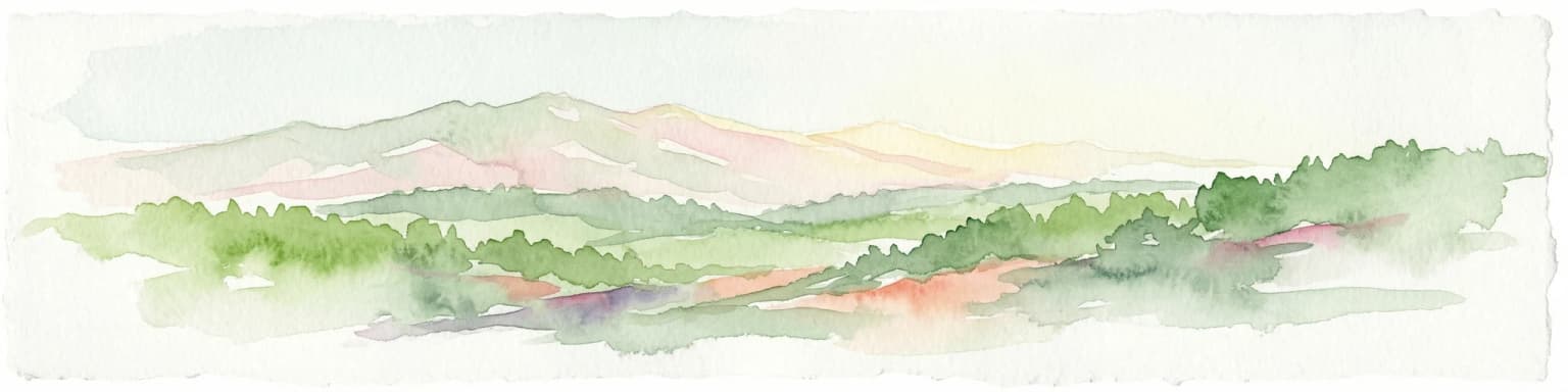
Watercolor painting of green forests, valleys, and distant mountains in the Carpathian Mountains
National parkIvano-Frankivsk Oblast
Carpathian National Nature Park

National Park mapped boundaries and regional geography.

Carpathian National Nature Park, in Ivano-Frankivsk Oblast, Ukraine. Landscapes: mountains, valleys, and rivers.

Area
515.7 km²
Established
1980
IUCN
II
Visitors
1M annual
Watercolor painting showing a lake surrounded by mountains and forests
National parkZakarpattia Oblast

Synevyr National Nature Park: National Park Protected Landscape in Zakarpattia Oblast

Mapped geographic context and protected area identity

Delve into Synevyr National Nature Park, a designated national park situated in the diverse geography of Zakarpattia Oblast, Ukraine. This page provides essential atlas-driven context, detailing the park's mapped boundaries and its significance as a protected landscape within the Carpathian region. Understand its unique place in Ukraine's network of natural areas and explore its regional geographic setting for a comprehensive overview.

Area
404 km²
Established
1974
IUCN
V
Relief
Mountain
Watercolor painting of a river, hills, and trees in a natural landscape.
National parkKhmelnytskyi Oblast

Podilski Tovtry National Nature Park: Mapped Limestone Ridges and Regional Geography

Explore this protected national park in Khmelnytskyi Oblast.

Podilski Tovtry National Nature Park is a vast protected area in western Ukraine, recognized for its distinctive Tovtry limestone ridge and intricate river canyon systems. This national park offers a rich geographic context for understanding the natural landscape of Khmelnytskyi Oblast, featuring unique geological formations and diverse habitats. Its protected status highlights the importance of its conservation value and its role within regional natural resource management, making it a key destination for atlas-based geographic discovery.

Area
2,613.16 km²
Established
1996
IUCN
II
Relief
Highland
Watercolor illustration of a mountainous landscape with green forests, a river, and distant mountains under a light sky
Nature reserveUkraine

Crimean Nature Reserve: Nature Reserve with Mountain Forests and Karst Geography

Explore protected area landscapes and terrain.

The Crimean Nature Reserve is a key protected area within the Crimean Mountains, recognized for its significant mountain forests and unique karst landscapes. This nature reserve encompasses a critical span of the peninsula's rugged terrain, from high mountain ridges to dramatic southern slopes. Its designation as a protected area highlights its ecological importance and its role in preserving diverse natural habitats and geological features within a regional geographic context, making it a notable destination for landscape exploration.

Area
442 km²
Established
1991
IUCN
Ia
Relief
Mountain
Watercolor depiction of a lake with reeds, forested shoreline, and distant mountains
National parkUkraine

Shatsk National Natural Park: Ukraine's Deepest Lake and Wetland Protected Area Atlas

Mapped landscape and protected geography of a premier Ukrainian national park.

Shatsk National Natural Park in Ukraine is a significant protected area featuring a remarkable cluster of over thirty lakes, most notably Svitiaz Lake, the nation's deepest. This park protects vital wetland and forest ecosystems within the Polissia region, offering a rich geographic context for atlas exploration. Understanding its mapped boundaries and terrain provides insight into its importance as a Ramsar site and a key corridor for migratory birds, making it a cornerstone of conservation geography in Eastern Europe.

Area
489.77 km²
Established
1983
IUCN
II
Relief
Lowland
Watercolor illustration of a mountainous landscape with forests, lakes, and rolling hills under a light sky
National parkUkraine

Uzh National Nature Park: Primeval Beech Forests and Protected Landscape in Ukraine

Explore its mapped boundaries and Carpathian geography.

Uzh National Nature Park, a protected national park in Ukraine's Carpathian Mountains, safeguards a crucial segment of the Primeval Beech Forests of the Carpathians, a UNESCO World Heritage site. This atlas-focused exploration reveals the park's mapped terrain, defined by river valleys and ancient forest ecosystems, offering essential geographic context for this significant protected landscape. Discover the natural heritage preserved within its boundaries, showcasing exceptional biodiversity and the unique character of the Eastern Carpathians.

Area
391.593 km²
Established
1999
IUCN
II
Relief
Mountain
Watercolor illustration of rolling hills, a winding river, and patches of vegetation
National parkKherson Oblast

Dzharylhach National Nature Park: Protected Landscape Atlas & Regional Geography

Explore the mapped protected area in Kherson Oblast, Ukraine.

Delve into the geographic details and protected landscape characteristics of Dzharylhach National Nature Park. As a designated national park within Kherson Oblast, this entry provides vital information for understanding its mapped boundaries and its place in the regional geography. MoriAtlas enables a structured approach to discovering and contextualizing protected areas like Dzharylhach, offering a unique perspective for atlas exploration.

Area
100 km²
Established
2009
IUCN
II
Relief
Lowland
Watercolor illustration showing a river winding through a forested valley with rolling hills and distant mountains under a light sky
National parkDonetsk Oblast

Holy Mountains National Nature Park: Donetsk Oblast Protected Landscape

Mapped boundaries and regional geographic context.

This entry details Holy Mountains National Nature Park, a protected national park located in Donetsk Oblast, Ukraine. It serves as a key point for exploring the mapped protected areas and natural landscapes within the Donbas region. Understand the park's geographic significance and its place within the atlas of eastern Ukraine's diverse terrain and conservation efforts.

Area
406 km²
Established
1997
IUCN
II
Relief
Mixed relief
Watercolor illustration showing a wetland area with green vegetation, a winding water body, and purple-hued mountains in the background
National parkUkraine

Azov, Syvash National Nature Park: National Park Protected Landscape and Geography

Explore mapped boundaries and regional landscape context.

Azov, Syvash National Nature Park stands as a notable protected area, offering a distinct geographic identity within Ukraine's atlas of natural landscapes. This national park's mapped boundaries provide a foundation for understanding its landscape context and regional significance. MoriAtlas enables detailed exploration of its protected terrain and its place within the country's conservation geography, serving as a gateway to structured geographic information and detailed park data for researchers and explorers.

Area
525.8 km²
Established
1993
IUCN
II
Relief
Lowland
Watercolor illustration of a landscape with grassy fields, trees, a river, and distant hills.
National parkKherson Oblast

Oleshky Sands National Nature Park: Mapping Ukraine's Distinctive Semi-Arid Dune Landscape

Explore protected sandy steppe, dunes, and conservation areas in Kherson Oblast.

Oleshky Sands National Nature Park is a critical protected landscape in Kherson Oblast, Ukraine, renowned for its unusual semi-arid terrain dominated by expansive sand dunes and sandy steppe. This page provides detailed geographic context for the park, highlighting its unique mapped boundaries, the contrast between its Radensk and Burkut zones, and its ecological importance as part of the Pontic-Caspian steppe. Understand the specific landscape features and regional geography that make this national park a significant natural asset within Ukraine's protected area network.

Area
80.2 km²
Established
2010
IUCN
II
Relief
Mixed relief
Watercolor illustration of rolling hills, distant mountains, green fields, scattered trees, and colorful wildflowers
National parkUkraine

Skole Beskids National Nature Park: Protected Landscape Atlas and Geographic Context in Ukraine

Explore the mapped boundaries and regional geography of this Ukrainian national park.

Delve into the specifics of Skole Beskids National Nature Park, a designated national park contributing to Ukraine's protected lands. This detail page offers a structured atlas view, focusing on the park's geographic positioning, its mapped natural landscape features, and its significance within the regional context. Understand the core identity of this protected area through detailed geographic and landscape data, enabling focused map exploration.

Area
357 km²
Established
1999
IUCN
II
Relief
Mountain
Watercolor illustration of a landscape with mountains, trees, a river, and fields
National parkUkraine

Hutsulshchyna National Park: National Park of Ukraine's Carpathian Mountains

Discover mapped protected landscapes and regional geography.

Explore Hutsulshchyna National Park, a designated national park within Ukraine's Carpathian Mountains. This protected area showcases representative Carpathian forest ecosystems and mountain terrain, offering significant insight into the region's natural landscape and geographic context. The park's boundaries protect rolling slopes and river valleys, contributing to the ecological richness of the Eastern Carpathians. MoriAtlas provides structured data for understanding its place within the national and regional atlas.

IUCN
II
Scope
Terrestrial
Landscape and environment

Understand how Ukraine is shaped by terrain, ecosystems, and seasonal conditions

Ukraine geography, nature, climate, and landscape context for park-focused travel research

Explore the physical geography, natural setting, and climate patterns of Ukraine through a location-first overview built for travel research, national park discovery, and broader regional context. This section helps explain how landscapes, habitats, and environmental conditions shape what people search for, where they travel, and how they experience protected areas in Ukraine.

Ukraine geography and landscape

Ukraine occupies 603,628 km² in Eastern Europe, making it the second-largest country in Europe. It shares borders with Russia, Belarus, Poland, Slovakia, Hungary, Romania, and Moldova. The country has a southern coastline along the Black Sea and Sea of Azov. The terrain includes plains, steppes, and the Carpathian Mountains in the west.

Ukraine nature and environment

Ukraine's natural landscape includes extensive steppes, forests, and wetlands. The Carpathian Mountains in the west contain biodiversity. The country has several protected areas and nature reserves across its diverse ecosystems.

Ukraine climate and seasonal conditions

Ukraine has a temperate continental climate with cold winters and warm summers. Coastal areas near the Black Sea have milder conditions. The climate varies from the more humid west to the drier eastern steppes.

Explore this place

Related topics and popular queries

Ways to explore Ukraine

Useful phrases, related topics, and discovery prompts connected to Ukraine.
where is ukraine locatedwhat is ukraine capital cityukraine country factseastern european countries ukraineukraine population and areaukraine borders which countriesukraine countryeastern europe nationukraine capital kyivukraine geographyukraine bordersukrainian hryvniaukraine populationukraine second largest country europe
Park map

Examine the geographic distribution of Ukraine's protected areas, understanding their placement across its varied Eastern European terrain.

Ukraine National Parks Map: Visualize Protected Areas and Regional Geographic Context

Browse the mapped locations of Ukraine's national parks and various protected areas, including forests, wetlands, and mountain regions, to see their distribution across this Eastern European nation. This geographic overview provides essential context for understanding Ukraine's conservation landscapes and helps users plan deeper park exploration within its borders.
Natural feature types

Explore the Full Index of Natural Features in Ukraine Protected Areas

Begin your search through the diverse geography and natural landmarks integrated into the national parks of Ukraine. MoriAtlas connects these distinct features to provide a spatial understanding of the country protected territories and regional natural landscapes.

Explore key geographic context and conservation landscapes across Ukraine's diverse network of protected areas.

Frequently Asked Questions About National Parks and Protected Areas in Ukraine

Navigate common questions about Ukraine's national parks and protected areas to understand their regional importance and geographic spread. Explore the diverse conservation landscapes, from wetlands and ancient forests to steppe regions and Carpathian foothills, that comprise Ukraine's rich natural heritage.
Other countries

Compare Ukraine's protected areas with national park geography in neighboring countries.

Discover National Parks and Protected Areas in Countries Beyond Ukraine

From Ukraine, explore national park lists and protected area geography across diverse Eastern European countries and beyond. This comprehensive atlas perspective allows for deeper geographic comparison of regional conservation landscapes and varied terrain.

Lithuania: parks and protected areas

Parks and protected areas in Lithuania, including Curonian Spit and Aukštaitija.

18 parks

Slovakia: parks and protected areas

Parks and protected areas in Slovakia, including TANAP and Poloniny.

9 parks

Kosovo: parks and protected areas

Parks and protected areas in Kosovo, including Bjeshkët e Nemuna National Park and Sharr Mountains.

2 parks

Protected area types

Continue Exploring Ukraine's Designation-Based Park Geography

Deepen your understanding of Ukraine's protected natural areas by navigating into specific designation categories. Each classification offers a unique lens through which to view the country's conservation landscapes and mapped park boundaries. Continue your exploration to see how these designation types are distributed across Ukraine's diverse terrain and identify areas for further geographic discovery.

Ukraine Protected Area Designations
MoriAtlas Explorer

National parks and protected areas worldwide

Find a park and explore its geography, habitats, and monthly climate.

Global natural geography