Mori Atlas logo
Nearby park discovery

Mapping the geographic distribution and surrounding landscape context of local protected sites.

Regional Protected Areas and National Parks Near Abaco National Park in the Bahamas

Examine the geographic distribution of protected lands situated within the vicinity of Abaco National Park. This regional overview highlights the spatial relationship between surrounding protected areas and the unique Caribbean pine forest terrain, providing a clear map of conservation landscapes across the island geography.

Related tags

Caribbean pine forestEndemic bird speciesBahama parrotProtected areaBirdwatching

Pine forest refuge for Bahama parrots and endemic birdlife

Abaco National Park

Abaco National Park is a protected area in South Abaco, one of the major islands in the Bahamas archipelago. Established in 1994, the park encompasses approximately 20,500 acres of diverse Caribbean terrain, with roughly 5,000 acres dedicated to Caribbean pine forest. The park represents one of the most significant conservation areas in the Bahamas, protecting critical habitat for endemic bird species including the distinctive Bahama parrot. Located on the eastern side of Great Abaco Island, the park serves as a stronghold for pine forest ecosystems that are otherwise limited in the Caribbean region. The protected area is managed by the Bahamas National Trust and provides important ecological corridors for species found nowhere else on Earth.

Location
Bahamas
Park type
National park
Established
1994
Area
83 km²
Abaco National Park protected area
Regional park map

See the ranked park cluster in its geographic setting

Nearby parks around Abaco National Park

This regional map shows the same 20 nearby parks ranked below around Abaco National Park. Select a ranked marker to highlight that park’s boundary where boundary data is available.
Reference park: Abaco National ParkRanked nearby park20 nearby parks shown
20 nearby parks

Geographic proximity and environmental comparison across surrounding island terrain

Ranked Protected Areas and Parks Near Abaco National Park

Examine the ranked collection of parks near Abaco National Park, ordered by straight-line geographic separation and directional orientation. Review surrounding protected landscapes and recorded environmental traits to understand broader regional patterns across the territory.
National parkBahamas
About 52 km away#1 closest

Northeast

Pelican Cays Land and Sea Park: Protected Marine Landscape in the Bahamas

Explore coral reefs, undersea caves, and vital sea turtle habitats.

Pelican Cays Land and Sea Park, a protected national park in the Bahamas, offers a rich marine atlas experience. Its landscape is defined by extensive coral reef formations and unique undersea cave systems, supporting remarkable biodiversity. This park highlights the importance of protected waters for species like sea turtles and provides exceptional opportunities for exploring submerged geography and vibrant coral ecosystems.

Area
8 km²
Established
1972
IUCN
II
Relief
Lowland
Nature reserveHope Town
About 58 km away#2 closest

North

Tilloo Cay National Reserve Nature Reserve: Coastal Habitat for White-Tailed Tropicbirds

Mapped protected area within the Hope Town region of the Abacos.

Tilloo Cay National Reserve, a protected nature reserve situated near Hope Town, represents a significant habitat for the white-tailed tropicbird, a species reliant on such island nesting sites. This 11-acre reserve showcases a characteristic Bahamian small island ecosystem, featuring coastal terrain and scrub vegetation. Its protected status under the Bahamas National Trust ensures the security of critical breeding grounds, making it a key focus for conservation within the Abaco Islands. The reserve offers a distinct example of targeted habitat preservation, contributing to the broader atlas of protected natural landscapes in the Caribbean.

Area
0.04 km²
Established
1990
IUCN
II
Relief
Lowland
National parkBahamas
About 75 km away#3 closest

North

Fowl Cays National Park: Bahamas Marine Protected Area and Coral Reef Atlas

Discover the mapped geography and marine ecosystems of this Bahamian national park.

Fowl Cays National Park in the Bahamas is a protected marine environment known for its significant coral reef formations and supporting seagrass meadows. This atlas-focused entry details the park's geographic setting within the Abaco Islands, highlighting its importance as a marine conservation landscape. Users can explore the protected boundaries and the ecological richness of this vital Caribbean ecosystem.

Area
9 km²
Established
2009
IUCN
II
Climate
Subtropical
National parkNorth Abaco
About 89 km away#4 closest

North

Black Sound Cay National Reserve National Park: Protected Landscape in North Abaco

Explore its mapped boundaries and regional geographic context.

Black Sound Cay National Reserve is a key protected area situated in North Abaco, within the Bahamas. This national park offers a unique lens into the island's natural geography and conservation landscapes. Users can delve into the park's mapped outlines and understand its specific role within the broader Abaco Islands archipelago, providing critical geographic context for any atlas-based discovery.

Area
0.008 km²
Established
1988
IUCN
Ia
Relief
Lowland
National parkBahamas
About 109 km away#5 closest

South

Bonefish Pond National Park: Essential Bahamas Coastal Wetland & Marine Nursery

Mapped protected area, mangrove ecosystem, and habitat for key marine species.

Bonefish Pond National Park, a protected national park on New Providence island in The Bahamas, is essential for its role as a thriving marine nursery. The park's landscape features extensive red mangrove forests, tidal channels, and shallow lagoons crucial for juvenile bonefish, crawfish, and conch. This area highlights effective wetland restoration and conservation, offering valuable insights into Caribbean coastal protected landscapes and their geographic importance.

Area
5 km²
Established
2002
IUCN
II
Relief
Lowland
National parkBahamas
About 110 km away#6 closest

South

Primeval Forest National Park: A Protected Landscape within the Bahamas Archipelago

Explore mapped boundaries and regional geography in the Lucayan Archipelago.

Primeval Forest National Park serves as a key protected area within the Bahamas, offering a focused view of island geography and conservation landscapes. This national park is a critical element for understanding the archipelago's natural terrain and mapped protected lands. Its presence provides valuable geographic context, allowing for detailed exploration of its boundaries and its place within the broader Bahamian atlas.

Established
2002
Relief
Mixed relief
Climate
Tropical
Access
Easy access
National parkGrand Bahama
About 139 km away#7 closest

Northwest

Lucayan National Park: National Park Geography and Mapped Landscape Exploration

Discover protected area boundaries on Grand Bahama.

Lucayan National Park stands as a distinct national park entity within the geography of Grand Bahama. This page provides a focused atlas-style exploration of the park's protected landscape, detailing its mapped area and contributing to a structured understanding of its regional context. Delve into the geographic specifics that define Lucayan National Park as a key element of the Bahamas' protected lands, suitable for detailed map-based discovery and analysis.

Area
7.84 km²
Established
1982
IUCN
II
Climate
Tropical
National parkBahamas
About 139 km away#8 closest

Southwest

North and South Marine Parks National Park: Geographic Atlas and Protected Landscape in the Bahamas

Mapping Bahamian protected marine geography and its national park boundaries.

Delve into the atlas-view of North and South Marine Parks, a key national park in the Bahamas. This page details the park's specific geographic features and its protected landscape identity within the island nation. Understand its placement and significance as a protected marine area contributing to the regional geography.

Area
20 km²
Established
2002
IUCN
II
Climate
Tropical
National parkAndros
About 150 km away#9 closest

Southwest

Blue Holes National Park: A National Park for Detailed Geographic and Landscape Exploration

Explore mapped boundaries and regional terrain context.

Delve into the specifics of Blue Holes National Park, a designated national park offering rich opportunities for geographic discovery. This entry provides structured information focused on its protected landscape identity, mapped outlines, and its contribution to the regional geography of Andros, Bahamas. Understand the park's unique setting through detailed map context and atlas-driven insights.

Area
162 km²
Established
2002
IUCN
II
Relief
Mixed relief
National parkAndros
About 156 km away#10 closest

South

Crab Replenishment Reserve National Park: Explore Andros Protected Landscape Boundaries

Mapped geography and regional park context

Investigate Crab Replenishment Reserve National Park, a significant protected landscape located in the Andros region. This page provides detailed atlas-style information, focusing on the park's mapped boundaries and its specific geographic setting. Understand how this national park contributes to the regional protected area network and its overall landscape identity for atlas-driven exploration.

Area
16 km²
Established
2002
IUCN
II
Relief
Lowland
National parkBahamas
About 179 km away#11 closest

South

Exuma Cays Land and Sea Park National Park: Mapped Protected Landscape in the Bahamas

Explore its geographic identity and atlas context.

This page provides detailed map-based information on Exuma Cays Land and Sea Park, a significant national park located in the Bahamas. Discover its protected area boundaries, explore its unique geographic setting within the archipelago, and understand its role as a key natural landscape. The content is geared towards atlas exploration, offering a factual overview of the park's spatial and regional importance without any visitor logistics or operational details.

Area
455.84 km²
Established
1959
Relief
Lowland
Climate
Tropical
National parkBahamas
About 188 km away#12 closest

Northwest

Walker's Cay National Park: Bahamas National Park Featuring a Premier Barrier Reef Ecosystem

Explore mapped underwater geography and marine protected boundaries.

Walker's Cay National Park is a vital marine protected area located in the Bahamas, safeguarding approximately 3,840 acres of coastal and ocean waters. Its most distinguishing feature is the expansive barrier reef, a complex underwater geography teeming with diverse marine species that draws attention for diving and snorkeling. This park serves as a crucial element within the atlas of Bahamian protected lands, offering structured insights into marine conservation and the mapped distribution of critical reef habitats.

Area
16 km²
Established
2002
IUCN
II
Relief
Lowland
National parkBahamas
About 201 km away#13 closest

South

West Side National Park National Park: Extensive Protected Landscape in the Bahamas

Mapped marine and mangrove ecosystems, plus pine forest terrain

Delve into the geographical identity of West Side National Park, a protected national park in the Bahamas renowned for its vast scale and diverse ecosystems. This landscape features significant Caribbean pine forests transitioning into extensive, intact mangrove systems along its coastlines, integrating directly with vital marine habitats. As one of the largest protected areas in the Caribbean, its ecological representation from land to sea offers a unique atlas perspective on Bahamian natural heritage and conservation.

Area
6,070 km²
Established
2002
IUCN
II
Relief
Mixed relief
Marine protected areaFlorida Keys
About 289 km away#14 closest

West

Florida Keys National Marine Sanctuary: Geographic Atlas and Marine Protected Area Overview

Submerged reef structures and archipelago geography

Focusing on the marine geography of the Florida Keys, this detailed record outlines the sanctuary's boundaries, ranging from Atlantic coral reefs to Gulf of Mexico seagrass flats. Understand the physical scale of this protected system, its role in coastal conservation, and the unique underwater terrain that defines the southern tip of the United States.

Area
9,947 km²
Established
1990
Relief
Lowland
Climate
Subtropical
National parkMiami-Dade County
About 293 km away#15 closest

West

Biscayne National Park: Mapped Protected Area and Coastal Landscape

Explore its protected status and geographic setting in Miami-Dade County.

Biscayne National Park represents a significant protected area managed as a U.S. National Park, safeguarding extensive coastal and marine environments. This page offers detailed insight into the park's geographic placement within Miami-Dade County, Florida, focusing on its mapped boundaries and the unique landscape it encompasses. Understand its ecological importance and its distinct contribution to the atlas of protected lands.

Area
700 km²
Established
1980
IUCN
V
Visitors
701K annual
National parkExuma
About 318 km away#16 closest

Southeast

Moriah Harbour Cay National Park: Protected Area Atlas and Geographic Context within Exuma

Explore mapped boundaries and landscape identity.

Gain a comprehensive understanding of Moriah Harbour Cay National Park as a protected landscape within the Exuma region. This entry provides essential geographic context, detailing its mapped territory and unique natural characteristics for atlas-based discovery. Understand the park's significance through its protected area designation and its place within the broader Bahamian geography.

Area
68 km²
Established
2002
Relief
Lowland
Scope
Mixed
National parkFlorida
About 331 km away#17 closest

West

Everglades National Park: Protected Landscape Identity and Regional Geographic Context

Explore its unique natural terrain and mapped boundaries.

Understand Everglades National Park as a distinct protected landscape with significant geographic features within Florida. This page offers an atlas-driven view of its protected area, detailing its mapped boundaries and the surrounding regional natural terrain. Discover the core identity of this national park through its landscape and geographic setting, providing context for broader atlas exploration.

Area
6,106.61 km²
Established
1947
IUCN
II
Visitors
1.2M annual
National parkBahamas
About 351 km away#18 closest

Southeast

Conception Island National Park: Bahamas Protected Landscape Atlas

Explore protected area boundaries and geographic context.

Conception Island National Park represents a key protected landscape within the Bahamas, offering a focused point for atlas exploration of island geography. Understand the mapped boundaries and the unique environmental context of this national park. As part of the wider Lucayan Archipelago, its protected status contributes to the regional conservation narrative and geographic understanding of the Atlantic Islands.

Area
121.41 km²
Established
1964
Relief
Lowland
Climate
Tropical
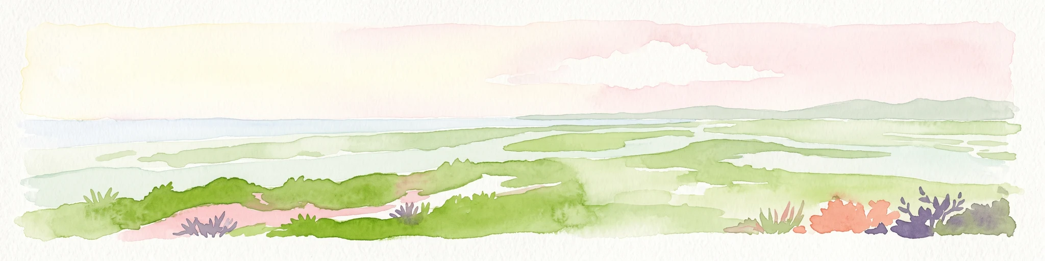
Watercolor illustration depicting a panoramic view of a coastal estuary with green mangrove islands, tidal channels, and a soft pink sunset sky.
Marine protected areaFlorida
About 454 km away#19 closest

West

Rookery Bay National Estuarine Research Reserve: Coastal Geography and Protected Estuarine Waters

Subtropical mangrove landscapes within the Florida Gulf Coast region.

This marine protected area encompasses a vast sweep of sheltered coastal waters and tidal forests at the northern edge of the Ten Thousand Islands. The reserve stands as a prime example of an undisturbed subtropical estuary, characterized by continuous mangrove shorelines and intricate hydrologic networks that provide critical habitat for numerous estuarine dependent species.

Area
445.15 km²
Established
1980
Relief
Lowland
Climate
Subtropical
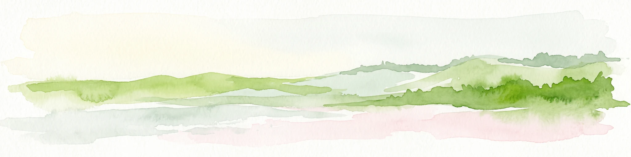
A minimalist watercolor illustration showing green rolling hills and a shoreline against a pale background, representing the natural coastal landscape.
Protected landscapeFlorida
About 470 km away#20 closest

Northwest

Canaveral National Seashore Protected Landscape and Barrier Island Geography

Coastal ecosystems of the Florida Atlantic shore

Canaveral National Seashore stands as a significant protected landscape on the Florida coast, offering a cross section of barrier island geography. This protected area connects the dynamic Atlantic oceanfront with the calm, biodiverse waters of the Mosquito Lagoon, forming a vital refuge of dunes, maritime hammocks, and estuarine wetlands.

Area
233.35 km²
Established
1975
IUCN
V
Visitors
2.5M annual
Distance methodology

Geographic measurements, not driving distances

How nearby park distances are calculated

Distances use park boundaries whenever the available geometry allows it. When one or both boundaries are missing, the mapped park locations provide a clearly labelled estimate. Every value represents straight-line geographic separation and does not use roads or routing.

Boundary distance

Calculated between the nearest points of both park boundaries.

Location-to-boundary estimate

Estimated from one mapped park location to the nearest boundary of the other park.

Mapped-location estimate

Estimated between the mapped locations of both parks.

MoriAtlas Explorer

Continue Exploring Abaco National Park's Geographic Identity and Mapped Boundaries

Delve deeper into the structured geographic information for Abaco National Park. Understanding its precise location, protected landscape character, and relation to South Abaco's regional geography enhances your atlas-based discovery of protected areas in the Bahamas. This detailed view supports a comprehensive grasp of the park's mapped context.

Global natural geography