Mori Atlas logo
Nearby park discovery

Mapping regional geographic context and proximity for mountain protected areas

Protected Areas and Natural Landscapes Surrounding Rila National Park in Bulgaria

Discover the network of protected landscapes located in the vicinity of Rila National Park. This regional geographic index provides a spatial overview of nearby natural reserves and conservation areas situated across the Rila mountain range, helping identify shared topographical features and the distribution of protected terrain in southwestern Bulgaria.

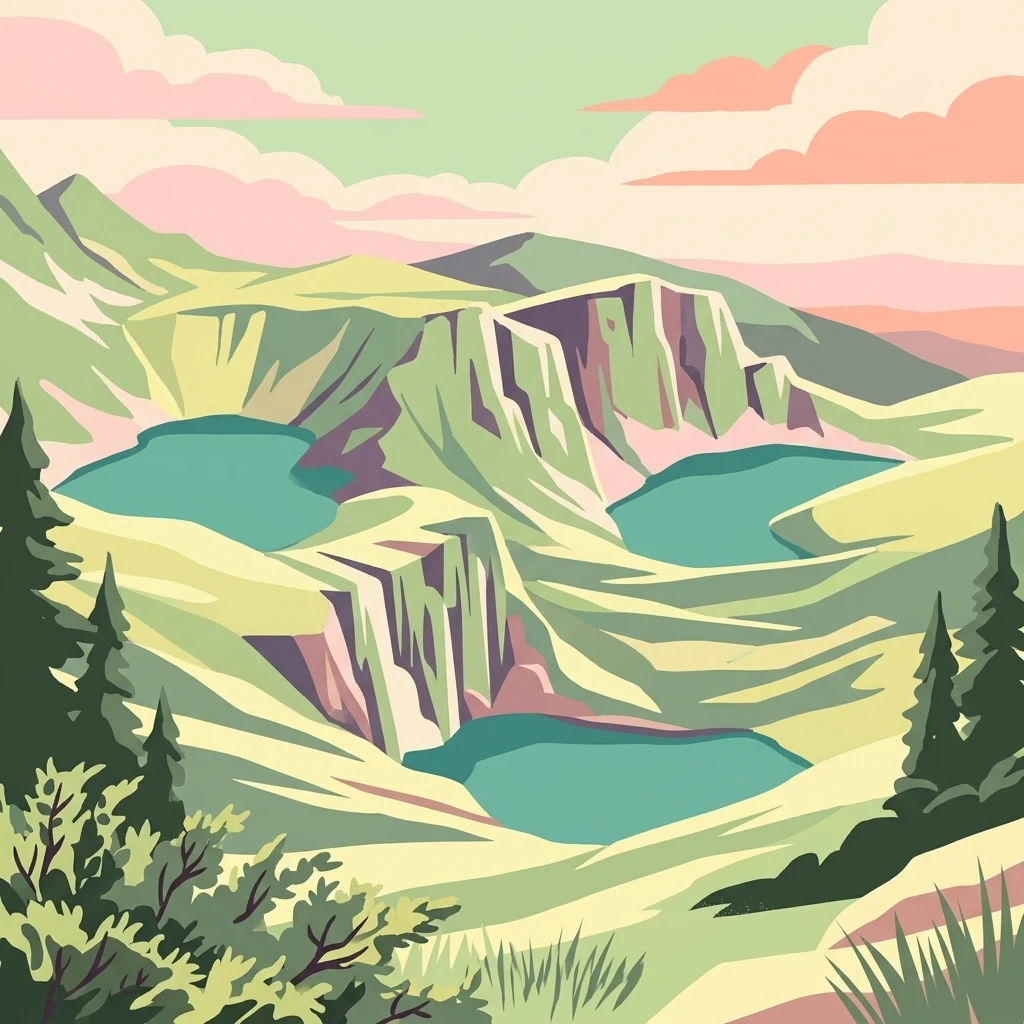
Stylized illustration of mountain peaks with three blue lakes, green valleys, pine trees, and a pastel sky

Bulgaria's largest national park protecting the highest peak in the Balkans and a remarkable alpine landscape of glacial lakes, ancient forests, and endemic biodiversity

Rila National Park

Rila National Park is the largest national park in Bulgaria, spanning over 810 square kilometers in the Rila mountain range in the southwest of the country. Established on 24 February 1992, the park was created to protect several ecosystems of national importance, preserving self-regulating ecological communities, habitats of rare and endangered species, and landscapes of outstanding scientific and cultural significance. The park encompasses terrain ranging from 800 meters near Blagoevgrad to 2,925 meters at Musala Peak, the highest summit in the entire Balkan Peninsula. Within its boundaries lie 120 glacial lakes, including the famous Seven Rila Lakes, and the headwaters of major rivers including the Maritsa, which carries the most water of any river flowing entirely within the Balkans, and the Iskar, the longest river contained entirely within Bulgaria. The park occupies territory across four Bulgarian provinces and contains four strict nature reserves: Parangalitsa, Central Rila Reserve, Ibar, and Skakavitsa.

Location
Bulgaria
Park type
National park
Established
1992
Area
810.5 km²
Highest point
2,925 m
Rila National Park Protected Landscape
Regional park map

See the ranked park cluster in its geographic setting

Nearby parks around Rila National Park

This regional map shows the same 20 nearby parks ranked below around Rila National Park. Select a ranked marker to highlight that park’s boundary where boundary data is available.
Reference park: Rila National ParkRanked nearby parkSelected boundary: Rila National Park20 nearby parks shown
20 nearby parks

Distance ranked regional park geography and surrounding protected landscapes

Parks and Protected Areas Geographically Near Rila National Park

Geographic separation metrics establish a structured ranking of protected areas surrounding Rila National Park for comparative spatial analysis. Recorded environmental characteristics and country context illuminate broader regional patterns across adjacent terrain.
Watercolor illustration of green mountains and a lake with trees
National parkBlagoevgrad Province
6.8 km away#1 closest

South

Pirin National Park: Protected Area and Regional Geographic Context in Bulgaria

Explore Pirin National Park's mapped boundaries and landscape.

Pirin National Park serves as a vital national park entity within the atlas of Blagoevgrad Province, Bulgaria. This page details its protected landscape, offering a structured view of its geographic setting and mapped terrain. Users can investigate the park's specific identity and its relation to the surrounding regional geography, providing essential context for understanding protected areas and natural landscapes within a comprehensive map-driven framework.

Area
403.56 km²
Established
1962
IUCN
II
Relief
Mountain
Watercolor painting showing a mountain range with green hills, a lake, and trees in the foreground
National parkLovech Province
65 km away#2 closest

Northeast

Central Balkan National Park: Bulgaria's Majestic National Park and Protected Landscape

Explore mapped alpine terrain and ancient forests in Lovech Province.

Central Balkan National Park is a significant protected area in Bulgaria, renowned for its stunning mountain geography and exceptionally well-preserved ancient beech forests. Located within Lovech Province, the park's landscape is defined by dramatic peaks, including Botev Peak, deep canyons, and alpine meadows, offering a rich context for geographical exploration and understanding its protected status. Its ecosystem health and ecological value are underscored by multiple nature reserves and its recognition as part of a UNESCO World Heritage Site.

Area
716.69 km²
Established
1991
IUCN
II
Relief
Mountain
Watercolor painting of a lake landscape with marshy foreground reeds, distant hills, and soft pastel colors.
Protected areaCentral Macedonia
About 82 km away#3 closest

South

Lake Kerkini Protected Area: Geography and Wetland Mapping in Central Macedonia

A significant reservoir within a mountain-framed basin

Lake Kerkini functions as a vital wetland habitat in the Central Macedonia region of Greece. Created as a reservoir along the Strymon River, it serves as a central waypoint for migratory species while providing a structured landscape of water, reed beds, and riverside forest. This atlas entry covers its geographic boundaries and its character as a working ecosystem shaped by both natural features and agricultural heritage.

Area
75 km²
Established
1932
Relief
Mixed relief
Climate
Mediterranean
Watercolor illustration of a lake surrounded by green hills and mountains with a pinkish rocky outcrop on the right
Protected areaSerbia
83 km away#4 closest

Northwest

Vlasina Ramsar Wetland: Protected Area Atlas and Geographic Context in Serbia

Discover its mountain lake ecosystem and mapped natural landscape.

Vlasina Ramsar Wetland is a critical protected area in Serbia, notable for its high-altitude mountain lake and river ecosystem within the Rhodopian Mountains. This page details its mapped geographic boundaries, unique terrain, and protected landscape identity, offering users a focused atlas exploration of a significant natural site. Delve into the specific geography and conservation context that define this internationally recognized wetland.

Established
2007
IUCN
V
Relief
Mountain
Scope
Terrestrial
Watercolor illustration showing mountains, river, and forested area
National parkGreece
About 87 km away#5 closest

Southeast

Rodopi Mountain Range National Park: Greece's Largest Protected Forest Landscape Explorer

Mapped boundaries, old-growth ecosystems, and Balkan geography.

Rodopi Mountain Range National Park is a critical protected forest area in Greece, safeguarding one of Europe's last primeval forests, the Frakto Virgin Forest. As the nation's largest woodland conservation site, it showcases remarkable biodiversity and complex mountain terrain, from low-lying forests to subalpine meadows. This page provides detailed mapping context and geographic specifics for understanding this unique protected landscape and its ecological significance within the Rhodope Mountains.

Area
1,731.5 km²
Established
2009
IUCN
VI
Relief
Mountain
Watercolor illustration of rolling hills and a winding path with green and pink terrain
National parkSerbia
About 127 km away#6 closest

Northwest

Stara Planina National Park: Serbia's expansive national park in the Balkan Mountains

Mapped protected landscape and regional geography discovery

Stara Planina National Park is a newly established national park in eastern Serbia, notable for its extensive mountain terrain and designation within the Balkan Mountains. This protected area features the distinctive Kopren plateau, Tupavica waterfall, and rugged landmarks, all contributing to its unique geographic identity. MoriAtlas provides a structured atlas view of Stara Planina National Park, detailing its protected boundaries and landscape context for comprehensive discovery.

Area
1,200 km²
Established
2022
IUCN
II
Relief
Mountain
A soft watercolor illustration featuring a winding river flowing through green wetlands towards gentle rolling hills under a pale pink and light orange sky.
National parkGreece
About 140 km away#7 closest

South

Parc national des lacs Korónia, Vólvi et du Témpi macédonien: Landscape and Map Atlas

Protected wetland basins and river gorge terrain in northern Greece

Spanning 159 square kilometers, this national park protects essential Mediterranean wetland habitats. Examine the unique intersection of Lake Korónia, the expansive Lake Vólvi, and the Richios River gorge that shapes the ecological character of this prominent Macedonian protected area.

Area
159.28 km²
Established
2004
IUCN
VI
Relief
Lowland
Watercolor painting depicting a river flowing through rolling hills with green and yellow tones
Protected landscapeSerbia
About 148 km away#8 closest

Northwest

Sićevo Gorge Protected Landscape: Explore Serbia's Dramatic Karst Geography

Mapping the unique limestone cliffs and river valley terrain.

Delve into the atlas details of Sićevo Gorge, a protected landscape in Serbia defined by its spectacular limestone cliffs and the Nišava River canyon. This page provides a structured overview of its dramatic topography, intricate karst formations, and the regional geographic context. Understand the mapped boundaries and the unique geological character that makes this gorge a standout feature in Serbia's natural landscape.

IUCN
V
Scope
Terrestrial
Water
Minor water
Watercolor painting depicting a wide, soft-focus view of marshland, low-lying green vegetation, and distant purple mountains under a clear sky.
National parkEastern Macedonia and Thrace
About 162 km away#9 closest

Southeast

Parc national de Macédoine-Orientale-et-Thrace: Wetland Atlas and Geographic Boundaries

Coastal lagoons and river delta protected landscapes

Gain insight into the ecological and geographic structure of Parc national de Macédoine-Orientale-et-Thrace. This protected area encompasses a complex mosaic of river deltas, shifting saline lagoons, and remnant riparian forests that anchor the natural landscape of Eastern Macedonia and Thrace.

Area
929.47 km²
Established
2008
IUCN
V
Relief
Lowland
Watercolor illustration of mountainous landscape with rolling hills, green fields, and distant snow-capped peaks.
National parkNorth Macedonia
164 km away#10 closest

West

Šar Planina National Park: North Macedonia's Premier Alpine Protected Landscape

Explore glacial lakes, high peaks, and critical Balkan lynx habitat.

Šar Planina National Park is an expansive protected area in North Macedonia, defined by its striking alpine terrain and significant ecological value. The park safeguards a landscape featuring approximately 220 peaks over 2,000 meters and 29 permanent glacial lakes, known as 'Šar's Eyes.' This national park serves as a vital refuge for endangered wildlife, including the Balkan lynx, and offers a unique geographic context for understanding mountain wilderness and protected land distribution in the Balkan region. Its mapped boundaries encompass a rich biodiversity and a landscape shaped by glacial and fluvial processes.

Area
627 km²
Established
2021
IUCN
II
Relief
Mountain
Watercolor depiction of a river delta with green fields, a winding river, wildflowers, and distant hills
National parkCentral Macedonia
About 168 km away#11 closest

Southwest

Axios Delta National Park: Central Macedonia's Premier Protected Wetlands and Bird Sanctuary

Mapping the unique geography of this vital European bird migration corridor.

Axios Delta National Park is a significant protected wetland located in Central Macedonia, Greece, renowned for its role as a critical stopover and breeding ground for countless bird species along the East Atlantic Flyway. The park's landscape is shaped by the Axios, Haliacmon, Loudias, and Gallikos river deltas, creating a dynamic mosaic of lagoons, reedbeds, and coastal dunes. As a Ramsar site and Natura 2000 network area, it highlights the importance of understanding mapped protected landscapes and their regional geographic context for conservation efforts. Explore the distinct natural features and ecological significance of this unique delta.

Area
338 km²
Established
2009
IUCN
VI
Relief
Lowland
Watercolor painting of rolling mountains with green forests and pastel-colored hills
National parkKosovo
About 181 km away#12 closest

West

Sharr Mountains National Park: Kosovo's Alpine Protected Landscape and Geographic Atlas

Explore its dramatic peaks and glacial terrain.

Sharr Mountains National Park in Kosovo is a prime example of dramatic alpine topography, featuring jagged peaks, steep glacial valleys, and clear evidence of ancient glacial shaping. This protected area safeguards critical ecosystems, including extensive old-growth forests and diverse alpine meadows, supporting notable wildlife conservation efforts. Its scenic ridgelines, glacial lakes, and mountain streams define the park's natural landscape, offering rich context for atlas-based geographic discovery within the Balkans.

IUCN
II
Relief
Mountain
Scope
Terrestrial
Watercolor painting of a landscape with green trees, rolling hills, and distant mountains under a light sky
National parkMunicipality of Bitola
196 km away#13 closest

Southwest

Pelister National Park: North Macedonia's Oldest National Park and Alpine Protected Landscape

Explore unique glacial features and endemic forests within Municipality of Bitola.

Pelister National Park, a pioneering protected area in North Macedonia, offers a rich tapestry of alpine geography and unique geological formations. This page provides detailed information on the park's landscape, including its dramatic mountain massif within Municipality of Bitola, the rare Macedonian pine forests, the striking 'stone rivers' formed by ancient glacial processes, and the serene Pelister Eyes glacial lakes. Discover the park's mapped boundaries and its significance as a conservation heritage site within the Balkan Peninsula.

Area
171.5 km²
Established
1948
IUCN
II
Visitors
30K annual
National parkNorth Macedonia
201 km away#14 closest

West

Mavrovo National Park: North Macedonia's Extensive Protected Alpine Terrain and Wildlife

Mapped geography of Alpine peaks, gorges, and unique endemic species.

Mavrovo National Park, North Macedonia's largest protected area, offers a deep dive into a complex Alpine geography. Dominated by the Šar, Korab, and Bistra mountain systems, the park features towering peaks and the dramatic Radika River gorge. This protected landscape is globally significant for its role in conserving the rare Balkan lynx and harbors endemic tertiary relic plant species like Macedonian pine. Explore the mapped boundaries, glacial lakes, and distinct terrain that define this vital conservation area.

Area
730.88 km²
Established
1949
IUCN
II
Relief
Mountain
A watercolor illustration of a landscape with soft green hills and a pinkish water area, set against a plain white background.
National parkWestern Macedonia
218 km away#15 closest

Southwest

Prespa National Park: Mapping the Biodiversity and Lake Landscapes of Western Macedonia

A Ramsar wetland reserve and transboundary protected area

Prespa National Park encompasses 32,700 hectares of diverse habitats, from the shallow waters of Small Prespa Lake to the surrounding forested uplands. This protected area acts as a vital sanctuary for migratory bird species and endemic plants, offering a rich look at the ecological interplay between water, floodplains, and mountain terrain in northern Greece.

Area
327 km²
Established
2009
IUCN
VI
Relief
Mixed relief
Watercolor illustration of mountainous landscape with forests and distant hills
National parkSerbia
219 km away#16 closest

Northwest

Kopaonik National Park: Serbia's Premier Protected Mountain Landscape

Explore Balkan biodiversity and unique geographic terrain.

MoriAtlas presents Kopaonik National Park, a key protected area celebrated for its extraordinary endemic plant species and its distinctive mountainous geography. This national park safeguards a significant biodiversity hotspot within the Balkans, characterized by a prominent mountain plateau and peaks exceeding 2,000 meters. Discover the park's varied terrain, from forested slopes to subalpine meadows, and understand its role in regional natural landscapes. Utilize our map-based exploration tools to grasp Kopaonik National Park's protected boundaries and its unique place in geographic context.

Area
118.1 km²
Established
1981
IUCN
II
Relief
Mountain
Watercolor painting of an alpine mountain range with rolling green hills and pink wildflowers in the foreground.
Protected landscapeDibër County
About 221 km away#17 closest

West

Korab-Koritnik Nature Park: Mapping the Alpine Terrain of Dibër County and the European Green Belt

A critical protected landscape featuring Albania's highest mountain peak and glacial basins

Korab-Koritnik Nature Park represents a major expanse of high-altitude wilderness, stretching across the rugged borderlands of Dibër County. The protected landscape is characterized by diverse terrain, including dramatic rock walls, deep glacial valleys, and extensive coniferous forests. As a central component of the European Green Belt, the park serves as a vital geographic anchor for studying mountain ecosystems and protected-area connectivity in the Balkan region.

Area
555.5 km²
Established
2011
IUCN
IV
Relief
Mountain
Watercolor painting of a mountain range, pine trees, and a small stream in the foreground against a light, misty background.
National parkThessaly
About 221 km away#18 closest

Southwest

Olympus National Park: Protected Mountain Landscapes and Geographic Mapping of Northern Greece

High mountain terrain, forest zones, and protected boundaries

Olympus National Park preserves the towering summit of Mount Olympus and its surrounding canyons. This record highlights the park's geologic structure, its diverse vegetation zones ranging from Bosnian pine to alpine grasslands, and its status as a cornerstone of the natural geography spanning the borders of Thessaly and Central Macedonia.

Area
39.88 km²
Established
1938
IUCN
II
Visitors
180K annual
Watercolor illustration of green fields, clusters of trees, distant mountains, and a light yellow sky
National parkEastern Macedonia and Thrace
About 224 km away#19 closest

Southeast

Dadia-Lefkimi-Soufli Forest National Park: Protected Landscape Atlas and Raptor Habitat

Mapped terrain and protected area context in Eastern Macedonia and Thrace.

This canonical entry for Dadia-Lefkimi-Soufli Forest National Park provides a structured atlas view of its protected landscape. Understand the park's geographic setting within Eastern Macedonia and Thrace, its mapped boundaries, and its significance as a critical sanctuary for raptors across Europe. Explore the diverse natural terrain that defines this protected area and its ecological importance.

Area
428 km²
Established
2006
IUCN
VI
Visitors
50K annual
A soft watercolor painting of a lake landscape with rolling green hills, distant mountains, and gentle reflections in pale greens, pinks, and yellows.
Nature reserveNorth Macedonia
227 km away#20 closest

Southwest

Lake Ohrid Nature Reserve: Mapped Geographic Boundaries and Ancient Balkan Lake Ecosystems

A tectonic mountain lake system in North Macedonia

Lake Ohrid represents a monumental protected landscape within the mountainous southwestern Balkans. As one of the oldest and deepest lakes in Europe, it serves as a critical refuge for unique endemic species that exist in its clear, oligotrophic waters. This area showcases the complex interplay between tectonic geological history, high-mountain terrain, and the sustained conservation of a globally significant natural basin.

Area
358 km²
Relief
Mixed relief
Climate
Mediterranean
Access
Easy access
Distance methodology

Geographic measurements, not driving distances

How nearby park distances are calculated

Distances use park boundaries whenever the available geometry allows it. When one or both boundaries are missing, the mapped park locations provide a clearly labelled estimate. Every value represents straight-line geographic separation and does not use roads or routing.

Boundary distance

Calculated between the nearest points of both park boundaries.

Location-to-boundary estimate

Estimated from one mapped park location to the nearest boundary of the other park.

Mapped-location estimate

Estimated between the mapped locations of both parks.

MoriAtlas Explorer

Continue Exploring Rila National Park's Geography and Protected Landscape Atlas

Deepen your understanding of Rila National Park by delving into its specific geographic context and protected landscape attributes. This page serves as a gateway to appreciating the mapped features, alpine terrain, and unique ecosystems that define this significant national park. Continue your atlas exploration to uncover the detailed cartography and regional significance of Rila National Park within Bulgaria's natural heritage.