North
Arrábida Natural Park
Mapped boundaries of this key Portuguese protected area.
Arrábida Natural Park, in Portugal. Landscapes: mountains, valleys, and forests.
- Area
- 176.41 km²
- Established
- 1976
- IUCN
- V
- Visitors
- 23.1K annual
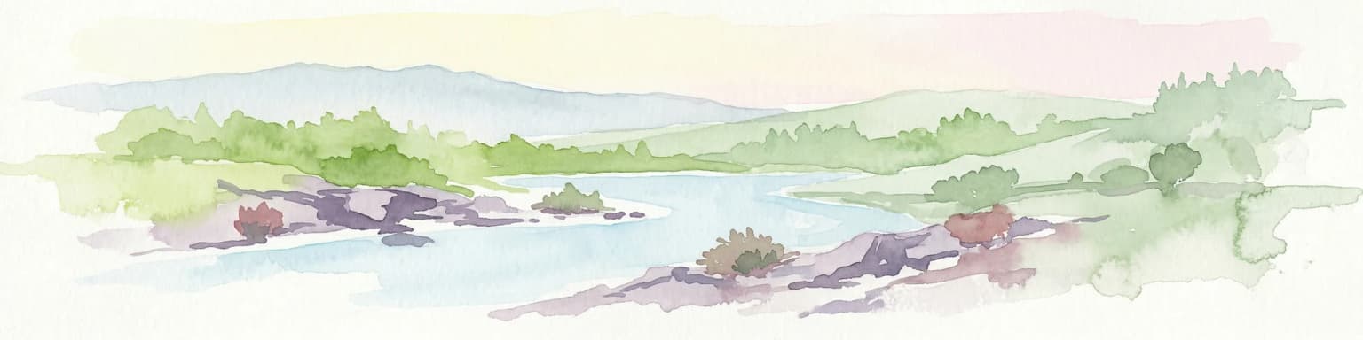
Mapping regional park boundaries and nearby landscape conservation zones in Alentejo Litoral
Examine the spatial relationship and geographic distribution of protected landscapes surrounding Southwest Alentejo and Vicentine Coast Natural Park. This overview provides a clear mapping of neighboring protected areas within the Alentejo Litoral region, allowing for a structured comparison of coastal and inland natural zones based on their proximity and regional geographic context.

Portugal's rugged southwestern coastline and last strongholds of wild European coast
Southwest Alentejo and Vicentine Coast Natural Park is a protected landscape in southwestern Portugal spanning approximately 896 square kilometers along one of Europe's most unspoiled coastal stretches. The park encompasses both terrestrial and marine environments, with roughly 606 square kilometers of land and 290 square kilometers of coastal waters, creating a comprehensive seascape protection zone. Established on July 7, 1988, the park was created to safeguard the region's exceptional natural resources while promoting sustainable development in the surrounding communities. The area represents one of the last truly wild coastal environments in mainland Europe, characterized by dramatic cliff formations, secluded beaches, and a rich mosaic of habitats that support remarkable biodiversity including over a dozen endemic plant species and significant bird nesting sites.
See the ranked park cluster in its geographic setting
Ranked spatial proximity, directional separation, and comparative regional park geography

North
Mapped boundaries of this key Portuguese protected area.
Arrábida Natural Park, in Portugal. Landscapes: mountains, valleys, and forests.

East
Explore its mapped geography and protected land context.
Guadiana Valley Natural Park is identified as a protected landscape, providing a specific focus for geographic study and map-based exploration. This entry details the park's unique protected-area status and its contextual placement within the expansive Beja District of southern Portugal. Understand the mapped boundaries and landscape features that define this area, serving as a key point for regional geographic understanding on MoriAtlas.

Southeast
Explore mapped protected landscapes and regional geographic context.
Examine Ria Formosa Natural Park, a protected landscape that defines a significant portion of the Algarve's natural heritage. This atlas-focused exploration details the park's geographic features, its protected status, and its position within the wider regional geography. Understand the mapped extent of this protected landscape and its contribution to the natural context of southern Portugal.

North
Explore Atlantic coast geography and historic palatial terrain.
The Sintra-Cascais Natural Park is a designated protected landscape in Portugal's Lisbon District, renowned for its fusion of natural beauty and historical architecture. This page offers an atlas-style exploration of its mapped boundaries, showcasing the unique Serra de Sintra mountain range meeting the Atlantic coast. Discover the protected area's geographic features, from its lush forested slopes crowned with iconic palaces to the dramatic cliffs and beaches of Cabo da Roca, providing essential context for understanding this distinctive Portuguese natural landscape.

North
Explore the mapped boundaries and natural landscape of this Portuguese protected area.
Understand the Aire and Candeeiros Ranges Natural Park as a key protected landscape in Portugal. This page offers detailed geographic information, focusing on the park's mapped boundaries and its intrinsic connection to the surrounding regional geography. It serves as a portal for atlas exploration, providing structured data for users interested in the specific protected area and its landscape characteristics within the Iberian Peninsula.

Northeast
Explore the unique mountain terrain and ecosystems of Portalegre District.
Delve into the geographic and ecological identity of Serra de São Mamede Natural Park, a significant protected landscape situated in Portugal's Portalegre District. This area is renowned for its dramatic quartzite ridges and its role as a crucial meeting point for Atlantic and Mediterranean plant communities, offering a unique atlas perspective on regional biodiversity. Examining its mapped boundaries and diverse terrain provides essential context for understanding its ecological importance and its distinct position within the Alentejo region's geography.

East
Explore Huelva's key protected area and its regional geographic setting.
Doñana National Park, in Province of Huelva, Spain. Landscapes: dunes, wetlands, and beaches.

North
Explore the dramatic geography of this nature reserve.
Serra da Estrela Natural Park is a significant protected landscape in Portugal, celebrated for containing the nation's highest peak and exceptional Quaternary glacial formations. The park's terrain includes dramatic valleys carved by ice, numerous glacial lakes, and a stark alpine plateau around Torre. This nature reserve preserves a unique environment shaped by both geological history and traditional pastoralism, offering rich mapped context for understanding Portugal's mountainous geography and protected areas.

Northeast
Explore mapped terrain and regional geography within this Spanish National Park.
Monfragüe National Park, in Spain.
Southeast
Explore the protected landscape and regional context of Merja Zerga.
Merja Zerga is a designated protected area situated on Morocco's Atlantic coast, characterized by its important wetland ecosystems. This entry facilitates detailed atlas exploration, providing users with mapped geographic data and insights into the park's protected boundaries. Understanding Merja Zerga offers valuable context for the distribution of protected lands and natural landscapes within the broader North African region.

East
Mapped protected landscape and unique geologic features
Sierra de las Nieves National Park stands as a remarkable protected area in Andalusia, Spain, celebrated for its world-leading Spanish fir forests and intricate karst topography. This national park showcases significant geological diversity, from towering limestone formations and deep caves to the striking red peridotite mountains of Sierra Bermeja. Its elevation, reaching Pico Torrecilla at 1,919 meters, offers a unique alpine landscape context within southern Europe, mapped for detailed geographic discovery and protected area exploration.

Northeast
A study of reservoir coastlines and Mediterranean serranías
La Siberia Biosphere Reserve offers a deep look into the rural landscape of Extremadura, Spain. Characterized by five major reservoirs and vast Mediterranean oak dehesas, the area provides essential habitat for raptors and preserves significant prehistoric rock art within its complex serranía topography. Explore the geographic boundaries and water-dominated landscape of this distinct inland region.

North
Discover dramatic landscapes and mapped terrain.
Alvão Natural Park is a protected area in northern Portugal distinguished by its stark geological contrasts: upper granite plateaus and steep schist lowlands. This unique geography supports diverse ecosystems and features the impressive Fisgas de Ermelo waterfall. Explore the park's mapped boundaries and its role as a significant protected landscape within the region, offering rich context for any geographic exploration.

Northeast
Mapped Geography of Montes de Toledo Protected Area
Cabañeros National Park, in Province of Toledo, Spain. Landscapes: mountains, valleys, and forests.

North
Mapped protected areas and regional landscape discovery near Esposende.
Uncover the geographic identity of Northern Littoral Natural Park, a key protected landscape situated near Esposende. This MoriAtlas entry focuses on its mapped boundaries and regional significance, providing a factual basis for understanding its role within Portugal's network of protected areas. Explore the park's natural terrain and its context within the broader geography of the Norte region for comprehensive atlas-based discovery.

Southeast
Explore its mapped boundaries and natural terrain.
Talassemtane National Park is a vital protected area contributing to the geographic diversity of Morocco. This entry focuses on its identity as a national park, detailing its mapped boundaries and providing context within the broader atlas of protected lands. Discover the specific geographic and landscape characteristics that define this Moroccan national park, offering a unique lens for regional exploration.

North
Granite peaks, glacial valleys, and cultural heritage mapped.
Peneda-Gerês National Park represents a cornerstone of protected landscapes in Portugal, celebrated for its rugged granite mountains and deep glacial valleys sculpted over millennia. This national park showcases a rare ecological transition zone with unique endemic species and features dramatic waterfalls and pristine river systems. The park's rich cultural tapestry, interwoven with its natural environment, offers a compelling subject for atlas-based geographic discovery and landscape exploration.

East
Mapping the rugged Mediterranean boundary in Andalusia, Spain
Discover the complex geography of Acantilados de Maro-Cerro Gordo, a protected nature reserve defined by vertical cliffs exceeding 200 meters and isolated coastal coves. This atlas entry details the transition between Betic mountain terrain and marine ecosystems, documenting prominent headlands like Cerro Gordo and the biological richness of its protected reefs and seagrass meadows.

Northeast
Explore mapped boundaries and regional geographic context.
Tablas de Daimiel National Park represents one of the last remaining examples of floodplain wetland systems in Spain's interior. Located in Castilla-La Mancha, this protected area showcases a unique confluence of fresh and brackish waters, supporting a rich mosaic of emergent vegetation and serving as a critical habitat for migratory birds. Use MoriAtlas to explore its precise geographic setting, mapped terrain, and its role as a vital conservation landscape within the Iberian Peninsula.
Geographic measurements, not driving distances
Calculated between the nearest points of both park boundaries.
Estimated from one mapped park location to the nearest boundary of the other park.
Estimated between the mapped locations of both parks.
Delve deeper into the Southwest Alentejo and Vicentine Coast Natural Park's protected landscape details. Understand its precise geographic context within Alentejo Litoral and how its mapped boundaries contribute to the regional atlas of protected areas. MoriAtlas provides the structured framework to appreciate this natural area's role and its unique geographic characteristics.