Mori Atlas logo
Nearby park discovery

Regional landscape context and mapped proximity analysis for the Bering Sea archipelago

Geographic Distribution of Protected Areas and National Parks Near Commander Islands

Discover the network of protected areas and natural landscapes situated in the vicinity of the Commander Islands. This geographic overview highlights the regional distribution of protected terrain across the Bering Sea and Kamchatka Krai, providing a spatial perspective on these remote subarctic environments and their surrounding maritime features.

Related tags

Remote islandsMarine mammalsSeabird coloniesBering SeaAleutian Islands

Remote Russian archipelago in the Bering Sea with exceptional marine wildlife and seabird colonies

Commander Islands

The Commander Islands are a remote archipelago located in the Bering Sea, forming the westernmost extension of the Aleutian Islands chain about 175 kilometers east of the Kamchatka Peninsula in the Russian Far East. The group consists primarily of Bering Island, the larger landmass measuring 95 by 15 kilometers, and Medny Island, a narrower 55 by 5 kilometer strip, along with fifteen smaller islets and rocky outcroppings. Despite their subarctic latitude, the islands experience a relatively mild maritime climate with 220 to 240 days of precipitation annually, though summers are notably foggy. The only permanent settlement is the village of Nikolskoye on Bering Island's northwestern tip, home to approximately 600 residents of predominantly Russian and Aleut heritage. The islands are renowned for their extraordinary marine mammal populations, supporting some of the largest colonies of northern fur seals in the world with approximately 200,000 individuals summering there, along with about 5,000 Steller sea lions. Sea otters, common seals, and several whale species, including endangered North Pacific right whales and fin whales, rely on the surrounding productive Bering Sea waters. The terrestrial landscape is treeless, dominated by lichens, mosses, and marshy vegetation with low grasses and dwarf growth, a result of the harsh climatic conditions and exposure to strong winds. The highest points are Steller's Peak on Bering Island at 755 meters and Stenjeger's Peak on Medny Island at 647 meters.

Location
Russia
Park type
Protected area
Area
1,846 km²
Highest point
755 m
Commander Islands Protected Area Atlas
Regional park map

See the ranked park cluster in its geographic setting

Nearby parks around Commander Islands

This regional map shows the same 20 nearby parks ranked below around Commander Islands. Select a ranked marker to highlight that park’s boundary where boundary data is available.
Reference park: Commander IslandsRanked nearby park20 nearby parks shown
20 nearby parks

Explore surrounding protected landscapes and regional geography by proximity

Ranked Parks and Protected Areas Geographically Near Commander Islands

Examine the ranked collection of parks near Commander Islands ordered strictly by geographic separation across the surrounding marine and coastal terrain. Review recorded environmental signals and regional proximity metrics to compare nearby protected areas within the broader atlas database.
A horizontal watercolor illustration showing soft green, white, and pale pink tones depicting a misty coastal landscape with grassy banks and distant hills.
National parkKamchatka Krai
About 20 km away#1 closest

Southeast

Komandorsky Islands National Park: A Comprehensive Atlas of Volcanic Islands and Marine Territory

Remote island geography within the Kamchatka Krai volcanic arc.

Spanning both the Commander Islands and a substantial marine buffer in the Bering Sea, this park defines a rugged frontier of tundra slopes, basalt sea stacks, and deep coastal bays. It serves as a primary site for marine conservation, where oceanic weather and volcanic rock shape a dramatic, remote landscape of significant geographic interest.

Area
36,486.8 km²
Established
1993
IUCN
II
Relief
Upland
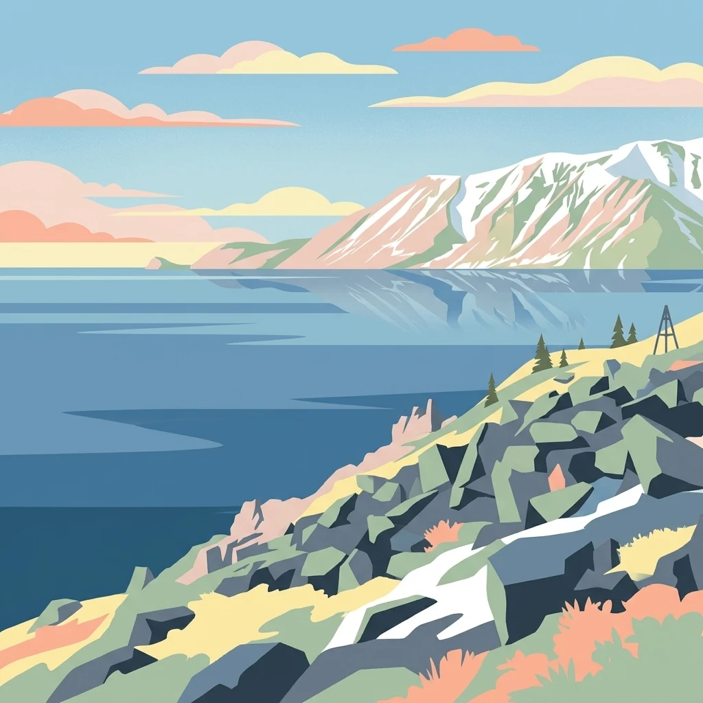
Stylized illustration of a mountainous coastline with rocky shore, calm water, and snow-capped peaks under a sky with clouds
National parkChukotka Autonomous Okrug
About 1,510 km away#2 closest

North

Beringia National Park: Arctic Tundra and Mountain Landscape Discovery in Chukotka

Explore protected boundaries and subarctic geographic features

Beringia National Park offers an expansive look at the subarctic ecosystems of the Chukchi Peninsula. This protected area preserves a unique terrain characterized by low-lying tundra plains and dramatic mountain ridges. Its position along the Bering Strait provides significant geographic context for understanding northern land connections and the remnants of ice age migrations within the Russian Arctic wilderness.

Area
30,532 km²
Established
2013
IUCN
II
Relief
Mixed relief
A horizontal watercolor painting depicting a pale, calm body of water in the foreground, with a grassy shoreline and rolling mountain silhouettes in the distance under a soft sky.
National parkChukotka Autonomous Okrug
About 1,536 km away#3 closest

Northeast

Beringia National Park: Arctic Tundra and Coastal Protected Area in Chukotka

Geography of the Russian Far East and Bering Strait

Beringia National Park protects a sprawling network of Arctic tundra, dramatic shoreline, and isolated islands within the Chukotka Autonomous Okrug. The area maps the unique environmental transition between Siberia and the Bering Strait, highlighting a complex landscape of river basins and coastal cliffs that support diverse Arctic wildlife and migratory populations.

Area
18,194.5 km²
Established
1993
IUCN
II
Relief
Lowland
National parkKhabarovsk Krai
About 1,836 km away#4 closest

West

Shantar Islands National Park: Remote Archipelago Atlas with Rugged Terrain

Mapping protected marine and island geography in Khabarovsk Krai.

Shantar Islands National Park represents a significant protected landscape within Khabarovsk Krai, notable for its dramatic coastal geography, mountainous terrain, and rich marine ecosystems. This national park, encompassing a chain of islands in the Sea of Okhotsk, is a vital habitat for marine mammals and seabird colonies. Explore its mapped boundaries and unique regional atlas context, understanding its role as a protected coastal area in the Russian Far East.

Area
5,155 km²
Established
2013
IUCN
II
Relief
Mountain
National parkHokkaido
About 1,912 km away#5 closest

Southwest

Shiretoko National Park: Hokkaido's Protected Natural Landscape and Geography

Explore mapped boundaries and regional park context.

Shiretoko National Park, designated as a national park in Hokkaido, Japan, serves as a vital point for understanding regional geography and protected landscape exploration. This entry offers a structured view of the park's geographic scope, focusing on its mapped boundaries and natural terrain. Discover how Shiretoko National Park contributes to the broader atlas of conservation lands in the Hokkaido region, providing context for its unique ecological and geographic significance.

Area
386.36 km²
Established
1964
IUCN
II
Relief
Mountain
National parkSakha Republic
About 1,983 km away#6 closest

North

Kytalyk National Park: Arctic Tundra Geography and Protected Siberian Wilderness

Exploration of permafrost terrain in the Sakha Republic

Situated in the Sakha Republic, Kytalyk National Park protects nearly 1.9 million hectares of low-lying Arctic coastal tundra. The park provides an essential look at intact polar environments, featuring thermokarst landforms, extensive peat bogs, and critical nesting grounds for migratory bird species across the Siberian landscape.

Area
18,856 km²
Established
2020
IUCN
II
Relief
Lowland
National parkHokkaido
About 2,037 km away#7 closest

Southwest

Akan Mashu National Park: Hokkaido National Park Geography and Protected Landscape

Mapped protected area boundaries and regional landscape context.

Delve into the distinct geographic identity of Akan Mashu National Park, a protected national park located in Hokkaido, Japan. This page provides detailed atlas-level information focusing on its mapped boundaries, regional landscape context, and the broader geographical significance of this protected natural area. Understand the park's terrain and its role within the Hokkaido region's natural geography for informed discovery.

Area
914.13 km²
Established
1934
IUCN
V
Relief
Mountain
Watercolor painting of a wetland landscape with reeds, trees, and distant hills
National parkHokkaido
About 2,066 km away#8 closest

Southwest

Kushiro-Shitsugen National Park: Protected Wetland Ecosystems and Landscape

Explore the mapped terrain of eastern Hokkaido's vital peatlands.

Kushiro-Shitsugen National Park is a national park in eastern Hokkaido, Japan, safeguarding the nation's largest wetland and peatland. The park encompasses the expansive Kushiro Wetlands, characterized by vast reedbeds and a network of meandering rivers, making it a critical habitat for species like the endangered red-crowned crane. This protected area offers a unique landscape for understanding Japan's freshwater ecosystems and their geographic distribution within the region.

Area
268.61 km²
Established
1987
IUCN
II
Visitors
460K annual
National parkJapan
About 2,086 km away#9 closest

Southwest

Daisetsuzan National Park: Japan's Premier Volcanic Alpine Protected Landscape

Explore Hokkaido's largest national park and its vast mountain terrain.

Daisetsuzan National Park is a monumental protected area, covering extensive mountainous territory in Hokkaido, Japan. This national park is characterized by its dramatic volcanic geography, featuring numerous peaks over 2,000 meters and a rugged backcountry that defines Japan's northern alpine wilderness. Delve into the mapped boundaries and regional context of this significant protected landscape to understand its unique geological identity and ecological importance.

Area
2,267.64 km²
Established
1934
IUCN
II
Visitors
6M annual
National parkHokkaido
About 2,086 km away#10 closest

West

Rishiri-Rebun-Sarobetsu National Park: Volcanic Islands and Coastal Wetlands of Northern Hokkaido

Explore its mapped geography and unique subarctic alpine flora.

Rishiri-Rebun-Sarobetsu National Park in Hokkaido, Japan, offers a unique exploration of dramatic volcanic islands and vital coastal wetland ecosystems. This protected area showcases striking geological formations, from the conical peaks of Rishiri and Rebun islands to the vast peat bogs of the Sarobetsu Plain. Its subarctic environment supports a rich tapestry of alpine flora, providing a distinct case study in protected landscape geography and mapping for the region.

Area
241.66 km²
Established
1974
IUCN
II
Visitors
730K annual
Watercolor painting of a river flowing through green hills with pink flowering trees and distant mountains under a light sky
National parkKhabarovsk Krai
About 2,113 km away#11 closest

West

Anyuysky National Park: Geographic and Protected Landscape Discovery in Khabarovsk Krai

Ecological corridors from the Amur River to the Sikhote-Alin mountains.

Anyuysky National Park represents a critical, remote expanse in the Russian Far East. Its boundaries protect a continuous gradient of habitats, linking the flat wetlands of the Amur River floodplain with the forested slopes of the Sikhote-Alin highlands. The park serves as a key area for habitat preservation and environmental mapping.

Area
4,294 km²
Established
1999
IUCN
II
Relief
Mixed relief
Watercolor illustration of a serene river landscape with birch trees in the foreground, forest in the midground, and soft-colored mountain ranges in the background.
National parkKhabarovsk Krai
About 2,113 km away#12 closest

West

Anyuysky National Park: Protected Sikhote-Alin Forests and River Valley Geography

An intact wilderness refuge in Khabarovsk Krai, Russia.

Anyuysky National Park stands as a primary reference for intact East Asian ecosystems. The park encompasses a dramatic landscape of forested ridges, riparian zones, and the signature Anyui Pillars. These sandstone rock formations overlook a valley that remains largely untouched by human activity, serving as a critical habitat within the greater Sikhote-Alin range. This geography offers a rare look at the transition from high-mountain terrain to the expansive Amur River basin.

Area
4,293 km²
Established
2007
IUCN
II
Relief
Mountain
National parkSakha Republic
About 2,146 km away#13 closest

North

Kytalyk National Park: Mapping Arctic Wilderness and Tundra Landscapes

Protected arctic ecosystems in the Sakha Republic

Kytalyk National Park functions as a benchmark for pristine Arctic wilderness. The terrain is characterized by low-relief tundra plains, polygon mires, and high-density thaw-lake networks. This protected area remains a vital site for avian breeding ground research and represents one of the most intact permafrost-driven landscapes within the Russian Far East.

Area
18,855.5 km²
Established
2019
IUCN
II
Relief
Lowland
Watercolor painting showing a river flowing through a forested valley with mountains in the background
National parkPrimorsky Krai
About 2,174 km away#14 closest

West

Bikin National Park: Protected Landscapes and Geographic Boundaries in Primorsky Krai

Old-growth forest wilderness in the Sikhote-Alin range

Spanning over 1.16 million hectares, Bikin National Park protects one of the most biodiverse temperate forest ecosystems in the Northern Hemisphere. The mountainous terrain and the Bikin River basin provide essential habitats for rare wildlife, representing a world-class conservation landscape within the Russian Far East.

Area
11,600 km²
Established
2015
IUCN
II
Relief
Mountain
Wildlife reserveAlaska
About 2,180 km away#15 closest

Northeast

Innoko Wilderness: Geographic Profile and Protected Landscape of Interior Alaska

Subarctic wilderness tracking wetlands and boreal transitions

Spanning over one million acres in the Alaskan interior, Innoko Wilderness offers a unique look at a sprawling subarctic ecosystem. Dominated by muskeg, interconnected lakes, and the floodplains of the Yukon and Innoko Rivers, this protected area functions as a critical transition zone between interior forests and western tundra landscapes.

Area
5,000 km²
Established
1980
IUCN
Ib
Relief
Lowland
Abstract watercolor painting with soft green and light blue hues on white background
National parkHokkaido
About 2,205 km away#16 closest

Southwest

Hidakasanmyaku-Erimo-Tokachi National Park: Japan's Largest Protected Landscape Atlas

Volcanic peaks, coastal cliffs, and Hokkaido's expansive geography.

Hidakasanmyaku-Erimo-Tokachi National Park represents Japan's largest national park, offering a comprehensive exploration of its protected landscape. This vast area in Hokkaido combines the rugged topography of the Hidaka volcanic mountain range with the striking maritime environment of Cape Erimo. Users can explore detailed geographic contexts, understand the park's extensive boundaries, and appreciate its role as a crucial protected natural area at the intersection of alpine and coastal ecosystems.

Area
2,456.68 km²
Established
2024
IUCN
II
Relief
Mountain
National parkNorthwest Arctic Borough
About 2,212 km away#17 closest

Northeast

Kobuk Valley National Park: Protected National Park with Regional Geography Context

Explore mapped boundaries and natural terrain within Northwest Arctic Borough.

Kobuk Valley National Park serves as a primary protected landscape within the Northwest Arctic Borough, Alaska. This entry facilitates detailed atlas exploration of its specific geography, mapped protected boundaries, and the natural terrain that defines its character as a designated national park. Understand its place within the broader regional landscape for comprehensive geographic discovery.

Area
7,084.9 km²
Established
1980
IUCN
II
Visitors
17.6K annual
National parkAlaska
About 2,269 km away#18 closest

Northeast

Katmai National Park and Preserve: Alaska National Park Atlas and Protected Landscape Exploration

Discover mapped boundaries and regional geographic context within Alaska.

Katmai National Park and Preserve represents a significant protected landscape within the state of Alaska, offering a unique point for atlas-based geographic inquiry. This detail page provides structured information focused on the park's mapped boundaries, its place within regional geography, and the characteristics of its natural terrain. Understand the core identity of Katmai National Park and Preserve as a protected national park entity for comprehensive map exploration.

Area
16,564.1 km²
Established
1980
IUCN
II
Visitors
34.5K annual
National parkAmur Oblast
About 2,275 km away#19 closest

West

Tokinsko-Stanovoy National Park: Protected Landscape Geography and Atlas Context

National Park in Amur Oblast, Russia

Delve into the specifics of Tokinsko-Stanovoy National Park, a designated national park within Amur Oblast. This entry provides essential context on its protected landscape characteristics and its place in the regional geography. Understand the park's mapped boundaries and discover its natural terrain as part of a larger atlas-driven exploration of protected areas in the Russian Far East.

Area
2,430 km²
Established
2019
IUCN
II
Relief
Mountain
A soft watercolor illustration showing a winding river through a forested valley with rolling hills in the background.
National parkPrimorsky Krai
About 2,276 km away#20 closest

West

Bikin National Park: Protected Landscape Map and Regional Geography in Primorsky Krai

A vast wilderness corridor in the Sikhote-Alin mountain range

Bikin National Park is a prominent protected area in Primorsky Krai, encompassing the Bikin River valley and surrounding mountain ridges. This wilderness preserve is integral to the survival of the Amur tiger and features a distinct mix of coniferous and broadleaf forest ecosystems. The geography highlights a transition between boreal and temperate forest zones, maintained as a largely untouched natural landscape within the Russian Far East.

Area
11,604.7 km²
Established
2015
IUCN
II
Relief
Mountain
Distance methodology

Geographic measurements, not driving distances

How nearby park distances are calculated

Distances use park boundaries whenever the available geometry allows it. When one or both boundaries are missing, the mapped park locations provide a clearly labelled estimate. Every value represents straight-line geographic separation and does not use roads or routing.

Boundary distance

Calculated between the nearest points of both park boundaries.

Location-to-boundary estimate

Estimated from one mapped park location to the nearest boundary of the other park.

Mapped-location estimate

Estimated between the mapped locations of both parks.

MoriAtlas Explorer

Continue Exploring the Commander Islands Protected Area and Kamchatka Krai Geography

Further your understanding of the Commander Islands Protected Area by continuing your exploration within MoriAtlas. Discover how this protected landscape relates to other natural areas and the broader regional geography of Kamchatka Krai. Engage with structured map data to gain deeper insights into the protected area's unique setting and its place within the extensive atlas of natural landscapes.