Mori Atlas logo
Nearby park discovery

Analyzing regional park boundaries and nearby highland landscapes in the Canton of Schwyz

Geographic Distribution of Protected Areas and Nature Reserves Near Ibergeregg, Switzerland

This geographic overview maps the distribution of nature reserves and protected lands surrounding the Ibergeregg pass. By focusing on the spatial relationship between nearby protected terrain, the data provides context for the pre-Alpine plateau geography and the surrounding watersheds of the Muotatal region.

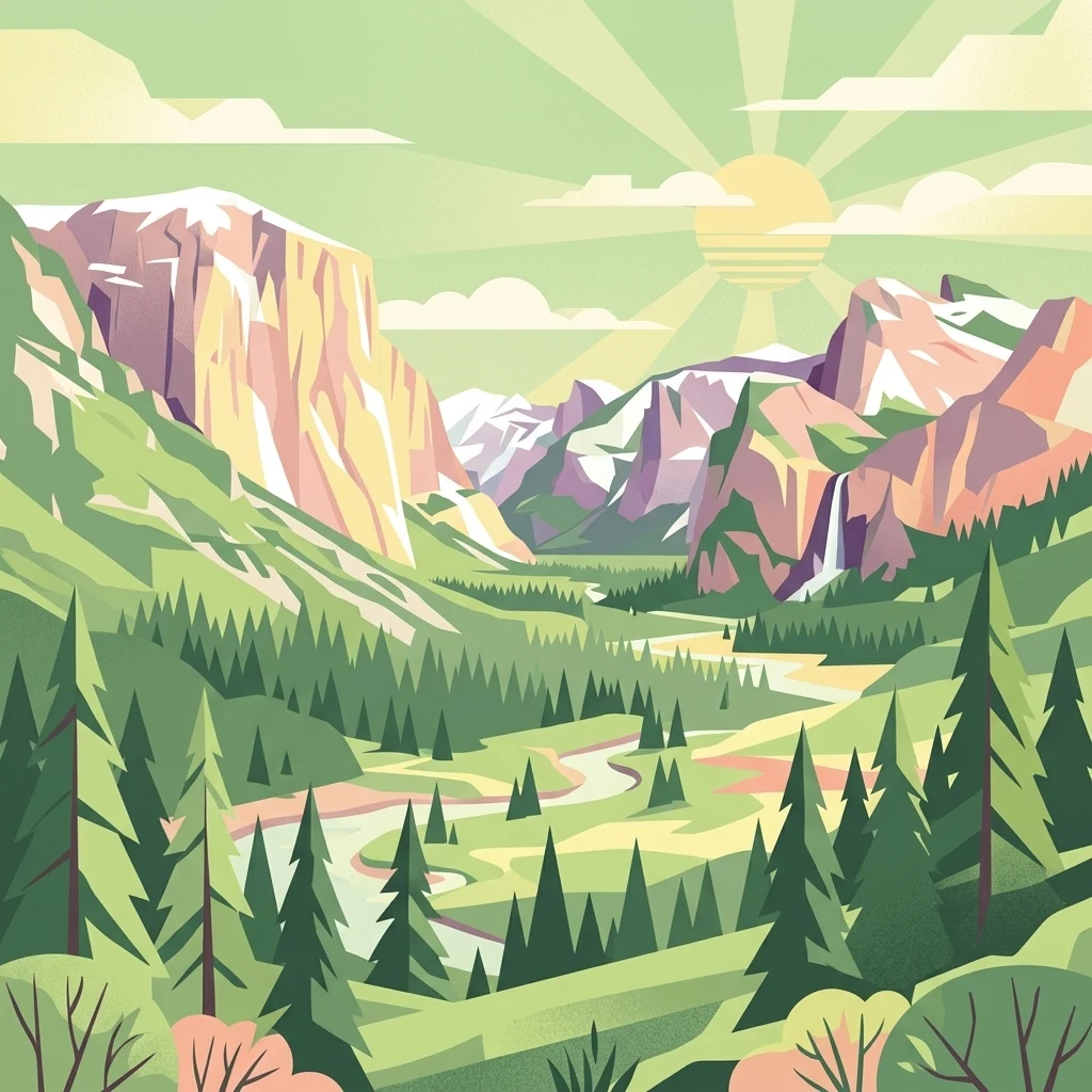
Stylized vector illustration showing a mountainous alpine landscape with a sunlit sky, a central winding river, coniferous forests, and distant peaks.

A pre-Alpine mountain pass in Canton Schwyz protecting raised bogs, moor forests, and panoramic alpine views.

Ibergeregg

Ibergeregg is a Swiss mountain pass located in the Canton of Schwyz, connecting the town of Schwyz in the Muotatal region with the high valley villages of Oberiberg and Unteriberg toward Einsiedeln and the Sihlsee. The pass sits at roughly 1,406 meters above sea level between the summits of Furggelenstock to the north and Firstspitz to the south, forming a gentle saddle in the pre-Alpine landscape between the Muota and Sihl watersheds. Although it is best known as a scenic gateway to the Mythenregion and Hoch-Ybrig ski areas, Ibergeregg is also a designated cantonal nature reserve. Its high plateau preserves numerous raised bogs, flat moors, and rare moor forests that were recognized as the Landscape of the Year in 2019. The pass combines transportation heritage, alpine tourism, and ecological significance in a single compact highland setting.

Location
Switzerland
Park type
Nature reserve
Highest point
1,656 m
Ibergeregg Nature Reserve Atlas
Regional park map

See the ranked park cluster in its geographic setting

Nearby parks around Ibergeregg

This regional map shows the same 20 nearby parks ranked below around Ibergeregg. Select a ranked marker to highlight that park’s boundary where boundary data is available.
Reference park: IbergereggRanked nearby park20 nearby parks shown
20 nearby parks

Geographic proximity, directional separation, and regional park comparisons across central Switzerland

Ranked Protected Areas and Surrounding Parks Near Ibergeregg

Examine the ranked collection of protected areas situated geographically near Ibergeregg to evaluate surrounding regional park geography. Structured distance metrics and recorded environmental characteristics provide reliable baseline signals for comparing alpine terrain across the wider territory.
A soft watercolor painting of undulating green hills, meadows, and a winding path against a white background.
Protected landscapeSwitzerland
About 19 km away#1 closest

Northwest

Glaziallandschaft Lorze, Sihl mit Höhronenkette und Schwantenau: Landscape and Terrain Atlas

A study of glacial formations and protected Swiss ecosystems.

Trace the moraine-dominated terrain and river gorges of this nationally recognized protected landscape. From the drumlin fields near Menzingen to the rare peatland habitats of the Schwantenau, this area offers a comprehensive look at the geological and hydrological history of the Swiss Pre-Alps.

Area
10.808 km²
Relief
Mountain
Climate
Alpine
Access
Moderate access
Protected landscapeZürich
About 25 km away#2 closest

Northwest

Wildnispark Zürich: Atlas and Geographic Overview of the Protected Landscape

Swiss nature reserve located in the Canton of Zürich

Wildnispark Zürich manages roughly twelve square kilometers of land, bridging the gap between urban density and wild forest environments. The site includes the Sihlwald, a large tract of mixed beech forest, and the Langenberg wildlife area. This atlas entry covers the park geography, its role within the Mittelland forest corridor, and the distribution of protected zones that support native European species.

Area
12 km²
Established
2009
Visitors
600K annual
Relief
Upland
A soft watercolor painting of a wetland landscape with rolling hills, grassy plains, and gentle water channels in muted green and pink tones.
Nature reserveSt. Gallen
About 28 km away#3 closest

Northeast

Kaltbrunner Riet Nature Reserve and Wetland Landscape in the Canton of St. Gallen

Mapping the protected fen habitats and agricultural wetland remnants of the Linthebene.

Kaltbrunner Riet serves as a primary nature reserve in the canton of St. Gallen, encompassing critical lowland fen and amphibian spawning habitats. As a protected Ramsar wetland, the reserve offers an essential window into the historic Linthebene landscape, showcasing how traditional meadow management sustains biodiversity across the Swiss plateau.

Area
0.5 km²
Established
1914
Relief
Lowland
Climate
Temperate
A soft watercolor painting of rolling hills and distant mountains in light green and muted tones.
Biosphere reserveLucerne
About 44 km away#4 closest

West

Entlebuch Biosphere Reserve: Mapped Protected Landscapes in the Canton of Lucerne

Exploring karst formations and alpine wetland ecosystems

Entlebuch stands as a pioneering example of community-driven conservation in the Swiss Alps. This protected landscape encompasses extensive peatlands, forested slopes, and the iconic Schrattenfluh karst massif. Use this geographic entry to understand the regional topography and the spatial distribution of protected habitats throughout this central Swiss valley.

Area
397 km²
Established
2001
Relief
Mountain
Climate
Alpine
A horizontal watercolor painting depicting a soft-focus mountain landscape with green rolling hills in the foreground and pale yellow mountain silhouettes in the distance.
Protected landscapeGraubünden
About 46 km away#5 closest

South

Greina, Piz Medel: Exploring the Geography of a Swiss Protected Landscape

High-alpine plateau, glacier forelands, and mountain peaks.

The Greina, Piz Medel protected area is defined by the contrast between its broad, level plateau and the surrounding ring of summits in the Adula Alps. This high-altitude region holds nationally important floodplains, diverse dry meadows, and active glacial basins that cross the European watershed, providing a profound study in alpine terrain and environmental conservation.

Area
150 km²
Established
1996
Relief
Mountain
Climate
Alpine
Regional parkGraubünden
About 48 km away#6 closest

Southeast

Naturpark Beverin: Exploring Alpine Gorges and Cultural Landscapes in Graubünden

A regional nature park shaped by high alpine ridges and ancient settlement traditions.

Naturpark Beverin encompasses a vast, multi-layered environment in the Swiss Alps. The area is defined by the sharp vertical contrast between carved river gorges like the Viamala and high-elevation ridges. Beyond the rugged mountain terrain, this protected landscape preserves centuries of pastoral history through the distinct settlement traditions of its Romanesque and Walser valleys.

Area
515 km²
Established
2013
Relief
Mountain
Climate
Alpine
A minimalist watercolor painting depicting a winding river through a flat alpine valley surrounded by gentle mountain ridges.
Nature reserveGraubünden
About 49 km away#7 closest

Southeast

Aue Plaun la Greina Nature Reserve: Geography and Mapped Landscape Context

A protected high-alpine floodplain in the Swiss canton of Graubünden.

Aue Plaun la Greina sits within a high plateau between three major Adula mountain massifs, defined by its braided river channels, glacial moraines, and sensitive alpine mire habitats. The reserve protects a unique ecosystem that survives in a harsh, tundra-like climate at the heart of the European watershed, representing a major achievement in regional landscape preservation and geological study.

Area
0.39 km²
Established
1992
IUCN
IV
Relief
Mountain
Watercolor painting of a green landscape with rolling hills, meadows, and a water body in the foreground against a light background.
Protected areaSwitzerland
About 54 km away#8 closest

Southwest

Rhonegletschervorfeld Protected Area: Alpine Glacier Geography and Mapping

Proglacial landscape and glacial history in the Swiss Alps.

The Rhonegletschervorfeld provides an unparalleled view into the geomorphology of the Swiss Alps, showcasing a continuous record of ice loss through moraines, exposed bedrock, and emerging meltwater systems. Situated near the Furka Pass, this protected area serves as an essential reference for glaciology, offering a clear visual timeline of glacier retreat that has shaped modern alpine tourism and climate science. Explore the mapped terrain where the Rhone River headwaters emerge from the retreating ice.

Area
13.58 km²
Relief
Mountain
Climate
Alpine
Access
Easy access
A soft watercolor painting depicting a wide river flowing through a green floodplain with distant mountains in the background.
Nature reserveGraubünden
About 57 km away#9 closest

Southeast

Naturschutzgebiet Rhäzünser Rheinauen: Protected River Landscape and Floodplain Geography

Graubünden Alpine floodplain and alluvial river system

Located in the Swiss canton of Graubünden, Naturschutzgebiet Rhäzünser Rheinauen encompasses 157 hectares of rare, free-flowing river landscape. This protected area supports a diverse succession of plant communities, ranging from pioneer species on shifting gravel bars to mature softwood and hardwood floodplain forests, framed by the dramatic mountain terrain of the Hinterrhein valley.

Area
1.569 km²
Established
1992
IUCN
IV
Relief
Mountain
A soft watercolor painting of a panoramic landscape featuring a marshy fen area in the foreground with distant mountain ranges in the background, rendered in pastel greens, purples, and yellows.
Nature reserveBern
About 58 km away#10 closest

Southwest

Chessibidmer Nature Reserve: Glacial Granite and Protected Alpine Moorland Landscapes

Protected alpine bog and granite terrace in the Bernese Oberland

Chessibidmer offers a detailed look at a nationally significant flat bog and moorland landscape situated above the upper Aare valley in the Bernese Oberland. The area provides an exceptional map of glacial geomorphology, featuring granite domes, rock-bound tarns, and successional peatlands that sit as a protected mosaic within the surrounding high-alpine terrain of the Swiss Alps.

Area
0.5 km²
Established
1998
IUCN
IV
Relief
Mountain
Watercolor painting of soft, rolling alpine terrain, green vegetation, and distant purple-toned mountains under a pale sky.
Nature reserveBern
About 61 km away#11 closest

Southwest

Naturschutzgebiet Mederlouwenen: Alpine Moor and Protected Glacial Terrain in the Bernese Oberland

A high-elevation nature reserve featuring rare flat-moor vegetation and peat-forming bogs.

Naturschutzgebiet Mederlouwenen occupies a distinctive series of glacial granite terraces in the Bernese Oberland, where high-altitude slope bogs and relict conifer forests create a vital refuge for rare alpine flora. This protected area stands as a primary example of Swiss mountain ecology, blending ancient geological history with the fragile, moisture-dependent ecosystems found at the head of the Aare valley.

Area
0.053 km²
Established
2004
IUCN
IV
Relief
Mountain
Nature reserveKanton Luzern
About 62 km away#12 closest

Southwest

Naturschutzgebiet Laubersmad - Salwidili: Exploring a Vast Swiss Moorland and Alpine Reserve

A critical moorland complex in the heart of Kanton Luzern

Spanning over 1,300 hectares, this protected nature reserve in Kanton Luzern constitutes the largest contiguous moorland landscape in Switzerland. The area is defined by a unique geological flysch trough that supports a rich diversity of peatland types, including raised bogs and fens, alongside spruce forest and alpine pasture. As an IUCN Category IV area, it provides essential habitat for endangered mire flora and high-altitude wildlife in a remarkably intact hydrological setting.

Area
13.76 km²
IUCN
IV
Relief
Mountain
Scope
Terrestrial
A soft watercolor painting of a green landscape featuring rolling hills and a winding river with distant mountains in the background.
Nature reserveBern
About 62 km away#13 closest

Southwest

Naturschutzgebiet Gauligletscher: Glacial Landscape and Nature Reserve in Bern

A high-alpine protected area in the Bernese Oberland

Discover the unique geography of Naturschutzgebiet Gauligletscher, a protected area in Bern featuring a wide amphitheater of moraines, glacial lakes, and retreating ice. This site functions as an active laboratory for river dynamics and alpine vegetation colonization across an expansive, mineral-dominated valley floor.

Area
5.7 km²
Established
2001
IUCN
IV
Relief
Mountain
Light watercolor illustration of a winding river or lake curving through green trees and vegetation with pale mountains in the distant background
Nature reserveLiechtenstein
About 63 km away#14 closest

East

Gampriner Seelein Nature Reserve: Geographical Context and Mapped Protected Boundaries

A rare natural lake within the Rhine Valley lowlands

Gampriner Seelein serves as a vital nature reserve and the sole naturally formed lake in Liechtenstein. Formed by historic Rhine flood events, this site preserves a rare floodplain forest ecosystem and managed wetland, providing essential habitat for diverse aquatic species and birds within a densely developed regional geography.

Area
0.015 km²
Established
1961
Relief
Lowland
Climate
Temperate
A wide watercolor illustration showing a landscape of green fields, trees, small white buildings, and distant purple mountains.
Biosphere reserveVorarlberg
About 63 km away#15 closest

East

Biosphere Reserve Großes Walsertal: Regional Geography and Protected Alpine Landscapes

A mapped conservation zone within the Vorarlberg Alps

Biosphere Reserve Großes Walsertal encompasses a protected valley characterized by significant geological diversity. Explore the transition from the soft flysch ridges of the Walserkamm to the dramatic limestone crests of the Kalkhochalpen, reflecting a modern approach to managing Alpine natural resources and cultural heritage in western Austria.

Area
192.31 km²
Established
2000
A soft watercolor illustration of a green alpine valley with distant mountains in light yellow and purple tones.
Regional parkCanton of Graubünden
About 66 km away#16 closest

Naturpark Calancatal: Protected Alpine Valleys and Mountain Geography in Graubünden

Mapping regional landscapes and mountain terrain in Southern Switzerland

Spanning 13,900 hectares, Naturpark Calancatal protects a near-entire alpine side valley defined by the Calancasca stream. From high glacier-fed headwaters to Mediterranean-influenced gorges, the park offers a unique look at the diverse mountain terrain, alpine pastures, and protected forests within the Canton of Graubünden.

Area
139.21 km²
Established
2024
Relief
Mountain
Climate
Alpine
A watercolor illustration of a landscape with green meadows, trees, and soft mountains in the background, set against a white background.
Nature reserveLiechtenstein
About 67 km away#17 closest

Northeast

Ruggeller Riet Nature Reserve: Geographic Context and Mapped Wetland Boundaries in Liechtenstein

A vital lowland moorland and wetland ecosystem in the Rhine valley.

Ruggeller Riet serves as the primary lowland nature reserve in Liechtenstein, featuring an expansive 88-hectare wetland landscape. Positioned in the Alpine Rhine valley near the tripoint with Austria and Switzerland, this protected area preserves the post-glacial history of the region through its distinctive peat meadows, bogs, and grassland habitats.

Area
0.88 km²
Established
1978
IUCN
Ia
Relief
Lowland
A watercolor painting showing a panoramic view of green rolling hills and wooded ridges under a soft light.
Regional parkAargau
About 71 km away#18 closest

Northwest

Jurapark Aargau: Geographic Overview of a Swiss Regional Nature Park and Jura Landscapes

Protected Jura mountain terrain and regional landscape mapping

Located in northern Switzerland, Jurapark Aargau encompasses a vast, connected perimeter defined by the interaction of tabular limestone plateaus and dramatic folded mountain ridges. This regional nature park serves as an essential refugium for native flora, preserving ancient geological history through fossil-rich sediments, steep escarpments, and traditional rural land use that persists between the Aargau, Zurich, and Basel regions.

Area
299 km²
Established
2012
Relief
Mountain
Climate
Temperate
Nature reserveAargau
About 72 km away#19 closest

Northwest

Klingnauer Stausee Nature Reserve: Aargau Wetland and Aare River Floodplain Landscapes

Protected riparian habitat in the northern Swiss Jura

Klingnauer Stausee stands as a primary example of integrated hydropower and conservation. This artificial reservoir and its surrounding wetlands, located in the Aargau region, encompass a variety of protected habitats ranging from open still waters to alluvial forests. These landscapes provide essential refuge for migratory waterbirds and preserve unique remnants of the historical Aare River floodplain structure.

Area
1.16 km²
Established
1935
Relief
Lowland
Climate
Temperate
Watercolor painting of a river landscape with lush green riverbanks, patches of grass in the foreground, and gentle rolling hills in the background.
Protected landscapeAargau
About 74 km away#20 closest

Northwest

Aarelandschaft bei Klingnau: A Protected Riverine Landscape in Northern Switzerland

Wetland geography, alluvial forests, and floodplain corridors

The Aarelandschaft bei Klingnau preserves a unique riverine mosaic where the Aare River meets the Rhine in northern Aargau. This protected landscape encompasses the Klingnauer Stausee reservoir, rich alluvial forests, and remnant oxbows. It serves as a vital migratory node for avian populations and provides a structured look at the interplay between human-engineered power infrastructure and protected natural river channels.

Area
3.6 km²
Established
1996
IUCN
V
Relief
Lowland
Distance methodology

Geographic measurements, not driving distances

How nearby park distances are calculated

Distances use park boundaries whenever the available geometry allows it. When one or both boundaries are missing, the mapped park locations provide a clearly labelled estimate. Every value represents straight-line geographic separation and does not use roads or routing.

Boundary distance

Calculated between the nearest points of both park boundaries.

Location-to-boundary estimate

Estimated from one mapped park location to the nearest boundary of the other park.

Mapped-location estimate

Estimated between the mapped locations of both parks.

MoriAtlas Explorer

Explore the Ibergeregg Nature Reserve Geography and Protected Wetland Boundaries

Gain insight into the high-altitude topography and environmental significance of Ibergeregg. This MoriAtlas destination provides mapped terrain context, park boundary definitions, and regional geographic details that illustrate why this protected wetland complex in the canton of Schwyz remains a central focus for alpine landscape research.

Global natural geography