Mori Atlas logo
Nearby park discovery

Explore the regional geography and distribution of protected natural landscapes nearby.

National Parks and Protected Areas Surrounding Losiny Ostrov National Park in Russia

Examine the geographic distribution of protected areas and national parks situated within the vicinity of Losiny Ostrov National Park. This regional overview highlights the spatial context of surrounding wilderness zones and forest habitats throughout the Moscow Oblast territory and beyond.

Illustration of a landscape with a waterfall, birch trees, grassy fields, and mountains under a sun and clouds

Europe's largest urban wilderness, a centuries-old royal hunting ground now protecting Moscow's wild heart

Losiny Ostrov National Park

Losiny Ostrov National Park is a remarkable urban wilderness spanning roughly 116 square kilometers across Moscow and Moscow Oblast in central Russia. Established on 24 August 1983, it stands as the second oldest national park in Russia and the largest urban park in Europe, forming a vital green corridor within one of the world's most densely populated metropolitan regions. The park occupies the ecological junction of the Meshchera Lowlands and the Klin-Dmitrov ridge, where the watersheds of the Moskva River and Klyazma River converge. Despite its proximity to a city of over 12 million people, Losiny Ostrov supports surprisingly intact forest ecosystems, wetland habitats, and populations of wild mammals including the park's namesake moose. Its historical significance stretches back to the 14th century when the forests were documented in the testaments of Russian princes as royal hunting territories, and it has maintained some form of protected status for over two centuries.

Location
Russia
Park type
National park
Established
1983
Area
116 km²
Highest point
175 m
Losiny Ostrov National Park Map and Geography
Regional park map

See the ranked park cluster in its geographic setting

Nearby parks around Losiny Ostrov National Park

This regional map shows the same 12 nearby parks ranked below around Losiny Ostrov National Park. Select a ranked marker to highlight that park’s boundary where boundary data is available.
Reference park: Losiny Ostrov National ParkRanked nearby parkSelected boundary: Losiny Ostrov National Park12 nearby parks shown
12 nearby parks

Distance ranked collection and regional park geography for comparative environmental analysis

Parks and Protected Areas Geographically Near Losiny Ostrov National Park

Examine the ranked collection of protected areas situated geographically near Losiny Ostrov National Park through measured spatial separation and directional bearings. These surrounding landscapes provide structured data for comparing regional terrain features, country context, and ecological characteristics across central Russia.
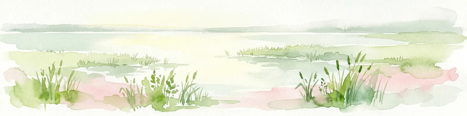
Watercolor painting showing a lake with grasses in the foreground and distant shoreline
National parkYaroslavl Oblast
About 107 km away#1 closest

Northeast
Pleshcheyevo Ozero National Park: National Park Mapping and Regional Protected Area Atlas

Discover its protected landscape and geographic setting.

Pleshcheyevo Ozero National Park is a key protected area within the geography of Yaroslavl Oblast, Russia. This page offers detailed insights into the park's specific landscape character, its mapped boundaries, and its significance as a national park. It serves as an entry point for understanding the protected lands of the region and exploring its natural terrain within a broader atlas context.

Area
238 km²
Established
1997
IUCN
II
Relief
Lowland
Watercolor illustration of a lake surrounded by forests and mountains under a light sky
National parkTver Oblast
About 116 km away#2 closest

Northwest

Zavidovo National Park: Geographic and Protected Landscape Atlas of Tver Oblast

Exploring river floodplains and mixed forest terrain.

Zavidovo National Park represents a distinctive protected landscape within Russia, characterized by its flat glacial moraine terrain and complex water systems. The park protects critical wetlands, peat bogs, and river corridors that sustain diverse game and avian populations. Explore the geographic boundaries and ecological features that define this notable natural zone situated in the heart of Tver Oblast.

Area
1,329 km²
Established
2015
IUCN
II
Relief
Lowland
Watercolor painting of a lake surrounded by trees and distant hills
National parkVladimir Oblast
About 145 km away#3 closest

East

Meshchyora National Park: A Premier Wetland Protected Area in Vladimir Oblast

Explore its mapped boundaries and intricate floodplain geography.

Meshchyora National Park is a key protected landscape in central Russia, renowned for its expansive wetland ecosystems across the Meshchera Lowlands of Vladimir Oblast. Covering nearly 119,000 hectares, the park preserves a unique glacial terrain of peatlands, lakes, and meandering rivers, supporting remarkable biodiversity. Its role as a vital component of the Oka River basin and its conservation focus on restoring degraded peatlands make it a significant site for atlas-based geographic discovery and understanding protected area landscapes.

Area
1,189 km²
Established
1992
IUCN
II
Relief
Lowland
A watercolor painting showing a soft, hazy landscape of pine trees alongside a body of water, rendered in shades of green, light pink, and soft purple.
National parkRyazan Oblast
About 160 km away#4 closest

Southeast

Meshchyorsky National Park: Ryazan Oblast Protected Landscape Exploration

National park geography and mapped terrain.

Investigate Meshchyorsky National Park, a key protected area situated in Ryazan Oblast, Russia. This page provides detailed atlas-level context, focusing on the park's geographic identity, its mapped boundaries, and its role as a national park within the regional landscape. Explore the natural terrain and discover the protected land's place in Central Russia's geography through structured data and mapping.

Area
66 km²
Established
1992
IUCN
II
Visitors
5K annual
Watercolor painting showing a river flowing through a valley with green fields, scattered trees, and mountain ranges in the background
National parkRussia
About 201 km away#5 closest

Southwest

Ugra National Park: Explore Russia's Protected Landscape and National Park Atlas

Mapped boundaries and regional geographic context.

Ugra National Park represents a crucial protected area within Russia, offering detailed geographic context for atlas-based exploration. This entry details the park's specific identity as a national park, highlighting its mapped boundaries and landscape character. Engage with the structured data to understand Ugra National Park's position within Russia's geography and its significance as a protected natural landscape, facilitating comprehensive map exploration.

Area
986,245 km²
Established
1997
IUCN
II
Relief
Lowland
A flat-style digital illustration showing a calm lake in the foreground with forest reflection, dense mixed forest with birch and coniferous trees in the background, and a soft-colored sky with clouds.
National parkOryol Oblast
About 321 km away#6 closest

Southwest

Orlovskoye Polesye National Park: Protected Forest and Wetland Atlas

Geographic overview of the Central Russian Upland sanctuary

Orlovskoye Polesye National Park spans the distinctive terrain of the Central Russian Upland, where forested groves meet expansive wetlands. As a major conservation zone for the European bison, the park showcases a rare forest-marsh ecosystem within Oryol Oblast. Use this geographic record to trace the protected boundaries and understand the regional landscape context of this significant wilderness area.

Area
777.45 km²
Established
1994
IUCN
II
Relief
Lowland
Watercolor illustration of a lake with green forests and grassy foreground, distant hills, and purple and orange water tones
National parkRussia
About 359 km away#7 closest

Northwest

Valdaysky National Park: Russia's National Park & Protected Landscape Explorer

Discover its mapped boundaries and regional geographic context.

Valdaysky National Park represents a significant protected area, offering a focused entry into Russia's natural landscapes. This MoriAtlas page provides detailed geographic context, mapping the park's protected boundaries and its position within the regional terrain. Use this resource to understand the park's unique landscape identity and its value for structured atlas-based discovery of protected lands.

Area
1,585 km²
Established
1990
IUCN
II
Visitors
60K annual
A digital illustration of a serene lake scene framed by pine and birch trees in the foreground, with an island in the middle of the water under a soft pink and cream sunset sky.
National parkSmolensk Oblast
About 396 km away#8 closest

West

Smolenskoye Poozerye National Park: Protected Landscape and Regional Geography

Explore mapped boundaries and geographic context within Smolensk Oblast.

Smolenskoye Poozerye National Park is a protected natural area offering valuable insights into the geography of Smolensk Oblast. As a national park, its mapped boundaries define a significant landscape within Central Russia. This resource provides detailed information for atlas-based exploration, allowing users to understand the park's protected status and its place within the regional natural terrain.

Area
1,462 km²
Established
1992
IUCN
II
Visitors
250K annual
Watercolor illustration of a landscape with trees, hills, and water
National parkVologda Oblast
About 452 km away#9 closest

North

Russky Sever National Park: Glacial Landscapes and Historical Protected Areas

Regional geography in the Vologda Oblast of Russia

Situated in the Vologda Oblast, Russky Sever National Park encompasses extensive forests, glacial hills, and riverine ecosystems. This protected area stands out for its deep connection to medieval Russian architecture, featuring preserved monasteries within a landscape shaped by long-standing agricultural and religious traditions.

Area
1,664 km²
Established
1992
IUCN
II
Relief
Highland
National parkNizhny Novgorod Oblast
About 462 km away#10 closest

East

Nizhegorodskoe Povolzhie National Park: Geographic Boundaries and Protected Area Identity

Regional Russian park network spanning five distinct ecological clusters.

Spanning across nine districts in Nizhny Novgorod Oblast, this federal national park protects a vast array of natural environments within a single designation. From the dark coniferous stands of the Kilemarsky Taiga to the limestone sinkholes of Ichalkovsky Bor and the Volga river floodplains, the park offers a detailed look at the intersection of boreal and central Russian ecosystems.

Area
658.02 km²
Established
2024
Relief
Mixed relief
Climate
Temperate
Watercolor painting of a river winding through grassy wetlands with distant hills under a pastel sky
National parkRepublic of Mordovia
471 km away#11 closest

East

Smolny National Park: National Park Protected Area and Geographic Context in Republic of Mordovia

Explore the mapped landscape and regional geography of Smolny National Park.

Delve into the specifics of Smolny National Park, a designated national park in Russia's Republic of Mordovia. This detailed atlas view focuses on its protected area identity and geographic setting, providing essential context for understanding its landscape. Discover the mapped boundaries and regional placement that define this protected territory, crucial for any structured exploration of Russian natural areas.

Area
365 km²
Established
1995
IUCN
II
Relief
Lowland
A flat-style digital illustration showing a calm river flowing through a lush forest and meadow landscape at sunrise.
National parkSumy Oblast
About 493 km away#12 closest

Southwest

Desna, Stara Huta National Nature Park: Key Protected Area and Regional Geographic Context in Ukraine

Explore mapped landscapes of river floodplains and boreal forests.

This page details Desna, Stara Huta National Nature Park, a significant protected area within Ukraine's Sumy Oblast. It showcases a landscape defined by the Desna River floodplain, unique wetlands, and the southernmost extension of the Bryansk Forest. Users can explore its geographic identity, protected status, and its role in the atlas of Eastern European natural regions, focusing on landscape diversity and mapped boundaries.

Area
162 km²
Established
1999
IUCN
II
Relief
Lowland
Distance methodology

Geographic measurements, not driving distances

How nearby park distances are calculated

Distances use park boundaries whenever the available geometry allows it. When one or both boundaries are missing, the mapped park locations provide a clearly labelled estimate. Every value represents straight-line geographic separation and does not use roads or routing.

Boundary distance

Calculated between the nearest points of both park boundaries.

Location-to-boundary estimate

Estimated from one mapped park location to the nearest boundary of the other park.

Mapped-location estimate

Estimated between the mapped locations of both parks.

MoriAtlas Explorer

Explore the Geographic Details of Losiny Ostrov National Park

Examine the mapped boundaries, forest ecosystems, and river systems that define the character of this unique national park. MoriAtlas provides a structured look at the terrain and environmental context of this landmark protected area near Moscow.