Mori Atlas logo
Nearby park discovery

Understanding the regional distribution of protected lands near this Arctic wildlife reserve

Protected Areas and Geographic Landscapes Near Qaqulluit National Wildlife Area in Nunavut

Examine the geographic context of Qaqulluit National Wildlife Area by analyzing the distribution of surrounding protected sites. This regional overview highlights how coastal cliff ecosystems and Arctic marine habitats relate to neighbouring protected landscapes across the Qikiqtaaluk region.

Related tags

Arcticseabird cliffsImportant Bird AreaNunavutmarine protected area

A remote Arctic seabird sanctuary on the northern cliffs of Qaqulluit Island in Nunavut.

Qaqulluit National Wildlife Area

Qaqulluit National Wildlife Area is a federally protected area in the Qikiqtaaluk region of Nunavut, Canada, situated on the northern tip of Qaqulluit Island along the eastern Arctic coastline. The reserve was established in 2010 and is managed by the Canadian Wildlife Service as one of only five National Wildlife Areas located in Nunavut. Its defining feature is a towering Arctic sea cliff complex at Cape Nuvuttiq, which rises several hundred metres above the surrounding ocean and provides one of the most significant seabird nesting habitats in the Canadian Arctic. The protected area covers roughly 398 square kilometres, the great majority of which is ocean, with only a small terrestrial portion at the cliffs themselves. This combination of dramatic vertical sea cliffs and clean Arctic marine waters creates the conditions that sustain one of the largest and most important seabird colonies anywhere in Canada, particularly for the northern fulmar. The wildlife area represents an important node in the broader network of Arctic protected places that safeguard breeding seabirds, marine mammals, and fragile coastal cliff ecosystems in a region where such habitats are extremely limited. Because of its relative isolation, its strictly protected status, and its ecological concentration on a single, highly productive cliff ecosystem, Qaqulluit stands out as a focused conservation area rather than a multi-use park. It plays a disproportionate role in protecting Arctic seabird reproduction at a national scale, while also supporting seasonal presence of iconic Arctic marine mammals such as polar bears, walruses, and harp seals along its waters.

Location
Canada
Park type
Wildlife reserve
Established
2010
Area
398.2 km²
Qaqulluit National Wildlife Area Map and Geography
Regional park map

See the ranked park cluster in its geographic setting

Nearby parks around Qaqulluit National Wildlife Area

This regional map shows the same 20 nearby parks ranked below around Qaqulluit National Wildlife Area. Select a ranked marker to highlight that park’s boundary where boundary data is available.
Reference park: Qaqulluit National Wildlife AreaRanked nearby parkSelected boundary: Qaqulluit National Wildlife Area20 nearby parks shown
20 nearby parks

Geographic proximity and regional environment comparisons across surrounding Arctic landscapes

Ranked Protected Areas and Nearby Parks Near Qaqulluit National Wildlife Area

Explore distance-ranked protected areas located geographically near Qaqulluit National Wildlife Area to analyze surrounding regional park geography. Examining these neighboring territories reveals broader ecological patterns across northern conservation landscapes without assuming shared terrain.
National parkNunavut
47 km away#1 closest

Northwest

Auyuittuq National Park: Nunavut National Park and Protected Landscape Atlas

Explore Arctic protected area geography and mapped boundaries.

Auyuittuq National Park is a key protected area within Nunavut, Canada, serving as a vital component of the national park system. This entry provides the essential geographic and atlas context for understanding Auyuittuq National Park, highlighting its status as a mapped protected landscape. Examine its role within the regional geography of Nunavut and its contribution to the broader atlas of Canadian conservation lands.

Area
21,470 km²
Established
1972
IUCN
II
Visitors
256 annual
Wildlife reserveNunavut
260 km away#2 closest

Northwest

Ninginganiq National Wildlife Area: Geographic Overview and Protected Landscape Mapping

A vital Arctic wildlife reserve on Baffin Island, Nunavut.

Ninginganiq National Wildlife Area stands as a cornerstone of Arctic conservation, encompassing the fog-defined shores of Isabella Bay. This protected area on Baffin Island serves as a critical seasonal feeding ground for bowhead whales and protects a vast expanse of tundra, marine inlets, and coastal ecosystems. Its establishment reflects a cooperative stewardship model between the federal government and Inuit communities, grounding this reserve in both ecological importance and cultural history.

Area
3,362 km²
Established
2010
IUCN
Ib
Relief
Lowland
National parkNewfoundland and Labrador
762 km away#3 closest

South

Torngat Mountains National Park: National Park Atlas and Protected Landscape Exploration

Explore the mapped geography and protected status of this Canadian national park.

Gain a structured understanding of Torngat Mountains National Park, a protected national park in Newfoundland and Labrador. This destination focuses on its geographic identity, mapped boundaries, and place within the broader regional landscape of the Canadian Arctic. Discover the park's terrain and conservation context, essential for anyone exploring Canada's protected areas and natural geography.

Area
9,700 km²
Established
2008
IUCN
II
Visitors
599 annual
Watercolor illustration of green rolling hills and a body of water under a pale sky
National parkGreenland
827 km away#4 closest

Northeast

Northeast Greenland National Park: Arctic Wilderness and Protected Landscape Atlas

Explore the world's largest national park and its mapped terrain.

Northeast Greenland National Park represents an extraordinary expanse of Arctic wilderness, renowned as the largest protected area globally. This national park protects a diverse landscape, from the interior Greenland Ice Sheet to dramatic glacial fjords and ice-free polar desert regions. Discover its extensive mapped boundaries and its significance as a sanctuary for vital Arctic megafauna, offering a profound case study in large-scale protected landscape geography.

Area
972,000 km²
Established
1974
IUCN
II
Relief
Mixed relief
Wildlife reserveNunavut
917 km away#5 closest

West

Refuge d'oiseaux de la baie Est: Protected Coastal Landscapes on Southampton Island

Wildlife reserve in the Nunavut territory of Canada

Refuge d'oiseaux de la baie Est functions as a federally protected sanctuary within the Hudson Strait ecosystem. The terrain is characterized by broad intertidal flats, coastal saltmarshes, and low-lying tundra that supports migratory birds at the edge of their Arctic breeding range. This site maps as a cornerstone of conservation in the Kivalliq region, safeguarding seasonal habitats from the coast to the inland wetlands.

Area
1,128.11 km²
Established
1959
IUCN
Ib
Relief
Lowland
National parkNunavut
About 936 km away#6 closest

Northwest

Sirmilik National Park: Nunavut National Park Atlas and Protected Landscape Map

Explore the geographic boundaries and regional context of Sirmilik National Park.

This entry provides detailed insights into Sirmilik National Park, a designated national park situated in Nunavut, Canada. It serves as a focal point for understanding the park's specific geography, its mapped protected landscape, and its role within the regional atlas. Users can explore the park's defined boundaries and its contribution to the broader landscape context of Nunavut, making it an essential destination for detailed geographic discovery.

Area
22,200 km²
Established
2001
IUCN
II
Visitors
6 annual
National parkNunavut
1,098 km away#7 closest

West

Ukkusiksalik National Park: Nunavut Protected Area Geography and Map Context

Explore the protected landscape and mapped terrain of this Canadian National Park.

Ukkusiksalik National Park serves as a protected national park within Nunavut, offering a distinct geographic identity. This entry provides structured insights into the park's mapped boundaries and its surrounding regional landscape, facilitating a deeper understanding of its place within the broader atlas of protected areas. Examine the geographic context and discover the unique attributes of Ukkusiksalik National Park's protected territory.

Area
20,885 km²
Established
2003
IUCN
II
Relief
Mixed relief
National parkNewfoundland and Labrador
1,456 km away#8 closest

South

Mealy Mountains National Park Reserve: National Park Protected Landscape and Map Boundaries

Explore the geography and natural terrain of Newfoundland and Labrador.

Mealy Mountains National Park Reserve represents a key protected landscape within Newfoundland and Labrador, offering detailed insights for atlas-based discovery. This national park's geographic scope and mapped boundaries are crucial for understanding its regional context and natural terrain. Explore the structured facts and landscape characteristics that define this significant protected area, providing a clear view of its protected-land identity.

Area
10,700 km²
Established
2015
IUCN
II
Relief
Mountain
National parkNunavut
1,548 km away#9 closest

Northwest

Qausuittuq National Park: Explore Nunavut's Protected National Park Landscape and Geography

Mapped protected area boundaries and regional geographic context.

Delve into Qausuittuq National Park, a key protected area in Nunavut offering rich opportunities for geographic exploration. This destination provides detailed mapping of its protected boundaries and a comprehensive overview of its landscape context within the Arctic region. Discover how Qausuittuq National Park contributes to the mapped protected lands of Canada, ideal for users seeking structured geographic data and atlas-style discovery.

Area
11,000 km²
Established
2015
IUCN
II
Relief
Upland
National parkNunavut
1,555 km away#10 closest

North

Quttinirpaaq National Park: A Detailed Look at its Protected Landscape and Nunavut Geography

Mapped boundaries and regional context for this significant Arctic national park.

Gain a comprehensive understanding of Quttinirpaaq National Park, a protected national park located in the expansive region of Nunavut, Canada. This resource delves into the park's geographic identity, its mapped contours, and its position within the broader arctic landscape context. It is designed to support atlas-based exploration and a detailed appreciation of this protected area's unique setting within Northern Canada's geography.

Area
37,775 km²
Established
1988
IUCN
II
Visitors
7 annual
National parkIceland
About 1,728 km away#11 closest

East

Snæfellsjökull National Park: An Atlas of Volcanic Terrain and Protected Icelandic Coastlines

Volcanic peaks and coastal ecosystems of the Snæfellsnes Peninsula.

Snæfellsjökull National Park stands as a defining protected landscape in western Iceland. Defined by its central glacier-crowned stratovolcano, the park territory maps out a complex transition from high-altitude volcanic basalt and lava fields to sheltered bays and dramatic seaside cliffs. This geographic record explores the intersection of glacial ice, maritime habitats, and the volcanic belt that shapes the outer edge of the Snæfellsnes Peninsula.

Relief
Mountain
Climate
Subpolar
Scope
Mixed
Water
Major water bodies
Watercolor illustration of a mountain landscape with a glacier-capped peak and surrounding green fields
National parkIceland
About 1,732 km away#12 closest

East

Snæfellsjökull National Park: Geography and Protected Landscapes of Western Iceland

Glacial volcanoes, lava fields, and coastal topography.

Snæfellsjökull National Park sits at the western tip of the Snæfellsnes peninsula, creating a unique intersection of glacial, volcanic, and maritime environments. This database provides structured insights into the park's rugged terrain, including its moss-covered lava fields, sea-carved cliffs, and the namesake glacier that dominates the local landscape.

Established
2001
IUCN
II
A horizontal watercolor illustration depicting a soft, pink-hued coastal landscape with rolling hills, rocky outcrops, and a quiet bay.
National parkIceland
About 1,732 km away#13 closest

East

Snæfellsjökull National Park: Volcanic Stratovolcano and Coastal Protected Area in Iceland

Mapped geologic features, glacier terrain, and coastal volcanic landmarks.

Snæfellsjökull National Park features a unique assembly of volcanic landforms, including the iconic glacier-capped stratovolcano, the towering Lóndrangar basalt pinnacles, and symmetrical craters like Saxhóll. This protected area offers deep insights into the glacial and submarine origins of western Iceland through its diverse palagonite ridges and extensive lava plains.

Area
170 km²
Established
2001
Relief
Mountain
Scope
Terrestrial
Wildlife reserveQuebec
About 1,778 km away#14 closest

South

Baie-de-Brador Migratory Bird Sanctuary: Mapped Geography and Protected Landscapes

A remote wildlife reserve in the Gulf of St. Lawrence.

Located near the Lower North Shore of Quebec, this protected area spans both land and sea to preserve critical colonial seabird habitats. The site features the rocky islands of Île aux Perroquets and Île Greenly, set within a marine buffer zone that reflects the cold, subarctic character of the Atlantic corridor.

Area
5.59 km²
Established
1925
IUCN
Ia
National parkManitoba
1,780 km away#15 closest

West

Wapusk National Park: Manitoba National Park Protected Landscape & Geographic Exploration

Mapped park boundaries and regional landscape context in Manitoba.

Delve into Wapusk National Park, a federally protected area in Manitoba designed for geographic exploration and atlas-based discovery. Understand its specific role as a national park, examining its mapped boundaries and the unique natural landscape it preserves within the broader regional geography of Manitoba. This park serves as a key data point for comprehending Canada's network of protected lands and their geographical significance.

Area
11,475 km²
Established
1996
IUCN
II
Visitors
82 annual
Watercolor painting depicting a landscape with cliffs, a body of water, and distant hills under a light sky
National parkSouthern Region
1,863 km away#16 closest

East

Þingvellir National Park: Witness Tectonic Plates and Ancient Icelandic Governance

Explore the rift valley and historic parliament site in Iceland's Southern Region.

Þingvellir National Park offers a singular opportunity for geographic discovery, situated in Iceland's Southern Region. This protected national park is globally recognized for its visible expression of the Mid-Atlantic Ridge, where the North American and Eurasian tectonic plates actively diverge, creating a dramatic rift valley. Moreover, Þingvellir served as the site of the Althing, Iceland's ancient parliament, making it a crucial historical landmark. Explore this landscape to understand both powerful geological processes and the foundations of Icelandic democratic history through its mapped terrain.

Area
92.7 km²
Established
1930
IUCN
II
Relief
Lowland
National parkMinganie Regional County Municipality
1,877 km away#17 closest

South

Mingan Archipelago National Park Reserve: Mapped Protected Landscape

Discover its national park geography in Minganie

Mingan Archipelago National Park Reserve is a designated national park offering a distinct protected landscape within the Minganie Regional County Municipality. This entry provides core geographic context and mapped details crucial for atlas exploration. Understand the park's boundaries and its regional landscape setting for comprehensive discovery of Canada's protected natural areas.

Area
151 km²
Established
1984
IUCN
II
Visitors
44K annual
Wildlife reserveQuebec
1,888 km away#18 closest

South

Refuge d'oiseaux migrateurs de la Baie-des-Loups Protected Area and Coastal Map

Marine-focused wildlife reserve on the Quebec coast

This wildlife reserve protects essential island and offshore foraging grounds in the Gulf of St. Lawrence. Its geography highlights the intersection of protected land and marine environments, creating a critical habitat for North Atlantic seabird populations along the Quebec lower North Shore.

Area
38.72 km²
Established
1925
IUCN
Ia
Wildlife reserveMinganie
About 1,888 km away#19 closest

South

Refuge d'oiseaux migrateurs de Betchouane: Wildlife Reserve and Coastal Geography

Mapped protected island terrain in the Minganie region.

The Refuge d'oiseaux migrateurs de Betchouane comprises a cluster of small islands and surrounding marine environments along the north shore of the Gulf of St. Lawrence. This wildlife reserve serves as a critical nesting site, showcasing the intersection of Precambrian geology and marine conservation. Gain a clear understanding of the sanctuary boundaries and the island-focused terrain that defines this unique protected sector of the Minganie coastline.

Area
4.35 km²
Established
1925
IUCN
Ia
Relief
Lowland
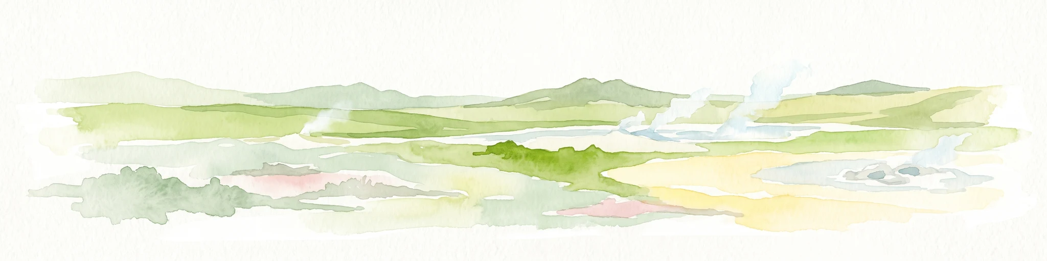
A watercolor painting showing a wide view of a geothermal area with green hills, steam plumes rising from hot springs, and yellow-toned ground patches.
Natural monumentIceland
About 1,908 km away#20 closest

East

Hveravellir Natural Monument: Geothermal Plateau Geography and Highland Protected Areas

Central Iceland geothermal field and volcanic plateau

Located on the Kjölur route, Hveravellir serves as a protected natural monument characterized by high-temperature geothermal activity. The area features a concentration of fumaroles, geysers, and mineral-rich springs set upon a stark volcanic plateau. This site offers significant insights into the geological processes shaping the central highlands of Iceland, blending ancient lava fields with active thermal surface transformations.

Area
2.5 km²
Relief
Highland
Climate
Subpolar
Access
Moderate access
Distance methodology

Geographic measurements, not driving distances

How nearby park distances are calculated

Distances use park boundaries whenever the available geometry allows it. When one or both boundaries are missing, the mapped park locations provide a clearly labelled estimate. Every value represents straight-line geographic separation and does not use roads or routing.

Boundary distance

Calculated between the nearest points of both park boundaries.

Location-to-boundary estimate

Estimated from one mapped park location to the nearest boundary of the other park.

Mapped-location estimate

Estimated between the mapped locations of both parks.

MoriAtlas Explorer

Continue Exploring the Protected Landscapes of Qaqulluit National Wildlife Area

Deepen your understanding of the Qaqulluit National Wildlife Area through its unique coastal terrain and marine ecosystem. MoriAtlas provides a focused look at this Nunavut reserve, highlighting the intersection of sheer sea cliffs and the productive Arctic waters that define this significant protected area.