Mori Atlas logo
Nearby park discovery

Explore the regional geography and distribution of protected land surrounding this limestone nature reserve.

Protected Areas and Natural Landscapes Near Réserve naturelle régionale des grottes de la côte de la Baume

Identify the network of conservation sites and protected natural landscapes positioned in proximity to the Réserve naturelle régionale des grottes de la côte de la Baume. This geographic perspective clarifies how local karst environments, cliff habitats, and forested slopes integrate into the broader protected area system across the Bourgogne-Franche-Comté region.

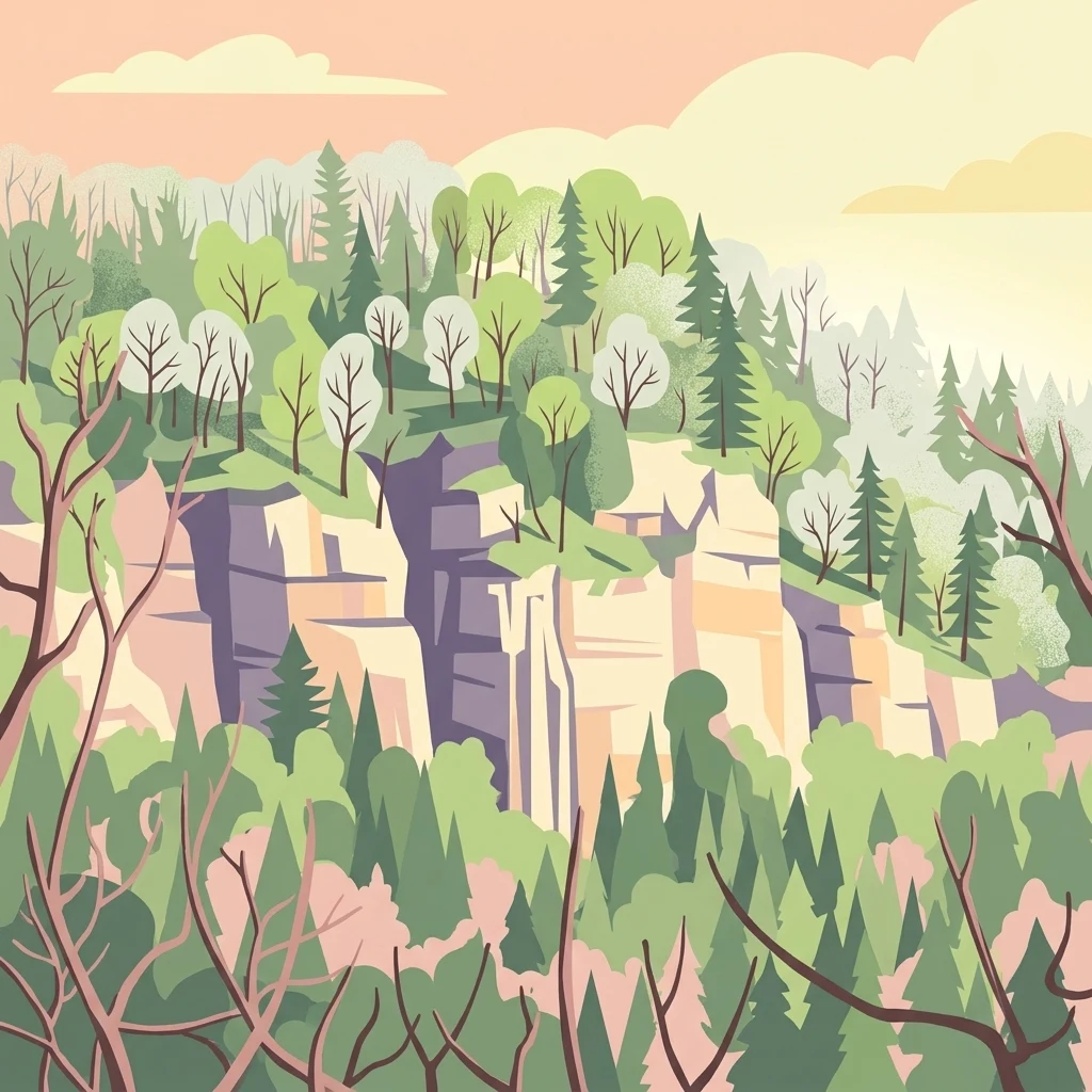
A stylized flat illustration of a forested limestone cliff landscape at sunset, featuring layered rocky bluffs surrounded by coniferous and deciduous trees.

A small limestone cave reserve in the Jura protecting bats and their underground habitat.

Réserve naturelle régionale des grottes de la côte de la Baume

The Réserve naturelle régionale des grottes de la côte de la Baume is a small French regional nature reserve located in the Jura department of the Bourgogne-Franche-Comté region. It covers only about 5.4 hectares on the slopes of the reculée de Vaux-sur-Poligny, a limestone amphitheater-shaped valley near the town of Poligny. The reserve was created on 17 November 2017 and belongs to a regional network of caves dedicated to the protection of bats and their underground habitats. Two natural cavities open on the cliffs of this limestone slope, and both have been recognized as important bat sites for decades. The reserve's compact surface area is explained by its focus on these cave entrances and the surrounding sensitive forest cover. The site combines karst geology, cliff habitat, and slope forest into one tightly defined protected area. The reserve is managed by CPEPESC Franche-Comté and forms part of a broader scheme that links together cave sites hosting priority bat species across the former Franche-Comté region. It is also covered by a Natura 2000 site, a ZNIEFF inventory area, and a prefectoral biotope protection order for cliff-nesting birds, making it a quietly important node in the regional conservation network.

Location
France
Park type
Nature reserve
Established
2017
Area
0.1 km²
Réserve naturelle régionale des grottes de la côte de la Baume Geography
Regional park map

See the ranked park cluster in its geographic setting

Nearby parks around Réserve naturelle régionale des grottes de la côte de la Baume

This regional map shows the same 20 nearby parks ranked below around Réserve naturelle régionale des grottes de la côte de la Baume. Select a ranked marker to highlight that park’s boundary where boundary data is available.
Reference park: Réserve naturelle régionale des grottes de la côte de la BaumeRanked nearby park20 nearby parks shown
20 nearby parks

Geographic distance ranking and regional landscape comparison for surrounding protected natural areas

Protected Areas and Parks Near Réserve Naturelle Régionale des Grottes de la Côte de la Baume

Spatial proximity rankings organize surrounding protected areas by geographic separation and directional orientation relative to Réserve naturelle régionale des grottes de la côte de la Baume. Analyzing recorded environmental characteristics across nearby regional landscapes provides structured comparison signals for adjacent protected territory.
A soft watercolor illustration depicting rolling green hills, gentle slopes, and small clusters of trees against a light, neutral background.
Nature reserveBourgogne-Franche-Comté
About 24 km away#1 closest

Southwest

Réserve naturelle régionale de la côte de Mancy: Protected Landscapes and Geography

Limestone escarpments and calcareous grasslands in eastern France

Delve into the geography of Réserve naturelle régionale de la côte de Mancy, a 49-hectare nature reserve in the Jura department. This site features Jurassic limestone cliffs, thin calcareous soils, and scrubby woodlands, documenting a rich intersection of habitats that preserve rare reptiles and diverse butterfly populations within the Revermont.

Area
0.492 km²
Established
2010
IUCN
IV
Relief
Upland
Wildlife reserveBourgogne-Franche-Comté
About 24 km away#2 closest

East

Tourbières et lacs de la montagne jurassienne: Mapping High-Altitude Wetlands and Glacial Landscapes

A vast protected wildlife reserve in the Bourgogne-Franche-Comté region

Covering more than 12,000 hectares, this wildlife reserve forms a crucial conservation benchmark for peatland and glacial lake systems in the Jura Massif. The landscape encompasses deep combes, broad plateaus, and clear-water basins like Lac de Saint-Point, providing a vital habitat mosaic for diverse flora and fauna across the French highlands.

Area
121.56 km²
Established
2021
Relief
Mountain
Climate
Temperate
Nature reserveBourgogne-Franche-Comté
About 26 km away#3 closest

Southwest

Réserve naturelle nationale de la grotte de Gravelle: Underground Protected Nature Reserve

A limestone cave sanctuary in the Bourgogne-Franche-Comté region

This protected area represents a specialized subterranean habitat in the French Jura, preserving essential maternity and hibernation roosts for eleven bat species. The reserve, set within forested limestone cliffs, remains a key node in the regional network of protected underground sites, emphasizing the conservation of fragile environments.

Area
0.014 km²
Established
1992
IUCN
IV
Relief
Upland
A horizontal watercolor painting showing a soft, misty landscape with coniferous trees, grassy wetlands, and rolling hills in the background, executed in a muted color palette.
Nature reserveBourgogne-Franche-Comté
About 31 km away#4 closest

East

Réserve naturelle régionale de la Seigne des Barbouillons Protected Landscape Atlas

Geography and wetland boundaries in the Jura plateau of France

The Réserve naturelle régionale de la Seigne des Barbouillons protects a characteristic raised bog ecosystem in the Mignovillard commune. This compact area serves as a vital reference point for understanding the distribution of sphagnum mires and specialized butterfly habitats across the Jura plateau, illustrating the contrast between protected peatlands and their surrounding agricultural environment.

Area
0.346 km²
Established
2014
IUCN
IV
Relief
Upland
A watercolor illustration of a landscape with green forest, wetland grasses, and pale mountains in the background, set against a clean white background.
Nature reserveBourgogne-Franche-Comté
About 34 km away#5 closest

East

Réserve naturelle régionale des tourbières de Frasne-Bouverans Protected Landscape Atlas

Peatland mosaic geography in the Drugeon valley of Bourgogne-Franche-Comté

Trace the boundaries and ecological features of this significant regional nature reserve. Spanning the Forbonnet massif and the wider Drugeon basin, the area features a dense concentration of raised bogs, woodlands, and mire habitats defined by complex glacial geology.

Area
2.926 km²
Established
1986
IUCN
IV
Visitors
17.5K annual
Nature reserveBourgogne-Franche-Comté
About 35 km away#6 closest

North

Réserve naturelle régionale du gouffre du Creux à Pépé: Protected Karst and Bat Landscapes

Jura foothills nature reserve with critical cave habitats

Located in the Doubs department, the Réserve naturelle régionale du gouffre du Creux à Pépé protects a rare limestone sinkhole within a mosaic of dry calcareous grassland. This site stands as a key node in regional bat conservation efforts, providing essential wintering and spring transit roosts within the Jura mountain foothills, all anchored by a dense network of biotope and Natura 2000 protective instruments.

Area
0.007 km²
Established
2015
IUCN
IV
Relief
Upland
A horizontal watercolor painting depicting a soft, layered landscape with distant hills, gentle slopes, and clusters of evergreen trees in shades of green and purple.
Nature reserveBourgogne-Franche-Comté
About 36 km away#7 closest

South

Réserve naturelle régionale des tourbières du bief du Nanchez: Protected Jura Mountain Peatlands

Mapping bog systems and wet grassland geography in Eastern France

Located in the Jura department, this regional nature reserve preserves forty-nine hectares of vital peatland, including diverse mire communities and forested slopes. The site provides a critical look at montane landscape restoration, documenting significant bog flora and complex hydrological patterns along the Combe du Nanchez valley floor.

Area
0.488 km²
Established
2021
IUCN
IV
Relief
Upland
Watercolor painting of a hilly landscape featuring green rolling hills, a rocky cliff formation to the right, and trees against a soft white background.
Nature reserveBourgogne-Franche-Comté
About 39 km away#8 closest

Northeast

Réserve naturelle régionale des grottes de Chenecey: Protected Karst and Limestone Cliffs

Regional Nature Reserve in the Doubs, France

This nature reserve protects a diverse mosaic of habitats along the Loue valley. The site integrates surface calcareous grasslands with fragile underground cave galleries, providing critical refuge for rare bat species. It represents a significant conservation effort in the Jura region, mapping the intersection of subterranean voids and exposed limestone terrain.

Area
0.214 km²
Established
2017
IUCN
IV
Relief
Upland
A horizontal watercolor painting depicting a soft-edged, green-and-white landscape of rolling hills and distant limestone ridgelines.
Nature reserveBourgogne-Franche-Comté
About 40 km away#9 closest

Northeast

Réserve naturelle nationale du ravin de Valbois: Protected Jura Blind Valley and Limestone Ravines

Geographic landscape exploration of the Doubs department's protected natural reserve.

Spanning 235 hectares, this protected nature reserve in Bourgogne-Franche-Comté preserves a textbook Jura reculée. The terrain showcases vertical limestone cliffs, deep forested ravines, and a 40-meter cascade. As a hotspot for butterfly diversity and Mediterranean-montane vegetation, the area offers a significant study in microclimatic gradients and old-growth forest conservation within the French landscape.

Area
2.35 km²
Established
1983
IUCN
IV
Relief
Mountain
Nature reserveBourgogne-Franche-Comté
About 56 km away#10 closest

North

Réserve naturelle régionale de la grotte de Beaumotte: Protected Karst and Cave Landscapes

A regional nature reserve focused on subterranean conservation.

Located in the Haute-Saône department, this regional nature reserve protects a critical limestone cave system that supports complex subterranean ecosystems and bat species of regional concern. The site occupies a modest surface area on the edge of the Monts de Gy massif, yet provides significant geological and ecological value through its horizontal gallery network and captured springs.

Area
0.088 km²
Established
2015
IUCN
IV
Relief
Upland
Nature reserveAuvergne-Rhône-Alpes
About 62 km away#11 closest

South

Réserve naturelle régionale du récif fossile de Marchon - Christian Gourrat Geological Site

A protected Jurassic fossil reef in the Auvergne-Rhône-Alpes region

Located in the Ain department, this small nature reserve is scientifically renowned for its Kimmeridgian reef outcrop. The site protects a fossilized coral and rudist assemblage within the forêt de Marchon, offering a quiet, forested setting for studying France's ancient marine geological history.

Area
0.001 km²
Established
2015
IUCN
IV
Scope
Terrestrial
A soft watercolor painting of a green, hilly landscape with small groups of trees, set against a white background.
Nature reserveBourgogne-Franche-Comté
About 63 km away#12 closest

North

Réserve naturelle régionale du vallon de Fontenelay: Protected Area Atlas and Map

High-density marly grasslands and wetland seepage slopes

Situated in the Haute-Saône department, this nature reserve features a distinct valley landscape formed by marly soil and limestone. Explore the site's rich biodiversity including alkaline marshes and its significant role in the regional conservation network for northeastern France.

Area
0.416 km²
Established
2010
IUCN
IV
Relief
Upland
A soft, horizontal watercolor painting depicting a winding river flowing through a lush, green landscape with distant hills and sparse trees.
Nature reserveVaud
About 66 km away#13 closest

Southeast

Chanivaz, Delta de l’Aubonne: Geography, Map, and Protected Landscape Context

A rare glacial geotope and river delta on Lake Geneva.

Chanivaz, Delta de l’Aubonne provides a rich look at the alluvial fan of the River Aubonne. Explore its layered terrace terrain, protected reedbeds, and riparian forests in the canton of Vaud, representing one of the best-preserved natural river mouths remaining on the northern shore of Lake Geneva.

Area
3 km²
Established
2003
Relief
Lowland
Climate
Temperate
Nature reserveBourgogne-Franche-Comté
About 72 km away#14 closest

North

Réserve naturelle régionale de la grotte de la Baume noire Protected Area Map and Geography

Regional karst landscape in Bourgogne-Franche-Comté

This 19-hectare reserve in the Monts de Gy is defined by its Jurassic limestone geology and protected cave systems. The site remains a primary focal point for monitoring subterranean bat habitats and maintaining the ecological integrity of the surrounding deciduous forest landscape.

Area
0.191 km²
Established
2015
IUCN
IV
Relief
Upland
Watercolor painting of a green, rolling landscape showing forested hills in varying shades of light green and soft earth tones against a white background.
Nature reserveBourgogne-Franche-Comté
About 74 km away#15 closest

Northwest

Réserve naturelle nationale de la combe Lavaux-Jean Roland Protected Area Geography

Limestone cliff landscapes in Bourgogne-Franche-Comté

Spanning over 400 hectares, this nature reserve showcases a dramatic interplay of steep limestone walls and scree slopes. The geographic profile highlights the contrast between north-facing forest and sunlit grasslands, creating a vital corridor for endemic species within the Burgundy landscape.

Area
4.87 km²
Established
2004
IUCN
IV
Relief
Upland
A soft, light watercolor painting of a winding river flowing through a gentle, rolling landscape with trees and distant hills against a pale, warm sky.
Nature reserveAuvergne-Rhône-Alpes
About 75 km away#16 closest

South

Réserve naturelle régionale de la galerie du Pont-des-Pierres Regional Nature Reserve

Protected gorge landscapes and underground habitats in France

An essential record of the Réserve naturelle régionale de la galerie du Pont-des-Pierres, detailing its critical role in safeguarding cliff and underground habitats within the Valserine gorges. This protected land in the Ain department represents a vital ecological intersection of geological features and specialized faunal refuges.

Area
0.093 km²
Established
2009
IUCN
IV
Relief
Mountain
A watercolor landscape painting showing green hills, trees, and marshy river banks.
Nature reserveGeneva
About 76 km away#17 closest

South

Naturschutzgebiet Moulin de Vert: Protected Wetland and Forest Geography in Geneva

Detailed nature reserve map and regional landscape context

The Naturschutzgebiet Moulin de Vert nature reserve protects a mosaic of riverside woodland, meadows, and managed pond systems along the Rhône in the Canton of Geneva. Spanning approximately 132 hectares, this conservation area is recognized for supporting extensive biodiversity, from nesting peregrine falcons to diverse amphibian populations. Access this detailed geographic perspective to visualize the park boundaries, internal terrain features, and its ecological connection to the broader Swiss river landscape.

Area
1.32 km²
Established
2001
IUCN
IV
A soft, panoramic watercolor illustration of rolling hills, mountains, and trees in pastel shades of green, yellow, and pink.
Nature reserveAuvergne-Rhône-Alpes
About 77 km away#18 closest

South

Réserve naturelle nationale de la grotte de Hautecourt: Jura Mountain Cave Geography

Protected subterranean landscapes in the Ain department of France.

This nature reserve protects a complex underground environment characterized by a vertical 36-meter cave system and rich invertebrate biodiversity. Located on the flank of Mont Rosset in the Auvergne-Rhône-Alpes region, the area provides a crucial habitat that balances delicate subterranean passages with surface limestone ridges and dry grassland ecosystems.

Area
0.102 km²
Established
1980
IUCN
IV
A wide watercolor illustration showing a soft landscape with pink flowers on the left, green bushes and rocks on the right, and distant mountains across a misty valley.
Protected areaFrance
About 80 km away#19 closest

Southwest

Site naturel protégé de la Boucherette: Protected Limestone Grasslands in Southern Burgundy

Calcareous habitat and botanical trail geography

Located in the Saône-et-Loire commune of Lugny, this 104-hectare protected area showcases a distinctive transition between limestone hills and the Saône valley. The site is recognized for its concentration of wild orchids and its integration of ecological conservation with the historical footprint of centuries-old stone quarrying and tile production.

Area
1.04 km²
Established
2000
Visitors
1K annual
Relief
Upland
A pale, minimalist watercolor painting depicting rolling hills and mountains in shades of soft green, purple, and yellow against a white background.
Natural monumentNeuchâtel
About 80 km away#20 closest

East

Creux du Van et Gorges de l’Areuse Natural Monument and Regional Protected Landscape

Geological exploration of the Folded Jura and Areuse river valley

Spanning the Cantons of Neuchâtel and Vaud, this protected area unites the dramatic rock bowl of the Creux du Van with the narrow, cascading passages of the Gorges de l’Areuse. The site provides a comprehensive view of Jura mountain landforms, highlighting millions of years of river erosion, glacial activity, and karst weathering in a singular, well-defined geographic corridor.

Area
21.21 km²
Established
1876
Relief
Mountain
Climate
Temperate
Distance methodology

Geographic measurements, not driving distances

How nearby park distances are calculated

Distances use park boundaries whenever the available geometry allows it. When one or both boundaries are missing, the mapped park locations provide a clearly labelled estimate. Every value represents straight-line geographic separation and does not use roads or routing.

Boundary distance

Calculated between the nearest points of both park boundaries.

Location-to-boundary estimate

Estimated from one mapped park location to the nearest boundary of the other park.

Mapped-location estimate

Estimated between the mapped locations of both parks.

MoriAtlas Explorer

Explore the Protected Landscapes of Réserve naturelle régionale des grottes de la côte de la Baume

Delve into the mapped terrain and ecological boundaries of this Jura nature reserve. MoriAtlas provides a structured view of the karst caves and forest habitats that define this protected area, offering a clearer understanding of its role in the Bourgogne-Franche-Comté conservation network.