Mori Atlas logo
Countries

Explore the mapped distribution of protected lands and natural landscapes across Russia's vast geography.

Russia's National Parks and Protected Areas: An Atlas for Geographic Discovery

MoriAtlas provides a structured geographic view of Russia's protected areas, offering a gateway to understanding the nation's expansive natural landscapes. As the world's largest country, Russia features a diverse array of national parks and conservation zones, each with unique mapped boundaries and regional context. Use this atlas to navigate the geographic distribution of these vital protected lands and explore their place within the broader Russian Federation.

Related tags

countrylargest countryeastern europenorth asiatranscontinental
About

Explore the mapped geography and distribution of Russia's protected landscapes and conservation sites.

Navigate Russia: A Comprehensive Atlas to National Parks and Protected Areas
As the world's largest country by area, Russia offers an unparalleled geographic context for exploring a vast array of national parks and protected areas. This atlas provides a structured entry point to discover the immense scale of Russia's conservation landscapes, spanning diverse ecosystems and regional park lists across its transcontinental geography.

Russia is a transcontinental nation spanning eleven time zones, bordered by fourteen countries. It is the world's largest country by area, covering 17,098,246 km². Moscow is the capital and largest city, while Saint Petersburg is the second-largest and a major cultural centre.

Russia is the world's's largest country by land area, spanning Eastern Europe and North Asia. With a population of over 140 million, it is the most populous country in Europe and the ninth-most populous globally. The country is highly urbanised, with sixteen urban areas exceeding one million inhabitants. Russia has a rich history dating back to the East Slavs and Kievan Rus', evolving through the Tsardom, Russian Empire, Soviet Union, and into the current Russian Federation.

Largest city:Moscow
Currency code:RUB
ISO code:RU
Parks count
64
Capital
Moscow
Area
17,098,200 km²
Population
146,028,325 (2,025)

Coastal
Island
Mountainous
Landlocked
Park atlas64 parks

Browse Russia's extensive network of protected landscapes and natural reserves on an interactive atlas.

Discover National Parks and Protected Areas Across Russia's Vast Geography
Explore Russia's national parks and protected areas, from the Arctic to the Far East. This comprehensive country-level atlas provides detailed information and geographic context for each protected landscape, helping you understand their distribution across the world's largest country. Uncover diverse ecosystems and conservation efforts.
Watercolor illustration showing green hills, a river, and grassy foreground
Nature reserveSakha Republic

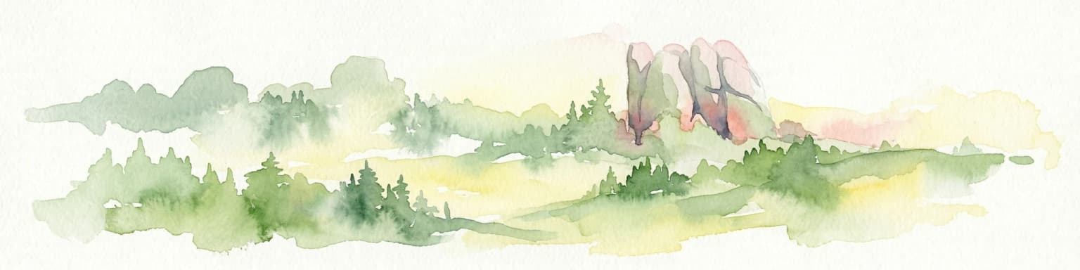
Lena Pillars Nature Reserve: Mapped Protected Area in Sakha Republic's Vast Geography

Explore the regional landscape and park boundaries.

Discover Lena Pillars Nature Reserve, a key protected area located within the expansive Sakha Republic of Russia. This page offers focused atlas exploration, detailing the park's geographic setting and its mapped boundaries against the backdrop of Siberia's largest federal subject. Understand the unique natural landscape context and its significance within regional conservation efforts, providing structured geographic data for your exploration.

Area
13,870 km²
Relief
Lowland
Climate
Subpolar
Access
Moderate access
National parkKrasnoyarsk Krai

Krasnoyarsk Pillars National Park: Geographic Atlas and Protected Landscape Exploration

Discover mapped terrain and regional park context in Siberia.

This detailed entry for Krasnoyarsk Pillars National Park offers an in-depth look at its identity as a protected landscape within Krasnoyarsk Krai. It provides structured geographic information, focusing on mapped boundaries and the park's position within the vast Siberian terrain. Users can leverage this data for atlas exploration, gaining a clear understanding of the park's physical dimensions and its role in the regional geography of Russia. Explore the unique landscape character and mapped context of this significant national park.

Area
471.54 km²
Established
2019
IUCN
II
Visitors
200K annual
Watercolor illustration of rolling green hills with distant mountains and a light sky
National park

Russian Arctic National Park: Russia's Premier Northernmost Protected Landscape

Arctic Islands, Glacial Terrain, and Marine Mammal Habitats

Russian Arctic National Park preserves some of the planet's most remote and pristine Arctic environments across the Novaya Zemlya and Franz Josef Land archipelagos. This protected area offers unparalleled insight into Arctic geography, showcasing dramatic glacial landscapes, extensive seabird colonies, and critical feeding grounds for polar bears and bowhead whales. Explore the park's unique protected landscape and its significance within the broader atlas of global conservation efforts.

Area
14,260 km²
Established
2009
IUCN
II
Relief
Lowland
Watercolor painting of a coastal landscape featuring trees, birds, and soft pastel-colored hills
National parkKaliningrad Oblast

Curonian Spit National Park: Coastal Dunes and Baltic Protected Landscape

Explore a UNESCO World Heritage sand spit with unique terrain.

Curonian Spit National Park offers a remarkable study in coastal geography and protected landscapes, situated on one of the longest sand spits globally. This protected area within Russia's Kaliningrad Oblast features dynamic dune systems, distinctive forest formations, and serves as a vital corridor for migratory birds. Its UNESCO status underscores its international significance for natural heritage and landscape exploration, providing rich context for regional geography within the MoriAtlas platform.

Area
66 km²
Established
1987
Relief
Lowland
Climate
Temperate
National parkKomi Republic

Yugyd Va National Park: Protected Taiga Wilderness & Ural Mountain Landscape

Explore Europe's largest national park within the Komi Republic.

Yugyd Va National Park is a premier protected area, recognized as Europe's largest national park and a critical component of the Virgin Komi Forests World Heritage Site. This vast wilderness in Russia's Komi Republic showcases a diverse geographic tapestry, from the highest peaks of the Ural Mountains to extensive boreal forests and alpine tundra. MoriAtlas provides detailed mapping and geographic context for understanding the park's unique landscape, its position on the Europe-Asia boundary, and its significance as a protected subarctic ecosystem.

Area
18,917 km²
Established
1994
Visitors
4K annual
Relief
Mountain
Watercolor artwork depicting a waterfall cascading between forested hills with a lake in the foreground and distant mountains
National parkKrasnodar Krai

Sochi National Park: Detailed Protected Landscape and Geographic Atlas Information

Explore its boundaries and regional context within Krasnodar Krai.

Sochi National Park represents a significant protected area within Krasnodar Krai, Russia, ideal for users interested in geographic discovery and atlas-based exploration. This entry provides detailed context on the park's protected landscape identity and its mapped boundaries, situating it within the regional geography of the Southern Federal District. Delve into the specific natural landscape features and understand how this national park contributes to the broader atlas of protected areas in Southern Russia.

Area
1,937.37 km²
Established
1983
IUCN
II
Relief
Mountain
Watercolor illustration of rolling green hills, scattered trees, and distant mountains under a pale sky.
National parkPrimorsky Krai

Land of the Leopard National Park: Protected Area Map and Geographic Context in Primorsky Krai

Atlas exploration of Russia's critical Amur leopard habitat.

Investigate Land of the Leopard National Park, a nationally significant protected area situated in Primorsky Krai, Russia. This park is celebrated as the exclusive remaining sanctuary for the critically endangered Amur leopard, making it a focal point for global conservation efforts. Its varied landscape, characterized by forested slopes and mountainous terrain, serves as essential habitat not only for leopards but also for Siberian tigers. The park provides a rich geographic setting for understanding protected land distribution and regional ecosystems within the Russian Far East.

Area
2,799 km²
Established
2012
IUCN
II
Relief
Mixed relief
Watercolor illustration showing a lake, green vegetation, and mountains under a light sky
National parkIrkutsk Oblast

Pribaikalsky National Park: A Protected Siberian Landscape on Lake Baikal's Shores

Explore mapped boundaries and regional geography.

Pribaikalsky National Park is a key protected area in Irkutsk Oblast, critical for conserving the biodiversity and unique topography of Lake Baikal. This national park encompasses dramatic mountain terrain, coastal landscapes, and the significant Olkhon Island, offering a detailed geographic study for atlas exploration. Discover the mapped extent of this important natural reserve and its role in preserving one of Earth's most exceptional freshwater ecosystems and its surrounding Siberian environment.

Area
4,173 km²
Established
1986
IUCN
II
Visitors
400K annual
Watercolor illustration of a landscape with lake, trees, and hills
National parkRepublic of Karelia

Paanajärvi National Park: Republic of Karelia's Premier Protected Landscape

Explore mapped boundaries and regional geography of this national park.

This MoriAtlas entry details Paanajärvi National Park, a significant protected area situated in the Republic of Karelia. Delve into its specific geographic profile, understand its mapped protected boundaries, and see how it fits into the wider atlas of Russia's natural and protected landscapes. It serves as a dedicated point for focused discovery of this national park's unique landscape context.

Area
1,043.71 km²
Established
1992
IUCN
II
Relief
Highland
National parkMurmansk Oblast

Khibiny National Park: Arctic National Park with Mapped Protected Boundaries in Murmansk Oblast

Explore Murmansk Oblast's unique protected landscape and regional geography.

Delve into the geography and protected landscape of Khibiny National Park, a significant national park situated in Russia's Murmansk Oblast. This resource provides essential details for understanding the park's mapped boundaries, its arctic terrain, and its position within the broader context of the Kola Peninsula's natural geography. Explore Khibiny National Park as a key protected area and a crucial element for atlas-based discovery of Russia's northwestern regions.

Area
848 km²
Established
2018
IUCN
II
Relief
Mountain
Protected areaKamchatka Krai

Commander Islands Protected Area: Detailed Map and Regional Geographic Context

Explore protected landscapes in Kamchatka Krai.

Delve into the Commander Islands Protected Area, a significant protected landscape located within the vast geography of Kamchatka Krai. This detailed entry provides essential atlas-level context, focusing on the park's mapped boundaries and its position within the regional landscape. Understand the protected area's geographic identity and its role in the natural terrain of the Russian Far East through our structured exploration tools.

Area
1,846 km²
Relief
Mixed relief
Climate
Subpolar
Access
Remote access
National parkPrimorsky Krai

Bikin National Park: A Vast Protected Landscape in Primorsky Krai's Sikhote-Alin Mountains

Explore Russia's largest old-growth forest and Amur tiger stronghold.

Bikin National Park is a monumental protected area safeguarding the largest remaining tract of old-growth temperate rainforest in the Northern Hemisphere. Situated within Primorsky Krai, it serves as a vital refuge for an estimated 10% of the world's wild Amur tigers, making its mapped boundaries essential for conservation. Recognized as a World Heritage Site, the park's extensive forests and complex terrain offer a unique glimpse into one of Asia's last great wilderness areas, supporting unparalleled biodiversity and crucial ecological processes.

Area
11,600 km²
Established
2015
IUCN
II
Relief
Mountain
Landscape and environment

Understand how Russia is shaped by terrain, ecosystems, and seasonal conditions

Russia geography, nature, climate, and landscape context for park-focused travel research
Explore the physical geography, natural setting, and climate patterns of Russia through a location-first overview built for travel research, national park discovery, and broader regional context. This section helps explain how landscapes, habitats, and environmental conditions shape what people search for, where they travel, and how they experience protected areas in Russia.

Russia geography and landscape

Russia spans Eastern Europe and North Asia, covering 17,098,246 km². It shares land borders with fourteen countries—more than any other nation—and spans eleven time zones. The landscape includes vast plains, mountain ranges such as the Urals and Caucasus, and extensive coastlines along the Arctic Ocean, Pacific Ocean, Baltic Sea, Black Sea, and Caspian Sea.

Russia nature and environment

Russia's vast territory encompasses diverse ecosystems including tundra, taiga forests, steppes, and mountainous regions. The country has numerous protected areas, nature reserves, and national parks preserving its biodiversity.

Russia climate and seasonal conditions

Russia experiences extreme climate diversity due to its vast size, ranging from Arctic conditions in the north to temperate climates in the south. The country spans multiple climate zones.

Explore this place

Related topics and popular queries

Ways to explore Russia
Useful phrases, related topics, and discovery prompts connected to Russia.
where is russia locatedwhat is the largest country in the worldrussia population and capitalrussia borders which countriesrussian federation factsrussia countryrussian federationlargest country in worldeastern europe countrynorth asiamoscow capitalrussia geographyrussia population
Park map

Explore the geographic distribution of Russia's national parks, revealing how protected areas are positioned across its transcontinental expanse.

Explore the National Parks Map of Russia: Discover Protected Areas Across the World's Largest Country
Preview the geographic locations of Russia's national parks and protected areas on an interactive map, understanding their placement within this immense transcontinental nation. This overview allows for quick spatial comparison and provides an entry point to the dedicated, comprehensive country map for deeper geographic exploration.

Explore the vast geographic spread and conservation landscapes across Russia's diverse territories.

Common Questions About Russia's National Parks, Protected Areas, and Geography
Delve into key insights regarding Russia's national parks and extensive network of protected areas, spanning its immense transcontinental geography. These frequently asked questions provide essential context on park distribution, regional ecosystems, and conservation efforts across the world's largest country.
Other countries

Compare national park geographies and diverse protected areas across countries bordering Russia.

Discover Other Countries: National Parks and Protected Areas Beyond Russia
From Russia, explore national parks and protected areas situated in neighboring countries and across related continental geographies. This structured atlas view facilitates comprehensive geographic discovery, illustrating the distribution of conservation landscapes and diverse terrains beyond Russia's extensive borders.

Finland National Parks and Protected Areas: Explore Geographic Distribution

Access a structured geographic atlas for Finland, detailing its national parks and protected areas. This resource facilitates exploration of the country's diverse natural landscapes, emphasizing mapped boundaries and regional context. Understand how protected lands are distributed across Finland, providing a clear overview for geographic discovery and atlas-based navigation of its natural terrain.

42 parks

Explore Sweden's National Parks and Protected Areas: A Geographic Atlas View

Navigate Sweden's rich collection of national parks and protected areas through MoriAtlas. This platform provides a structured overview of their geographic distribution, allowing for detailed map-based exploration of protected lands. Understand the landscape context and regional geography of Sweden's natural reserves, facilitating a comprehensive discovery of its conservation areas.

26 parks

Kazakhstan National Parks and Protected Areas: Browse Mapped Landscapes and Geography

Delve into the geographic richness of Kazakhstan with this structured atlas entry. Discover the mapped distribution of national parks and protected areas across the country, gaining insight into the diverse natural terrain and conservation landscapes. This resource facilitates a clear understanding of regional park geography, enabling navigation to detailed information about Kazakhstan's significant protected territories.

15 parks

Discover National Parks and Protected Areas Across Estonia | Geographic Atlas Overview

Navigate Estonia's protected natural areas, from national parks to conservation zones, with a geography-first approach. MoriAtlas presents a structured atlas view, highlighting the mapped boundaries and regional context of these important landscapes. This resource is ideal for understanding the geographic spread and ecological significance of protected lands within Estonia.

4 parks

Latvia's National Parks and Protected Areas: A Geographic Atlas Overview

Navigate the protected natural areas of Latvia through a comprehensive geographic lens. This atlas-focused resource details the mapped boundaries and distribution of national parks and protected lands, providing essential context for understanding the country's conservation efforts and natural terrain. Discover Latvia's diverse protected landscapes and explore their regional placement within Northern Europe.

3 parks

Explore National Parks and Protected Areas: Lithuania's Geographic Landscape Atlas

MoriAtlas offers a comprehensive view of Lithuania's protected natural areas, focusing on their geographic distribution and mapped boundaries. This resource serves as a crucial atlas entry point for understanding the country's protected landscapes, enabling users to navigate and discover the extent of national parks and reserves within their regional context.

3 parks

Kosovo National Parks and Protected Areas: Geographic Atlas and Landscape Context

Navigate the protected natural areas of Kosovo through an atlas lens. This entry provides a comprehensive geographic overview, highlighting the distribution of national parks and protected lands. Understand the unique landscape features and regional context of conservation efforts within Kosovo, ideal for structured map-based exploration.

2 parks

Belarus National Parks and Protected Landscapes: Geographic Atlas Overview

MoriAtlas offers a detailed atlas view of Belarus, focusing on its national parks and protected areas. Understand the geographic spread and mapped boundaries of conserved regions, providing essential context for exploring the nation's natural landscapes. This resource is designed for users seeking structured information on protected lands and their spatial relationships.

2 parks
MoriAtlas Explorer

Continue Your Global Geographic Exploration with MoriAtlas Park Discovery

Dive deeper into the world's protected landscapes and national parks through MoriAtlas's structured atlas interface. Discover how continents and countries are organized, and how individual park geography fits into the broader map. Our platform is built for understanding the distribution and context of protected areas worldwide, facilitating your journey through global natural geography.

Global natural geography