Mori Atlas logo
Nearby park discovery

Geographic map of surrounding protected lands and coastal landscape distributions

Regional Protected Areas and National Park Landscapes Near Al Hoceima National Park

Examine the geographic distribution of protected areas and national parks located within the regional context of Al Hoceima National Park. This view provides a spatial perspective on nearby wilderness areas and coastal terrain, highlighting the arrangement of protected landscapes along the northern Moroccan coast and the surrounding Mediterranean geography.

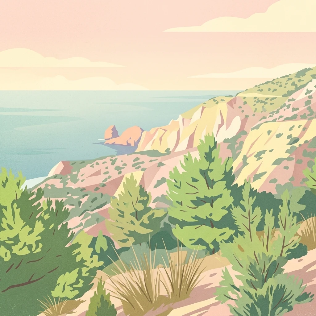
Stylized illustration showing coastal cliffs with green vegetation and the sea under a pale sky

Mediterranean coastal wilderness with dramatic cliffs and marine biodiversity

Al Hoceima National Park

Al Hoceima National Park is a protected coastal and marine area established in 2004 in northern Morocco, near the town of Al Hoceima along the Mediterranean shoreline. The park encompasses approximately 480 square kilometers of terrestrial and maritime landscape, representing one of the most unspoiled coastal environments on Morocco's northern coast. Its protected territory spans from the Mediterranean Sea cliffs in the north to the foothills of the Ibaqouyen Rif mountain range in the south, creating a dramatic transition between marine and terrestrial ecosystems. The park is managed by Morocco's Haut-Commissariat des eaux et forêts et de la lutte contre la désertification and serves as a critical refuge for both Mediterranean and Atlantic-influenced biodiversity.

Location
Morocco
Park type
National park
Established
2004
Area
480 km²
Al Hoceima National Park Protected Landscape
Regional park map

See the ranked park cluster in its geographic setting

Nearby parks around Al Hoceima National Park

This regional map shows the same 20 nearby parks ranked below around Al Hoceima National Park. Select a ranked marker to highlight that park’s boundary where boundary data is available.
Reference park: Al Hoceima National ParkRanked nearby park20 nearby parks shown
20 nearby parks

Distance ranked park geography and surrounding protected landscape patterns

Parks and Protected Areas Geographically Near Al Hoceima National Park

Geographic separation metrics organize surrounding protected areas by linear proximity to Al Hoceima National Park, establishing a structured comparison framework for regional terrain. Evaluating neighboring conservation zones reveals broader ecological patterns across the Mediterranean coastal landscape without requiring shared habitat traits.
Watercolor painting showing a landscape with green mountains, a river, and trees
National parkMorocco
About 84 km away#1 closest

West

Talassemtane National Park: Morocco's Premier Protected Landscape and Geographic Atlas Entry

Explore its mapped boundaries and natural terrain.

Talassemtane National Park is a vital protected area contributing to the geographic diversity of Morocco. This entry focuses on its identity as a national park, detailing its mapped boundaries and providing context within the broader atlas of protected lands. Discover the specific geographic and landscape characteristics that define this Moroccan national park, offering a unique lens for regional exploration.

Area
589.5 km²
Established
2004
IUCN
II
Relief
Mountain
National parkTaza Province
About 122 km away#2 closest

South

Tazekka National Park: Protected Landscape and Geographic Context in Taza Province

Discover its national park status and mapped terrain.

Tazekka National Park serves as a vital protected area within the geographic framework of Taza Province, Morocco. This national park offers a distinct landscape for exploration, allowing users to investigate its mapped boundaries and regional natural features. Understand the park's role in the local geography and its contribution to Morocco's atlas of protected lands. Its specific terrain and setting make it a key point for structured geographic discovery.

Area
120 km²
Established
1950
IUCN
II
Relief
Mountain
National parkSpain
About 169 km away#3 closest

Northwest

Sierra de las Nieves National Park: Ancient Fir Forests and Karst Geography in Andalusia

Mapped protected landscape and unique geologic features

Sierra de las Nieves National Park stands as a remarkable protected area in Andalusia, Spain, celebrated for its world-leading Spanish fir forests and intricate karst topography. This national park showcases significant geological diversity, from towering limestone formations and deep caves to the striking red peridotite mountains of Sierra Bermeja. Its elevation, reaching Pico Torrecilla at 1,919 meters, offers a unique alpine landscape context within southern Europe, mapped for detailed geographic discovery and protected area exploration.

Area
939.3 km²
Established
1989
IUCN
II
Visitors
100K annual
Watercolor painting of green rolling hills and a winding path or coastline with a light, soft aesthetic.
Nature reserveAndalusia
About 171 km away#4 closest

North

Acantilados de Maro-Cerro Gordo: Protected Coastal Cliffs and Marine Geography Atlas

Mapping the rugged Mediterranean boundary in Andalusia, Spain

Discover the complex geography of Acantilados de Maro-Cerro Gordo, a protected nature reserve defined by vertical cliffs exceeding 200 meters and isolated coastal coves. This atlas entry details the transition between Betic mountain terrain and marine ecosystems, documenting prominent headlands like Cerro Gordo and the biological richness of its protected reefs and seagrass meadows.

Area
19.129 km²
Established
1989
Relief
Upland
Climate
Mediterranean
Protected areaMorocco
About 192 km away#5 closest

West

Merja Zerga Protected Area: Moroccan Coastal Wetland Map and Geography

Explore the protected landscape and regional context of Merja Zerga.

Merja Zerga is a designated protected area situated on Morocco's Atlantic coast, characterized by its important wetland ecosystems. This entry facilitates detailed atlas exploration, providing users with mapped geographic data and insights into the park's protected boundaries. Understanding Merja Zerga offers valuable context for the distribution of protected lands and natural landscapes within the broader North African region.

IUCN
VI
Watercolor painting showing mountains, trees, and fields
National parkAndalusia
About 204 km away#6 closest

North

Sierra Nevada National Park: Protected Alpine Terrain and Geographic Context in Andalusia

Explore Spain's highest mountain range mapped across Andalusia's atlas.

Sierra Nevada National Park offers a profound exploration of Spain's highest alpine environments and a significant entry in the regional geography atlas. This protected area showcases classic glacial landforms, U-shaped valleys, and numerous high-mountain lakes, alongside a remarkable abundance of endemic plant species thriving in its unique microclimates. Understanding its mapped boundaries reveals a landscape vital for both biodiversity and watershed, situated prominently within the broader geographic context of Andalusia.

Area
858.83 km²
Established
1999
IUCN
II
Relief
Mountain
National parkMorocco
About 215 km away#7 closest

Southwest

Ifrane National Park: Protected Landscape and Geographic Context in Morocco

National park boundaries and mapped terrain.

Investigate Ifrane National Park, a designated national park in Morocco, and its contribution to the country's protected lands. This profile details its geographic location, providing context for its mapped presence and the natural landscapes it encompasses. Delve into the atlas-relevant features that define this protected area, focusing on its geographic identity within Morocco's natural heritage.

Area
500 km²
Established
2004
IUCN
II
Relief
Mountain
National parkTlemcen Province
About 264 km away#8 closest

East

Tlemcen National Park National Park: Mapped Boundaries and Regional Geographic Context

Discover protected landscapes within Tlemcen Province.

Delve into Tlemcen National Park, an important protected landscape situated within Tlemcen Province. This detail page offers a focused exploration of its specific geographic identity, mapped park boundaries, and the natural terrain it encompasses, providing essential context for understanding its role in regional geography and protected land exploration within Algeria.

Area
82.25 km²
Established
1993
IUCN
II
Relief
Mixed relief
Watercolor illustration of a river flowing through wetlands with trees and distant hills
National parkHuelva
About 265 km away#9 closest

Northwest

Doñana National Park National Park: Mapped Geography and Protected Landscape Context

Explore Huelva's key protected area and its regional geographic setting.

Delve into the structured geographic data and mapped boundaries of Doñana National Park. This entry highlights its identity as a national park within the Huelva region, providing essential context for understanding its protected landscape. MoriAtlas offers this detail to facilitate a clear, atlas-driven exploration of its natural terrain and its place in the broader geographic framework of Spain.

Area
543 km²
Established
1969
IUCN
II
Visitors
376.3K annual
National parkMorocco
About 277 km away#10 closest

Southwest

Khenifra National Park: National Park Atlas and Mapped Protected Landscape

Geographic context and protected area mapping for Morocco.

Explore the atlas perspective of Khenifra National Park, a designated national park in Morocco. This page provides detailed geographic context, focusing on its mapped protected landscape and its role within the country's network of conservation areas. Understand the park's terrain and regional setting through structured geographic data.

Area
842 km²
Established
2008
Relief
Mountain
Climate
Mediterranean
National parkMorocco
About 347 km away#11 closest

South

Haut Atlas Oriental National Park: National Park Mapping and Protected Landscape Identity

Explore its mapped geography and regional atlas context.

Delve into the specifics of Haut Atlas Oriental National Park, a designated national park in Morocco. This page serves as a detailed atlas entry, focusing on the park's protected landscape characteristics, its defined geographic boundaries, and its significance within the national park system. Understand the terrain and regional context that shape this important natural area for focused discovery.

Area
490 km²
IUCN
II
Relief
Mountain
Climate
Alpine
Watercolor illustration of a wetland landscape with grasses, low vegetation, and distant hills under a pale sky
Protected landscapeAlgarve
About 388 km away#12 closest

Northwest

Ria Formosa Natural Park Protected Landscape: Algarve Regional Geography

Explore mapped protected landscapes and regional geographic context.

Examine Ria Formosa Natural Park, a protected landscape that defines a significant portion of the Algarve's natural heritage. This atlas-focused exploration details the park's geographic features, its protected status, and its position within the wider regional geography. Understand the mapped extent of this protected landscape and its contribution to the natural context of southern Portugal.

Area
179.01 km²
Established
1978
IUCN
V
Relief
Lowland
Watercolor illustration showing a river flowing through a valley with hills and vegetation
Protected landscapeBeja District
About 396 km away#13 closest

Northwest

Guadiana Valley Natural Park: Protected Landscape Discovery in Beja District

Explore its mapped geography and protected land context.

Guadiana Valley Natural Park is identified as a protected landscape, providing a specific focus for geographic study and map-based exploration. This entry details the park's unique protected-area status and its contextual placement within the expansive Beja District of southern Portugal. Understand the mapped boundaries and landscape features that define this area, serving as a key point for regional geographic understanding on MoriAtlas.

Area
697 km²
Established
1995
IUCN
V
Visitors
749 annual
National parkAlgeria
About 427 km away#14 closest

Southeast

Djebel Aissa National Park: Algeria's Mapped Protected Landscape and Geographic Context

Explore the geographic features and park boundaries.

Djebel Aissa National Park represents a key protected natural landscape within Algeria, serving as a vital point for atlas-driven geographic discovery. Users can explore the park's mapped boundaries and understand its role as a national park within the broader context of Algerian geography. This detailed view highlights the park's specific landscape identity and its contribution to the regional protected areas map, offering a focused look at its terrain and protected status.

Area
244 km²
Established
2003
IUCN
II
Climate
Arid
Watercolor illustration showing a wetland landscape with grasses, a body of water, and distant hills
National parkSpain
About 435 km away#15 closest

North

Tablas de Daimiel National Park: Spain's Inland Wetland National Park and Protected Area

Explore mapped boundaries and regional geographic context.

Tablas de Daimiel National Park represents one of the last remaining examples of floodplain wetland systems in Spain's interior. Located in Castilla-La Mancha, this protected area showcases a unique confluence of fresh and brackish waters, supporting a rich mosaic of emergent vegetation and serving as a critical habitat for migratory birds. Use MoriAtlas to explore its precise geographic setting, mapped terrain, and its role as a vital conservation landscape within the Iberian Peninsula.

Area
30.3 km²
Established
1973
IUCN
II
Relief
Lowland
Biosphere reserveExtremadura
About 449 km away#16 closest

North

La Siberia Biosphere Reserve: Mapped Geography and Protected Lands of Extremadura

A study of reservoir coastlines and Mediterranean serranías

La Siberia Biosphere Reserve offers a deep look into the rural landscape of Extremadura, Spain. Characterized by five major reservoirs and vast Mediterranean oak dehesas, the area provides essential habitat for raptors and preserves significant prehistoric rock art within its complex serranía topography. Explore the geographic boundaries and water-dominated landscape of this distinct inland region.

Area
2,836.7 km²
Established
2019
Relief
Mountain
Climate
Mediterranean
Watercolor painting showing green fields, scattered trees, and distant mountains under a light sky
National parkToledo Province
About 453 km away#17 closest

North

Cabañeros National Park: Spain's Premier Iberian Oak Woodland Protected Landscape

Mapped Geography of Montes de Toledo Protected Area

Cabañeros National Park is celebrated as the most extensive and well-conserved example of Iberian Mediterranean forest in Spain. Situated within the Montes de Toledo, the park features a remarkable dichotomy between its unique raña flatlands and mountainous sierras, harboring ancient oak woodlands and significant biodiversity. This national park serves as a crucial component of the region's geographic context and a prime destination for atlas-based discovery of protected landscapes.

Area
409 km²
Established
1995
IUCN
II
Visitors
104.6K annual
Protected landscapeAlentejo Litoral
About 463 km away#18 closest

Northwest

Southwest Alentejo and Vicentine Coast Natural Park: A Protected Landscape in Alentejo Litoral

Explore its mapped boundaries and regional geographic context.

This detail page offers a deep dive into the Southwest Alentejo and Vicentine Coast Natural Park, a protected landscape situated in Portugal's Alentejo Litoral region. Understand the park's identity as a protected area through its geographic features and mapped extent. MoriAtlas facilitates a structured understanding of this natural landscape, enabling focused discovery of its protected boundaries and regional geographical significance.

Area
895.7 km²
Established
1988
IUCN
V
Visitors
12.7K annual
Watercolor illustration of a landscape with green hills, scattered trees, and distant mountains under a pink and yellow sky
Protected landscapePortalegre District
About 509 km away#19 closest

Northwest

Serra de São Mamede Natural Park: A Protected Landscape Defined by Ecological Transition

Explore the unique mountain terrain and ecosystems of Portalegre District.

Delve into the geographic and ecological identity of Serra de São Mamede Natural Park, a significant protected landscape situated in Portugal's Portalegre District. This area is renowned for its dramatic quartzite ridges and its role as a crucial meeting point for Atlantic and Mediterranean plant communities, offering a unique atlas perspective on regional biodiversity. Examining its mapped boundaries and diverse terrain provides essential context for understanding its ecological importance and its distinct position within the Alentejo region's geography.

Area
560.6 km²
Established
1989
IUCN
V
Visitors
4.5K annual
Watercolor illustration of rolling green hills, a winding river, and a distant horizon with a soft sun
National parkExtremadura
About 520 km away#20 closest

North

Monfragüe National Park: Dramatic Cliffs, Raptor Haven, and Extremadura's Protected Landscape

Discover its mapped terrain and unique geography in Spain.

Monfragüe National Park, situated in Extremadura, Spain, offers a compelling study in protected landscape geography. The park's identity is shaped by its formidable cliffs and river valleys carved by the Tagus, providing critical nesting grounds for European raptors. This MoriAtlas entry details the park's mapped boundaries and its significance as a vital protected area within the region. Users can explore the specific natural terrain and regional context that establish Monfragüe as a unique protected territory.

Area
179 km²
Established
2007
IUCN
II
Visitors
331.8K annual
Distance methodology

Geographic measurements, not driving distances

How nearby park distances are calculated

Distances use park boundaries whenever the available geometry allows it. When one or both boundaries are missing, the mapped park locations provide a clearly labelled estimate. Every value represents straight-line geographic separation and does not use roads or routing.

Boundary distance

Calculated between the nearest points of both park boundaries.

Location-to-boundary estimate

Estimated from one mapped park location to the nearest boundary of the other park.

Mapped-location estimate

Estimated between the mapped locations of both parks.

MoriAtlas Explorer

Continue Exploring Al Hoceima National Park's Coastal Geography and Marine Atlas

Deepen your understanding of Al Hoceima National Park by exploring its specific geographic features, mapped protected boundaries, and the full extent of its coastal and marine landscape. Discover how this unique Moroccan national park contributes to the regional atlas of protected lands and offers a window into Mediterranean biodiversity. Continue your structured exploration of this vital protected area.