Mori Atlas logo
Nearby park discovery

Mapping regional geographic context and surrounding protected natural territories

Protected Areas and National Park Landscapes Near Monti Sibillini National Park

Examine the geographic distribution of protected lands surrounding Monti Sibillini National Park within the central Italian Apennines. This analysis provides a structured view of mountain environments and adjacent natural landscapes, facilitating a clearer understanding of the regional conservation network through mapped territorial data.

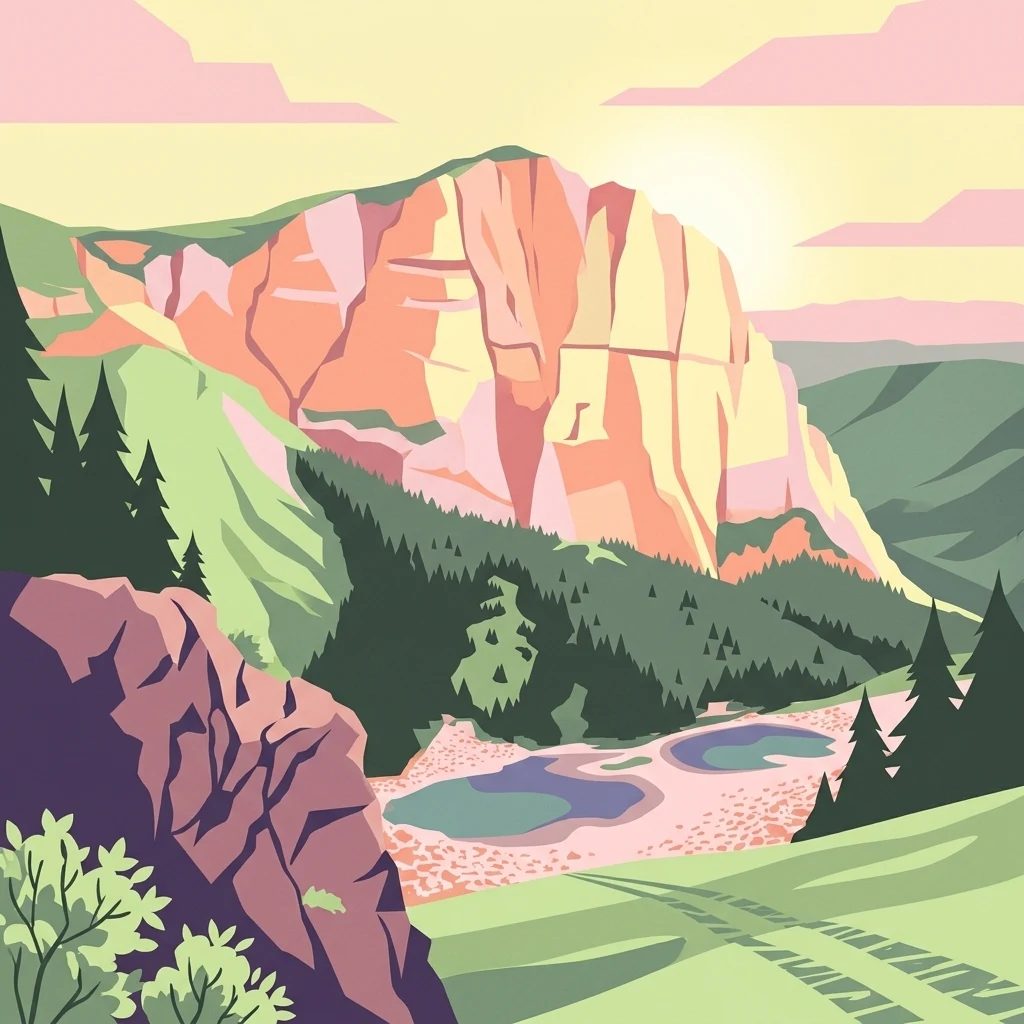
Stylized illustration of a mountain landscape with layered rock cliffs, green forests, two lakes in a valley, and a pastel sky

Apennine mountain wilderness spanning Marche and Umbria

Monti Sibillini National Park

Monti Sibillini National Park is a protected wilderness area in central Italy, established in 1993 to preserve the distinctive Apennine mountain landscape of the Monti Sibillini range. The park straddles the regions of Marche and Umbria, encompassing portions of four provinces: Macerata, Fermo, Ascoli Piceno, and Perugia. With an area of approximately 697 square kilometers, it ranks among Italy's larger national parks and protects a rugged territory of steep peaks, deep valleys, alpine meadows, and dense forests that characterize the central Apennines. The park's name refers to the legendary Sibyl, a figure from medieval folklore associated with the caves and mountains of this region, lending a layer of cultural mystique to the landscape. This protected area serves as a critical refuge for central Apennine ecosystems and represents the biodiversity heritage of one of Italy's most scenically significant mountain environments.

Location
Italy
Park type
National park
Established
1993
Area
697.2 km²
Highest point
2,476 m
Monti Sibillini National Park Protected Area
Regional park map

See the ranked park cluster in its geographic setting

Nearby parks around Monti Sibillini National Park

This regional map shows the same 20 nearby parks ranked below around Monti Sibillini National Park. Select a ranked marker to highlight that park’s boundary where boundary data is available.
Reference park: Monti Sibillini National ParkRanked nearby parkSelected boundary: Monti Sibillini National Park20 nearby parks shown
20 nearby parks

Distance-ranked protected landscapes and regional topography surrounding Monti Sibillini

Parks and Protected Areas Geographically Near Monti Sibillini National Park

Examine the ranked collection of protected areas positioned geographically near Monti Sibillini National Park to understand regional spatial relationships. Spatial separation and recorded environmental characteristics provide structured comparison signals for surrounding Apennine terrain.
Watercolor painting of mountains, green valleys, and a river
National parkItaly
Park boundaries overlap#1 closest

Southeast

Gran Sasso and Monti della Laga National Park: Italy's National Park Geographic Context

Mapped protected areas and regional natural landscape details.

Delve into the geography of Gran Sasso and Monti della Laga National Park, a prominent national park in Italy. This resource provides essential context for understanding its protected landscape, mapped boundaries, and integration within the regional geography. Ideal for users seeking detailed atlas-style information on protected areas and their natural terrain, it serves as a foundational point for exploring the park's unique geographic character and landscape significance.

IUCN
II
A wide, panoramic watercolor illustration depicting a serene wetland scene with a calm lake, foreground reeds and grasses, midground trees, and distant purple hills under a pale sky.
Nature reserveUmbria
About 70 km away#2 closest

Southwest

Oasi naturalistica Lago di Alviano: Protected Wetland Landscapes and River Geography

A vital nature reserve in the Tiber Valley region of Umbria

Discover the unique wetland geography of Oasi naturalistica Lago di Alviano, where marshy river basins meet extensive hygrophilous forest corridors. This reserve serves as a critical node in central Italy for migratory waterbird habitats, showcasing the natural transition between riparian woodland and shallow aquatic ecosystems within the broader Tiber Valley protected network.

Area
9 km²
Established
1990
Scope
Terrestrial
Water
Major water bodies
Watercolor painting showing mountains, forests, and a body of water in a scenic landscape
National parkAbruzzo
77 km away#3 closest

Southeast

Maiella National Park: Abruzzo's Protected Landscape and Regional Geography

Explore mapped park boundaries and natural terrain.

Delve into the protected landscape of Maiella National Park, situated within the Abruzzo region of southern Italy. This page offers detailed atlas-level insights into its mapped boundaries, allowing for a clear understanding of its geographic setting. Discover how this national park contributes to the regional natural terrain and protected area context, providing a foundation for structured geographic exploration.

Area
628.38 km²
Established
1991
IUCN
II
Relief
Mountain
A soft watercolor painting of a coastal landscape with rolling green hills, scattered trees, and a light-colored sandy foreground, rendered in a minimalist style.
Nature reserveAbruzzo
About 105 km away#4 closest

Southeast

Punta dell'Acquabella Nature Reserve: Adriatic Coastal Landscape and Geography

Protected Mediterranean shoreline in the Abruzzo region of Italy

Punta dell'Acquabella is a distinct nature reserve on the Adriatic coast of Abruzzo, characterized by its promontory, cliff habitats, and clear coastal waters. The area serves as a significant intersection of natural heritage and cultural landscape within the Trabocchi coast, offering a deep look into the regional geography and environmental features that define this protected territory.

Area
0.28 km²
Established
2007
Relief
Upland
Climate
Mediterranean
Watercolor painting of a landscape with rolling hills, green fields, and a body of water under a pink sky
National parkForlì-Cesena Province
117 km away#5 closest

Northwest

Foreste Casentinesi, Monte Falterona, Campigna National Park: A Mapped Protected Landscape in Italy

National Park within Forlì-Cesena Province, Emilia-Romagna

Foreste Casentinesi, Monte Falterona, Campigna National Park is an important protected natural area situated in Forlì-Cesena Province, northeastern Italy. As a designated national park, it serves as a key landmark for exploring mapped protected land boundaries and understanding its specific contribution to the regional geography. This page provides an atlas-centric view, highlighting the park's geographic context and its identity as a significant protected landscape for discovery and reference.

Area
368 km²
Established
1993
IUCN
II
Relief
Mountain
Watercolor painting showing a landscape with rolling green hills, a river, and scattered trees
National parkItaly
About 119 km away#6 closest

Southeast

Abruzzo, Lazio and Molise National Park

Protected landscape in Italy's Apennines.

Explore the mapped boundaries and protected status of Abruzzo, Lazio and Molise National Park. This historic Italian national park offers a detailed look at Apennine mountain geography and landscape.

Established
1923
IUCN
II
A wide panoramic watercolor painting showing a landscape with a body of water in the foreground, green grasses and trees on the banks, and layers of purple and pink hills in the distance under a pale sky.
Nature reserveAbruzzo
About 140 km away#7 closest

Southeast

Riserva naturale regionale Marina di Vasto: Coastal Nature Reserve in Abruzzo, Italy

Mapping protected Adriatic dune and wetland ecosystems

This nature reserve protects a vital 3-kilometer strip of the Adriatic coastline in Abruzzo, acting as a rare sanctuary for specialized flora and fauna. By managing a delicate ecotone of shifting sand dunes and brackish wetland basins, the area maintains a high degree of ecological significance within the regional landscape. The geography provides an important look at integrated coastal conservation at the meeting point of urbanized hinterlands and the Adriatic sea.

Area
0.57 km²
Established
2007
Relief
Lowland
Climate
Mediterranean
Marine protected areaFrance
141 km away#8 closest

West

Sanctuaire Pelagos Marine Protected Area: Mediterranean Geography and Seascape

A transboundary conservation zone spanning 87,500 square kilometers.

Sanctuaire Pelagos represents a unique collaborative effort in marine conservation across the Mediterranean. Spanning the waters between France, Italy, and Monaco, this protected maritime area is defined by its deep-sea canyons and nutrient-rich currents that sustain diverse cetacean populations. Its immense scale and international governance make it a focal point for understanding Mediterranean marine biodiversity and environmental policy.

Area
87,500 km²
Established
1999
IUCN
IV
Relief
Lowland
Watercolor illustration showing a coastal landscape with green hills, trees, and water body
National parkItaly
146 km away#9 closest

South

Circeo National Park: Protected Landscape of Italy's Lazio Coast

Explore mapped terrain and Mediterranean ecosystem boundaries.

Circeo National Park offers a distinct protected landscape anchored by the striking Monte Circeo limestone promontory and its associated coastal dunes and island environments. As one of Italy's earliest national parks, it preserves a vital mosaic of Mediterranean ecosystems, providing a unique subject for geographic study and atlas-based navigation of protected areas. Users can explore its mapped context and the interplay between karst geology, coastal terrain, and diverse natural habitats.

IUCN
II
National parkTuscany
166 km away#10 closest

West

Arcipelago Toscano National Park: Protected Islands and Mediterranean Landscape Atlas

Explore Tuscany's unique archipelago geography and protected natural terrain.

Arcipelago Toscano National Park offers a unique perspective on Mediterranean island ecosystems through its comprehensive atlas and mapped landscape context. Covering seven main islands and surrounding marine areas off the coast of Tuscany, this park protects dramatic granite cliffs, endemic flora, and vital habitats for marine and avian life. Understand its geographic scope, protected boundaries, and the distinctive natural terrain that defines this significant Italian conservation landscape.

Area
746.63 km²
Established
1996
IUCN
II
Relief
Mixed relief
Watercolor illustration of rolling hills, trees, and a body of water
Nature reserveDugi Otok
172 km away#11 closest

Northeast

Telašćica Nature Park: Adriatic Sea Cliffs, Lake Mir, and Protected Landscape

Dugi Otok's Premier Nature Reserve on the Dalmatian Coast

Telašćica Nature Park safeguards a highly distinctive coastal environment on Croatia's Dugi Otok island. This protected area is defined by its imposing 161-meter-high vertical limestone cliffs, locally named 'stene,' which create a breathtaking interface with the Adriatic Sea. Within the park, the unique saltwater Lake Mir offers a fascinating geological feature, while the sheltered bay and its surrounding landscape showcase a rich Mediterranean flora and a complex archipelago. The park serves as a prime example of Adriatic karst landscape preservation and mapped coastal geography.

Area
70.5 km²
Established
1988
IUCN
II
Relief
Mixed relief
National parkŠibenik-Knin County
176 km away#12 closest

Northeast

Kornati Islands National Park: Dense Mediterranean Archipelago and Protected Karst Landscape

Explore the mapped geography and unique protected island terrain.

Kornati Islands National Park, located in Šibenik-Knin County, Croatia, is distinguished as the Mediterranean's most densely packed archipelago. This national park protects a vast expanse of karst limestone islands, dramatic sea cliffs, and unique flat rock plateaus, alongside its significant marine environment. MoriAtlas provides detailed geographic context and mapped boundaries, enabling structured exploration of this exceptional protected landscape and its ecological significance within the Adriatic Sea.

Area
320 km²
Established
1980
IUCN
II
Relief
Lowland
Nature reserveEmilia-Romagna
About 178 km away#13 closest

Northwest

Riserva naturale speciale di Alfonsine: Protected Wetlands and Forest Oases

Regional nature reserve in the Emilia-Romagna lowlands

This reserve comprises three separate oases that protect remnants of rare lowland wetlands. Featuring a mixture of marshy pond basins, canal corridors, and flooded forests, the site provides a sanctuary for waterbirds and the European pond terrapin. The area represents a focused effort to conserve aquatic habitats and riparian woodlands nestled within the wider agricultural plains of northern Italy.

Area
0.12 km²
Established
1990
Watercolor illustration of a tree, green hills, and distant water view
National parkApulia
185 km away#14 closest

Southeast

Gargano National Park: Apulia's Protected Landscape and Regional Geographic Context

Mapped boundaries and natural terrain of a key Italian national park.

Delve into Gargano National Park, a designated national park situated in the Apulia region of Italy. This protected landscape offers valuable insights into the geography of the Gargano promontory. Through MoriAtlas, users can explore its mapped boundaries, understand its terrain, and connect it to the broader regional geography of southern Italy, providing a solid foundation for protected-area discovery.

Area
1,181.44 km²
Established
1991
IUCN
II
Relief
Mixed relief
Watercolor painting of coastal landscape with green islands, trees, and calm water under a soft sky
National parkCroatia
201 km away#15 closest

North

Brijuni Islands National Park: Adriatic Protected Landscape and Historical Atlas

Mapped boundaries, regional geography, and ecological context.

Brijuni Islands National Park is a significant protected area comprising a Croatian archipelago in the northern Adriatic Sea. This national park showcases a unique Mediterranean landscape blending natural habitats with extensive archaeological sites, offering a rich context for atlas-based exploration. Understanding Brijuni Islands National Park contributes to a broader appreciation of regional geography and the mapped distribution of protected lands.

Area
7.5 km²
Established
1983
IUCN
II
Relief
Lowland
Watercolor illustration of a mountain landscape with trees and water
National parkCroatia
220 km away#16 closest

Northeast

Paklenica National Park: Croatia's Iconic Karst Canyon and UNESCO Beech Forests

Explore dramatic protected landscape and regional geography.

Paklenica National Park presents a spectacular protected area defined by its deep karst canyons, with Velika Paklenica and Mala Paklenica carving dramatic vertical walls into the Velebit mountain range. This national park is celebrated for its status as a leading European climbing destination and its ancient beech forests, part of a UNESCO World Heritage site. Exploring Paklenica offers insight into unique geological formations, extensive cave systems, and the rich biodiversity of this significant Croatian landscape.

Area
95 km²
IUCN
II
Relief
Mountain
Climate
Mediterranean
Watercolor artwork showing mountain peaks, forested slopes, and a lake with pink and green hues
National parkCroatia
About 225 km away#17 closest

Northeast

Northern Velebit National Park: Croatia's Mapped Protected Landscape Identity

Explore the geography and protected area context.

Northern Velebit National Park stands as a prominent protected area, contributing significantly to the geographic understanding of Croatia's Velebit mountain range. This page provides focused details on its protected landscape features, mapped boundaries, and position within the Dinaric Alps. It serves as an essential entry point for users seeking structured atlas-based information on national parks and their role in regional conservation efforts, highlighting its unique geographic characteristics.

IUCN
II
National parkŠibenik-Knin County
228 km away#18 closest

Northeast

Krka National Park: Croatia's National Park with European Cascade Waterfalls

Explore the mapped protected landscape and karst geography.

Krka National Park, designated as a national park in Croatia, offers a rich exploration of its protected landscape. Located in Šibenik-Knin County, the park is defined by the Krka River and its extraordinary seven travertine waterfalls, most notably Skradinski buk, the largest cascade system of its kind in Europe. This atlas-focused view highlights the park's unique karst terrain, Mediterranean ecosystems, and its position within the regional geography, providing essential context for understanding its protected natural heritage.

Area
109 km²
Established
1985
IUCN
II
Relief
Lowland
Watercolor illustration of a mountainous landscape with green hills, a valley with a river, and distant mountains under a pink and yellow sky
National parkCampania
228 km away#19 closest

Southeast

Vesuvius National Park: Protected Volcanic Landscape in Campania, Italy

Explore mapped boundaries and regional geography.

Discover Vesuvius National Park, a vital protected area safeguarding Italy's iconic active volcano. This page provides essential geographic context, detailed mapped terrain, and insights into the park's unique volcanic landscape within the Campania region. It serves as a key entry point for understanding the park's protected status and its geological significance for structured atlas exploration.

Area
72.59 km²
Established
1995
IUCN
II
Relief
Mountain
Watercolor painting of rolling green hills under a sunset sky with soft color transitions
National parkEmilia-Romagna
247 km away#20 closest

Northwest

Appennino Tosco-Emiliano National Park: Explore Its National Park Boundaries and Geography

Discover the mapped landscape and regional context of this protected area.

Appennino Tosco-Emiliano National Park is a designated national park offering a rich area for geographic exploration. This MoriAtlas entry details the park's protected landscape, providing insights into its mapped boundaries and its contribution to the natural terrain of the Emilia-Romagna region. Understand its significance within the broader atlas of Italian protected areas, focusing on its unique geographic identity and landscape context.

Area
227.92 km²
Established
2001
IUCN
II
Relief
Mountain
Distance methodology

Geographic measurements, not driving distances

How nearby park distances are calculated

Distances use park boundaries whenever the available geometry allows it. When one or both boundaries are missing, the mapped park locations provide a clearly labelled estimate. Every value represents straight-line geographic separation and does not use roads or routing.

Boundary distance

Calculated between the nearest points of both park boundaries.

Location-to-boundary estimate

Estimated from one mapped park location to the nearest boundary of the other park.

Mapped-location estimate

Estimated between the mapped locations of both parks.

MoriAtlas Explorer

Continue Exploring Monti Sibillini National Park's Regional Geography and Mapped Terrain

Begin a deeper atlas exploration of Monti Sibillini National Park by examining its precise geographic context within Marche. Understanding the park's protected landscape is key to appreciating its role in the wider regional atlas, allowing for focused discovery of its mapped terrain and natural boundaries. Continue navigating the structured geography of Italy's national parks and protected areas.