Mori Atlas logo
Nearby park discovery

Geographic mapping of surrounding protected terrain and regional landscape distribution

Protected Areas and Natural Landscapes Near Sintra-Cascais Natural Park in Lisbon District

Examine the geographic distribution of protected lands surrounding Sintra-Cascais Natural Park. This overview provides a structured perspective on regional terrain and landscape connections across the Lisbon District, facilitating the comparison of nearby protected areas through mapped spatial data and environmental contexts.

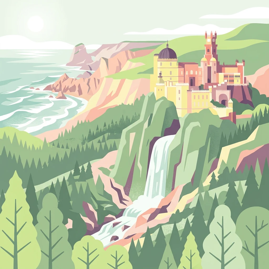
Illustration showing a castle on a hillside with a waterfall cascading down rocky terrain toward the ocean with forested mountains in the background

Where the Serra de Sintra meets the Atlantic coast, protecting cultural heritage and Mediterranean landscapes near Lisbon

Sintra-Cascais Natural Park

Sintra-Cascais Natural Park is a protected landscape along Portugal's Portuguese Riviera, encompassing the dramatic Serra de Sintra mountain range and its transition to the Atlantic coastline. Located approximately 25 kilometers west of Lisbon, the park stretches from the foothills surrounding the historic town of Sintra westward to Cabo da Roca, the westernmost point of continental Europe. Established as a protected area in 1981 and redesignated as a Natural Park in 1994, this IUCN Category V protected area spans roughly 145 square kilometers of coastal cliffs, forested hills, agricultural lands, and dramatic palace complexes that punctuate the landscape. The park represents a unique fusion of natural ecosystems and cultural heritage, where Romantic-era palaces such as Pena Palace and the Castle of the Moors sit atop forested peaks, and traditional wine and fruit production continues in the rolling agricultural zones below.

Location
Portugal
Park type
Protected landscape
Established
1981
Area
144.5 km²
Sintra-Cascais Natural Park Protected Landscape
Regional park map

See the ranked park cluster in its geographic setting

Nearby parks around Sintra-Cascais Natural Park

This regional map shows the same 20 nearby parks ranked below around Sintra-Cascais Natural Park. Select a ranked marker to highlight that park’s boundary where boundary data is available.
Reference park: Sintra-Cascais Natural ParkRanked nearby parkSelected boundary: Sintra-Cascais Natural Park20 nearby parks shown
20 nearby parks

Geographic proximity and regional comparison metrics for surrounding protected landscapes

Ranked Nearby Parks and Protected Areas Surrounding Sintra-Cascais Natural Park

Examine the ranked collection of protected areas situated geographically near Sintra-Cascais Natural Park to evaluate surrounding regional geography. Compare spatial separation and recorded environmental attributes across nearby conservation zones to understand broader territorial patterns.
Watercolor illustration showing rolling hills, greenery, and distant mountains under a light sky.
Protected landscapePortugal
31 km away#1 closest

Southeast

Arrábida Natural Park: Protected Landscape Atlas and Geographic Context in Portugal

Mapped boundaries of this key Portuguese protected area.

Arrábida Natural Park is presented here as a significant protected landscape, offering rich details for geographic exploration and atlas-based research. Users can investigate its specific mapped boundaries, understand its environmental setting within Portugal, and utilize this data for comparative analysis of protected areas. This resource focuses on the park's inherent geographic identity and its role as a defined natural landscape.

Area
176.41 km²
Established
1976
IUCN
V
Visitors
23.1K annual
Watercolor illustration of a landscape with rolling hills, a body of water, and vegetation
Protected landscapePortugal
61 km away#2 closest

Northeast

Aire and Candeeiros Ranges Natural Park: Protected Landscape and Regional Geographic Context

Explore the mapped boundaries and natural landscape of this Portuguese protected area.

Understand the Aire and Candeeiros Ranges Natural Park as a key protected landscape in Portugal. This page offers detailed geographic information, focusing on the park's mapped boundaries and its intrinsic connection to the surrounding regional geography. It serves as a portal for atlas exploration, providing structured data for users interested in the specific protected area and its landscape characteristics within the Iberian Peninsula.

Area
383.93 km²
Established
1979
IUCN
V
Visitors
31.9K annual
Protected landscapeAlentejo Litoral
99 km away#3 closest

South

Southwest Alentejo and Vicentine Coast Natural Park: A Protected Landscape in Alentejo Litoral

Explore its mapped boundaries and regional geographic context.

This detail page offers a deep dive into the Southwest Alentejo and Vicentine Coast Natural Park, a protected landscape situated in Portugal's Alentejo Litoral region. Understand the park's identity as a protected area through its geographic features and mapped extent. MoriAtlas facilitates a structured understanding of this natural landscape, enabling focused discovery of its protected boundaries and regional geographical significance.

Area
895.7 km²
Established
1988
IUCN
V
Visitors
12.7K annual
Watercolor illustration showing a river flowing through a valley with hills and vegetation
Protected landscapeBeja District
169 km away#4 closest

Southeast

Guadiana Valley Natural Park: Protected Landscape Discovery in Beja District

Explore its mapped geography and protected land context.

Guadiana Valley Natural Park is identified as a protected landscape, providing a specific focus for geographic study and map-based exploration. This entry details the park's unique protected-area status and its contextual placement within the expansive Beja District of southern Portugal. Understand the mapped boundaries and landscape features that define this area, serving as a key point for regional geographic understanding on MoriAtlas.

Area
697 km²
Established
1995
IUCN
V
Visitors
749 annual
Watercolor illustration of a landscape with green hills, scattered trees, and distant mountains under a pink and yellow sky
Protected landscapePortalegre District
170 km away#5 closest

East

Serra de São Mamede Natural Park: A Protected Landscape Defined by Ecological Transition

Explore the unique mountain terrain and ecosystems of Portalegre District.

Delve into the geographic and ecological identity of Serra de São Mamede Natural Park, a significant protected landscape situated in Portugal's Portalegre District. This area is renowned for its dramatic quartzite ridges and its role as a crucial meeting point for Atlantic and Mediterranean plant communities, offering a unique atlas perspective on regional biodiversity. Examining its mapped boundaries and diverse terrain provides essential context for understanding its ecological importance and its distinct position within the Alentejo region's geography.

Area
560.6 km²
Established
1989
IUCN
V
Visitors
4.5K annual
Watercolor illustration of a landscape with green mountains, a body of water, and colorful wildflowers in the foreground
Nature reservePortugal
204 km away#6 closest

Northeast

Serra da Estrela Natural Park: Glacial Terrain and Highest Peaks in Portugal

Explore the dramatic geography of this nature reserve.

Serra da Estrela Natural Park is a significant protected landscape in Portugal, celebrated for containing the nation's highest peak and exceptional Quaternary glacial formations. The park's terrain includes dramatic valleys carved by ice, numerous glacial lakes, and a stark alpine plateau around Torre. This nature reserve preserves a unique environment shaped by both geological history and traditional pastoralism, offering rich mapped context for understanding Portugal's mountainous geography and protected areas.

Area
891.32 km²
Established
1976
IUCN
V
Visitors
7.6K annual
Watercolor illustration of a wetland landscape with grasses, low vegetation, and distant hills under a pale sky
Protected landscapeAlgarve
About 233 km away#7 closest

Southeast

Ria Formosa Natural Park Protected Landscape: Algarve Regional Geography

Explore mapped protected landscapes and regional geographic context.

Examine Ria Formosa Natural Park, a protected landscape that defines a significant portion of the Algarve's natural heritage. This atlas-focused exploration details the park's geographic features, its protected status, and its position within the wider regional geography. Understand the mapped extent of this protected landscape and its contribution to the natural context of southern Portugal.

Area
179.01 km²
Established
1978
IUCN
V
Relief
Lowland
Watercolor painting of sandy dunes with patches of grass, distant mountains, and a body of water under a light sky
Protected landscapeEsposende
286 km away#8 closest

North

Northern Littoral Natural Park Protected Landscape: Geographic Discovery and Atlas Context

Mapped protected areas and regional landscape discovery near Esposende.

Uncover the geographic identity of Northern Littoral Natural Park, a key protected landscape situated near Esposende. This MoriAtlas entry focuses on its mapped boundaries and regional significance, providing a factual basis for understanding its role within Portugal's network of protected areas. Explore the park's natural terrain and its context within the broader geography of the Norte region for comprehensive atlas-based discovery.

Area
87.62 km²
Established
1987
IUCN
V
Relief
Lowland
Watercolor landscape illustration featuring mountains, forests, fields, and trees
Protected areaPortugal
297 km away#9 closest

Northeast

Alvão Natural Park Protected Area: Atlas Exploration of Northern Portugal's Mountain Geography

Discover dramatic landscapes and mapped terrain.

Alvão Natural Park is a protected area in northern Portugal distinguished by its stark geological contrasts: upper granite plateaus and steep schist lowlands. This unique geography supports diverse ecosystems and features the impressive Fisgas de Ermelo waterfall. Explore the park's mapped boundaries and its role as a significant protected landscape within the region, offering rich context for any geographic exploration.

Area
72.03 km²
Established
1983
IUCN
V
Visitors
29.6K annual
Watercolor illustration of rolling green hills, a winding river, and a distant horizon with a soft sun
National parkExtremadura
302 km away#10 closest

Northeast

Monfragüe National Park: Dramatic Cliffs, Raptor Haven, and Extremadura's Protected Landscape

Discover its mapped terrain and unique geography in Spain.

Monfragüe National Park, situated in Extremadura, Spain, offers a compelling study in protected landscape geography. The park's identity is shaped by its formidable cliffs and river valleys carved by the Tagus, providing critical nesting grounds for European raptors. This MoriAtlas entry details the park's mapped boundaries and its significance as a vital protected area within the region. Users can explore the specific natural terrain and regional context that establish Monfragüe as a unique protected territory.

Area
179 km²
Established
2007
IUCN
II
Visitors
331.8K annual
Watercolor painting of a river flowing through rolling hills with green fields and trees
National parkSpain
About 308 km away#11 closest

Northeast

Monfragüe National Park: Protected Landscape Atlas of Spanish Raptor Colonies

Explore mapped terrain and regional geography within this Spanish National Park.

As a national park in Spain's Extremadura region, Monfragüe National Park offers a distinct protected landscape shaped by the Tagus River and dramatic limestone cliffs. It is globally recognized for its exceptional birdlife, especially its large griffon vulture colonies and populations of Spanish imperial eagles, making it a significant site for ecological study and atlas-based exploration of protected areas. The park's landscape, characterized by Mediterranean woodlands and rugged terrain, provides crucial habitat and a unique geographic context for understanding Iberian Peninsula conservation.

IUCN
II
Scope
Terrestrial
Watercolor illustration of a river flowing through wetlands with trees and distant hills
National parkHuelva
310 km away#12 closest

Southeast

Doñana National Park National Park: Mapped Geography and Protected Landscape Context

Explore Huelva's key protected area and its regional geographic setting.

Delve into the structured geographic data and mapped boundaries of Doñana National Park. This entry highlights its identity as a national park within the Huelva region, providing essential context for understanding its protected landscape. MoriAtlas offers this detail to facilitate a clear, atlas-driven exploration of its natural terrain and its place in the broader geographic framework of Spain.

Area
543 km²
Established
1969
IUCN
II
Visitors
376.3K annual
Watercolor illustration of a river winding through a valley with mountains, forests, and pink flowering trees.
National parkPortugal
322 km away#13 closest

North

Peneda-Gerês National Park: A Distinct Protected Landscape in Northern Portugal

Granite peaks, glacial valleys, and cultural heritage mapped.

Peneda-Gerês National Park represents a cornerstone of protected landscapes in Portugal, celebrated for its rugged granite mountains and deep glacial valleys sculpted over millennia. This national park showcases a rare ecological transition zone with unique endemic species and features dramatic waterfalls and pristine river systems. The park's rich cultural tapestry, interwoven with its natural environment, offers a compelling subject for atlas-based geographic discovery and landscape exploration.

Area
695.93 km²
Established
1971
IUCN
II
Visitors
92.8K annual
Watercolor illustration of rolling green hills and distant purple mountains under a light sky
National parkGalicia
361 km away#14 closest

North

Atlantic Islands of Galicia National Park: Protected Archipelagos & Galician Coastline Geography

Explore mapped island ecosystems and protected marine areas.

Uncover the protected landscape of the Atlantic Islands of Galicia National Park, Spain's only national park in Pontevedra province. This atlas entry details the four distinct archipelagos, Cíes, Ons, Sálvora, and Cortegada, across the Rías Baixas. Discover the unique sea-land protected area, its rare bay laurel forests, significant seabird colonies, and the broader regional geography of Galicia.

Area
84.8 km²
Established
2002
IUCN
II
Visitors
472.3K annual
A watercolor painting showing a soft-toned landscape with a stone arch bridge spanning a river, framed by trees and gentle hills.
Biosphere reserveGalicia
368 km away#15 closest

North

Área de Allariz Biosphere Reserve: Mapping the Protected Landscapes of Inland Galicia

Exploring the river basins, granitic massifs, and ecological frontiers

The Área de Allariz biosphere reserve serves as a vital transition zone in northwestern Spain, characterized by its flat-floored tectonic basin, the River Limia, and varied highland terrain. This protected area offers an instructive look at the integration of traditional rural land management with large-scale ecological recovery and conservation across its core, buffer, and transition zones.

Area
214.82 km²
Established
2005
Relief
Mixed relief
Scope
Terrestrial
Biosphere reserveExtremadura
About 373 km away#16 closest

East

La Siberia Biosphere Reserve: Mapped Geography and Protected Lands of Extremadura

A study of reservoir coastlines and Mediterranean serranías

La Siberia Biosphere Reserve offers a deep look into the rural landscape of Extremadura, Spain. Characterized by five major reservoirs and vast Mediterranean oak dehesas, the area provides essential habitat for raptors and preserves significant prehistoric rock art within its complex serranía topography. Explore the geographic boundaries and water-dominated landscape of this distinct inland region.

Area
2,836.7 km²
Established
2019
Relief
Mountain
Climate
Mediterranean
Watercolor depiction of green hills, a small pond, and distant mountains under a soft sky.
Protected landscapeBragança District
375 km away#17 closest

Northeast

Montesinho Natural Park: Protected Landscape in Bragança District, Portugal

Explore mapped boundaries and regional landscape context.

Montesinho Natural Park is designated as a protected landscape in northeastern Portugal, located within the administrative region of Bragança District. This page serves as an entry point to understanding the park's protected area characteristics, its mapped geographic footprint, and its role in the broader natural landscape of the Trás-os-Montes region. Discover the atlas value of this significant protected territory and its relation to surrounding geography.

Area
742.25 km²
Established
1979
IUCN
V
Relief
Mountain
Watercolor painting showing green fields, scattered trees, and distant mountains under a light sky
National parkToledo Province
413 km away#18 closest

East

Cabañeros National Park: Spain's Premier Iberian Oak Woodland Protected Landscape

Mapped Geography of Montes de Toledo Protected Area

Cabañeros National Park is celebrated as the most extensive and well-conserved example of Iberian Mediterranean forest in Spain. Situated within the Montes de Toledo, the park features a remarkable dichotomy between its unique raña flatlands and mountainous sierras, harboring ancient oak woodlands and significant biodiversity. This national park serves as a crucial component of the region's geographic context and a prime destination for atlas-based discovery of protected landscapes.

Area
409 km²
Established
1995
IUCN
II
Visitors
104.6K annual
Marine protected areaGalicia
417 km away#19 closest

Northwest

Banco de Galicia Marine Protected Area: Submarine Seamount Geography and Atlantic Atlas

Deep-sea mapping of volcanic terrain and cold-water coral ecosystems

Banco de Galicia represents a significant bathymetric structure in the northeastern Atlantic, rising thousands of meters from the ocean floor. This marine protected area features a plateau of basaltic origin, hosting dense cold-water coral reefs and specialized benthic habitats that remain geographically distinct from the nearby continental shelf.

Area
6,200 km²
Relief
Mountain
Climate
Temperate
Access
Remote access
National parkSpain
440 km away#20 closest

Southeast

Sierra de las Nieves National Park: Ancient Fir Forests and Karst Geography in Andalusia

Mapped protected landscape and unique geologic features

Sierra de las Nieves National Park stands as a remarkable protected area in Andalusia, Spain, celebrated for its world-leading Spanish fir forests and intricate karst topography. This national park showcases significant geological diversity, from towering limestone formations and deep caves to the striking red peridotite mountains of Sierra Bermeja. Its elevation, reaching Pico Torrecilla at 1,919 meters, offers a unique alpine landscape context within southern Europe, mapped for detailed geographic discovery and protected area exploration.

Area
939.3 km²
Established
1989
IUCN
II
Visitors
100K annual
Distance methodology

Geographic measurements, not driving distances

How nearby park distances are calculated

Distances use park boundaries whenever the available geometry allows it. When one or both boundaries are missing, the mapped park locations provide a clearly labelled estimate. Every value represents straight-line geographic separation and does not use roads or routing.

Boundary distance

Calculated between the nearest points of both park boundaries.

Location-to-boundary estimate

Estimated from one mapped park location to the nearest boundary of the other park.

Mapped-location estimate

Estimated between the mapped locations of both parks.

MoriAtlas Explorer

Continue Exploring Sintra-Cascais Natural Park's Geographic Context and Mapped Terrain

Deepen your atlas discovery by exploring the intricate geography of Sintra-Cascais Natural Park. Understand its placement within Lisbon District and how its protected landscape contributes to the regional map. This park offers a rich case study in the intersection of natural terrain and human history, inviting further study of its unique ecological and geographical characteristics through structured data and mapping tools.